Struggle for the Bliss Farm Part 2 With Licensed Battlefield Guide Woody Christ
July 3, 2009
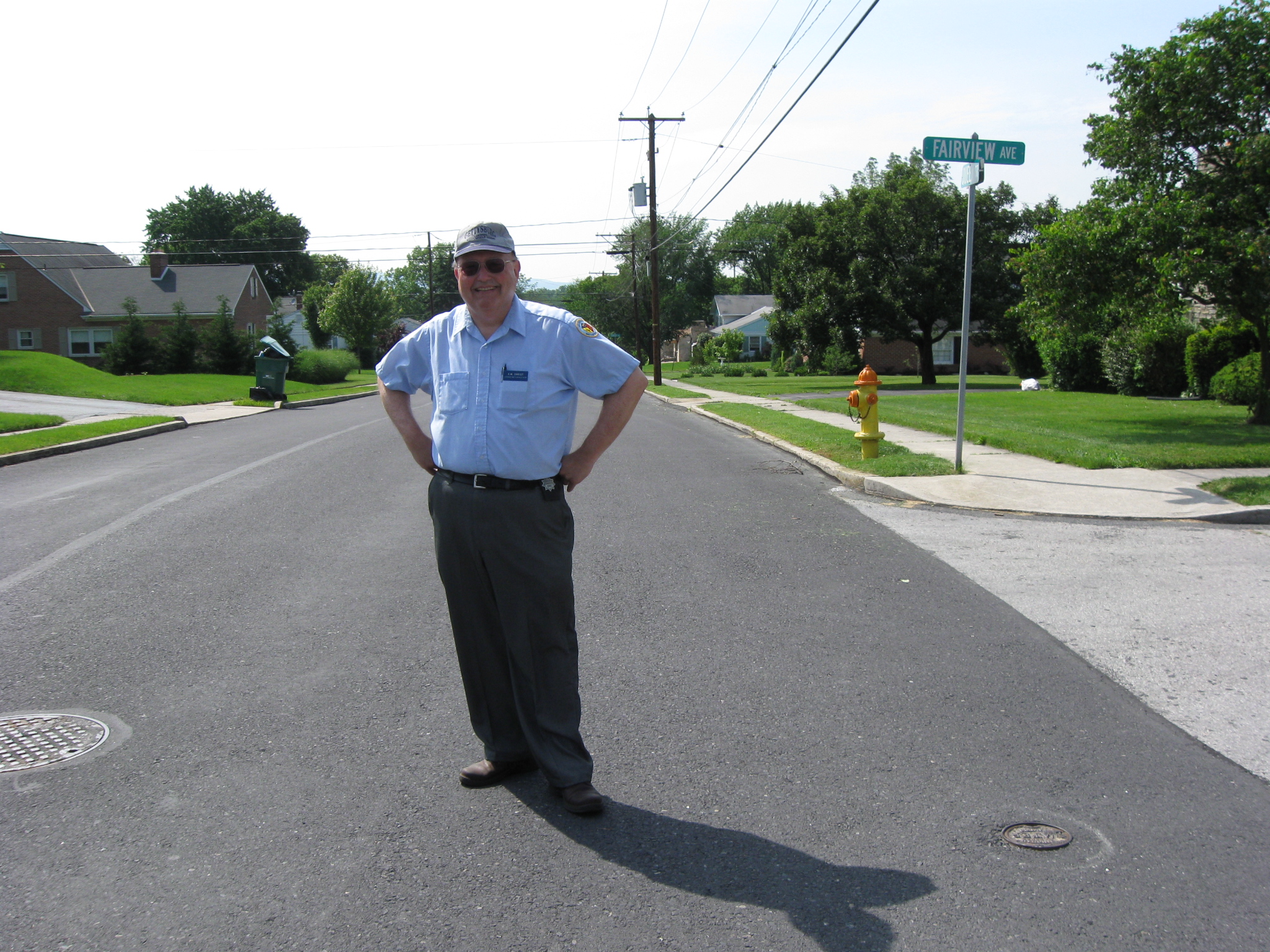
Gettysburg Licensed Battlefield Guide Elwood “Woody” Christ is the author of the book, Over a Wide, Hot,…Crimson Plain: The Struggle for the Bliss Farm at Gettysburg, July 2nd and 3rd, 1863. He is the host for our series on the fighting for the Bliss Farm. Woody is standing in Colt Park at the intersection of Fairview Avenue and Queen Street. This view was taken facing northwest at approximately 4:00 PM on Sunday, June 07, 2009.
Although many individuals know the fields of Pickett’s Charge, fewer know the action which took place in those fields around the Bliss Farm. Gettysburg Licensed Battlefield Guide Elwood “Woody” Christ begins a series on the struggle for the Bliss Farm. His book, Over a Wide, Hot,…Crimson Plain: The Struggle for the Bliss Farm at Gettysburg, July 2nd and 3rd, 1863 was published by Butternut and Blue in 1993. Woody is a Gettysburg College graduate, and has been a Licensed Battlefield Guide since 1982.
In our first post Woody Christ concentrated on some terrain in the area of the Bliss Farm, specifically in what is now the subdivision, Colt Park. In today’s post he continues his emphasis on the “broad flat knoll” which is Colt Park.
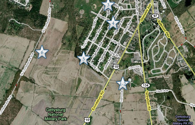
This map shows the location of where our Bliss Farm videos were produced. Videos #1-#2 were taken near the Bryan Farm. Video #3 was taken near Gettysburg Hospital on Long Lane. Video #4 was taken at the intersection of Fairview Avenue and Queen Street. Video #5 is at the intersection of Sunset Lane and Long Lane (the part of Long Lane that runs mostly east to west). Video #6 is taken in the area of the North Carolina State Monument on Seminary Ridge. This map was created facing north at approximately 4:30 PM on Wednesday, June 24, 2009.
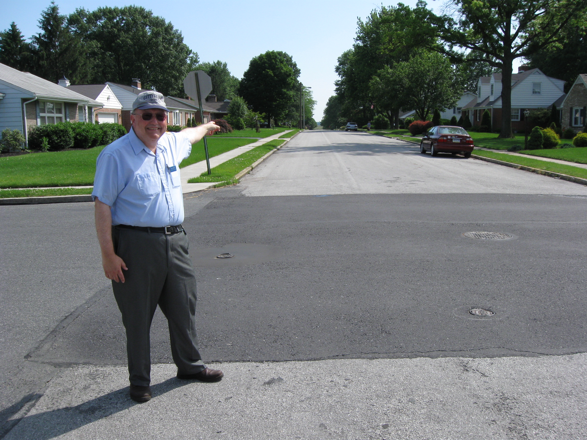
In Video #4 (Videos #s 1-3 were seen in our previous Bliss Farm post) Gettysburg Licensed Battlefield Guide Woody Christ is standing at the intersection of Fairview Avenue and Queen Street in Colt Park. He shows us how from that spot one looks downhill off the “broad, flat, knoll” in four directions. This view was taken facing northwest to southwest to northeast to southeast at approximately 4:00 PM on Sunday, June 07, 2009.
Licensed Battlefield Guide Woody Christ is still standing at the intersection of Queen Street (right to left) and Fairview Avenue which runs away from the camera position. In the distance are the Pickett’s Charge fields and the location of the Bliss Farm. This view was taken facing southwest at approximately 4:00 PM on Sunday, June 07, 2009.
Licensed Battlefield Guide Woody Christ is still standing at the intersection of Queen Street (right to left) and Fairview Avenue which runs away from the camera position. In the distance are the buildings of Gettysburg Hospital. This view was taken facing northwest at approximately 4:00 PM on Sunday, June 07, 2009.
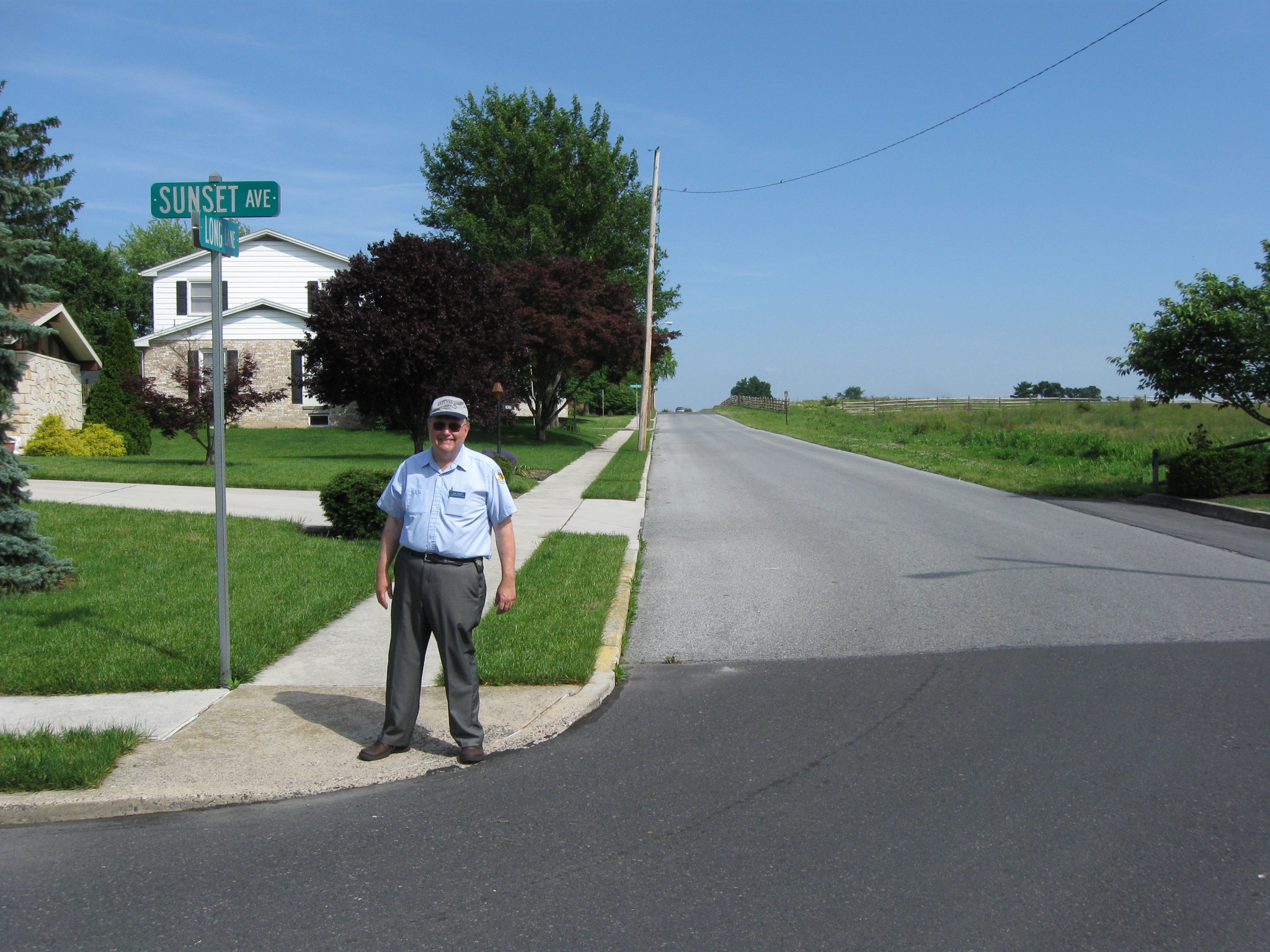
Woody Christ is standing where Sunset Avenue (coming from the left) meets Long Lane which runs away from the camera up the “broad, flat, knoll.” The “broad, flat, knoll” hides most of Cemetery Ridge. This view was taken facing southeast at approximately 4:00 PM on Sunday, June 07, 2009.
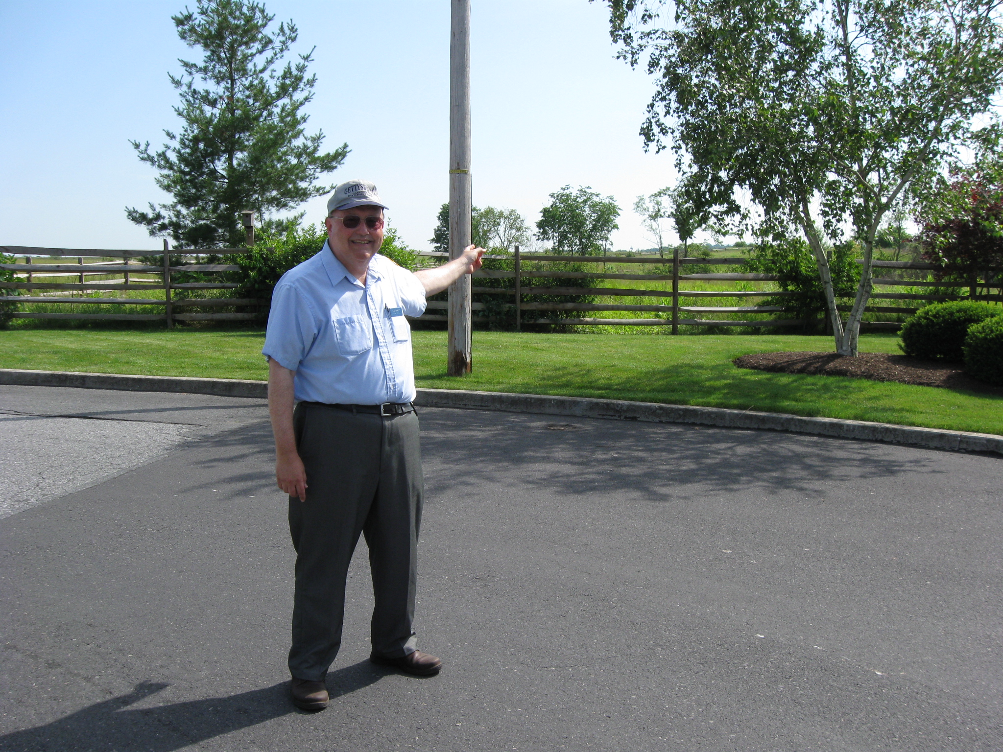
In Video #5 Gettysburg Licensed Battlefield Guide Woody Christ explains where the northern boundary of the Bliss Farm is located, and how the “broad, flat knoll” obstructs the Confederate view of Cemetery Ridge in this area. This view was taken facing southwest to southeast at approximately 4:00 PM on Sunday, June 07, 2009.
Woody points to the fence that marks the northern boundary of the Bliss Farm. The farm itself was located approximately 300 yards on the other (southwest) side of the fence. This view was taken facing southwest at approximately 4:00 PM on Sunday, June 07, 2009.
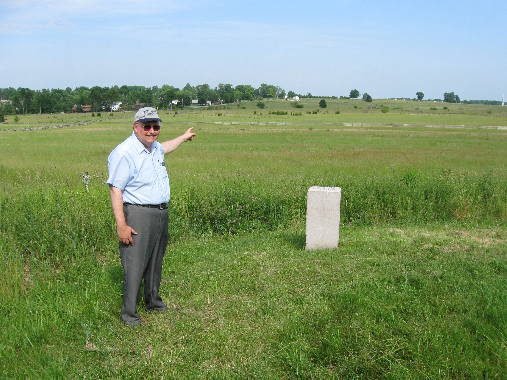
Woody is now northeast of the North Carolina State Monument on Seminary Ridge, and is pointing to the location of the Bliss Farm. Colt Park are the houses and trees in the left background. This view was taken facing southeast at approximately 4:00 PM on Sunday, June 07, 2009.
In Video #6 Gettysburg Licensed Battlefield Guide Woody Christ shows us the 60 acres of the Bliss Farm and how the subdivision, Colt Park, is located on the “broad, flat, knoll.” This view was taken facing southwest to east at approximately 4:00 PM on Sunday, June 07, 2009.
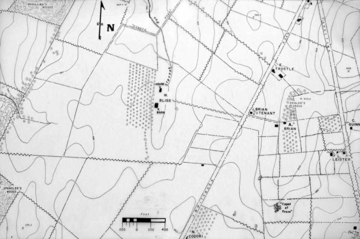
In our next Bliss Farm post we will bring the soldiers into the area of the Bliss Farm. We will use this map for the rest of the Bliss Farm posts. This map was provided by Woody Christ.
To see other posts by Gettysburg Licensed Battlefield Guides,click here.