Licensed Battlefield Guide Rich Kohr: William Wible’s Gettysburg Quarry
January 21, 2009
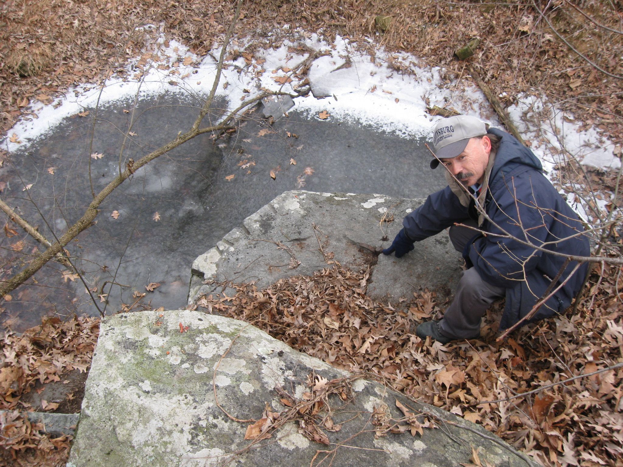
Gettysburg Licensed Battlefield Guide Rich Kohr stands atop rocks that formed William Wible’s rock quarry. This section of the quarry is east of Brook Avenue. The post-battle Gettysburg rock quarries provided material for monument bases, flank markers, bridge and road foundations, and culverts. This view was taken facing southwest at approximately 3:00 PM on Sunday, January 18, 2009.
Most of the monuments at Gettysburg National Military Park were not created in the Gettysburg area. Many times they were created in the area where a certain unit was raised, or ordered from a monument company/catalogue. Most of the bases and flank markers for these monuments, however, were quarried on the Gettysburg Battlefield. And they were taken from rocks that soldiers probably used for protection during the fighting. Post-war quarries existed in areas such as Culp’s Hill, Devil’s Den, and William Wible’s Quarry near Brooke Avenue and Rose’s Woods. The evidence that the quarry existed is still evident if one cares to do a little investigating. We were fortunate, once again, to have Licensed Battlefield Guide Rich Kohr show us the Wible Quarry site. If you have any questions for Rich, please click here to reveal his email address.
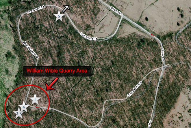
The area circled in red was used by William Wible as a post-war rock quarry. The white stars show numbers designated which video we recorded on that spot. The woods, known as Rose’s Woods at the time of the battle were known as Wible’s Woods in the late 1800s, early 1900s. Video #5 was taken just off the map in “the Loop” area. This map was created at approximately 7:30 PM on Sunday, January 18, 2009.
Video #1 starts off facing to the southwest, then panning to the northeast where Rich Kohr shows us evidence of quarrying in a large rock. This view was taken facing southwest to northeast at approximately 3:00 PM on Sunday, January 18, 2009.
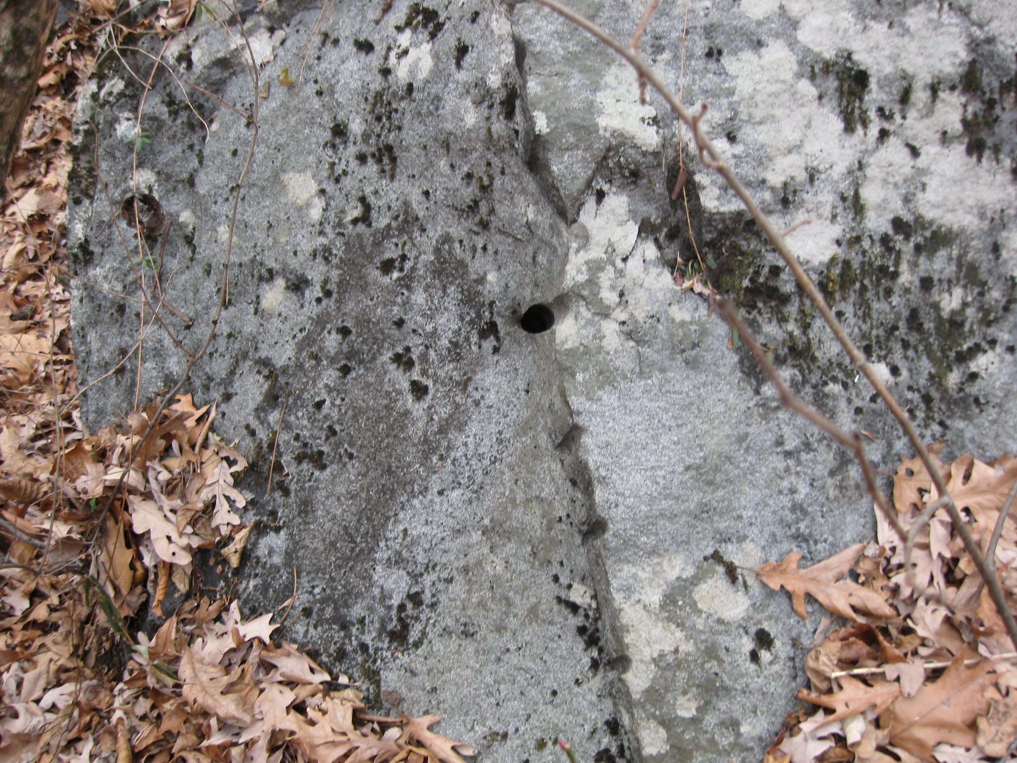
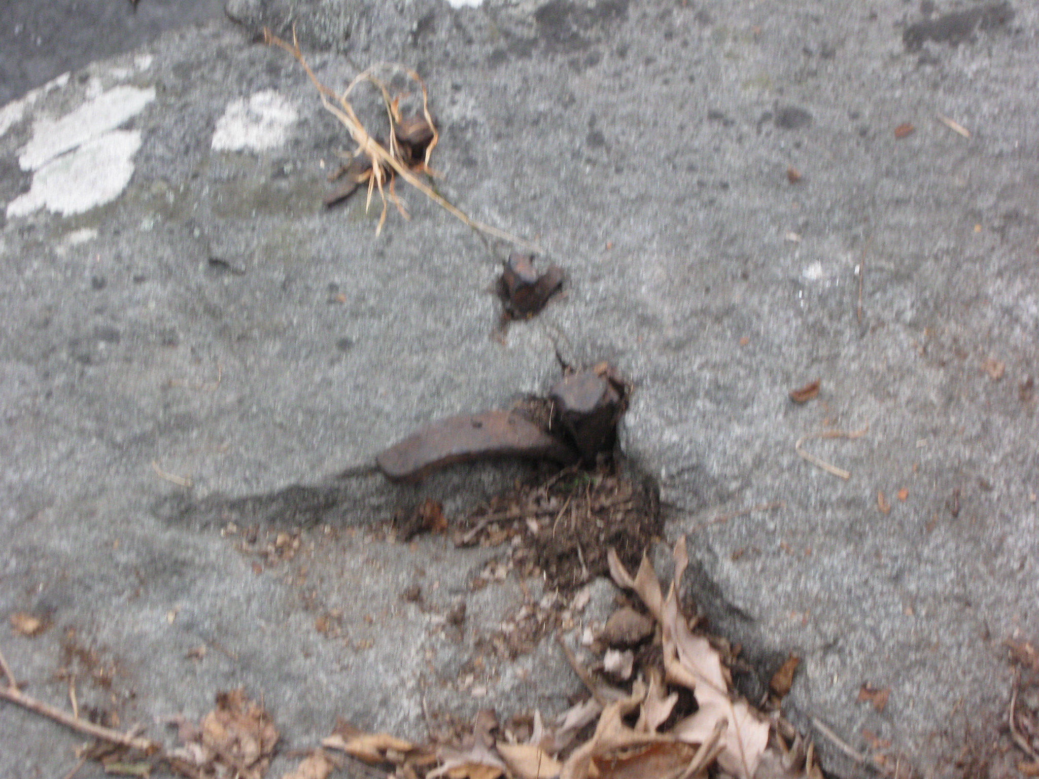
A closer view of the vertical spikes (plugs and feathers) which Rich discussed in Video #1. This view was taken facing northeast at approximately 3:00 PM on Sunday, January 18, 2009.
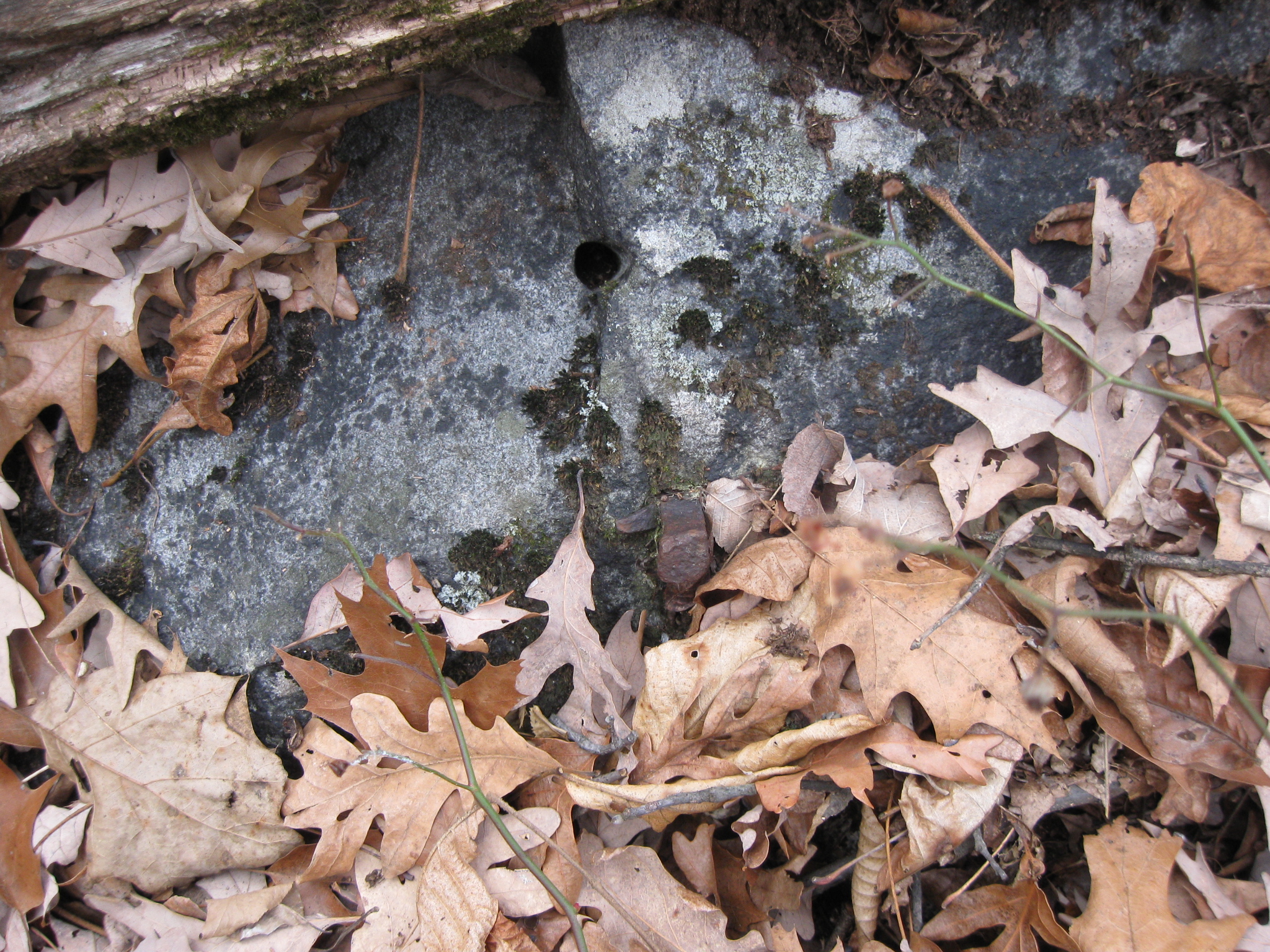
A closer view of the horizontal spikes which Rich pointed out in Video #1. This view was taken facing northeast at approximately 3:00 PM on Sunday, January 18, 2009.
We have moved to the southeast side of the rock which Rich was pointing out to us in Video #1. Here is what’s left of a corner of the rock after a piece was sheared off. Note the hole and the spike marks. This view was taken facing northwest at approximately 3:00 PM on Sunday, January 18, 2009.
Again, at the southeast side of the rock which Rich showed us in Video #1 is another spike. This view was taken facing northwest at approximately 3:00 PM on Sunday, January 18, 2009.
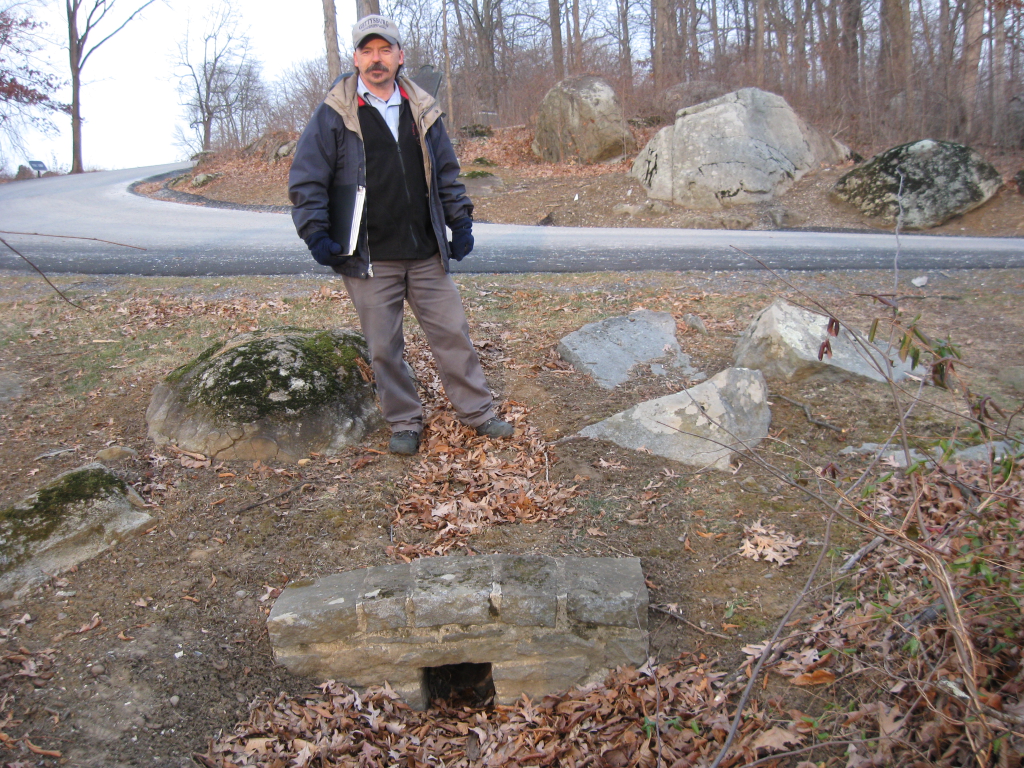
We have now moved to the west side of Brooke Avenue to the main section of William Wible’s Quarry. The large rocks below Rich have had their face sheared off from the quarrying. This view was taken facing west at approximately 3:00 PM on Sunday, January 18, 2009.
Rich is standing at the same spot in the previous picture. We have just moved above him. He is showing us where they put the plugs and feathers into the rock to make flank markers. This view was taken facing east at approximately 3:00 PM on Sunday, January 18, 2009.
In Video #2, Rich explains what they were quarrying, and shows us how far the spikes were spaced in the rock to make flank markers. This view was taken facing southeast to east at approximately 3:00 PM on Sunday, January 18, 2009.
Here is a closer view of some of the plugs and feathers that Rich showed us in Video #2. This view was taken facing southeast at approximately 3:00 PM on Sunday, January 18, 2009.
In Video #3, Rich has stayed in the same spot as Video #2, we have just moved to the east side of the quarry area. Rich shows us plugs and feathers on the east side of the rock. This view was taken facing west at approximately 3:00 PM on Sunday, January 18, 2009.
A closer view of the holes (score marks) which Rich showed us on the front (east) side of the rock in Video #3. This view was taken facing west at approximately 3:00 PM on Sunday, January 18, 2009.
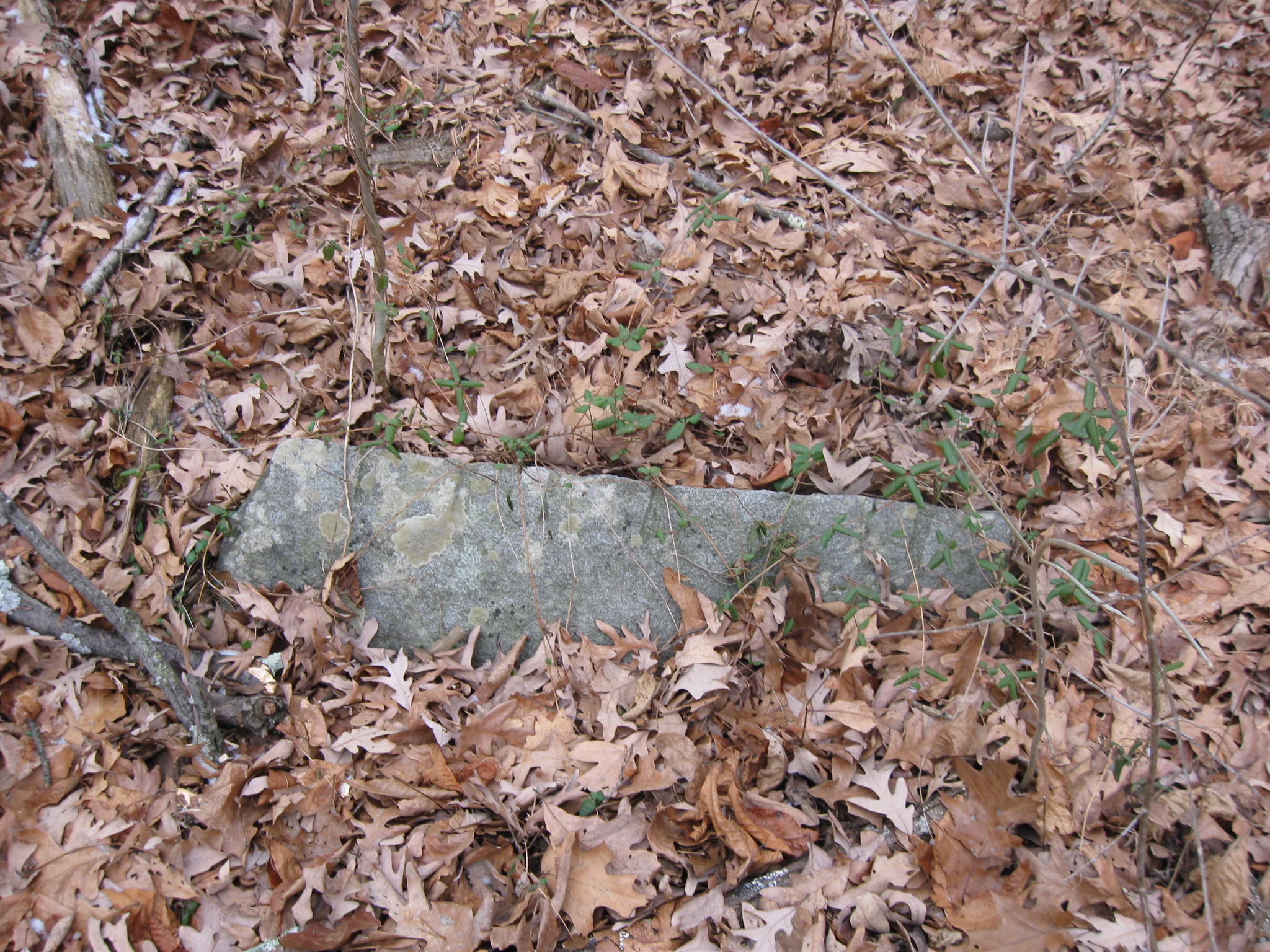
Closer to Brooke Avenue, we found this group of three quarried stones. This view was taken facing southwest at approximately 3:00 PM on Sunday, January 18, 2009.
In Video #4, Rich shows us three quarried stones on the ground near Brooke Avenue. This view was taken facing northeast to southwest at approximately 3:00 PM on Sunday, January 18, 2009.
Here’s what appears to be the partially buried flank marker that wasn’t used/needed on the field. Rich showed us this stone in Video #4. This view was taken facing northwest at approximately 3:00 PM on Sunday, January 18, 2009.
We are now in “the Loop” area, just west of the monument to the 22nd Massachusetts Infantry Regiment. Rich is standing by a culvert that was probably quarried from the stones around it. This view was taken facing north at approximately 4:30 PM on Sunday, January 18, 2009.
In Video #5, Rich shows us the culvert and the rocks that were quarried around it, and that possibly made it. We don’t know for sure if William Wible was responsible for this quarrying or not. This view was taken facing north at approximately 4:30 PM on Sunday, January 18, 2009.
See the following related posts:
Willoughby Run Quarry on December 4, 2008.
More Willoughby Run/McPherson Ridge Quarries on December 15, 2008.
Boundary Markers on November 27, 2008.
And the Nomination for Most Thorough Burying of a Flank Marker Goes To… on November 14, 2008.
Left flank marker of Knap’s Pennsylvania Battery thrown behind NPS building on November 9, 2008.
National Park Service moving flank markers on October 23, 2008.
National Park Service decision not to move the Reynolds Avenue flank markers on October 22, 2008.
“Do the Flank Markers on Reynolds Avenue Need to be Moved?” on October 16, 2008.
Dirt and gravel returning to the flank markers on October 15, 2008.
Dirt and gravel being removed from the flank markers on October 10, 2008.
Dirt and gravel burying the markers on October 9, 2008.
Doubleday Avenue Roadwork on October 1, 2008.
Asphalt touches the flank marker of the 147th New York on September 30, 2008.
Covering up their mistakes with asphalt touching boulders in The Loop on September 22, 2008.
Slathering the Loop With Asphalt on September 13, 2008.
Devil’s Den: Aftermath of the Construction on September 11, 2008.
See our previous posts on Gettysburg Licensed Battlefield Guides:
Gettysburg Guide Room: The Final Days on March 8, 2008.
Lights Out at the Electric Map on April 13, 2008.
New Guide Room at the New Visitor Center on April 19, 2008.
New Association of Licensed Battlefield Guide Office and Library Opens on August 25, 2008.
Evergreen Cemetery Headstone Damage with LBG Deb Novotny on October 20, 2008.
Camp Letterman Part 1 with LBG Phil Lechak on November 15, 2008.
Camp Letterman Part 2 with LBG Phil Lechak on November 17, 2008.
Gettysburg Artillery Part 1 with LBG George Newton on November 21, 2008.
“Mammy’s Little Baby Loves Guided Tours” with LBG Charlie Fennell on November 23, 2008.
Bucktails on McPherson’s Ridge Part 1 with LBG Rich Kohr on November 26, 2008.
Gettysburg Licensed Battlefield Guide Exam 2008 on December 6, 2008.
Gettysburg Hawk Hunting with Licensed Battlefield Guide Dave Weaver on December 14, 2008.
Licensed Battlefield Guide Rich Bellamy: Colonel Edward Ephraim Cross Part 1 on January 3, 2008.
Licensed Battlefield Guide Rich Bellamy: Colonel Edward Ephraim Cross Part 2 on January 5, 2009.