The tree cutting on the William Patterson Farm between Hancock Avenue and the Taneytown Road is exposing a large portion of Cemetery Ridge. The William Patterson House, still undergoing renovation on the east side of the Taneytown Road, is on the right. The Pennsylvania Monument on Cemetery Ridge is now clearly seen in the background. This view was taken facing northwest at approximately 8:30 AM on Sunday, November 9, 2008.
The Battlefield Rehabilitation (tree cutting) on the William Patterson Farm between the Taneytown Road and Hancock Avenue opens up the area to appear closer to the way that it looked at the time of the battle. The Pennsylvania Monument is now easily viewable from the Taneytown Road. The trees have been cut down up to the National Park Service Maintenance area. We have previously presented how earthworks have been revealed. A walk around this area shows that a few other items are also showing up in what used to be woods.
See our previous posts of the work in this area:
“Taneytown Road Battlefield Rehabilitation” on July 18, 2008.
“Cemetery Ridge Rehabilitation Update” on August 9, 2008.
“Tree Cutting Exposes and Sometimes Damages Cemetery Ridge Earthworks” on October 29, 2008.
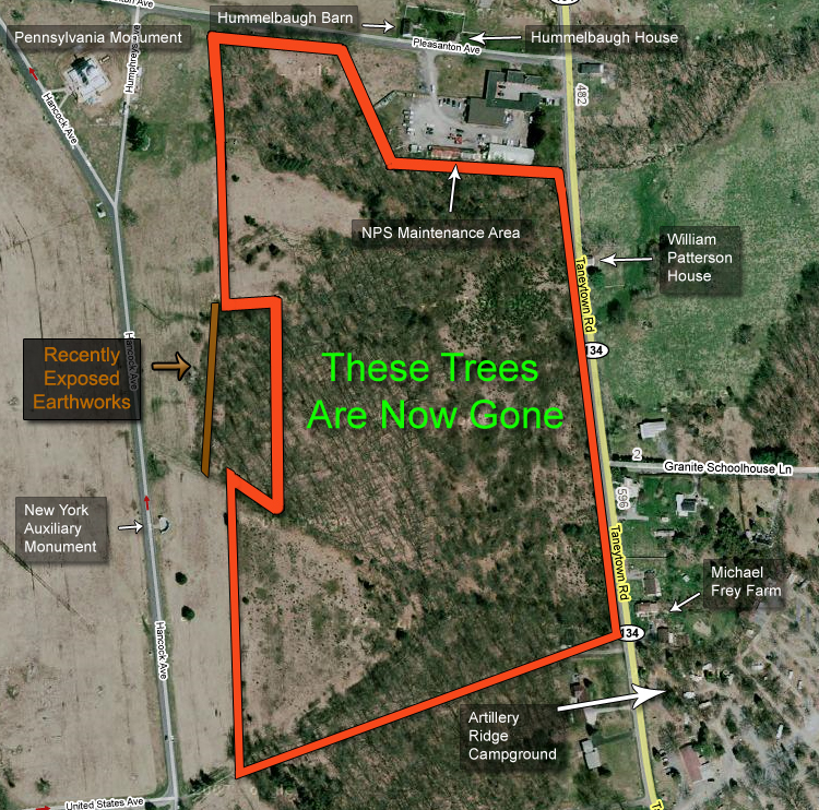
We have outlined in red the general area from which the trees have and are being removed. According to the map programs that we have, this area consists of just over 33 acres. This map was created from the south facing north at approximately 5:00 PM on Sunday, November 9, 2008.
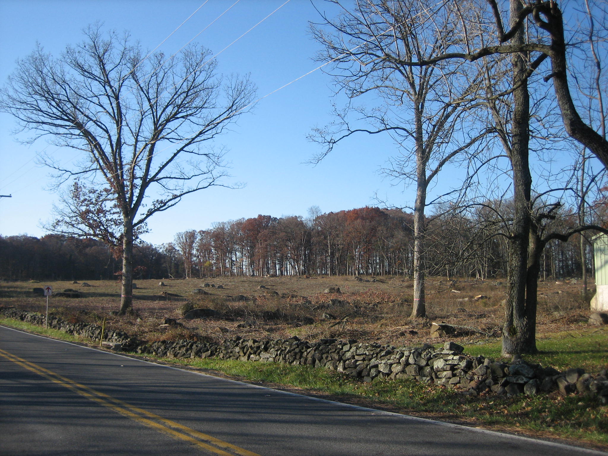
We’ll start our walk at the northeast corner of the tree cutting area near the National Park Service Maintenance area. The Taneytown Road is on the left. Part of the maintenance area is visible on the right. This view was taken facing southwest at approximately 8:30 AM on Sunday, November 9, 2008.
We are in the same area as the previous picture looking along the south side of the maintenance area. There have not been many trees left here to screen the maintenance area from the viewshed. This view was taken facing west at approximately 8:30 AM on Sunday, November 9, 2008.
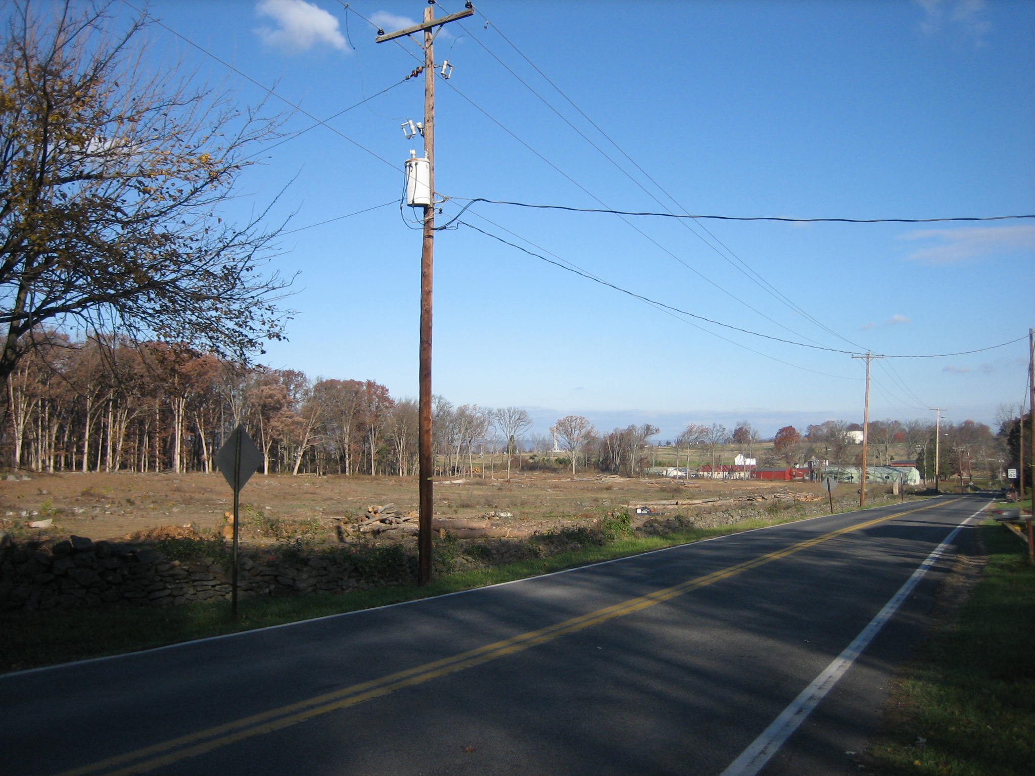
We are along the Taneytown Road just west of the William Patterson Farm. There is a large cleared area between the William Patterson House and the Pennsylvania Monument. This view was taken facing northwest at approximately 8:30 AM on Sunday, November 9, 2008.
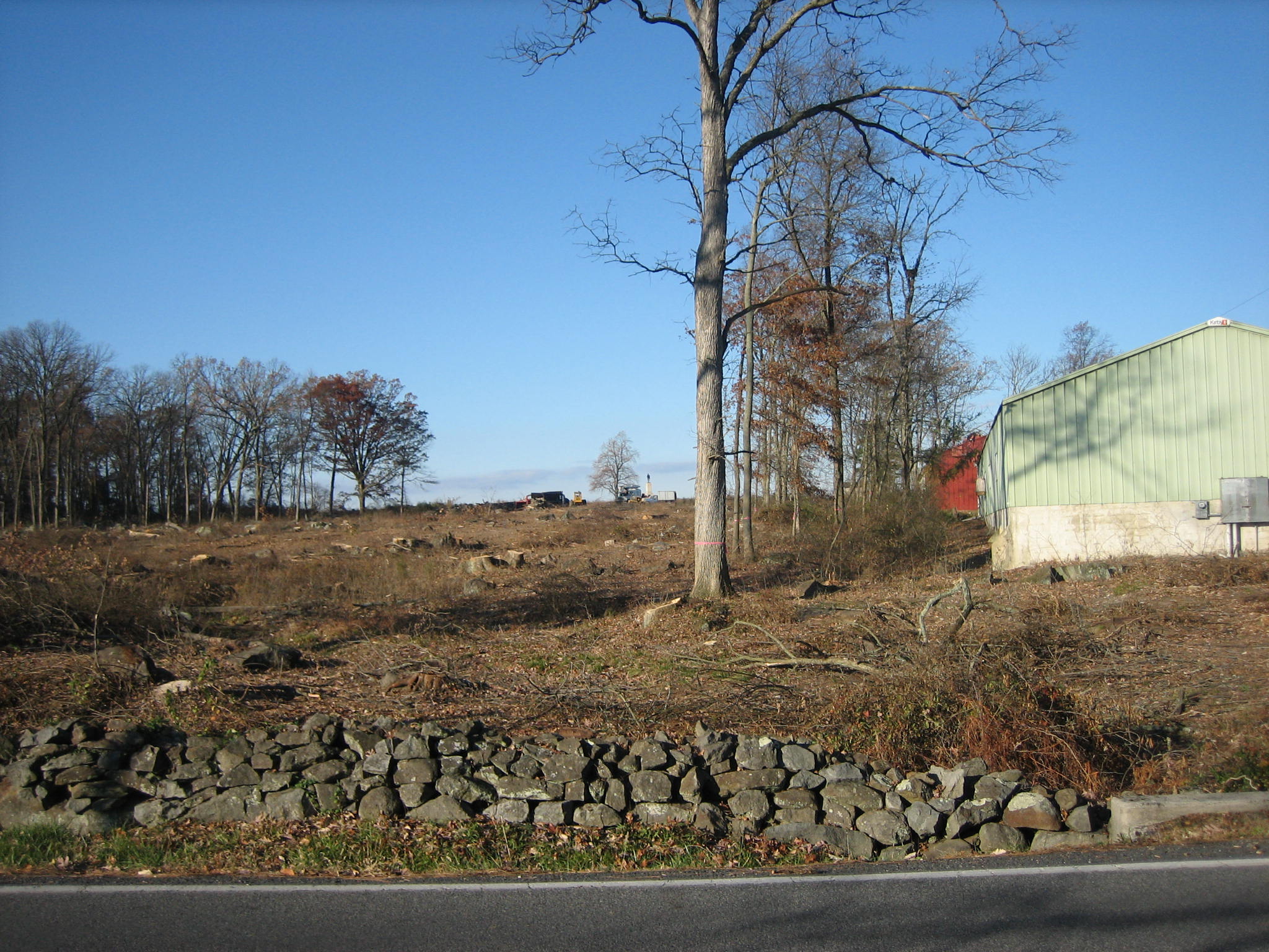
We’ve now come west into the field and turned to look at how exposed the maintenance area is. There has been talk among National Park Service personnel that after cutting down the trees, a fence will now have to be built to screen the buildings. This view was taken facing north at approximately 8:30 AM on Sunday, November 9, 2008.
This view shows the Pennsylvania Monument visible through the trees on the left. The Cyclorama building on Cemetery Hill is visible over the right (east) half of the green maintenance building. Above the red maintenance building is the white Hummelbaugh Barn. Above the left (west) half of the green maintenance building is the white Hummelbaugh House. This view was taken facing northwest at approximately 8:30 AM on Sunday, November 9, 2008.
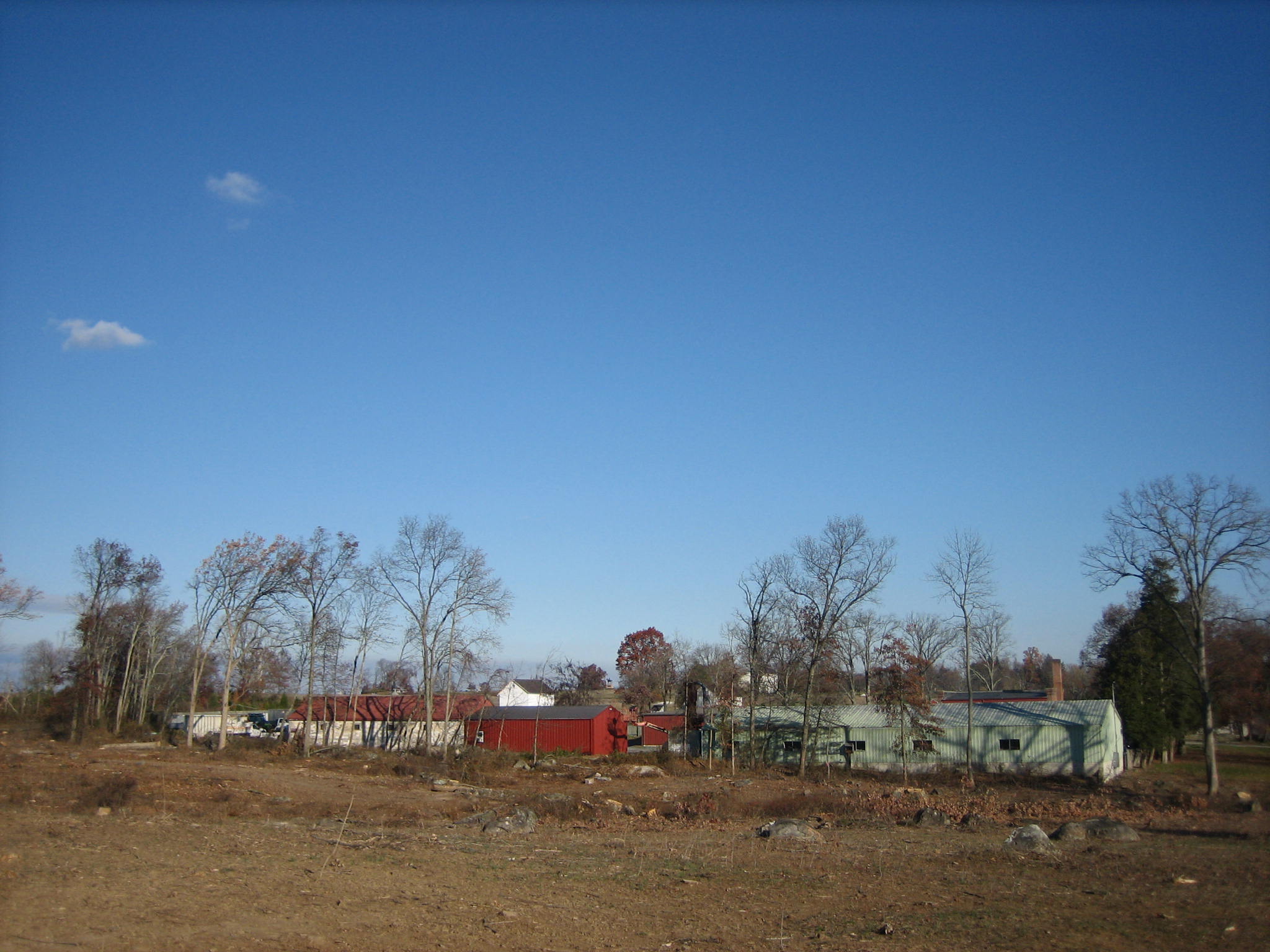
We are now by the Michael Frey Farm on the east side of the Taneytown Road. The Cyclorama building is still visible in the background above the green maintenance building. This view was taken facing northwest at approximately 8:30 AM on Sunday, November 9, 2008.
We’ll walk along the horse trail near Artillery Ridge Campground. The New York Auxiliary Monument is visible above the trail along Hancock Avenue. This view was taken facing west at approximately 8:30 AM on Sunday, November 9, 2008.
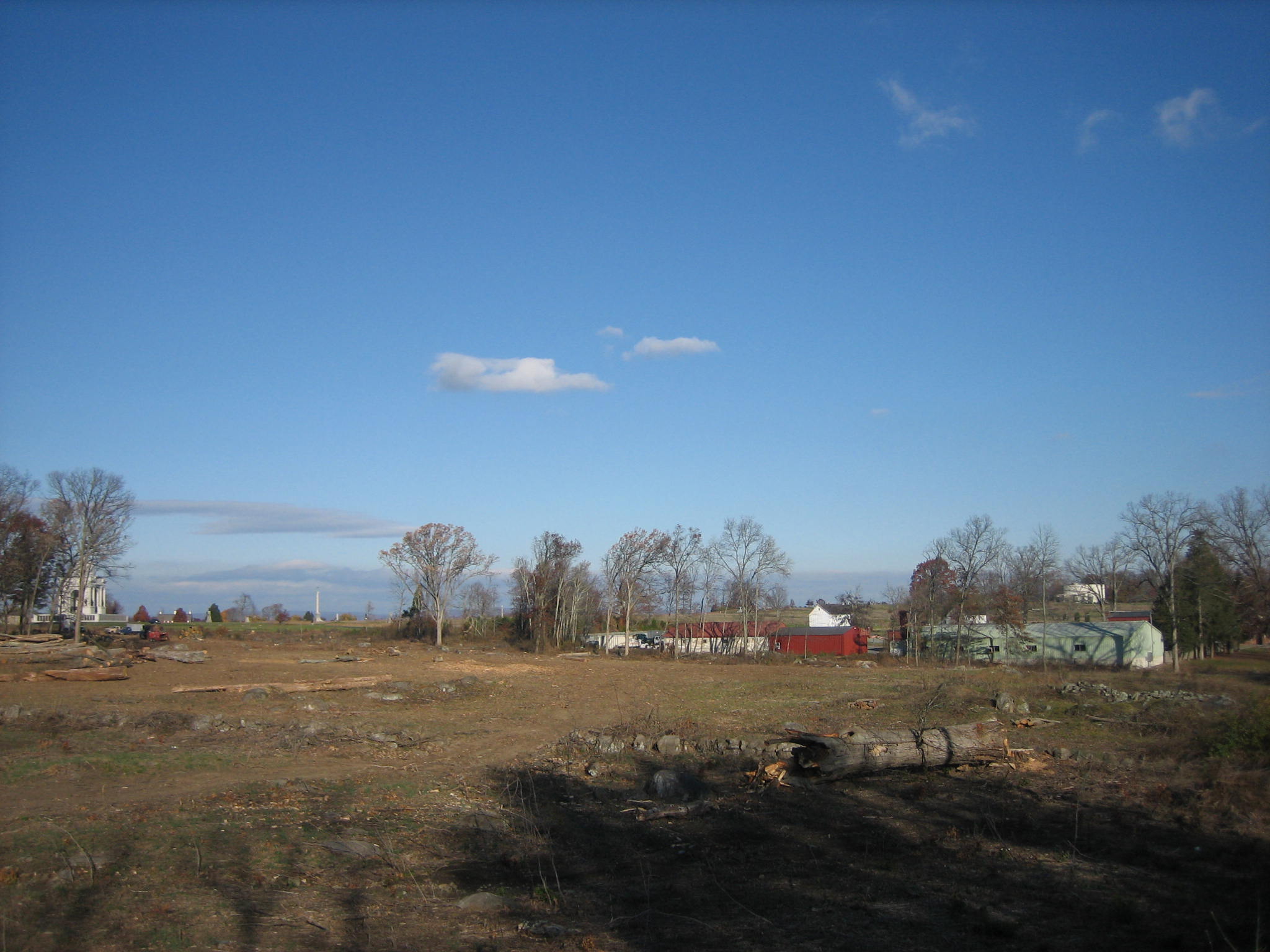
Here is the Patterson Farm from the southeast corner of the recently cleared area. This view was taken facing north at approximately 8:30 AM on Sunday, November 9, 2008.
Halfway up (west on) the trail. The Cyclorama Building is visible on Cemetery Hill (Ziegler’s Grove). The Hummelbaugh Barn is visible over the light colored maintenance building with the red roof. The Hummelbaugh House is visible over the red maintenance building with the dark colored roof. The William Patterson House is visible to the right on the east side of the Taneytown Road. This view was taken facing north at approximately 8:30 AM on Sunday, November 9, 2008.
The Patterson Farm from the southwest corner of the recently cleared area. The Hummelbaugh Barn is the white structure to the left of the light colored maintenance building with the red roof. The Hummbelbaugh House is now above the light colored structure with the red roof. The William Patterson House is to the left of the tree with yellow (gold?) leaves. This view was taken facing northeast at approximately 8:30 AM on Sunday, November 9, 2008.
The Patterson Farm from the northwest corner of the tree cutting area (from the top of the Pennsylvania Monument). The maintenance area is in what is left of the woods in the center background. The Hummelbaugh barn and house are the white buildings to the left (north) of the maintenance area. The William Patterson House is in the right background to the right of the yellow (gold) tree, and to the left of the green tree by the Taneytown Road. This view was taken facing east at approximately 11:45 AM on Sunday, November 9, 2008.
Here is a panorama from the southeast corner of the Pennsylvania Monument taken on October 17, 2008. We begin north with the Copse, or Clump, of Trees at the High Water Mark, and continue to the south until we see Hancock Avenue, and the First Minnesota Monument. This view was taken facing north, northeast, east, southeast, and south at approximately 5:30 PM on Friday, October 17, 2008.
Here is the same panorama today (for the larger JPEG version click here, or you can download the uncompressed TIFF file (27.2 MB) here). This view was taken facing north, northeast, east, southeast, and south at approximately 11:30 AM on Sunday, November 9, 2008.
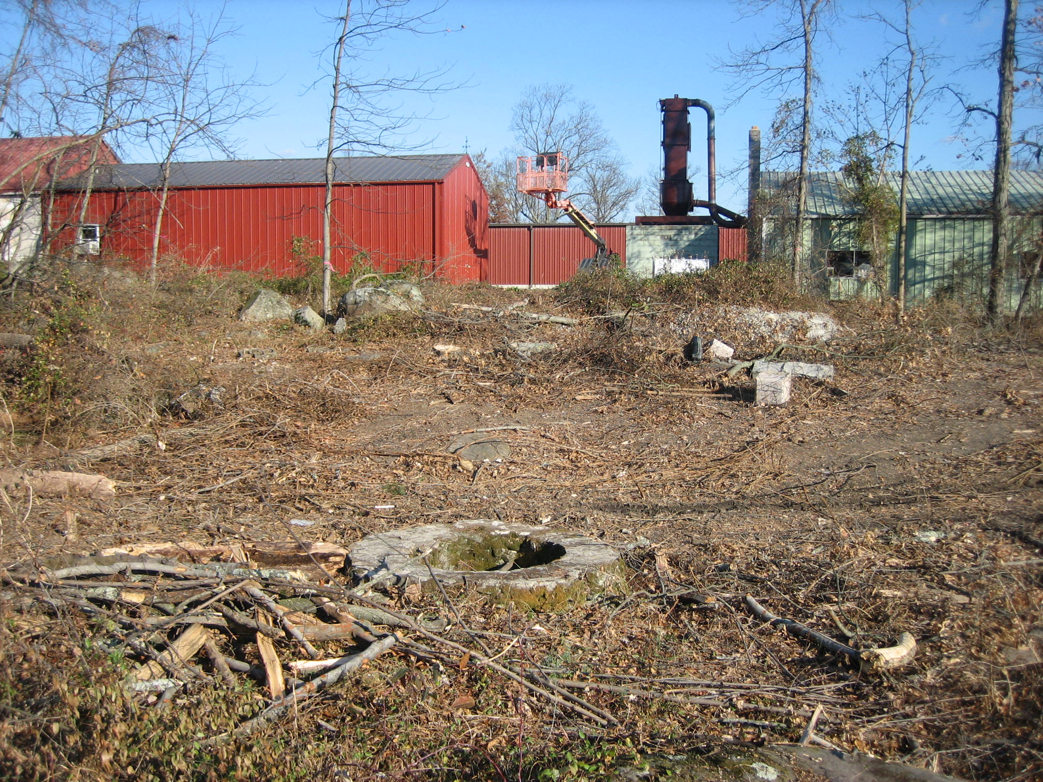
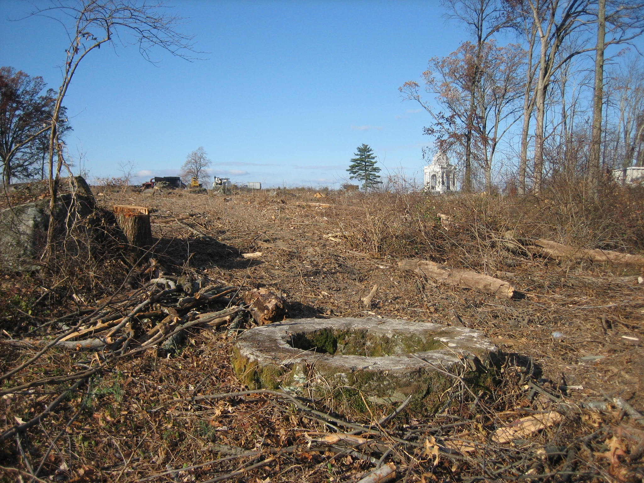
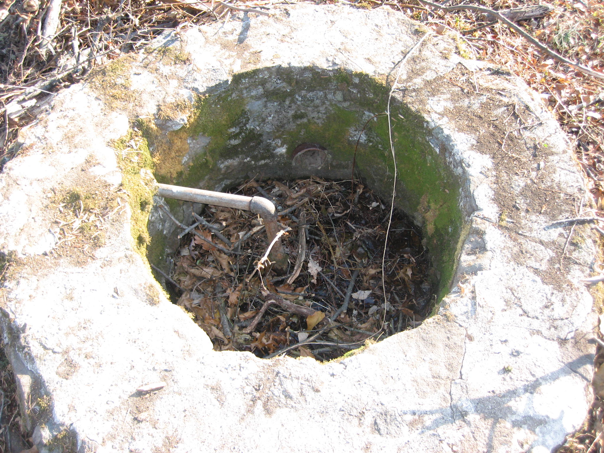
Now that the trees are cleared around the maintenance area, it’s interesting to see what has been revealed. Here is a well/cistern on the south side of the maintenance area. This view was taken facing north at approximately 8:30 AM on Sunday, November 9, 2008.
Not being well/cistern experts, we have no idea how old it is. This view was taken facing west at approximately 8:30 AM on Sunday, November 9, 2008.
The well/cistern sits in a drainage area (ditch) that channels the water eastward, underneath the Taneytown Road. This view was taken facing east at approximately 8:30 AM on Sunday, November 9, 2008.
Yes, it has been filled up. This view was taken facing east at approximately 8:30 AM on Sunday, November 9, 2008.
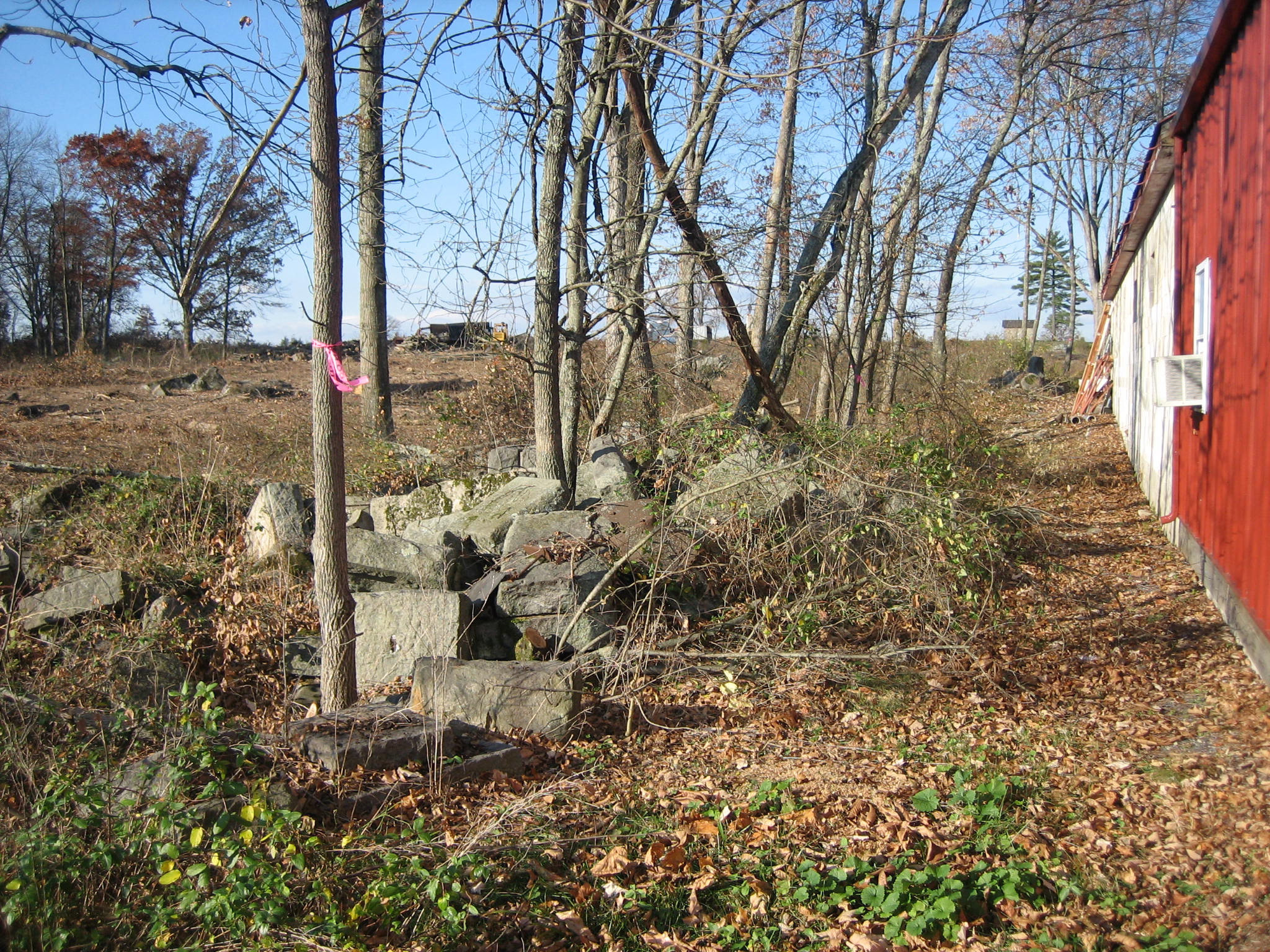
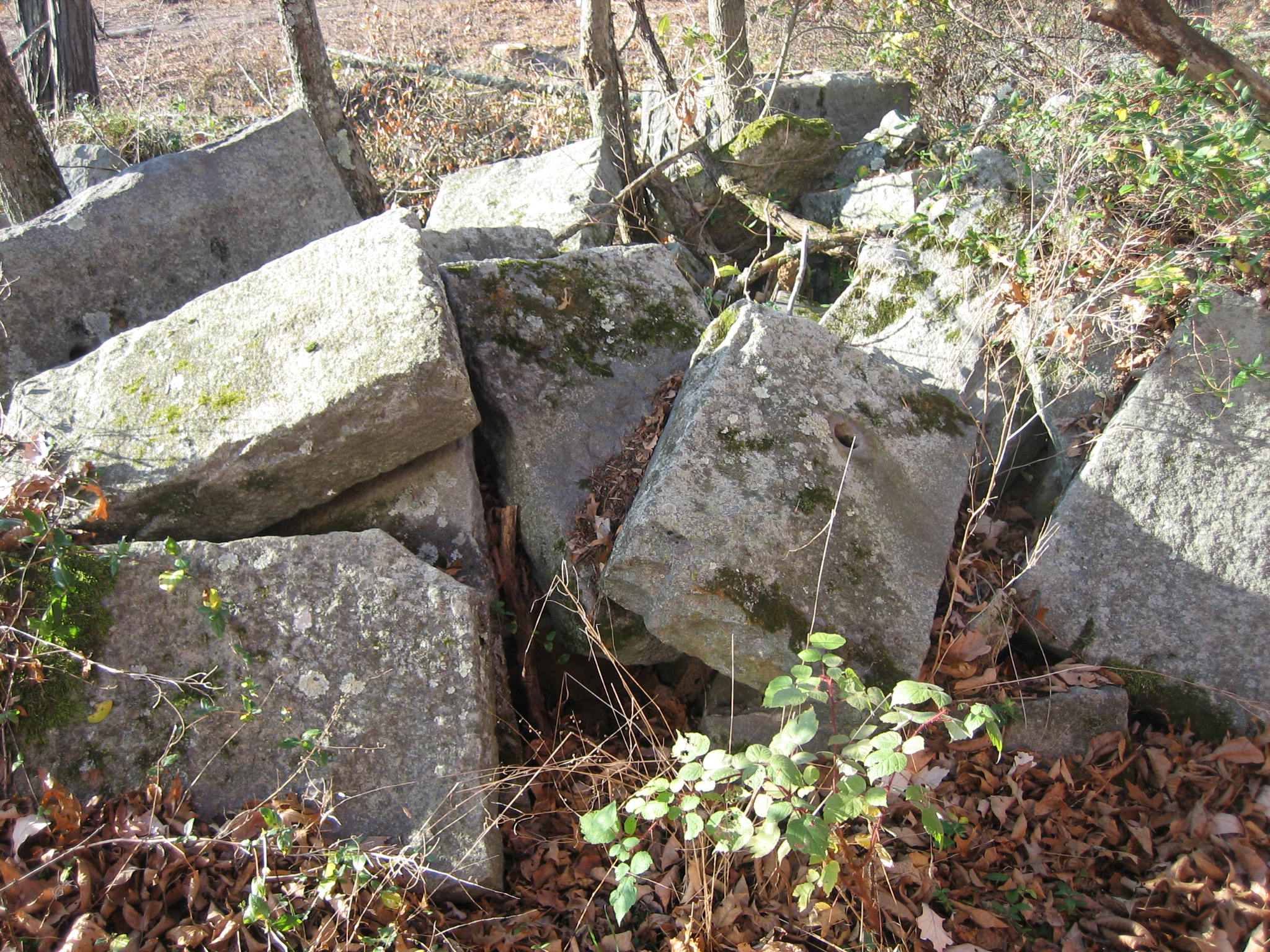
There are also piles of stones on the south side of the maintenance area. This view was taken facing west at approximately 8:30 AM on Sunday, November 9, 2008.
They appear to be the stones used in bridge work on the battlefield. This view was taken facing south at approximately 8:30 AM on Sunday, November 9, 2008.
There is a pile of cement posts that appear to be the posts that the War Department used as boundary markers. They stuck iron pipes in the stones to form fences to mark the National Military Park property line. This view was taken facing southwest at approximately 8:30 AM on Sunday, November 9, 2008.
What appears to be a garbage pile between the well/cistern and the maintenance building holds some interesting items. This view was taken facing south at approximately 8:30 AM on Sunday, November 9, 2008.
Maybe someone can inform us what part of a United States marker this is, because we can’t place it off the top of our heads. Contact us by email from our About Us page. This view was taken facing north at approximately 8:30 AM on Sunday, November 9, 2008.
The garbage pile looks more interesting from this angle. This view was taken facing north at approximately 8:30 AM on Sunday, November 9, 2008.
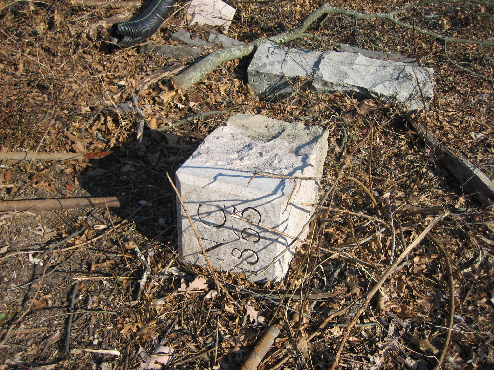
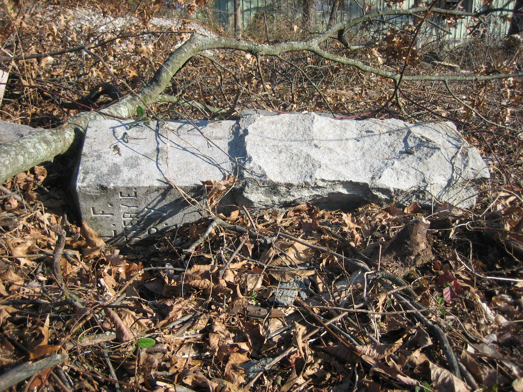
Here is the first of what we believe are two North Carolina markers that help show the boundary around the North Carolina State monument. This view was taken facing north at approximately 8:30 AM on Sunday, November 9, 2008.
Here’s the other one. Why aren’t these out on the field? This view was taken facing southwest at approximately 8:30 AM on Sunday, November 9, 2008.
Here’s the best find. At the beginning of October, someone stole the ball on top of the monument to Knap’s Pennsylvania Battery on Culp’s Hill near the observation tower. That hasn’t been found, but if anyone is looking for the left flank marker to Knap’s Pennsylvania Battery (Independent Battery E), here it is, partially buried south of the NPS maintenance buildings. This view was taken facing north at approximately 8:30 AM on Sunday, November 9, 2008.


