What is probably the most visible quarry at Gettysburg National Military Park was not a quarry at the time of the battle — it was a pond. The quarry is on the western arm of McPherson’s Ridge. Stone Avenue is on the right. McPherson’s/Herbst’s/Reynolds’ Woods is in the background. The statue to John Burns is in the center background. This view was taken facing southwest at approximately 4:15 PM on Monday, December 15, 2008.
This weekend, we were gently informed by Licensed Battlefield Guide Rich Kohr that the Quarry that we showed on our December 4th post is just a small part of the Quarry that was present at the time of the battle. We knew the Quarry was bigger, but Rich informed us that much of the larger part remains. We needed to go look at the whole area. So we did that on Sunday afternoon, and found out that of course, he was correct.
In our conversation he informed us of something else which we hopefully forgot a long time ago, or more likely, of which we were never aware. The pond, that is located near the 150th Pennsylvania monument on McPherson’s Ridge, was not only larger at the time of the battle, it originally was another quarry.
See our first post on the Willoughby Run Quarry on December 4, 2008.
We showed this map on our December 4, 2008 post with only one Quarry outlined in orange. UPON FURTHER REVIEW, however, we now know that other quarries are in the area. We have labeled the quarry which we featured on December 4th as #1. Quarries #2 and #3 probably joined with #1 in the 1860s to form one large quarry. We have also labeled the Quarry/Pond by the monument to the 150th Pennsylvania Infantry Regiment. This Map was created at approximately 5:30 PM on Sunday, December 14, 2008.
When the 150th Pennsylvania Infantry Regiment was in this position on the afternoon of July 1, 1863, where their monument is now located, they noticed Confederates approaching them, but then veering off to the left (south). The Confederates were probably Brockenbrough’s Virginia Brigade. One of the officers stated later that he didn’t understand at the time why they veered to the south until he walked down to the area and noticed a large quarry. Quarry #2 on our map is the area where the woods are pointing towards the 150th Pennsylvania. This view was taken facing northwest at approximately 2:30 PM on Sunday, December 14, 2008.
We jumped the fence at the edge of Reynolds’/Herbst’s/McPherson’s Woods near the monument to the 7th Wisconsin Infantry Regiment, and began walking towards the strip of woods that hides the quarry. This view was taken facing northwest at approximately 2:30 PM on Sunday, December 14, 2008.
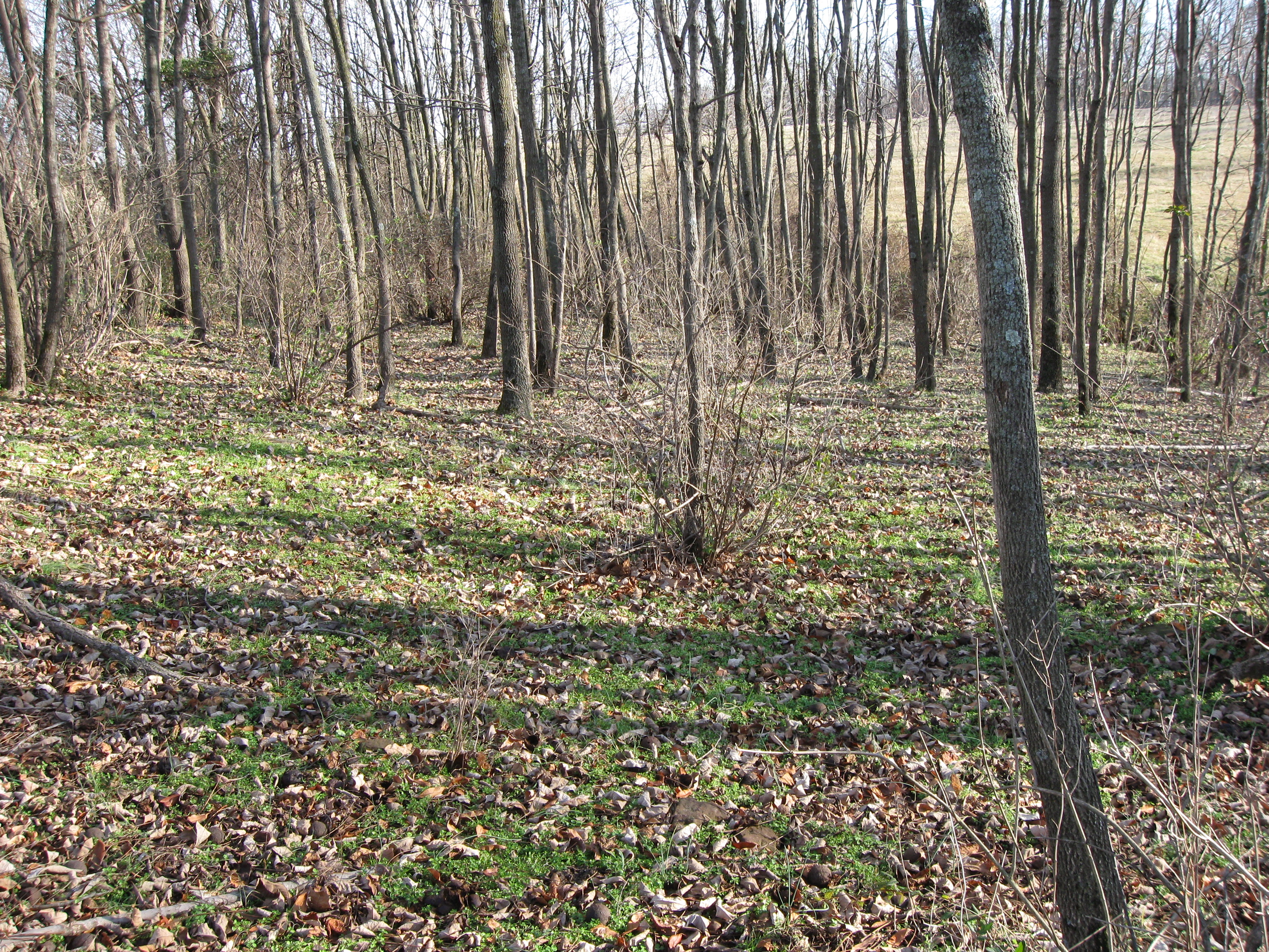
We arrived at the location where the woods point towards the McPherson Farm. This view was taken facing northwest at approximately 4:45 PM on Thursday, December 4, 2008.
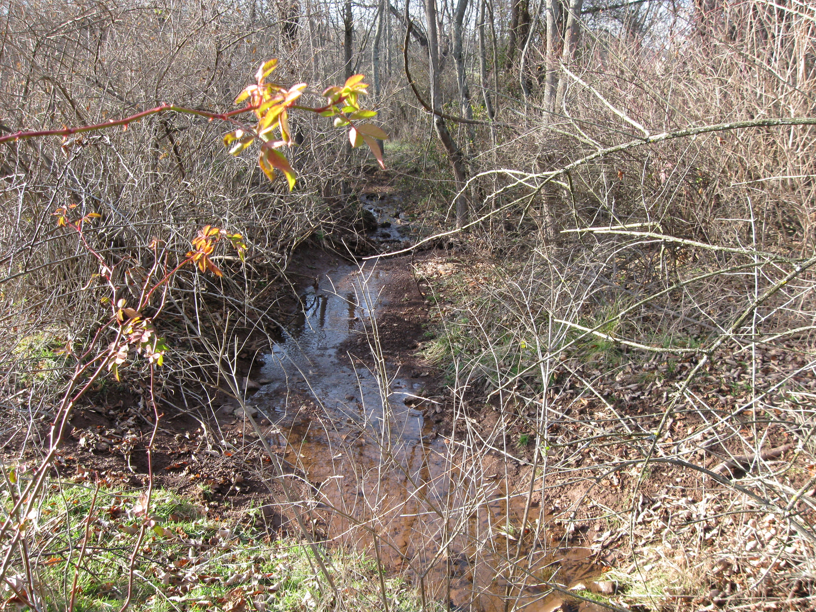
There is a small stream that leaves the Pond/Quarry on McPherson’s Ridge near Stone’s Avenue, and flows towards Willoughby Run. This view was taken facing northwest at approximately 2:30 PM on Sunday, December 14, 2008.
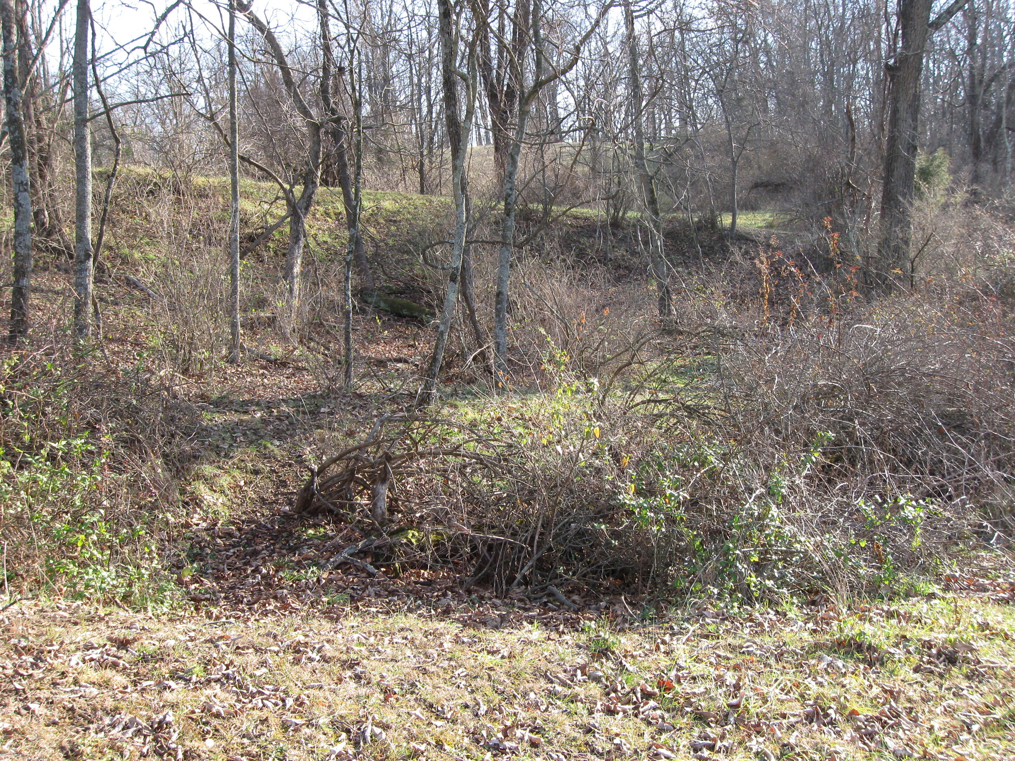
We’ve walked down the south side of the woods and are looking back towards the McPherson Barn. Here one can tell how steep the sides of the quarry are at this point, and it’s not all made by that runoff from the Quarry/Pond at the top of the hill. Look through the trees to the light colored grass on the other side. Notice how the elevation has dramatically changed. This view was taken facing northeast at approximately 2:30 PM on Sunday, December 14, 2008.
Now let’s walk down the other (north) side of the strip of woods surrounding Quarry #2. This view was taken facing southwest at approximately 2:30 PM on Sunday, December 14, 2008.
We’re again looking back at the McPherson Barn. The trees surrounding Quarry#2 are on the right. The trees behind (south of) the West End Guide Station are on the left. This view was taken facing east at approximately 2:30 PM on Sunday, December 14, 2008.
From this position we’re looking down into Quarry #2. The small runoff stream from the Pond/Quarry is at the bottom of Quarry #2. This view was taken facing southwest at approximately 2:30 PM on Sunday, December 14, 2008.
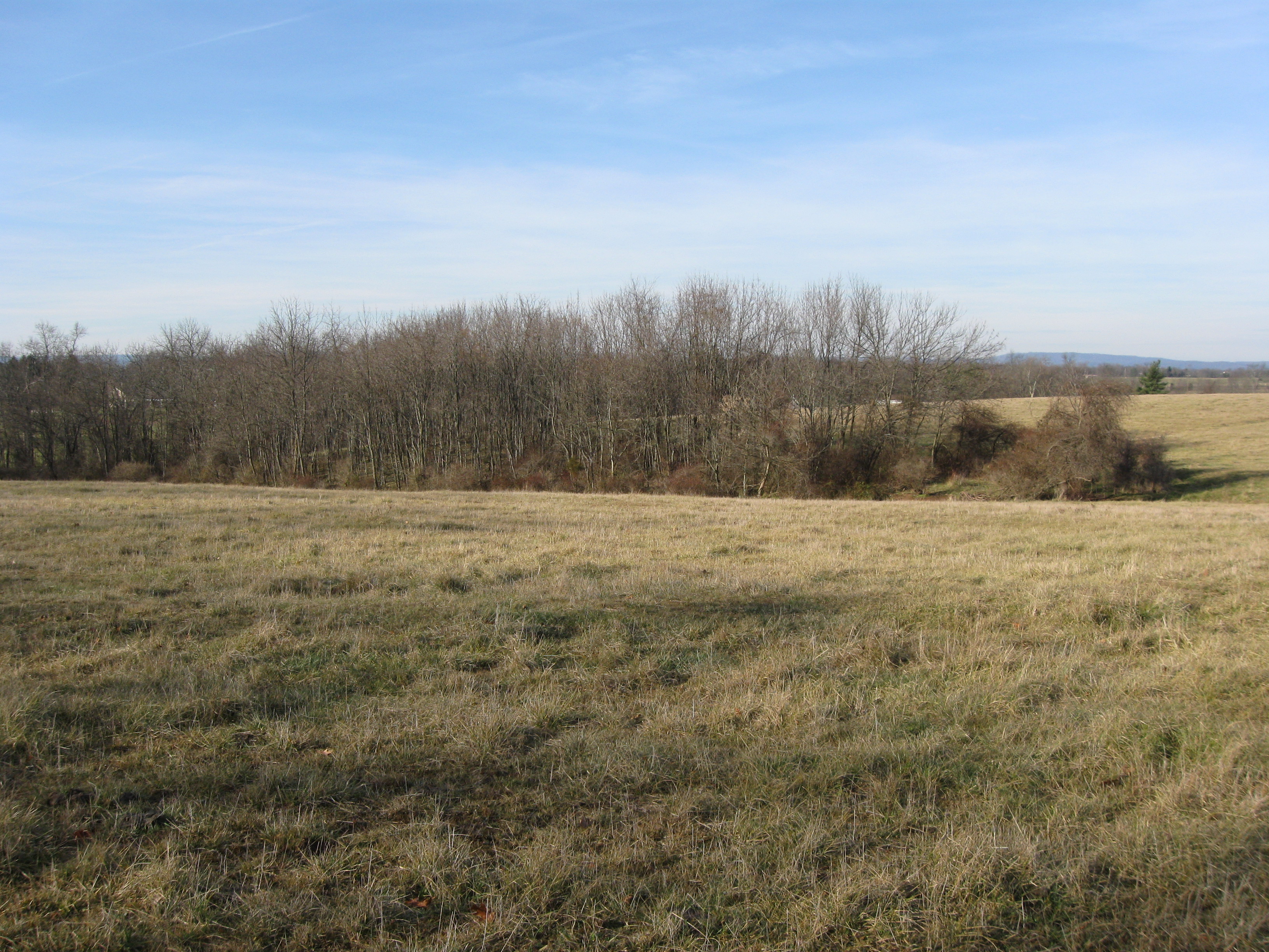
We’re in Quarry #2 and looking towards Herbst’s/Reynolds’/McPherson’s Woods on the higher ground across the field in the background. This view was taken facing southeast at approximately 2:30 PM on Sunday, December 14, 2008.
We exited Quarry #2 on the north side, and began walking west towards Willoughby Run when we came upon Quarry #3. This view was taken facing southwest at approximately 2:30 PM on Sunday, December 14, 2008.
Here’s the northern section of Quarry #3 with Willoughby Run in the background. This view was taken facing northwest at approximately 2:30 PM on Sunday, December 14, 2008.
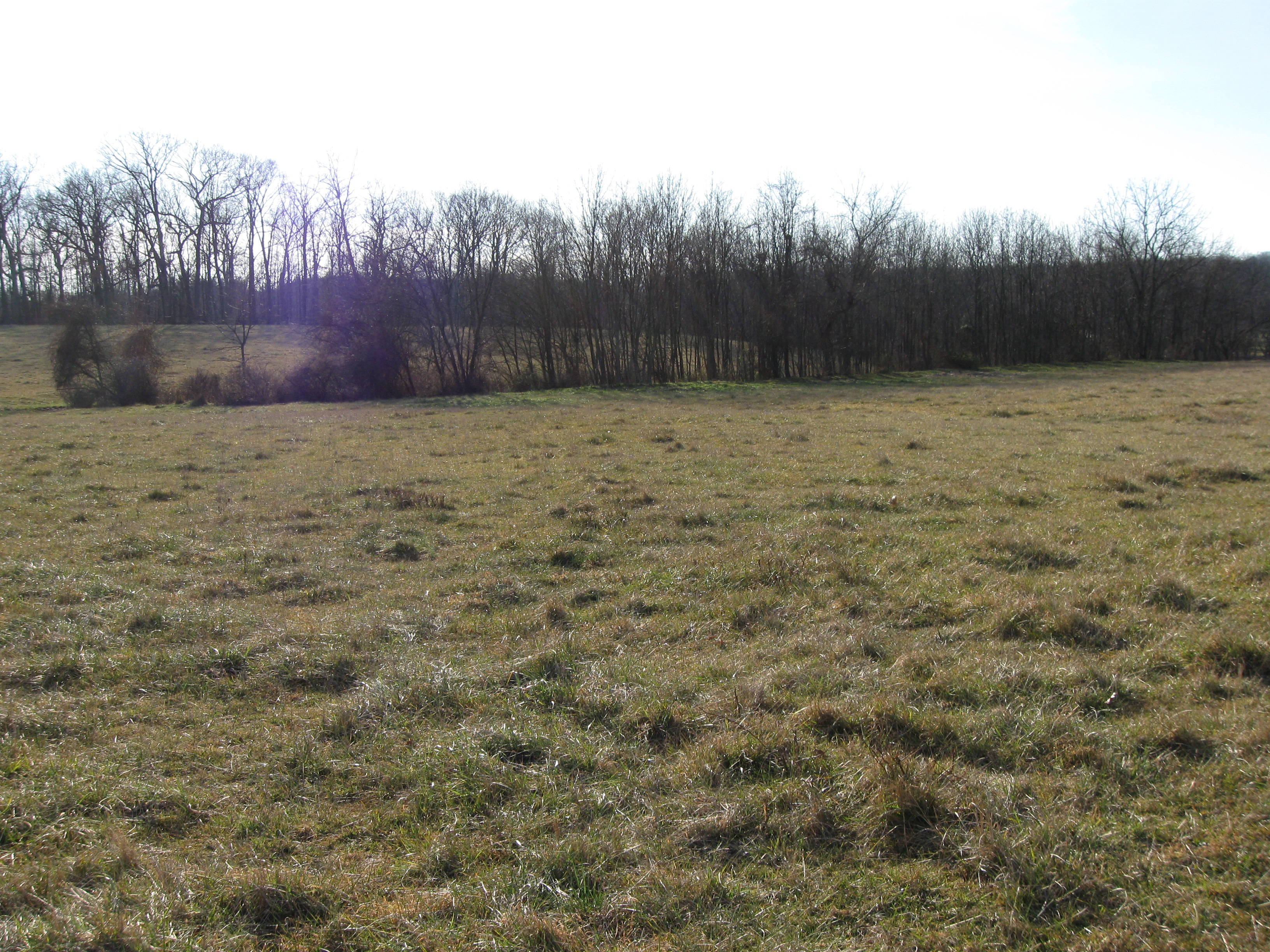
Quarry #3 is not very big, but one can tell that it was a quarry. In this location, the far side of Quarry #3 is approximately 15 feet tall. McPherson’s Woods are in the distant background, and on higher ground. This view was taken facing south at approximately 2:30 PM on Sunday, December 14, 2008.
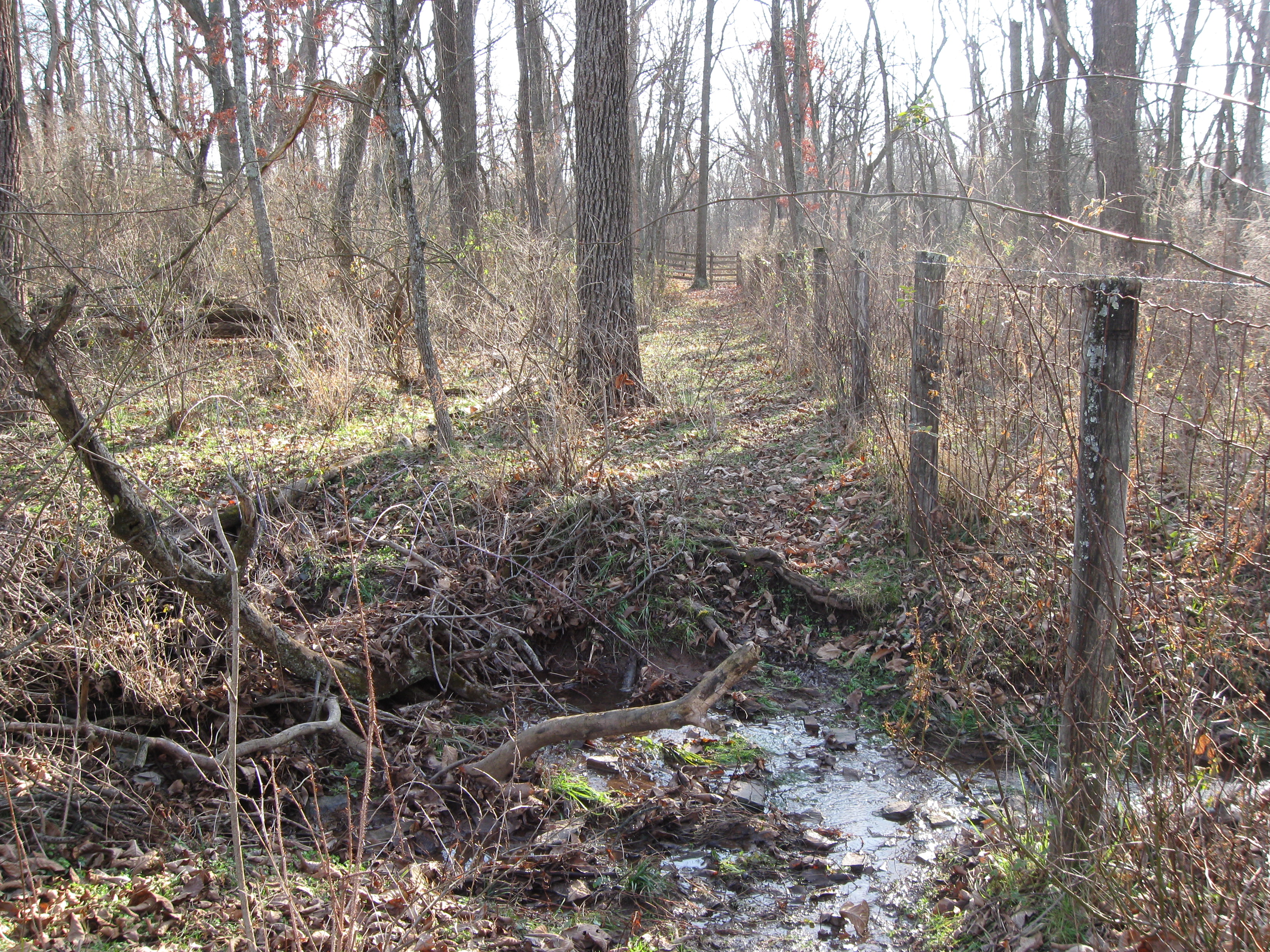
We reached the bottom of the hill, and came to the metal fence keeping us from going to Willoughby Run. Quarry #1 is near the far post and rail fence in the background. We are standing by the small run that flowed through Quarry #2, and flows from left to right (towards Willoughby Run) in this picture. This view was taken facing south at approximately 2:30 PM on Sunday, December 14, 2008.
We then went back to the top of the west arm of McPherson’s Ridge, gracefully jumped the fence, and walked towards the Pond/Quarry near the monument to the 150th Pennsylvania Infantry Regiment. This view was taken facing southeast at approximately 2:30 PM on Sunday, December 14, 2008.
The Pond/Quarry was larger in 1863 than it is today. Before Stone Avenue was constructed, the Pond/Quarry stretched from an area southeast of the 150th Pennsylvania across the road to the west. The tree in the foreground is located in the pond. McPherson’s/Reynolds’/Herbst’s Woods are in the background. This view was taken facing southeast at approximately 4:30 PM on Monday, December 15, 2008.
Here is Mathew Brady standing on the south side of the pond in 1863. These photographs are courtesy of the Metropolitan Museum of Art. This view was taken facing southwest on Wednesday, July 15, 1863.
Here is a similar view today, except that we are much closer to the pond than Brady’s cameraman was in 1863. This view was taken facing southwest at approximately 4:30 PM on Monday, December 15, 2008.
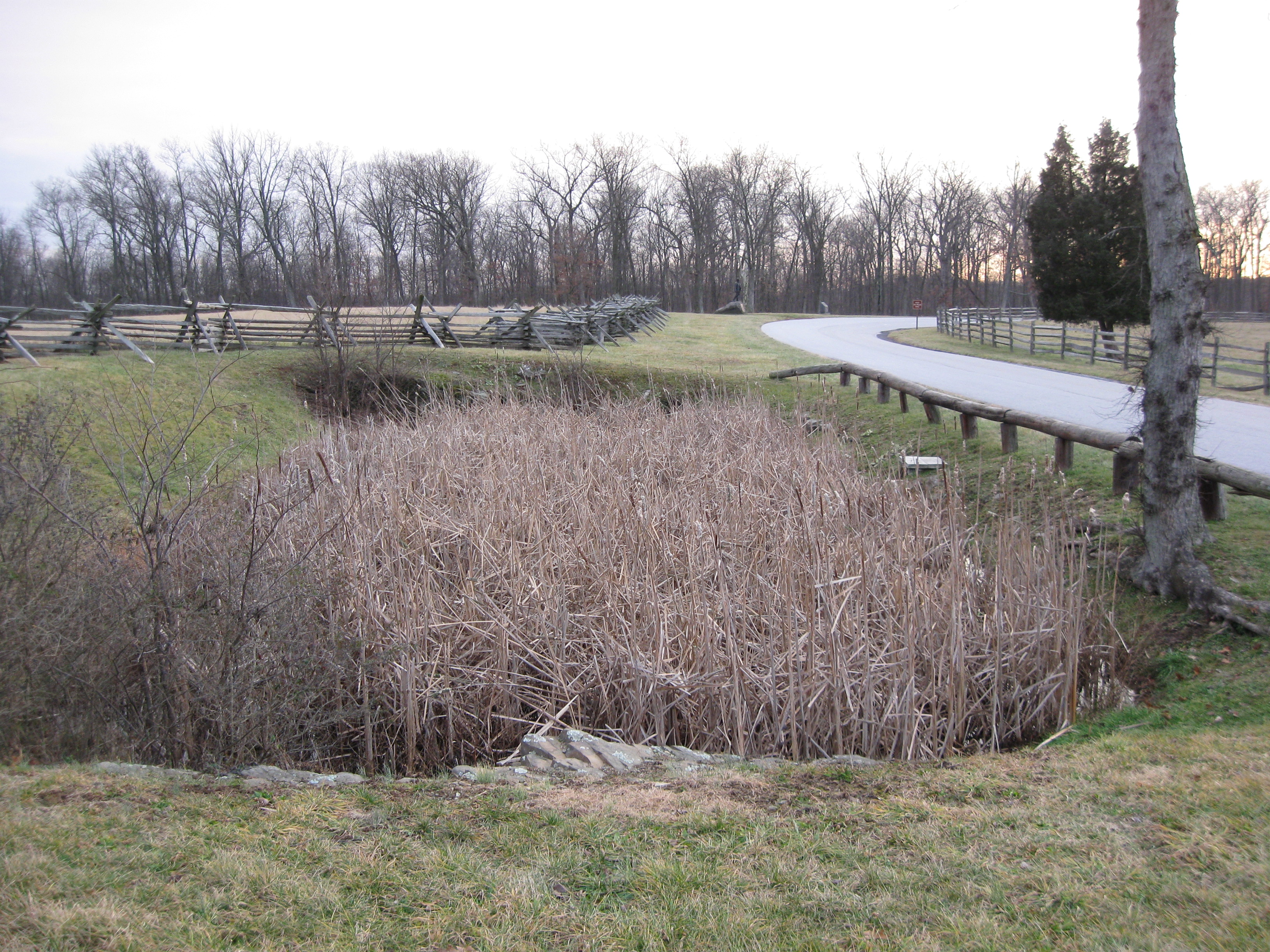
Here is the Pond/Quarry with the woods of the other quarries near Willoughby Run in the background. This view was taken facing northwest at approximately 4:30 PM on Monday, December 15, 2008.
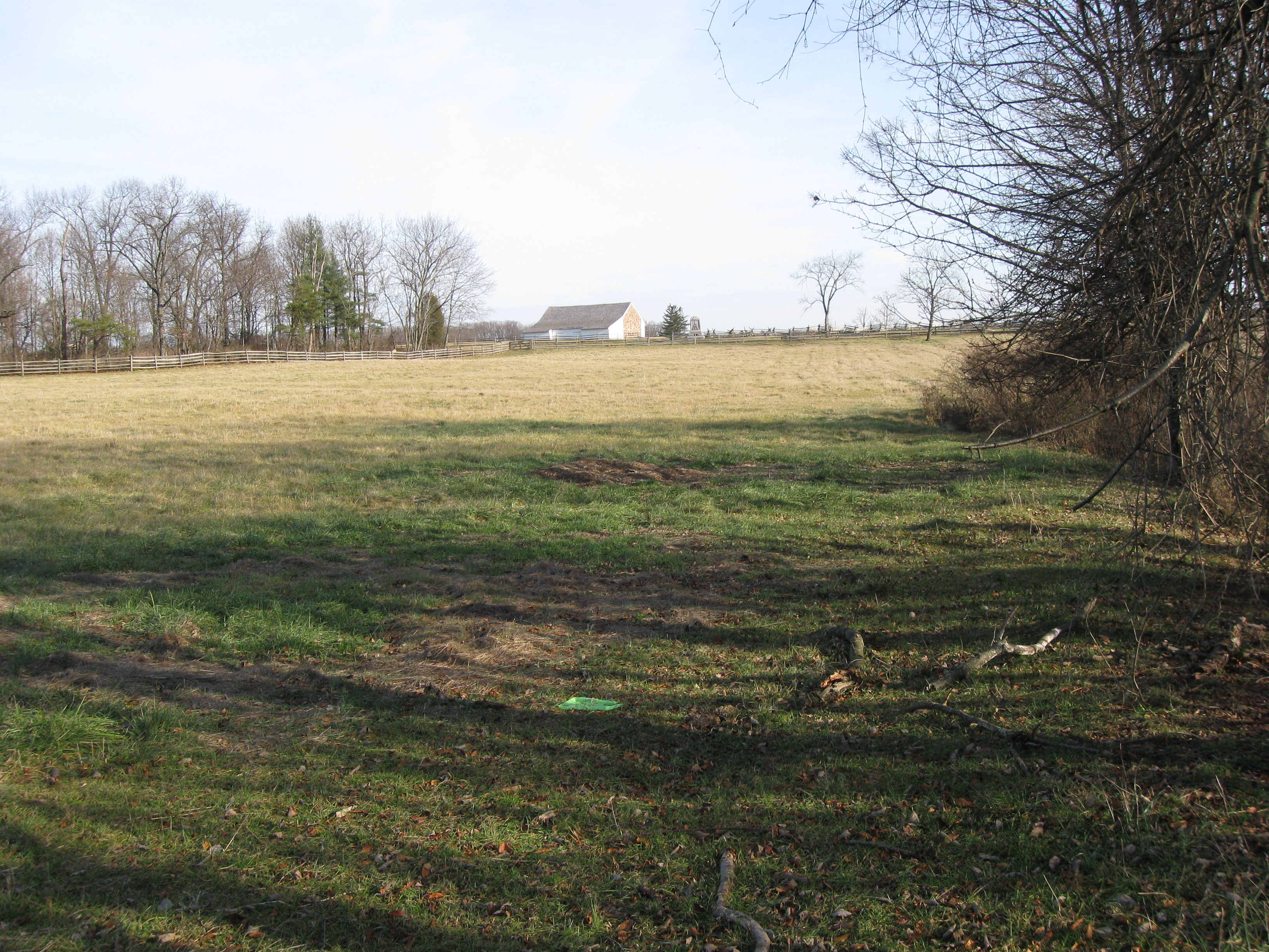
The Pond/Quarry looking back towards the 150th Pennsylvania on the left, the statue to Brigadier-General John Buford, the equestrian statue of Major-General John F. Reynolds, and the McPherson Barn in the background. This view was taken facing northeast at approximately 4:30 PM on Monday, December 15, 2008.
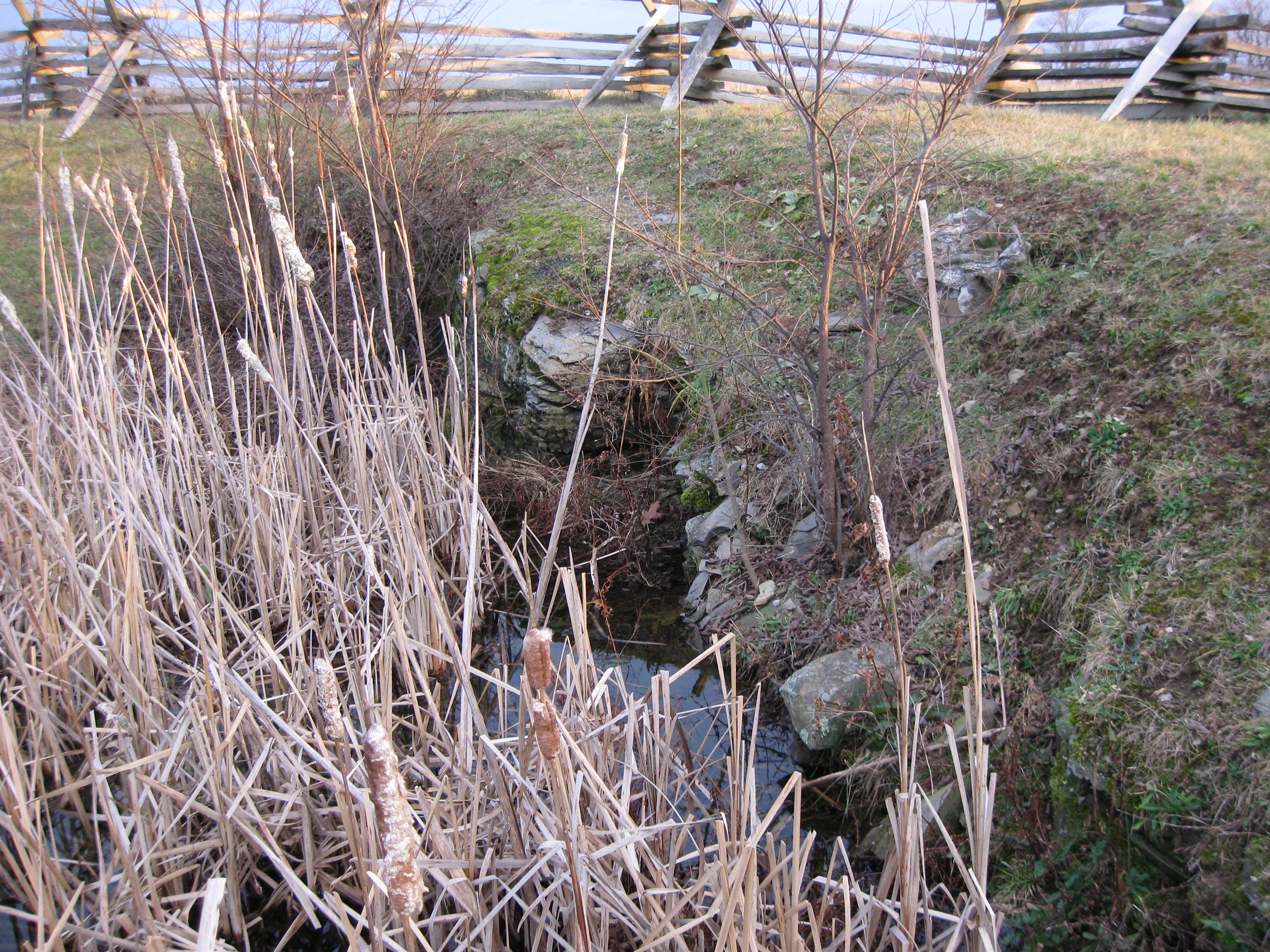
So if it’s a stone quarry, there must be some stones in here right? Here are the stones that are exposed on the south side of the Pond/Quarry. This view was taken facing southeast at approximately 4:30 PM on Monday, December 15, 2008.
And here are the stones that are exposed on the north side of the Pond/Quarry. Some of the stones taken from this quarry may have been used in the construction of the McPherson Barn in the background. This view was taken facing northeast at approximately 4:30 PM on Monday, December 15, 2008.
After all, it’s probably not a coincidence that one of the largest stone barns in the area is located next to some stone quarries. This view was taken facing northeast at approximately 4:30 PM on Monday, December 15, 2008.