William Patterson House and Old National Park Service Visitor Center Updates
April 15, 2009
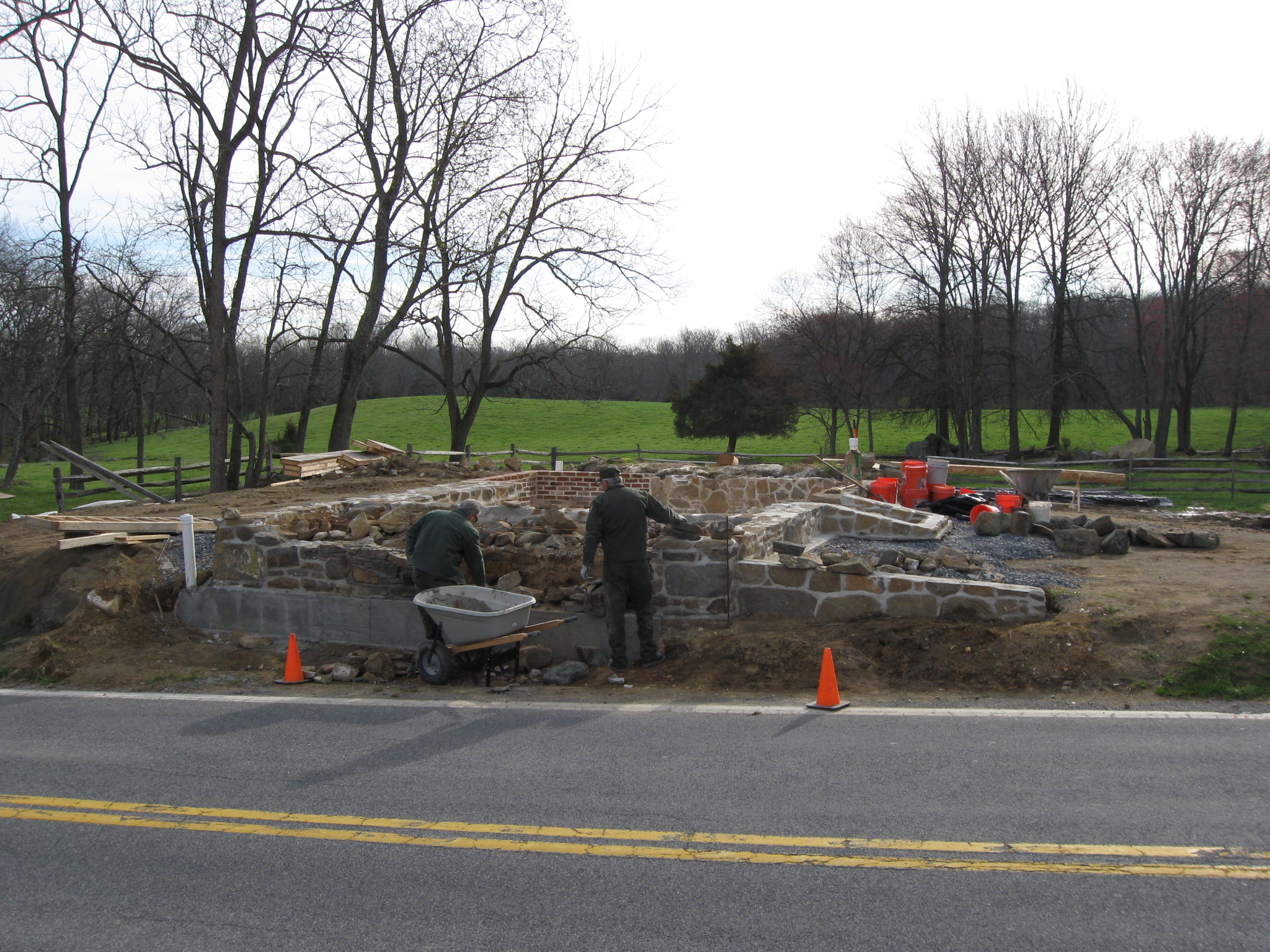
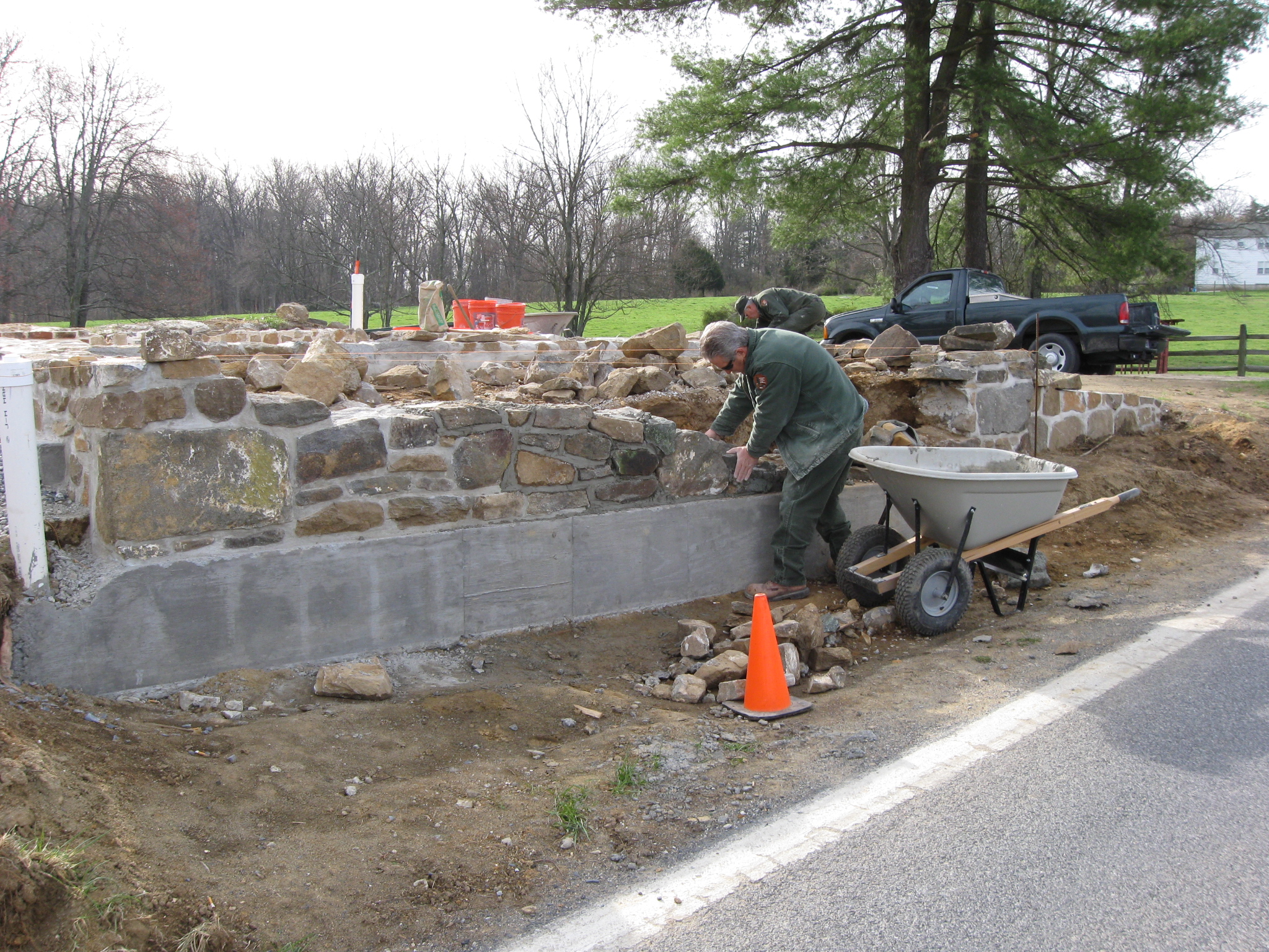
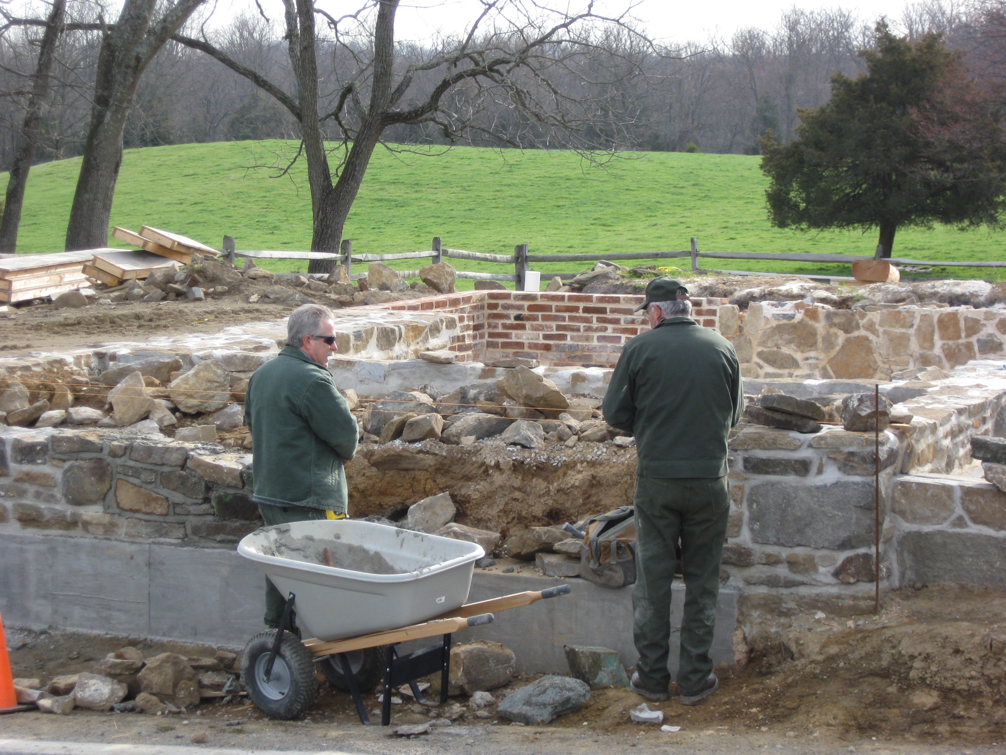
National Park Service employees Ray Singley (left) and Ray Miller work on the west foundation of the William Patterson House along the Taneytown Road. This view was taken facing east at approximately 8:45 AM on Monday, April 13, 2009.
Work continued on the William Patterson House foundation this week especially with foundation work on the west side of the building. We stopped by briefly on Monday morning and spoke with National Park Service employees Jeff Miller and Ray Singley.
Ray Miller (left) and Ray Singley hope to have the west foundation completed this week. This view was taken facing southeast at approximately 8:45 AM on Monday, April 13, 2009.
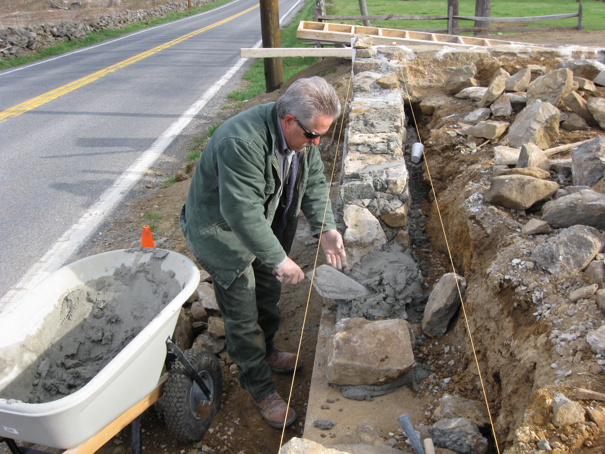
When we stopped by, Ray Singley was placing the rocks in the wall while Jeff Miller was searching for the correct shape of rock for each area. This view was taken facing northeast at approximately 8:45 AM on Monday, April 13, 2009.
They are trying, of course, to get the foundation close to the height of the strings. This view was taken facing north at approximately 8:45 AM on Monday, April 13, 2009.
In this video, you’ll see the care that they take to get just one rock in its proper place. As you can tell by the noise, they are doing this work as traffic quickly moves by them just a few feet away on the Taneytown Road. This view was taken facing northeast to north at approximately 8:45 AM on Monday, April 13, 2009.
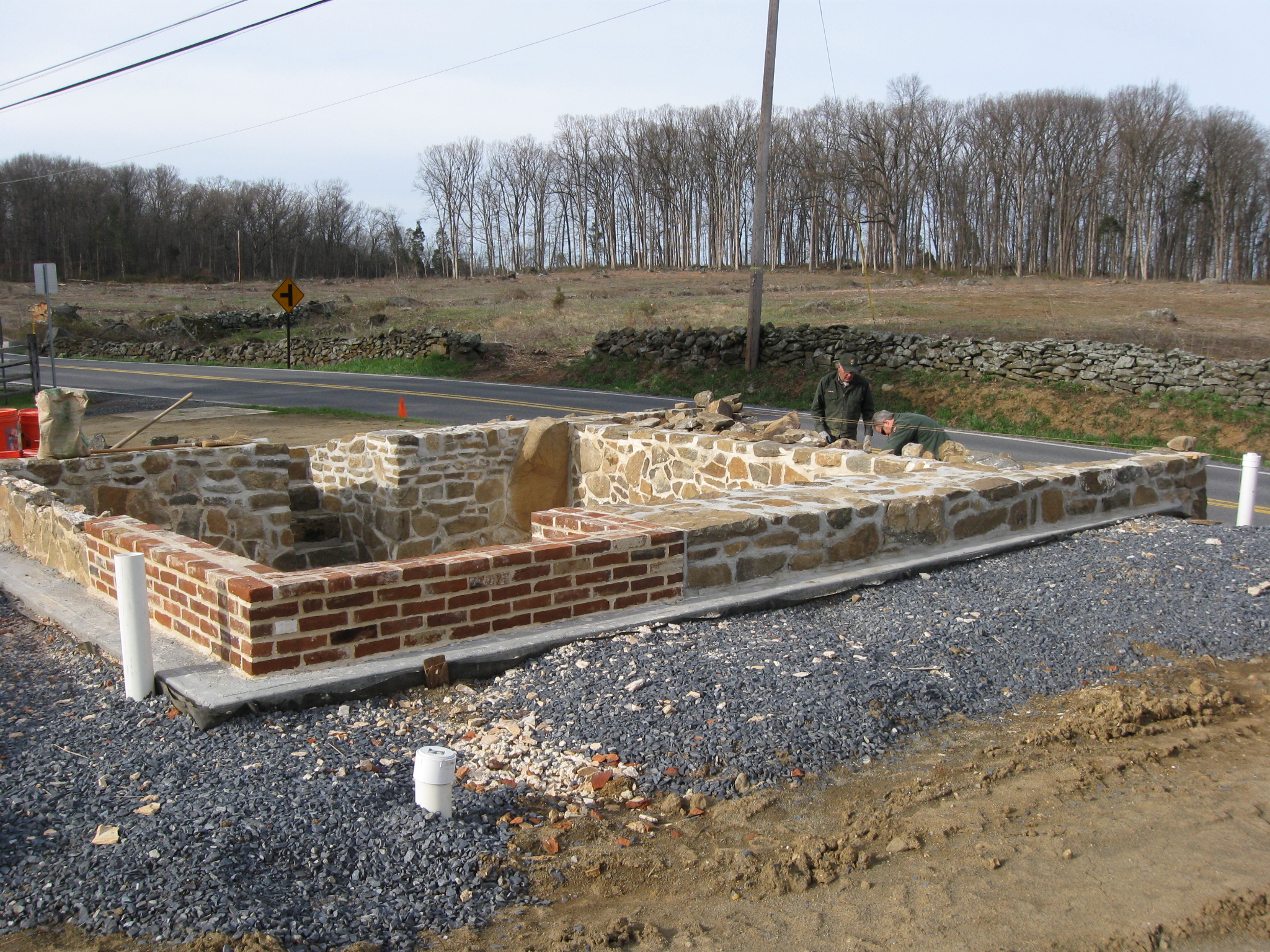
After they are finished with the wall on which they are working, their work is not completed. A log will be placed on the south wall… This view was taken facing north at approximately 8:00 AM on Monday, April 13, 2009.
… and another on the north wall… This view was taken facing southwest at approximately 8:00 AM on Monday, April 13, 2009.
…then the east wall… This view was taken facing west at approximately 8:45 AM on Monday, April 13, 2009.
… and after a log is secured on the west wall, more masonry work can continue. This view was taken facing west at approximately 8:00 AM on Monday, April 13, 2009.
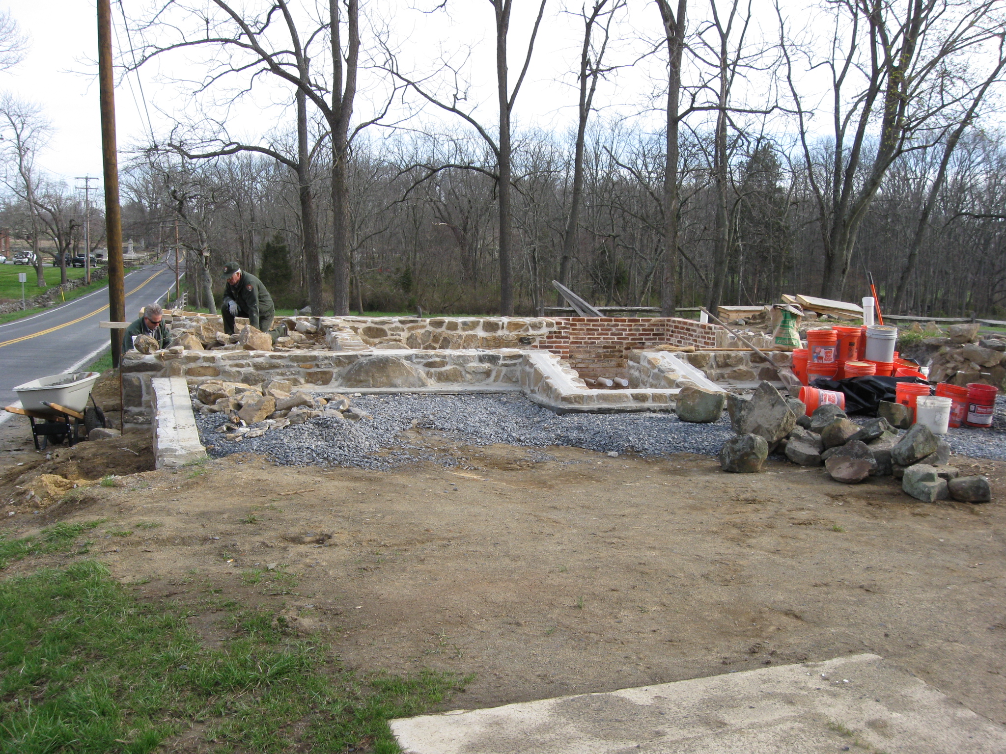
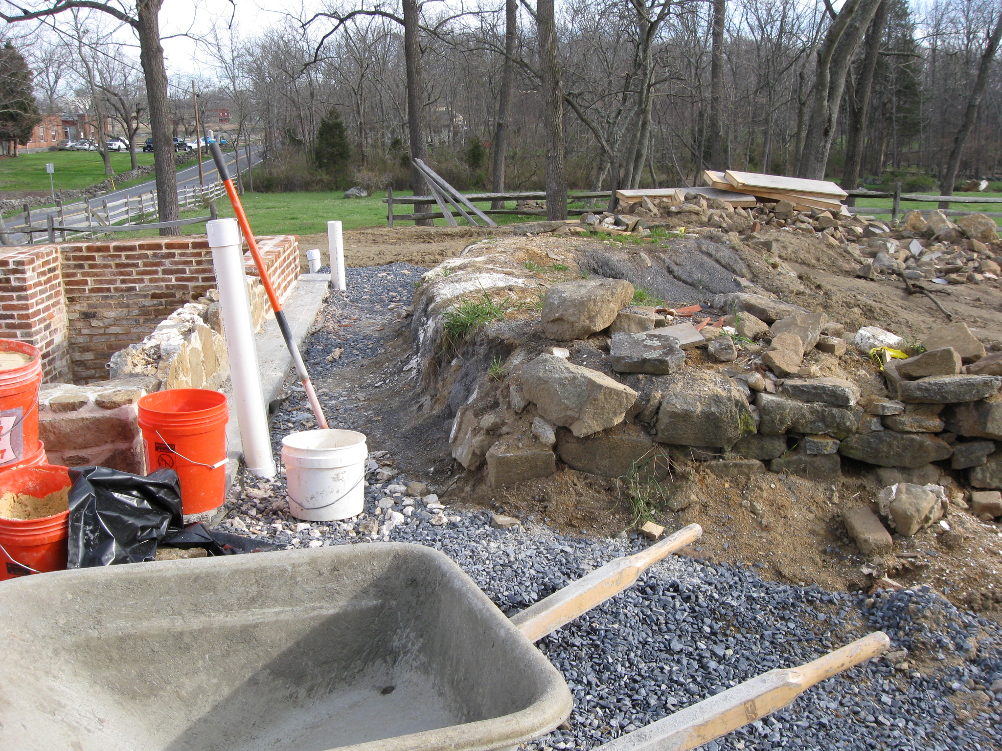
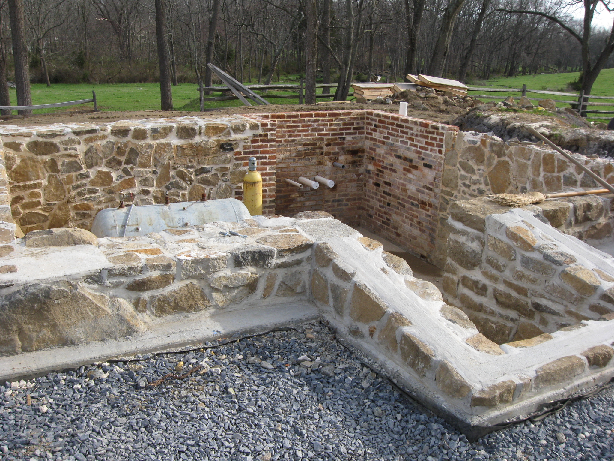
Mr. Miller explained to us that the kitchen foundation needs to be moved closer to the current foundation and be completely rebuilt. There should not be a gap, as there is now, between the house foundtaion on the left and the kitchen foundation on the right. This view was taken facing north at approximately 8:45 AM on Monday, April 13, 2009.
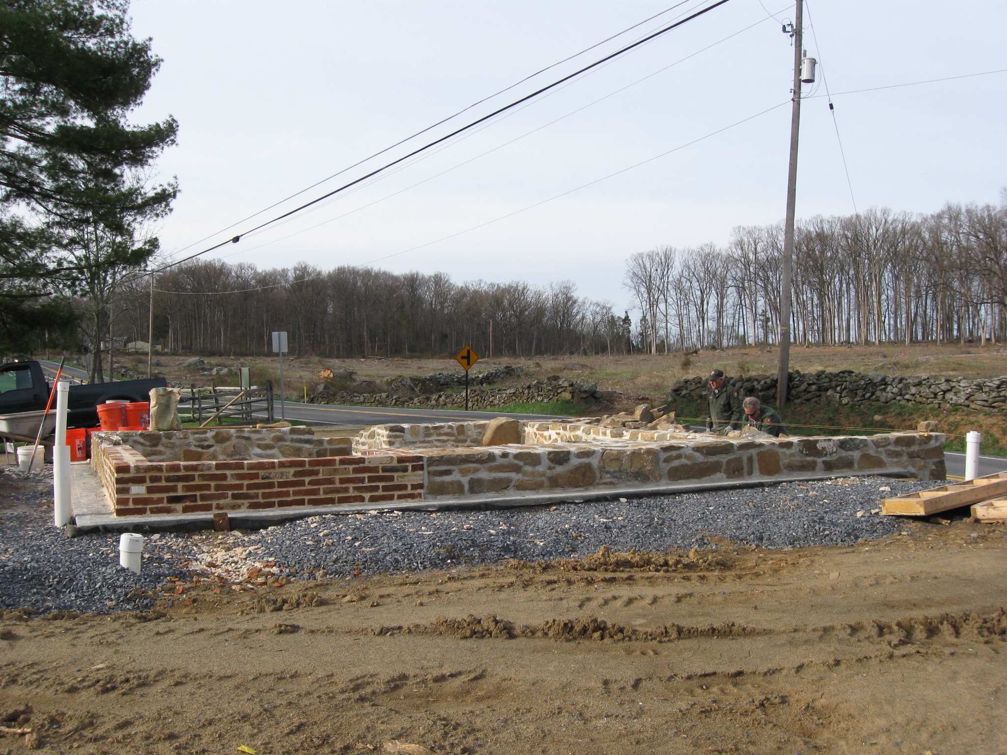
We also questioned Mr. Miller about why the corner closest to the camera is brick instead of stone. The answer has a little to do with the entrance steps that you see on the south wall on the other side of the structure. This view was taken facing southwest at approximately 8:45 AM on Monday, April 13, 2009.
Mr. Miller said that as families grew, their basement area or root cellar, in this case, did also. On the closest (south) wall, was the original entrance. When the family expanded their root cellar, they went through the stone foundation in the area that is now brick. Later, for whatever reason, they closed off the entrance on this south side with a stone wall, and built an entrance on the north side of the foundation where the bricks are now located. They probably decided to use brick, because they were made in town and they were inexpensive. They also might have been extras from construction occurring elsewhere. It is not known when the south entrance became the primary basement/root cellar entrance again. This view was taken facing northeast at approximately 8:45 AM on Monday, April 13, 2009.
New logs are arriving on the site. This view was taken facing north at approximately 8:45 AM on Monday, April 13, 2009.
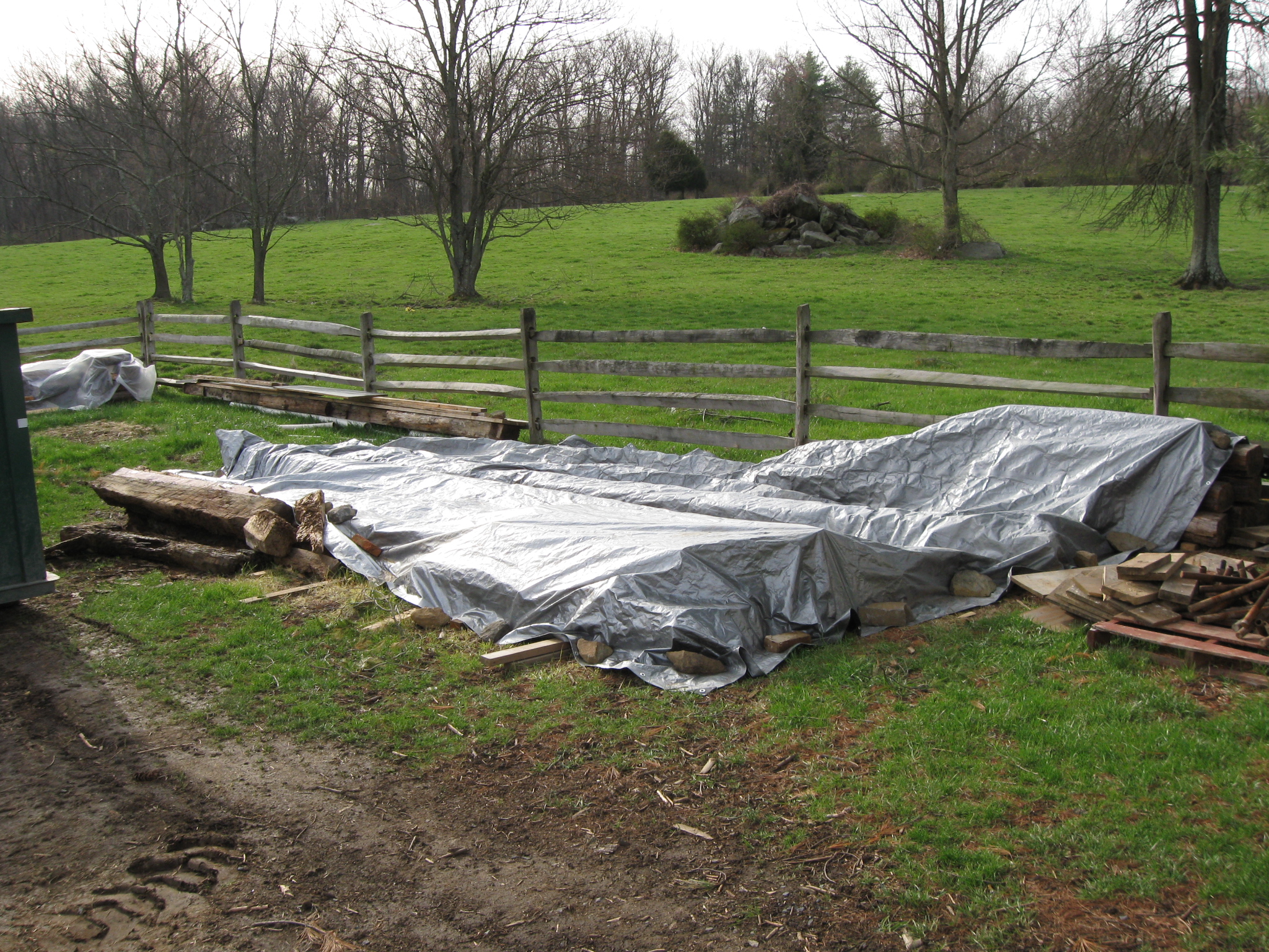
Approximately 66% of the original logs were judged to be sturdy enough to be placed in the reconstruction. Some of them are under this tarp. This view was taken facing southeast at approximately 8:45 AM on Monday, April 13, 2009.
So 34% of the logs will be new. The Pennsylvania State Memorial is in the center background. The National Park Service maintenance area is in the right background. The new logs need to be treated… This view was taken facing northwest at approximately 8:45 AM on Monday, April 13, 2009.
…tagged/labeled, have axe marks put on the sides to make them appear as if they are the original logs (they will attempt to match up the locations of the axe marks on the old logs)… This view was taken facing northwest at approximately 8:00 AM on Monday, April 13, 2009.
… and planed/flattened/squared. This view was taken facing west at approximately 8:00 AM on Monday, April 13, 2009.
The goal is to have the Patterson House completed by the end of this summer. This view was taken facing northeast at approximately 8:45 AM on Monday, April 13, 2009.
Related Posts:
Taneytown Road Battlefield Rehabilitation on July 18, 2008.
William Patterson House Stabilization on August 11, 2008.
Cemetery Ridge Rehabilitation Shows Subtleties of Terrain on September 2, 2008.
Tree Cutting on East Side of Cemetery Ridge Covers a Large Area on October 15, 2008.
William Patterson Tree Cutting Update on October 17, 2008.
William Patterson Field Earthworks on October 29, 2008.
Confederate Earthworks on Seminary Ridge on October 30, 2008.
William Patterson Farm Tree Cutting Update on November 9, 2008.
William Patterson Field Earthworks 1890s Photo on November 20, 2008.
William Patterson Farm Update and Patterson Field Panorama #4 on December 12, 2008.
Licensed Battlefield Guide Rich Bellamy: Colonel Edward Ephraim Cross Part 2 on January 5, 2009.
William Patterson House Deconstruction on January 18, 2009.
William Patterson House Stabilization: Reconstruction Methods Impressive on January 28, 2009.
William Patterson House Stabilization Update: Foundation Enclosed on February 22, 2009.
William Patterson House Stabilization Update: Foundation Nears Completion on April 5, 2009.
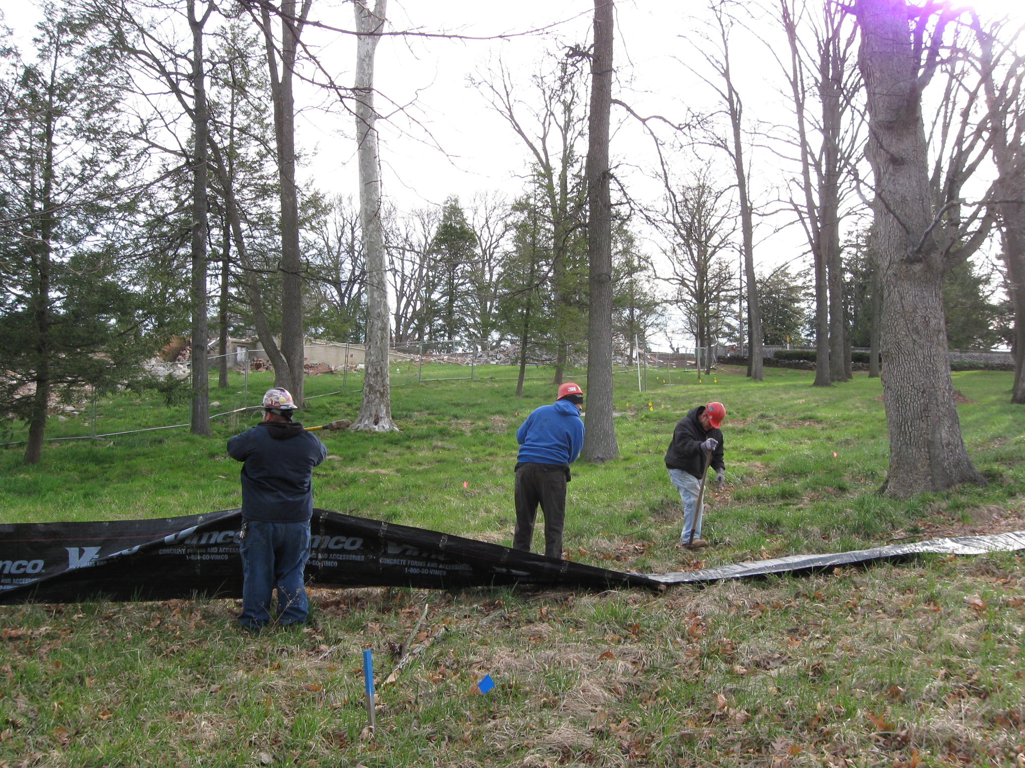
Contracters dug a ditch and erected a tarp barrier southwest of the Old National Park Service Visitor Center location in order to keep construction debris out of the sewer system/drainage system at the bottom of Cemetery Hill. This view was taken facing northwest at approximately 8:30 AM on Monday, April 13, 2009.
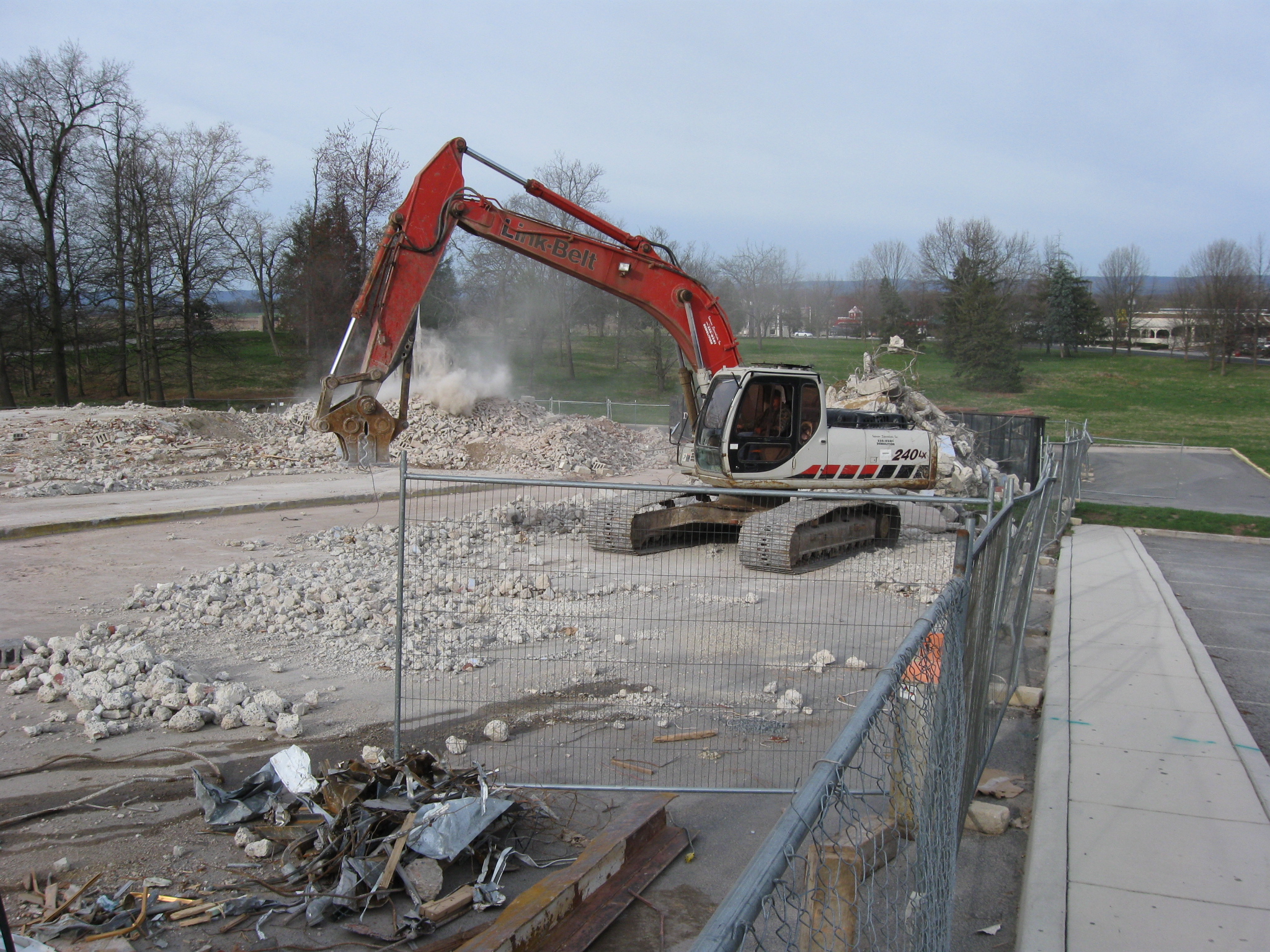
Back at the Old National Park Service Visitor Center demolition site, the rubble was still being carted away, and a tarp barrier was constructed in preparation to keep the construction debris and other material out of the sewer system/drainage system during the upcoming gas tanks’ removal.
The cement pads and yellow flags outline the location where gas tanks will be removed this week. This view was taken facing southwest at approximately 8:30 AM on Monday, April 13, 2009.
The tarp is not only to stop debris that might arrive from the removal of the gas tanks, but from other debris that might flow off Cemetery Hill. The Taneytown Road entrance to the Soldiers National Cemetery is in the background. This view was taken facing northeast at approximately 8:30 AM on Monday, April 13, 2009.
Most of the rubble has been cleared off the cement pads/floors. This view was taken facing west at approximately 8:30 AM on Monday, April 13, 2009.
Part of the wall to the restroom was still standing. This view was taken facing southwest at approximately 8:30 AM on Monday, April 13, 2009.
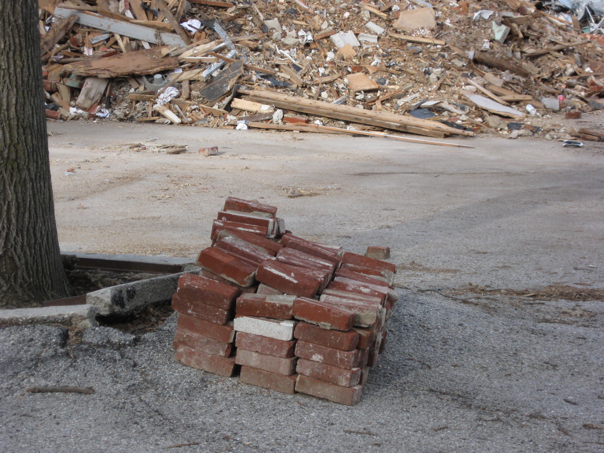
One of the visitors to our site stated that the pile of bricks by the tree might be engraved donors’ bricks that have been saved. We didn’t see any inscriptions on the bricks, but we weren’t close enough. This view was taken facing west at approximately 8:30 AM on Monday, April 13, 2009.
Monday morning, the contractors worked on removing the rubble pile on the north side of the demolition site. This view was taken facing southwest at approximately 8:30 AM on Monday, April 13, 2009.
One year ago from the day we took our pictures, was the last day that the National Park Service Visitor Center along the Taneytown Road was open. Here is the crowd lining up for the last Electric Map show. This view was taken facing southeast at approximately 4:15 PM on Sunday, April 13, 2008.
See the following related posts:
Culp’s Hill Part 2 with LBG Charlie Fennel, and Visitor Center Demolition #13 on April 10, 2009.
Demolition of the Old Gettysburg National Military Park Visitor Center Update #12 on April 8, 2009.
Demolition of the Old Gettysburg National Military Park Visitor Center Update #11 on April 7, 2009.
Demolition of the Old Gettysburg National Military Park Visitor Center Update #10 on April 6, 2009.
Demolition of the Old Gettysburg National Military Park Visitor Center Update #9 on April 4, 2009.
Demolition of the Old Gettysburg National Military Park Visitor Center Update #8 on April 3, 2009.
Demolition of the Old Gettysburg National Military Park Visitor Center Update #7 on April 2, 2009.
Demolition of the Old Gettysburg National Military Park Visitor Center Update #6 on April 1, 2009.
Demolition of the Old Gettysburg National Military Park Visitor Center Update #5 on March 31, 2009.
Demolition of the Old Gettysburg National Military Park Visitor Center Update #4 on March 27, 2009.
Demolition of the Old Gettysburg National Military Park Visitor Center Update #3 on March 26, 2009.
Demolition of the Old Gettysburg National Military Park Visitor Center Update #2 on March 25, 2009.
Demolition of the Old Gettysburg National Military Park Visitor Center Begins on March 24, 2009.
Cyclorama Construction Fencing: Completed on North Side, Redone on West Side on March 13, 2009.
A Fence Too Far: Cyclorama Construction Fencing Completed on West Side on March 1, 2009.
Construction Fences Arrive at Old Visitor Centers on February 27, 2009.
Old Visitor Center Lawn in Limbo on May 28, 2008.
Lights Out at the Electric Map on April 13, 2008.
Moving Day at the Gettysburg Visitor Center on April 12, 2008.
An Emptiness at the Visitor Center on March 31, 2008.
Gettysburg Guide Room: The Final Days on March 8, 2008.
A Sunday Afternoon Walk Around the Old Gettysburg Visitor Center on February 24, 2008.