
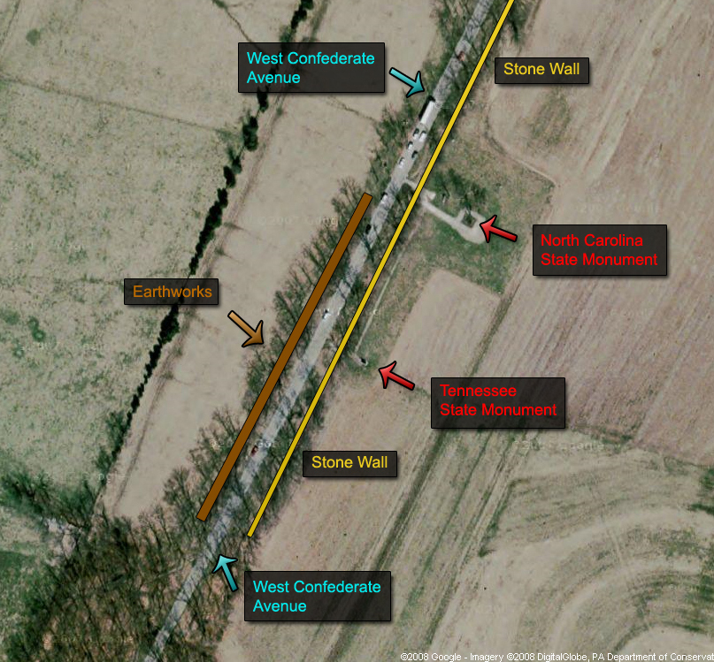
Here is a map of the Confederate earthworks on Seminary Ridge. We have marked the earthworks in brown. This map was created from the south facing north at approximately 7:00 PM on Thursday, October 30, 2008.
Some of the best known earthworks not restored/rehabilitated/desecrated (choose your word) by the Civilian Conservation Corps in the 1930s are located on Seminary Ridge behind (west of) the Tennessee State monument. The earthworks are eight to nine feet wide, and approximately 220 yards long. A row of trees grows along their crest. In today’s post we will show you the earthworks, and then the same picture with lines more or less outlining the earthworks.
See our post on the recently exposed Union earthworks on Cemetery Ridge on October 29, 2008.


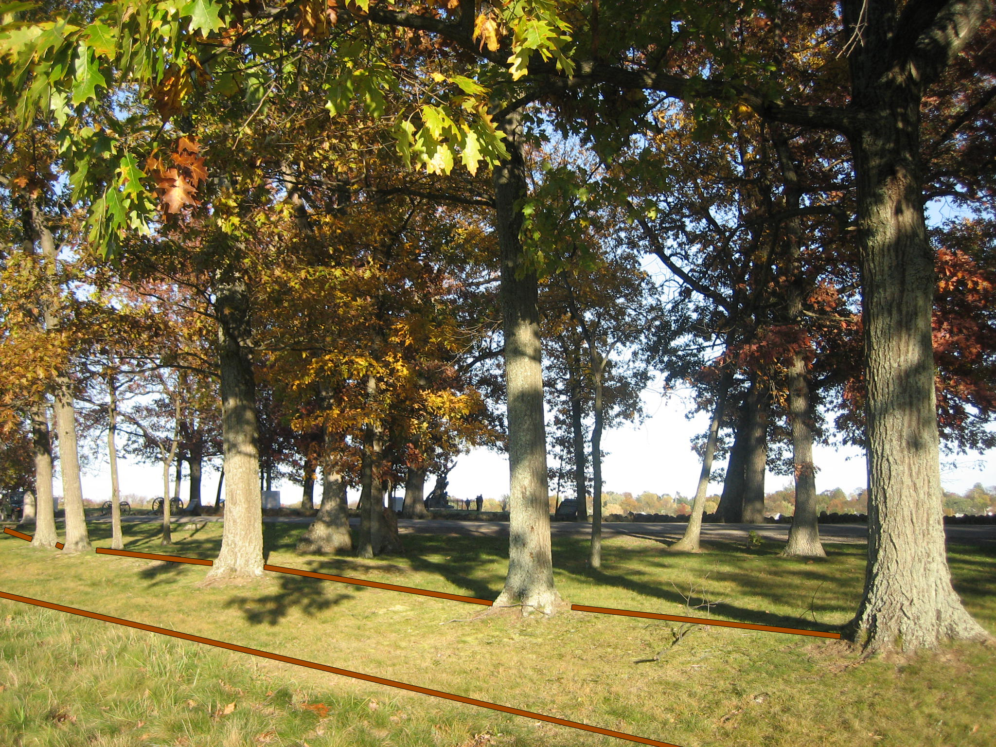
To get to the earthworks, drive south (because it’s a one way road) on West Confederate Avenue until you see the parking spots on the right (west) side of the road for the North Carolina State monument. The marker for Joseph Davis’ Brigade will be on your right, and the earthworks will begin here, a mere 17 yards on the right of (west of) West Confederate Avenue. This view was taken from the north facing south at approximately 5:00 PM on Thursday, October 30, 2008.

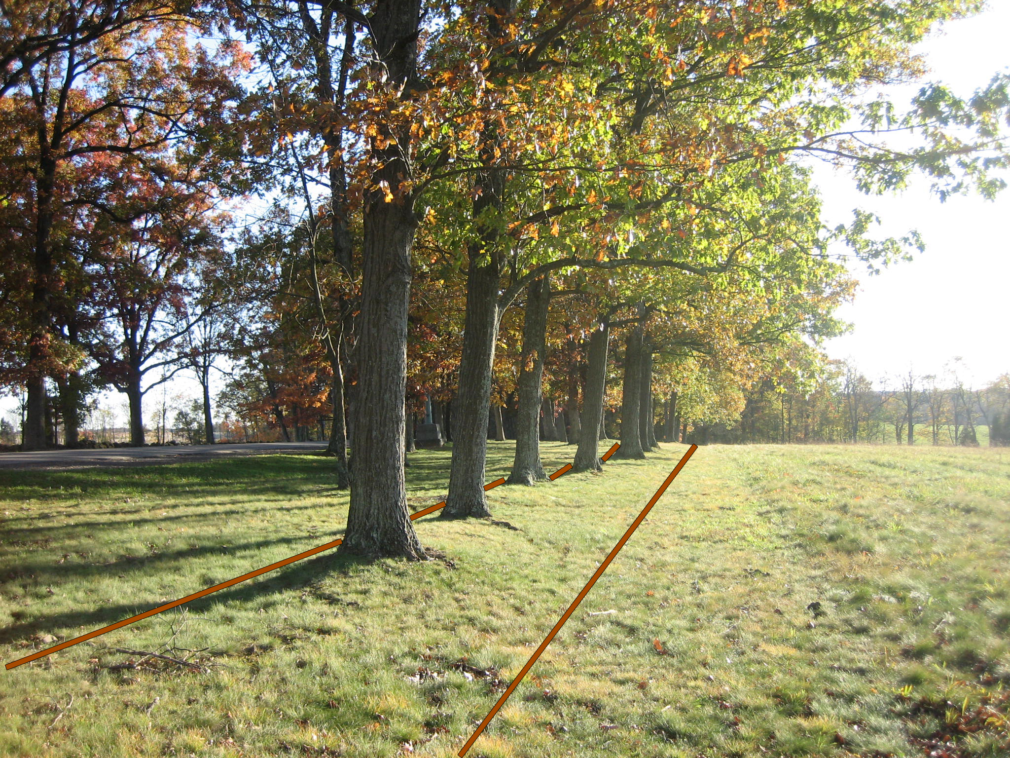
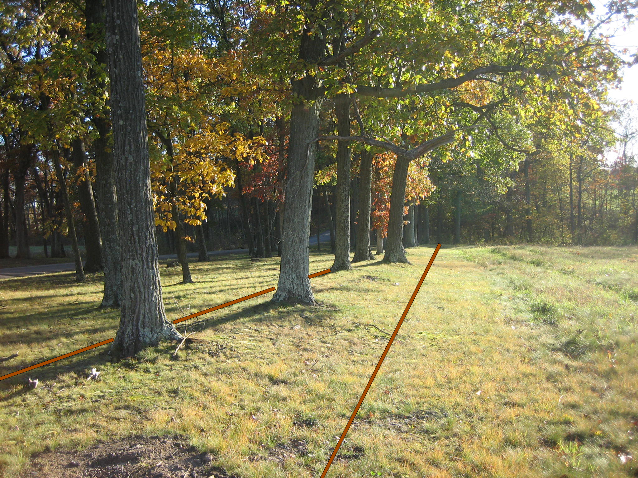
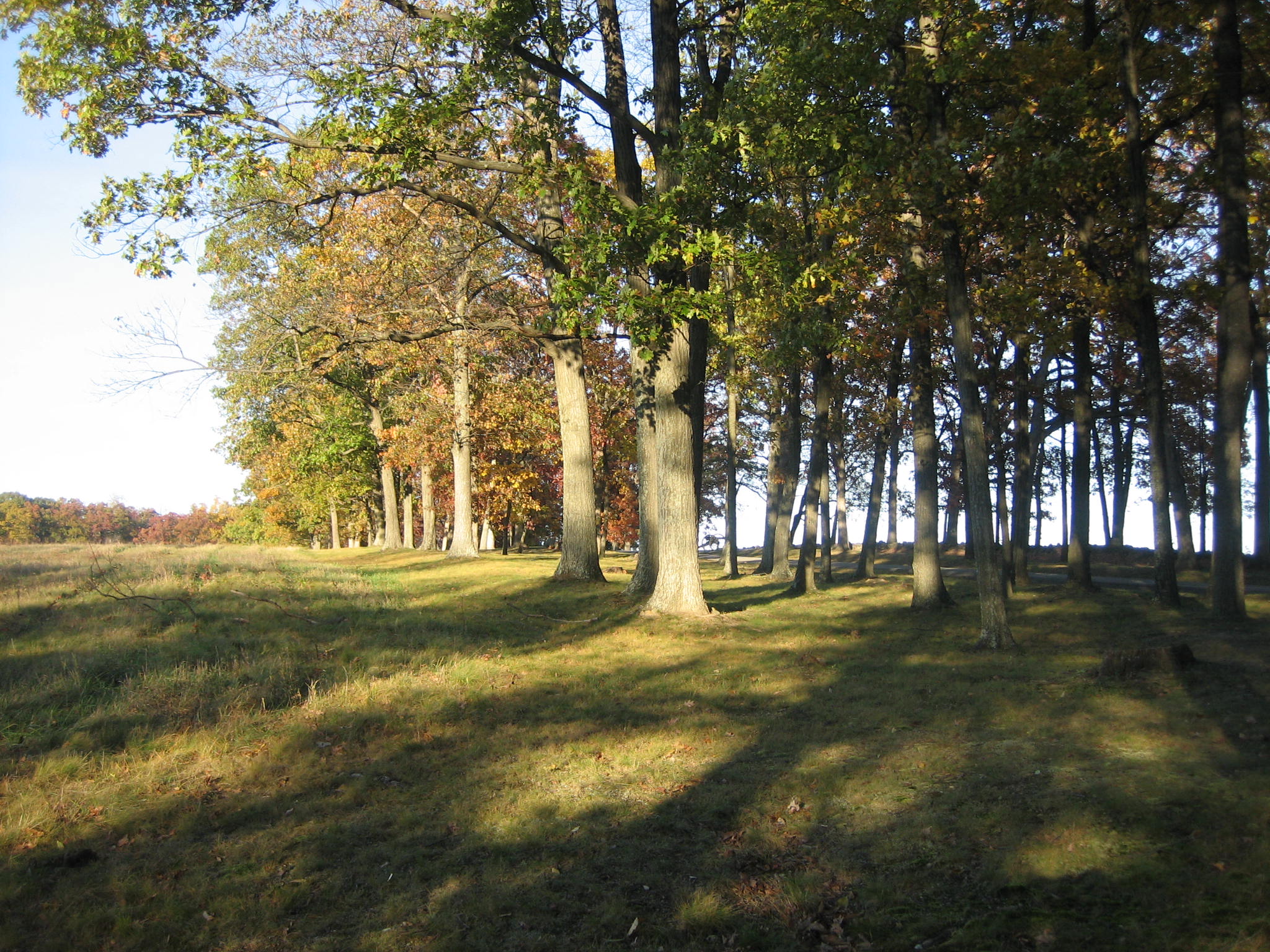
The earthworks begin behind (west of) the Davis Brigade Marker and continue south for approximately 220 yards. There is a row of trees growing along their crest. This view was taken from the north facing south at approximately 5:00 PM on Thursday, October 30, 2008.

As do the earthworks we featured yesterday on the reverse (east) slope of Cemetery Ridge, the Confederates on Seminary Ridge also placed their works on the reverse slope. Their location is approximately 40 yards from the stone wall on the crest of Seminary Ridge. The Copse of Trees and tree growing out of the outer angle are visible in the background. This view was taken from the west facing east at approximately 5:00 PM on Thursday, October 30, 2008.
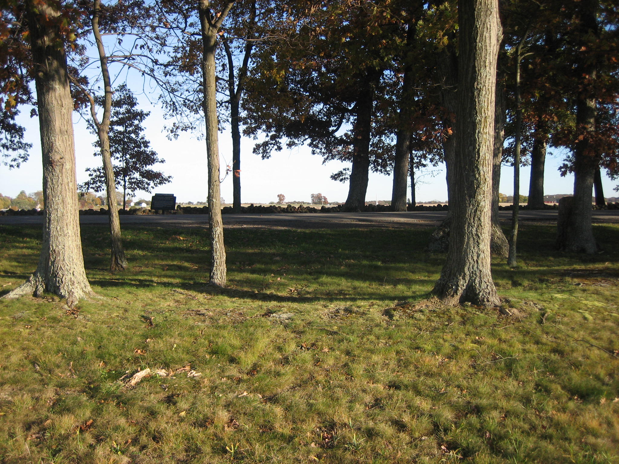
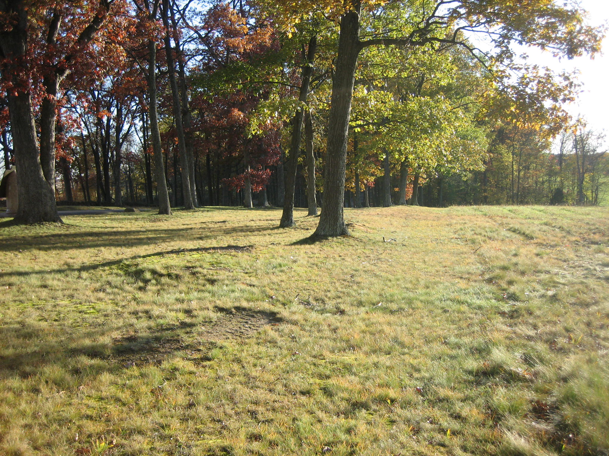
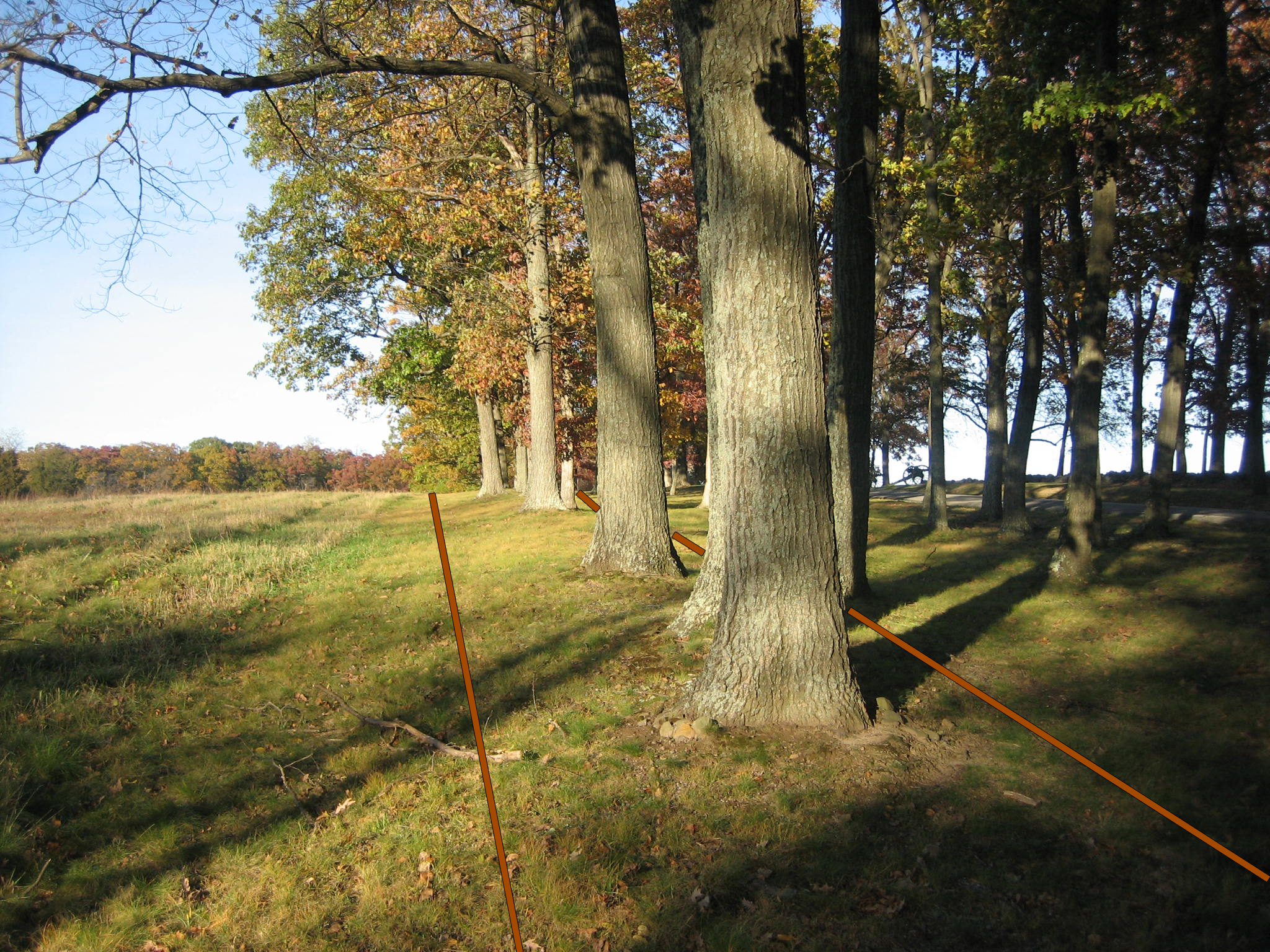
The closest trees are on the crest of the earthworks. This view was taken from the northwest facing southeast at approximately 5:00 PM on Thursday, October 30, 2008.
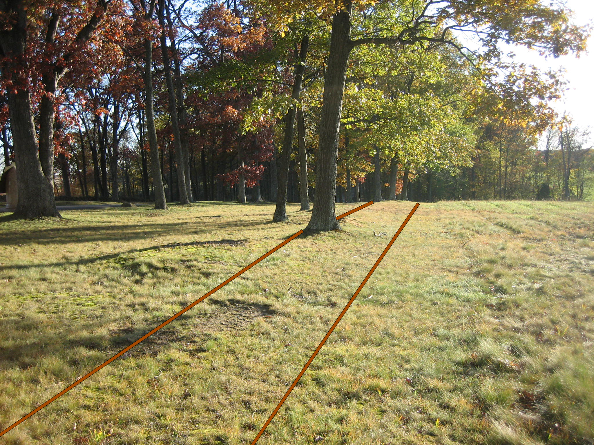
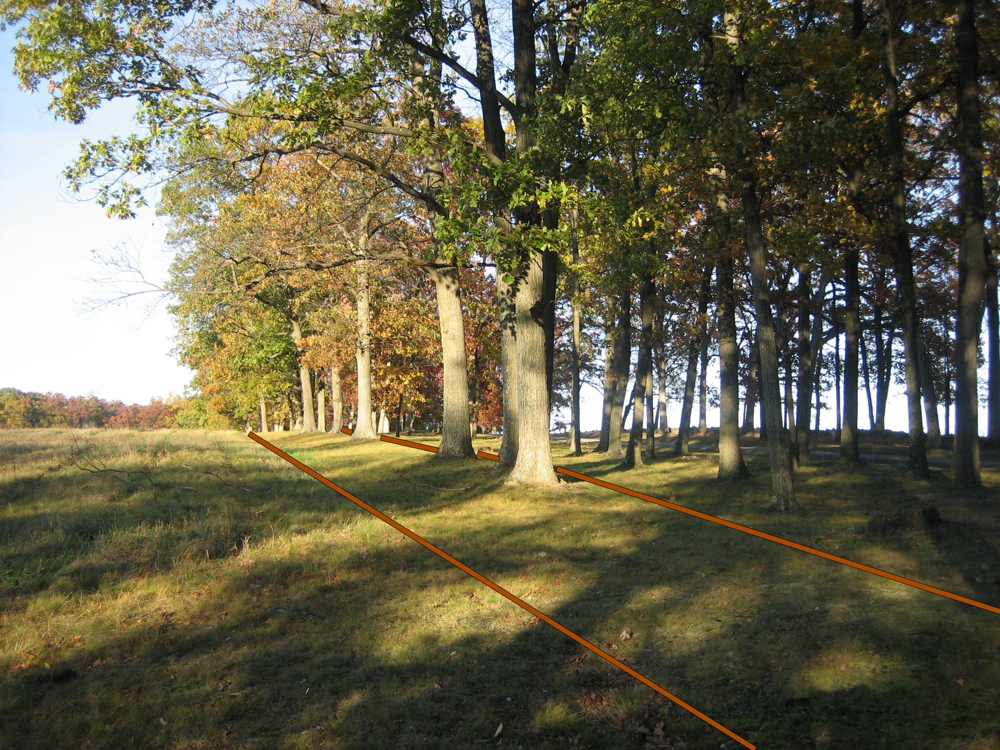
The earthworks then run downhill. This view was taken from the north facing south at approximately 5:00 PM on Thursday, October 30, 2008.

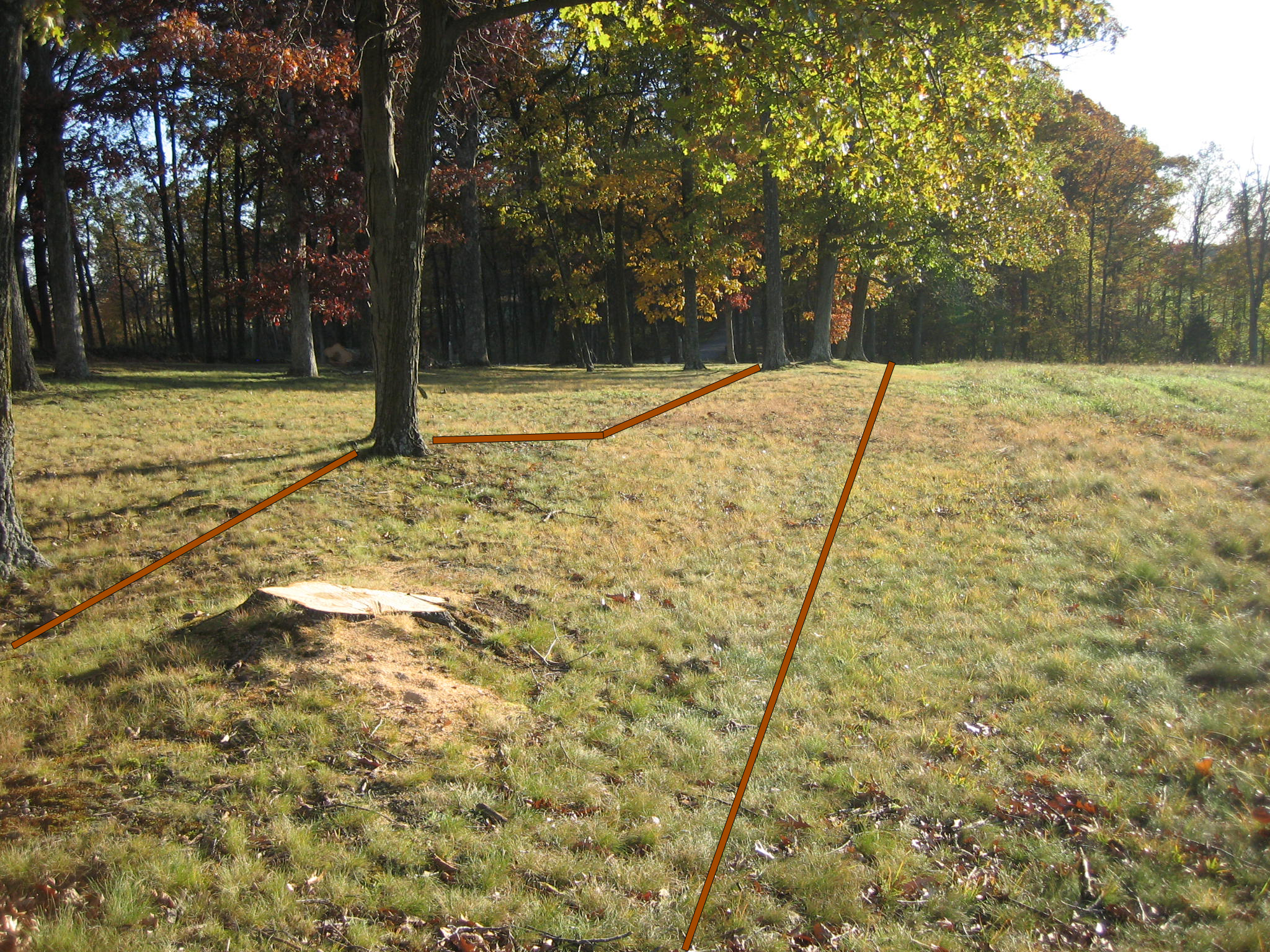
This newly cut tree stump sits on top of the earthworks. This view was taken from the north facing south at approximately 5:00 PM on Thursday, October 30, 2008.

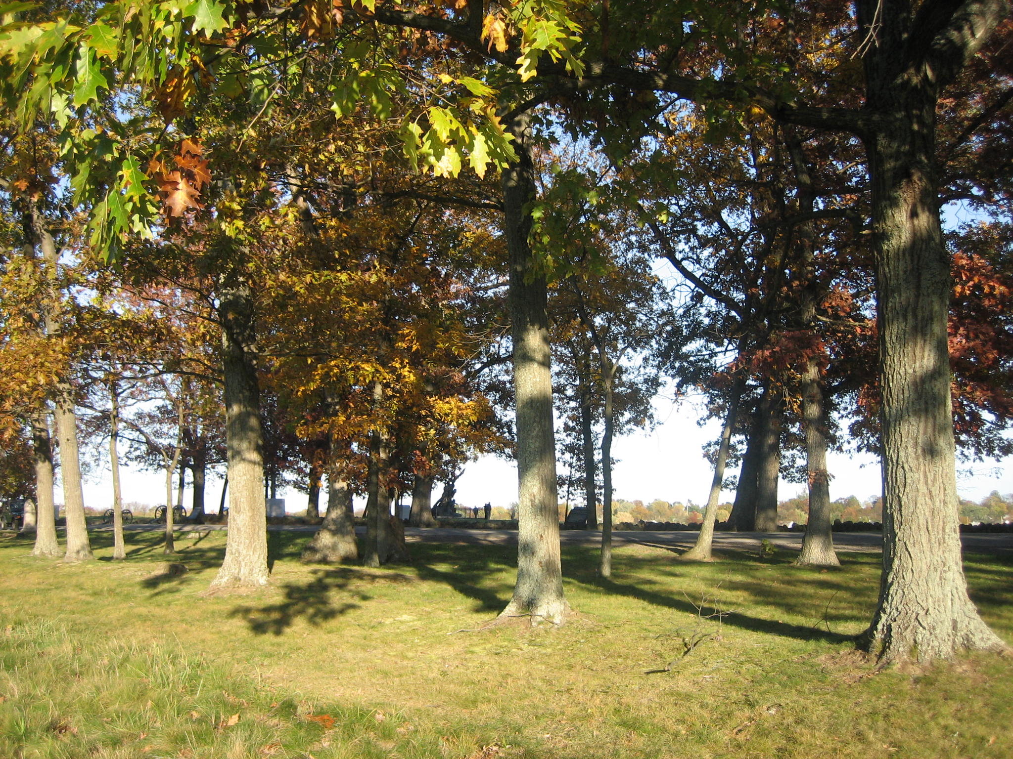
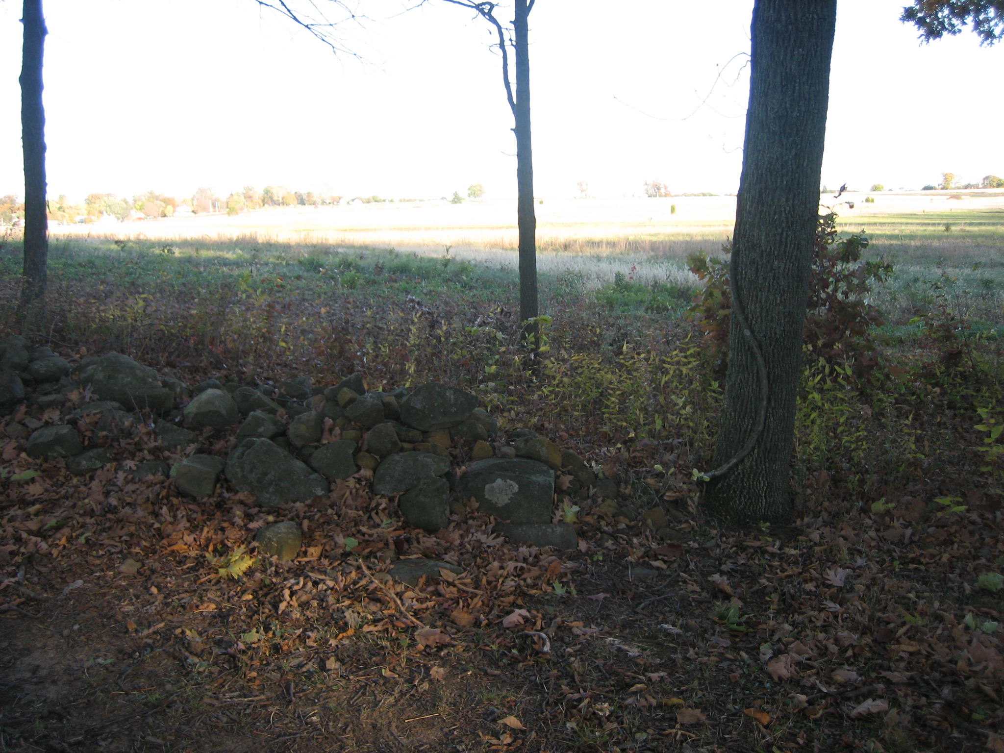
They continue down the hill and end at the woodline. This view was taken from the north facing south at approximately 5:00 PM on Thursday, October 30, 2008.

We are at the end of the earthworks looking back up the hill. This view was taken from the south facing north at approximately 5:00 PM on Thursday, October 30, 2008.

At the end of the works, one can look west to see the Brown Farm (No it’s not the Eisenhower Farm). This view was taken from the east facing west at approximately 5:00 PM on Thursday, October 30, 2008.
Or east to the Union lines on Cemetery Ridge. We are looking at the back of the marker to Archer’s Brigade of Tennesseeans and Alabamians. This view was taken from the west facing east at approximately 5:00 PM on Thursday, October 30, 2008.
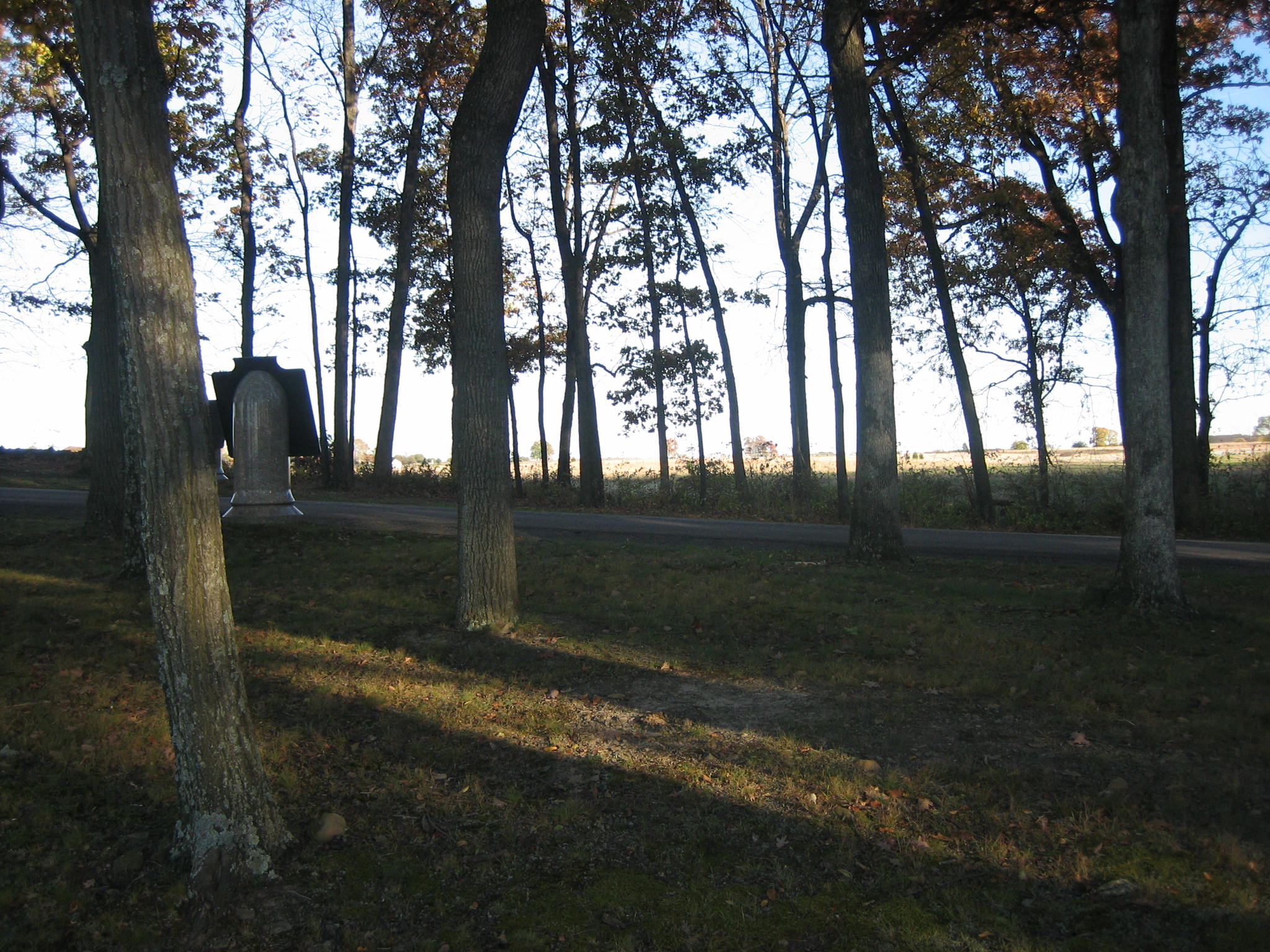
Interestingly enough, the stone wall on the east side of West Confederate Avenue also ends in this area. This view was taken from the west facing east at approximately 5:00 PM on Thursday, October 30, 2008.

The stone wall ends here, and goes northward to the David McMillan House. This view was taken from the south facing north at approximately 5:00 PM on Thursday, October 30, 2008.

The earthworks are approximately 40 yards behind (west of) the stone wall. The Tennessee State Monument is on the other side of the stone wall in the left center of the picture. This view was taken from the west facing east at approximately 5:00 PM on Thursday, October 30, 2008.

Here is the Tennessee State Monument on the crest of Seminary Ridge. This view was taken from the northwest facing southeast at approximately 5:00 PM on Thursday, October 30, 2008.
The soldiers in this area who may have built these works were mostly from Archer’s Brigade and Pettigrew’s Brigade. This view was taken from the southwest facing northeast at approximately 5:00 PM on Thursday, October 30, 2008.