
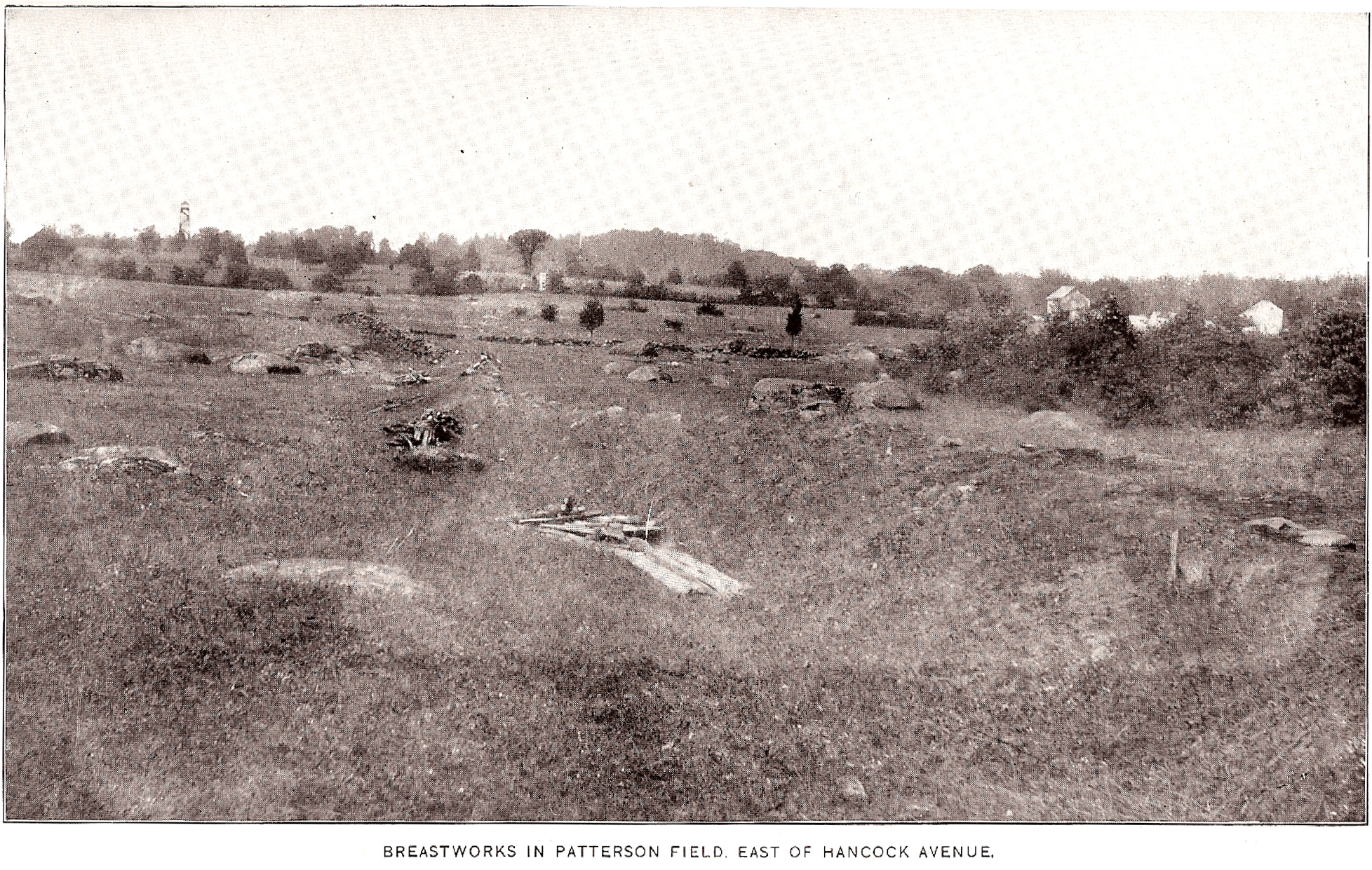
The William Patterson Field Earthworks, as shown in the Gettysburg National Military Park Report of 1905. This view was taken facing northeast in the 1890s or early 1900s.
The recent tree cutting between Hancock Avenue and the Taneytown Road has uncovered earthworks located behind the Army of the Potomac’s position on Cemetery Ridge. A photograph of these William Patterson Field Earthworks is contained in the Gettysburg National Military Park Report of 1905 for the years 1893-1904. Therefore, it was probably taken in the late 1890s to early 1900s. Thanks to Licensed Battlefield Guide George Newton for sending us this picture. We attempted to line it up with a modern shot with moderate success.
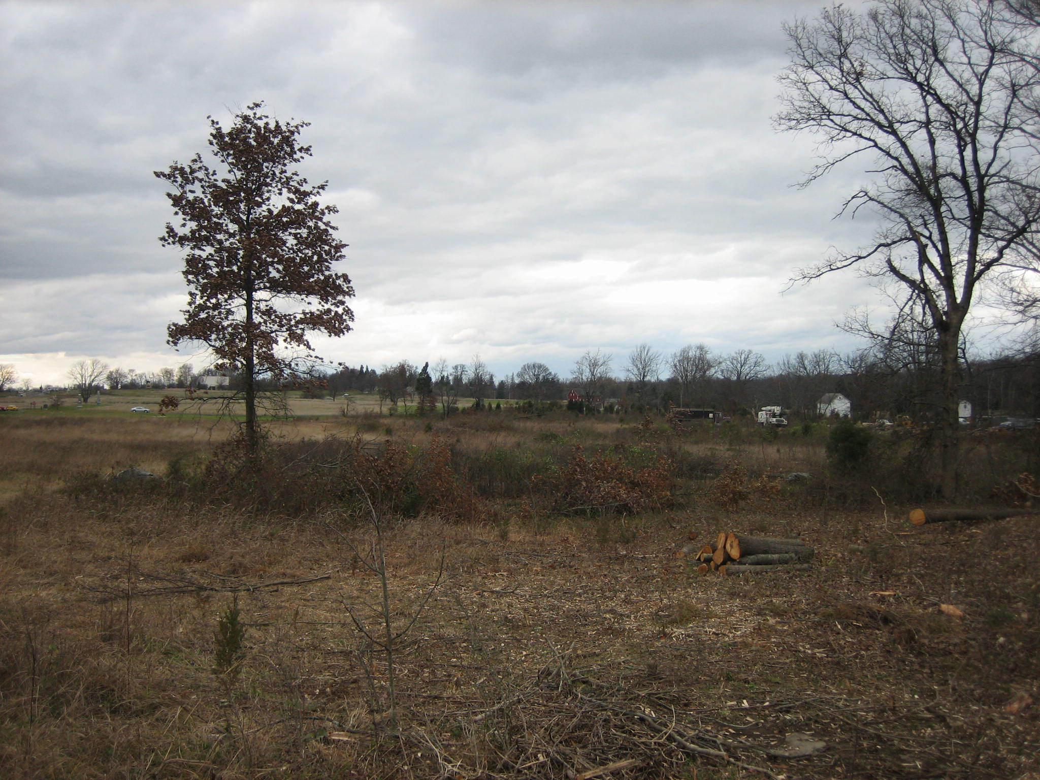
Our attempt to line up the same view today. We don’t have exactly the same angle, but we are able to feature some of the same structures that were in the 1890s to 1904 view. This view was taken facing northeast at approximately 1:45 PM on Sunday, November 17, 2008.

Here we’ve added a description of some of the structures, and if you couldn’t tell where the earthworks were located in the first picture, maybe we’ve helped you see them between the lines. This view was taken facing northeast in the 1890s or early 1900s, and filled with extraneous lines and labels at approximately 8:45 PM on November 19, 2008.

Our attempt to line up the same view today with lines and labels. This view was taken facing northeast at approximately 1:45 PM on Sunday, November 17, 2008.

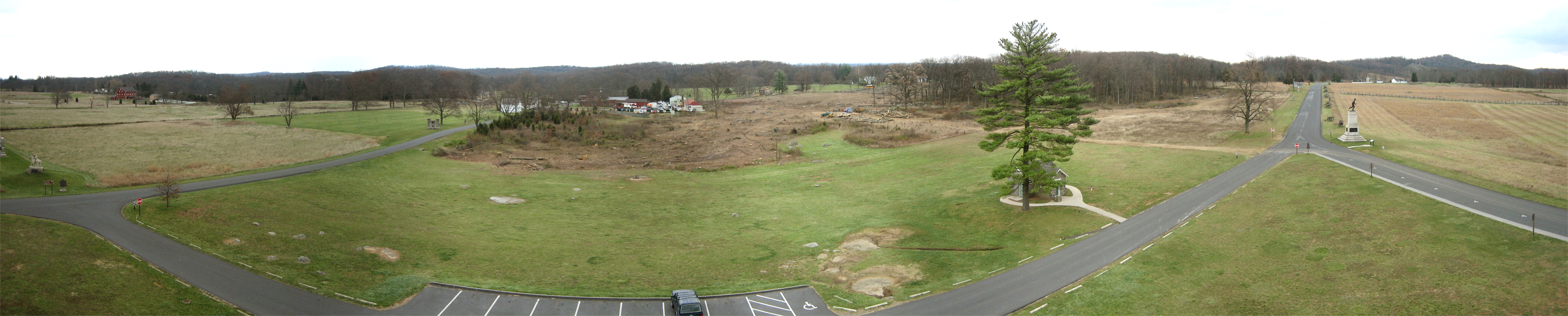
Here is a panorama from the southeast corner of the Pennsylvania Monument taken on October 17, 2008 (for the larger JPEG version click here, or you can download the uncompressed TIFF file (27.2 MB) here) This view was taken facing north, northeast, east, southeast, and south at approximately 5:30 PM on Friday, October 17, 2008.

Here is the same panorama taken on November 9th, 2008 (for the larger JPEG version click here, or you can download the uncompressed TIFF file (27.2 MB) here). This view was taken facing north, northeast, east, southeast, and south at approximately 11:30 AM on Sunday, November 9, 2008.

Here is the same panorama taken today (for the larger JPEG version click here, or you can download the uncompressed TIFF file (25.6 MB) here). This view was taken facing north, northeast, east, southeast, and south at approximately 2:45 PM on Thursday, November 20, 2008.
Related Posts:
William Patterson Field Earthworks on October 29, 2008.
Confederate Earthworks on Seminary Ridge on October 30, 2008.
William Patterson Farm Tree Cutting Update on November 9, 2008.