The Myth of Little Round Top Part 1: Gettysburg LBG Garry Adelman
March 24, 2010
Gettysburg Licensed Battlefield Guide Garry Adelman is the host for our Myth of Little Round Top series. He has been a Licensed Battlefield Guide since 1995. Little Round Top is in the background. This view was taken facing southeast at approximately 2:15 PM on Sunday, March 21, 2010.
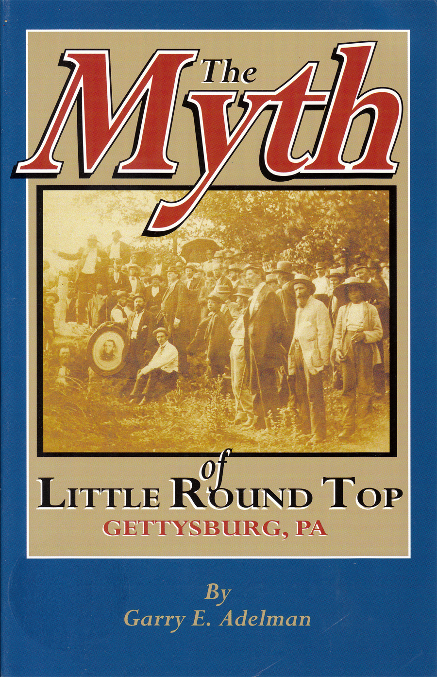
A native of the Chicago area, Garry Adelman earned his B.A. in business from Michigan State University and his M.A. in history at Shippensburg University of Pennsylvania. He is the author or co-author of Antietam: Then & Now (2005), The Myth of Little Round Top (2003), The Early Gettysburg Battlefield (2001), Little Round Top: A Detailed Tour Guide (2000), and Devil’s Den: A History and Guide (1997). He has published articles in The Gettysburg Magazine and the Civil War Preservation Trust’s Hallowed Ground and has served as editor for several Civil War image booklets. He conceived and drafted the text for wayside exhibits at the Third Winchester, First Day at Chancellorsville, Cedar Mountain and the Slaughter Pen Farm battlefields. A frequent lecturer at Civil War Round Tables, he has also appeared as a speaker on the History Channel, C-Span, and Pennsylvania Cable Network. He is the vice president of the Center for Civil War Photography and a Licensed Battlefield Guide at Gettysburg. His The Civil War Then & Now: War in the East will be published in 2011. He works full time as a historian at History Associates Incorporated in Rockville, MD and in April 2010 will become the Civil War Preservation Trust’s full time Director of History and Education.
Little Round Top is one of the most well-known historical sites in the United States. This small hill south of Gettysburg has often been called the “key” to the Union position during the battle, and some have stated that if it had fallen to the Confederates on the afternoon of July 2, 1863, the United States would have forever been split in two. Garry Adelman traces the growth of the popularity of the hill and assesses the military situation at the time when Little Round Top might have fallen into Confederate hands. He argues that the significance of Little Round Top has been exaggerated, and even if Confederates had captured Little Round Top, they had only a small chance to hold it.
In today’s post, Garry Adelman introduces us to the series, and shows us the initial placement of soldiers and Confederate assaults on the southwest face of Little Round Top.
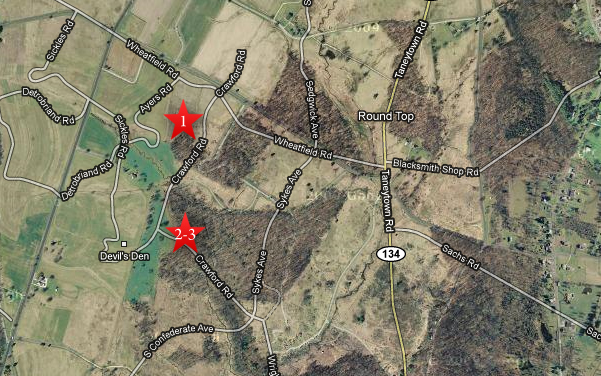
This map shows us the locations taken of videos for The Myth of Little Round Top series. Video #1 was taken on Houck’s Ridge near Ayres Avenue. Videos #2 and #3 were taken on Warren Avenue, which is mislabeled Crawford Avenue on this Google Map. This map was created facing north at approximately 7:00 PM on Monday, March 22, 2010.
In Video #1 Gettysburg Licensed Battlefield Guide Garry Adelman introduces us to the series, and explains that he wants to put the story of Little Round Top in its proper context. We apologize for the audio quality because of the windy day. This view was taken facing southeast at approximately 2:15 PM on Sunday, March 21, 2010.
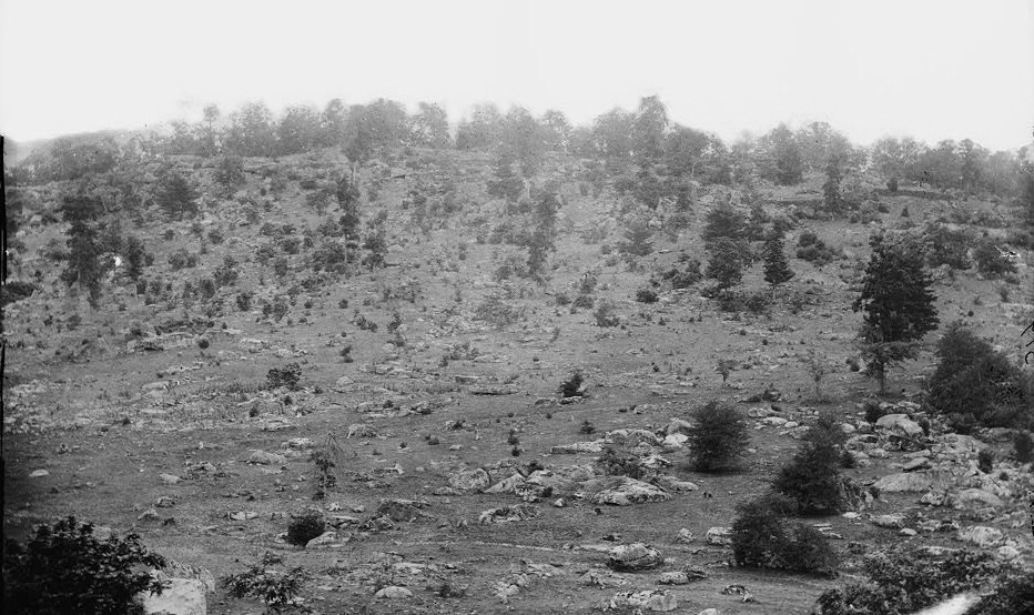
Little Round Top from Houck’s Ridge, as photographed by Alexander Gardner’s crew, July 1863. Courtesy Library of Congress. This view was taken facing southeast circa July, 1863.
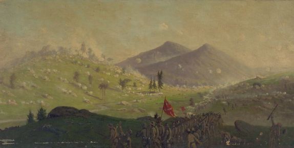
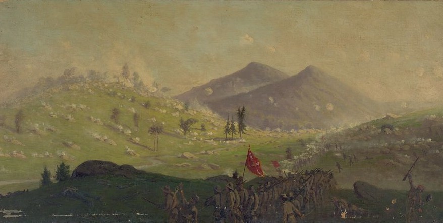
This romanticized painting (Attack on Little Round Top held by the 5th Corps commanded by General Sykes) shows the attack on Little Round Top’s Western face that never really materialized at twilight, July 2nd. By then, the Confederates moving across the Valley of Death were disorganized and few. This painting by Edwin Forbes, circa the 1870s, is courtesy of the Library of Congress.
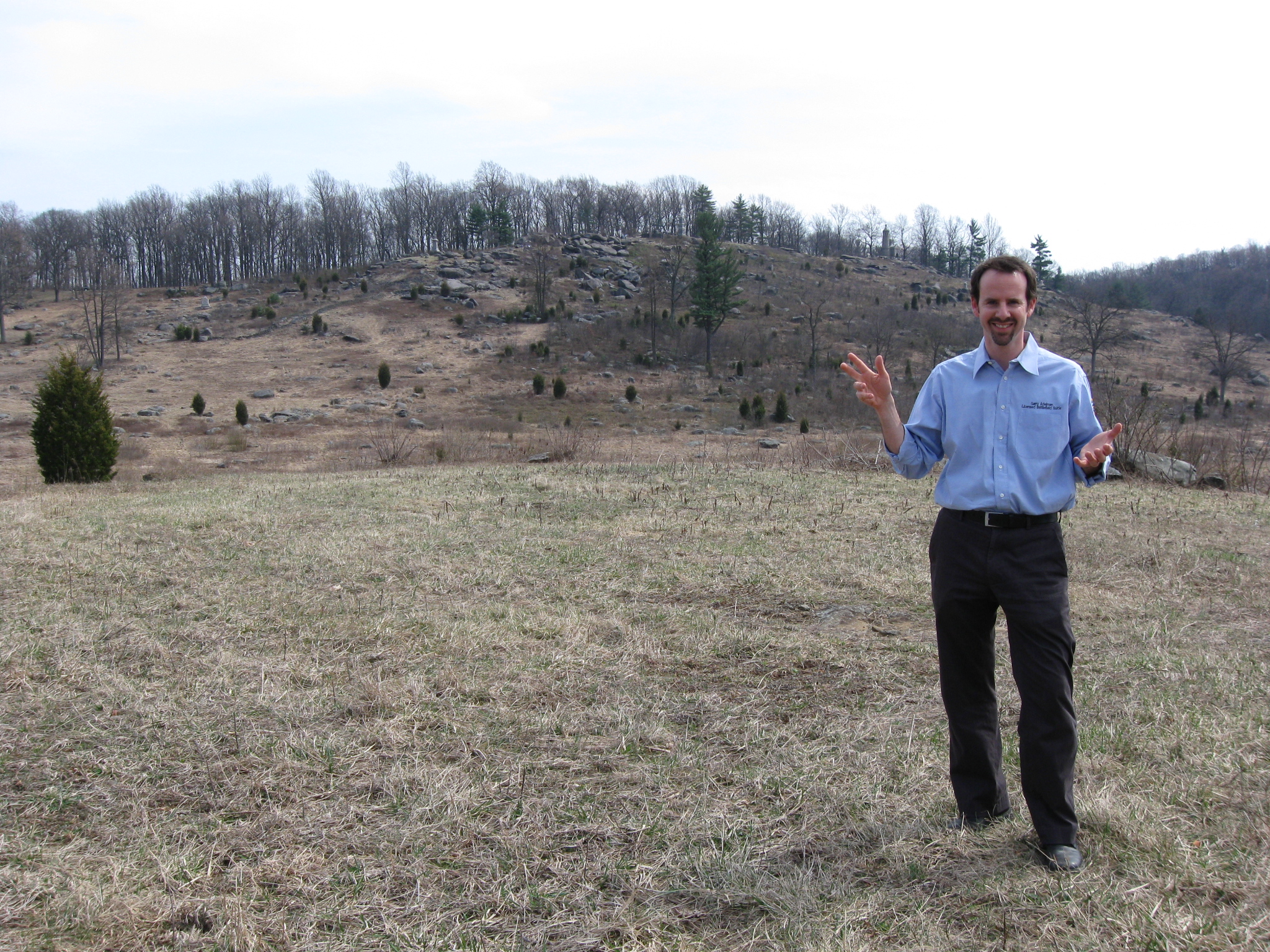
Licensed Battlefield Guide Garry Adelman is standing on the southwest side of Little Round Top near Warren Avenue, which is behind the cameraman. The castle-like monument to the 44th New York Infantry Regiment is on the top of the hill. The smaller gray monument to the 16th Michigan Infantry Regiment is above Garry’s head. This view was taken facing northeast at approximately 2:15 PM on Sunday, March 21, 2010.
In Video #2 Licensed Battlefield Guide Garry Adelman sets up the positions for the forces of both sides before the fighting began on July 2, 1863. This view was taken facing northeast to northwest to southwest at approximately 2:15 PM on Sunday, March 21, 2010.
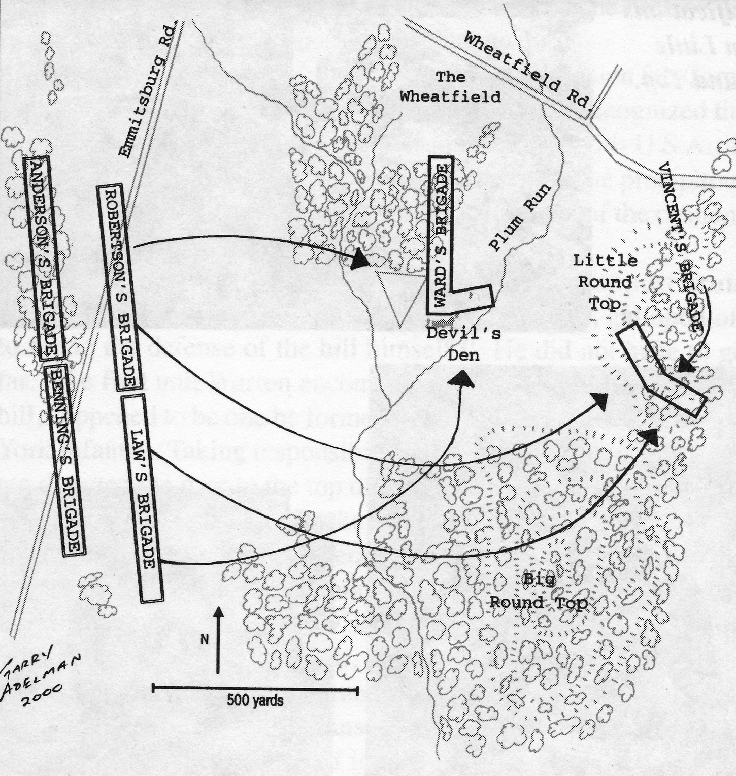
This map from Garry’s book, The Myth of Little Round Top, shows the approach of the Confederates from the left or west towards Devil’s Den and Little Round Top on July 2, 1863. This map was created by Garry Adelman in 2000.
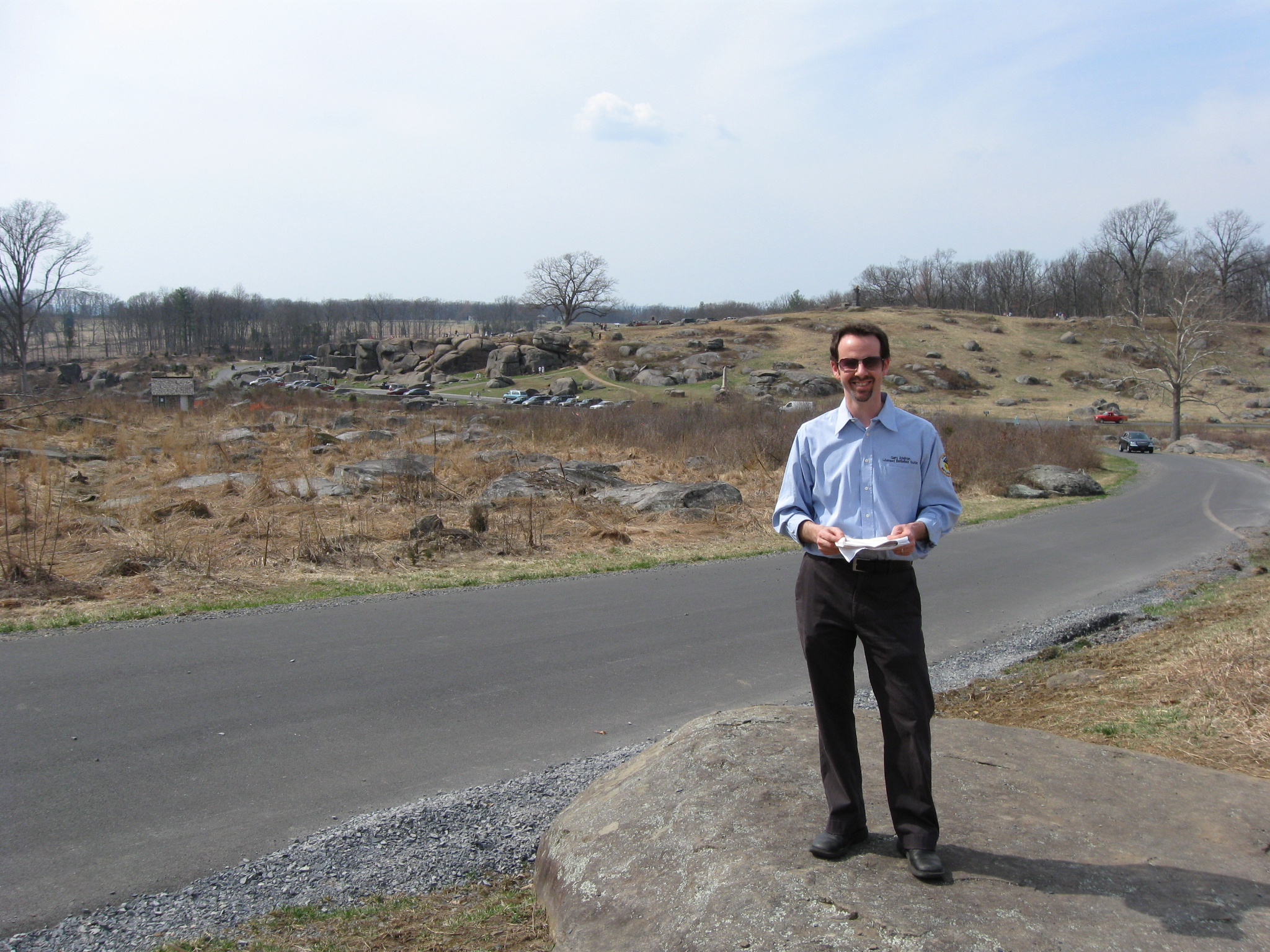
Garry Adelman is standing at the foot of Little Round Top (behind the cameraman) near Warren Avenue. Devil’s Den is in the left background. This view was taken facing southwest at approximately 2:15 PM on Sunday, March 21, 2010.
In Video #3 Garry Adelman explains the attack on the southwest side of Little Round Top, and how close the Confederates came to capturing the top. This view was taken facing southeast to northeast to southeast to northeast at approximately 2:15 PM on Sunday, March 21, 2010.
This map from Garry’s book, The Myth of Little Round Top, shows the Confederate attack up the west side of Little Round Top. The 4th Texas is outflanking the 16th Michigan as the 140th New York arrives on the summit. This map was created by Garry Adelman in 2000.