Gettysburg Rock Carvings 1 with Gettysburg Licensed Battlefield Guide Tim Smith
July 16, 2009
Gettysburg Licensed Battlefield Guide Tim Smith is the co-author of the book Devil’s Den, A History and Guide from Thomas Publications. He begins our look at Gettysburg Rock Carvings in the Devil’s Den area. This view was taken facing southwest at approximately 3:15 PM on Thursday, July 9, 2009.
Gettysburg Licensed Battlefield Guide Tim Smith begins a series on Gettysburg Rock Carvings. Tim is a native of Baltimore, Maryland, and has been a Licensed Battlefield Guide at Gettysburg National Military Park since 1992. Tim is the Research Historian for the Adams County Historical Society, and has written numerous articles, booklets, and books about the Gettysburg area. Tim is the co-author with Gettysburg Licensed Battlefield Guide Garry Adelman of Devil’s Den, A History and Guide.
In today’s post, Gettysburg Licensed Battlefield Guide Tim Smith begins our tour of Gettysburg Rock Carvings at Devil’s Den. He introduces us to the rock carvings and explains how the government chiseled away many of the rock carvings in 1894.
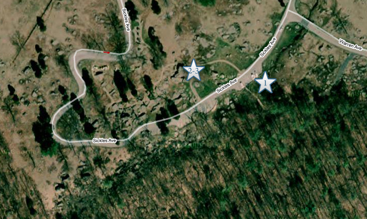
This map shows us the locations taken of videos for the Gettysburg Rock Carvings series. Video #1 was taken in the Slaughter Pen. Videos #2 and #3 were taken in the area of the “balancing rock” or “table rock” at Devil’s Den. This map was created facing north at approximately 8:00 PM on Tuesday, July 14, 2009.
In Video #1 Gettysburg Licensed Battlefield Guide Tim Smith introduces to the Gettysburg Rock Carvings, and explains why he thinks the rocks are important. This view was taken facing southwest at approximately 3:15 PM on Thursday, July 9, 2009.
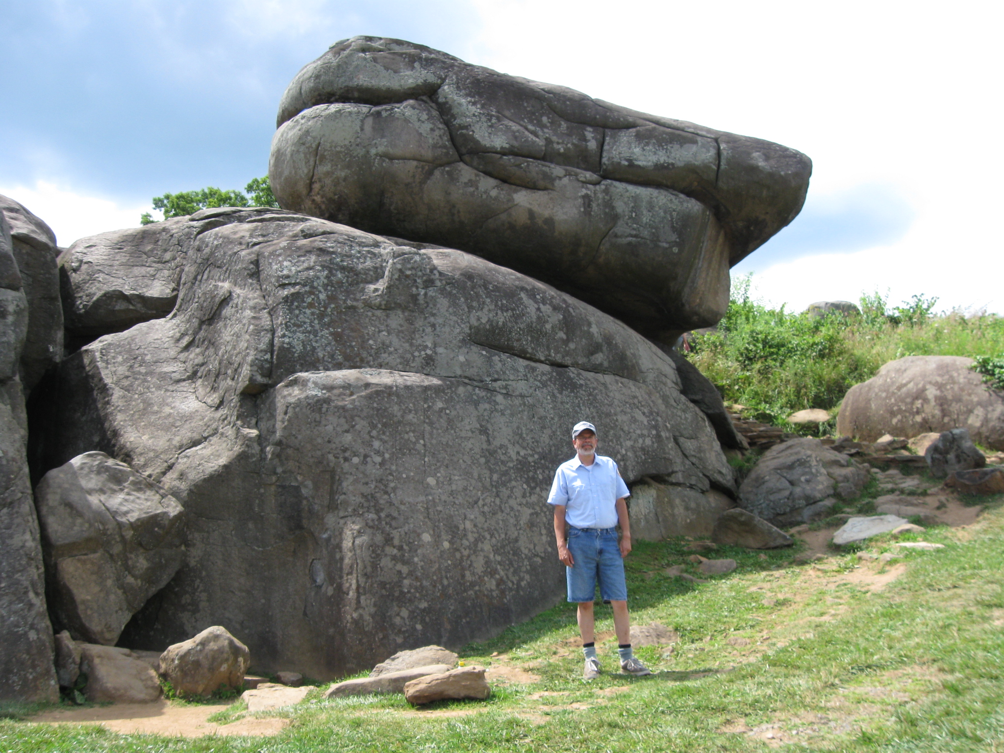
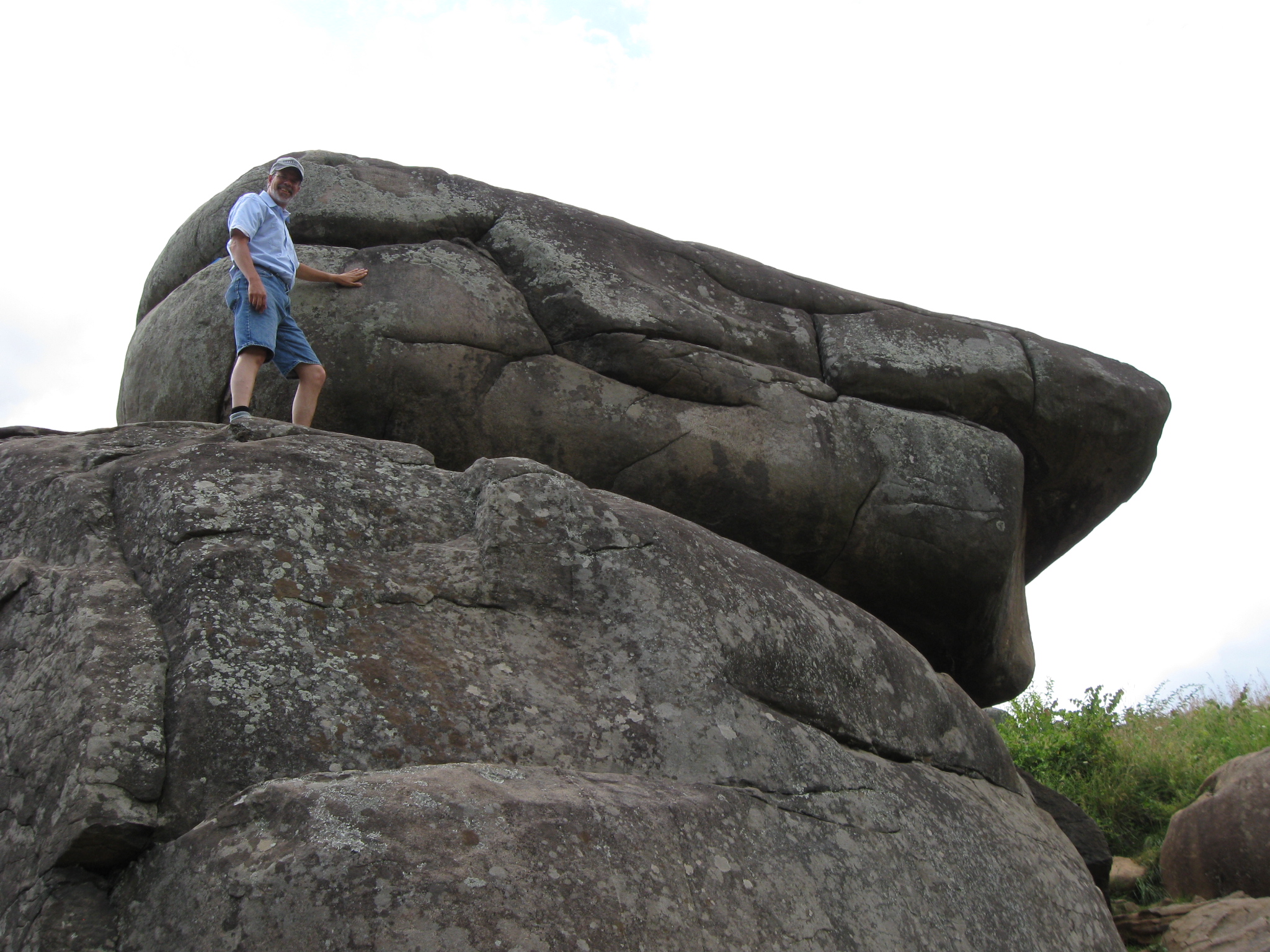
Gettysburg Licensed Battlefield Guide Tim Smith, wearing his rock climbing clothes (you will see why in subsequent posts) is standing beneath the “balancing rock” or “table rock.” This view was taken facing southwest at approximately 3:15 PM on Thursday, July 9, 2009.
In Video #2 Licensed Battlefield Guide Tim Smith tells us that Devil’s Den was a place for locals to visit before the battle. He also shows an example of when the government chiseled away a rock carving in 1894. This view was taken facing southwest at approximately 3:15 PM on Thursday, July 9, 2009.
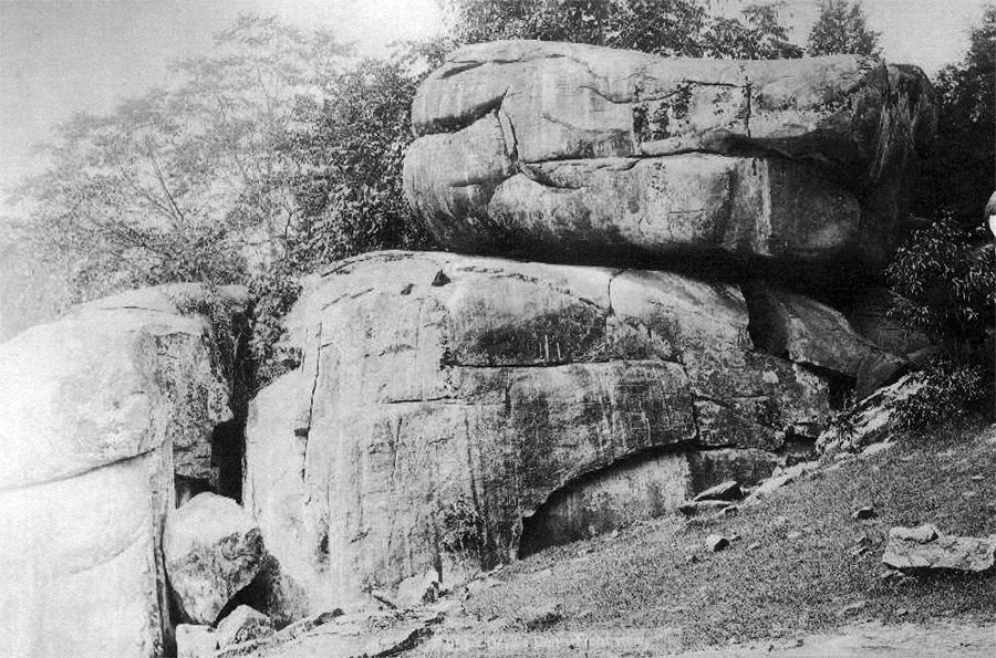
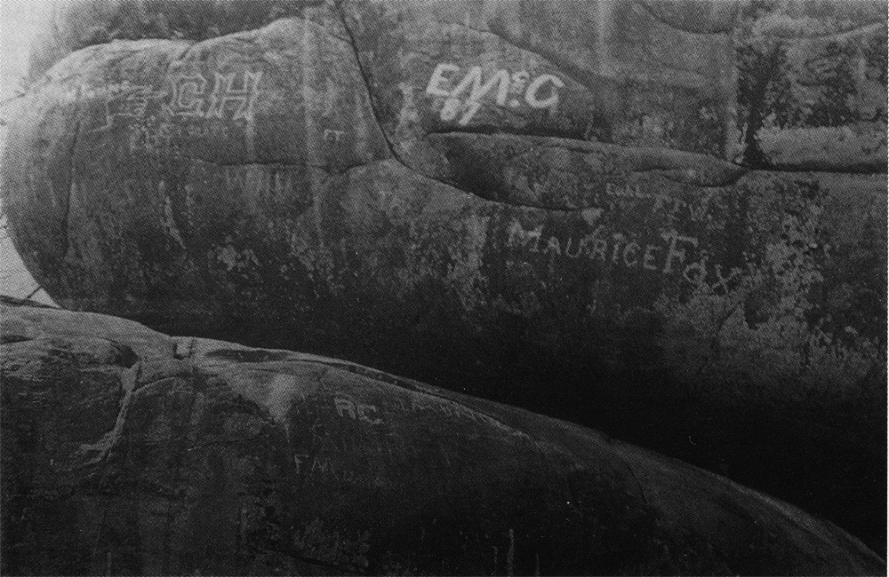
The white marks on the rocks show where the government chiseled away the rock carvings. The carving Tim Smith showed us in Video #2 is in the lower, center section of the rock. In our next video, he will show us where the government chiseled away carvings on the “table rock” or “balancing rock.” This photograph is courtesy of the Tim Smith Collection. This view was taken facing southwest circa 1895.
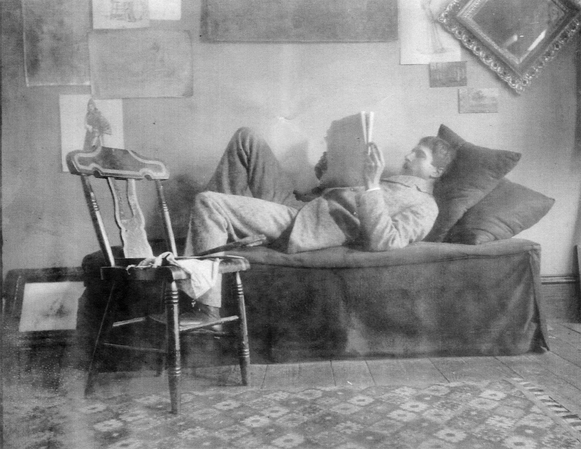
Tim Smith is near the Table Rock inside a crack of which he found a diary. He decides to look through the diary to uh…, find out who the owner was. This view was taken facing southwest at approximately 3:15 PM on Thursday, July 9, 2009.
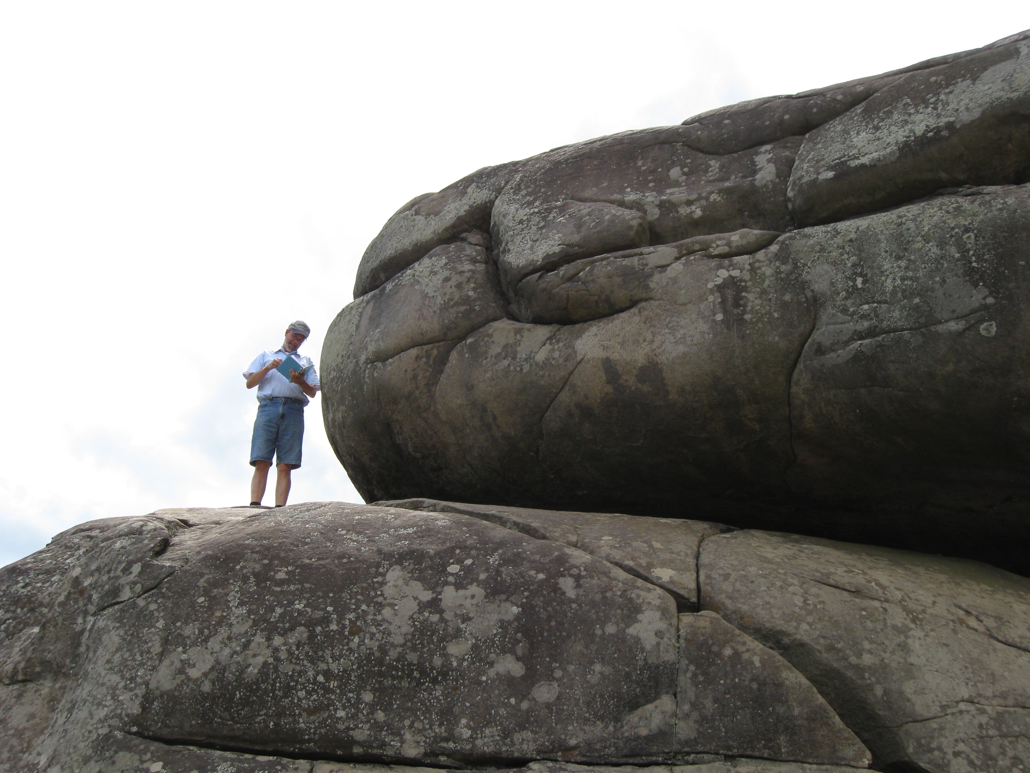
Tim Smith, no longer distracted by the diary, has his left hand on an area where the initials “C.H.” were carved in the Table Rock. This view was taken facing west at approximately 3:15 PM on Thursday, July 9, 2009.
In Video #3 Tim Smith shows the locations of the carvings of Maurice Fox, the large “C.H,” and the carving of Charles Morris Young. This view was taken facing southwest at approximately 3:15 PM on Thursday, July 9, 2009.
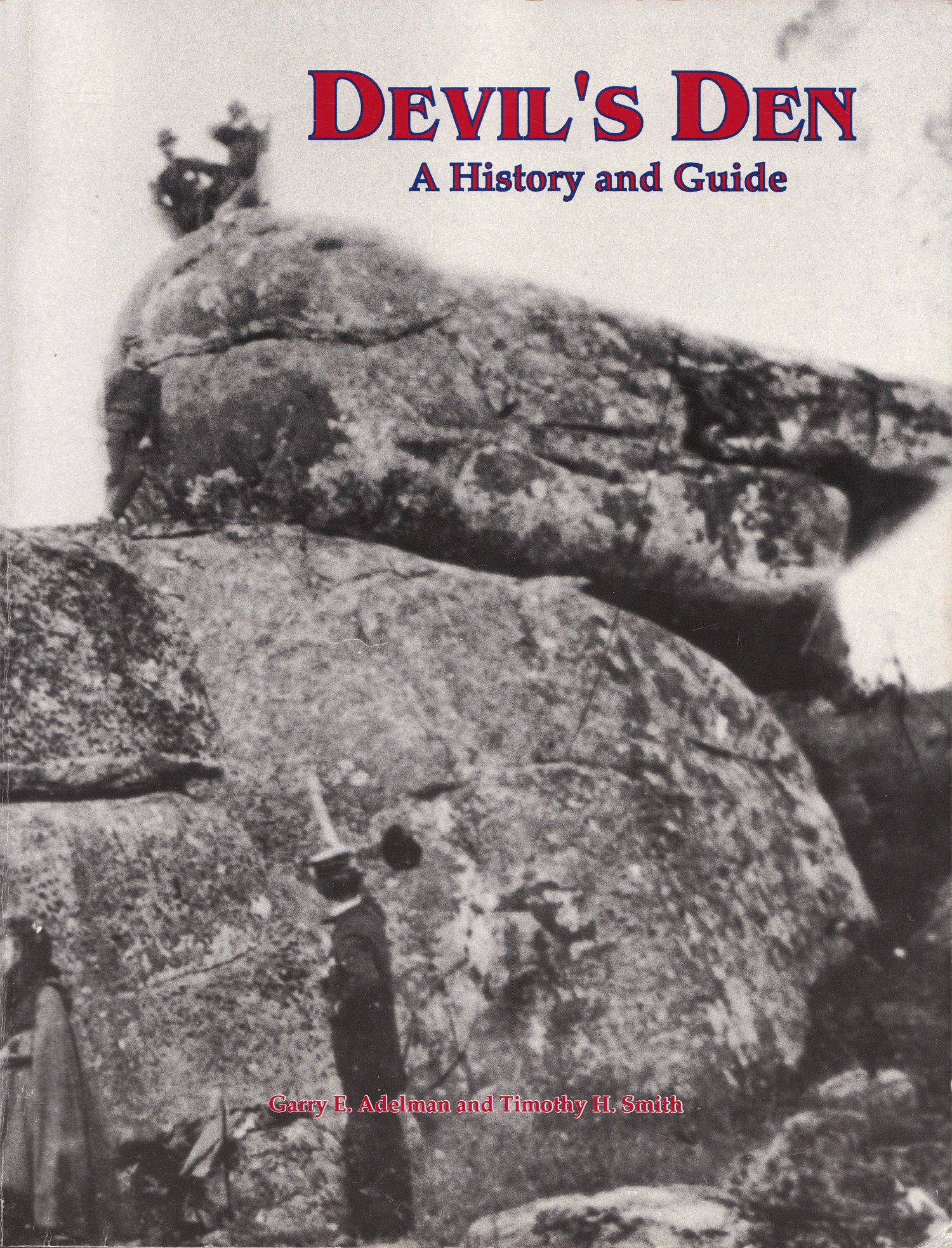
Tim Smith is the co-author with Gettysburg Licensed Battlefield Guide Garry Adelman of Devil’s Den, A History and Guide. It was first published by Thomas Publications, Gettysburg, Pennsylvania in 1997. This cover was scanned facing south at approximately 8:00 PM on Tuesday, July 14, 2009.
To see other posts by Gettysburg Licensed Battlefield Guides,click here.