Gettysburg Harrisburg RR Part 4 Presented by Licensed Battlefield Guide Don Walters
April 17, 2009
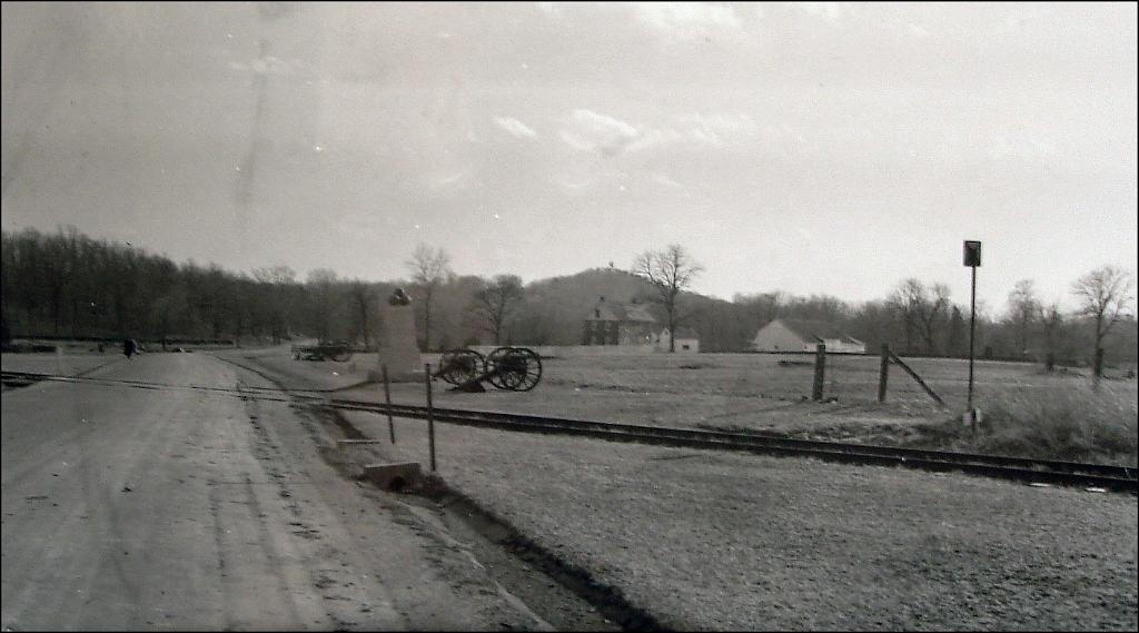
Tracks from the Gettysburg Harrisburg Railroad cross Hancock Avenue on Cemetery Ridge just north of the monument to Dow’s Maine Battery. The George Weikert Farm is in the background. Big Round Top is above the George Weikert Farm. Weikert Hill is in the left background. Also notice the taller sign on the other side of (west of) the tracks on the right side of this view. These directional/information signs for the railroad still have some of their bases remaining, as we will show you later in this post. This photograph is courtesy of Phil Lechak. This view was taken facing south circa 1900.
The Gettysburg-Harrisburg Railroad, which opened in 1884, was Gettysburg’s second railroad. It was the most direct route to Harrisburg. But it was also a response to Gettysburg’s growing tourism industry in an age before the automobile. Approximately a mile of the railroad still crosses the first day’s field. Over two miles of the railroad used to cross the fields of Pickett’s Charge to the foot of Little Round Top. Gettysburg Licensed Battlefield Guide Don Walters showed us the route of the railroad, including the parts that are still visible.
In our first post, Don Walters introduced us to the Gettysburg Harrisburg Railroad. In our second post, we viewed some visible parts of the railroad ties in the Borough of Gettysburg. In our third post, Don took the railroad across the fields of Pickett’s Charge. In today’s post, Don Walters takes the Gettysburg Harrisburg Railroad across Hancock Avenue, and into the woods east of Weikert Hill on which sits the First New Jersey Brigade Monument.
This map shows the locations of the videos that were created for these posts. Video #1 was taken at the Oak Ridge observation tower. Video #2 was taken at the Gettysburg Harrisburg Railroad station on North Washington Street. Video #3 was taken inside the Western Maryland Railroad station on Carlisle Street. Videos #4 and #5 were taken at Codori Memorials on Middle Street. Video #6 was taken in the Pickett’s Charge fields west of the Emmitsburg Road. Video #7 was taken near the monument to Colonel George Ward of the 15th Massachusetts Infantry regiment east of the Emmitsburg Road. Video #8 was taken near the Hancock Wounding Marker west of Hancock Avenue. Video #9 was taken near the monument to Dow’s Maine Battery on Hancock Avenue. Video #10 was on the west side of Weikert Hill and #11 was taken east of Weikert Hill. This map was created facing north at approximately 7:30 PM on Wednesday, April 15, 2009.
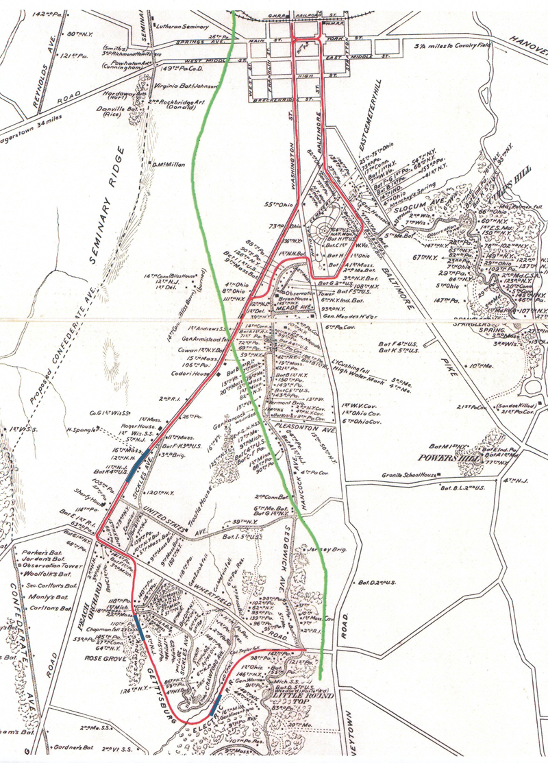
This map shows the route of the Gettysburg-Harrisburg Railroad with a green line. The Gettysburg Electric Trolley is shown with a red line. This map was created facing north in 2007.
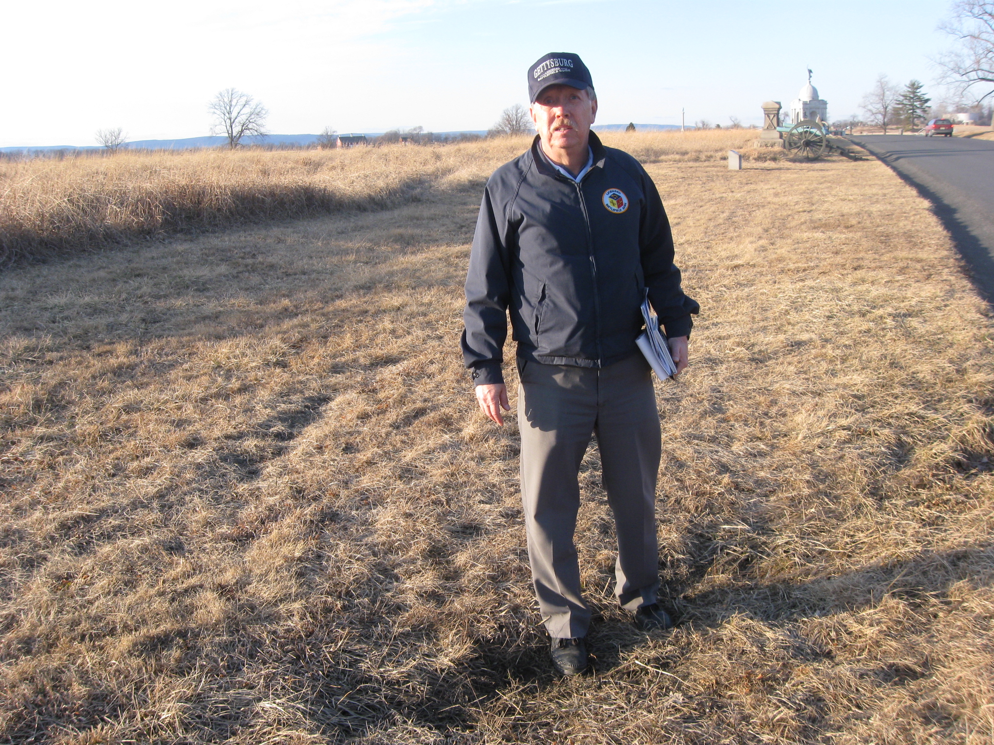
Gettysburg Licensed Battlefield Guide Don Walters is our host for this series on the Gettysburg Harrisburg Railroad. Here he is standing west of Hancock Avenue on Cemetery Ridge. The Pennsylvania State Memorial is the large domed monument in the background. The monument to Dow’s Maine Battery is a few feet behind the camera position. Don is standing in the depression made by one of the ties of the Gettysburg Harrisburg Railroad. This view was taken facing northwest at approximately 3:00 PM on Sunday, February 15, 2009.
In Video #9, Don Walters shows us how the railroad line paralleled Hancock Avenue until it crossed it at this location. He also shows us the location of some of the ties buried in this location. He then points us towards our next stop near Weikert Hill. This view was taken facing northwest to southeast at approximately 3:00 PM on Sunday, February 15, 2009.
Our next stop brings us to Weikert Hill, which is the location of the First New Jersey Brigade Monument. The monument is on the hill in the background. This view was taken facing east at approximately 3:00 PM on Sunday, February 22, 2009.
In Video #10, Don Walters is west of Weikert Hill near Hancock Avenue. He shows us the easiest way to get to the railroad line and talks about some of the New Jersey markers in the area.
We’ll follow Don into the area where the railroad bed was located. First we’ll walk northeast, down the stone wall which Don showed us in Video #10. This view was taken facing northeast at approximately 3:00 PM on Sunday, February 22, 2009.
We’ll then go through the first opening in the stone wall, near this New Jersey marker, and continue to the east. This view was taken facing northeast at approximately 3:00 PM on Sunday, February 22, 2009.
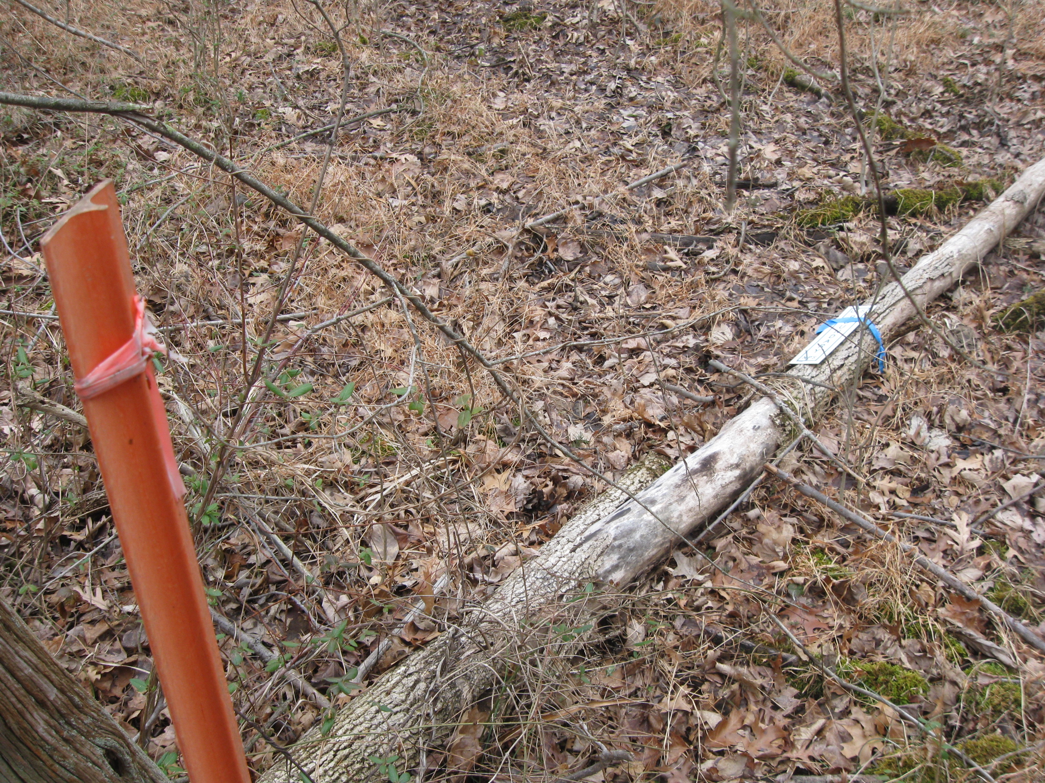
Walk past the orange post and the National Park Service boundary marker on the ground (but we are still on NPS property). This view was taken facing east at approximately 3:00 PM on Sunday, February 22, 2009.
Climb over the metal wire that Don is pointing out. This view was taken facing southeast at approximately 3:00 PM on Sunday, February 22, 2009.
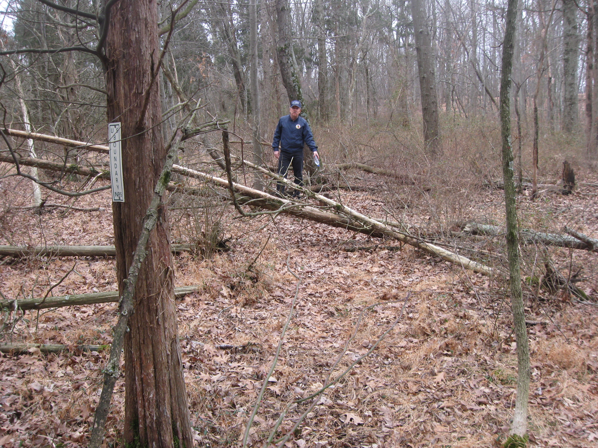
And then climb over this stone wall at whatever you consider the most convenient point. This view was taken facing east at approximately 3:00 PM on Sunday, February 22, 2009.
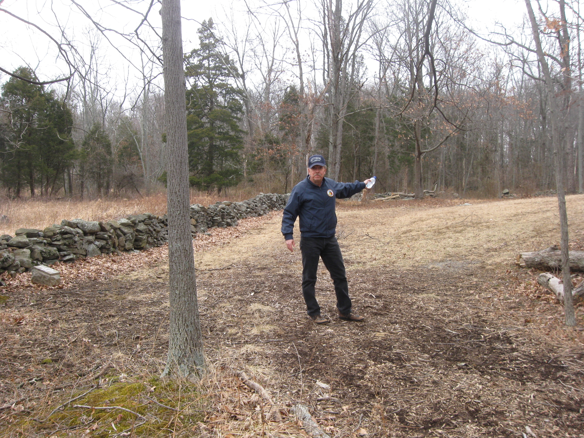
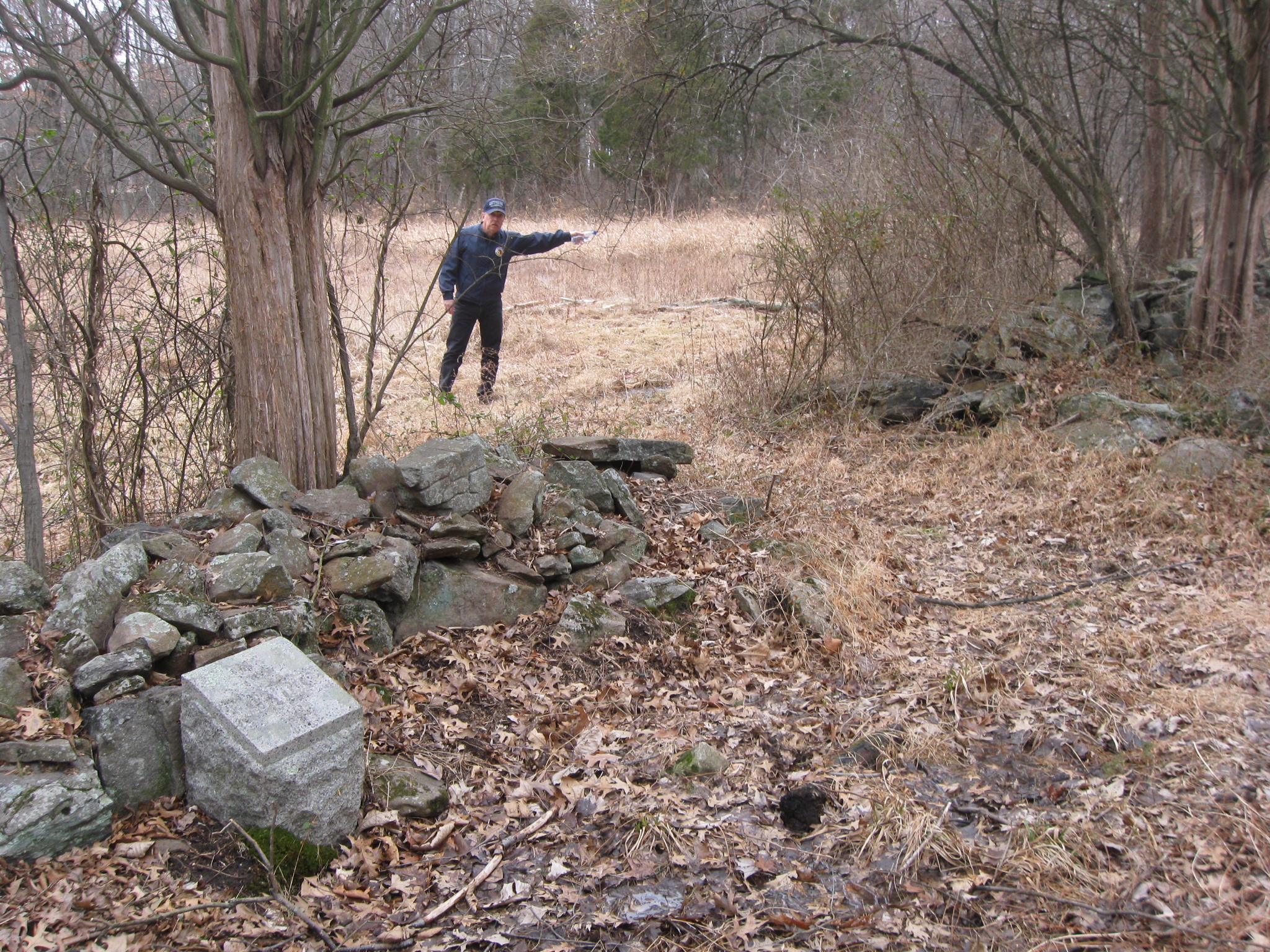
We are still on National Park Service land, and Don has discovered the landmark that he wants to point out to us. This view was taken facing south at approximately 3:00 PM on Sunday, February 22, 2009.
It’s easy to miss if you’re not looking for it. This view was taken facing east at approximately 3:00 PM on Sunday, February 22, 2009.
This is the base of one of the directional/information signs that we showed you in the first (black and white/circa 1900) picture of this post. This view was taken facing south at approximately 3:00 PM on Sunday, February 22, 2009.
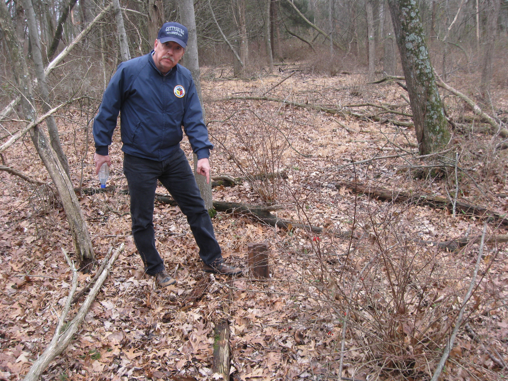
But the base isn’t directly next to the railroad bed. The railroad bed, located approximately seven yards west of this marker is raised almost two feet off the ground. Don is standing on the railroad bed. This view was taken facing west at approximately 3:00 PM on Sunday, February 22, 2009.
In Video #11, Don Walters explains why the sign would have been here, and shows the sign’s relationship to the railroad bed. His references to “Ding Dong, Ding Dong” and “Hannah Hunter of Greenbrier, Mississippi,” is of course from the 1959 John Ford movie, “The Horse Soldiers,” starring John Wayne and William Holden. This view was taken facing south to west at approximately 3:00 PM on Sunday, February 22, 2009.
To see other posts by Gettysburg Licensed Battlefield Guides, click here.