Gettysburg Harrisburg RR Part 3 Presented by Licensed Battlefield Guide Don Walters
April 6, 2009
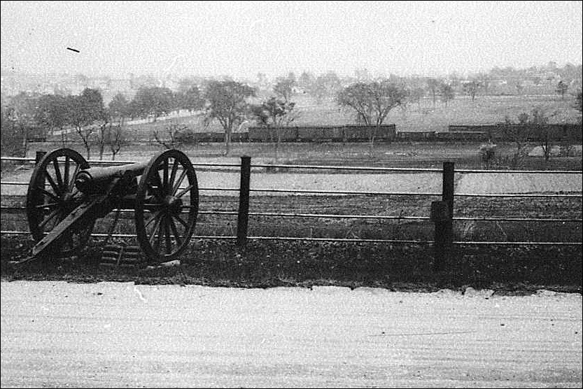
Cars sit on the Gettysburg Harrisburg Railroad tracks below (east of) Watson’s Battery on Seminary Ridge. This photograph is courtesy of Phil Lechak. This view was taken facing east circa 1900.
The Gettysburg-Harrisburg Railroad, which opened in 1884, was Gettysburg’s second railroad. It was the most direct route to Harrisburg. But it was also a response to Gettysburg’s growing tourism industry in an age before the automobile. Approximately a mile of the railroad still crosses the first day’s field. Over two miles of the railroad used to cross the fields of Pickett’s Charge to the foot of Little Round Top. Gettysburg Licensed Battlefield Guide Don Walters showed us the route of the railroad, including the parts that are still visible.
In our first post, Don Walters introduced us to the Gettysburg Harrisburg Railroad. In our second post, we viewed some visible parts of the railroad ties in the Borough of Gettysburg. In today’s post, Don takes the railroad across the fields of Pickett’s Charge.
This map shows the locations of the videos that were created for these posts. Video #1 was taken at the Oak Ridge observation tower. Video #2 was taken at the Gettysburg Harrisburg Railroad station on North Washington Street. Video #3 was taken inside the Western Maryland Railroad station on Carlisle Street. Videos #4 and #5 were taken at Codori Memorials on Middle Street. Video #6 was taken in the Pickett’s Charge fields west of the Emmitsburg Road. Video #7 was taken near the monument to Colonel George Ward of the 15th Massachusetts Infantry regiment east of the Emmitsburg Road. Video #8 was taken near the Hancock Wounding Marker west of Hancock Avenue. This map was created facing north at approximately 2:30 PM on Sunday, April 5, 2009.
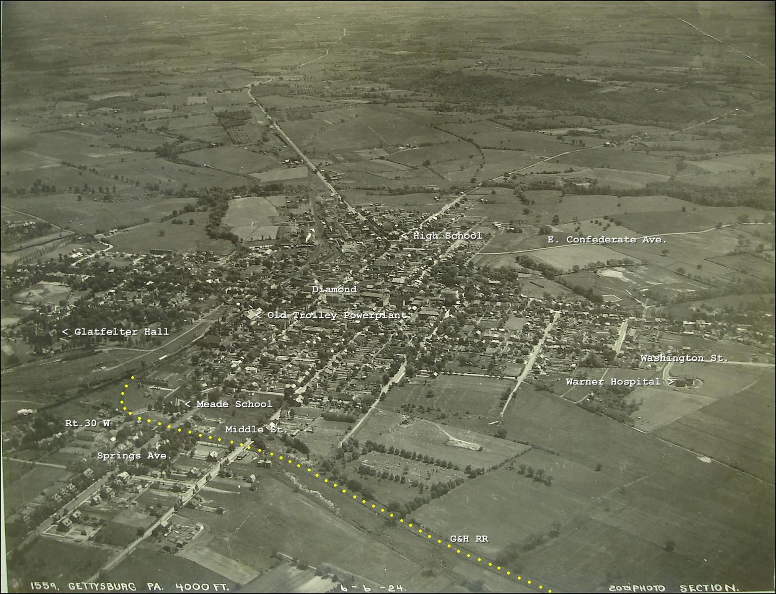
This map, provided to us by Licensed Battlefield Guide Phil Lechak shows the Round Top Branch of the Gettysburg Harrisburg Railroad with yellow dots as it traverses the Borough of Gettysburg and heads towards the Pickett’s Charge fields. This map is courtesy of Michael Waricher. This map was created facing east circa the 1920s (possibly June 6, 1924).
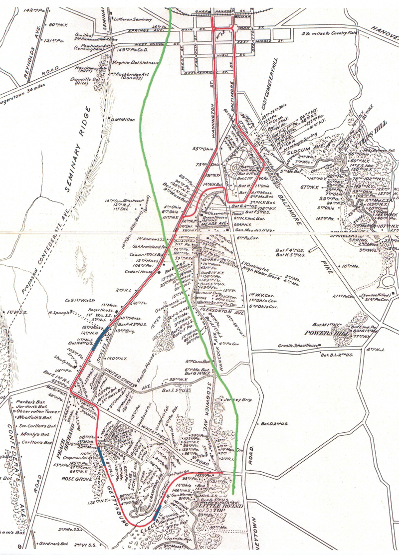
This map shows the route of the Gettysburg-Harrisburg Railroad with a green line. The Gettysburg Electric Trolley is shown with a red line. This map was created facing north in 2007.
Gettysburg Licensed Battlefield Guide Don Walters is our host for this series on the Gettysburg Harrisburg Railroad. In our previous post, we were in the town at Codori Memorials. Today he will show us how the railroad came across the fields of Pickett’s Charge. The subdivision Colt Park is visible in the right background. Seminary Ridge is in the left background. This view was taken facing northwest at approximately 3:00 PM on Sunday, February 15, 2009.
In video #6 (Videos 1-5 were in our first two posts on this subject) Don Walters explains, among other things how much of the Pickett’s Charge ground upon which visitors walk today was not here at the time of the battle. Tons of earth were brought in from other locations to build up the railroad bed. This view was taken facing northwest to southeast at approximately 3:00 PM on Sunday, February 15, 2009.
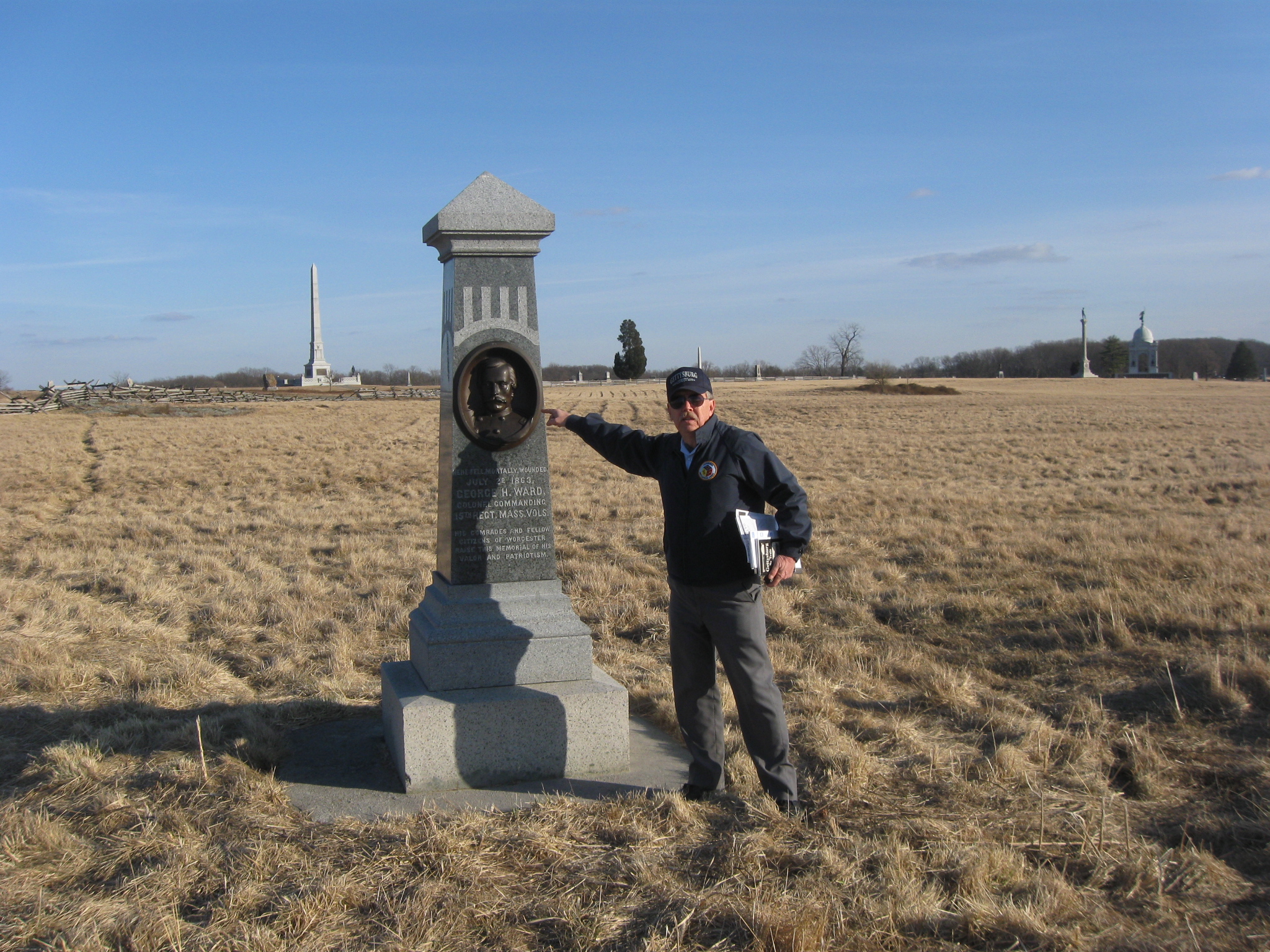
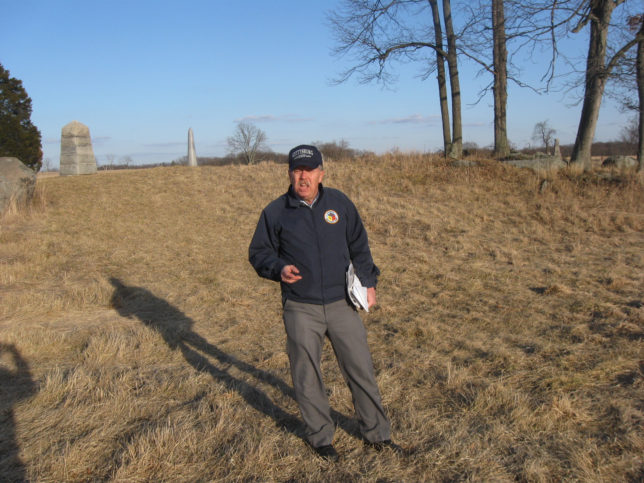
Don Walters has now moved to the monument marking the location where Colonel George Ward of the 15th Massachusetts was killed on July 2, 1863. The obelisk monument on Cemetery Ridge in the left background is to the U.S. Regulars. In the right background is the shaft-like Vermont State Monument and the Pennsylvania State Memorial. This view was taken facing southeast at approximately 3:00 PM on Sunday, February 15, 2009.
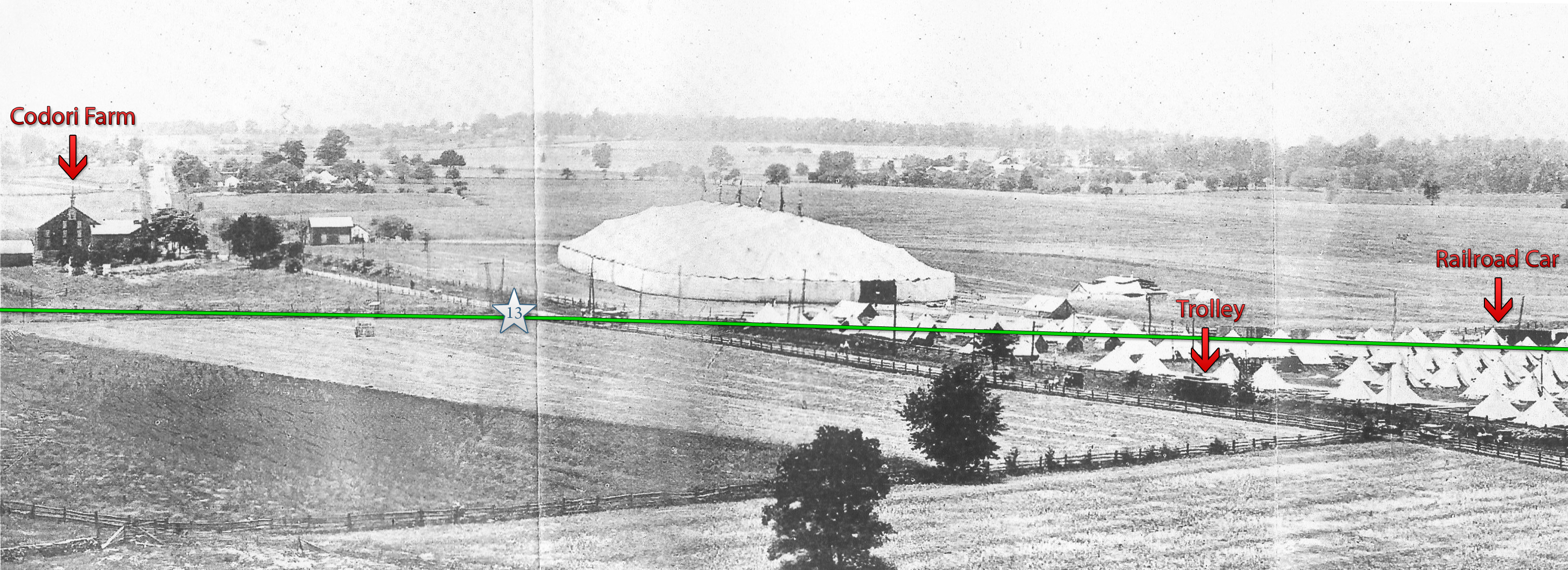
This photograph and the three following it we showed during our series on the Gettysburg Electric Railroad or Trolley. Because this is where the trolley intersected with the railroad, we’re bringing them out again. This is a photograph of the Pickett’s Charge area around the time of the 1913 Reunion. The large white tent, or Great Tent, hosted the larger meetings for the 50,000 veterans who attended the reunion. The Gettysburg Harrisburg Railroad tracks and some railroad cars are visible in this picture. This view is courtesy of the National Park Service. This view was taken facing southwest in June, 1913.
The green line represents the Harrisburg and Reading Railroad line which ran across the Pickett’s Charge fields towards the Round Tops. The white star is where we filmed video #13 for our posts on the Gettysburg Electric Trolley. We have pointed out a trolley on the Emmitsburg Road and a railroad car on the tracks west of the Emmitsburg Road. This view is courtesy of the National Park Service. This view was taken facing southwest in June, 1913.
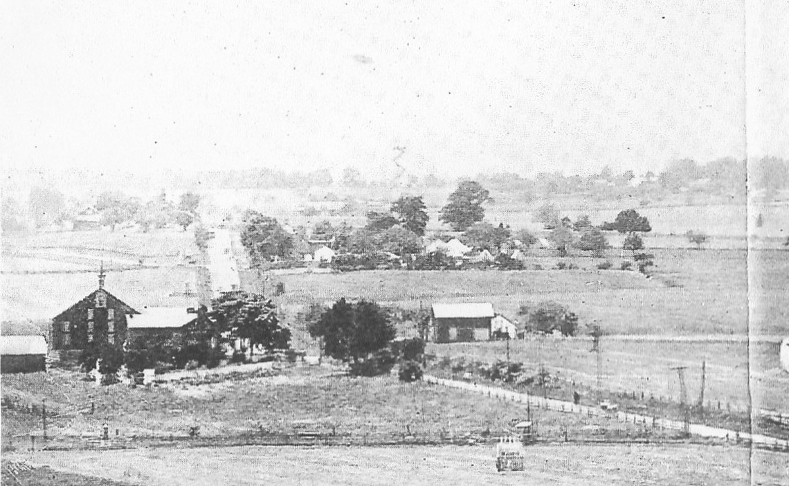
Here is a detail from the previous photograph. This view is courtesy of the National Park Service. This view was taken facing southwest in June, 1913.
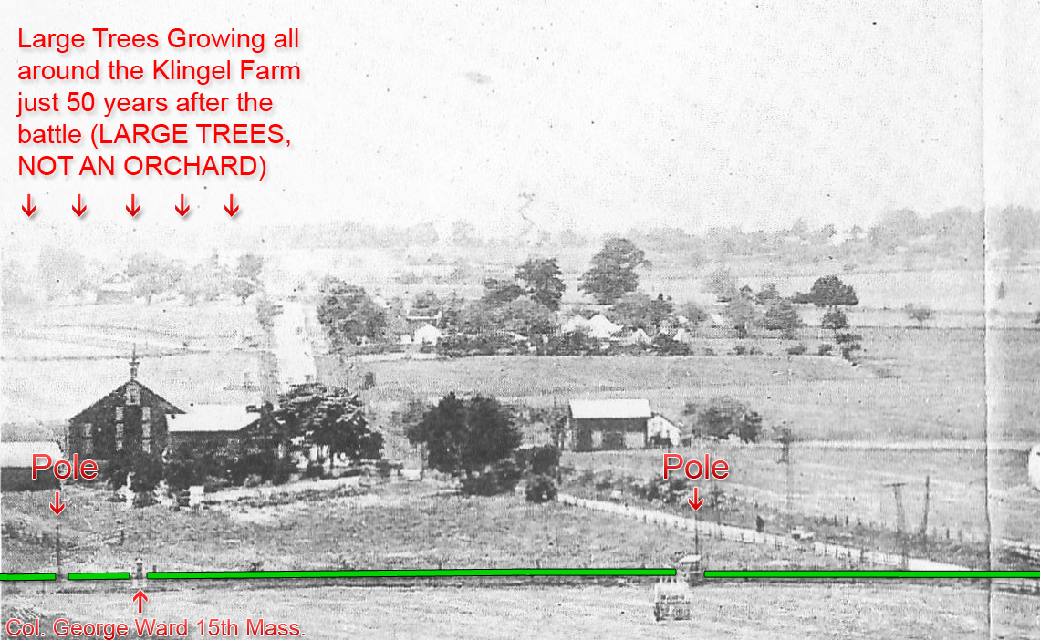
Again, the green line is the railroad line. At the bottom left is the monument showing where Colonel George Ward of the 15th Massachusetts Infantry Regiment was mortally wounded. We have also pointed out two poles. These could have been telegraph poles used by the railroad line. Again we can’t resist showing the Klingel Farm with very large trees only 50 years after the battle. In October, 2008, the National Park Service cut down some large trees here insisting that there was an orchard in their location at the time of the battle. This view is courtesy of the National Park Service. This view was taken facing southwest in June, 1913.
In Video #7, Don explains how visitors were hitting the George Ward Monument with sticks/canes and throwing various objects as they rode past it on the railroad cars. This view was taken facing northwest to southeast at approximately 3:00 PM on Sunday, February 15, 2009.
We have now moved below (west of) the knoll upon which sits the marker showing where Major-General Winfield Scott Hancock was wounded on July 3, 1863. The Hancock marker is in the far left background. This view was taken facing east at approximately 3:00 PM on Sunday, February 15, 2009.
In Video #8, Don Walters explains how the ground in the area near the Hancock wounding marker which at the time of the battle was possibly filled in by the railroad. Don also states that Hancock may have actually been wounded in the lower ground near the railroad bed. This is west of the knoll on which the Hancock wounding marker is located. This view was taken facing northwest to southeast to north to east to other directions at approximately 3:30 PM on Sunday, February 15, 2009.
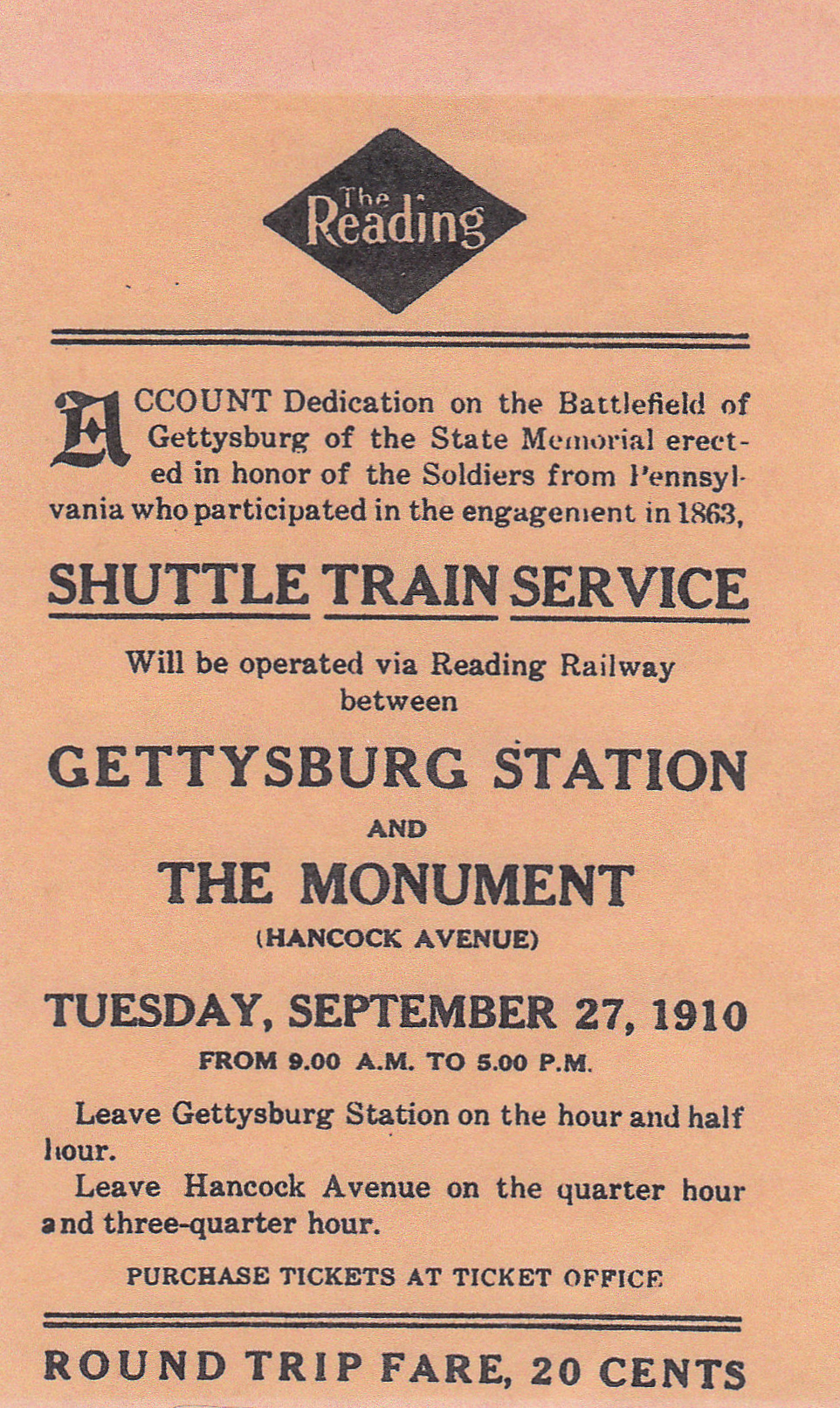
A copy of the ticket to Hancock Station for the dedication ceremonies of the Pennsylvania State Monument that Don mentioned in video #8. This ticket was scanned facing south at approximately 4:00 PM on Sunday, April 5, 2009.
A view of the Gettysburg Harrisburg Railroad tracks from the southwest corner of the Pennsylvania Monument. This picture is courtesy of Phil Lechak. This view was taken facing northwest circa the 1910s.
An aerial view of the Pennsylvania Monument shows the roadbed of the Gettysburg Harrisburg Railroad running right to left in front of (west of) the monument. The absence of tracks helps us date this photograph. The Gettysburg Harrisburg Reading Railroad ceased operations in Gettysburg in 1941. The tracks of the Round Top Branch of the railroad were removed in 1942 as part of a World War II scrap drive. This picture is courtesy of Phil Lechak. This view was taken facing southeast circa late 1940s, early 1950s.
See our previous posts on Gettysburg Licensed Battlefield Guides:
Culp’s Hill with Licensed Battlefield Guide Charlie Fennel here.
Gettysburg Guide Room: The Final Days on March 8, 2008.
Lights Out at the Electric Map on April 13, 2008.
New Guide Room at the New Visitor Center on April 19, 2008.
New Association of Licensed Battlefield Guide Office and Library Opens on August 25, 2008.
Evergreen Cemetery Headstone Damage with LBG Deb Novotny on October 20, 2008.
Camp Letterman with LBG Phil Lechak here.
Gettysburg Artillery with LBG George Newton here.
“Mammy’s Little Baby Loves Guided Tours” with LBG Charlie Fennell on November 23, 2008.
Bucktails on McPherson’s Ridge Part 1 with LBG Rich Kohr on November 26, 2008.
Gettysburg Licensed Battlefield Guide Exam 2008 on December 6, 2008.
Gettysburg Hawk Hunting with Licensed Battlefield Guide Dave Weaver on December 14, 2008.
Colonel Edward Ephraim Cross with LBG Rich Bellamy here.
Licensed Battlefield Guide Rich Kohr: William Wible’s Gettysburg Quarry on January 21, 2009.
The Gettysburg Electric Trolley with LBG Rich Kohr here
ACHS Battle of Gettysburg Civil War Research Room with LBG Tim Smith on February 10, 2009.
Lutheran Theological Seminary Cupola with LBG Tim Smith here
John F. Kennedy’s Gettysburg Visit with LBG Richard Goedkoop here.
Gettysburg Harrisburg Railroad with LBG Don Walters here.
Neill Avenue (Lost Avenue) with LBG Ted Gajewski here.