Gettysburg Harrisburg RR Part 2 Presented by Licensed Battlefield Guide Don Walters
March 21, 2009
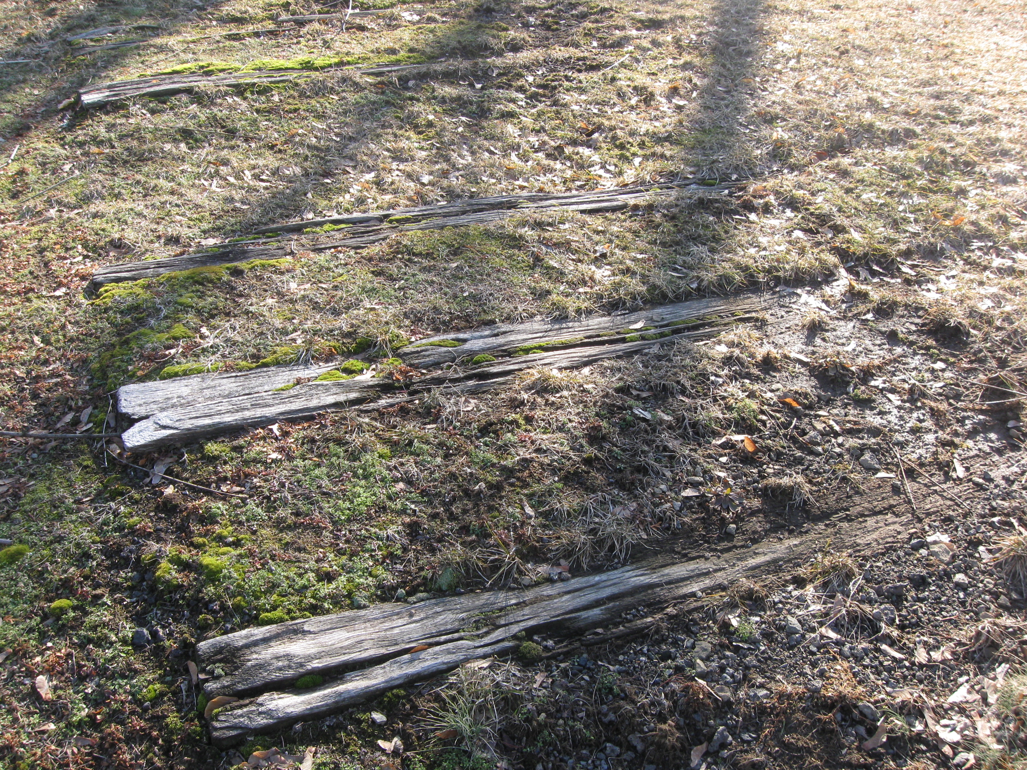
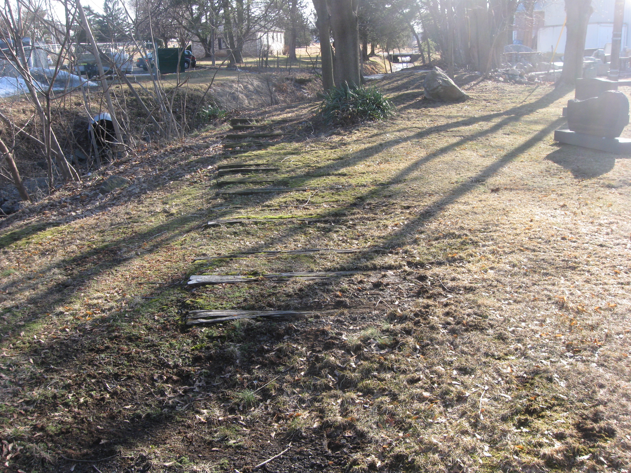
Ties from the Gettysburg & Harrisburg Railroad are still visible at Codori Memorials on Gettysburg’s Middle Street. This view was taken facing south at approximately 3:00 PM on Sunday, February 15, 2009.
The Gettysburg-Harrisburg Railroad, which opened in 1884, was Gettysburg’s second railroad. It was the most direct route to Harrisburg. But it was also a response to Gettysburg’s growing tourism industry in an age before the automobile. Approximately a mile of the railroad still crosses the first day’s field. Over two miles of the railroad used to cross the fields of Pickett’s Charge to the foot of Little Round Top. Gettysburg Licensed Battlefield Guide Don Walters showed us the route of the railroad, including the parts that are still visible.
In our first post, Don Walters introduced us to the Gettysburg Harrisburg Railroad. In today’s post, we view some visible parts of the railroad ties in the borough.
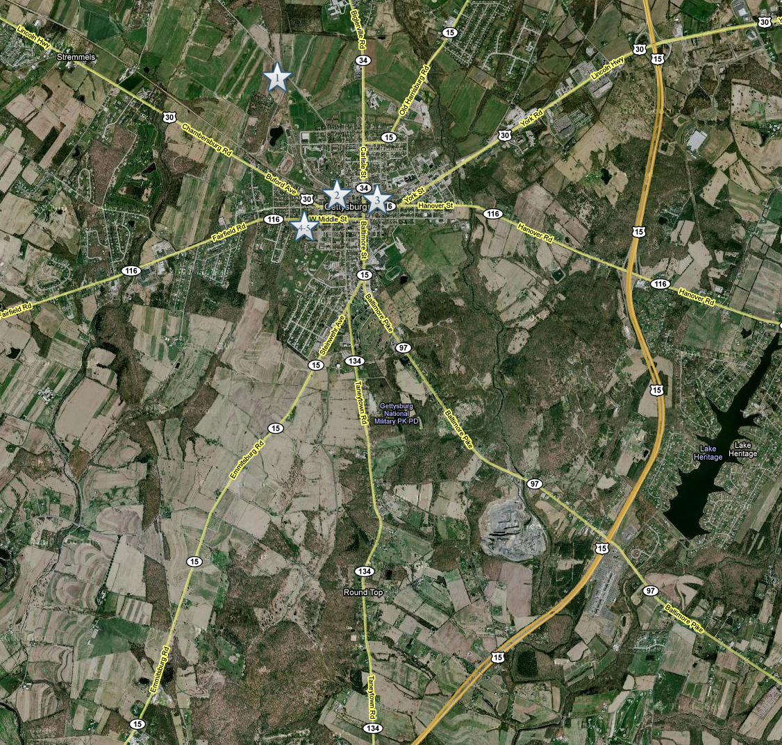
This map shows the locations of the videos that were created for these posts. Video #1 was taken at the Oak Ridge observation tower. Video #2 was taken at the Gettysburg Harrisburg Railroad station on North Washington Street. Video #3 was taken inside the Western Maryland Railroad station on Carlisle Street. Videos #4 and #5 were taken at Codori Memorials on Middle Street. This map was created facing north at approximately 8:30 PM on Friday, March 20, 2009.
Gettysburg Licensed Battlefield Guide Don Walters is standing on the property of Codori Memorials. Middle Street is on the right. This view was taken facing west at approximately 3:00 PM on Sunday, February 15, 2009.
In video #4 (Videos 1-3 were in our first post), Don Walters shows us the location of the railroad ties at Codori Memorials. This view was taken facing west to south at approximately 3:00 PM on Sunday, February 15, 2009.
The railroad ties are on the other side of these memorials, on the east side of the property. This view was taken facing east at approximately 3:00 PM on Sunday, February 15, 2009.
Although dimensions vary, railroad ties are approximately eight and a half feet long, nine inches wide, and seven inches thick. The Gettysburg & Harrisburg Railroad used on the Round Top extension that traversed the battlefield had 2149 ties. This view was taken facing southwest at approximately 3:00 PM on Sunday, February 15, 2009.
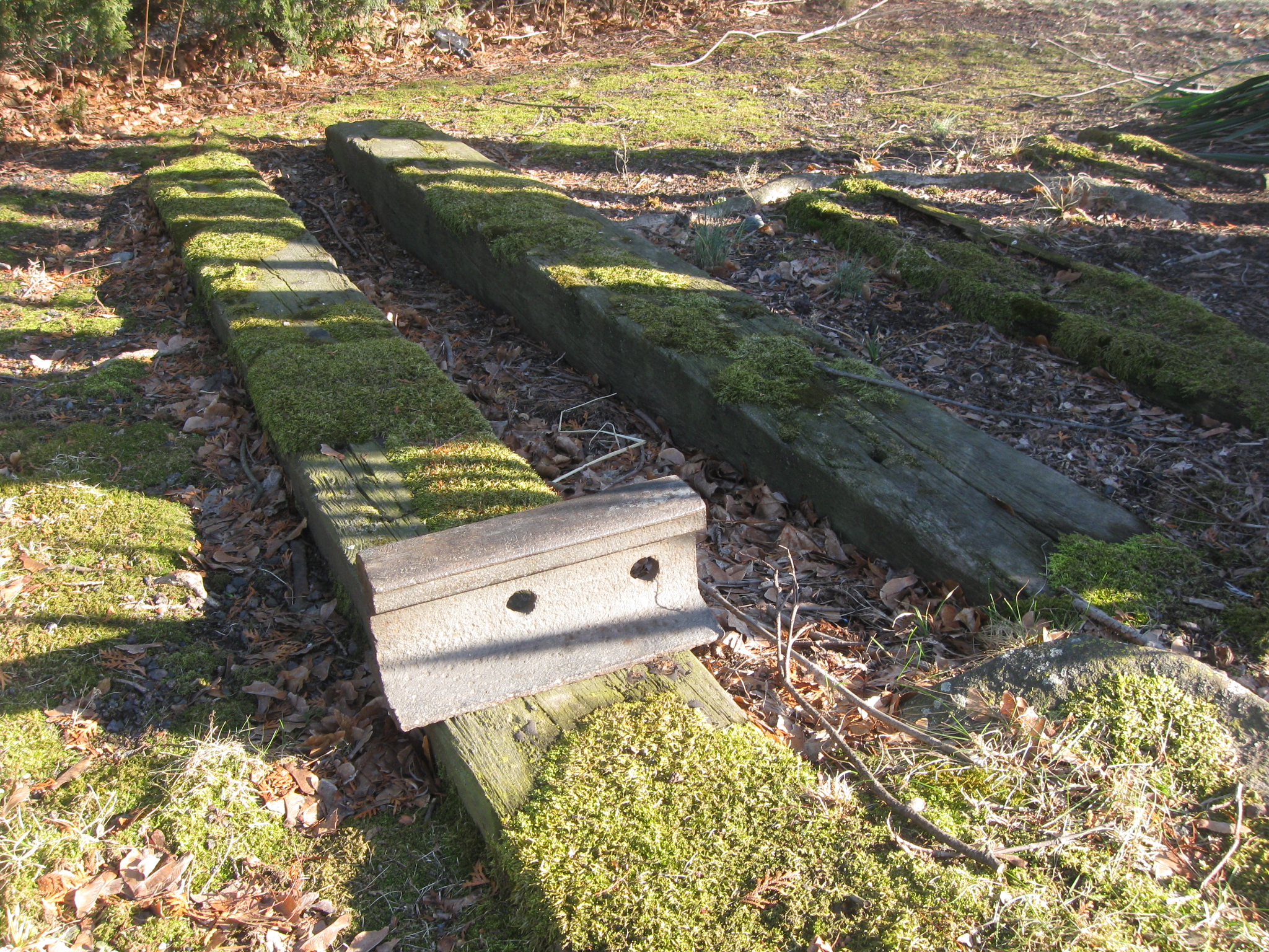
In video #5, Don Walters presents some statistics of equipment used on the Round Top extension and explains how heavy the rails were on this line. This view was taken facing east to southeast at approximately 3:00 PM on Sunday, February 15, 2009.
A closer view of the 20 pound piece of rail that Don showed us in video #5. At the end of its existence, the Round Top extension of the Gettysburg Harrisburg railroad had 90-pound rails. This view was taken facing east at approximately 3:00 PM on Sunday, February 15, 2009.
As you can tell from this view, some of the ties are very exposed. This view was taken facing south at approximately 3:00 PM on Sunday, February 15, 2009.
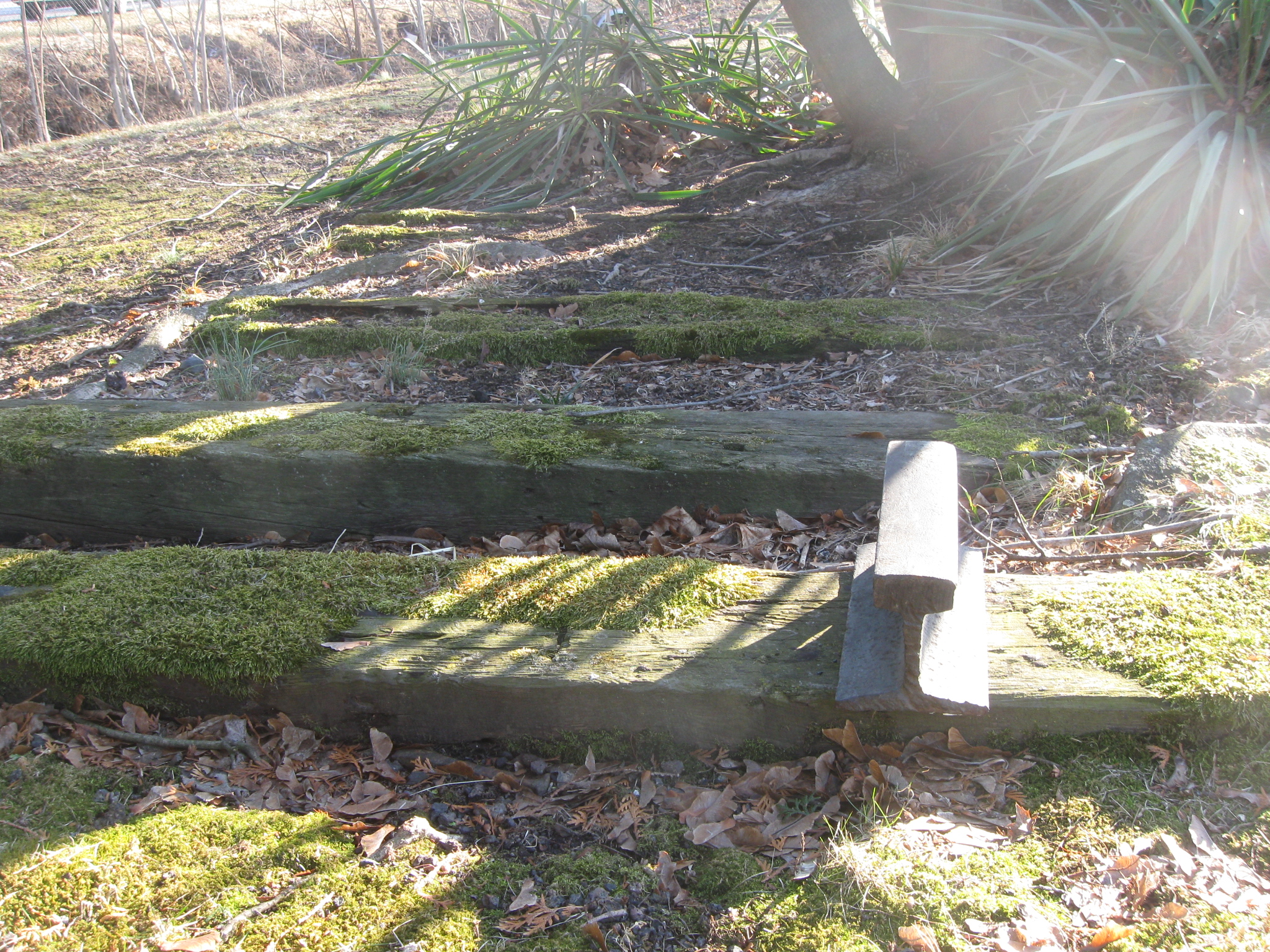
As Don pointed out in Video #4, the tracks went west of the property of the St. Francis Xavier Cemetery which is located on the other (south) side of the buildings in the background. This view was taken facing south at approximately 3:00 PM on Sunday, February 15, 2009.
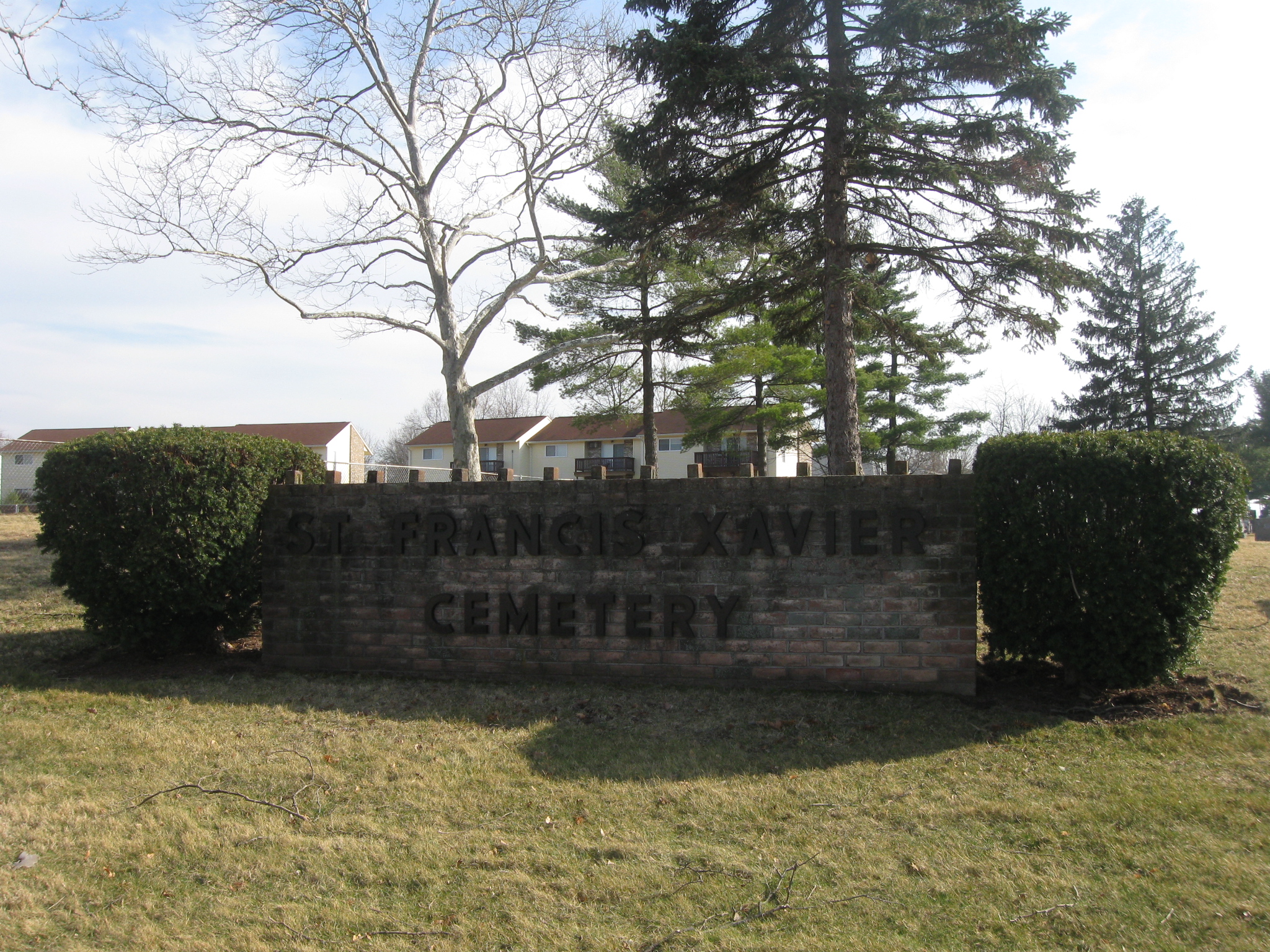
St. Francis Xavier Cemetery, Gettysburg’s Catholic Cemetery, is located on West High Street. This view was taken facing southeast at approximately 4:30 PM on Wednesday, March 18, 2009.
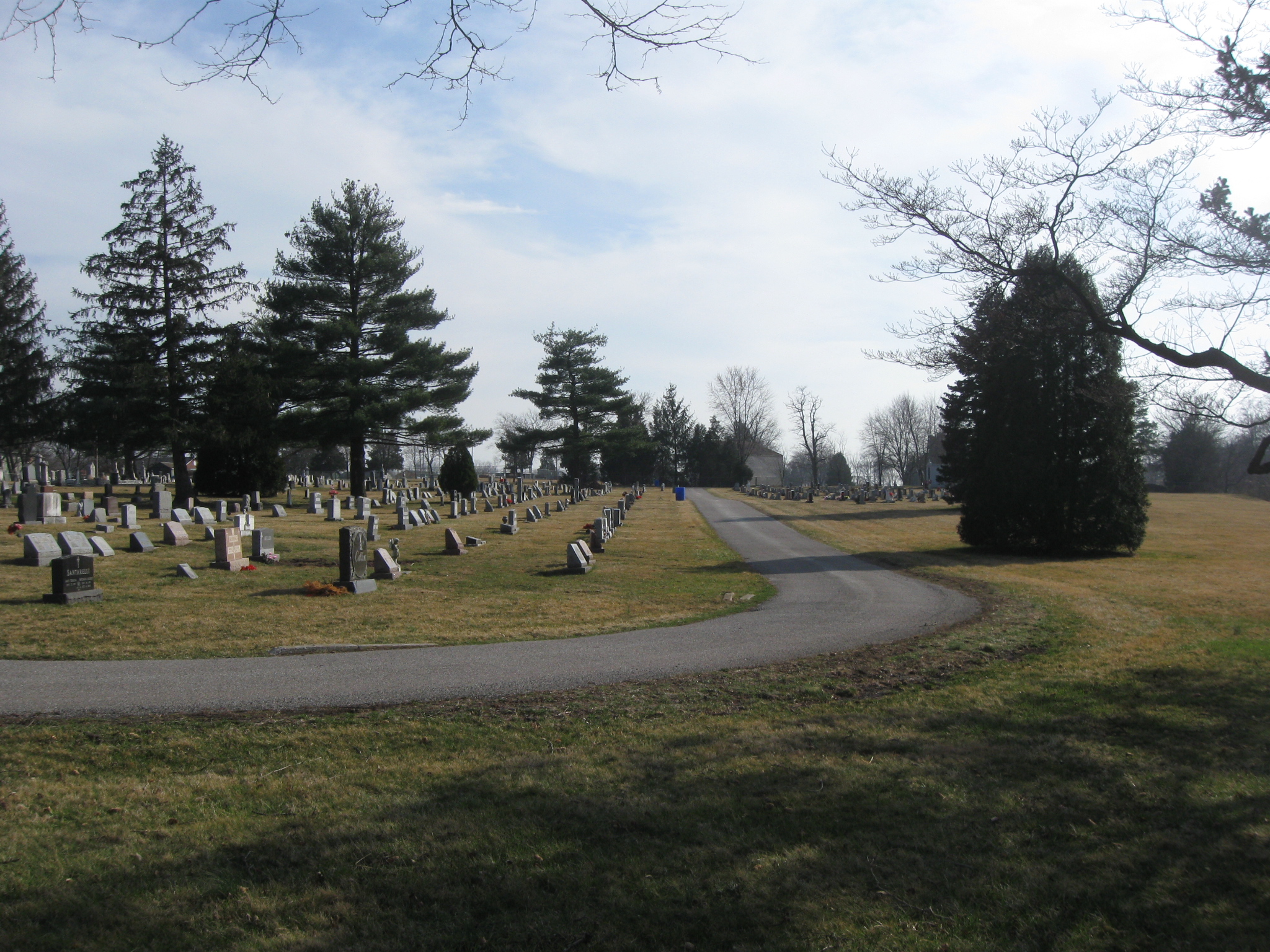
There are over 800 graves in the cemetery. This view was taken facing south at approximately 4:30 PM on Wednesday, March 18, 2009.
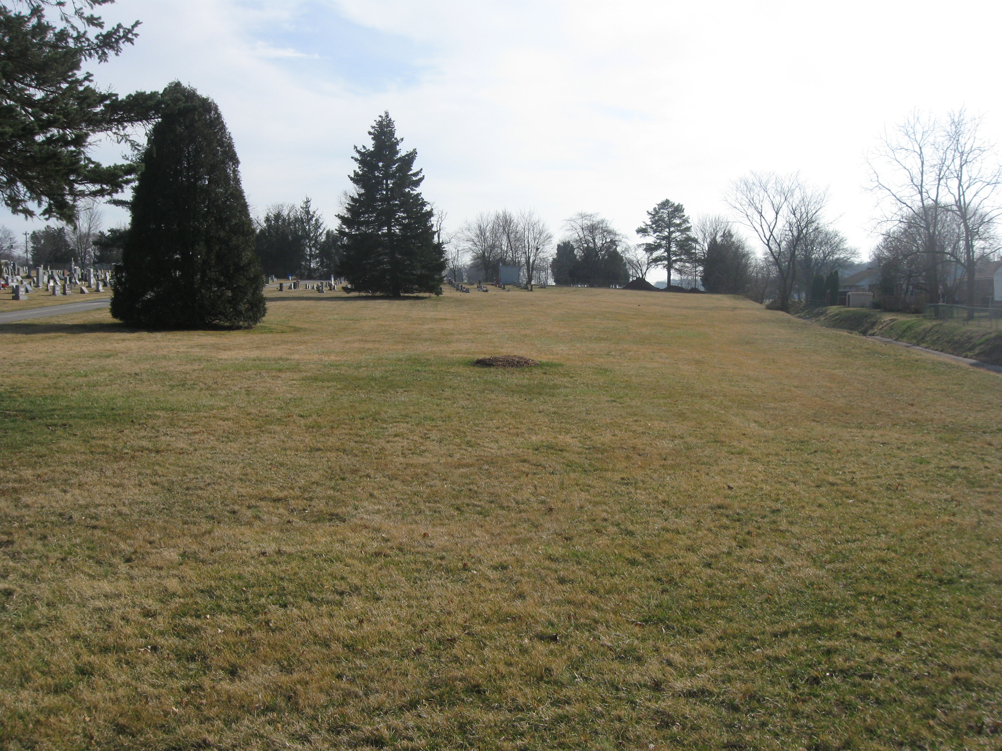
The railroad ran south on the east side of the cemetery, and eventually across the fields of Pickett’s Charge. We will cover the Pickett’s Charge location in our next Gettysburg Harrisburg Railroad post. This view was taken facing south at approximately 4:30 PM on Wednesday, March 18, 2009.
See our previous posts on Gettysburg Licensed Battlefield Guides:
Gettysburg Guide Room: The Final Days on March 8, 2008.
Lights Out at the Electric Map on April 13, 2008.
New Guide Room at the New Visitor Center on April 19, 2008.
New Association of Licensed Battlefield Guide Office and Library Opens on August 25, 2008.
Evergreen Cemetery Headstone Damage with LBG Deb Novotny on October 20, 2008.
Camp Letterman with LBG Phil Lechak here.
Gettysburg Artillery with LBG George Newton here.
“Mammy’s Little Baby Loves Guided Tours” with LBG Charlie Fennell on November 23, 2008.
Bucktails on McPherson’s Ridge Part 1 with LBG Rich Kohr on November 26, 2008.
Gettysburg Licensed Battlefield Guide Exam 2008 on December 6, 2008.
Gettysburg Hawk Hunting with Licensed Battlefield Guide Dave Weaver on December 14, 2008.
Colonel Edward Ephraim Cross with LBG Rich Bellamy here.
Licensed Battlefield Guide Rich Kohr: William Wible’s Gettysburg Quarry on January 21, 2009.
The Gettysburg Electric Trolley with LBG Rich Kohr here
ACHS Battle of Gettysburg Civil War Research Room with LBG Tim Smith on February 10, 2009.
Lutheran Theological Seminary Cupola with LBG Tim Smith here
John F. Kennedy’s Gettysburg Visit with LBG Richard Goedkoop here.
Gettysburg Harrisburg Railroad with LBG Don Walters here.
Neill Avenue (Lost Avenue) with LBG Ted Gajewski here.