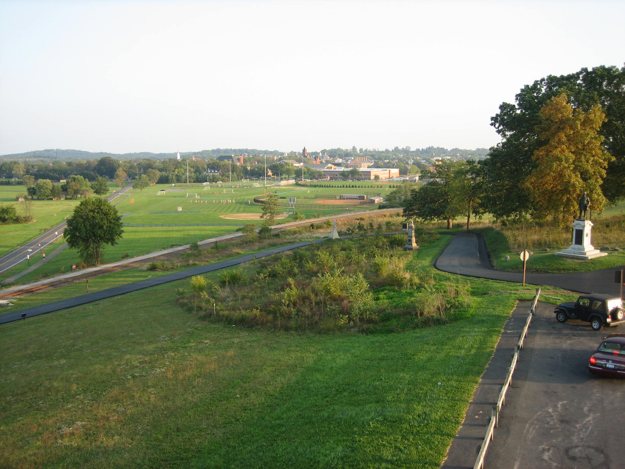
Robinson Avenue, which winds down the west slope of Oak Ridge, was resurfaced today. The grove of oak trees planted three years ago is within the curve. Robinson Avenue begins at the statue for Union Brigadier-General John C. Robinson at the top (right) of Oak Ridge…This view was taken from the north facing south at approximately 6:00 PM on Monday, September 29, 2008.
Robinson Avenue on the west side of Oak Ridge was the object of today’s resurfacing. Oak Ridge is a place used by local children for sledding on snowy days. Three years ago, oak trees were replanted on the west side of Oak Ridge, and the sledding area was reduced. Now, in an obvious effort to win back the hearts and minds of those young sledders, the National Park Service’s roadwork contractor added a toboggan run to the southwest side of Robinson Avenue. Sure, they may call it a ditch, but this four foot wide addition of asphalt will now be enjoyed by young daredevils for generations. The Park Service needs to be thanked for stretching your government dollars. Contract for a road and a ditch, and have a recreation area thrown in.
See our post titled “Devils Den: Aftermath of the ‘Construction'” on September 11, 2008.
See our post titled “Slathering the Loop With Asphalt” on September 13, 2008.
See our post on the dueling detour signs on August 18, 2008.
See our post on Crawford Avenue Construction and poor detour signs on August 6, 2008.
… and ends at the Mummasburg Road. This view was taken from the northwest facing southeast at approximately 6:00 PM on Monday, September 29, 2008.
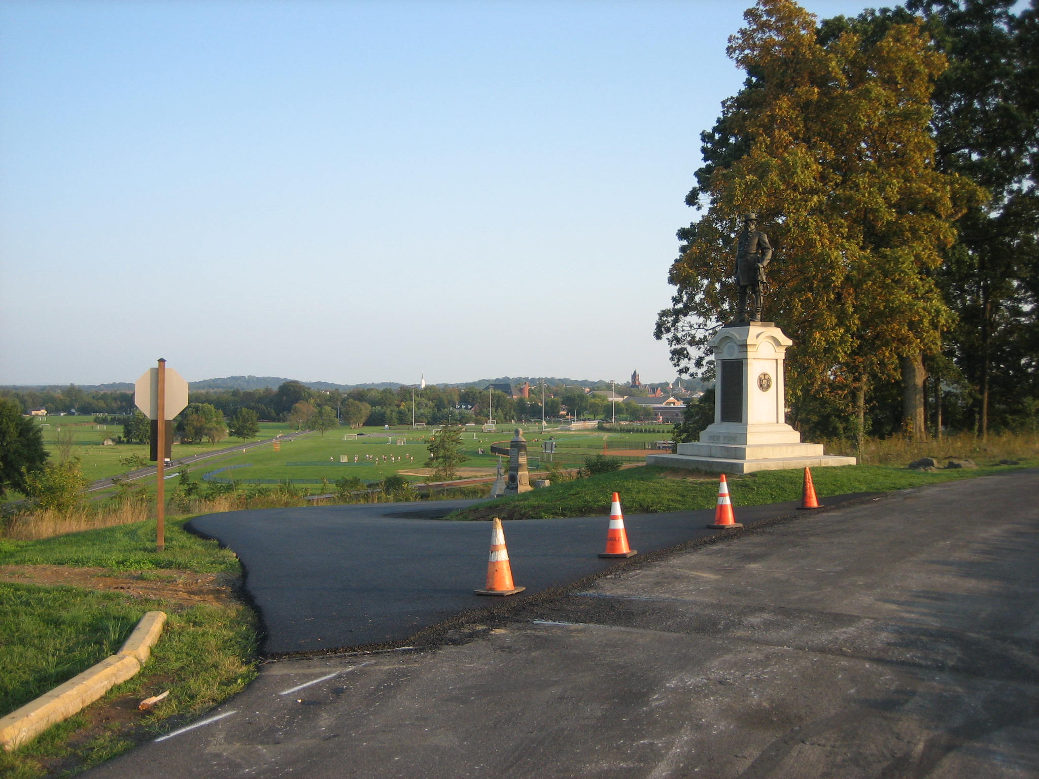
Robinson Avenue was of course closed where it intersected with Doubleday Avenue at the top of Oak Ridge. The statue of John C. Robinson is on the right. This view was taken from the northwest facing southeast at approximately 6:00 PM on Monday, September 29, 2008.
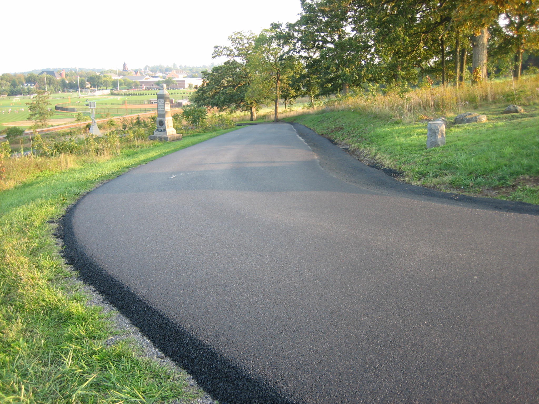
The road winds its way past the 104th New York Monument on the left. This view was taken from the northwest facing southeast at approximately 6:00 PM on Monday, September 29, 2008.
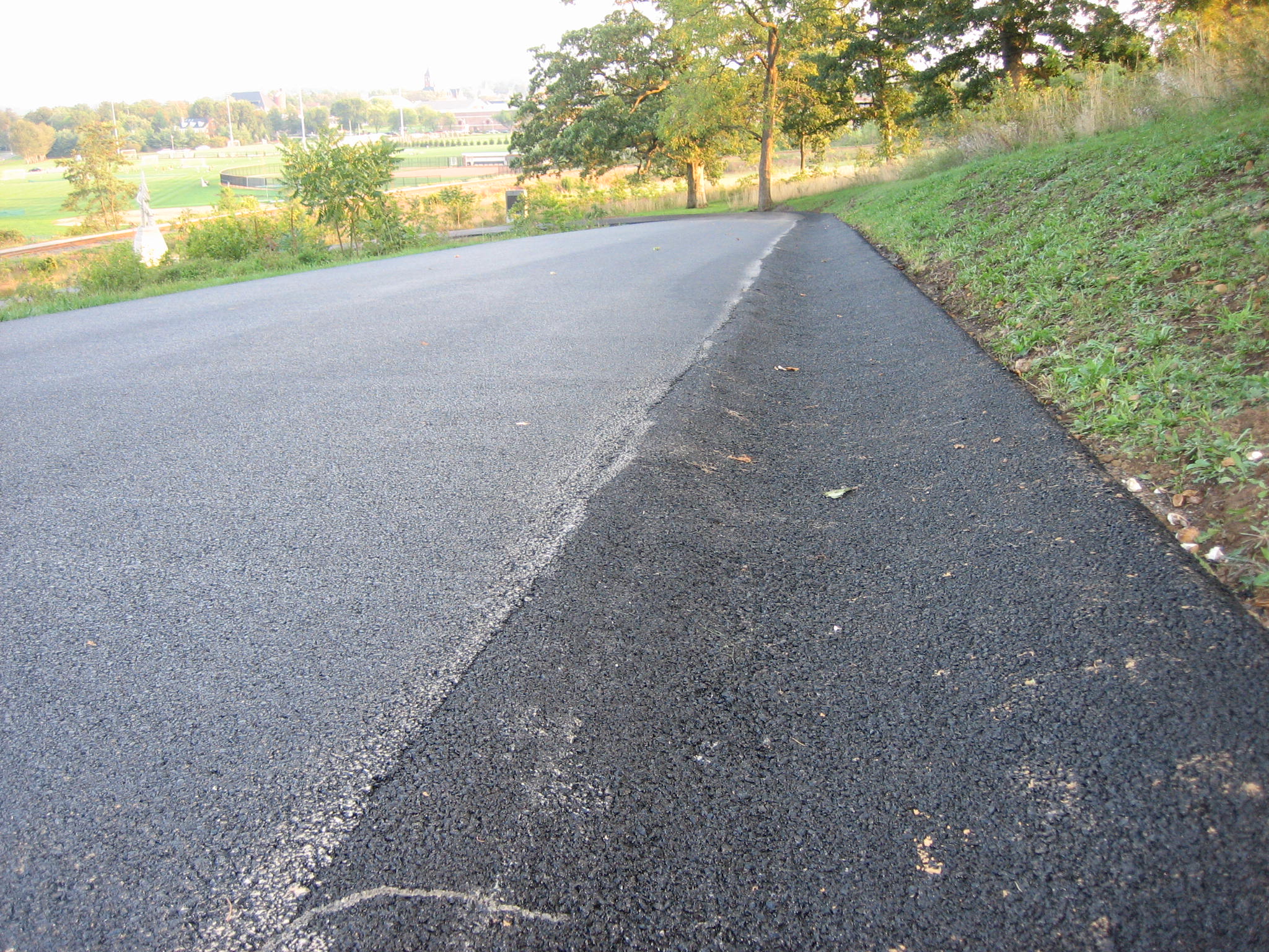
On the right (southwest) side of the road is the four foot wide ditch (toboggan run) which gives this project just the right amount of charm. This view was taken from the northwest facing southeast at approximately 6:00 PM on Monday, September 29, 2008.
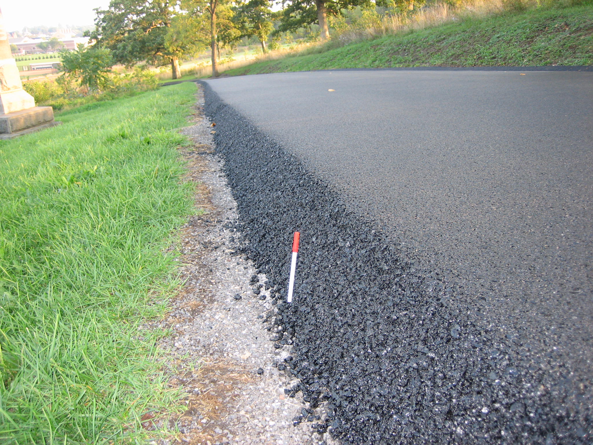
But let’s not forget the left (northeast) side of the road. Here the asphalt reigns a foot off the ground. The red ink pen is six inches tall. We can’t wait to see the dirt and crushed gravel mix that will be brought in to level this out stretching out another two to three feet to the left (northeast). This view was taken from the northwest facing southeast at approximately 6:00 PM on Monday, September 29, 2008.
If the sledders can avoid the tree on the right (and we’re amazed that the contractors did), the the toboggan run ends at the curve so that a nice soft landing can be made to the right of the Robinson’s Division Marker. This view was taken from the northwest facing southeast at approximately 6:00 PM on Monday, September 29, 2008.
The foot high ribbon of asphalt continues around the monument to the 13th Massachusetts Infantry Regiment. This view was taken from the southwest facing northeast at approximately 6:00 PM on Monday, September 29, 2008.
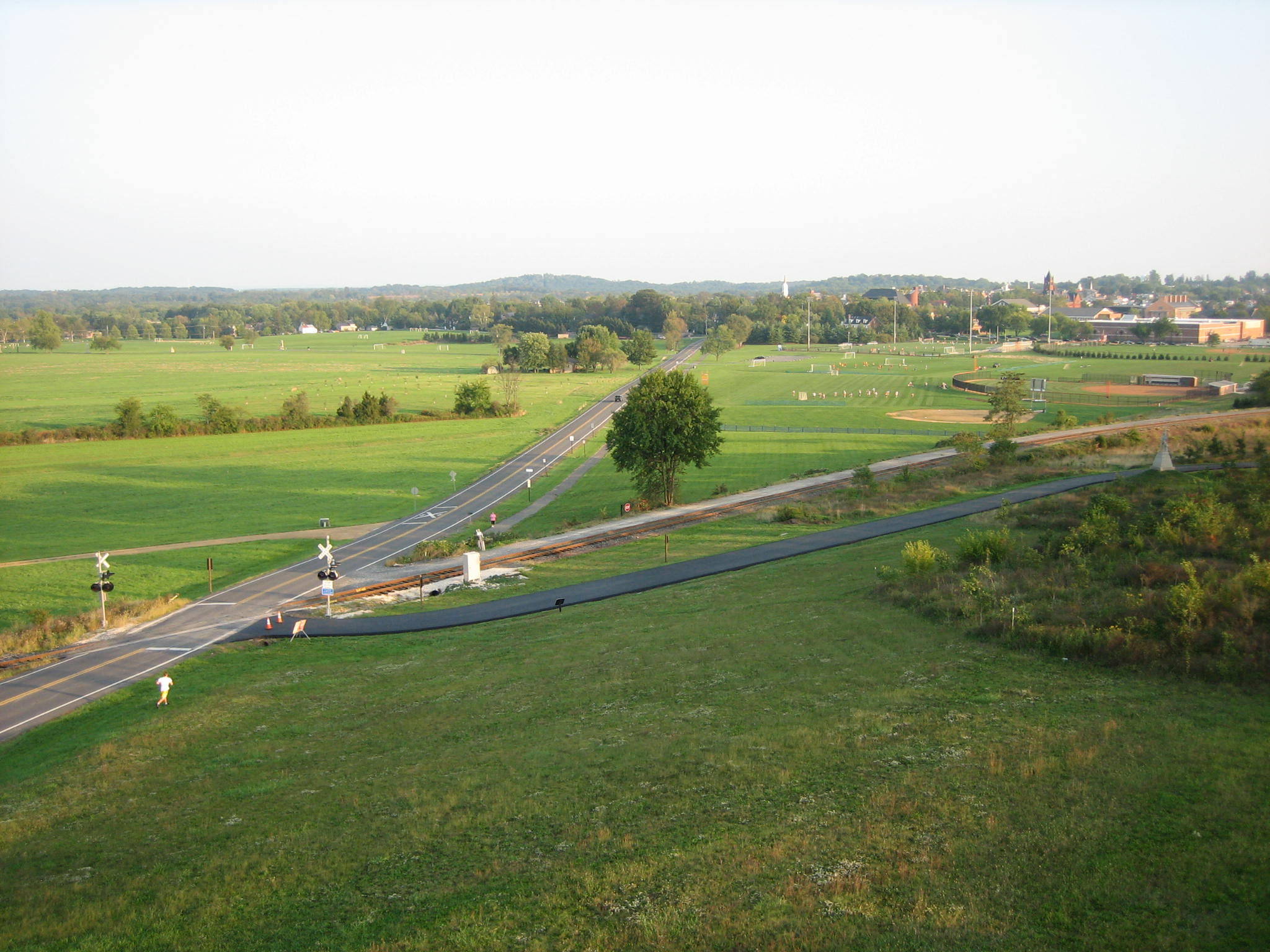
Robinson Avenue continues towards the McClean Farm on the southeast side of Oak Hill. This view was taken from the southwest facing northeast at approximately 6:00 PM on Monday, September 29, 2008.
Robinson Avenue ends at the Mummasburg Road. This view was taken from the southwest facing northeast at approximately 6:00 PM on Monday, September 29, 2008.
As a parting shot (so to speak), we have to once again praise the informative signs provided by the contractors to help visitors and residents navigate this area. There aren’t any. Visitors traveling north on Doubleday Avenue have to take a right on Robinson Avenue. But Robinson Avenue is closed, and there weren’t any signs informing the traffic of this fact before the traffic arrived. So does one turn around, or continue straight north to the left of the Oak Ridge Tower against the one way traffic and through the red DO NOT ENTER signs? All of the cars we saw this evening continued straight ahead against the oncoming traffic. This view was taken from the south facing north at approximately 6:00 PM on Monday, September 29, 2008.