
![]()
Visitors taking a guided tour by horse in front of the Trostle Barn. This view was taken facing southeast at approximately 5:15 PM on Wednesday, July 28, 2010.
As part of its continuing efforts to restore the battlefield to its 1863 appearance, National Park Service contractors will be removing a number of trees in the area of the Trostle Barn. Today we’ll show you a few pictures of the barn and the main area where the trees will be removed.
![]()
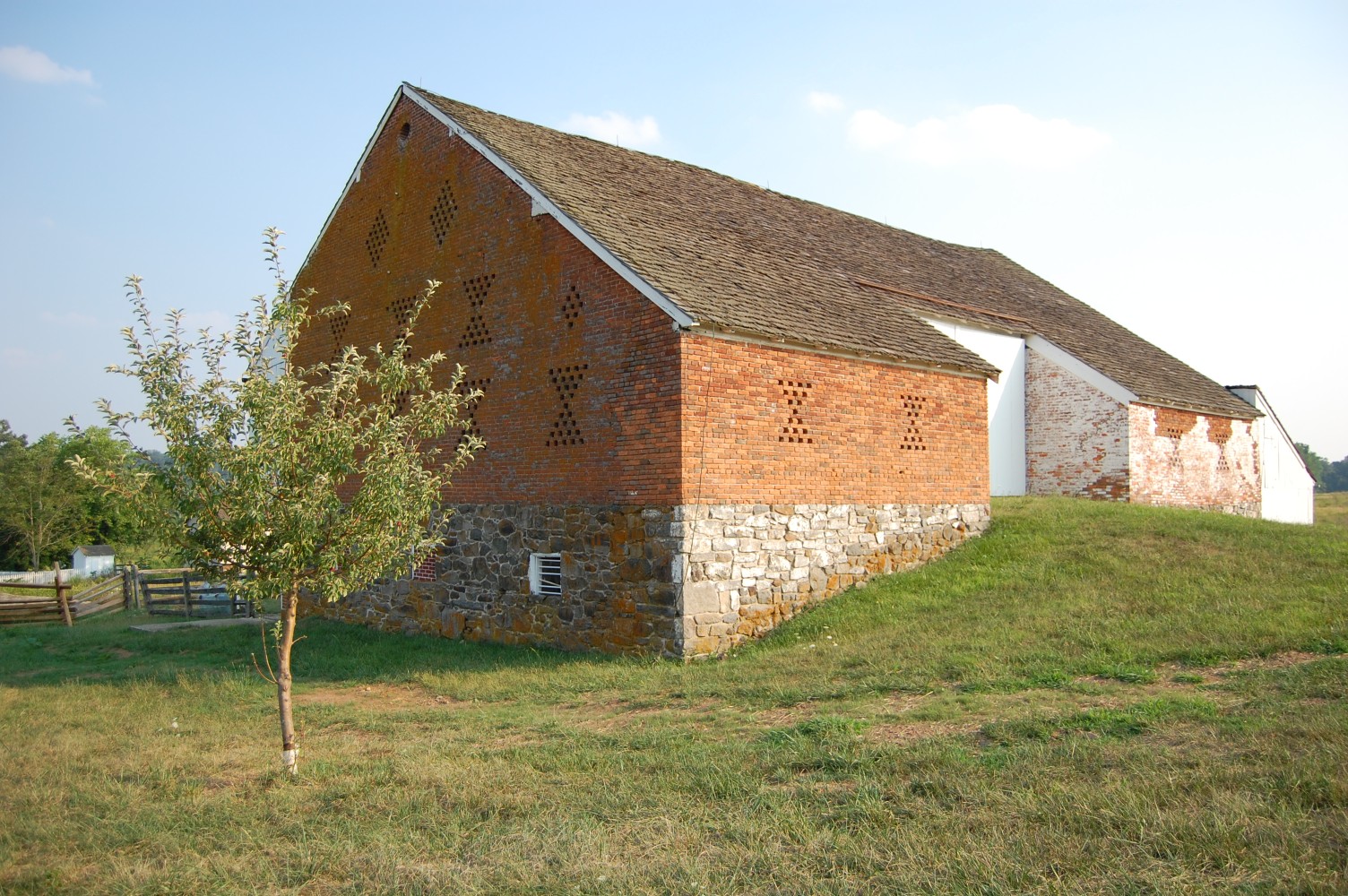
The Abraham Trostle Barn. Trostle owned over 134 acres in this area, stretching from Plum Rum to the Emmitsburg Road. Major-General Daniel Sickles was wounded just to the west of the barn on July 2, 1863. This view was taken facing south at approximately 5:15 PM on Wednesday, July 28, 2010.
![]()
The Sickles wounding monument is in the right-hand portion of this shot. If you go late in the afternoon, you’ll often see this cat around the grounds … This view was taken facing south at approximately 6:50 PM on Tuesday, July 27, 2010.
![]()
… He or she is quite friendly. This view was taken facing south at approximately 6:50 PM on Tuesday, July 27, 2010.
![]()
Let’s walk down US Avenue from the horse trail and barn. The headquarters marker to Major-General Daniel Sickles is in the right portion of this shot. This view was taken facing southeast at approximately 5:15 PM on Wednesday, July 28, 2010.
![]()
The Trostle House was used as a hospital after the battle and consisted of seven rooms and a basement. The Trostle family was not compensated for the losses sustained to their property during the battle, and in 1899 the farm was sold to the United States government. And just across from the house … This view was taken facing northeast at approximately 5:15 PM on Wednesday, July 28, 2010.
![]()
… And just across the road … This view was taken facing south at approximately 5:15 PM on Wednesday, July 28, 2010.
![]()
Is the area where this installment of tree-cutting will begin. Trees and undergrowth in this area will be removed to open up the viewshed here.This view was taken facing south at approximately 5:15 PM on Wednesday, July 28, 2010.
![]()
We are now standing at the edge of the woods, in front of the construction equipment in the previous shot. A number of pink “DO NOT CUT” tags have been placed on some of the trees here. This view was taken facing south at approximately 5:15 PM on Wednesday, July 28, 2010.
![]()
Looking west. From what we can tell, a few trees in the right portion of this image will be removed as well. We will show you what this area looks like after the cutting next week. This view was taken facing southeast at approximately 5:15 PM on Wednesday, July 28, 2010.