
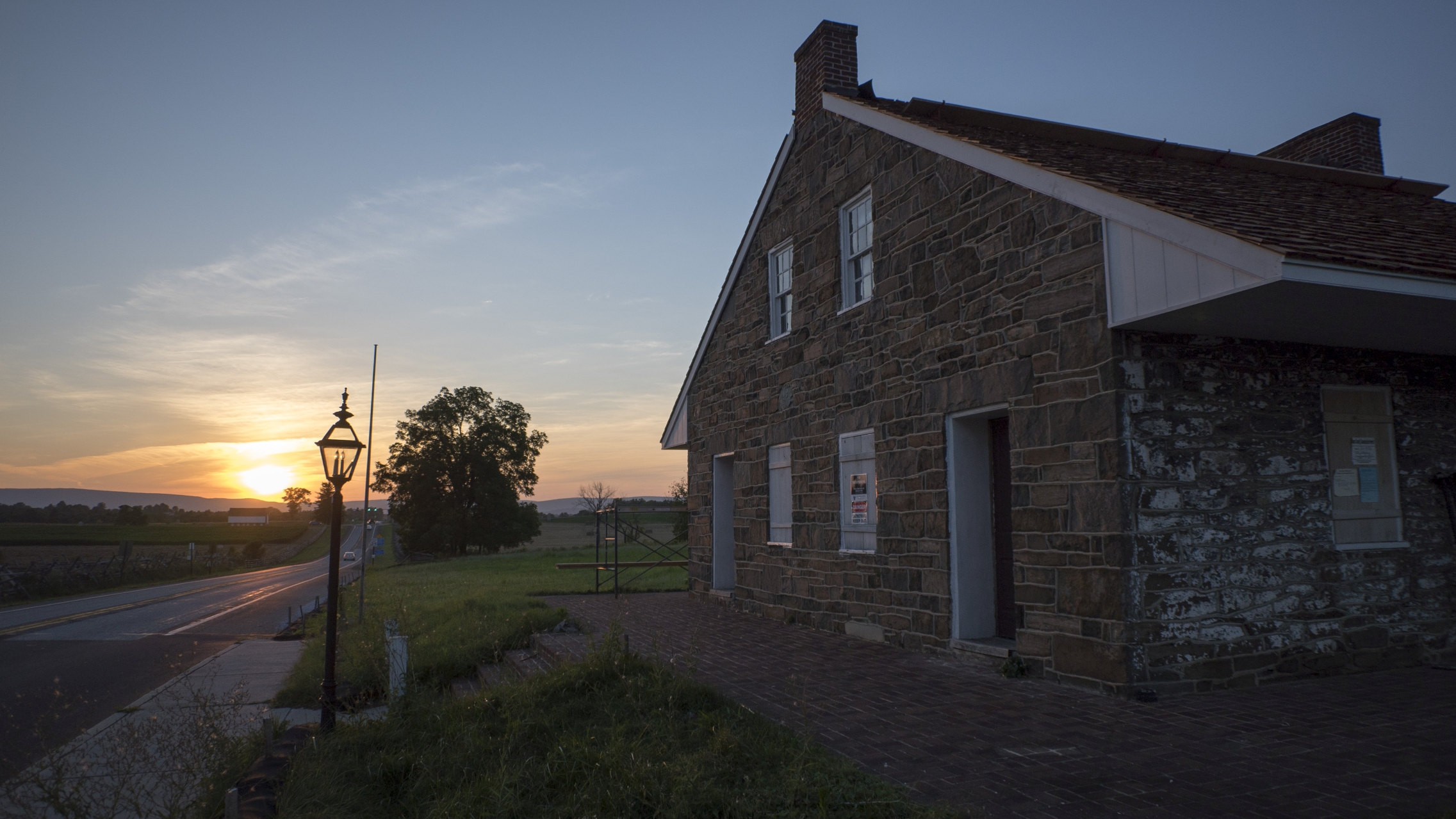
The widow Mary Thompson House, as the sun sets over the McPherson Barn and the Blue Ridge mountains in the background. The Civil War Trust purchased this property and is performing restoration of the landscape to its 1863 appearance. We took a walk around the property to show you the progress made since our last visit in 2010. Licensed Battlefield Guide Tim Smith will help us examine the significance of the Thompson house and its acquisition in a future post. This image was taken facing northwest at approximately 8:00 PM on Saturday July 23, 2016.

Red star #1 in this aerial view marks the location of the Mary Thompson House. This, along with the Dustman Barn (red star #2), are the only structures remaining on this property between the old Chambersburg Pike and the Railroad Cut. This image is courtesy of Google Maps.

We’ll start our walk along Seminary Ridge at the Lutheran Theological Seminary, where LBG Tim Smith once gave us a tour of the cupola. This image was taken facing southeast at approximately 8:00 PM on Saturday July 23, 2016.

If you haven’t visited Seminary Ridge since the arrival of the Seminary Ridge Museum, you’ll notice a trail with waysides providing interpretation. We provided a closer look at this Mathew Brady photograph the last time we visited the Thompson House. This image was taken facing north at approximately 8:00 PM on Saturday July 23, 2016.
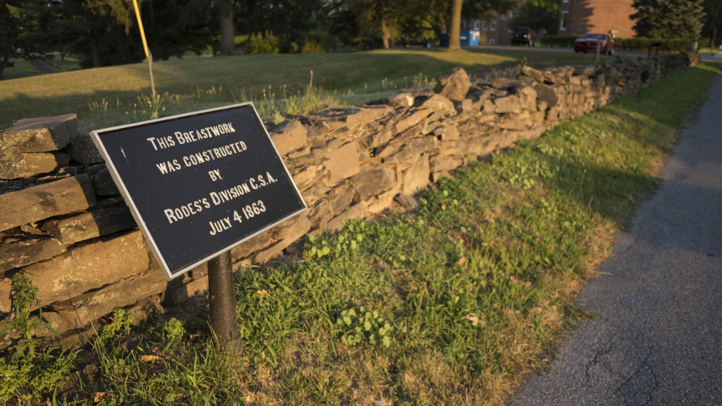
The stone wall here marks the location of the breastworks in the Brady photograph. This image was taken facing southeast at approximately 8:00 PM on Saturday July 23, 2016.
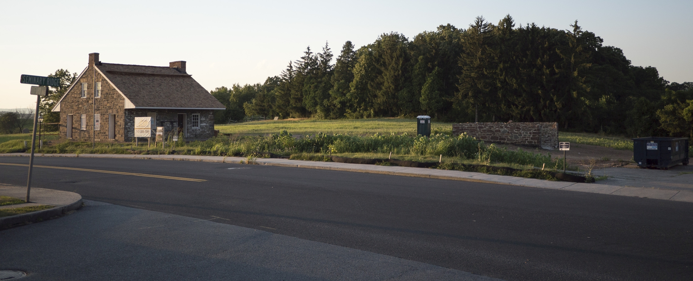
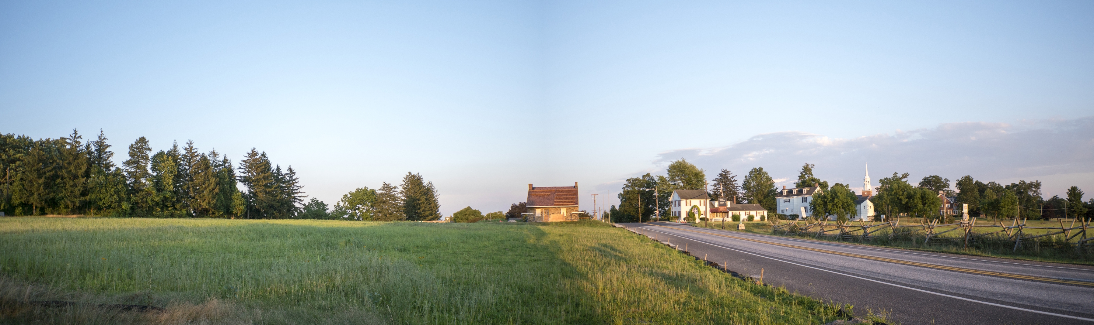
As we reach the intersection of the ridge and the Chambersburg Pike, the new appearance of the Thompson property comes into view. This image was taken facing north at approximately 8:00 PM on Saturday July 23, 2016.

The Civil War Trust purchased the property in 2015. No trespassing signs are on both sides of the Chambersburg Pike, reminding visitors to stay off the property. This view was taken facing west at approximately 8:00 PM on Saturday, July 2, 2016.
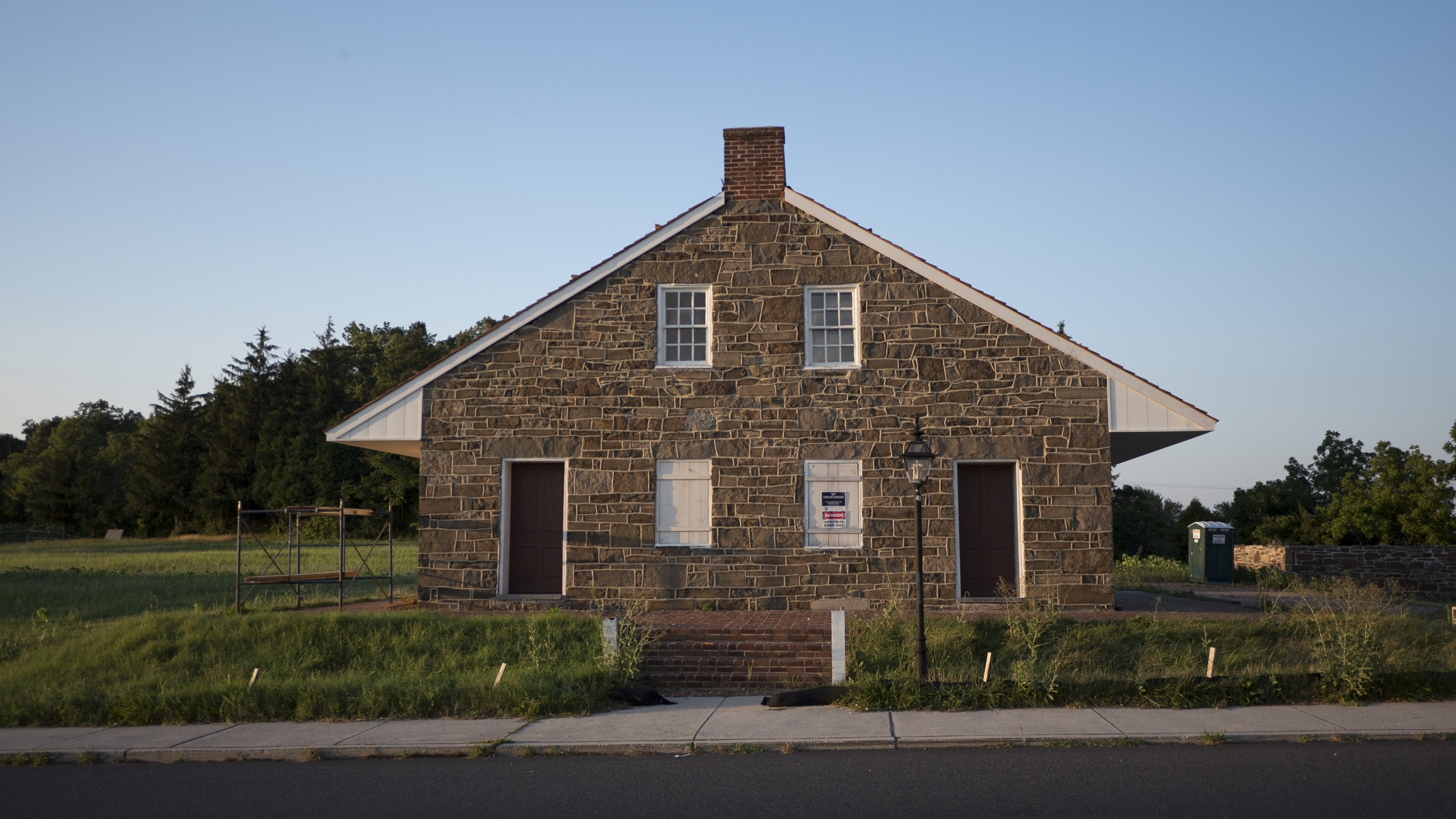
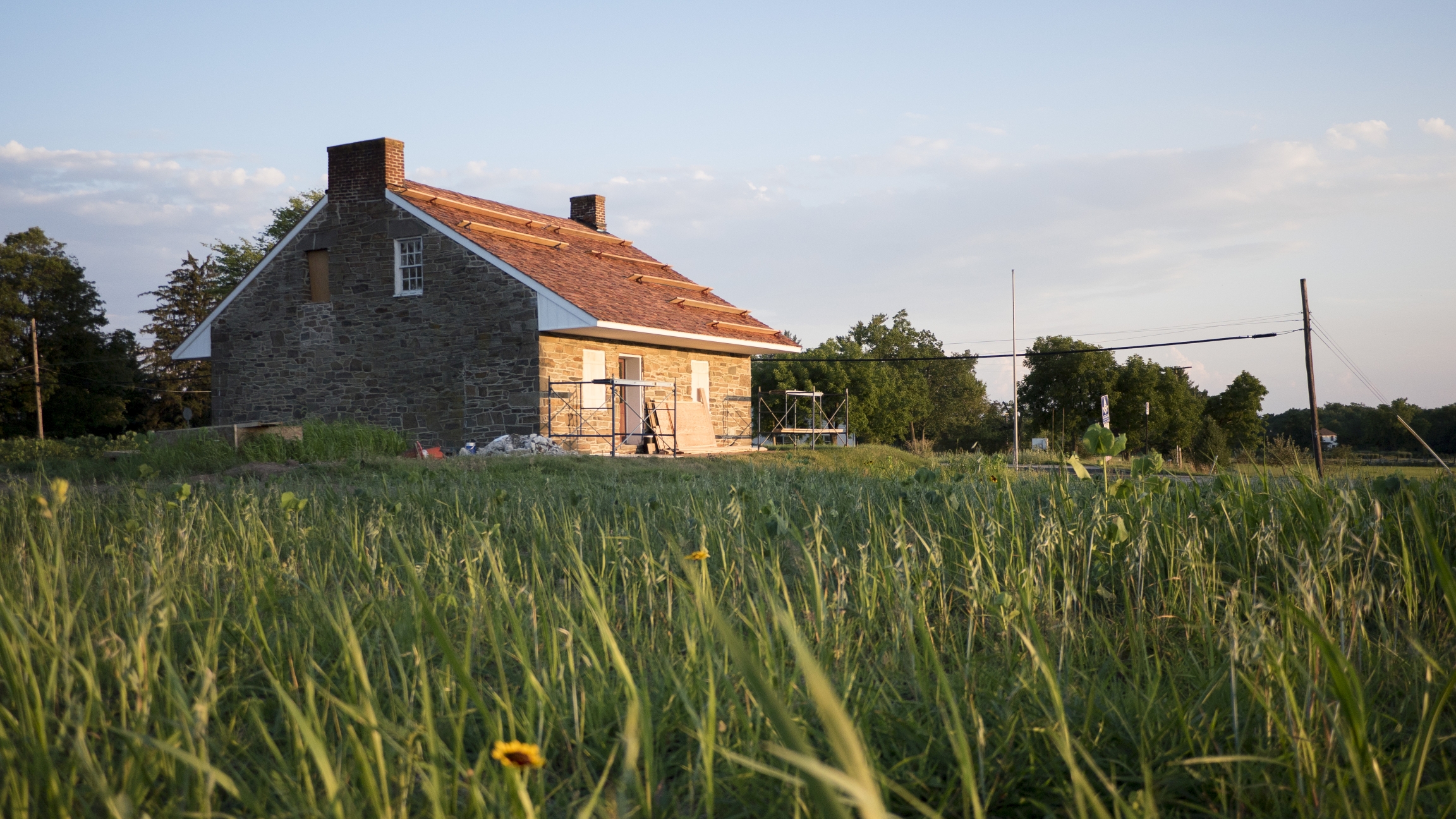
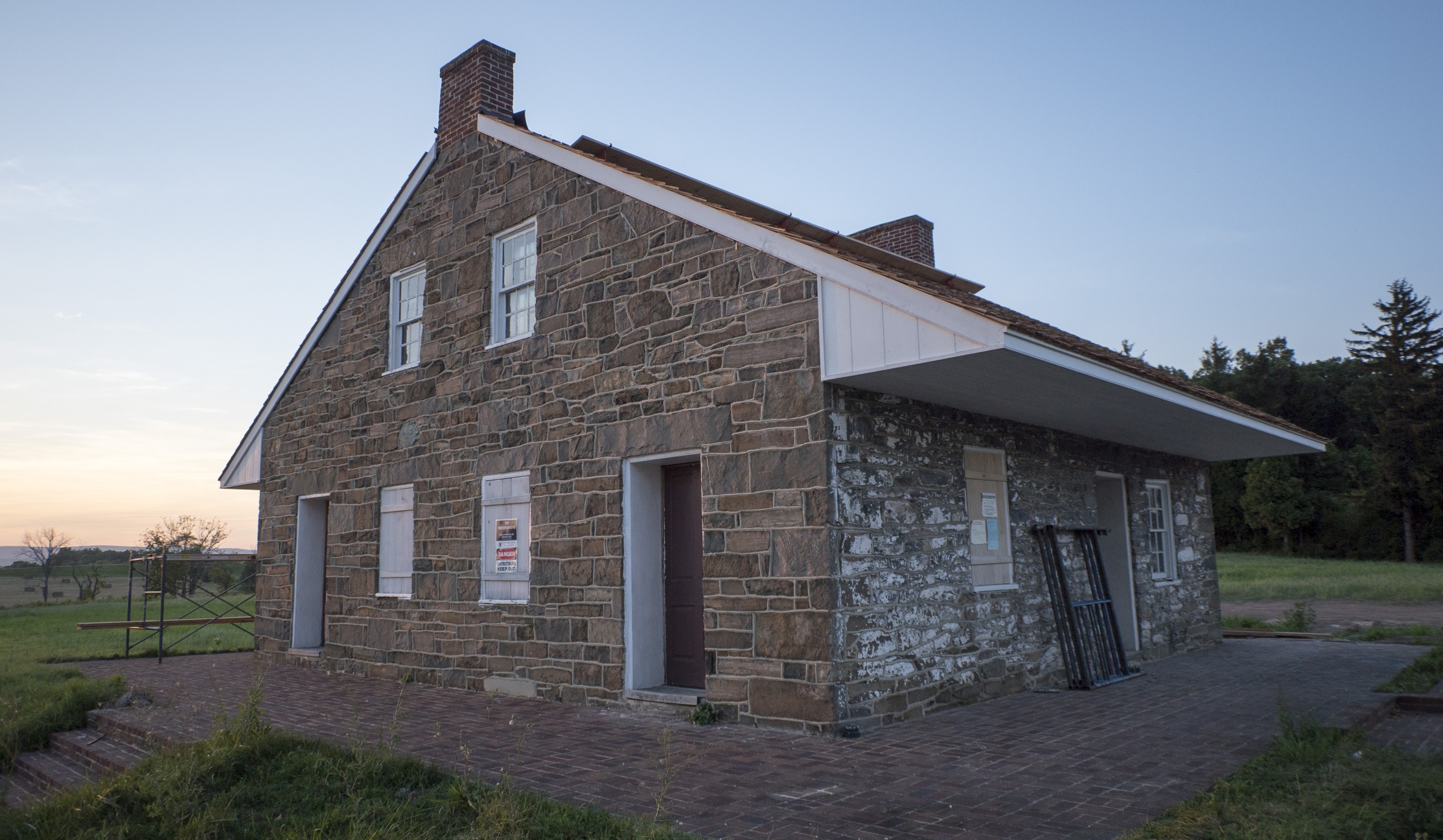
The one and a half story stone house was built circa 1833. Mary Thompson lived in the house at the time of the battle as a tenant. The property was owned by prominent Pennsylvania Congressman Thaddeus Stevens from 1846 until 1868. This image was taken facing slightly northeast at approximately 8:00 PM on Saturday July 23, 2016.

Until last year, the house and surrounding property were privately owned. A museum, restaurant, and a motel (most recently a Quality Inn) were established by the 1960s. This view was taken facing northeast at approximately 8:00 PM on Saturday July 23, 2016.
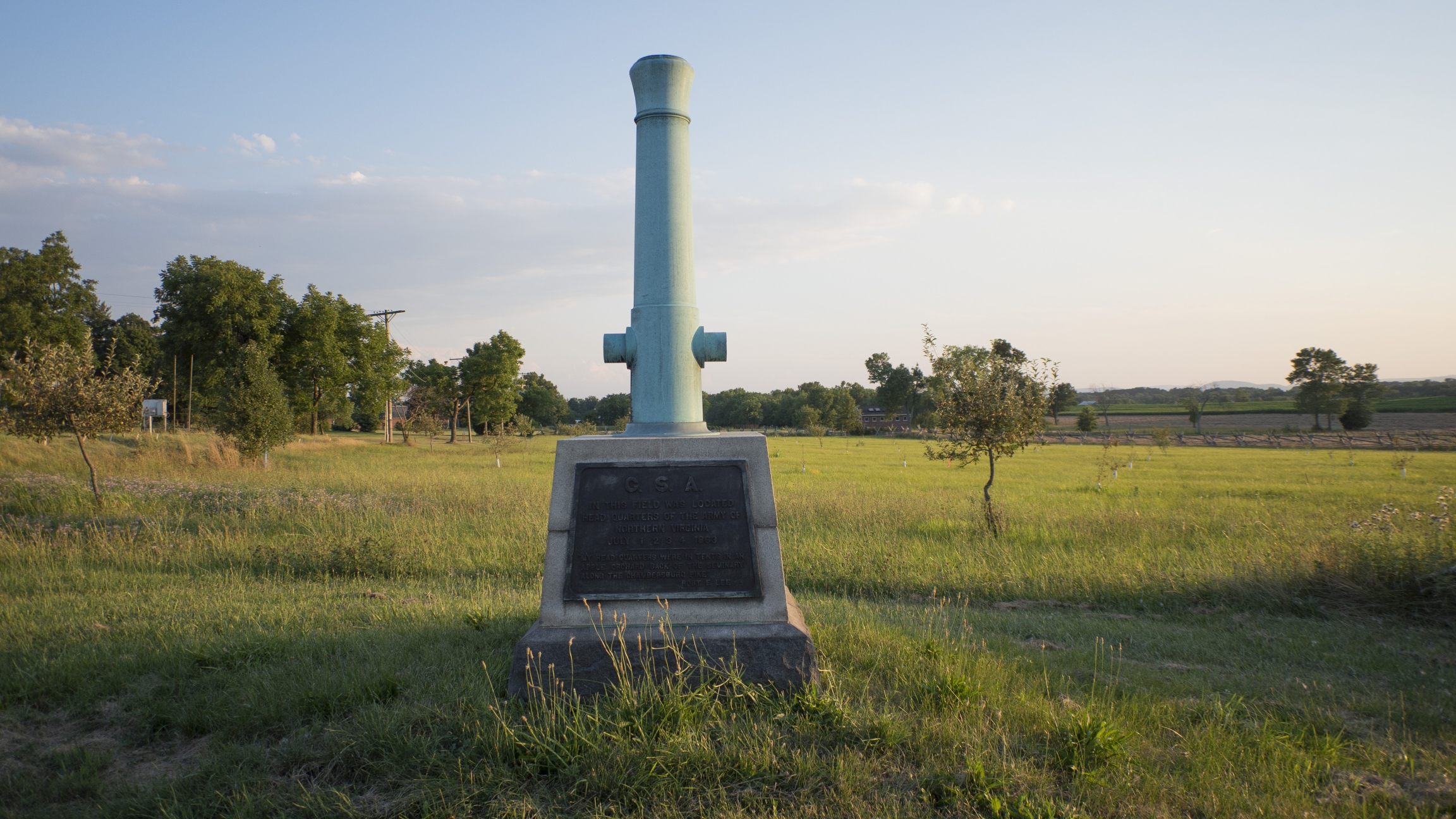
Across the street is the headquarters marker for Robert E. Lee, as placed by the War Department. The location of Lee’s Headquarters has been controversial (including the veracity of the quote contained on the marker), and we look forward to LBG Tim Smith enlightening us further on the topic. This view was taken facing southwest at approximately 8:00 PM on Saturday July 23, 2016.

In the last year and a half, the Civil War Trust removed all non-historic structures from the property… This view was taken facing east at approximately 8:00 PM on Saturday July 23, 2016.

…allowing for an unobstructed view from Seminary Ridge to McPherson’s Ridge in the background. The marker for Lieutenant James Stewart’s Battery B 4th US Artillery is just visible at the edge of the property line. We’ll walk down there shortly. This view was taken to facing northwest at approximately 8:00 PM on Saturday July 23, 2016.

Widow Thompson’s neighbor at the time of the battle was James Dustman. The foundation of the Dustman Barn can be seen in the left of frame, and because it was here in 1863, will remain on the property. This view was taken facing southeast at approximately 8:00 PM on Saturday July 23, 2016.
The roof of the building was redone after the removal of the non-historic dormers and additions. This view was taken facing south at approximately 8:00 PM on Saturday July 23, 2016.
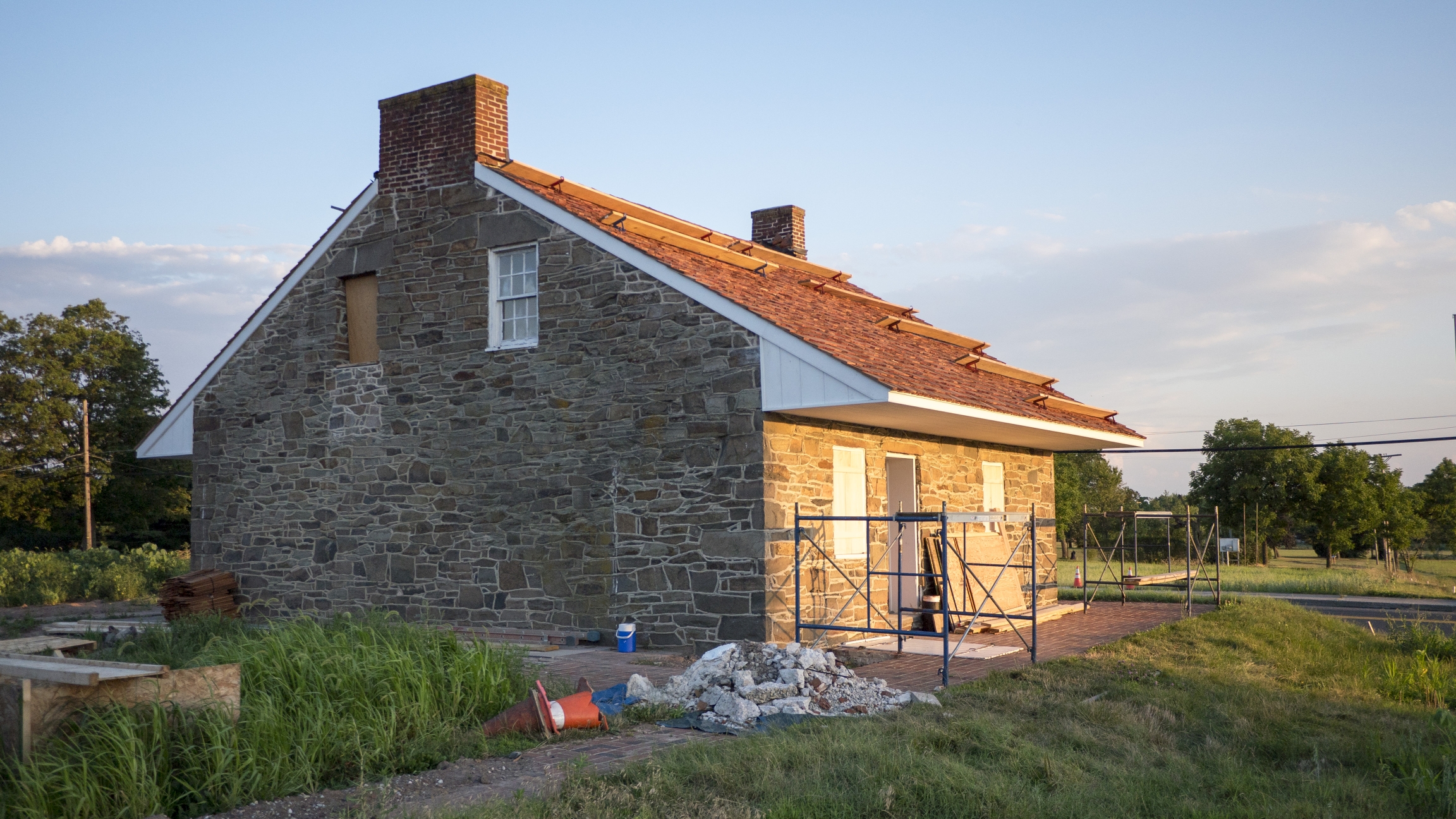
The interior of the building was also gutted… This view was taken facing south at approximately 8:00 PM on Saturday July 23, 2016.

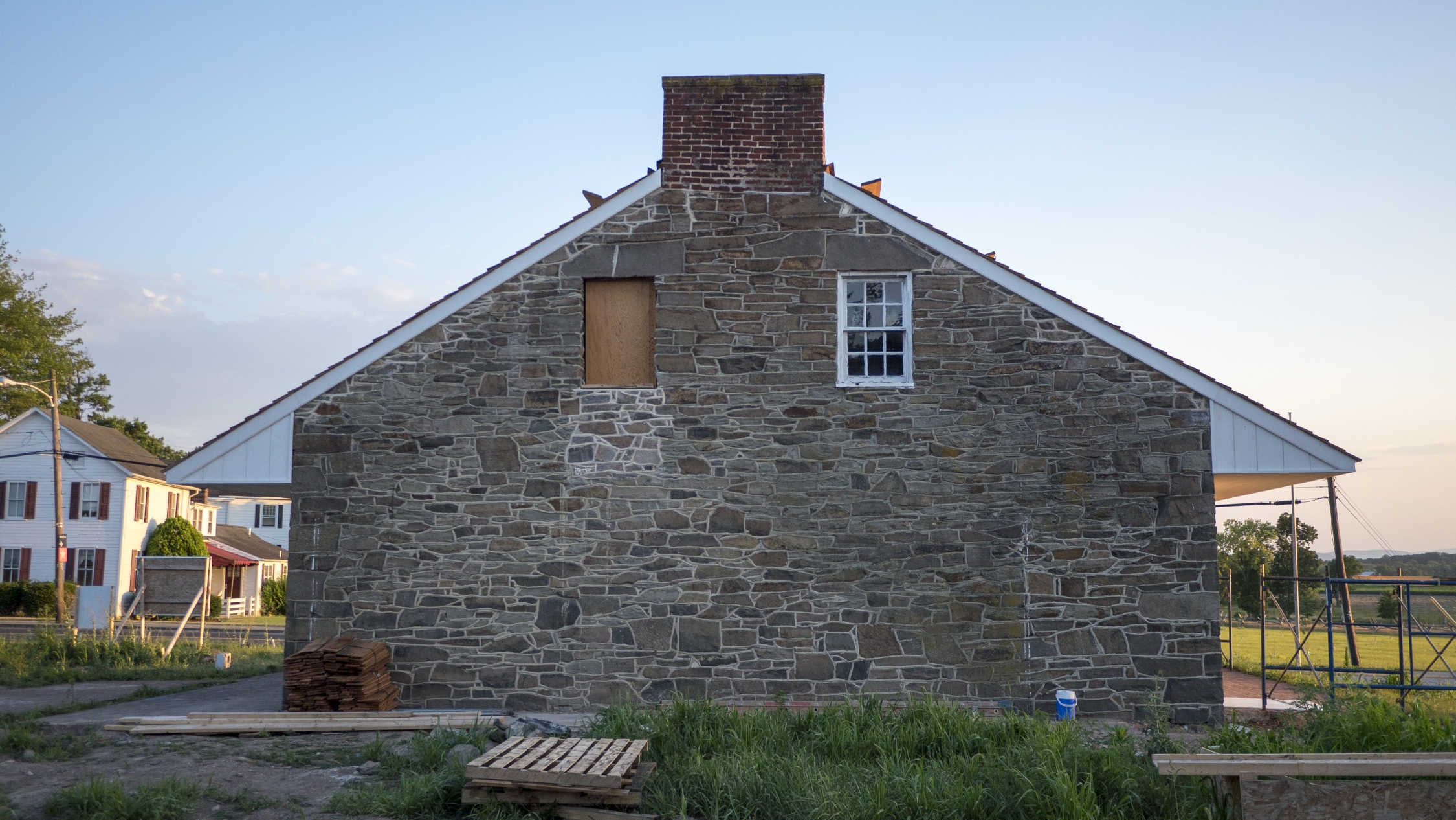
…revealing evidence of fire damage from an 1898 fire (note the blackened stones near the top of this image). (Civil War Trust Photo)
Though the project is nearing completion, a number of details remain, including reconstructing the historic fences on the property and installing an “interpretive trail” with waysides. This view was taken facing southwest at approximately 8:00 PM on Saturday July 23, 2016.

A closer view of the foundation of the Dustman Barn. The telephone lines in the background are along the Chambersburg Pike. This view was taken facing south at approximately 8:00 PM on Saturday July 23, 2016.

This is the current state of the inside of the foundation of the Dustman Barn. Both the Dustman property and the Thompson property were used as field hospitals. This view was taken facing west at approximately 8:00 PM on Saturday July 23, 2016.

The James Thompson House, owned by Mary’s son, is the white structure across the Chambersburg Road in the background (a modern addition is visible — the original structure can be seen in our previous post on the Mary Thompson house) This view was taken facing slightly southwest at approximately 8:00 PM on Saturday July 23, 2016.
We’ve now walked west along the old Chambersburg Pike and have stopped at the edge of the four acre property. Half of James Stewart’s Battery B 4th US would occupy this ground, supported by the 143rd Pennsylvania Infantry on the afternoon of July 1st. This panoramic view was taken facing northeast to southeast at approximately 8:00 PM on Saturday July 23, 2016.

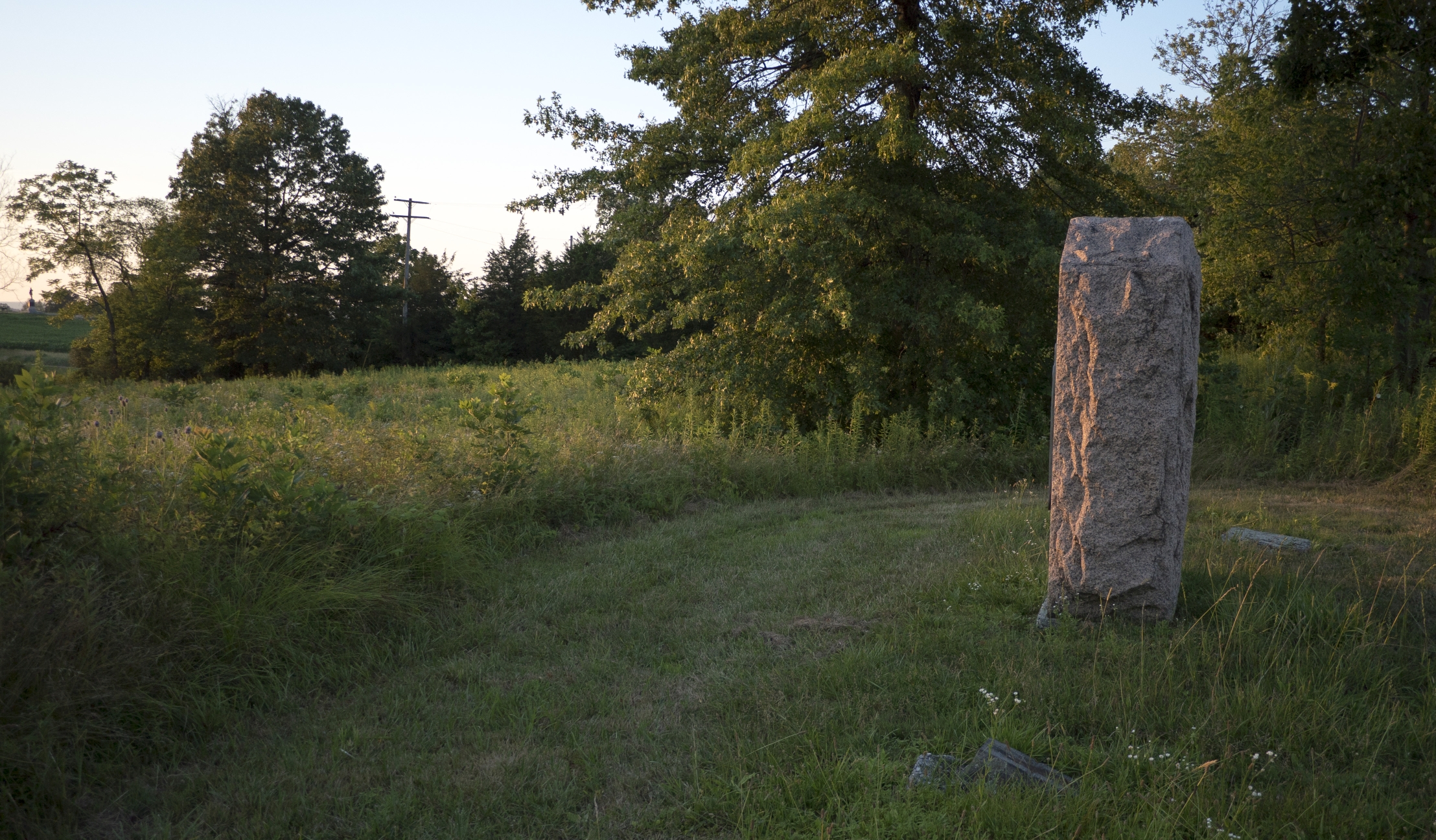
After taking the previous photo we looked down and saw the Department of the Interior property marker that notes where NPS land begins. This view was taken facing southeast at approximately 8:00 PM on Saturday July 23, 2016.
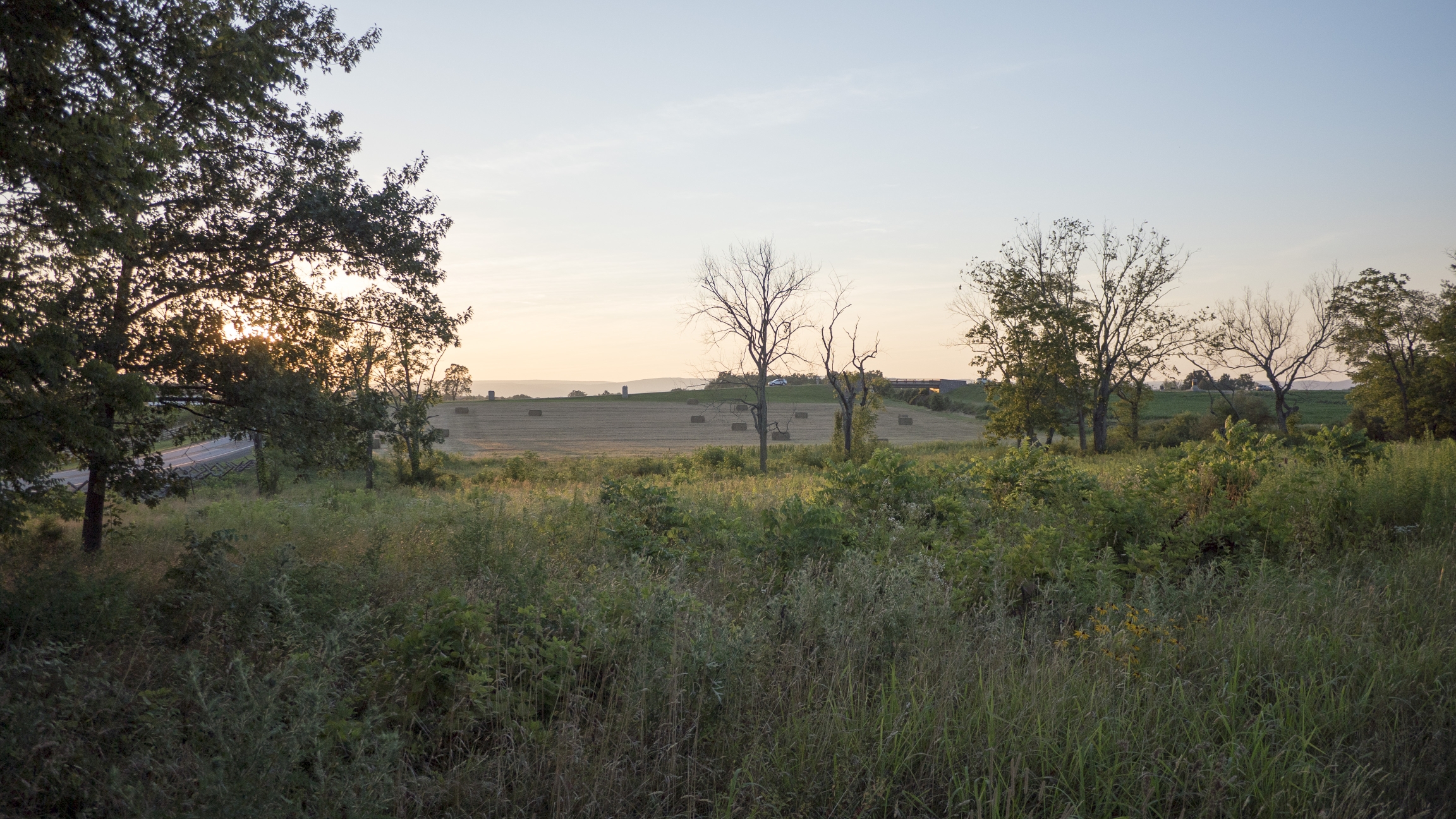
Looking west we can see McPherson’s Ridge and the bridge on Reynold’s Avenue over the Railroad Cut. We’re standing on a mowed path that leads us to… This view was taken facing northwest at approximately 8:00 PM on Wednesday, July 20, 2016.
…the marker to Stewart’s Battery. Three of Stewart’s guns were placed in front of the Thompson House along Seminary Ridge at approximately 3 PM on July 1, 1863. The other three guns took position north of the Railroad Cut in Sheads’ Woods (the cut is visible in the far left-center of frame). This view was taken facing north at approximately 8:00 PM on Wednesday, July 20, 2016.

Stewart’s Battery B 4th US would later take position on East Cemetery Hill near the Evergreen Cemetery Gatehouse. This view was taken facing southeast at approximately 8:00 PM on Saturday July 23, 2016.

There are spots for two cannon carriages near the marker, but they are not currently displayed on the field. This view was taken facing northeast at approximately 8:00 PM on Saturday July 23, 2016.
It’s great to see an organization working to restore the landscape to its 1863 appearance. This view was taken facing north at approximately 8:00 PM on Saturday July 23, 2016.
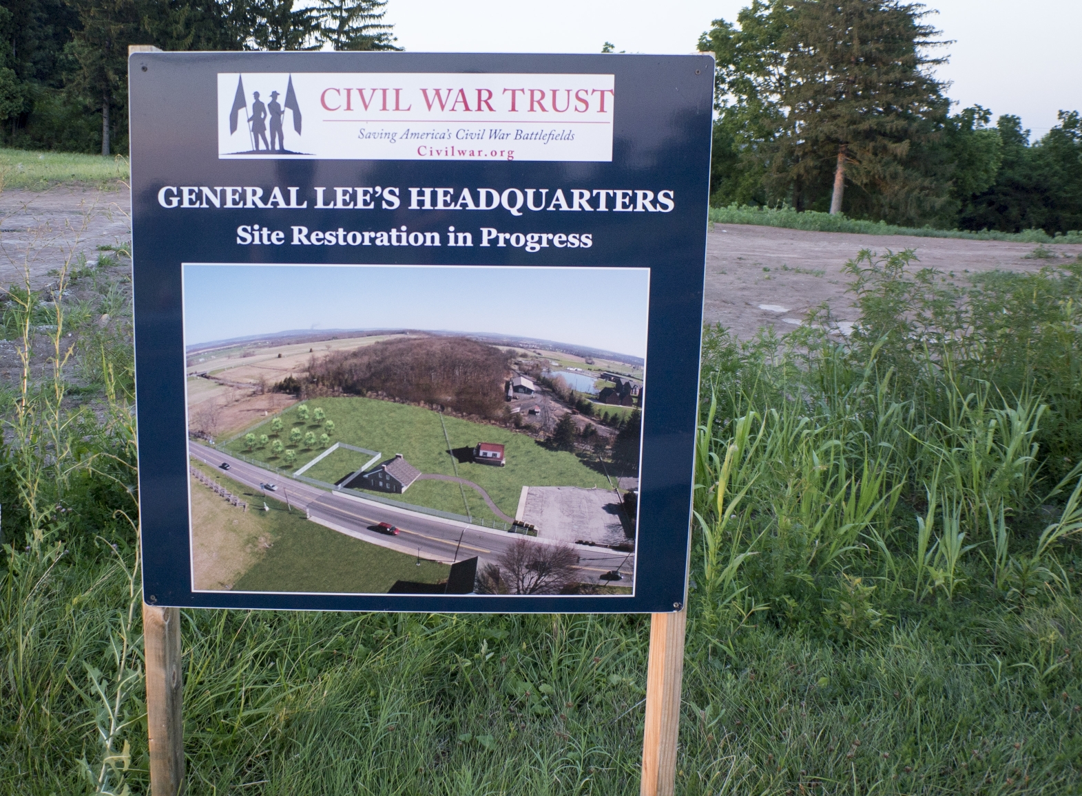
Here’s a look at the Thompson House restoration sign on the property. This view was taken facing northeast at approximately 8:00 PM on Saturday July 23, 2016.

Stay tuned for a more comprehensive update from LBG Tim Smith, author of “The Story of Lee’s Headquarters.” For photos of the restoration work and additional information on the property, check out the Civil War Trust. This view was taken facing northeast at approximately 8:00 PM on Saturday July 23, 2016.