

We checked in on the demolition progress at the Civil War Trust’s property on East Cemetery Hill yesterday evening. We last stopped by this property two weeks ago – we’re standing on Wainright Avenue, looking up at the rear of the house on Hillcrest Place. In the left of frame you can see the left flank marker to the 75th Ohio Infantry and the right flank marker to the 25th Ohio Infantry. This image was taken facing west at approximately 6:00 PM on Friday July 29, 2016.
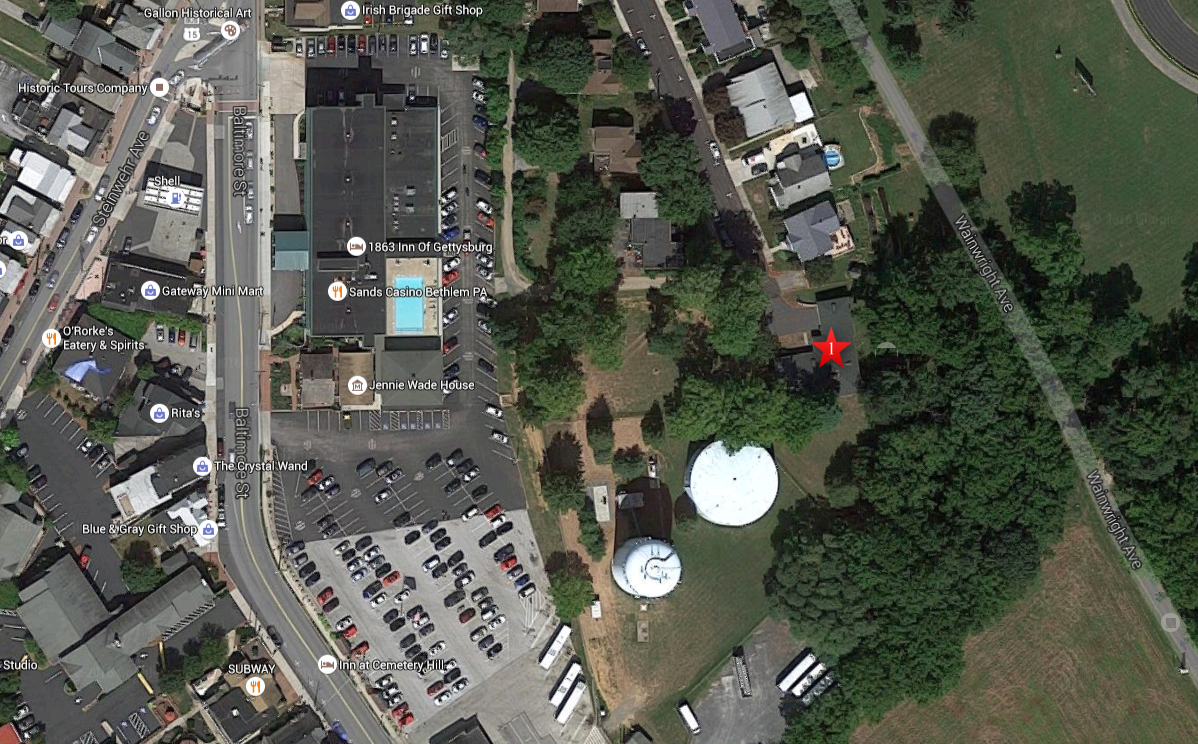
This aerial view shows the East Cemetery Hill area. The red star is on the structure that is being removed at 570 Hillcrest Place. This image is courtesy of Google Maps.

The Civil War Trust are doing their part to restore the ground on East Cemetery Hill to the way that it looked in 1863 when this line was lightly defended by Ohio soldiers who were overrun by Louisiana soldiers on the evening of July 2, 1863. Flank markers for the 25th, 75th, and 107th Ohio can be found along the hill. The marker to the left flank of the 107th Ohio is the hardest to photograph due to its proximity to the fence in the right of frame. The Hillcrest Place property is in the right background. This image was taken facing west at approximately 6:00 PM on Friday July 29, 2016.
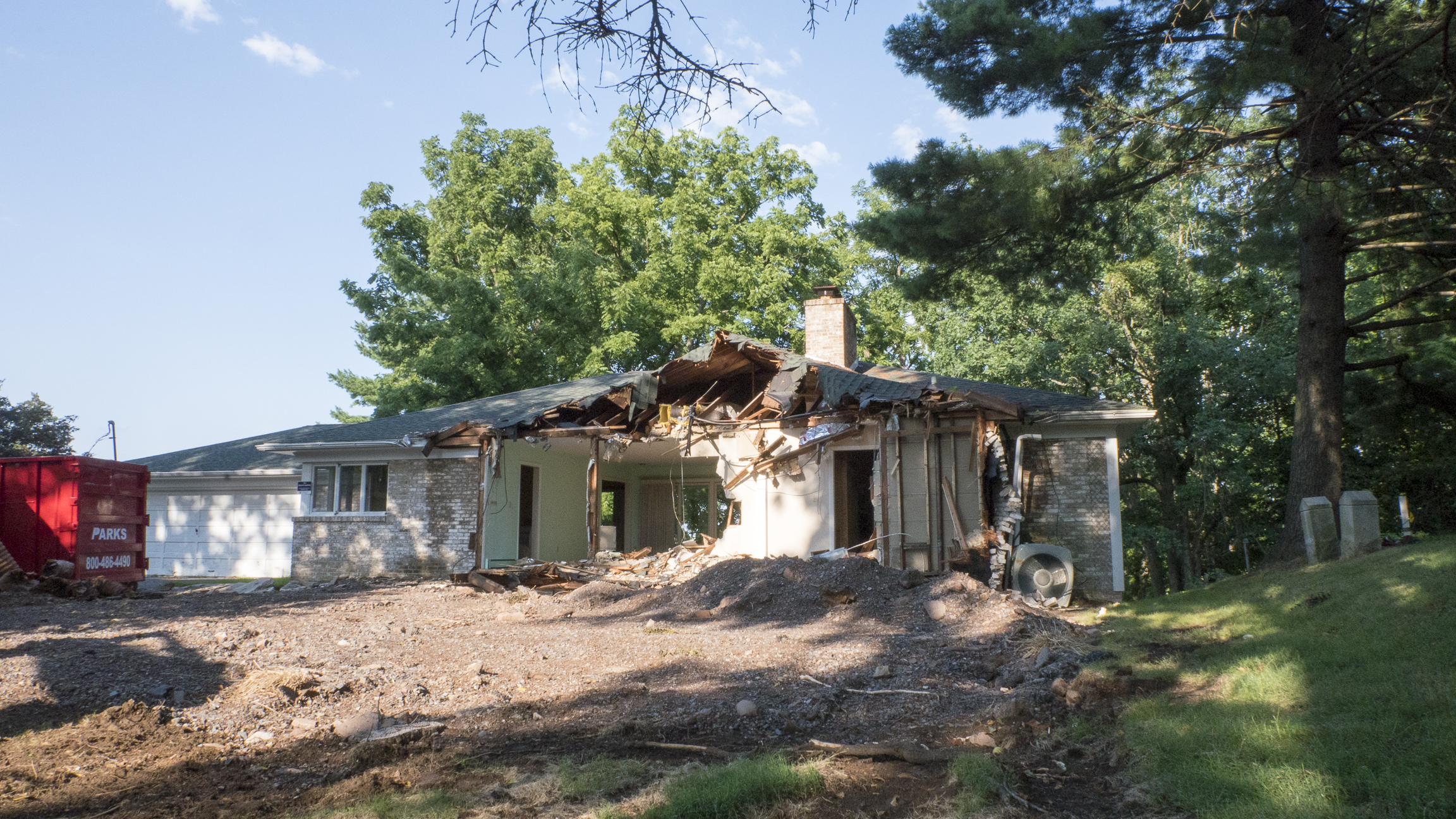
The right flank to the 107th Ohio, as well as the left flank of the 25th Ohio, can be seen in the right of frame. You can now see through the house into the backyard, but there hasn’t been a great deal of progress since our last visit. Let’s walk around to the rear of the house. This image was taken facing east at approximately 6:00 PM on Friday July 29, 2016.

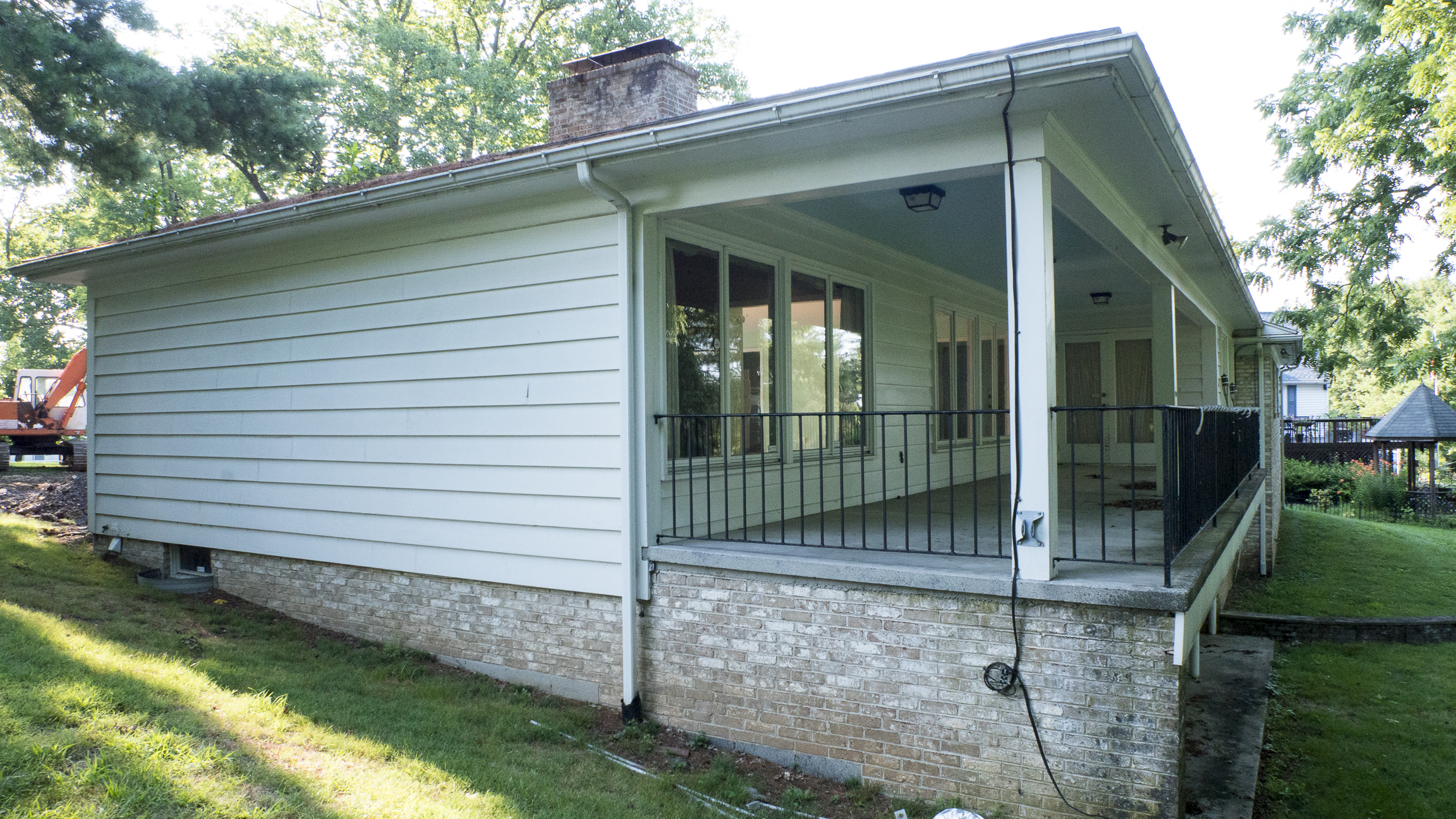
This image was taken facing northeast at approximately 6:00 PM on Friday July 29, 2016.

We ran into a couple walking their dog before taking this photograph, and they asked us if we knew why the house was being demolished. We forgot to show you this last time we were here, but there is a sign nearby. This view was taken facing northeast at approximately 6:00 PM on Friday July 29, 2016.

We’re now shooting from the other side of the Ohio flank markers in the previous photo. Let’s go check out the sign. This image was taken facing slightly southeast at approximately 6:00 PM on Friday July 29, 2016.

In the right of frame we can see the New York State Monument in the Soldiers National Cemetery. This view was taken facing south at approximately 6:00 PM on Friday July 29, 2016.
In order to show you the rest of the Ohio flank markers we have to walk around to the rear of the house. This view was taken facing northwest at approximately 6:00 PM on Friday July 29, 2016.

It appears that something is in the way. In the left background we can see the Gettysburg Area School District’s new football field. In the right background, along Wainright Avenue, is the monument to the 25th and 75th Ohio Infantry. The 107th Ohio Infantry does not have a monument here – their only monument is on Barlow’s Knoll: You can checkout Licensed Battlefield Guide Stuart Dempsey’s post on the 107th Ohio here. This view was taken facing northeast at approximately 6:00 PM on Friday July 29, 2016.

Here are the other flank markers we were looking for. National Park Service property begins on the other side of the stone wall where the flank markers are located. This view was taken facing southeast at approximately 6:00 PM on Friday July 29, 2016.

The right flank marker to the 25th Ohio Infantry and the left of the 75th Ohio Infantry. This view was taken facing north at approximately 6:00 PM on Friday July 29, 2016.

These markers have been hard to access for a number of years now, and the small path that does exist alongside the stone wall was barely noticeable. We hope that the path is cleared further so that it’s easier to walk the stone wall and to ascend the hill. This view was taken facing west at approximately 6:00 PM on Friday July 29, 2016.
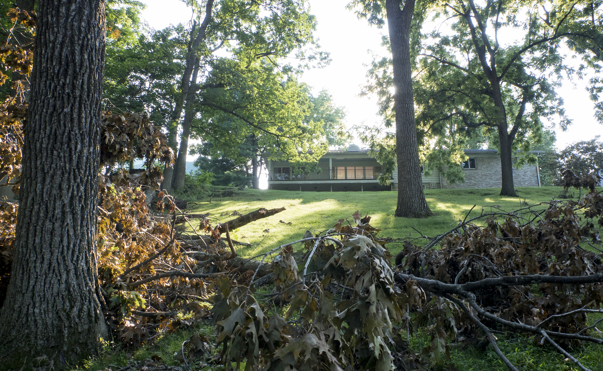
One last look at the house – we’ll wait until more significant progress is made on the demolition before we visit again, but while we’re here… This view was taken facing west at approximately 6:00 PM on Friday July 29, 2016.

… For many of our visitors that don’t have a chance to get to Gettysburg, here is a panoramic view of the new football stadium, as well as the new middle school in the left of frame. The new middle school was opened in 2014. The old building on Lefever Street was removed and some of the ground was changed – we’ll take a look at those changes in a future post. Louisiana troops attacked towards the camera on the evening of July 2nd, 1863. To see what this area looked like six years ago and in the snow, click here. This panoramic view was taken from the north (left of frame) to the southeast (right of frame) at approximately 6:00 PM on Friday July 29, 2016.