Licensed Battlefield Guide Rich Kohr: The Bucktails on McPherson’s Ridge Part 1
November 26, 2008
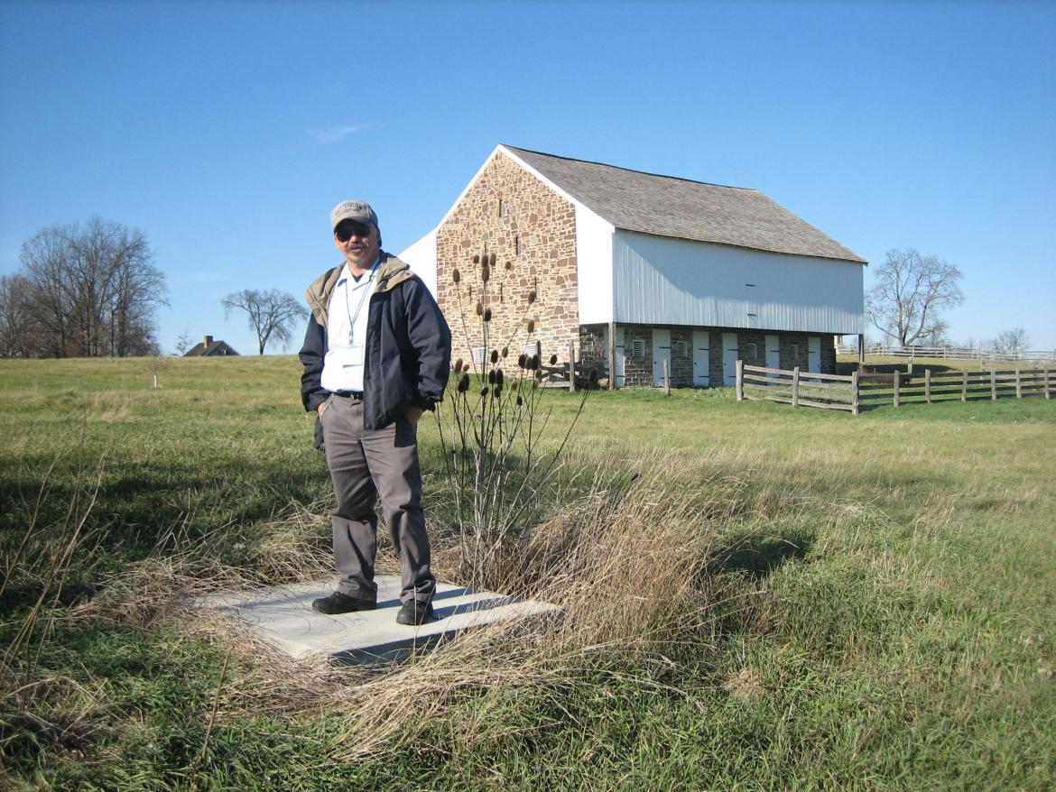
Video #1 has Licensed Battlefield Guide Rich Kohr on the southeast side of the Edward McPherson Barn introducing himself, and explaining how he became interested in the units that formed Roy Stones’ Brigade of Bucktails. If you would like to contact Rich, please click here to reveal his email address. This view was taken facing northwest at approximately 1:45 PM on Sunday, November 23, 2008.
The original “Bucktails” were the 13th Pennsylvania Reserves Regiment (42nd Pennsylvania Infantry Regiment). They were so named because of the regiment’s custom of having each man wear on his hat the tail of a deer he had shot. The Bucktails were said to be all superior marksmen, and during the first year of the war they distinguished themselves as skirmishers and sharpshooters.
In July 1862, because of this excellent record, Secretary of War Edwin M. Stanton directed Roy Stone, a major in the 13th Pennsylvania Reserves, to enlist an additional brigade of Bucktails. Stone raised 20 companies of recruits by the end of August to send to Harrisburg for official organization into the 149th and 150th Pennsylvania regiments. The new volunteers, having proudly adopted the distinctive badge of the earlier group, also called themselves the “Bucktails” or sometimes the “New Bucktails.” The 143rd Pennsylvania would join the brigade in February, 1863.
At the beginning of the war, most of this brigade’s time had been spent within the fortifications of Washington, D.C. They were not significantly engaged at Chancellorsville, so Gettysburg would be their first major battle. Their most important contribution to the Battle of Gettysburg occurred on McPherson’s Ridge on July 1, 1863.
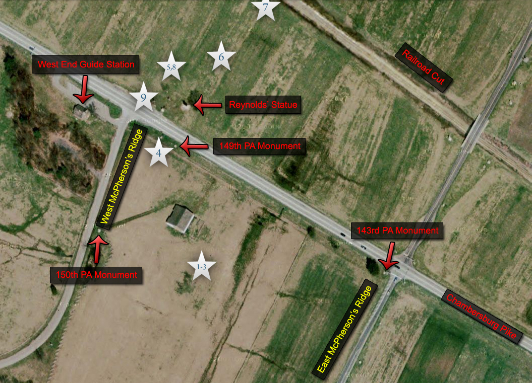
This map of the McPherson’s Ridge area points out the areas where our videos were recorded. The number in the star matches the number of the video listed on this post. This map was made at approximately 4:00 PM on Wednesday, November 26, 2008.
This map shows a closer view of the McPherson Farm area. We have outlined some of the buildings that are no longer standing, and have included the location of the McPherson Farm lane. The number in the star matches the number of the video listed on this post. This map was made at approximately 4:00 PM on Wednesday, November 26, 2008.
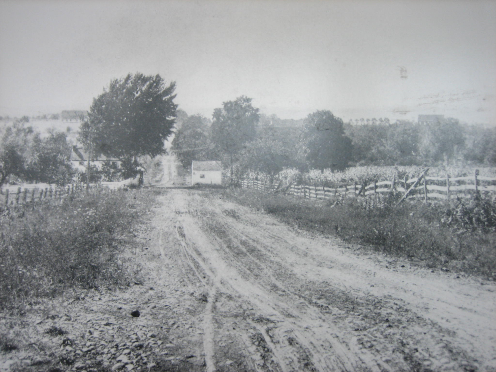
This 1880s to 1890s photograph of the McPherson farm is somewhat misleading. In 1863, there were only three buildings on the McPherson Farm: the barn, a one-story house, and a wagon shed. The barn, of course, is in the same location as it is today, although it has had some postwar additions. The wagon shed to the left of the barn would have been in the same location, but in 1863 the entrance was oriented from north to south instead of east to west as shown here. The house shown in this photograph is an 1880s house which burned in 1895. The 1863 house was one story, and like the 1863 wagon shed, was oriented from north to south instead of east to west as the two-story house is. The small, white, “chicken-coop” building between the wagon shed and the house did not exist in 1863. The building east of the house did not exist in 1863. This view was taken facing southwest between 1880 and 1895.
Here is a small Harper’s Weekly woodcut from a Matthew Brady photograph taken on July 15, 1863. One can see how the wagon shed is oriented from north to south. This view was taken facing northeast on July 15, 1863. The woodcut appeared in Harpers Weekly on August 22, 1863.
Licensed Battlefield Guide Rich Kohr is standing on the capped well located on the McPherson Farm. This view was taken facing northwest at approximately 1:45 PM on Sunday, November 23, 2008.
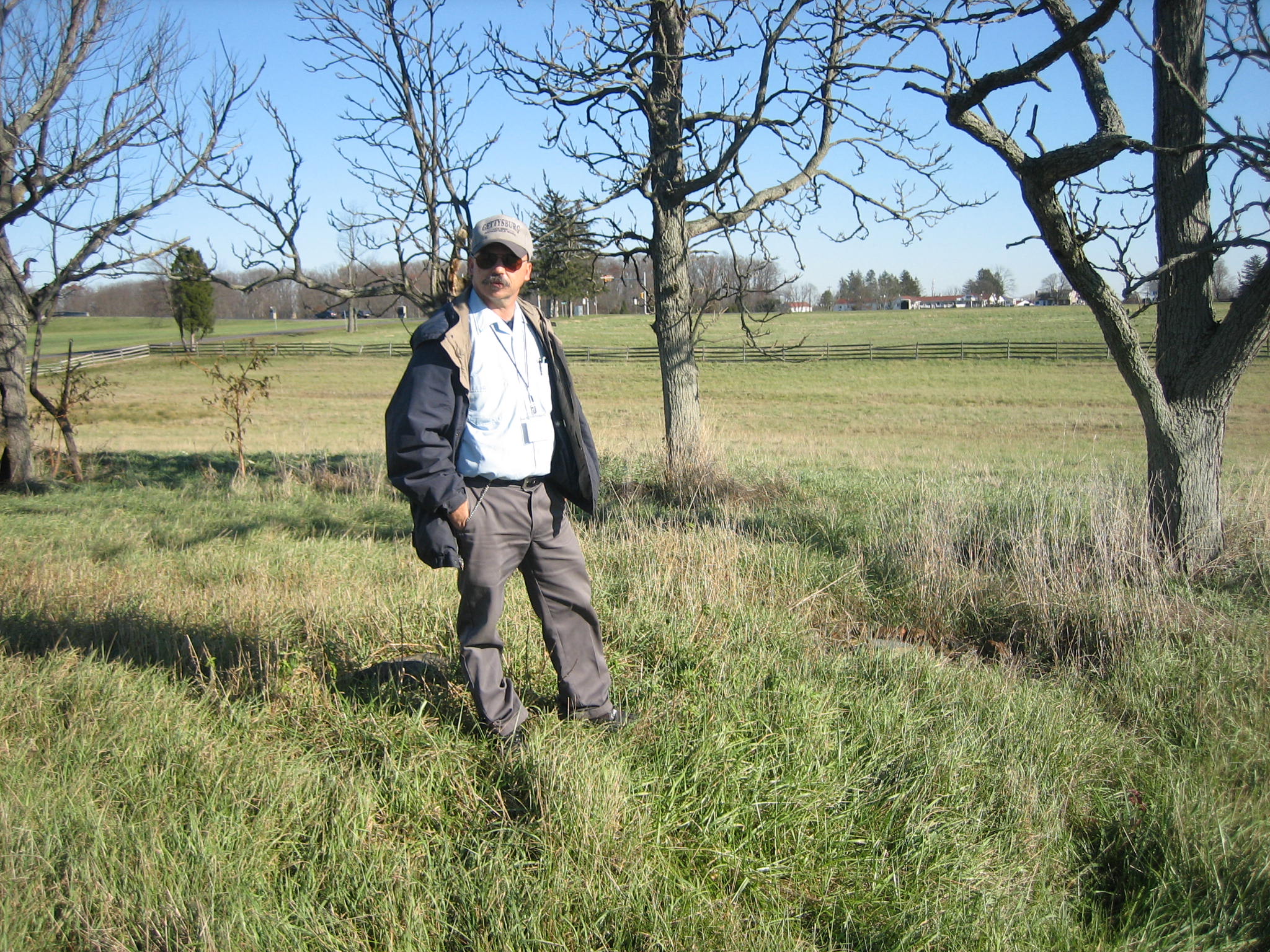
Just to the south of the well is a small group of trees where the McPherson House was located. It was a one story house in 1863. This view was taken facing southwest at approximately 1:45 PM on Sunday, November 23, 2008.
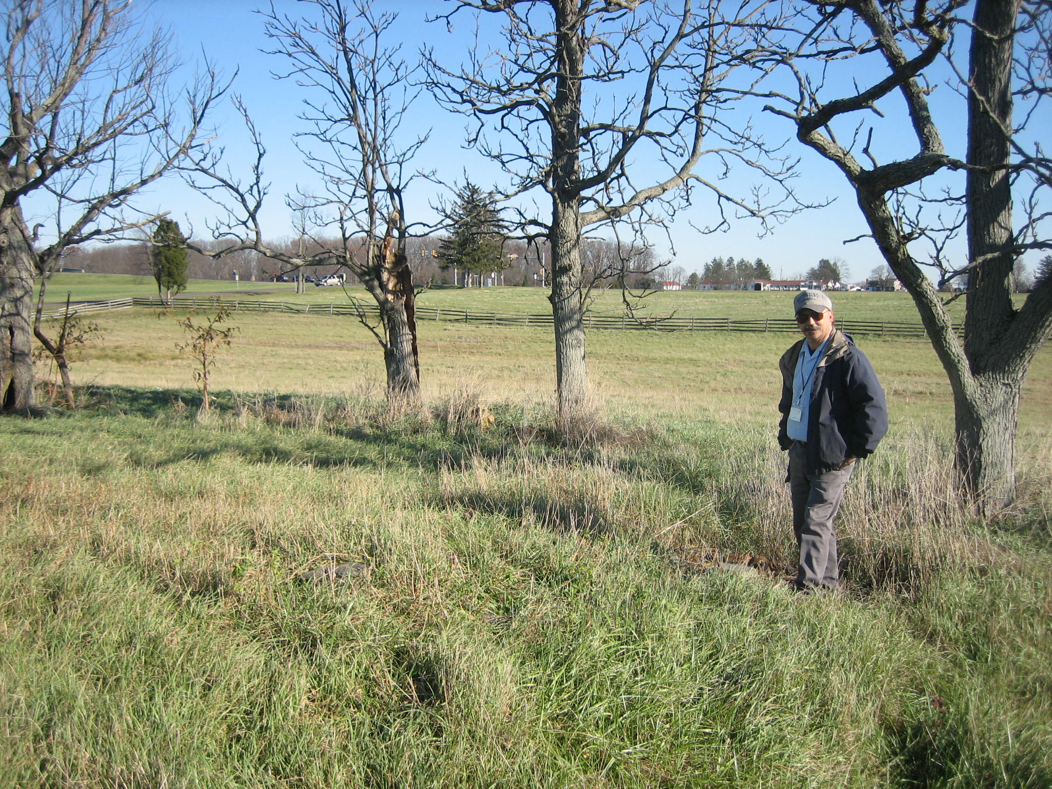
Congressman Edward McPherson did not live on this property in the 1860s. It was rented out to John Slentz and his family. Some of the foundation stones at one of the houses located here are still visible. Rich is standing near a foundation stone at the southwest corner of the house… This view was taken facing northeast at approximately 1:45 PM on Sunday, November 23, 2008.
… and here by the foundations stones near the southeast corner of the house. This view was taken facing northeast at approximately 1:45 PM on Sunday, November 23, 2008.
This might have been the location of the hearth to a fireplace. This view was taken facing northeast at approximately 1:45 PM on Sunday, November 23, 2008.
Rich is standing in the area of one of the wagon sheds that were located on this spot. This view was taken facing northwest at approximately 1:45 PM on Sunday, November 23, 2008.
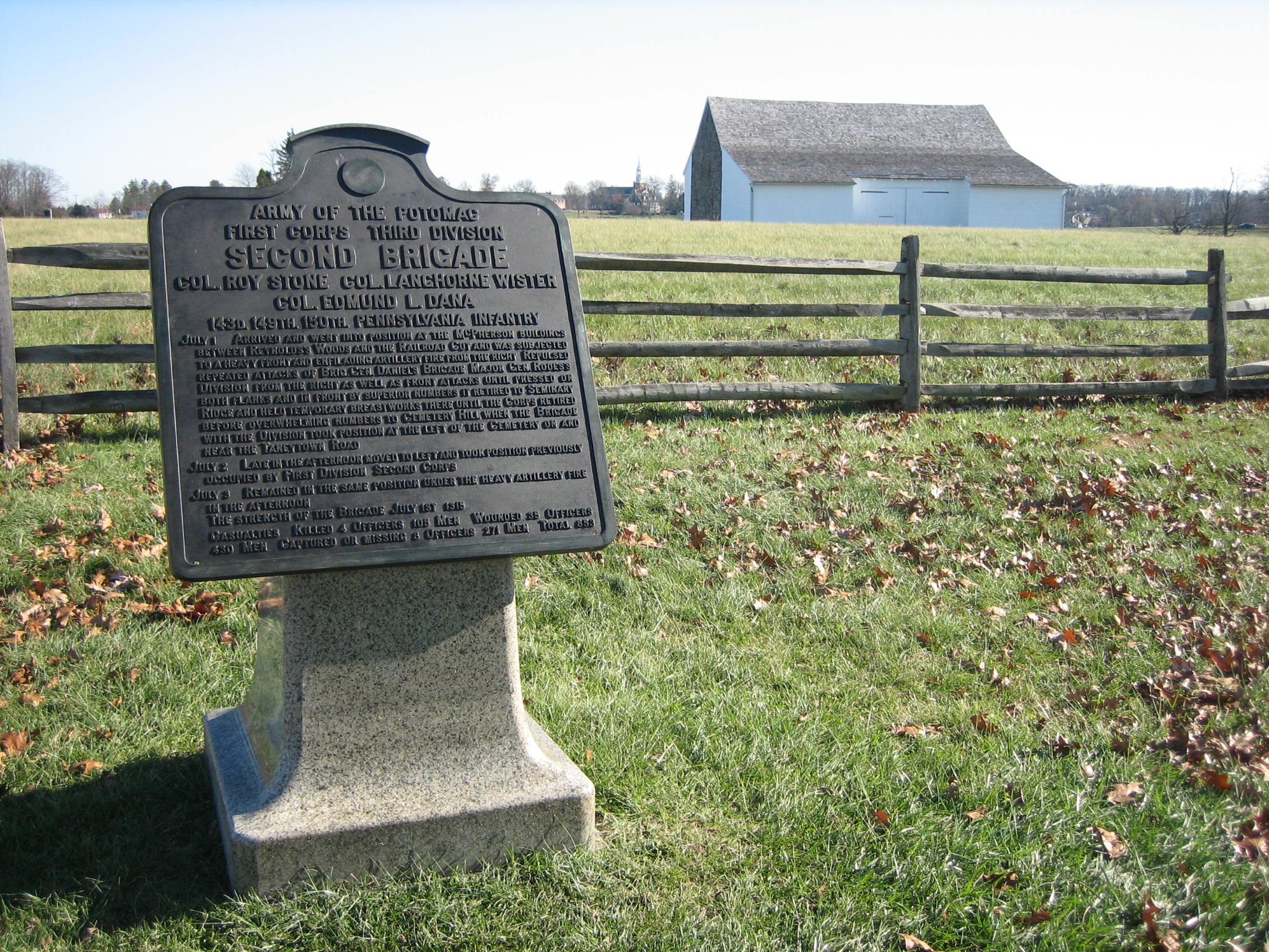
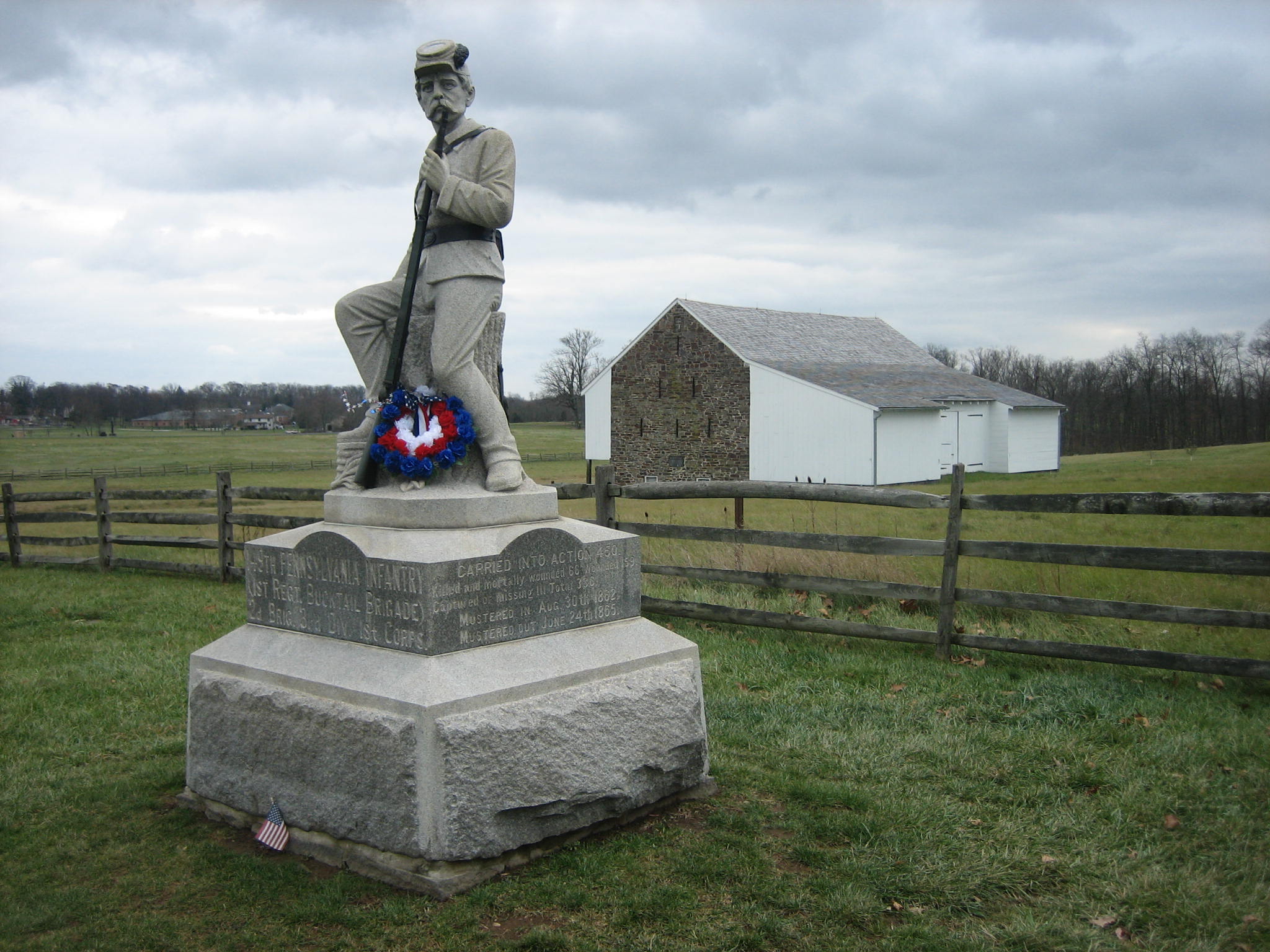
At the Battle of Gettysburg, Roy Stones’ Second Brigade of the Third Division of the First Army Corps consisted of the 143rd, 149th, and 150th Pennsylvania Infantry Regiments. Their engaged strength was approximately 1317 men. During the Battle of Gettysburg, this brigade suffered 853 casualties, or 64.8%. In total loss of Union brigades at Gettysburg, they ranked fifth. In percentage loss of Union brigades at Gettysburg, they ranked third. There were 247 Union regiments at Gettysburg. In total losses, all three “Bucktail” regiments were listed in the “top ten.” The 149th Pennsylvania’s 336 losses ranked them third in losses of all Union regiments at Gettysburg. The 264 losses suffered by the 150th Pennsylvania ranked them sixth, and the 253 losses of the 143rd Pennsylvania ranked them seventh. This view was taken facing east at approximately 1:45 PM on Sunday, November 23, 2008.
Video #2. In this video the camera is southeast of the McPherson Barn, pointed toward Seminary Ridge where Stones’ Brigade was first in reserve. Then we swing around from east to north to west to south where Rich Kohr explains how the three regiments were positioned. This view was taken facing east to west to south at approximately 1:45 PM on Sunday, November 23, 2008.
Video #3. In this video the camera is still southeast of the McPherson Barn. Rich explains how the Bucktails were first in position in this low ground east of the barn, protected from Confederate artillery fire on Herr’s Ridge. Then he points out how they have to shift position when Confederate artillery from Oak Hill begins to fire their way. This view was taken west to north to west to north at approximately 1:45 PM on Sunday, November 23, 2008.
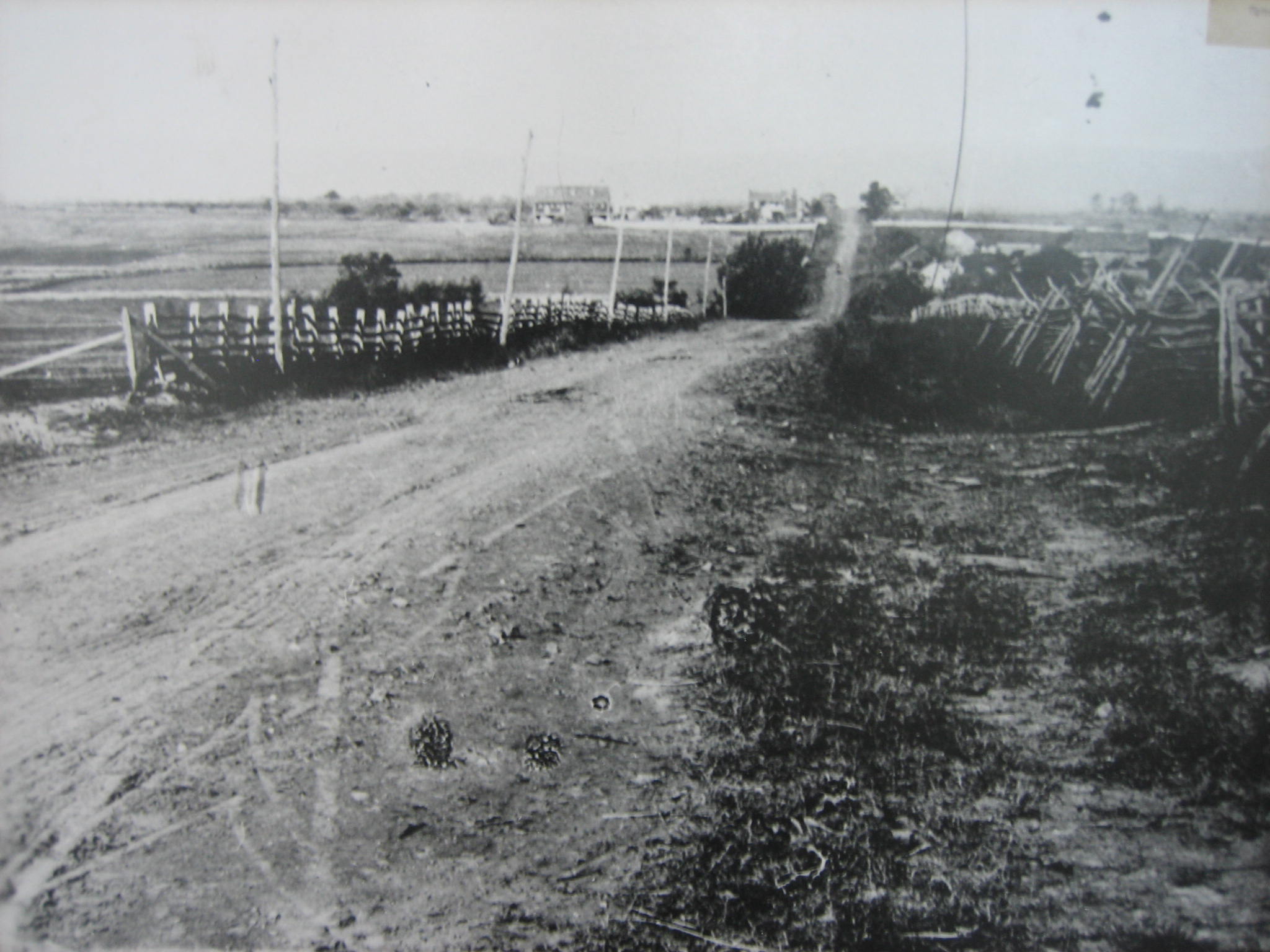
In this 1880s photograph by William Tipton, the photographer is standing on McPherson’s Ridge, on the right (north) side of the Chambersburg Pike. The McPherson Farm would be out of sight to the left (south). Herr’s Ridge, from where Confederate Artillery first opened on McPherson’s Ridge, is approximately three-fourths of a mile in the distance. The Herr Tavern/House is to the left (south) of the Chambersburg Pike, and the Herr Barn is visible to the left of the Tavern/House. This view was taken facing west in the 1880s.
Licensed Battlefield Guide Rich Kohr is pointing out where Confederate artillery shows up in the afternoon of the first day (July 1, 1863) on Oak Hill. Oak Hill is marked by the light-colored Eternal Light Peace Memorial (Peace Light). This view was taken facing north at approximately 1:45 PM on Sunday, November 23, 2008.
When the 149th Pennsylvania moved to face north in their position in a ditch on this (south) side of the Chambersburg Pike. Their right would have been in the low ground, mostly protected from artillery fire on Herr’s Ridge to the left or west. However, the 149th’s left was still on the high ground to the left (west) in this picture, and they were exposed to the Herr’s Ridge artillery fire. In the next video, Rich will explain this predicament. This view was taken facing north at approximately 1:45 PM on Sunday, November 23, 2008.
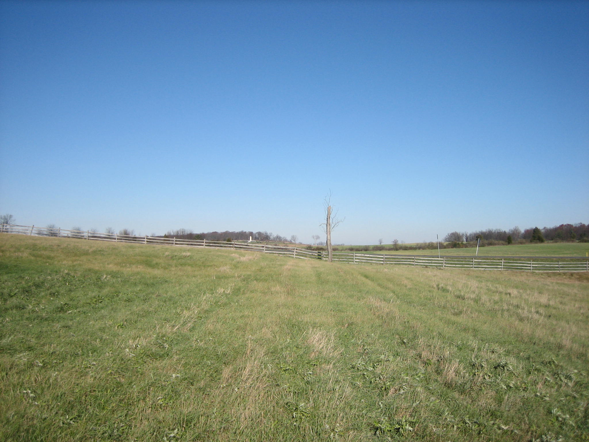
In 1863, a farm lane ran in this area, which we have outlined for you. It is still visible in these winter months. This view was taken facing north at approximately 1:45 PM on Sunday, November 23, 2008.
Video #4 In this video, we are northwest of the McPherson Barn near the Chambersburg Pike (US 30). We are looking at the back of the monument to the 149th Pennsylvania. The equestrian statue to Major-General John Reynolds is also shown in the background. This view was taken facing north to northeast to north to west at approximately 1:45 PM on Sunday, November 23, 2008.
We are now standing on the other side of the fence, looking at Rich Kohr and the monument to the 149th Pennsylvania. The left flank marker to the 149th Pennsylvania, is close to the monument, in the right foreground. This view was taken facing southeast at approximately 2:15 PM on Sunday, November 23, 2008.
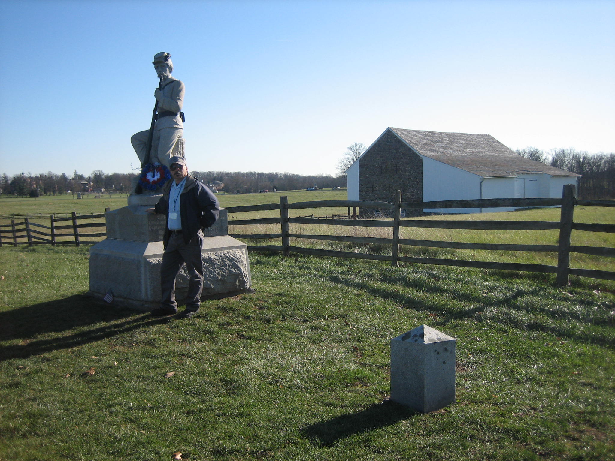
The monument to the 149th Pennsylvania was erected 120 years ago this month, in November, 1888. However, the veterans of the regiment thought the monument had a few artistics flaws, and that the text should be reworded. They demanded that changes should be made. The monument was officially dedicated on September 11, 1889. The figure on the monument is staring at the location where the colors were moved in order to save the regiment from more casualties. The wreath on the monument is from the Remembrance Day ceremonies last weekend. This view was taken facing southeast at approximately 12:45 PM on Wednesday, November 26, 2008.
Rich is pointing to the area where the colors to the 149th Pennsylvania will be moved. Above Rich’s extended left arm is the statue to Brigadier-General John Buford. Rich, after much research, believes that the colors were moved to a position approximately 50 yards to the right of (north of) the Buford statue. This view was taken facing northwest at approximately 2:15 PM on Sunday, November 23, 2008.
Video #5 In this video, Rich is standing on the location where he believes the colors of the 149th Pennsylvania were moved on the afternoon of July 1, 1863. The silver farm silo in the background is located on Herr Ridge, approximately three-fourths of a mile to the west. This view was taken facing west then south, then west again at approximately 2:15 PM on Sunday, November 23, 2008.
Video #6 In this video, The camera is pointing to the southeast to the east section of McPherson’s Ridge, where the 143rd Pennsylvania was located. The pickup truck and a white car in the video are shown driving down the east section of McPherson’s Ridge. Rich will show that the 143rd Pennsylvania did not join the 149th Pennsylvania in an attack to the north to the unfinished railroad cut when Junius Daniel’s North Carolina Brigade will attack that afternoon. The railroad cut is marked by the dark colored bushes. This view was taken facing southeast to east to the north at approximately 2:15 PM on Sunday, November 23, 2008.
Video #7 In this video, Rich is standing just to the south of the railroad cut on the west section of McPherson’s Ridge. He explains how the 149th Pennsylvania at first repulsed the attack of Junius Daniel’s Brigade in this location, but were then outflanked from infantry and artillery on the left or west, and retired back to the Chambersburg Pike. This view was taken facing north to east to southwest to northwest at approximately 2:15 PM on Sunday, November 23, 2008.
Video #8 In this video, we have returned to the location where the flags of the 149th Pennsylvania had been placed to the northwest of the regiment. He points out that not only did the flags fool Confederate artillery in the location of the Union line, they will also fool the infantry of Daniel’s Brigade. This view was taken facing northwest at approximately 2:15 PM on Sunday, November 23, 2008.
Video #9 In our last video for today, we are orienting you by using the statue to John Buford. Rich explains how the 32nd North Carolina of Daniel’s Brigade charged up the slope toward the flags of the 149th, not toward the actual regiment. The 32nd would be outflanked by the 150th Pennsylvania, who charged into them moving in a general direction from south to north. This view was taken facing northwest to southwest to northwest at approximately 2:15 PM on Sunday, November 23, 2008.
The 32nd North Carolina of Daniel’s Brigade crossed the railroad cut at a location where it is graded above the surrounding fields. We have highlighted the area where they crossed. This view was taken facing northwest to southwest to northwest at approximately 2:15 PM on Sunday, November 23, 2008.
Here is an 1870s photograph of the area where the 150th Pennsylvania charged from left to right, or south to north to outflank the 32nd North Carolina who was moving up the slope from west to east (up the slope, toward the camera position). The toll house is located on the right (north) side of the pike at the bottom of the slope near Willoughby Run, and the toll keeper’s house on the left side of the pike. The Herr Barn is visible to the left of the tree above the toll keeper’s house. This view was taken facing northwest in the 1870s.
Here is a modern view of the area where the last photograph was taken. The bridge over Willoughby Run is located where the light colored pavement crosses the Chambersburg Pike from right to left, or south to north. This view was taken facing northwest at approximately 12:45 PM on Wednesday, November 26, 2008.
In another effort to orient you, we are showing a view of this area of the western arm of McPherson’s Ridge. The brown and white sign at the left of the picture is located near the West End Guide Station. The monument to Hall’s Second Maine Battery is on the right side (north) of the Chambersburg Pike. The statue to John Buford is above the left cannon. The silver farm silo is located on Herr’s Ridge in the background. The statue to John Reynolds would be out of sight on the right. The flags to the 149th Pennsylvania would have been located 50 yards to the right (north) of the John Buford statue. On the afternoon of July 1, 1863, the 32nd North Carolina was charging up the slope toward this position (west to east) and towards the flags of the 149th Pennsylvania. The 150th Pennsylvania would have attacked them by moving from left to right, or south to north. This view was taken facing northwest at approximately 12:45 PM on Wednesday, November 26, 2008.