Neill Avenue (Lost Avenue) Part 2: Presented by LBG Ted Gajewski
March 18, 2009
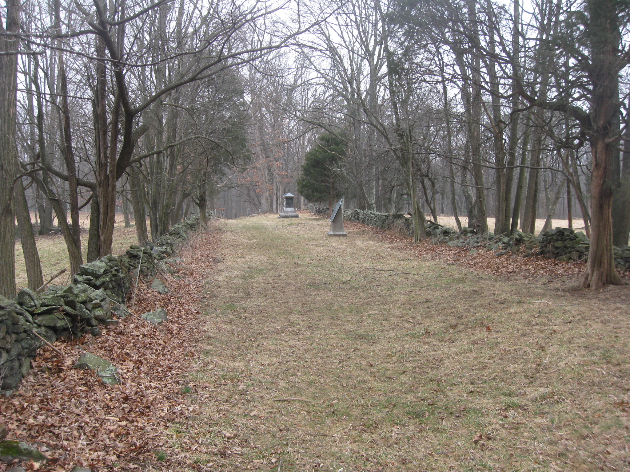
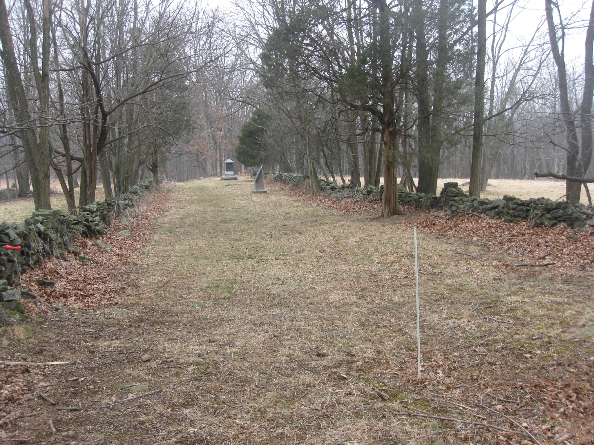
Gettysburg Licensed Battlefield Guide Ted Gajewski took us on a walk to Neill Avenue on Sunday. Lost Avenue, as it is also known, is one of the least visited locations at Gettysburg National Military Park. The rock walls mark the boundary of the National Park Service land at Neill Avenue. In the background is the Neill Brigade Marker, and the monument to the 43rd New York. This view was taken facing southwest at approximately 3:00 PM on Sunday, March 15, 2009.
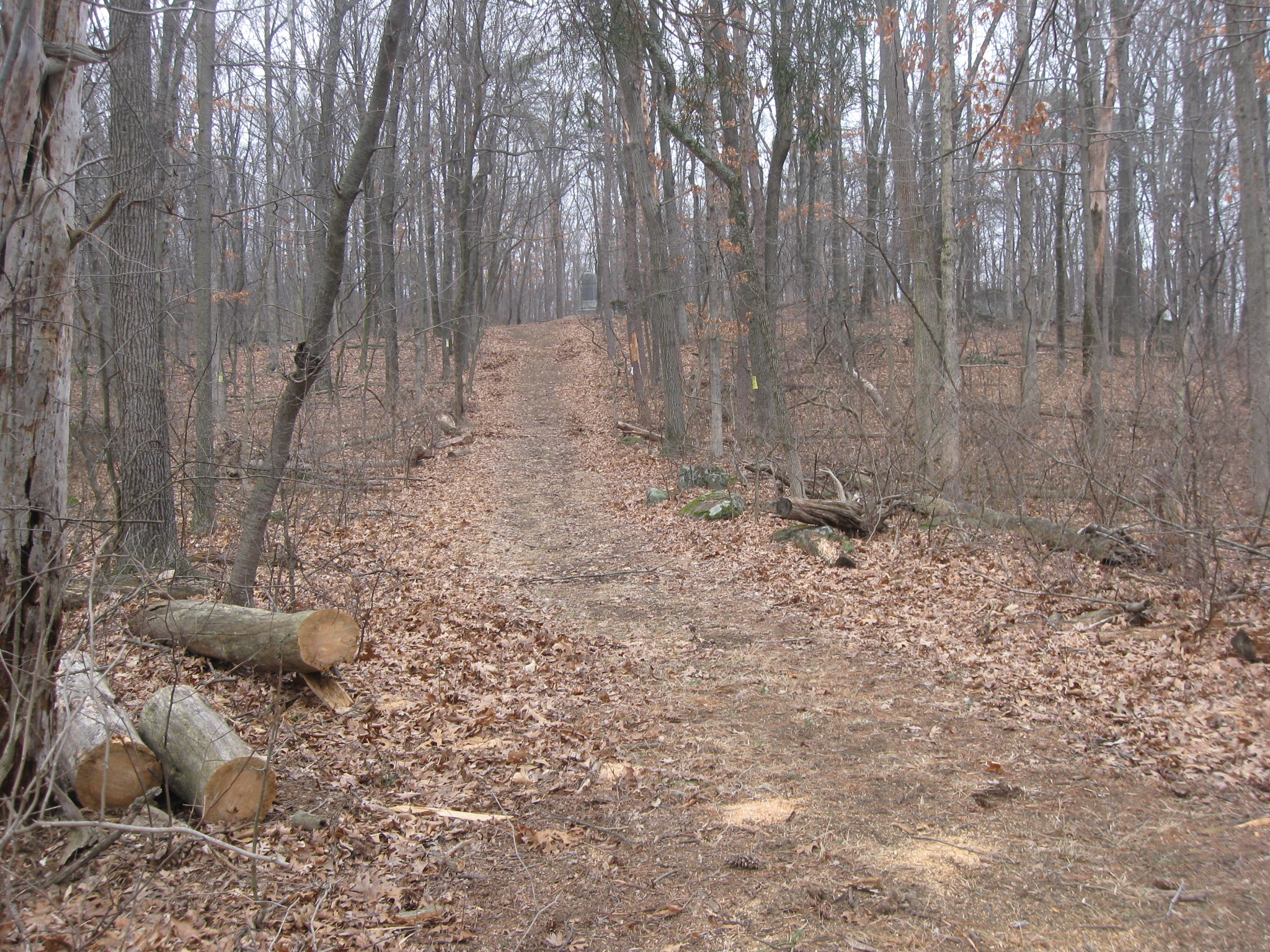
Gettysburg Licensed Battlefield Guide Ted Gajewski took some other LBGs on a visit to Neill Avenue on Sunday. He took us down the old National Park Service trail off Clapsaddle Road. Our previous Neill Avenue post covered the hike down the sometimes open trail. In today’s post we show the monuments and markers on Neill Avenue.
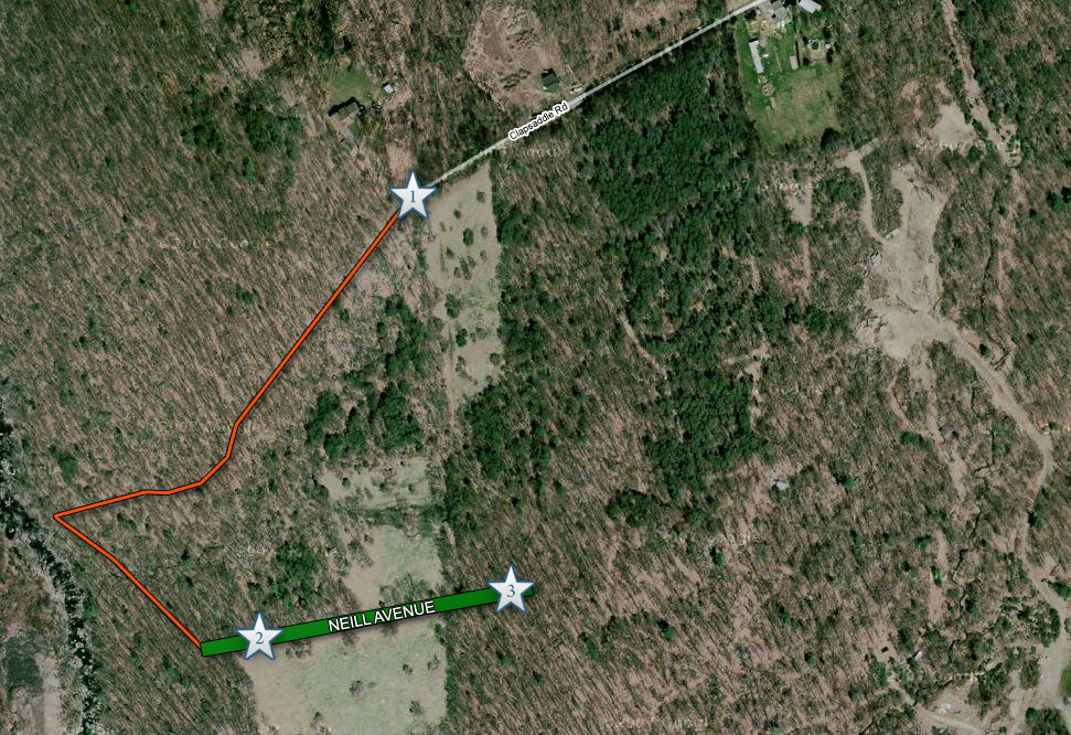
This map shows the “trail” with an orange line. Video #1 was shown in the previous post. Videos #2 and #3 are in this Neill Avenue post. This map was made facing north at approximately 5:30 PM on Monday, March 16, 2009.
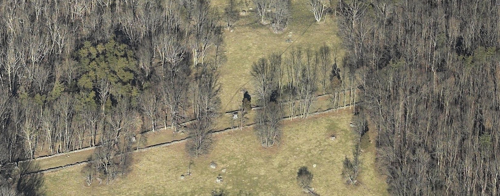
Here is an aerial view of Neill Avenue, which sits on the top of a ridge. The Confederates from the 2nd Virginia Infantry regiment that skirmished with the Union troops located on Neill Avenue would have been just out of sight at the top of the photograph. The Baltimore Pike is approximately 600 yards below (south of) Neill Avenue. This map was made facing north at approximately 5:30 PM on Monday, March 16, 2009.
Here is the same view as we previously showed, but we have labeled the monuments. This map was made facing north at approximately 5:30 PM on Monday, March 16, 2009.
In video #2 (Video #1 was in our previous Neill Avenue post), Licensed Battlefield Guide Ted Gajewski introduces us to Neill Avenue by the monument to the 49th New York Infantry Regiment. As you can tell from the video, this is also the area where he believes that Wesley Culp of the 2nd Virginia Infantry Regiment was killed. This view was taken facing northeast at approximately 3:00 PM on Sunday, March 15, 2009.
The left flank marker to the 49th New York is at the southwest section of Neill Avenue. This view was taken facing south at approximately 3:30 PM on Sunday, March 15, 2009.
The monument to the 49th New York Infantry Regiment was erected on July 2, 1893. Wolf Hill is in the background. This view was taken facing north at approximately 3:30 PM on Sunday, March 15, 2009.
During the American Civil War, the 49th New York had 141 men killed or mortally wounded, and 180 who died from other causes for a total of 321. This view was taken facing east at approximately 3:30 PM on Sunday, March 15, 2009.
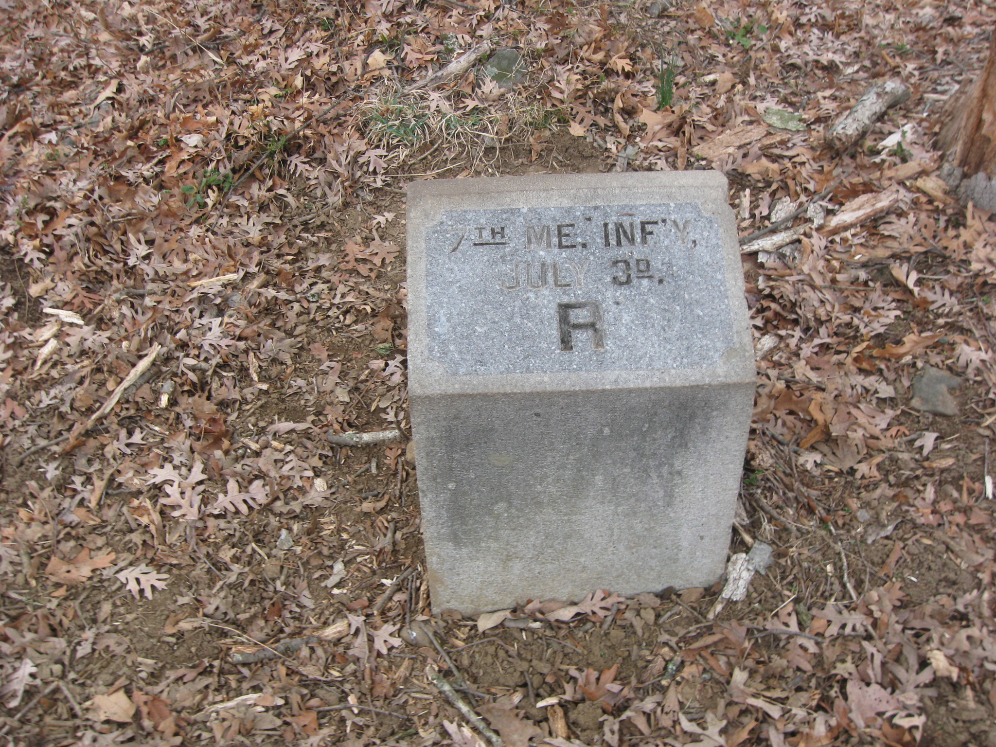
The right flank marker for the 49th New York is on the left, and the left flank marker for the 7th Maine Infantry is on the right. This view was taken facing northwest at approximately 3:30 PM on Sunday, March 15, 2009.
The flank markers which we showed in the last photograph are in the right foreground, and the monument to the 49th New York is in the background. The outline of Powers’ Hill is on the horizon. This view was taken facing southwest at approximately 3:30 PM on Sunday, March 15, 2009.
The monument to the 7th Maine Infantry Regiment was dedicated on October 3, 1889. This view was taken facing northwest at approximately 3:30 PM on Sunday, March 15, 2009.
During the Civil War, the 7th Maine Infantry Regiment had 128 men killed or mortally wounded, and 212 that died of other causes for a total of 340. This view was taken facing southwest at approximately 3:30 PM on Sunday, March 15, 2009.
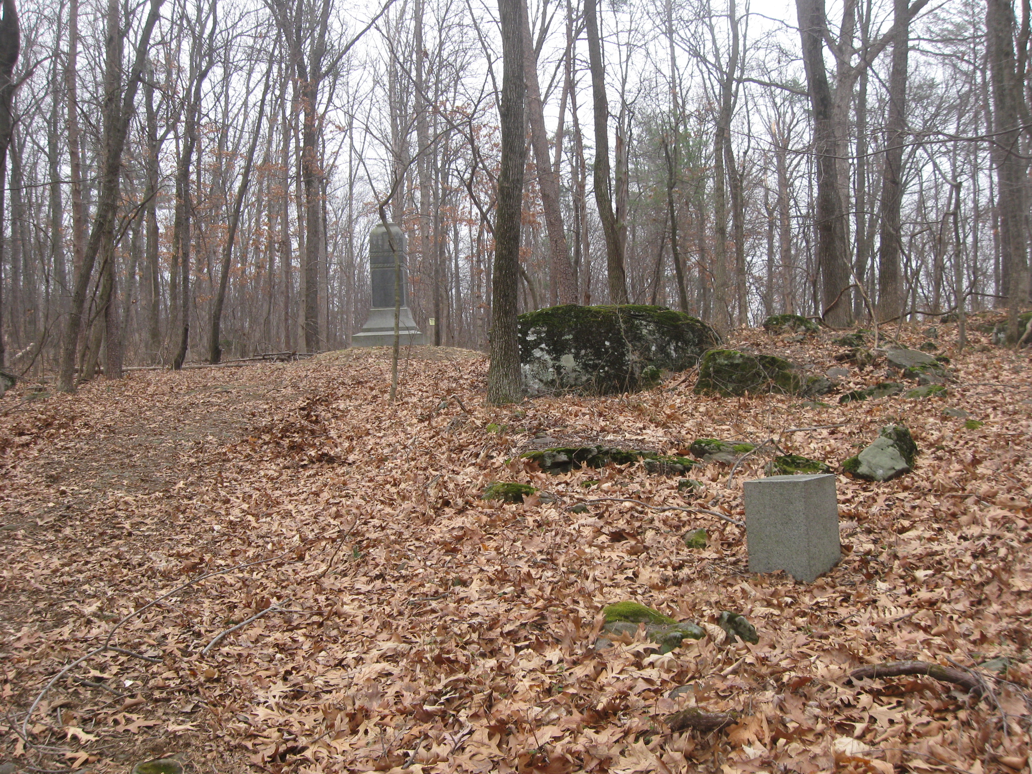
The right flank marker of the 7th Maine Infantry Regiment isn’t too far… This view was taken facing north at approximately 3:30 PM on Sunday, March 15, 2009.
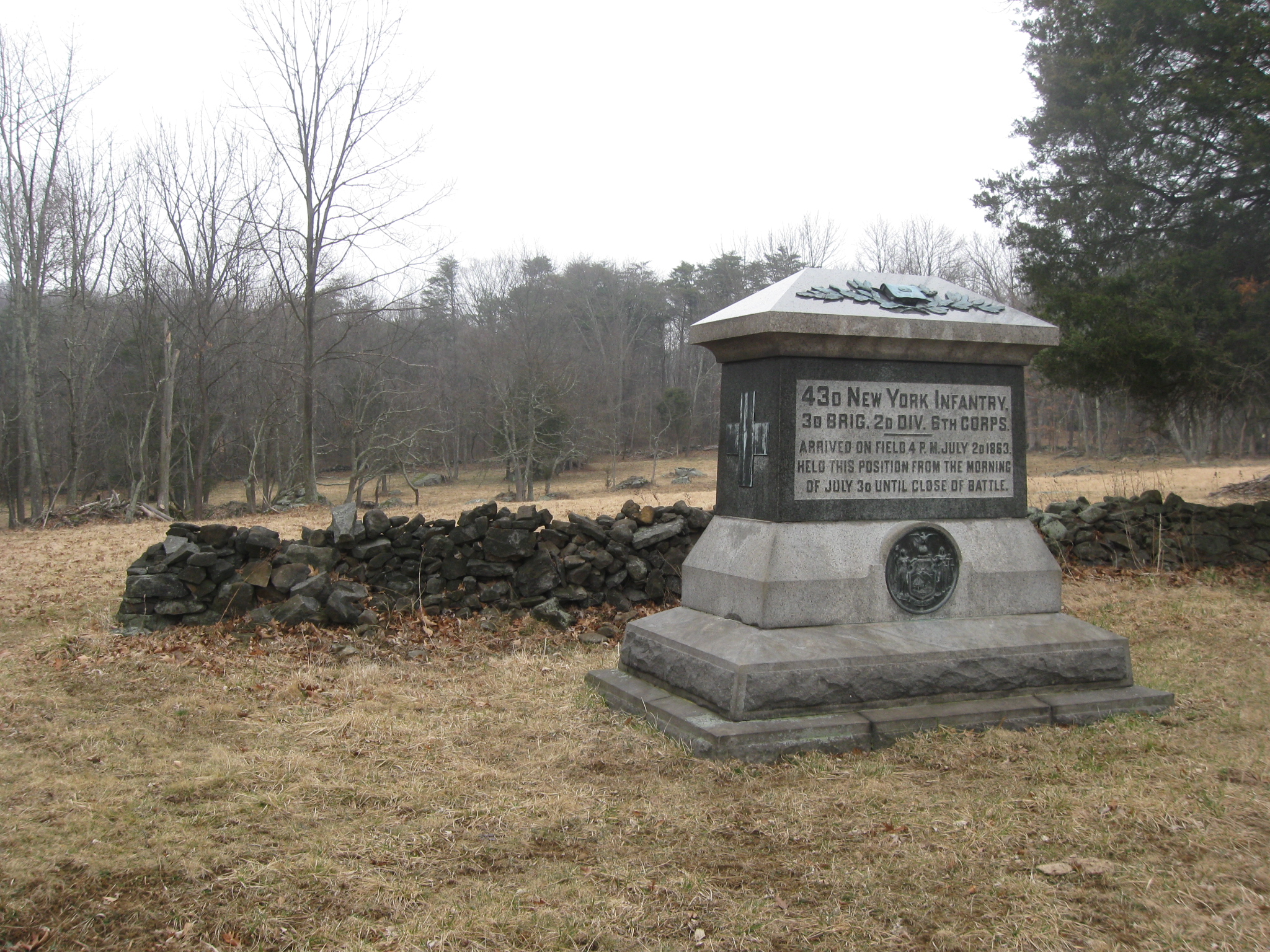
…from the left flank marker of the 43rd New York Infantry Regiment. This view was taken facing northwest at approximately 3:30 PM on Sunday, March 15, 2009.
The area of the monument to the 43rd New York is a good spot to show how Neill Avenue is located on a ridge. This view was taken facing north at approximately 3:30 PM on Sunday, March 15, 2009.
The Confederate skirmishers were located downhill from Neill Avenue at the stone wall in the woodline on the other side of the clearing. This view was taken facing north at approximately 3:30 PM on Sunday, March 15, 2009.
The Baltimore Pike is downhill on the other side of this ridge. This view was taken facing south at approximately 3:30 PM on Sunday, March 15, 2009.
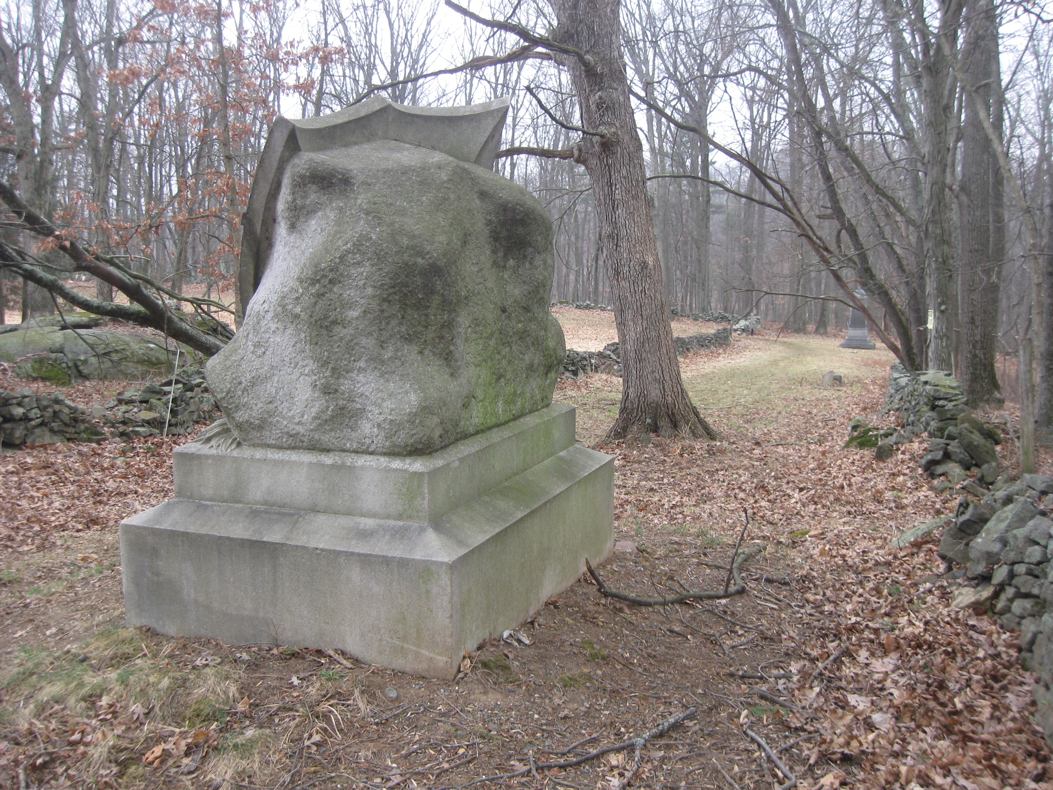
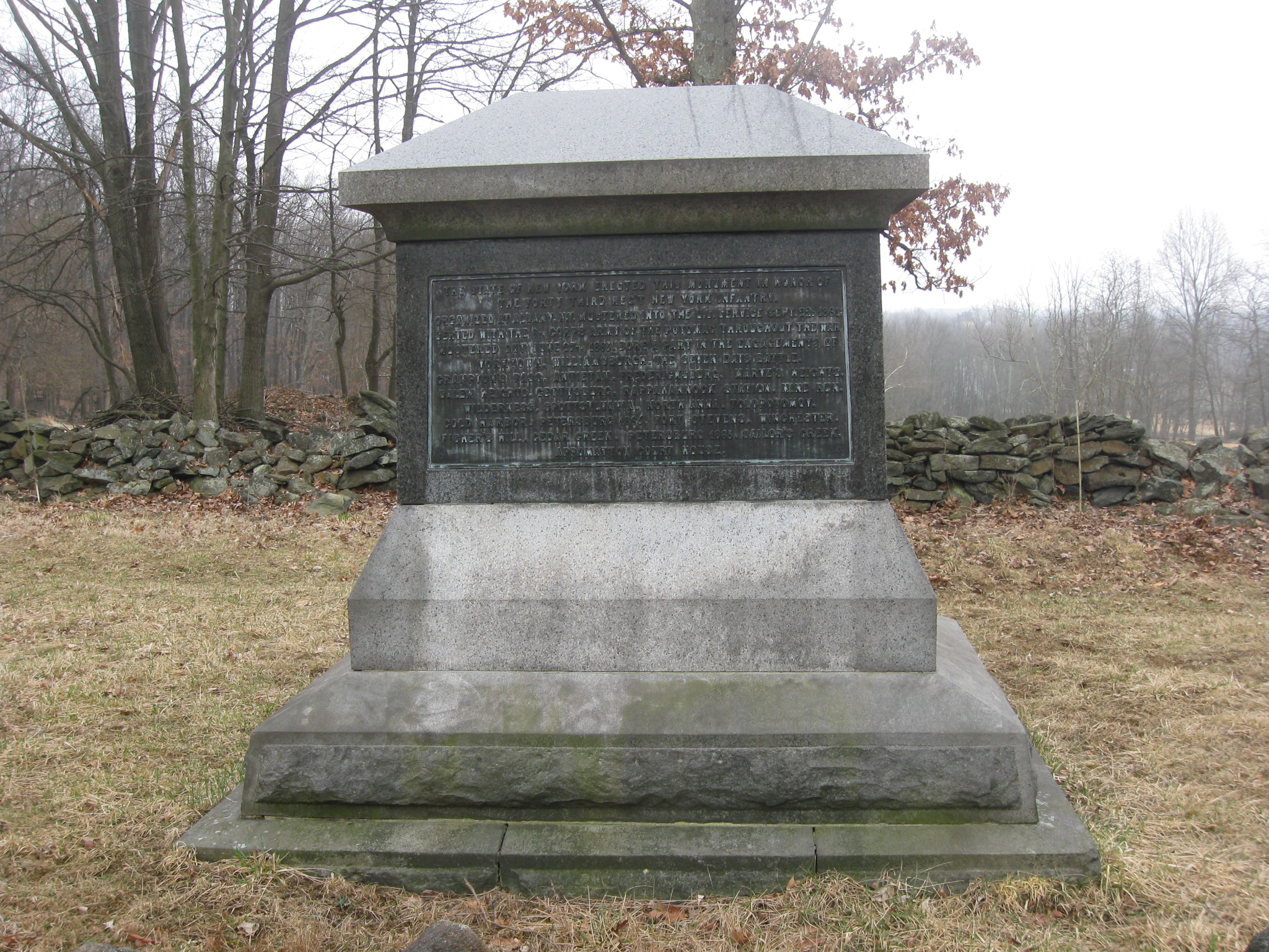
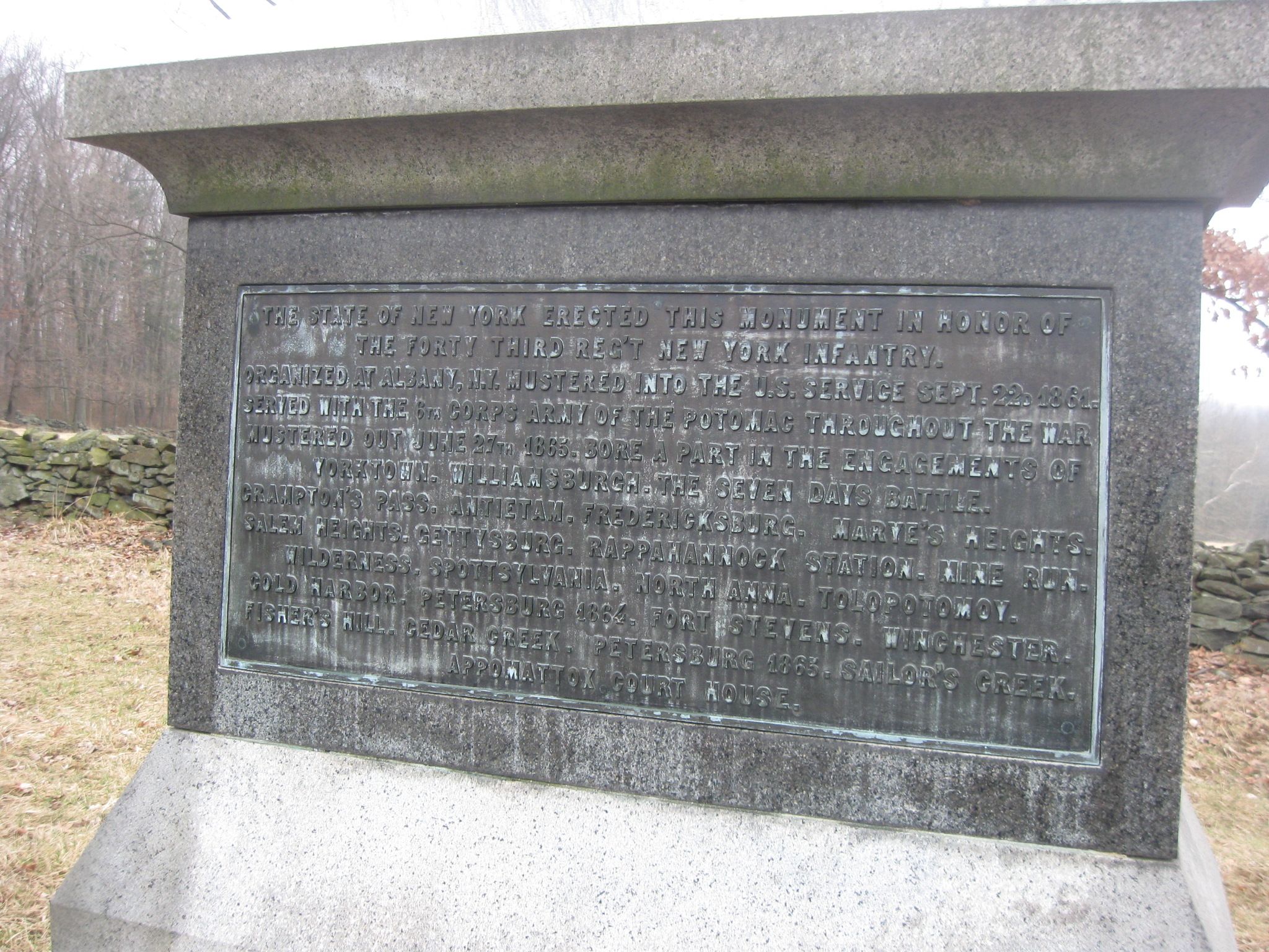
The monument to the 43rd New York Infantry Regiment was dedicated on September 17, 1889. This view was taken facing northwest at approximately 3:30 PM on Sunday, March 15, 2009.
The total strength of the 43rd New York Infantry Regiment during the Civil War was 2,327 members, of whom 692 were killed, wounded or captured. This view was taken facing southeast at approximately 3:30 PM on Sunday, March 15, 2009.
During the Civil War, 94 members of the 43rd New York died from accident or disease, and 27 died in prison for total casualties of 813. This view was taken facing southeast at approximately 3:30 PM on Sunday, March 15, 2009.
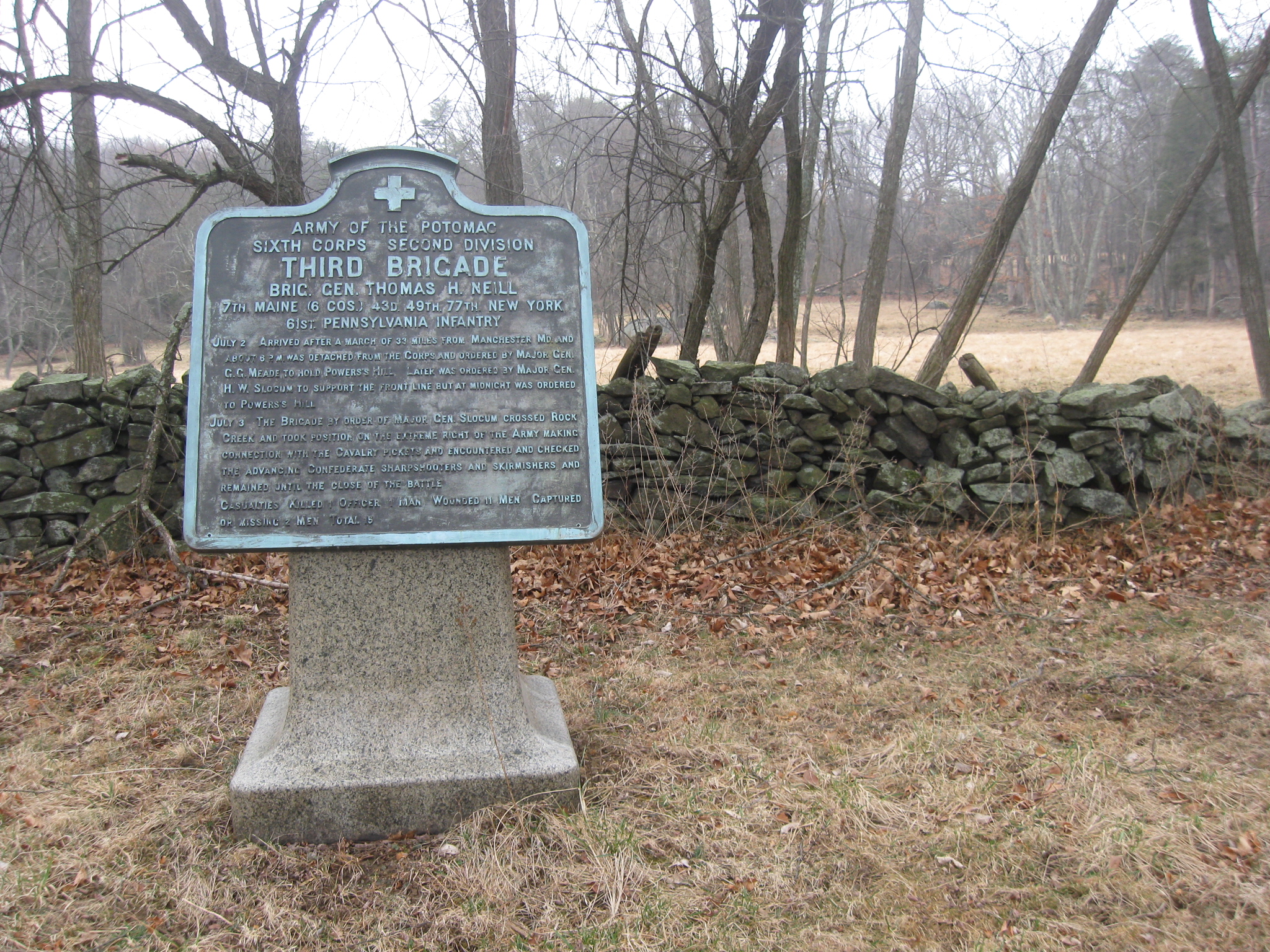
The marker to Neill’s Brigade. This view was taken facing northwest at approximately 3:30 PM on Sunday, March 15, 2009.
The 77th New York Infantry Regiment was placed on Powers’ Hill as infantry support for the artillery located there. This view was taken facing northwest at approximately 3:30 PM on Sunday, March 15, 2009.
The right flank marker of the 43rd New York. This view was taken facing northwest at approximately 3:30 PM on Sunday, March 15, 2009.
Looking southwest down Neill Avenue… This view was taken facing southwest at approximately 3:30 PM on Sunday, March 15, 2009.
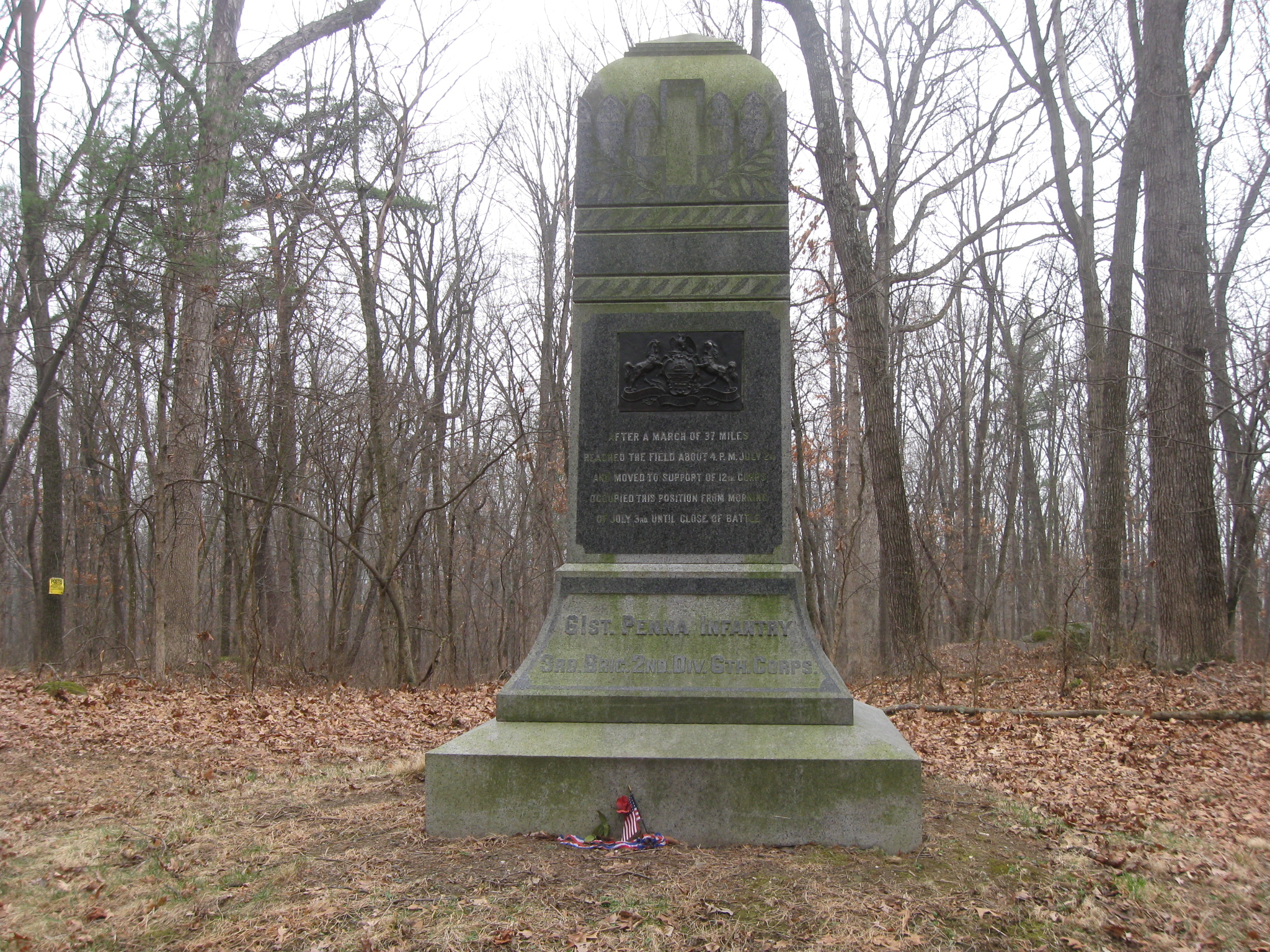
Looking northeast up Neill Avenue to the monument of the 61st Pennsylvania. This view was taken facing northeast at approximately 3:30 PM on Sunday, March 15, 2009.
The left flank marker to the 61st Pennsylvania, and the monument is in the background. This view was taken facing northeast at approximately 3:30 PM on Sunday, March 15, 2009.
A closer view of the marker to the 61st Pennsylvania. This view was taken facing southwest at approximately 3:30 PM on Sunday, March 15, 2009.
The monument to the 61st Pennsylvania Infantry Regiment was dedicated on July 24, 1888. This view was taken facing southeast at approximately 3:30 PM on Sunday, March 15, 2009.
The right side of the monument to the 61st Pennsylvania has an inscription. This view was taken facing southeast at approximately 3:30 PM on Sunday, March 15, 2009.
The inscription states that this was the extreme right of the infantry of the Army of the Potomac. This view was taken facing southeast at approximately 3:30 PM on Sunday, March 15, 2009.
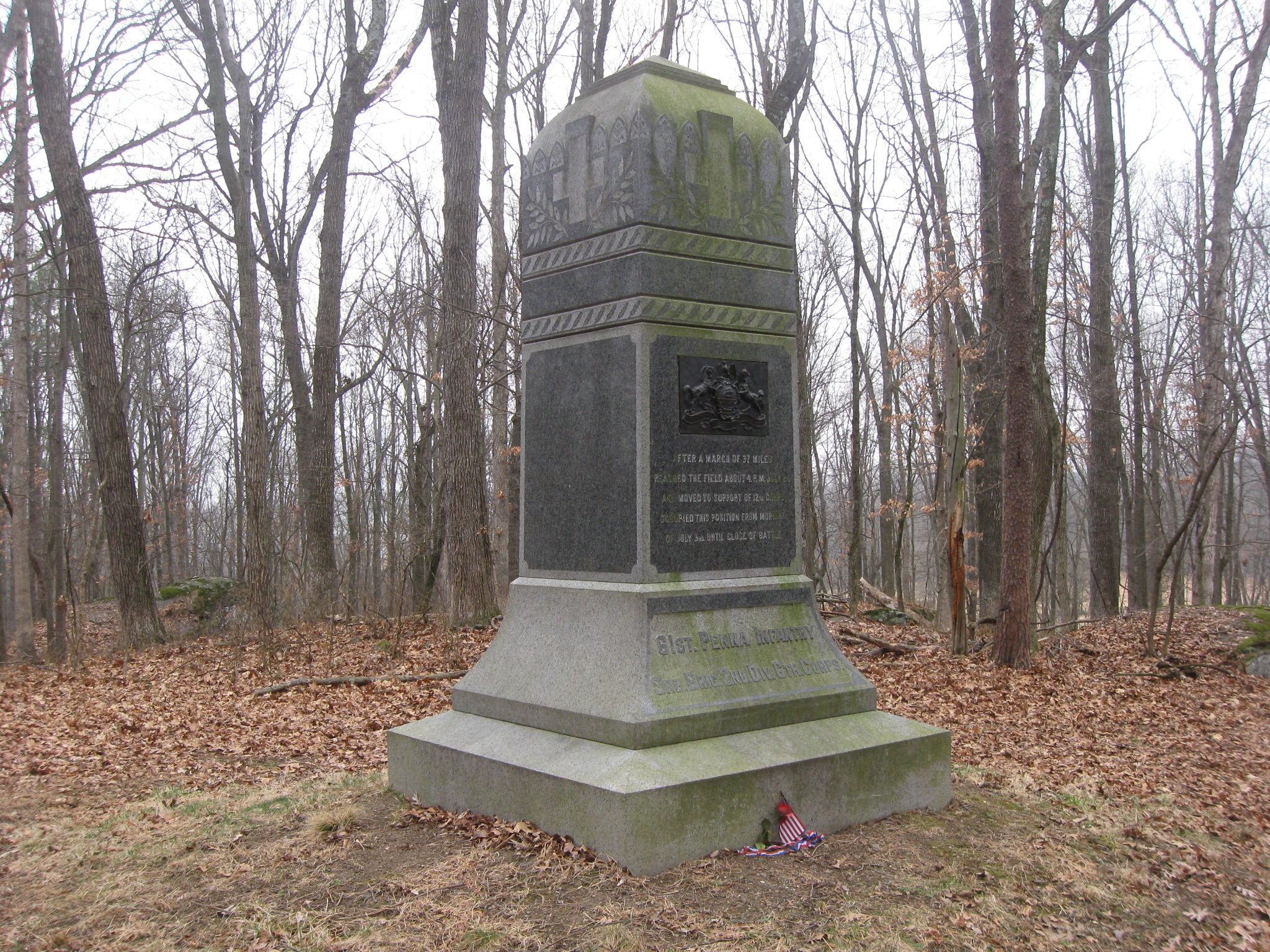
The left side of the monument does not have an inscription. During the Civil War, the regiment lost 19 officers and 218 enlisted men killed and mortally wounded and one officer and 100 enlisted men by disease. Total 338. This view was taken facing southwest at approximately 3:30 PM on Sunday, March 15, 2009.
The rear of the monument. The 61st Pennsylvania claimed to have had more officers killed than any other regiment during the Civil War. This view was taken facing northwest at approximately 3:30 PM on Sunday, March 15, 2009.
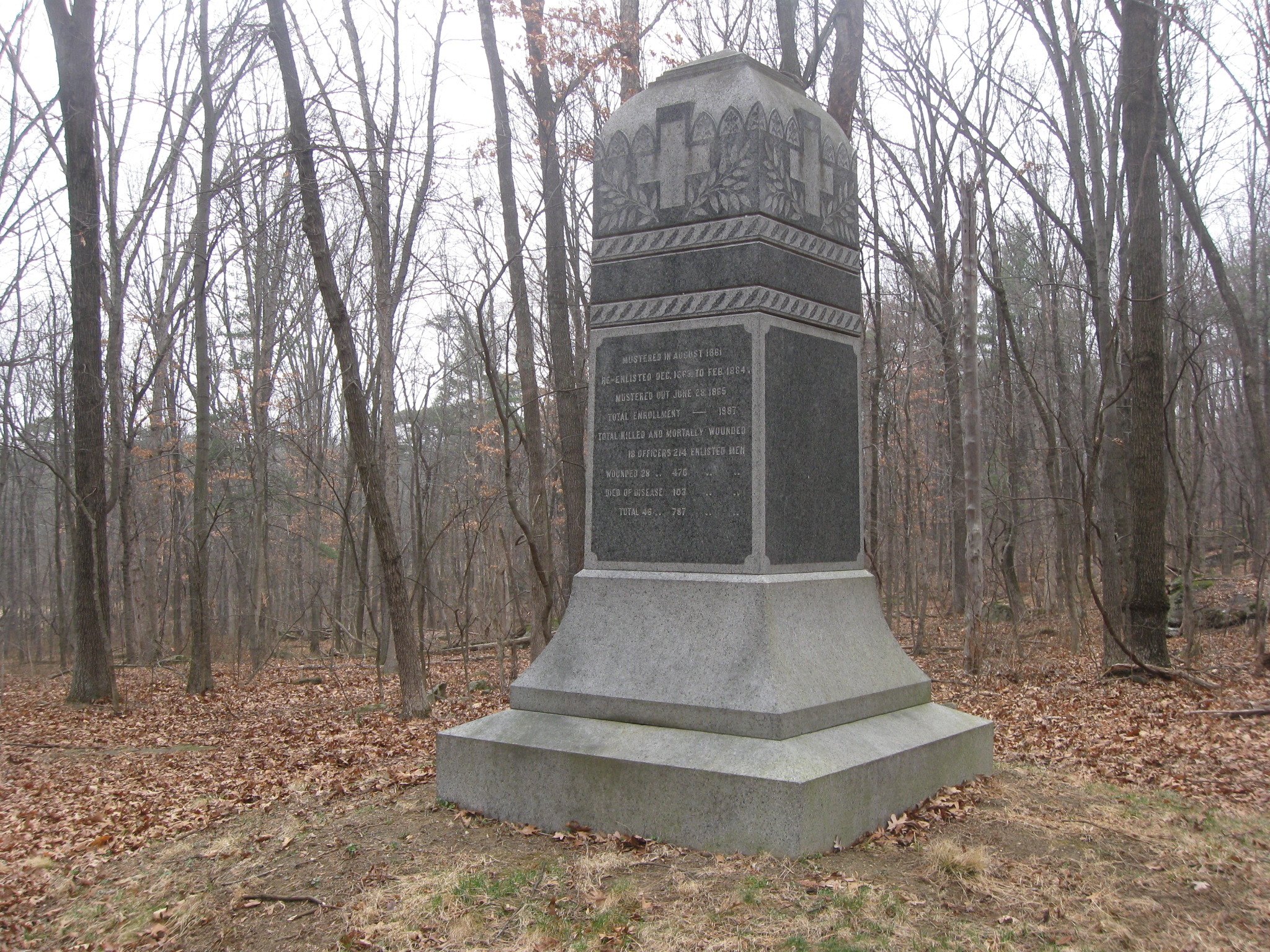
The closeup of the rear of the monument shows that when the wounded are added to the killed and mortally wounded, the total losses for the 61st Pennsylvania during the war was 787. This view was taken facing north at approximately 3:30 PM on Sunday, March 15, 2009.
In video #3, Ted Gajewski shows us the marker to the right of the infantry of the Army of the Potomac. This view was taken facing southwest to southeast at approximately 3:30 PM on Sunday, March 15, 2009.
Here are the markers that Ted showed us in video #3. The stone marker is the right flank marker to the 61st Pennsylvania Infantry Regiment. This view was taken facing southeast at approximately 3:30 PM on Sunday, March 15, 2009.
See our previous posts on Gettysburg Licensed Battlefield Guides:
Gettysburg Guide Room: The Final Days on March 8, 2008.
Lights Out at the Electric Map on April 13, 2008.
New Guide Room at the New Visitor Center on April 19, 2008.
New Association of Licensed Battlefield Guide Office and Library Opens on August 25, 2008.
Evergreen Cemetery Headstone Damage with LBG Deb Novotny on October 20, 2008.
Camp Letterman with LBG Phil Lechak here.
Gettysburg Artillery with LBG George Newton here.
“Mammy’s Little Baby Loves Guided Tours” with LBG Charlie Fennell on November 23, 2008.
Bucktails on McPherson’s Ridge Part 1 with LBG Rich Kohr on November 26, 2008.
Gettysburg Licensed Battlefield Guide Exam 2008 on December 6, 2008.
Gettysburg Hawk Hunting with Licensed Battlefield Guide Dave Weaver on December 14, 2008.
Colonel Edward Ephraim Cross with LBG Rich Bellamy here.
Licensed Battlefield Guide Rich Kohr: William Wible’s Gettysburg Quarry on January 21, 2009.
The Gettysburg Electric Trolley with LBG Rich Kohr here
ACHS Battle of Gettysburg Civil War Research Room with LBG Tim Smith on February 10, 2009.
Lutheran Theological Seminary Cupola with LBG Tim Smith here
John F. Kennedy’s Gettysburg Visit with LBG Richard Goedkoop here.
Gettysburg Harrisburg Railroad with LBG Don Walters here.
Neill Avenue (Lost Avenue) with LBG Ted Gajewski here.