Licensed Battlefield Guide Rich Kohr: Gettysburg Electric Trolley Part 5
February 6, 2009
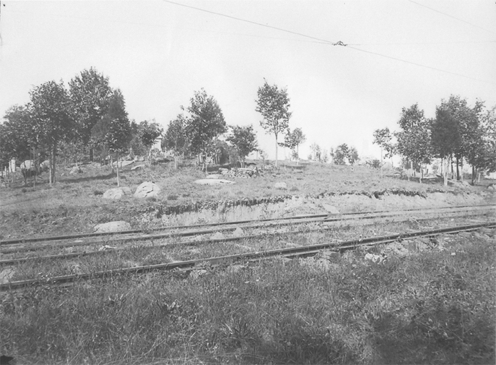
The Gettysburg Electric Trolley ran through the area of Rose’s Wheatfield. The Stony Hill/Loop area is in the left background. The Wheatfield is in the right background. Brooke Avenue is at the camera position running towards the trolley. This photograph is courtesy of the National Park Service. This view was taken facing north between 1893 and 1916.
We are continuing our series on the Gettysburg Electric Trolley, which existed from 1893 to 1916. In our first trolley post, Gettysburg Licensed Battlefield Guide Rich Kohr took us from the Electric Power Station in the town of Gettysburg, over Cemetery Hill to Evergreen Cemetery. In our second post, Rich took the trolley out of Evergreen Cemetery, around the area of the “old” National Park Service Visitor Center, and showed how it was not allowed to continue along its proposed route on Cemetery Ridge. Our third post showed that because the trolley couldn’t travel on Cemetery Ridge, the “outbound” route needed to go to the Emmitsburg Road, where there were some other options, including double tracks at the Klingel Farm. The fourth trolley post took the trolley south along the Emmitsburg Road to where it turns on the Wheatfield Road at the Peach Orchard. Today’s trolley post takes the trolley into the Wheatfield area.
Licensed Battlefield Guide Rich Kohr: The Gettysburg Electric Trolley Part 1 on January 23, 2009.
Licensed Battlefield Guide Rich Kohr: The Gettysburg Electric Trolley Part 2 on January 26, 2009.
Licensed Battlefield Guide Rich Kohr: The Gettysburg Electric Trolley Part 3 on January 29, 2009.
Licensed Battlefield Guide Rich Kohr: The Gettysburg Electric Trolley Part 4 on February 2, 2009.
This map shows the route of the trolley. The red line is the trolley route. The green line is the route of the Gettysburg/Harrisburg/Reading Railroad. For some time, the trolley used the Gettysburg/Harrisburg/Reading Railroad line from the Emmitsburg Road to Little Round Top to help establish a circular route on the battlefield. The blue sections are where the trolley had double or passing tracks. The white stars are the locations where we filmed videos, which we have numbered. Today’s post features videos #s 18-21. This map was created at approximately 8:30 PM on Monday, February 2, 2009.
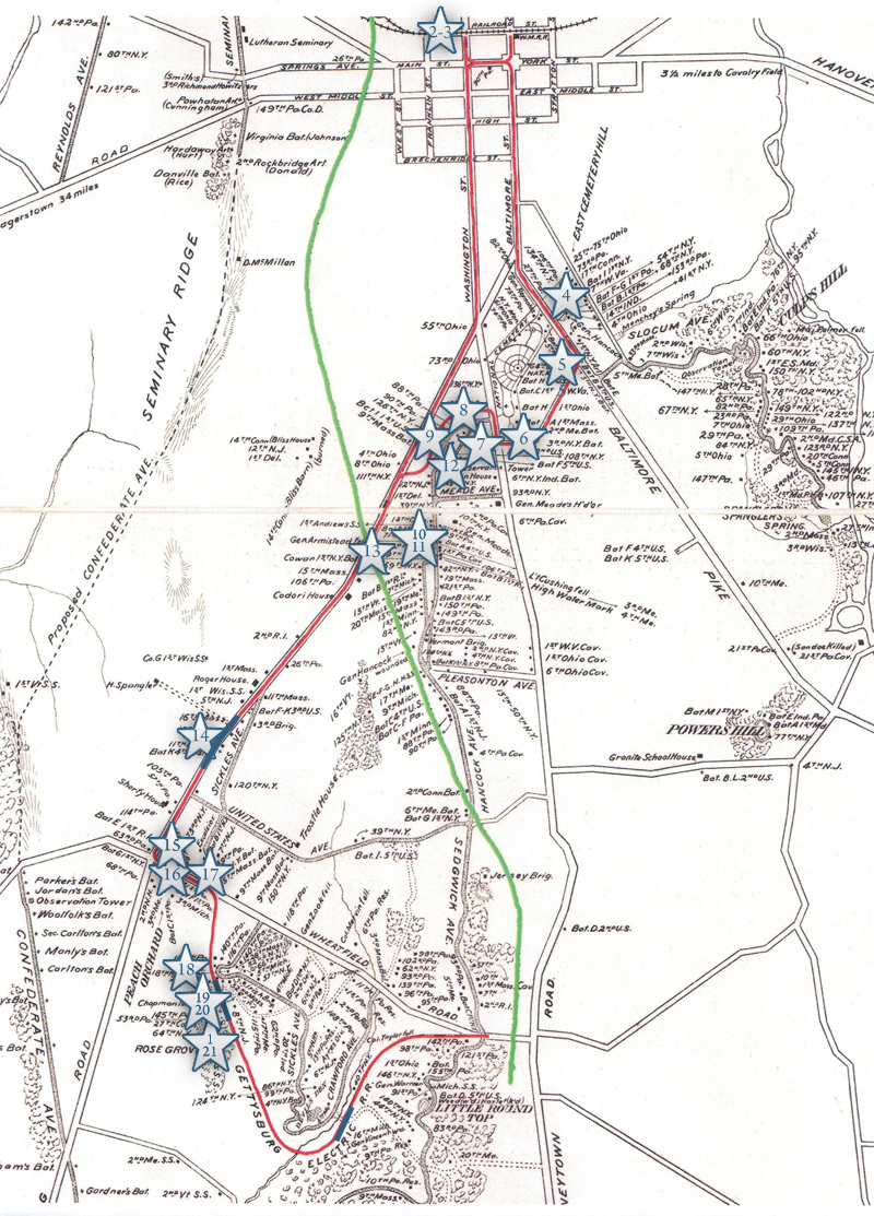
Before we show our first video for this post (Video #18), we want to give you an idea of where the trolley bed is that Rich will be showing us. We are in the woods west of the Stony Hill/Loop area, and the Rose Farm is in the background behind Rich. Rich is standing on the trolley bed. This view was taken facing southwest at approximately 2:00 PM on Sunday, January 18, 2009.
Rich is still standing on the trolley bed in the woods west of the Stony Hill/Loop area, and you will see near his feet a small drainage ditch that he will point out in Video #18. The monument to the 118th Pennsylvania Infantry Regiment (Corn Exchange Regiment) is in the background. This view was taken facing northeast at approximately 2:00 PM on Sunday, January 18, 2009.
In Video #18 (Videos 1-17 were featured on our first four trolley posts), Rich is standing in the trolley bed at the woods just west of the “Stony Hill/Loop” area. Rich shows us a drainage ditch along the trolley bed which eventually empties into Rose’s Run. This view starts by facing southwest until we turn to the west, northwest, north, northeast, and eventually to the east and southeast at approximately 2:00 PM on Sunday, January 18, 2009.
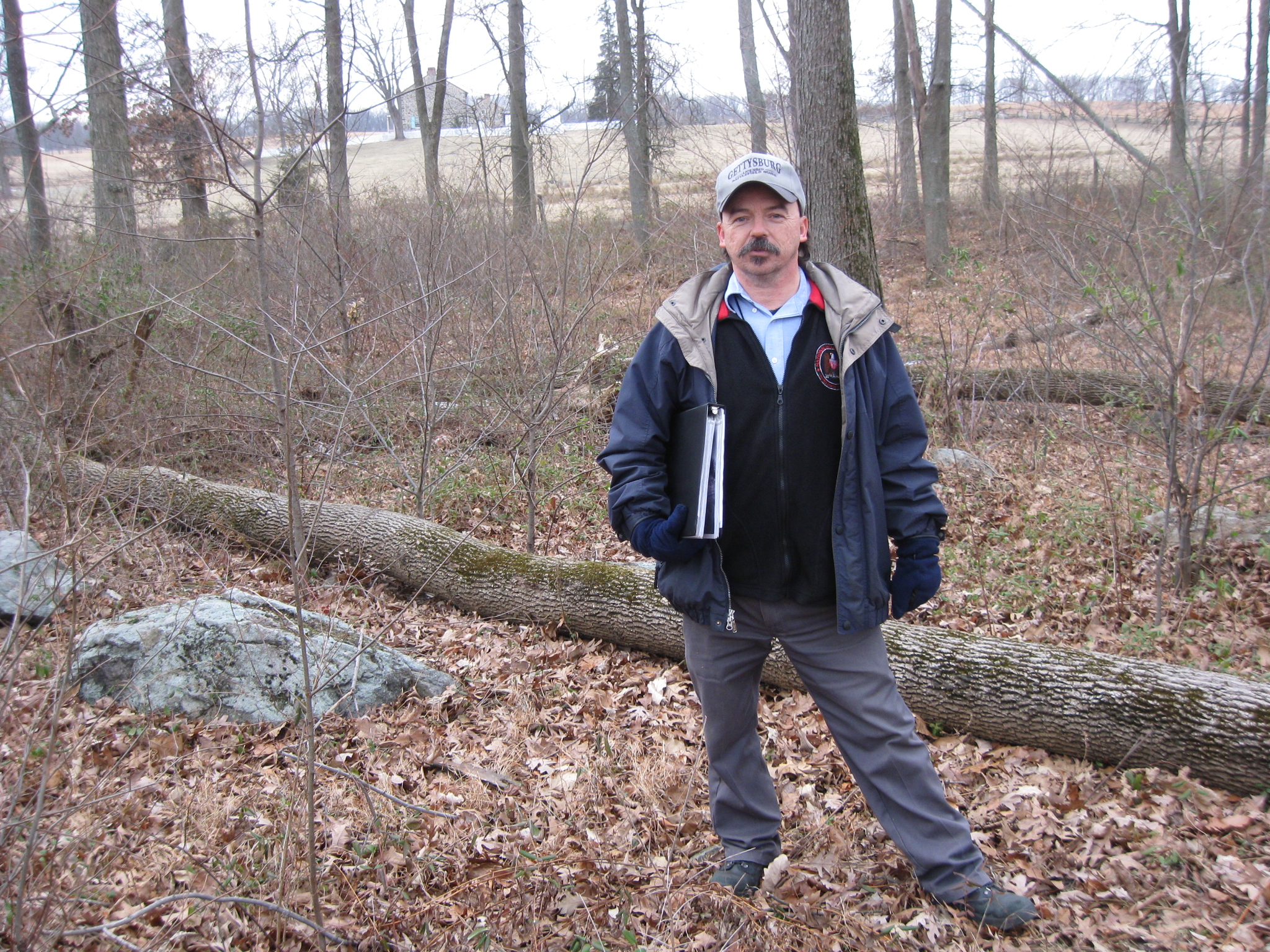
We have moved a little farther to the southwest from Video #18. The Stony Hill/Loop Area is behind (northeast of) Rich. A car is preparing to pass behind the monument to the 22nd Massachusetts Infantry Regiment. This is the area where Rich was standing for Video #19. This view was taken facing northeast at approximately 2:00 PM on Sunday, January 18, 2009.
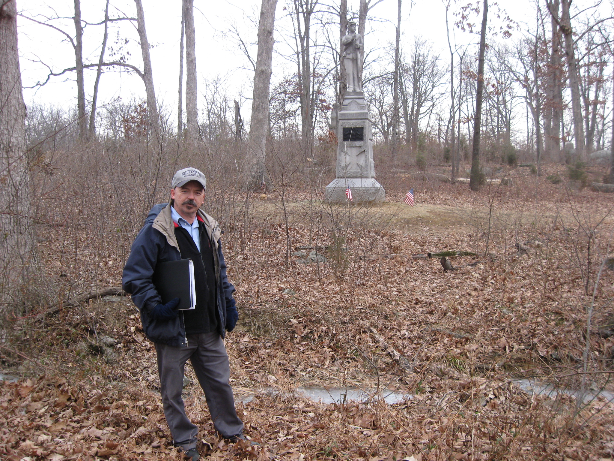
In Video #19 we are pointing the camera to the southwest to the Rose Farm. We then swing the camera to the northeast where Rich shows us a photograph taken of the double tracks or passing tracks in this area. He also shows us that part of the area that they dug out to make the trolley bed is still visible. This view was taken facing southwest to northeast at approximately 2:00 PM on Sunday, January 18, 2009.
This is the photograph that Rich showed us in Video #19. Visible are the double or passing tracks, and the electric wires. Also visible is the area on the side of the hill cut away to make room for the trolley bed, and the monument to the 22nd Massachusetts Infantry Regiment. This photograph is courtesy of the National Park Service. This view was taken facing northeast between 1895 and 1916.
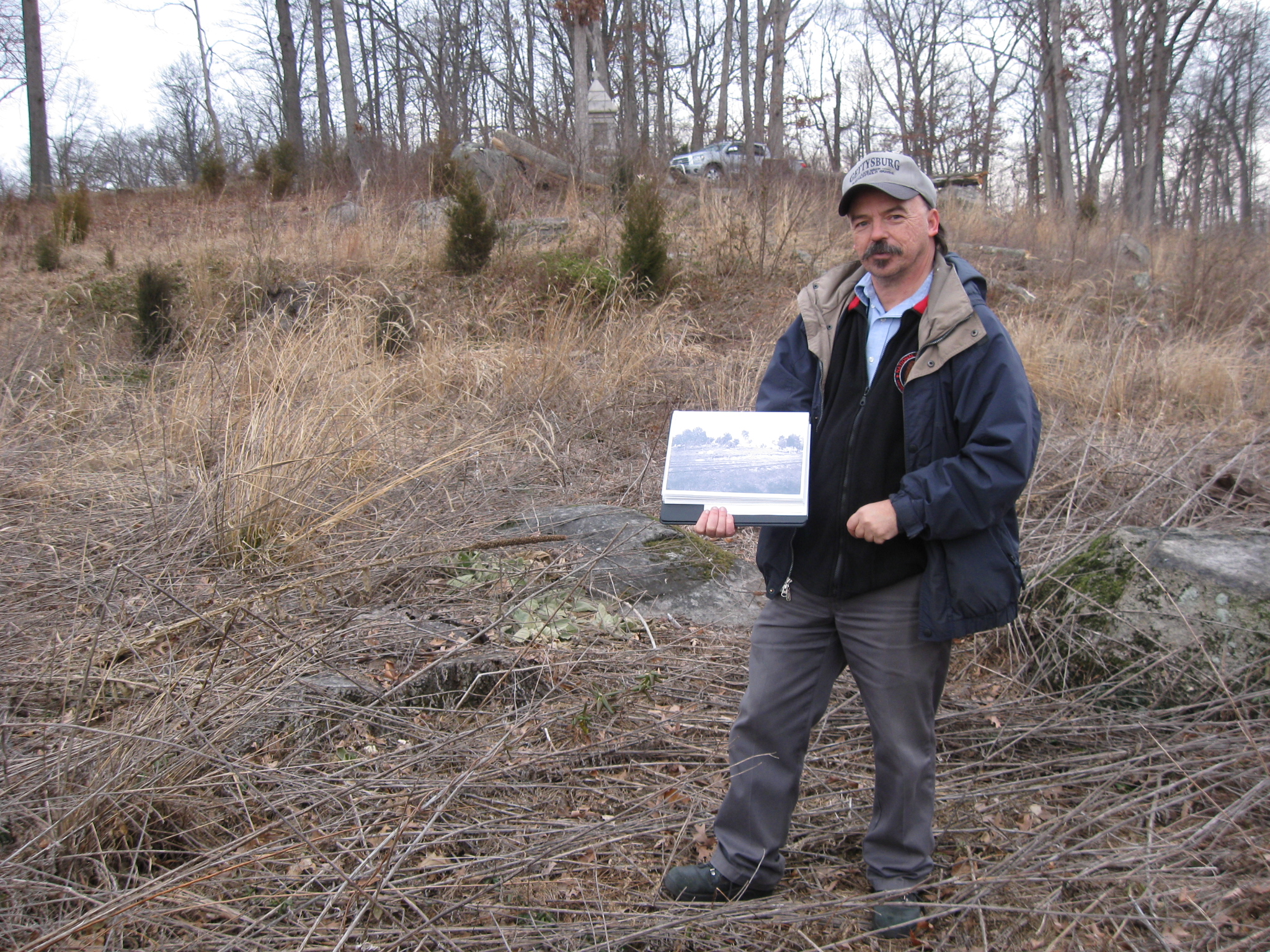
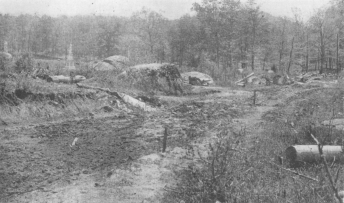
In Video #20, Rich is holding a photograph showing how the construction of the trolley bed impacted the Wheatfield area. He lines up the photo with rocks and monuments in the background. This view was taken facing east to southeast at approximately 2:00 PM on Sunday, January 18, 2009.
Here is the photograph Rich was showing in the previous video. The monuments in the background include those to the 110th Pennsylvania (dedicated September 11, 1889) and the 8th New Jersey (dedicated June 30, 1888). Big Round Top is in the right background. This photograph was featured in the Harpers Weekly article on the trolley construction, “Desecration of the Battlefield.” in 1893. This view was taken facing southeast in 1893.
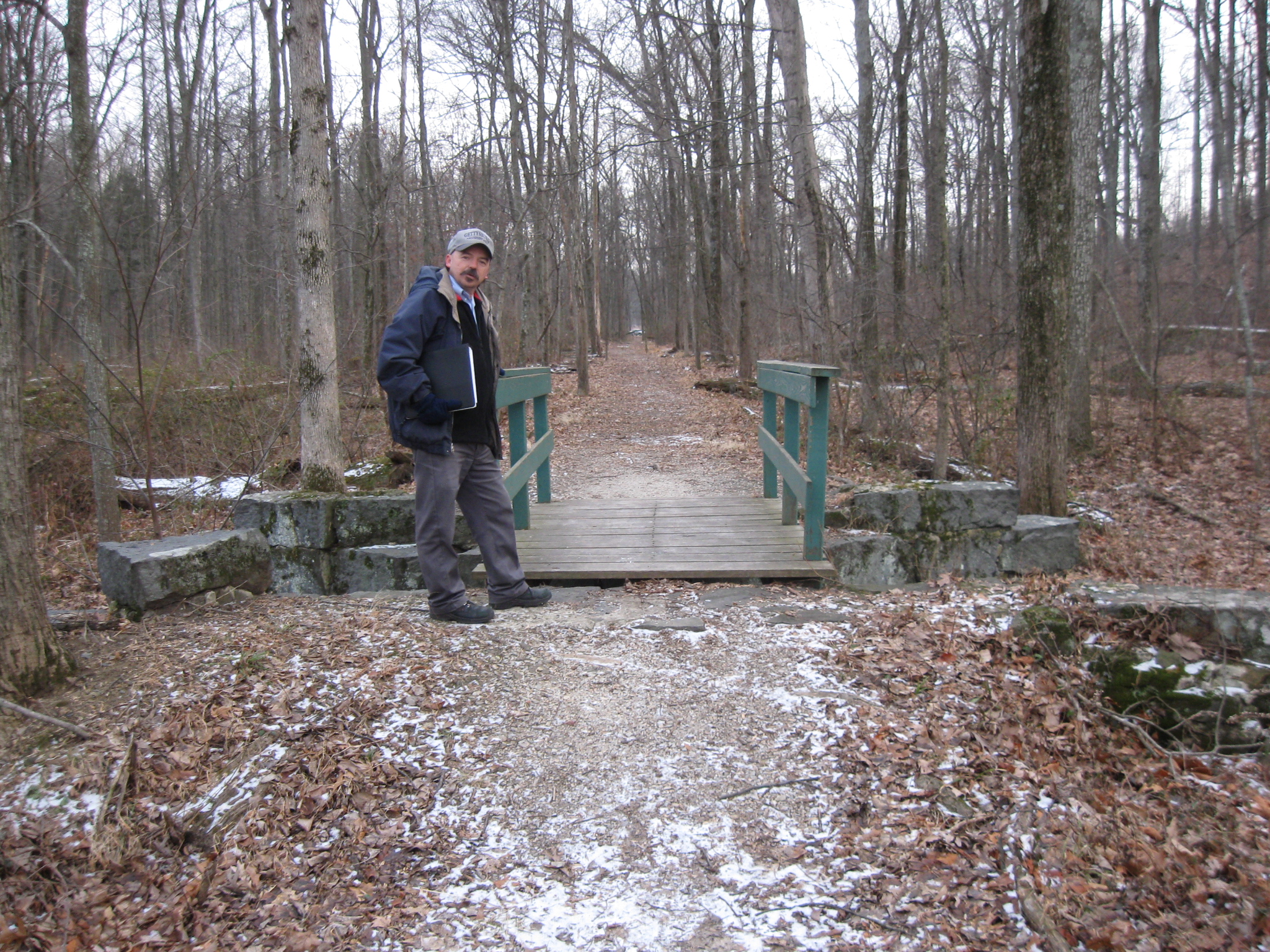
We have now moved to Rose’s Woods, and the bridge over Rose’s run, which is southwest of Rose’s Wheatfield. The remainder of the trolley bed is very visible in the distance. If one previously knew anything about the Gettysburg Electric Trolley at all, this is probably the area with which they were most familiar. Notice how this is now a small wooden bridge used for foot traffic, while the foundation used to support the trolley and its rails was much wider. In Video #21, we will be standing on the other side of the bridge looking back in this direction. This view was taken facing southeast at approximately 2:00 PM on Sunday, January 18, 2009.
In Video #21, We first show the Rose House barely visible in the background behind the trees. Rich explains how the trolley line entered Rose’s Woods, and William Wible (featured in a previous post about his flank marker quarry) had a stop on the trolley line here which included a picnic area. Rich also shows us how sturdy the foundation of the trolley bridge was. Much too sturdy to hold this small wooden foot bridge. This view was taken facing west to northwest at approximately 2:00 PM on Sunday, January 18, 2009.
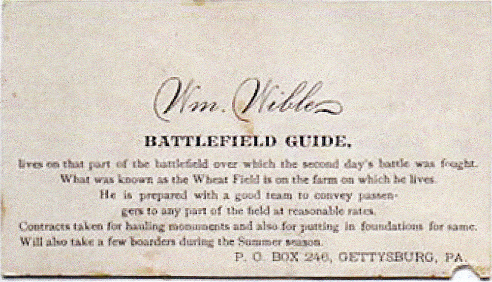
William Wible’s business card. The farm in which he lived in the 1890s was the Rose Farm. Notice how the card states that he provided foundations for monuments, which came from his rock quarry, also located in Rose’s Woods. This card is courtesy of Sue Boardman.
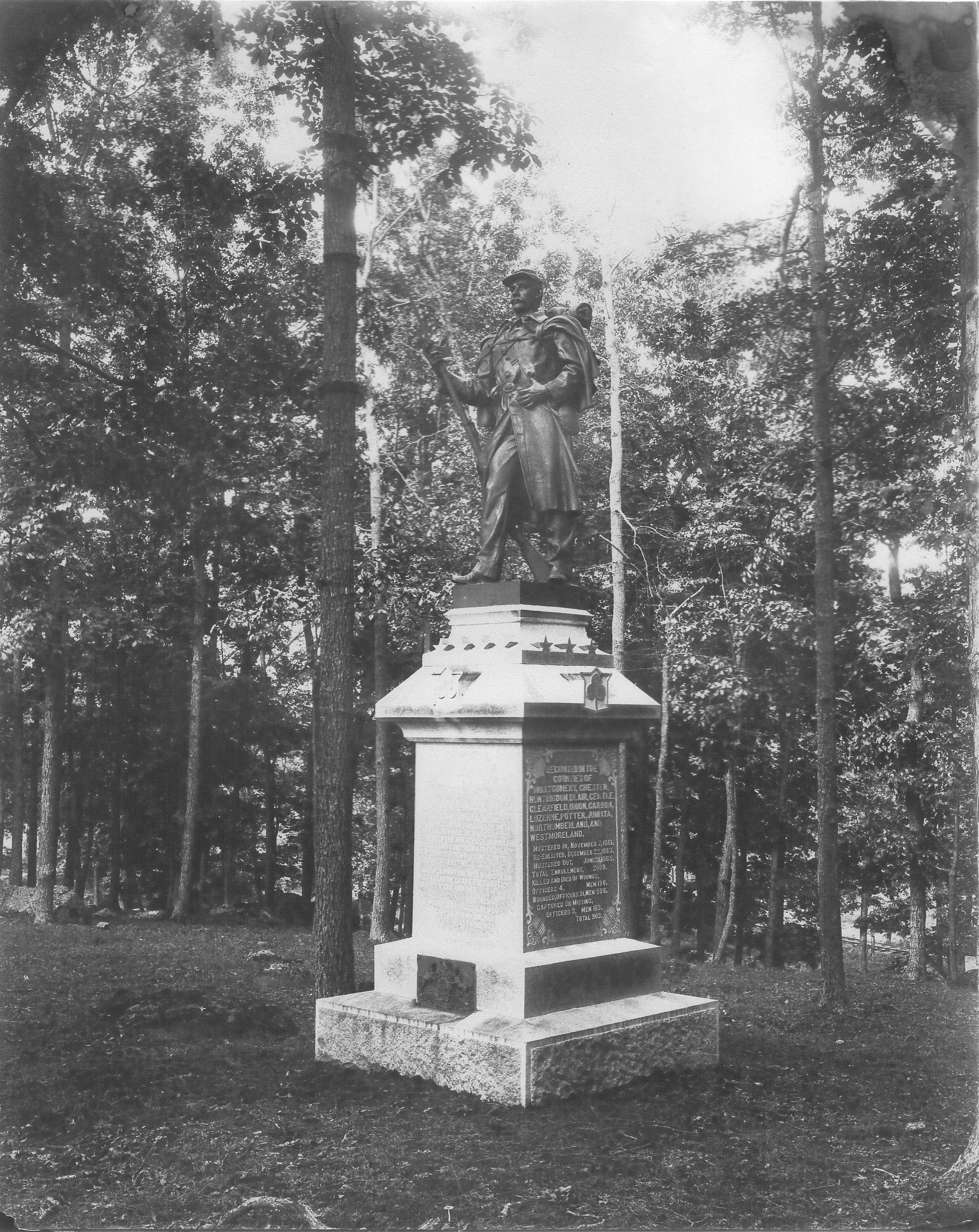
Here is the monument to the 53rd Pennsylvania Infantry Regiment on Brooke Avenue. This monument was dedicated on September 11, 1889. Look behind the monument near the bottom right of the photograph. The trolley tracks near the bridge over Rose’s Woods, which we showed in Video #21, are visible. This photograph is courtesy of Sue Boardman. This view was taken facing northwest between 1893 and 1916.
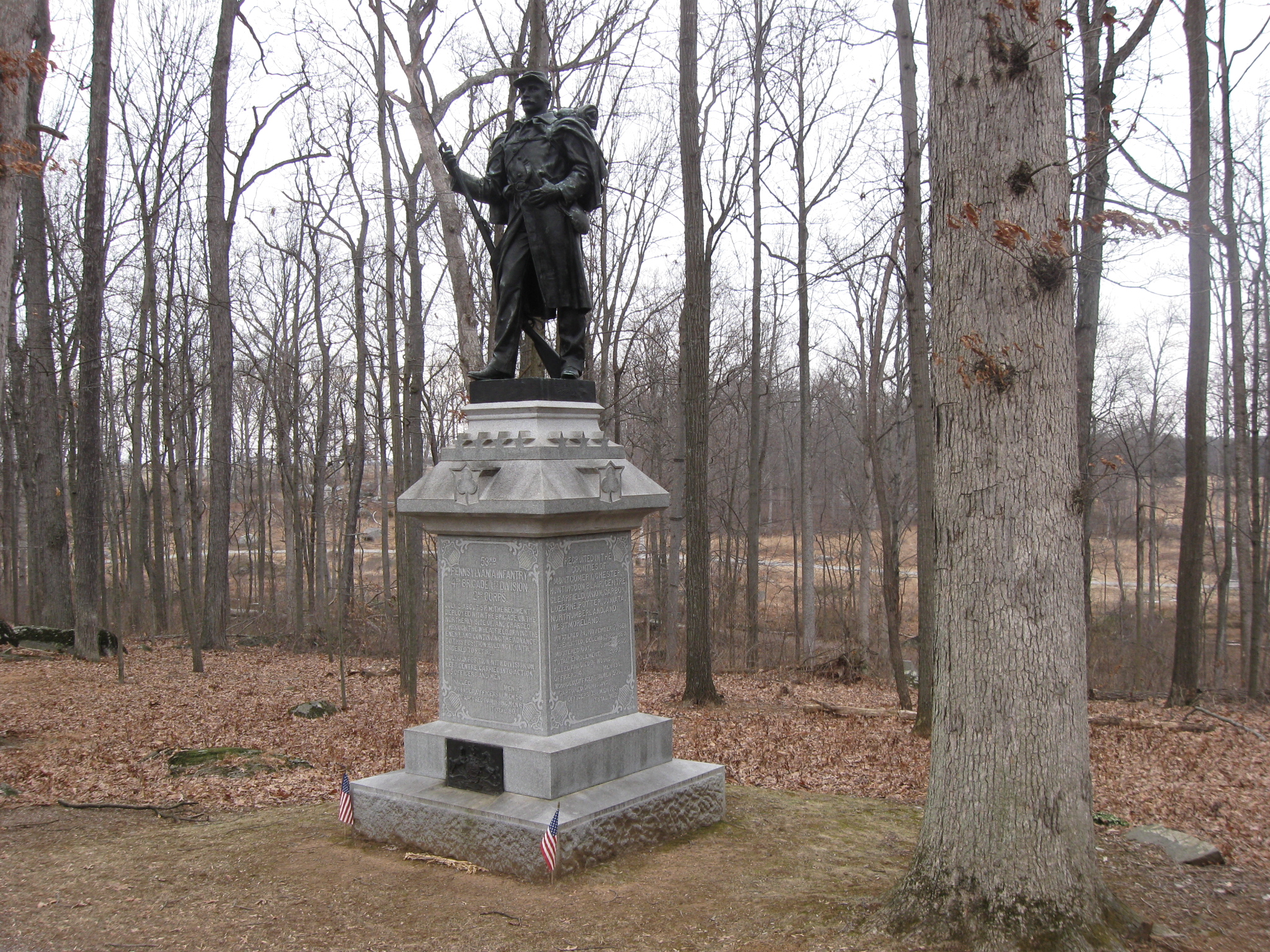
Here is a modern version of the previous view. The trolley bed is now a light brown trail in the bottom right of this photograph. This view was taken facing northwest at approximately 2:00 PM on Sunday, January 18, 2009.
See our previous posts on Gettysburg Licensed Battlefield Guides:
Gettysburg Guide Room: The Final Days on March 8, 2008.
Lights Out at the Electric Map on April 13, 2008.
New Guide Room at the New Visitor Center on April 19, 2008.
New Association of Licensed Battlefield Guide Office and Library Opens on August 25, 2008.
Evergreen Cemetery Headstone Damage with LBG Deb Novotny on October 20, 2008.
Camp Letterman Part 1 with LBG Phil Lechak on November 15, 2008.
Camp Letterman Part 2 with LBG Phil Lechak on November 17, 2008.
Camp Letterman Part 3 with LBG Phil Lechak on February 4, 2009.
Gettysburg Artillery Part 1 with LBG George Newton on November 21, 2008.
“Mammy’s Little Baby Loves Guided Tours” with LBG Charlie Fennell on November 23, 2008.
Bucktails on McPherson’s Ridge Part 1 with LBG Rich Kohr on November 26, 2008.
Gettysburg Licensed Battlefield Guide Exam 2008 on December 6, 2008.
Gettysburg Hawk Hunting with Licensed Battlefield Guide Dave Weaver on December 14, 2008.
Licensed Battlefield Guide Rich Bellamy: Colonel Edward Ephraim Cross Part 1 on January 3, 2008.
Licensed Battlefield Guide Rich Bellamy: Colonel Edward Ephraim Cross Part 2 on January 5, 2009.
Licensed Battlefield Guide Rich Kohr: William Wible’s Gettysburg Quarry on January 21, 2009.
Licensed Battlefield Guide Rich Kohr: The Gettysburg Electric Trolley Part 1 on January 23, 2009.
Licensed Battlefield Guide Rich Kohr: The Gettysburg Electric Trolley Part 2 on January 26, 2009.
Licensed Battlefield Guide Rich Kohr: The Gettysburg Electric Trolley Part 3 on January 29, 2009.
Licensed Battlefield Guide Rich Kohr: The Gettysburg Electric Trolley Part 4 on February 2, 2009.