High Tide at Gettysburg: Some Photographs of Plum Run Valley
January 26, 2010
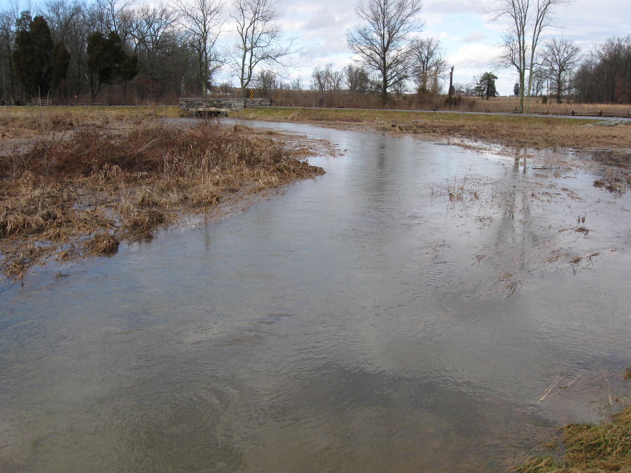
The banks of Plum Run or “Bloody Run” had difficulty containing the significant amounts of water received recently. The Round Tops are in the background. The bridge over Crawford Avenue is also visible. This view was taken facing southeast at approximately 1:45 PM on Monday, January 25, 2010.
The melting of the snow and the heavy rain on Sunday night and Monday morning, has made for some higher than usual amounts of water in Plum Run Valley. Crawford Avenue, and Warren Avenue were closed Monday until 2:00 PM because of the flooding concerns. We took a walk along Crawford Avenue, which connects the Wheatfield Road to Devil’s Den.
We’re looking east on the Wheatfield Road. This view was taken facing southeast at approximately 1:45 PM on Monday, January 25, 2010.
The drainage ditches were overflowing. The John Weikert House is in the background. This view was taken facing northeast at approximately 1:45 PM on Monday, January 25, 2010.
This fence allows the water to flow and keeps any cattle from wandering. This view was taken facing north at approximately 1:45 PM on Monday, January 25, 2010.
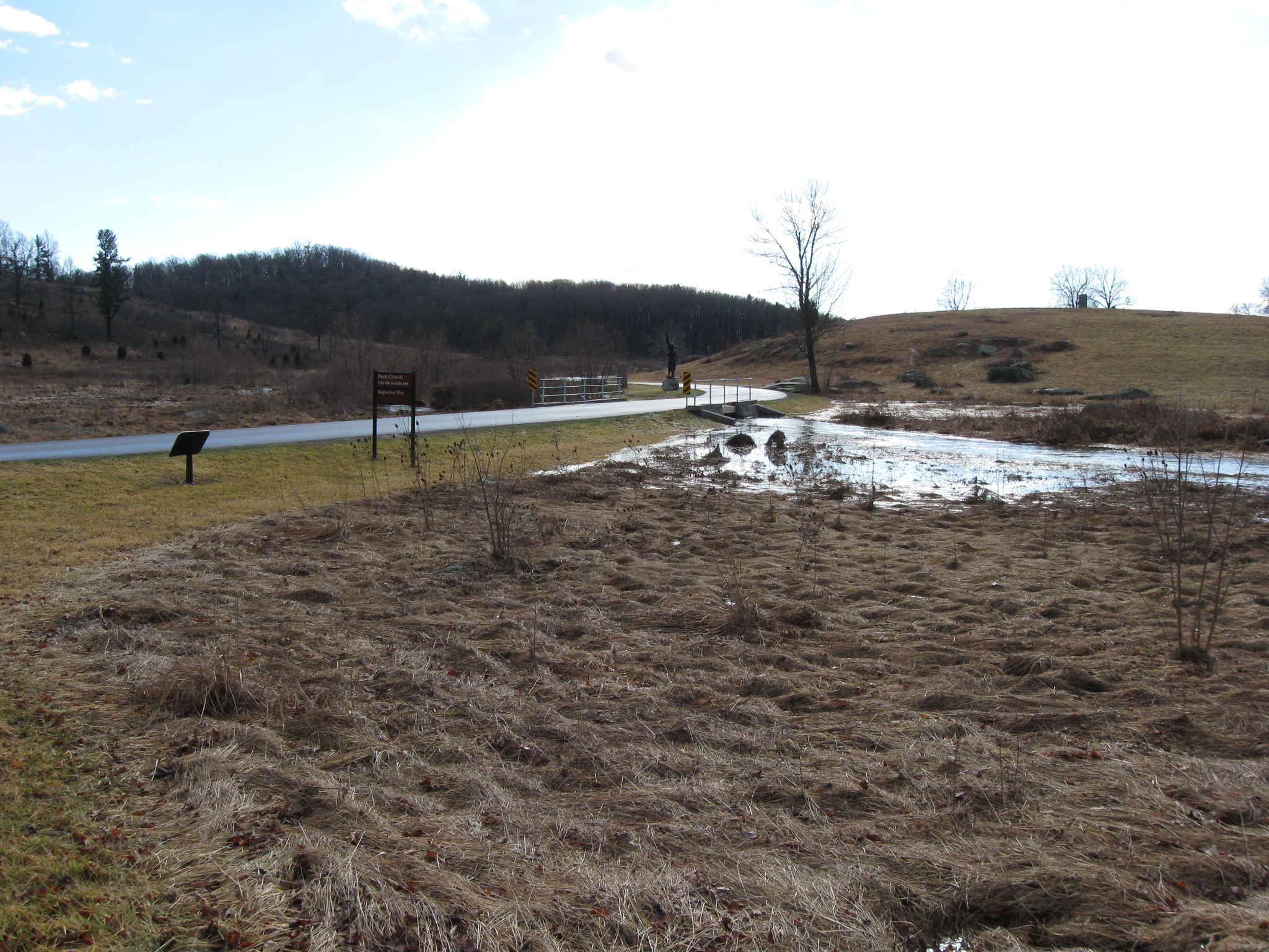
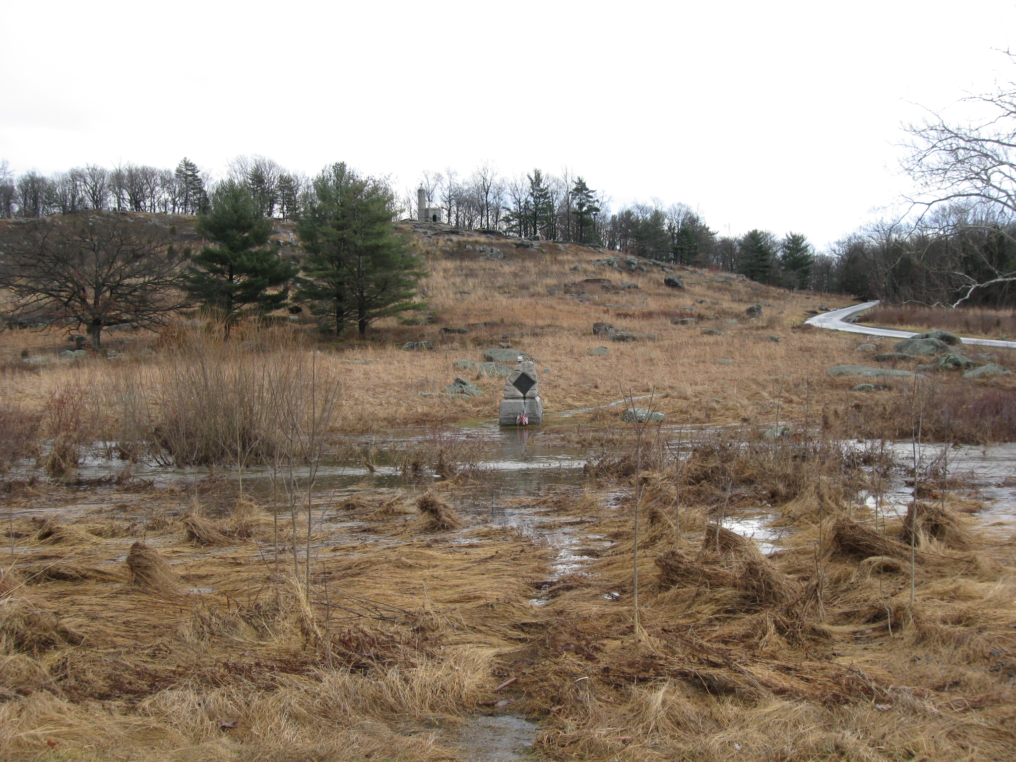
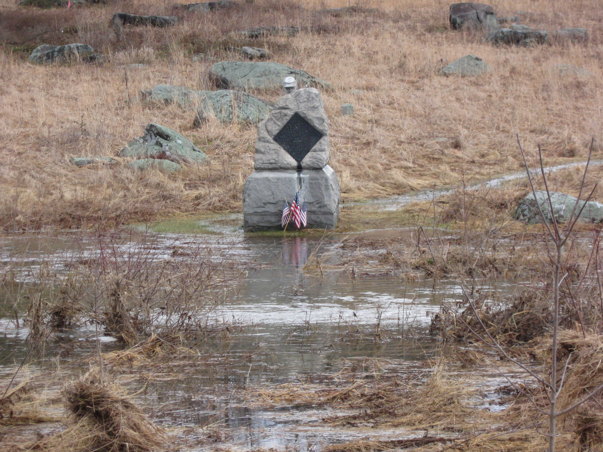
This would not be a good time to hike on the north side of the Wheatfield Road to look at the monument to the 6th Pennsylvania Reserves (35th Pennsylvania Infantry Regiment). The high ground near the Emmitsburg Road and above the Trostle Farm is in the background. This view was taken facing northwest at approximately 1:45 PM on Monday, January 25, 2010.
We’ll take a right, going south along Crawford Avenue. This view was taken facing southeast at approximately 1:45 PM on Monday, January 25, 2010.
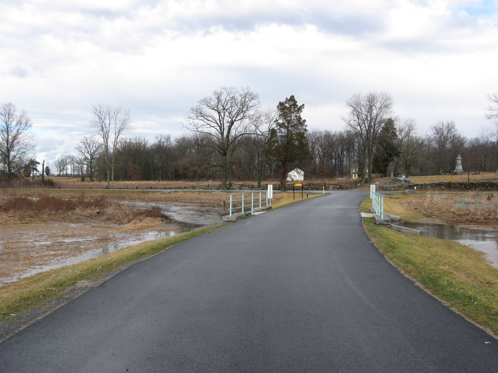
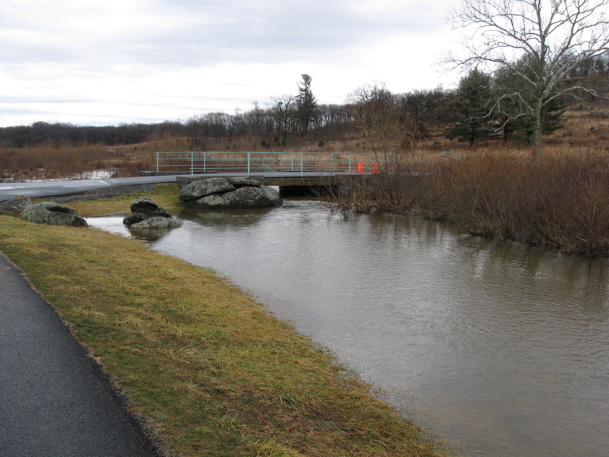
A closer view of the Crawford Avenue Bridge. This view was taken facing southeast at approximately 1:45 PM on Monday, January 25, 2010.
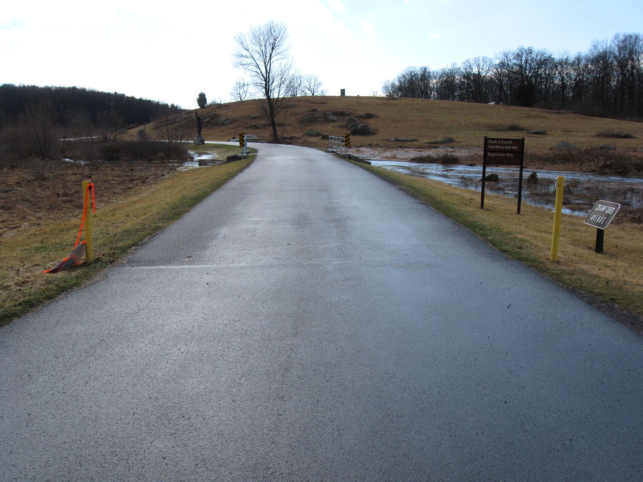
Crawford Avenue was closed on Monday until 2:00 PM because of flooding concerns. This view was taken facing southwest at approximately 1:45 PM on Monday, January 25, 2010.
We’ll move to the bridge… This view was taken facing southwest at approximately 1:45 PM on Monday, January 25, 2010.
…but before we get there, we’ll take a look back at the Wheatfield Road area where we were a few moments ago. This view was taken facing northwest at approximately 1:45 PM on Monday, January 25, 2010.
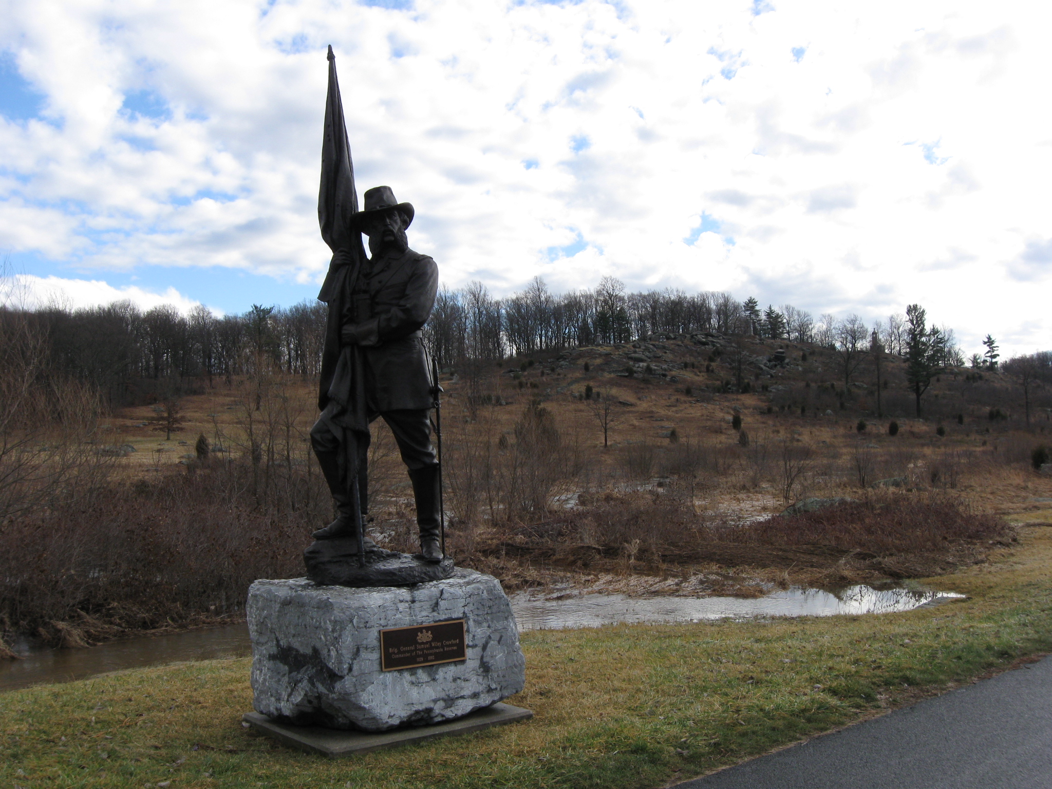
From the Crawford Avenue Bridge looking “down” Plum Run Valley. Little Round Top is in the left background. Big Round Top is in the center background. Houck’s Ridge is in the right background, as is the monument to Brigadier General Samuel Wiley Crawford. This view was taken facing south at approximately 1:45 PM on Monday, January 25, 2010.
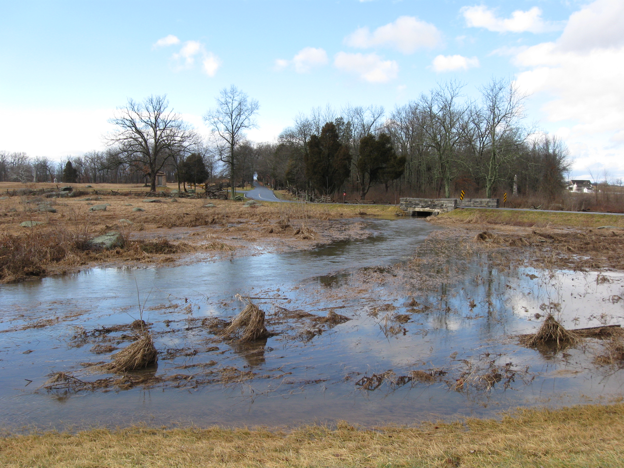
From the Crawford Avenue Bridge looking in the other direction towards the Wheatfield Road Bridge. This view was taken facing north at approximately 1:45 PM on Monday, January 25, 2010.
We’ve left the Crawford Avenue Bridge, but thought we’d turn around and take a look back. This view was taken facing north at approximately 1:45 PM on Monday, January 25, 2010.
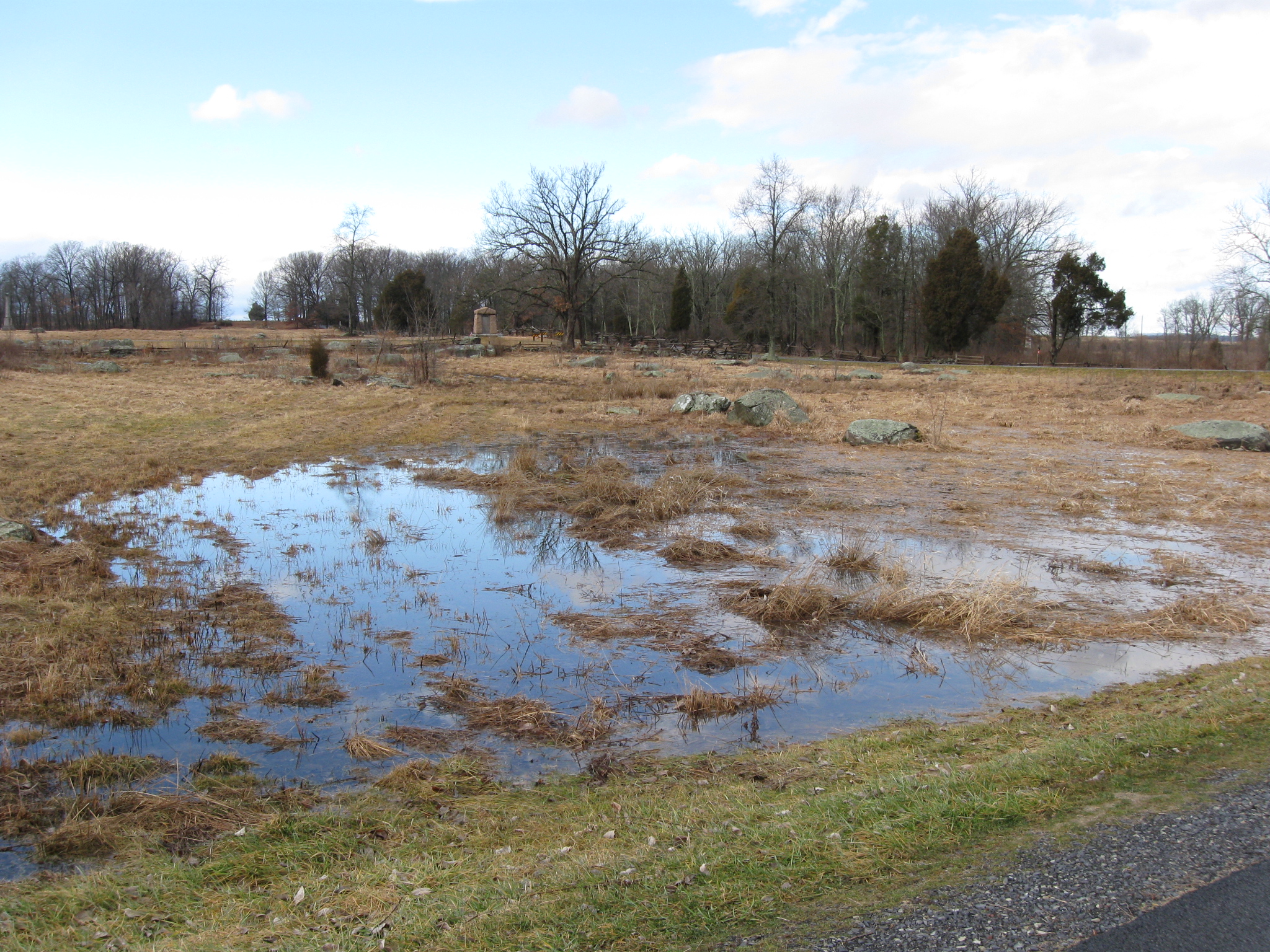
The ground on both sides of the road is very saturated. Rose’s Wheatfield (The Wheatfield) is in the background. This view was taken facing west at approximately at approximately 1:45 PM on Monday, January 25, 2010.
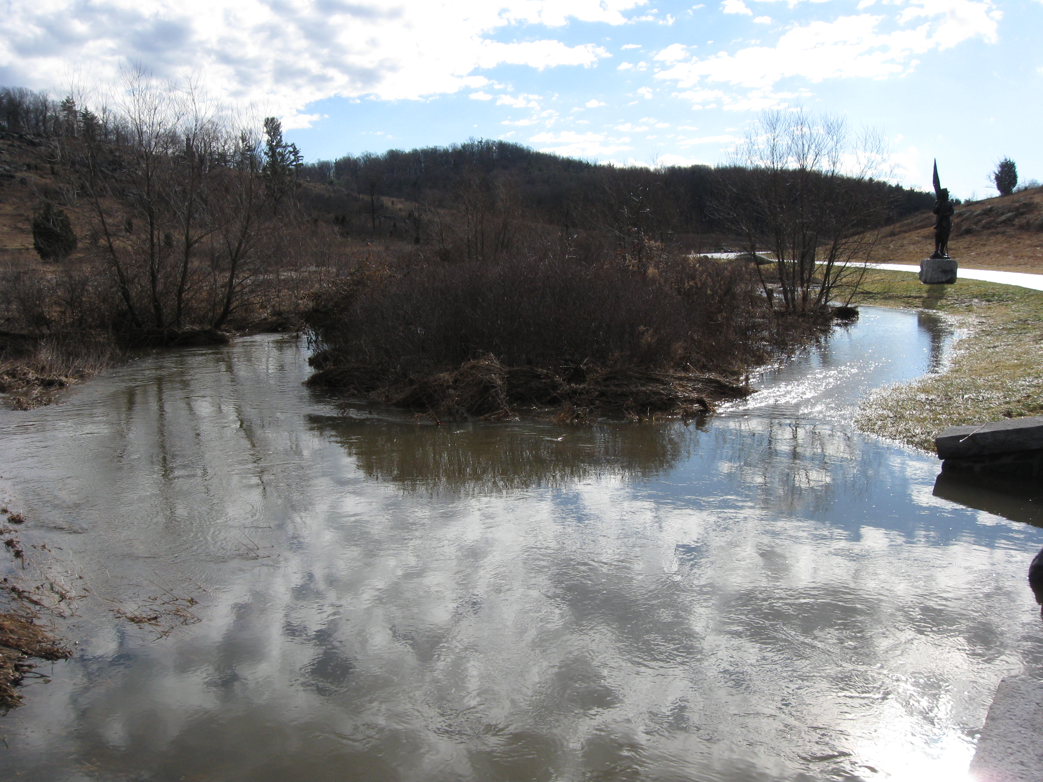
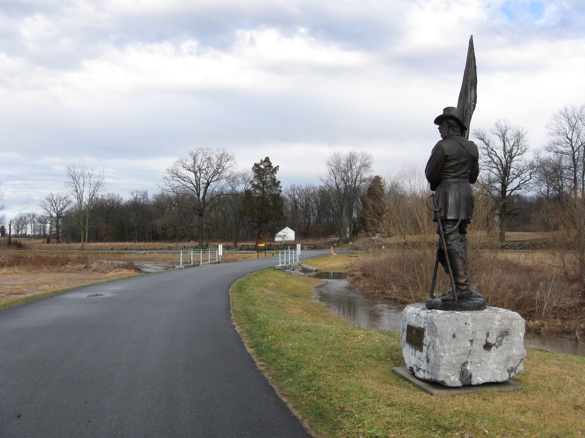
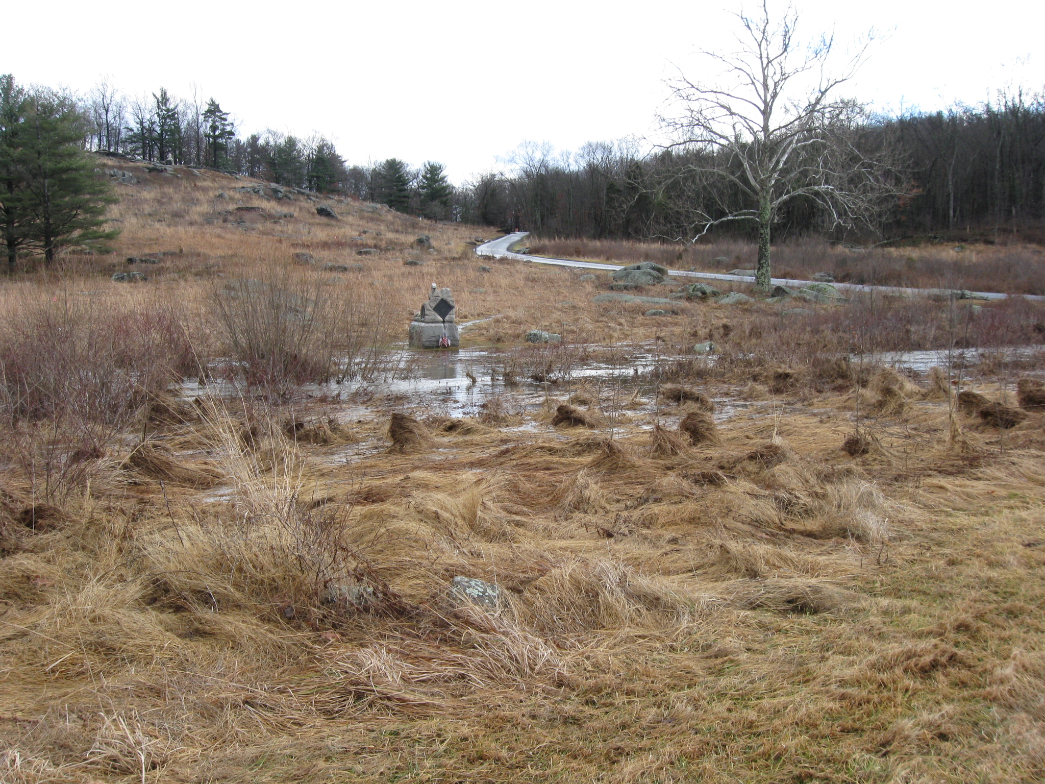
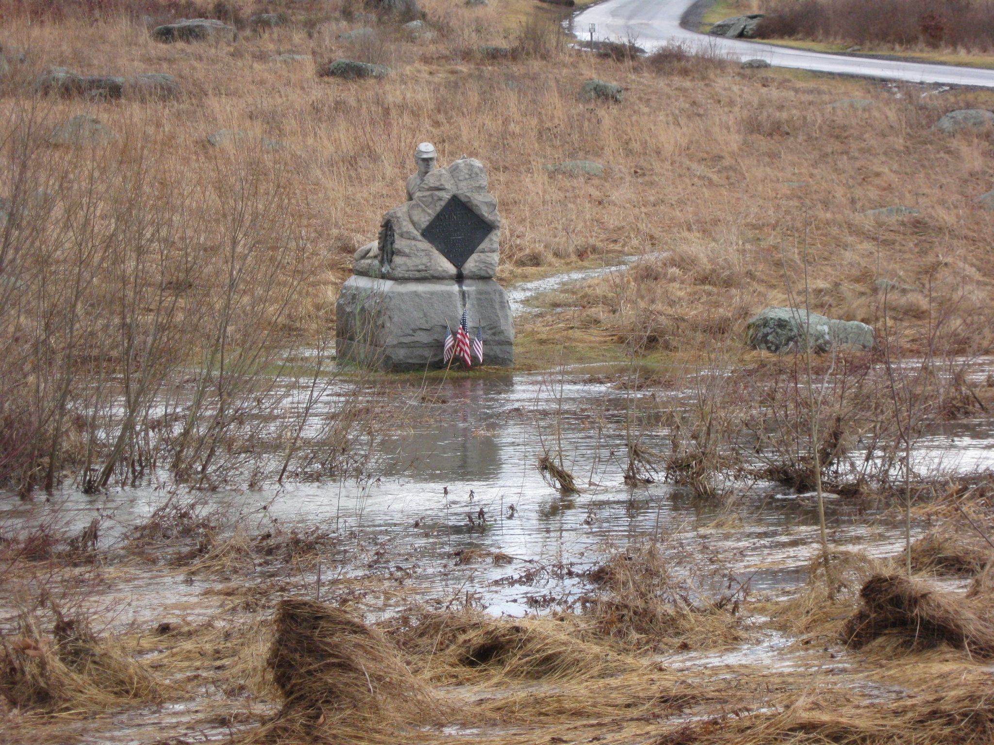
Brigadier General Samuel Wiley Crawford is holding the colors out of the water. This view was taken facing southeast at approximately 1:45 PM on Monday, January 25, 2010.
The main course of Plum Run does not run close to the road here, but the water is fairly close to the statue. This view was taken facing north at approximately 1:45 PM on Monday, January 25, 2010.
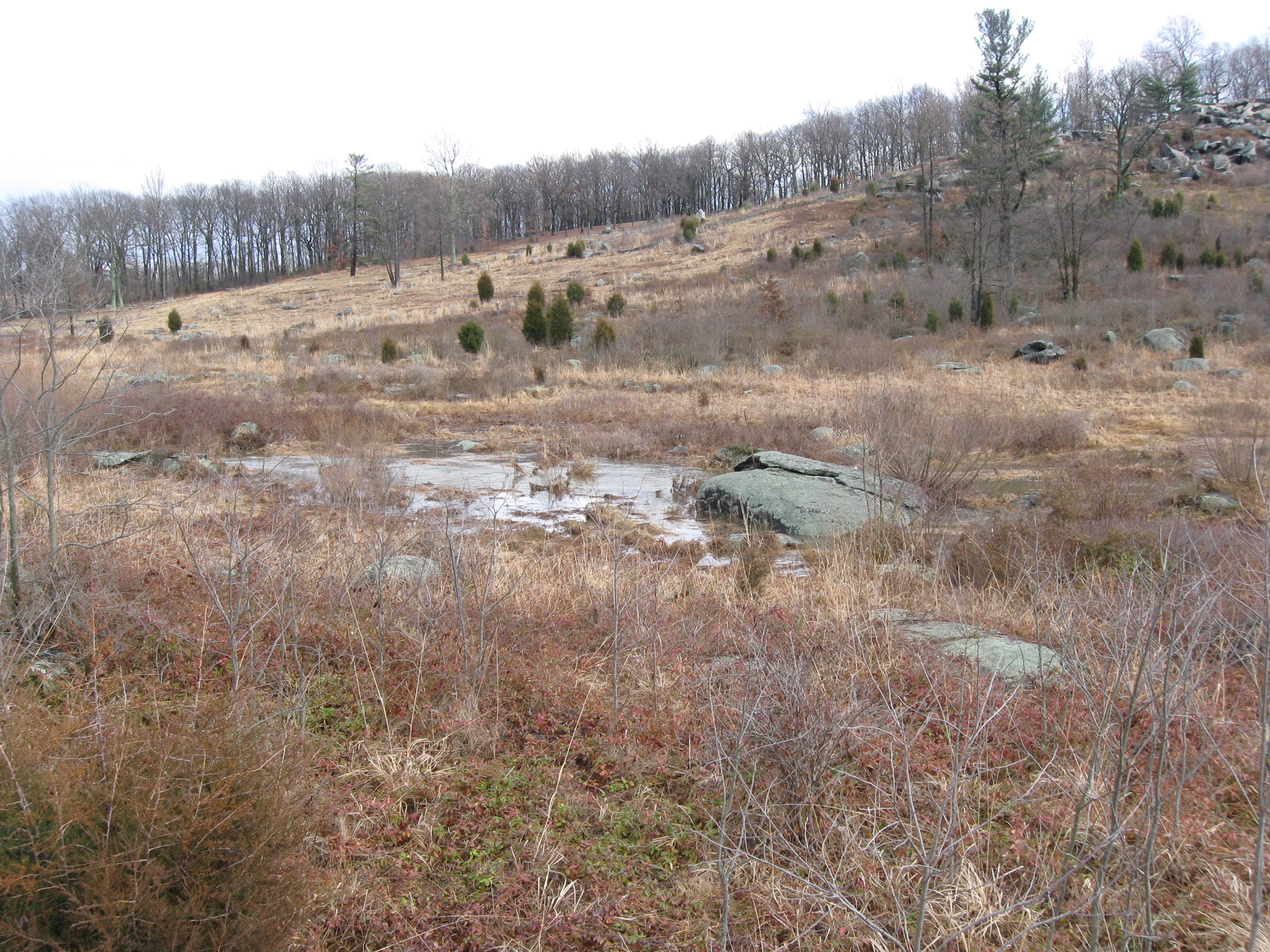
As we continued south along Crawford Avenue, we wanted to see the main course of Plum Run. So we climbed up on this rock…This view was taken facing southeast at approximately 1:45 PM on Monday, January 25, 2010.
…and the course is very visible behind the first bushes in this picture. This view was taken facing southeast 1:45 PM on Monday, January 25, 2010.
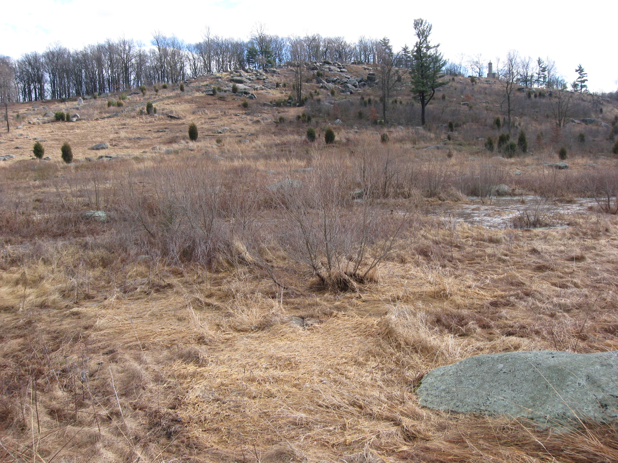
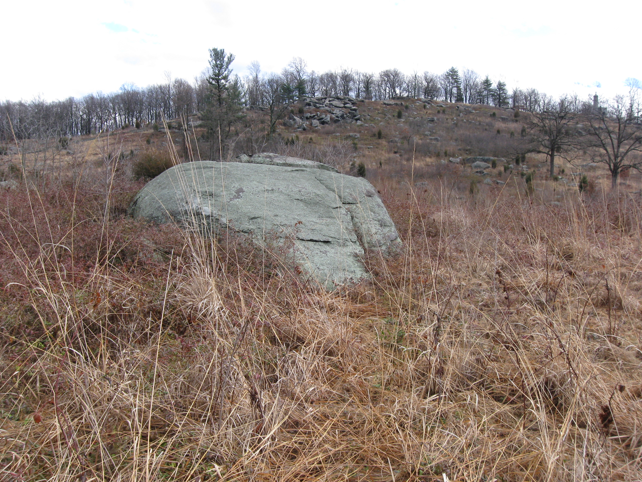
Moving approximately a hundred yards farther south, and we lost sight of Plum Run again, so we decided to climb on this rock. This view was taken facing east at approximately at approximately 1:45 PM on Monday, January 25, 2010.
Plum Run moves from left to right, or north to south, and is shown here “breaking” around the large rock. This view was taken facing northeast at approximately 1:45 PM on Monday, January 25, 2010.
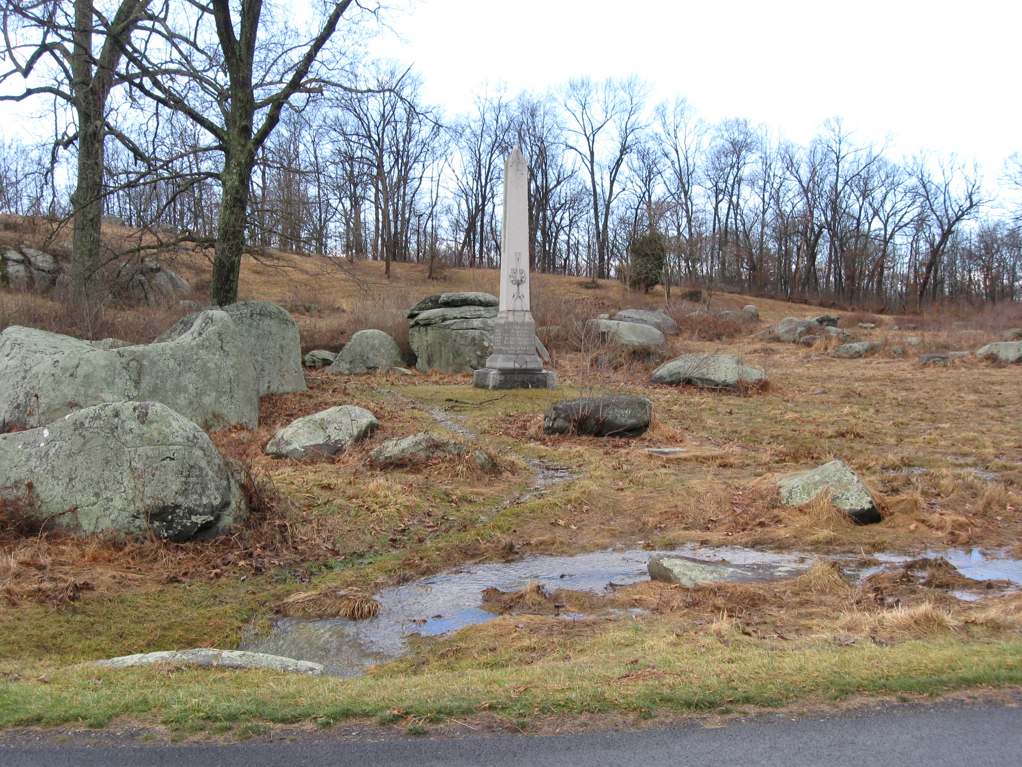
We’re now even with the monument to the 6th New Jersey Infantry Regiment. Notice the water emptying into the drainage ditch. This view was taken facing west at approximately 1:45 PM on Monday, January 25, 2010.
Here Plum Run flows closer to Crawford Avenue. This view was taken facing southeast at approximately 1:45 PM on Monday, January 25, 2010.
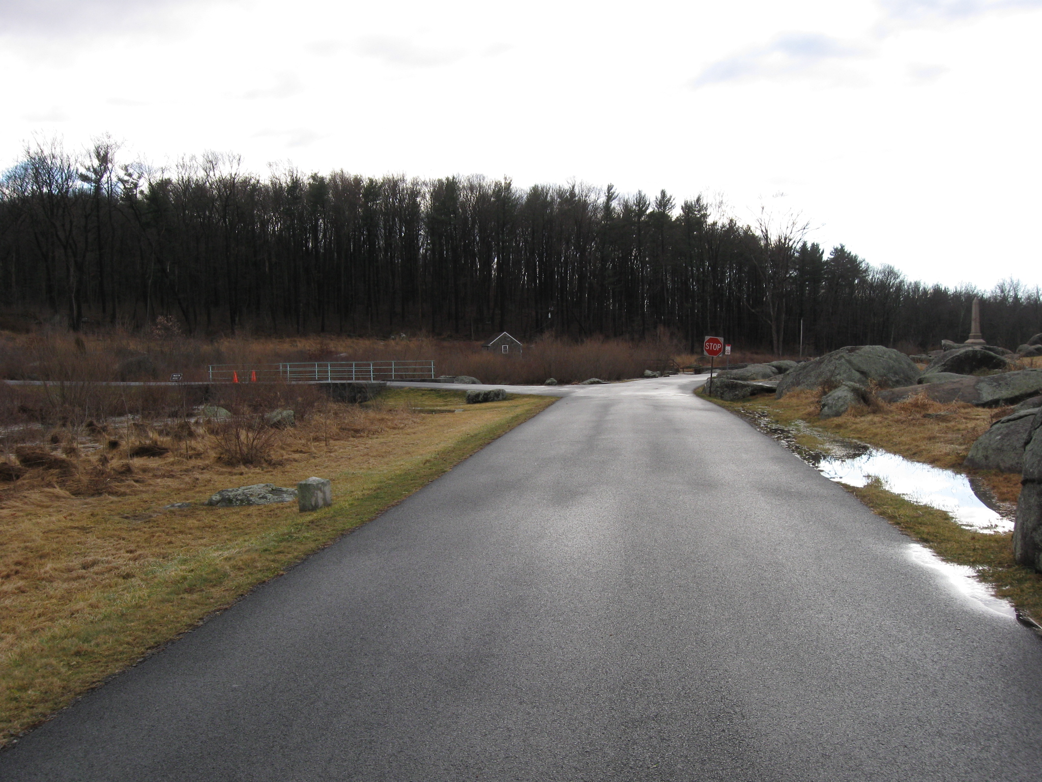
We are approaching the Devil’s Den area. Warren Avenue, which was also closed for most of Monday, joins Crawford Avenue at the stop sign. This view was taken facing southwest at approximately 1:45 PM on Monday, January 25, 2010.
Here’s the monument to the 40th New York Infantry Regiment… This view was taken facing southeast at approximately 1:45 PM on Monday, January 25, 2010.
…which appears to be floating on Plum Run. Or maybe they’re preparing for an amphibious assault. This view was taken facing southeast at approximately 1:45 PM on Monday, January 25, 2010.
The monument to the 40th New York Regiment is in the water. The “castle-like” monument to the 44th New York Infantry Regiment is much drier on top of Little Round Top. This view was taken facing east at approximately 1:45 PM on Monday, January 25, 2010.
The monument to the 40th New York is actually on some landscaped/raised earth. This view was taken facing east at approximately 1:45 PM on Monday, January 25, 2010.
We’re now at the junction of Warren Avenue and Crawford Avenue. This view was taken facing northeast at approximately 1:45 PM on Monday, January 25, 2010.
This view was taken facing northeast at approximately 1:45 PM on Monday, January 25, 2010.
Standing on the Warren Avenue Bridge looking “up” Plum Run Valley from the direction from which we came. This view was taken facing north at approximately 1:45 PM on Monday, January 25, 2010.
Standing on the Warren Avenue Bridge looking towards Devil’s Den. This view was taken facing southwest at approximately 1:45 PM on Monday, January 25, 2010.
We are continueing on Crawford, looking back at the Warren Avenue Bridge… This view was taken facing northeast at approximately 1:45 PM on Monday, January 25, 2010.
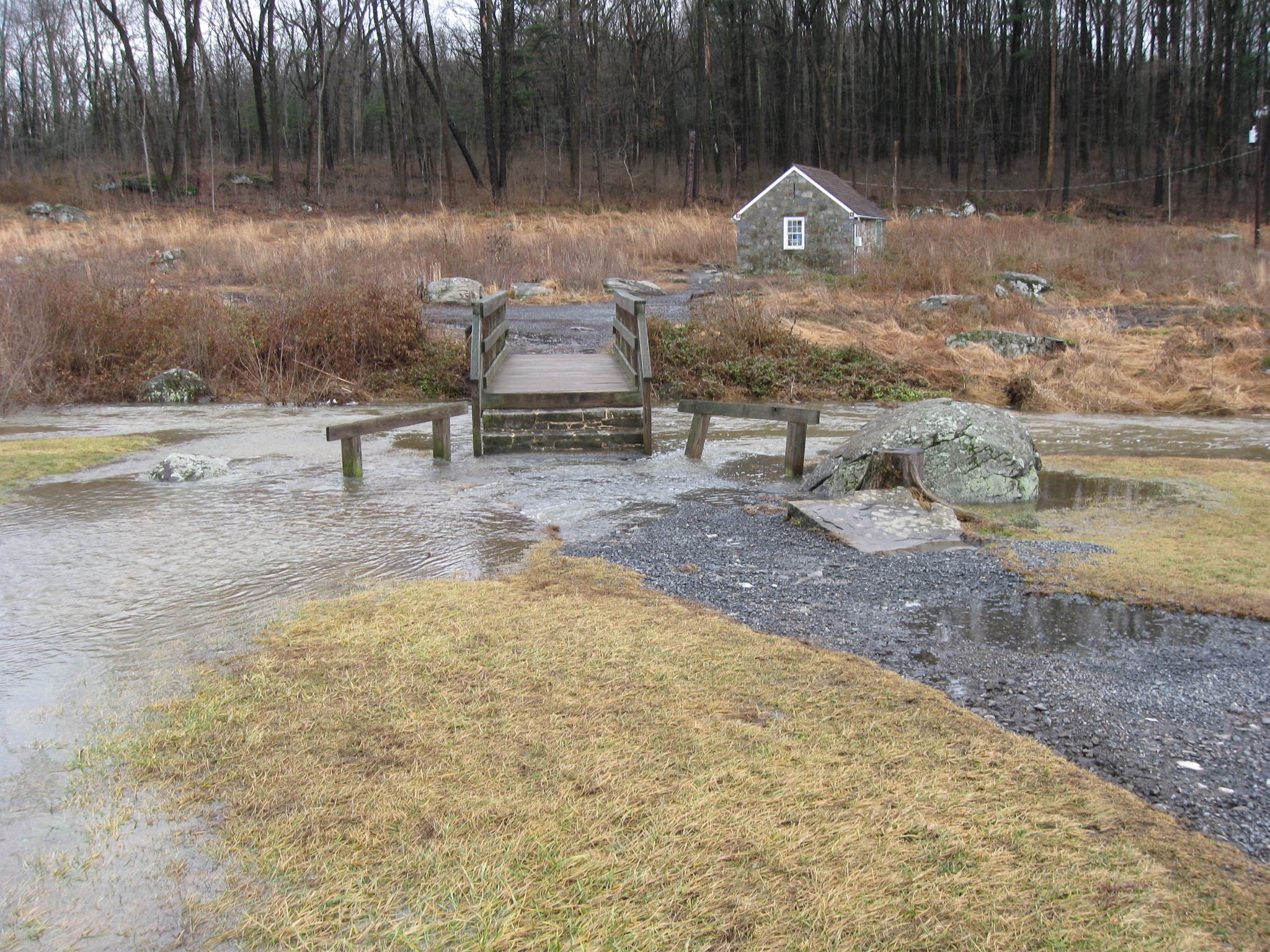
…and towards the first parking spaces and the wooden foot bridge over Plum Run. This view was taken facing southeast at approximately 1:45 PM on Monday, January 25, 2010.
The water is not standing still as it may appear in these still pictures… This view was taken facing southeast at approximately 1:45 PM on Monday, January 25, 2010.
…so we decided to shoot some film to give you an idea of the sound, and of how fast the water is flowing. This view was taken facing north to southeast at approximately 1:45 PM on Monday, January 25, 2010.
It’s not an everyday occurrence that the path to the foot bridge becomes flooded… This view was taken facing southeast at approximately 1:45 PM on Monday, January 25, 2010.
…so we decided to shoot some film here also. This view was taken facing north to southeast to south at approximately 1:45 PM on Monday, January 25, 2010.
For our final picture, we’ve moved south from the foot bridge. This view was taken facing northeast at approximately 1:45 PM on Monday, January 25, 2010.
This film clip shows where the water was the swiftest, presenting Plum Run’s version of white water rapids. This view was taken facing northeast to south at approximately 1:45 PM on Monday, January 25, 2010.