

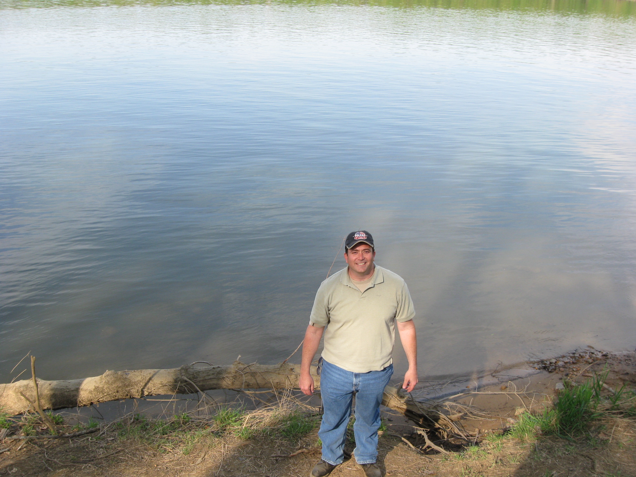
Historian Craig Swain is standing on the Virginia side of the Potomac River. In the background is the location where he believes that the second pontoon bridge was constructed by the Army of the Potomac at Edwards Ferry in June, 1863. This view was taken facing southeast at approximately 4:30 PM on Sunday, April 11, 2010.
The United States’ Army of the Potomac crossed the Potomac River near Leesburg, Virginia, from June 25-27, 1863. Historian Craig Swain describes this movement of men, animals, equipment and supplies, from Virginia to Maryland during the Gettysburg Campaign.
In today’s Edwards Ferry post, Historian Craig Swain explains how much men and material that the Army of the Potomac transported across the Edwards Ferry pontoon bridges and summarizes why he thinks that the crossing was important.
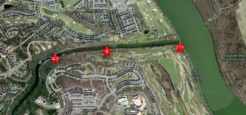
This map shows the location of the Edwards Ferry Videos. Video #s 1-3 were shown in our first Edwards Ferry post. Videos #4-5 were taken along Goose Creek near the site of Kephart’s Mill. Video #6 was taken near one of the canal locks of the Goose Creek canal. Videos #7-#15 were taken along the Virginia side of the Potomac River near the mouth of Goose Creek. This map was created facing north at approximately 7:00 PM on Monday, May 10, 2010.

This map shows some of the important locations along Goose Creek including the Goose Creek Canal, the locks of the canal, and the California Road crossing Goose Creek. The red X shows that the bridge had been destroyed earlier in the war, so was not available in 1863. In yellow are the pontoon bridges of the Army of the Potomac constructed in June, 1863. One bridge crosses Goose Creek (Craig showed where he believes its location was in our last picture on this post), the two pontoon bridges crossing the Potomac River at Edwards Ferry, and the bridges crossing the Chesapeake and Ohio Canal on the east (Maryland) side of the Potomac River. In today’s post, Craig explains why the crossing at Edwards Ferry was important to the Army of the Potomac during the Gettysburg Campaign. This map was provided by Craig Swain.
In Video #13 (Videos #1-#12 were shown in our previous Edwards Ferry posts) Craig Swain is standing on the Virginia side of the Potomac River near the mouth of Goose Creek. He gives us an idea of how much equipment is crossing the Potomac River in June, 1863, and long the column of the Army of the Potomac stretched. This view was taken facing southeast at approximately 4:30 PM on Sunday, April 11, 2010.

Craig Swain is on the Virginia side of the Potomac River and Goose Creek is behind him. Goose Creek is 55 miles long and drains much of Loudon County, Virginia. It is over 200 feet wide here at its mouth. This view was taken facing northeast at approximately 4:30 PM on Sunday, April 11, 2010.
In Video #14, Craig Swain compares the 1863 crossing at Edwards Ferry to the 1864 crossing of the James River. This view was taken facing north to northeast at approximately 4:30 PM on Sunday, April 11, 2010.
The Potomac River is 338 miles long and drains 14,700 square miles. This view was taken facing east at approximately 4:30 PM on Sunday, April 11, 2010.
In Video #15, Craig Swain summarizes the Edwards Ferry bridging operations and explains why the crossing of the Army of the Potomac at Edwards Ferry in June, 1863 was significant. This view was taken facing east at approximately 4:30 PM on Sunday, April 11, 2010.