Devil’s Den Part 4: Licensed Battlefield Guides Garry Adelman and Tim Smith
August 9, 2011
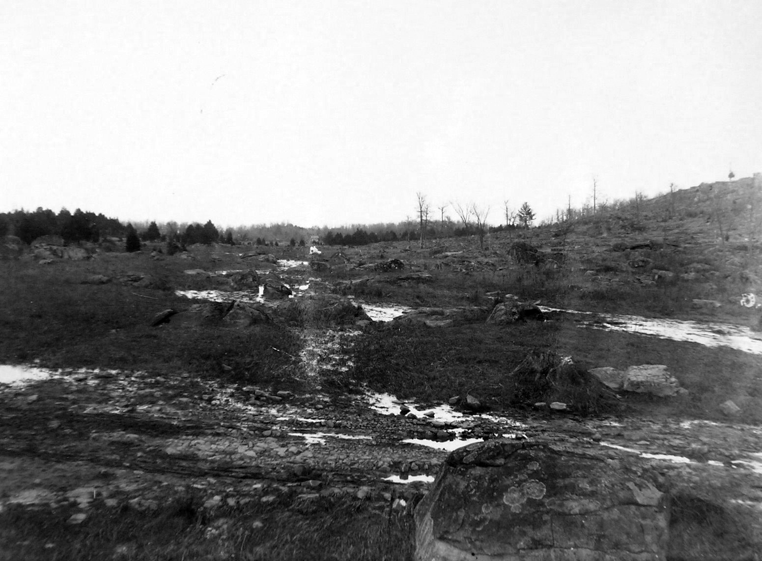
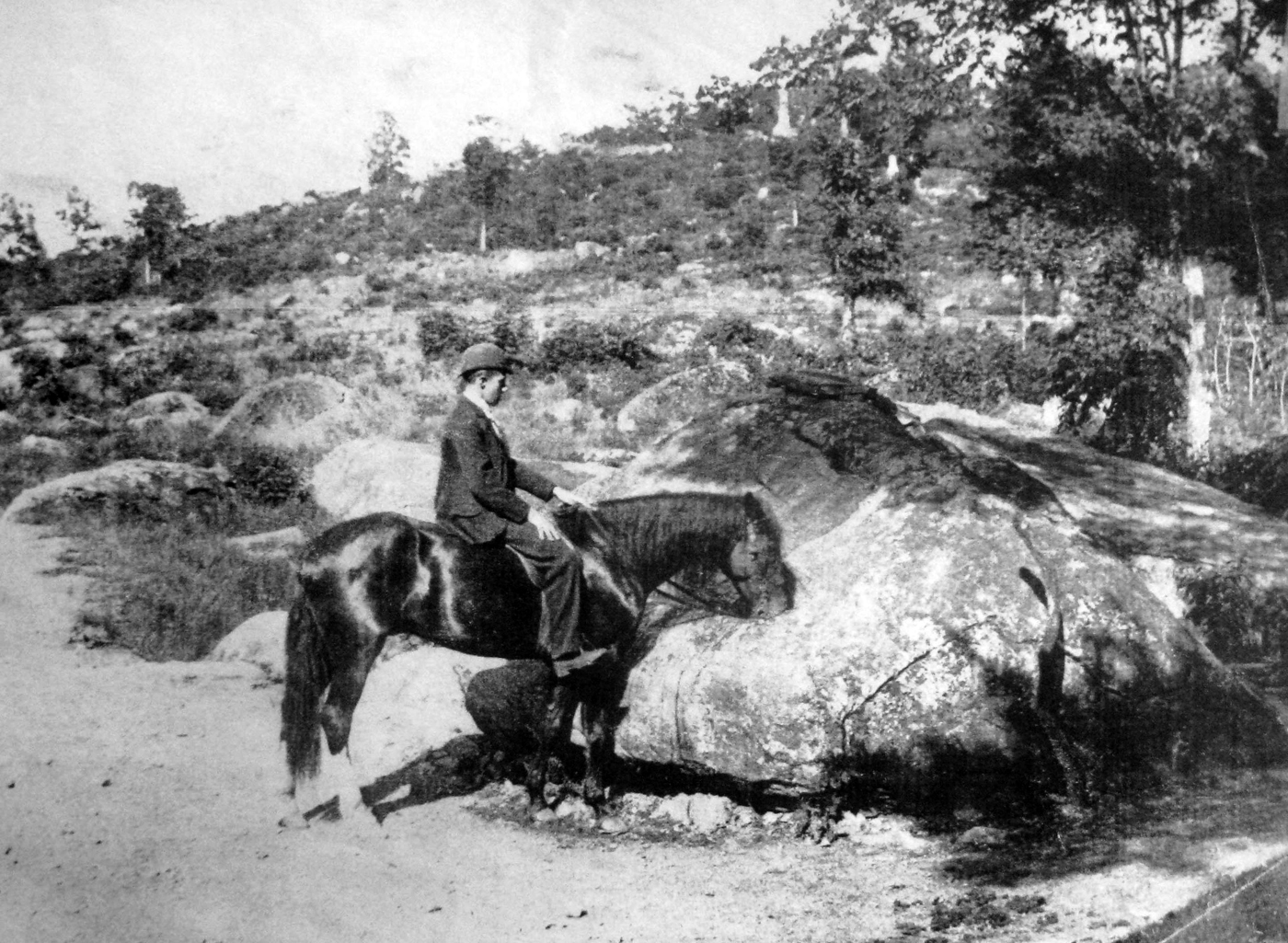
This photograph shows the Plum Run Valley/Valley of Death area in the late 1800s. The “Smirking Rock/Smart Ass Rock/Smiley Rock” is in the right lower section of this view. The new monument to the 40th New York Infantry Regiment is the light colored object in the center background. The slope of Little Round Top is on the right. This view was taken facing northeast circa 1888.
Director of History and Education for the Civil War Trust, Garry Adelman earned his B.A. in business from Michigan State University and his M.A. in history at Shippensburg University of Pennsylvania. He is the author, co-author or editor of The Civil War 150 (2011), Antietam Then and Now (2005), The Myth of Little Round Top (2003), The Early Gettysburg Battlefield (2001), Little Round Top: A Detailed Tour Guide (2000), and Devil’s Den: A History and Guide (1997) as well as eight Civil War image booklets. He has two more books coming out this spring. He has published articles in The Gettysburg Magazine and Hallowed Ground and conceived and drafted the text for wayside exhibits at the Third Winchester, First Day at Chancellorsville, Mine Run and Slaughter Pen Farm battlefields. A frequent lecturer at Civil War Round Tables, he has also appeared as a speaker on HISTORY, C-Span, and Pennsylvania Cable Network. He is the vice president of the Center for Civil War Photography and is a Licensed Battlefield Guide at Gettysburg.
Timothy H. Smith is a native of Baltimore and a life long student of the American Civil War. He is employed as a Licensed Battlefield Guide at the Gettysburg National Military Park and as a research historian at the Adams County Historical Society. He is an instructor for the Gettysburg Elderhostel and teaches classes on the battle and local history at the Gettysburg Campus of the Harrisburg Area Community College. Tim has written numerous articles and authored or co-authored ten books on Gettysburg related topics. He has lectured extensively at Civil War Round Tables and Seminars and has appeared on several television documentaries, including the Unknown Civil War and the popular PCN Gettysburg Battle Walk series.
In the first Devil’s Den post, Gettysburg Licensed Battlefield Guides Tim Smith and Garry Adelman introduced us to the Devil’s Den series. Garry showed us THE Devil’s Den and the Devil’s Bath.
In the second Devil’s Den post, Gettysburg Licensed Battlefield Guide Garry Adelman showed us where the 2nd Georgia Infantry might have attacked through Devil’s Den, the location of the hitching rail, and the Waud Rock.
In the third Devil’s Den post, Gettysburg Licensed Battlefield Guide Garry Adelman showed us “three rocks by the road” and the position of the 4th Maine Monument. Tim Smith showed us a pretty long snake skin.
In today’s Devil’s Den post, Gettysburg Licensed Battlefield Guides Garry Adelman and Tim Smith show us the “Smirking Rock/Smart Ass Rock/Smiley Rock,” the “Trough Rock,” and the location of the Devil’s Den Photography Studio.
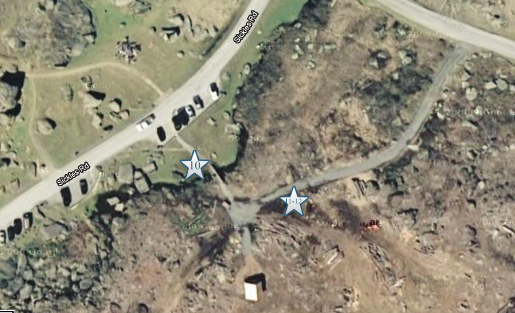
This map shows the location of the Devil’s Den videos. Videos #1-#9 were shown in our previous Devil’s Den posts. Video #10 was taken by the “Smirking Rock/Smart Ass Rock/Smiley Rock.” Video #11 was taken at the “Trough Rock.” Videos #12 was taken near the “Trough Rock and the site of the Devil’s Den Photography Studio. This map was created facing north at approximately 5:00 PM on Saturday August 6, 2011.
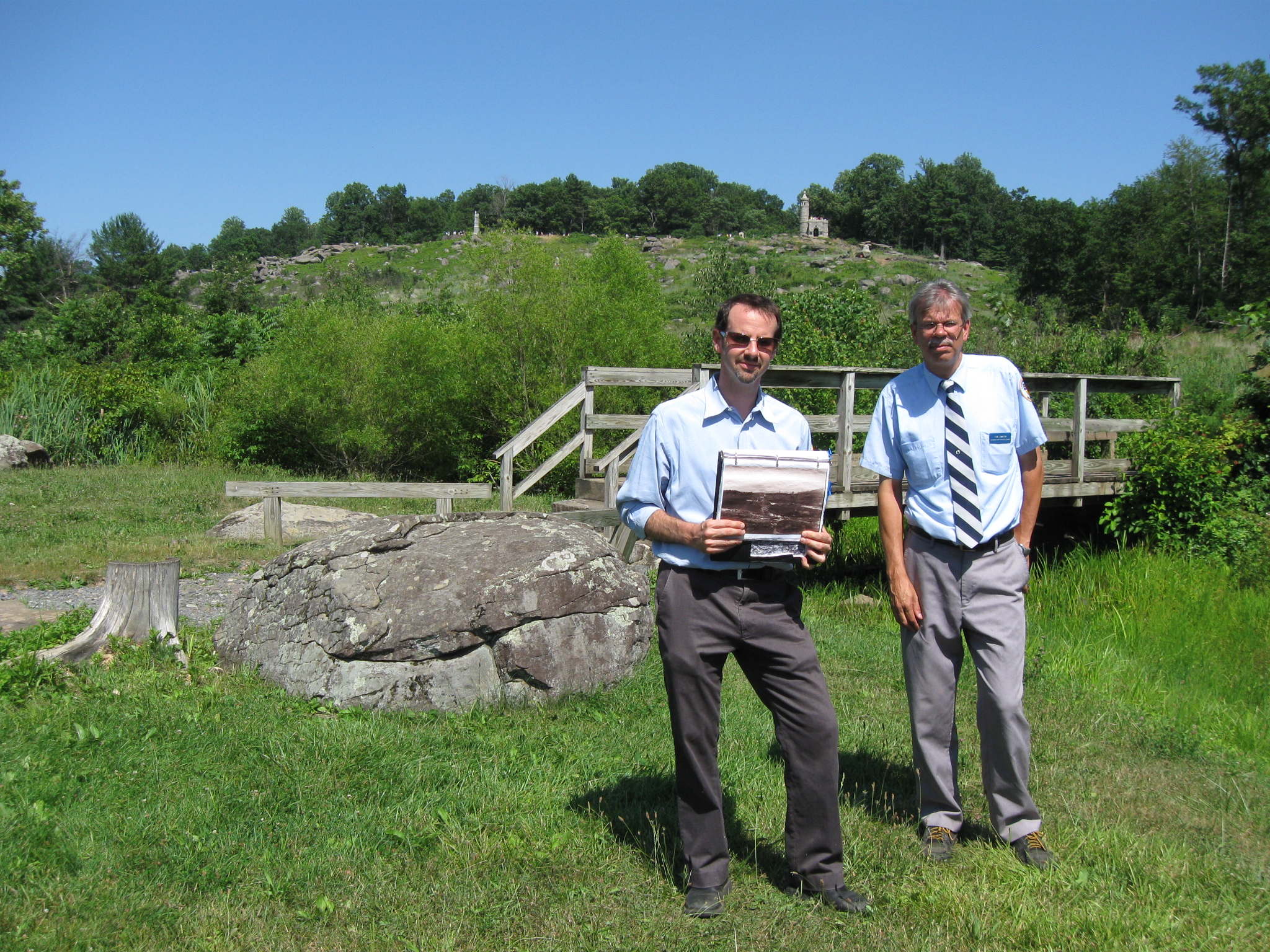
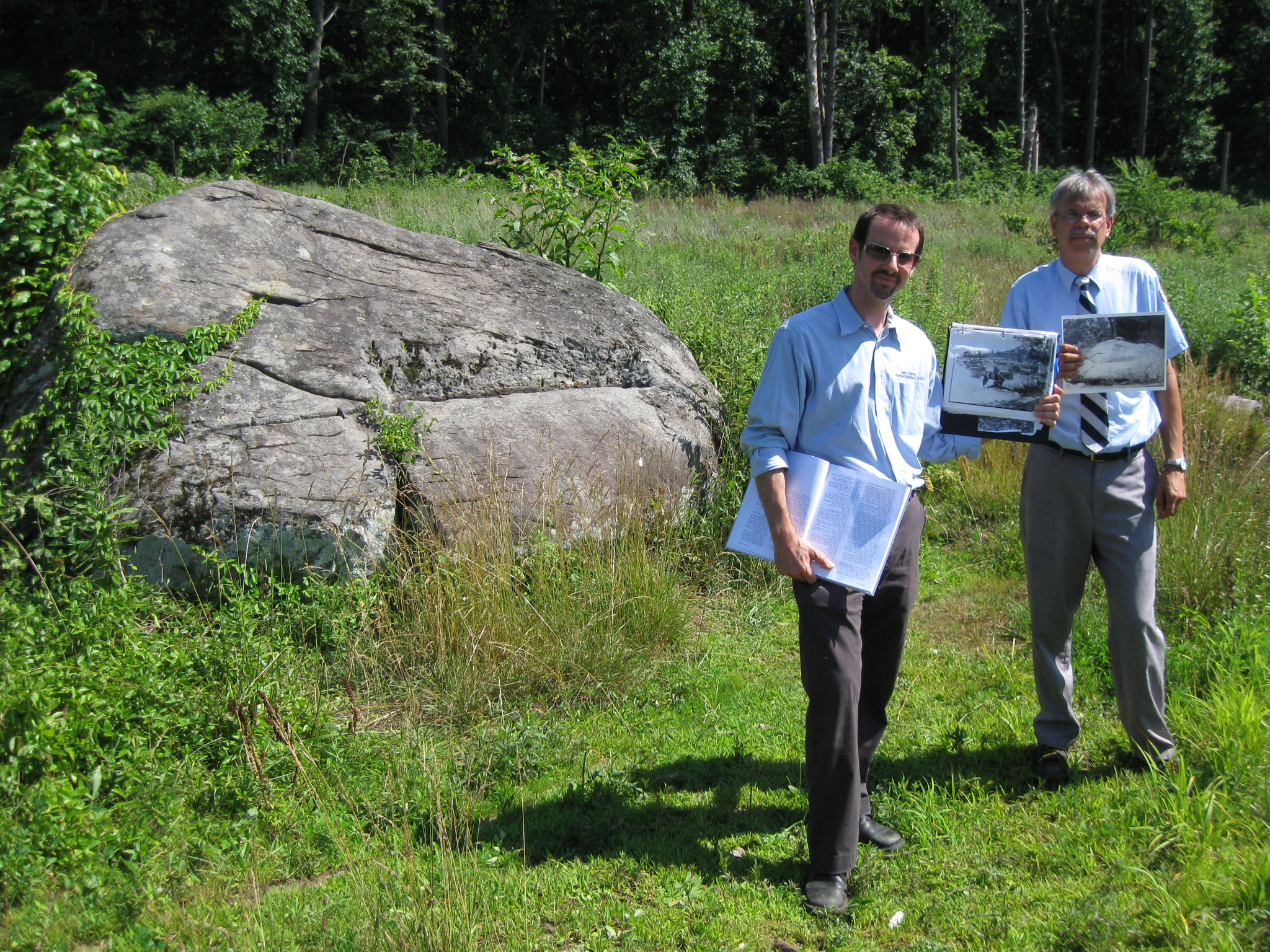
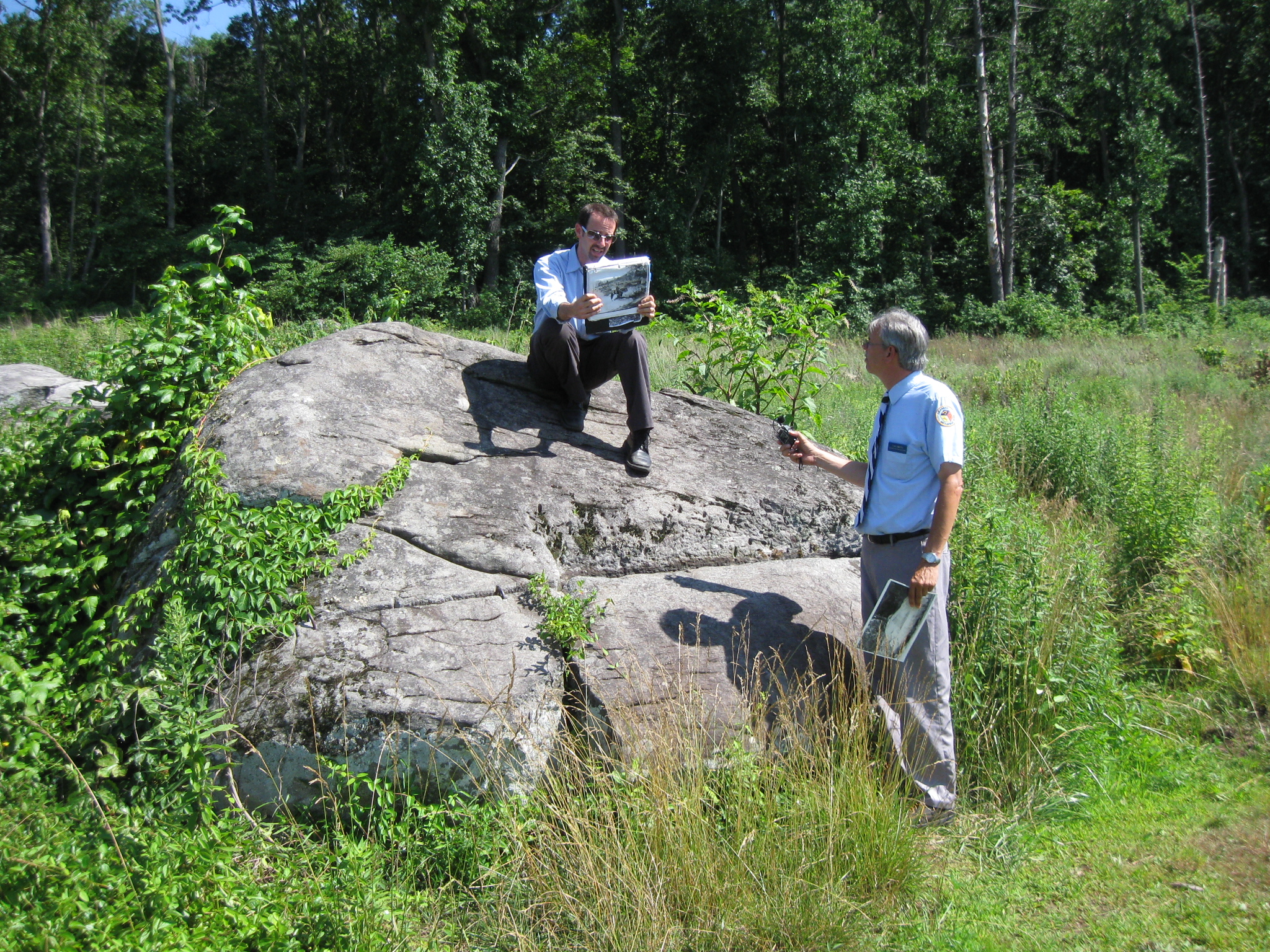
Gettysburg Licensed Battlefield Guides Garry Adelman (left) and Tim Smith are the hosts for our series on Devil’s Den. They are standing by the “Smirking Rock/Smart Ass Rock/Smiley Rock” and the bridge over Plum Run. Garry is holding the circa 1888 picture which we showed as the first picture of this post. Little Round Top is in the background. This view was taken facing northeast at approximately 4:00 PM on Friday, July 1, 2011.
In Video #10 (Videos #1-#9 were shown in our previous Devil’s Den posts) Gettysburg Licensed Battlefield Guides Garry Adelman and Tim Smith show the location of the carriage bridge over Plum Run and the “Smirking Rock/Smart Ass Rock/Smiley Rock.” This view was taken facing northeast at approximately 4:00 PM on Friday, July 1, 2011.
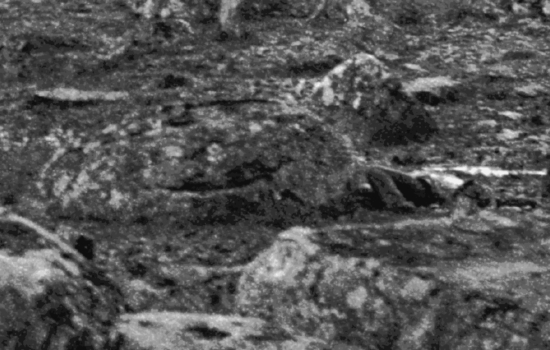
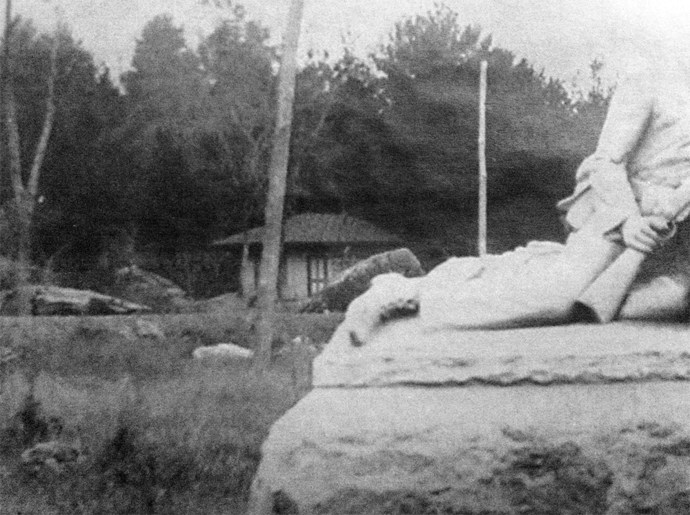
This is William Frassanito’s enhanced version of the “Smirking Rock/Smart Ass Rock/Smiley Rock” which shows the dead soldier to the right of the rock. This view was taken facing northeast by Alexander Gardner’s photography crew on either July 6th or 7th, 1863.
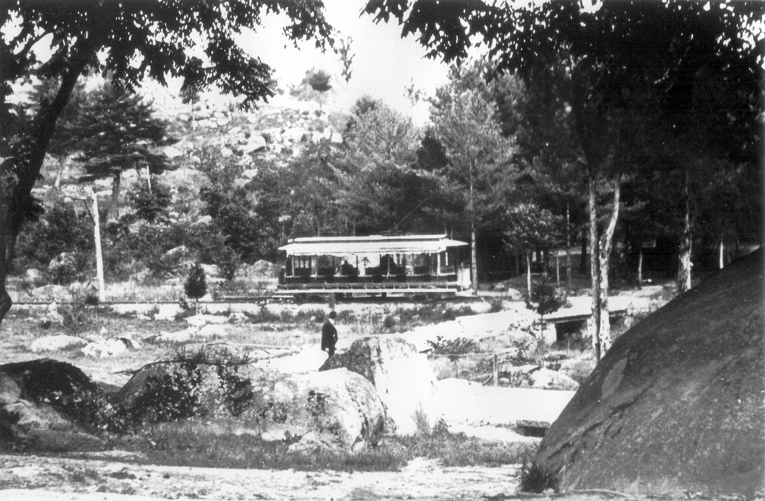
This photograph taken from Devil’s Den and looking towards the area of the “Slaughter Pen” shows the bridge over which carriages and possibly early automobiles drove, the “Smirking Rock/Smart Ass Rock/Smiley Rock,” and the Electric Trolley. Tim and Garry will talk more about the Trolley in our next visit to Devil’s Den. This view was taken by William Tipton facing northeast in the late 1800s, early 1900s.
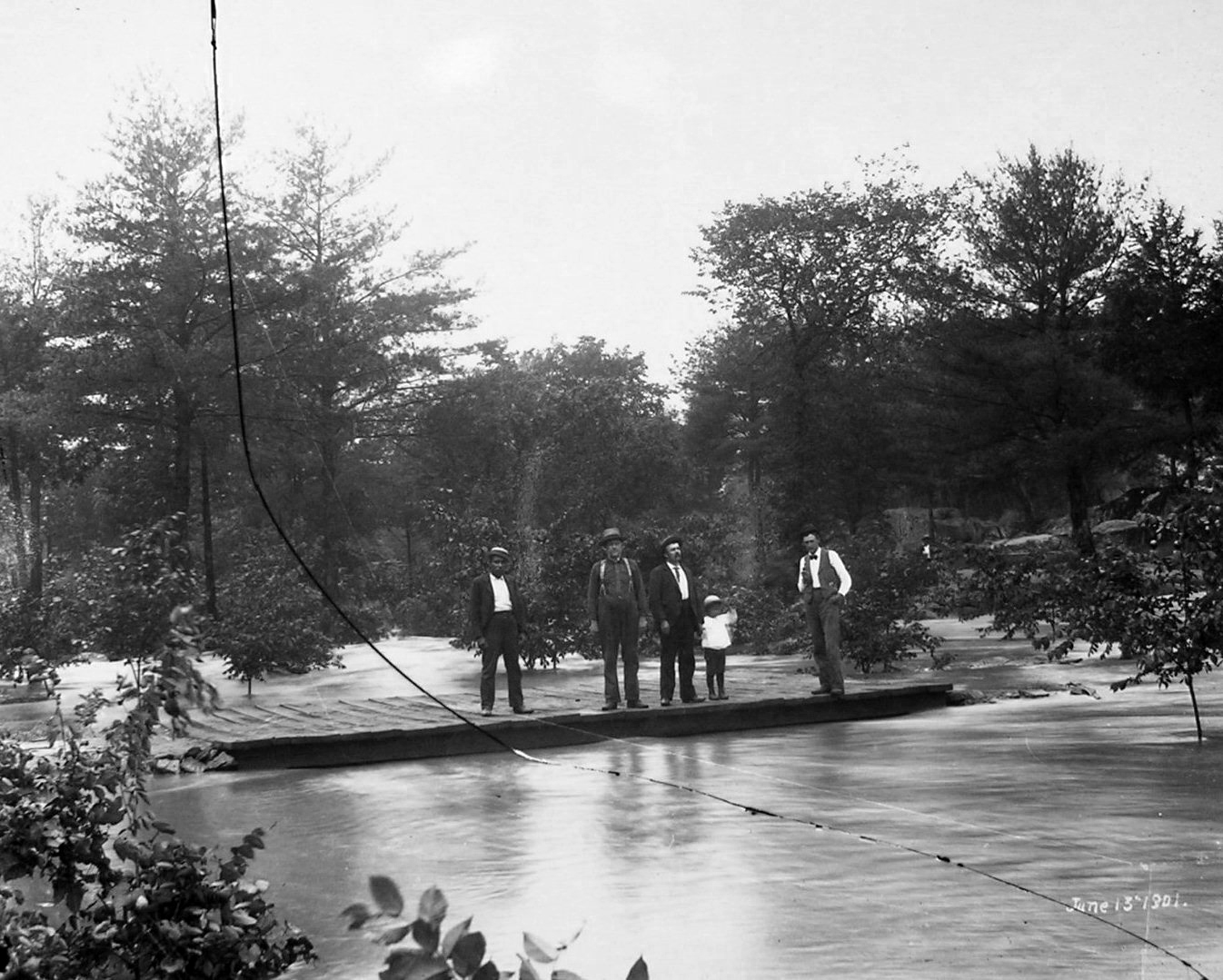
The individuals in this photograph are standing on the carriage bridge over Plum Run. This view was taken facing northeast on June 13, 1901.
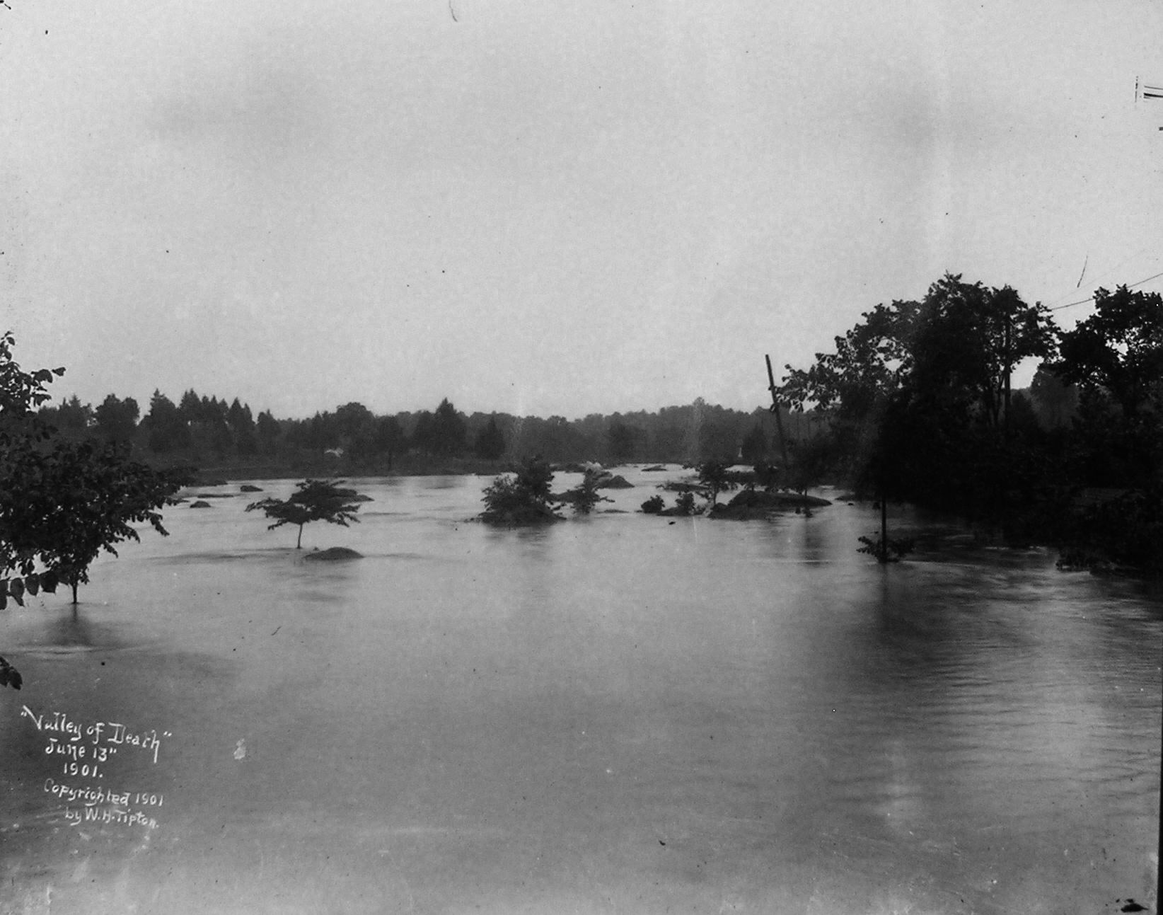
The flooded Valley of Death looking towards Devil’s Den, which is in the right background. This view by William Tipton was taken facing southwest on June 13, 1901.
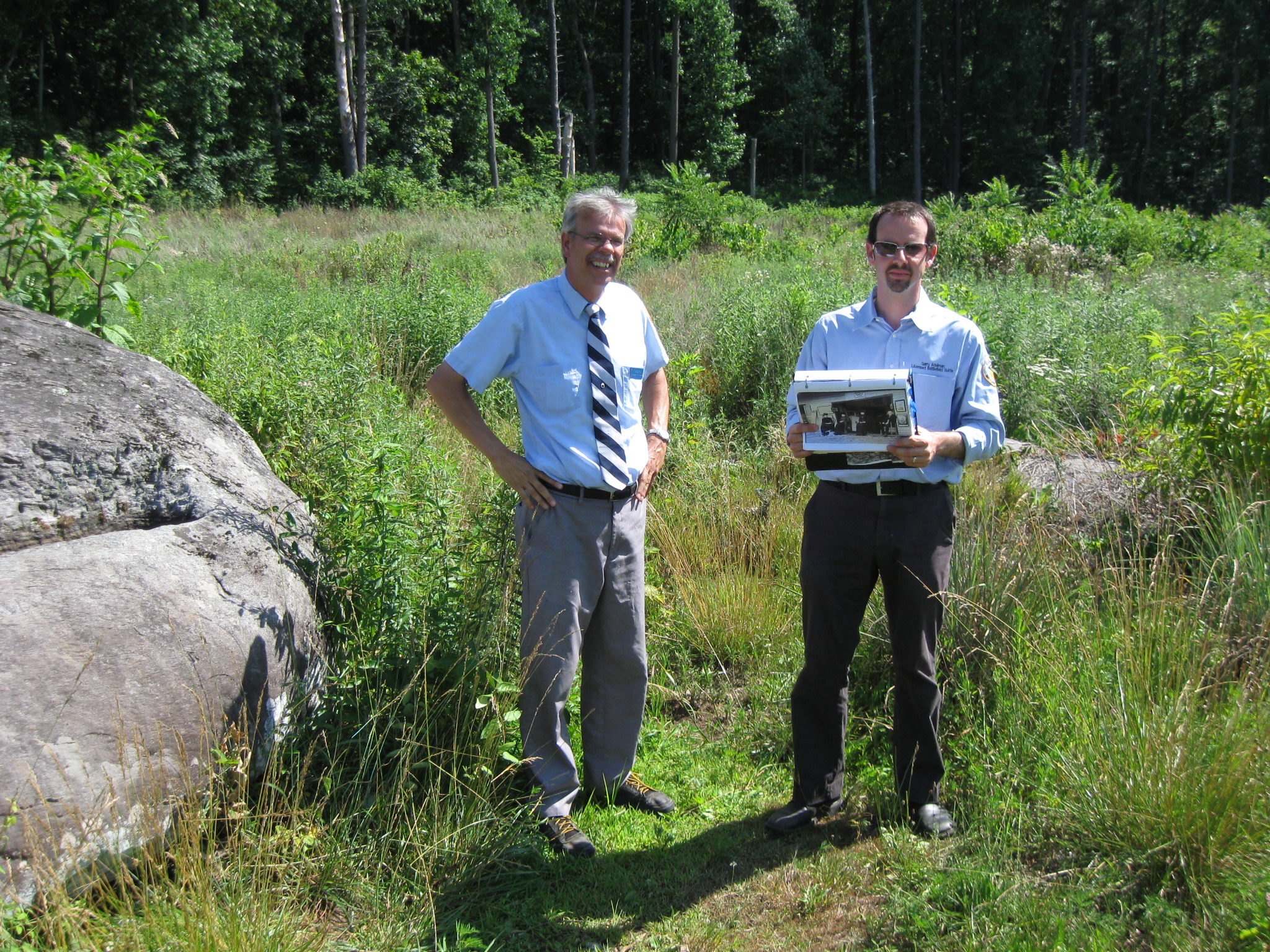
Gettysburg Licensed Battlefield Guides Garry Adelman (left) and Tim Smith are standing by the “Trough Rock,” which is on the left. The slope of Big Round Top begins in the background. This view was taken facing southeast at approximately 4:00 PM on Friday, July 1, 2011.
In Video #11 Gettysburg Licensed Battlefield Guides Tim Smith and Garry Adelman show us the “Trough Rock,” and explain its purpose. This view was taken facing southeast at approximately 4:00 PM on Friday, July 1, 2011.
The “Trough Rock,” primarily gets its name from photographs such as this. This view was taken facing northeast circa 1890.
Gettysburg Licensed Battlefield Guide Garry Adelman sitting on the “Trough Rock.” It was also nicknamed the “Fountain Rock” and the “Flowing Rock.” This view was taken facing southeast at approximately 4:00 PM on Friday, July 1, 2011.
The “Trough Rock/Fountain Rock/Flowing Rock.” Notice the stone on top of the rock which might have held a pipe to help the water flow into the trough. This view was taken facing east circa 1890.
The “Trough Rock/Fountain Rock/Flowing Rock.” Here is a closer view of the pipe which was attached to the rock on the left (northwest side) of the rock. This view was taken facing east circa 1890.
Gettysburg Licensed Battlefield Guides Garry Adelman and Tim Smith possibly retrieving some water for their stew which they mentioned in the previous video. This view was taken facing southeast at approximately 4:00 PM on Friday, July 1, 2011.
Gettysburg Licensed Battlefield Guides Garry Adelman and Tim Smith are standing near the location of the Photography Studio. The “Trough Rock” is on the left. The Photography Studio would have been just to Garry’s right. This view was taken facing southeast at approximately 4:00 PM on Friday, July 1, 2011.
In Video #12 Gettysburg Licensed Battlefield Guides Tim Smith and Garry Adelman show us the location of the Devil’s Den darkroom/souvenir stand/tintype gallery, and some images taken by the staff at the gallery. This view was taken facing southeast at approximately 4:00 PM on Friday, July 1, 2011.
The Devil’s Den Photography Studio/Dark Room/Souvenir Stand was first operated by Levi Mumper. His son, Jacob Mumper, shown seated at the right, later purchased part of the business from his father. This view was taken circa 1888.
The Devil’s Den Photography Studio/Dark Room/Souvenir Stand/Tintype Gallery is seen in this view of the monument to the 40th New York Infantry Regiment. This view was taken facing southeast circa 1888.
A closer view of the Devil’s Den Photography Studio/Dark Room/Souvenir Stand/Tintype Gallery is seen in left background of the view of the monument to the 40th New York Infantry Regiment. This view was taken facing southeast circa 1888.
The government condemned the land occupied by the Photography Studio in Devil’s Den, and the studio was moved up the slope of Little Round Top alongside Warren Avenue. This view was taken facing northeast circa 1902.
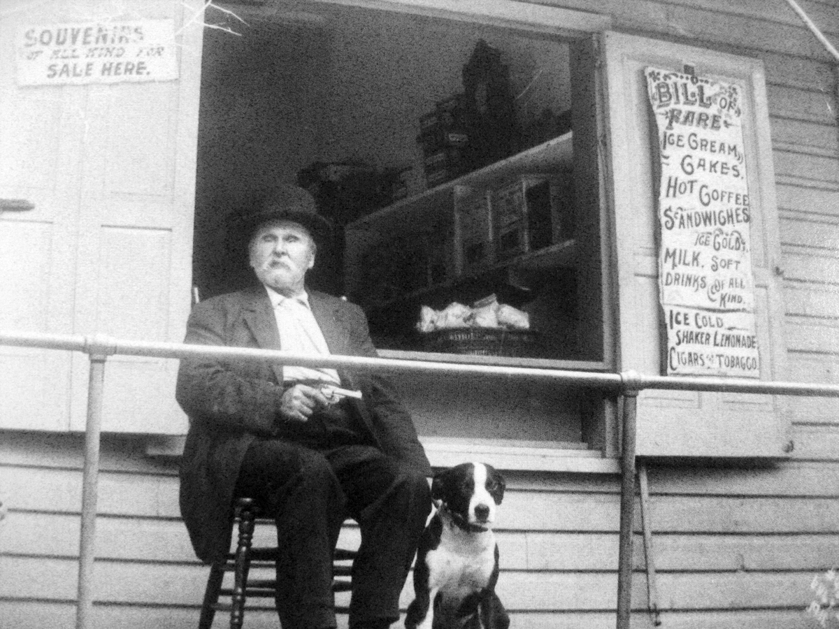
David Weikert “lost his sight in ‘a premature blast during the construction of the Round Top Extension of the Gettysburg & Harrisburg Railroad in May of 1884. ‘On account of his misfortune,’ Mr. Weikert was given permission to conduct a stand” in the old photography studio now located alongside Warren Avenue, and ran the studio from 1901 until 1919. In this image, “Blind Davey” is holding a dog in his left hand and a gun in his right hand. This view was taken facing northeast circa the early 1900s.
Some images from the Mumper Studio which was later purchased by William Tipton. These views were taken in the late 1800s to early 1900s.
Another image from the Mumper Studio/Tipton Studio located in the Devil’s Den area. This view was taken in the late 1800s to early 1900s.
The views were usually taken in close proximity to the Mumper Studio/Tipton Studio. Notice the spring in the right foreground. This view was taken in the late 1800s to early 1900s.
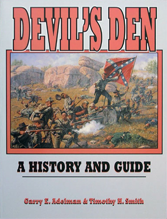
Tim Smith and Garry Adelman are the co-authors of Devil’s Den: A History and Guide. It was first published by Thomas Publications, Gettysburg, Pennsylvania in 1997. This cover was scanned facing south at approximately 8:00 PM on Tuesday, July 14, 2009.
To see other posts by Gettysburg Licensed Battlefield Guides,click here.