Culp’s Hill Part 7: Gettysburg Licensed Battlefield Guide Charlie Fennell
June 24, 2009
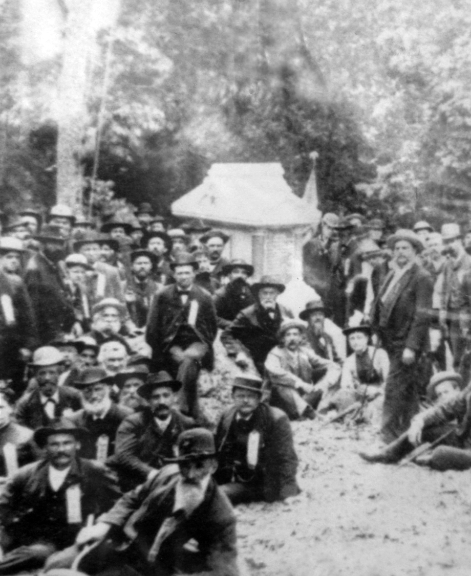
The monument to the 20th Connecticut Infantry Regiment was dedicated on July 3, 1885. George W. Warner, who unveiled the flag covering the monument during the ceremony is sitting on the rock. This view was taken facing south on Friday, July 3, 1885.
Our Culp’s Hill series is led by Gettysburg Licensed Battlefield Guide Dr. Charles Fennell. Dr. Fennell received his Ph.D. in history from the West Virginia University in 1992. His dissertation was titled, “The Battle of Culp’s Hill.” In our first post on Culp’s Hill, he began our tour at the summit, near the observation tower. In our second post he continued his walk around Culp’s Hill by discussing the position of the 60th New York Infantry Regiment. In our third post he looked at the earthworks in the area of the monuments to the 150th New York Infantry Regiment and the 78th and 102nd New York Infantry Regiments. In our fourth post, Charlie showed us the monuments to the 149th and 137th New York Infantry Regiments, and discusses some of their actions. In our fifth post, Dr. Fennell showed us the 137th New York’s position on lower Culp’s Hill/Spangler’s Hill and the monument to the 2nd Maryland Infantry Regiment (CSA). In our sixth post we looked at the fighting at Spangler’s Meadow on the morning of July 3, 1863. In today’s post we look at the Union line on Lower Culp’s Hill/Spangler’s Hill before the Union troops abandoned it on July 2, 1863, and the beginning of the fighting at Pardee Field on July 3, 1863.
This map will show the locations of the videos we will show on the tour. Videos #1-#3 were taken on the summit of Culp’s Hill near the observation tower. Videos #4-#7 were taken near the monument to the 60th New York Infantry Regiment. Videos #8-#10 were taken between the monuments to the 150th New York and the 78th/102nd New York Infantry Regiments. Videos #11-#12 were taken by the monument to the 149th New York Infantry Regiment. Video #13 was taken near the monument to the 137th New York Infantry Regiment. Video #14 was taken near the marker for the 84th New York (14th Brooklyn) Infantry Regiment. Videos #15-#17 were taken on or near lower Culp’s Hill/Spangler’s Hill. Videos #s 18-20 were taken on the Coble Rock overlooking Spangler’s Meadow. Video #21 was taken at the Smith Brigade Marker on the north side of Spangler’s Meadow. Videos #s 22-23 were taken at the advance marker for the 27th Indiana Infantry regiment. Video #24 was taken at the monument to the 20th Connecticut Infantry Regiment. Video #25 was taken across Slocum Avenue from the 20th Connecticut. Video #26 was taken on Geary Avenue near Pardee Field. Video #27 was taken west of Geary Avenue and behind the monument to the 5th Ohio Infantry Regiment. This map was created facing north at approximately 9:30 PM on Sunday, June 14, 2009.
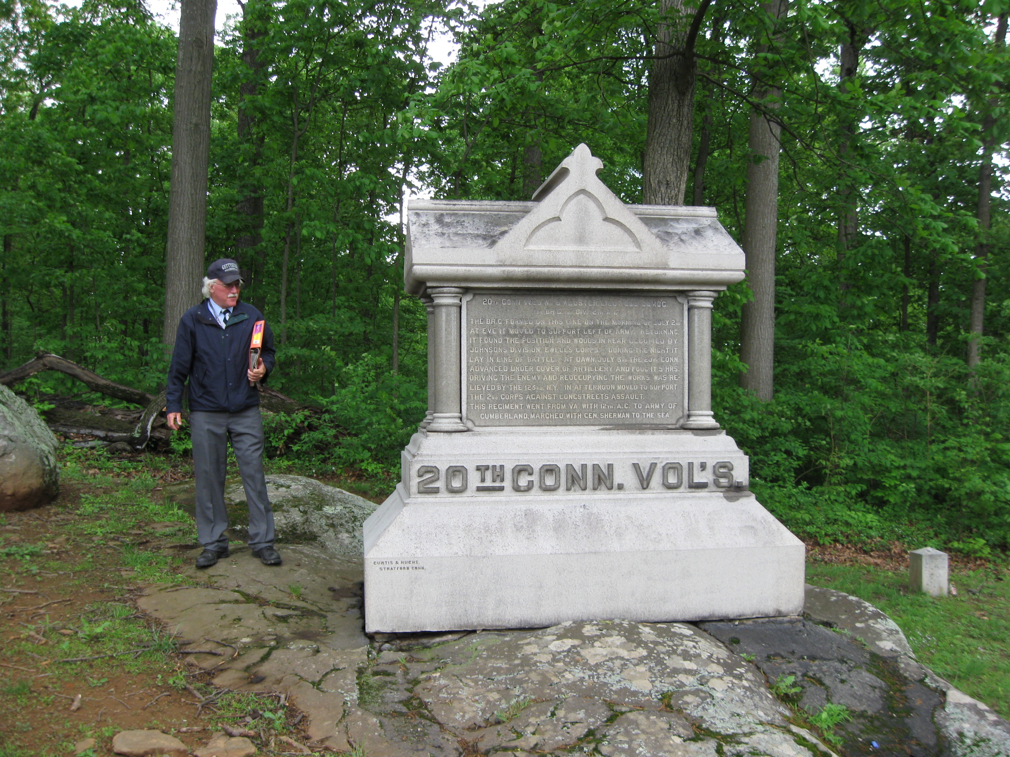
In Video #24 (Videos #s 1-23 were shown in the previous posts on Culp’s Hill), Charlie Fennell shows us the monument to the 20th Connecticut Infantry Regiment on Lower Culp’s Hill/Spangler’s Hill. This view was taken facing south at approximately 9:45 AM on Sunday, May 17, 2009.
Although this side faces the road, this is actually the back of the 20th Connecticut Infantry Monument. This view was taken facing northeast at approximately 9:45 AM on Sunday, May 17, 2009.
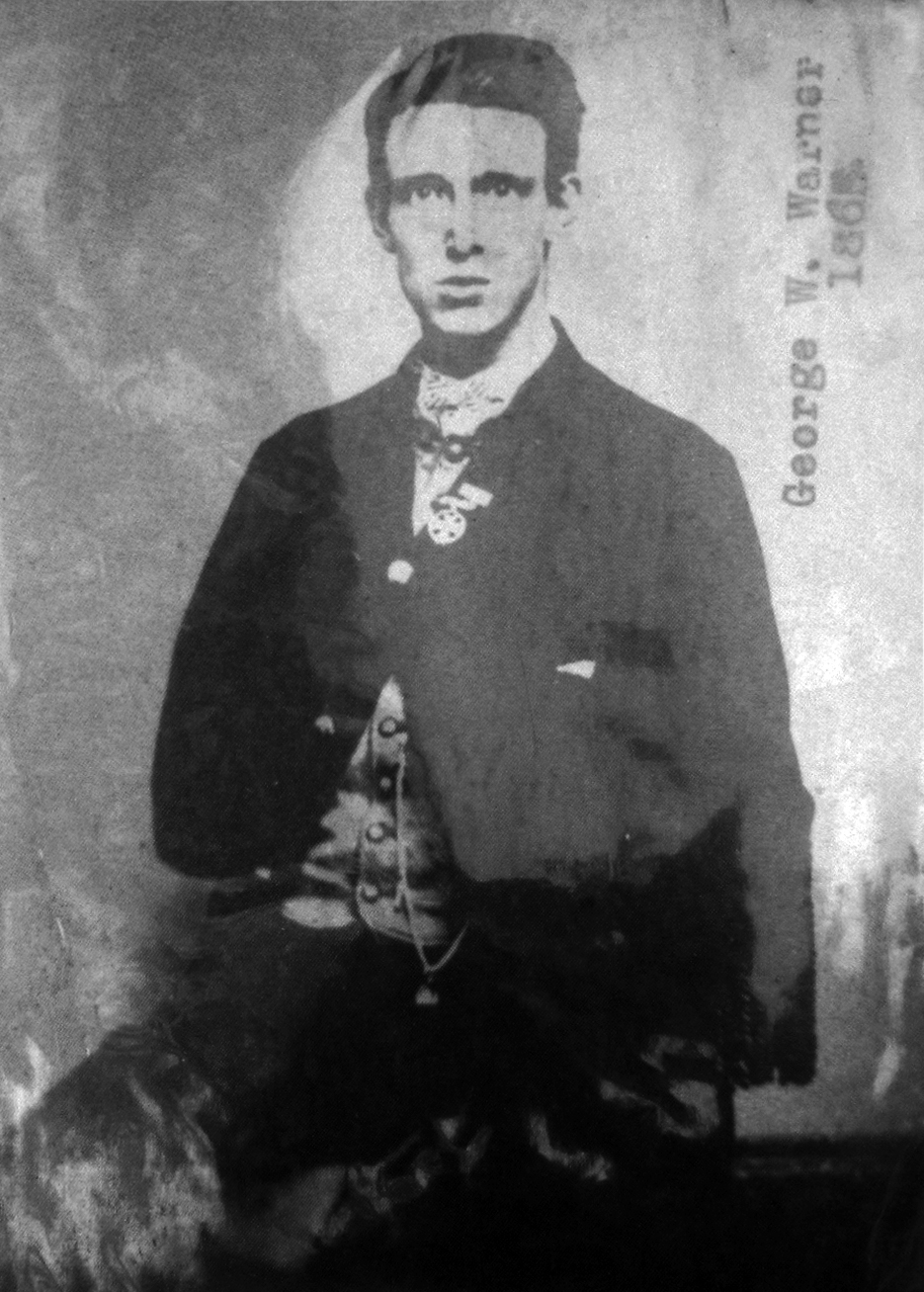
Private George W. Warner in 1865… This view was taken in 1865.
…and approximately 25 years later. This photograph was taken circa 1890.
Charlie has now moved to the west side of Slocum Avenue to show McDougall’s line on Lower Culp’s Hill/Spangler’s Hill. This view was taken facing southeast at approximately 9:45 AM on Sunday, May 17, 2009.
In video #25, Dr. Fennell shows us the battle line of McDougall’s Brigade, and how some members of the brigade would later correct “friendly fire” on their position. This view was taken facing southeast at approximately 9:45 AM on Sunday, May 17, 2009.
Gettysburg Licensed Battlefield Guide Charlie Fennell is now standing on Geary Avenue with Pardee Field in the background. Pardee Field is on the western slope of Lower Culp’s Hill/Spangler’s Hill. The rock wall which separates Culp property from Spangler property is in the left background. Spangler property is on this (southwest) side of the stone wall. The Pardee Rock is in the right background. This view was taken facing east at approximately 9:45 AM on Sunday, May 17, 2009.
In video #26, Charlie Fennell orients us to the Pardee Field area. This view was taken facing east to northeast to southeast at approximately 9:45 AM on Sunday, May 17, 2009.
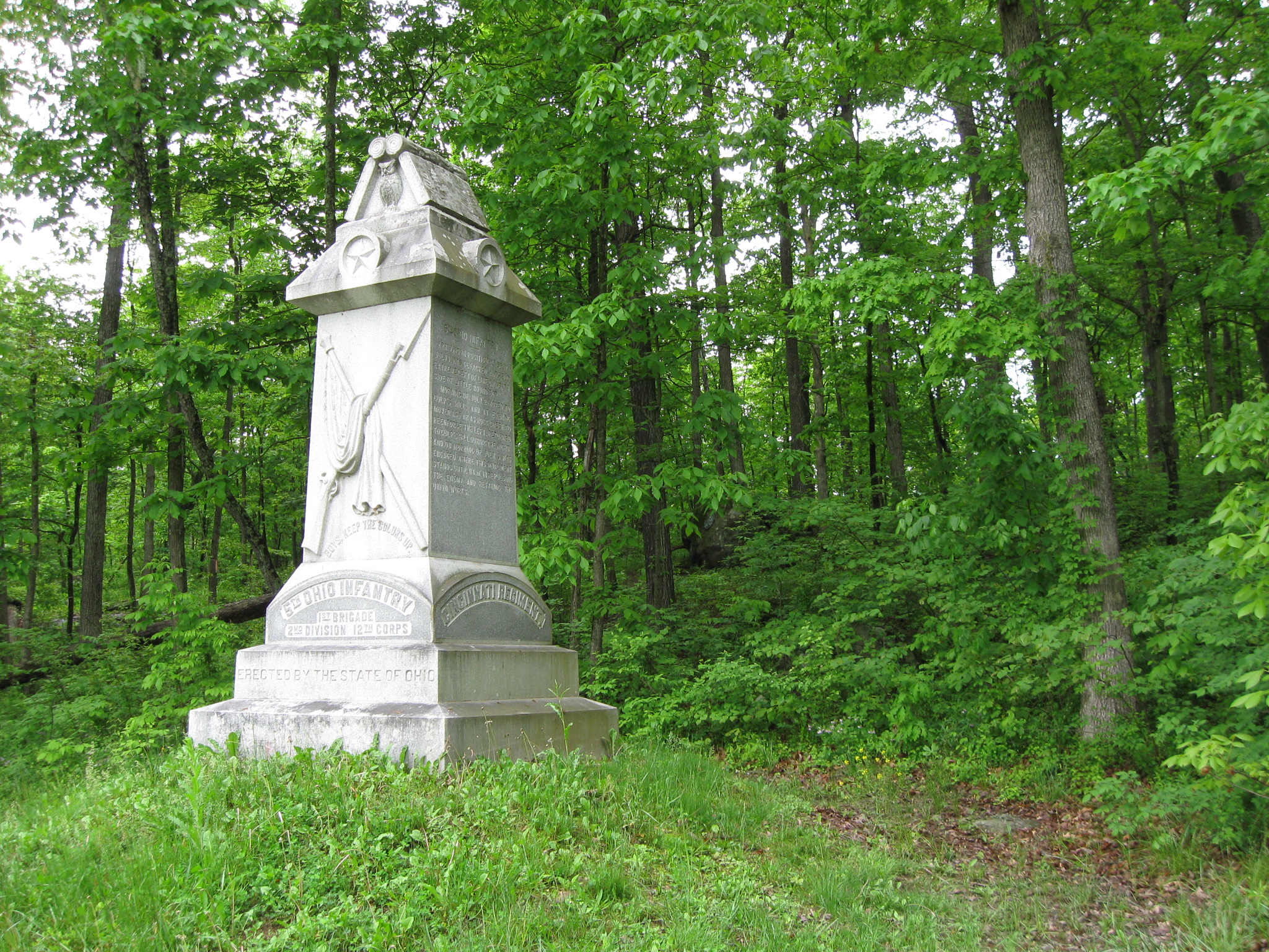
The monument to the 5th Ohio Infantry Regiment is just west of Geary Avenue behind the cameraman in our last video. Spangler’s Lane ran behind the monument from bottom right to upper left in this picture. There is a rock behind the monument, and approximately halfway up the slope. It is just visible in this picture. This view was taken facing southwest at approximately 9:45 AM on Sunday, May 17, 2009.
Charlie has now moved to stand by the rock which marks the battle line of the 5th Ohio. This view was taken facing southwest at approximately 9:45 AM on Sunday, May 17, 2009.
In video #27, Licensed Battlefield Guide Charlie Fennell explains how the position occupied by the 5th Ohio Infantry Regiment along Spangler’s Lane, and why the plaque is on this rock. This view was taken facing southwest at approximately 9:45 AM on Sunday, May 17, 2009.
Here is the plaque on the stone which marks the location where the first man in the 5th Ohio was killed at the Battle of Gettysburg. This view was taken facing west at approximately 9:45 AM on Sunday, May 17, 2009.
To see other posts by Gettysburg Licensed Battlefield Guides, click here.