
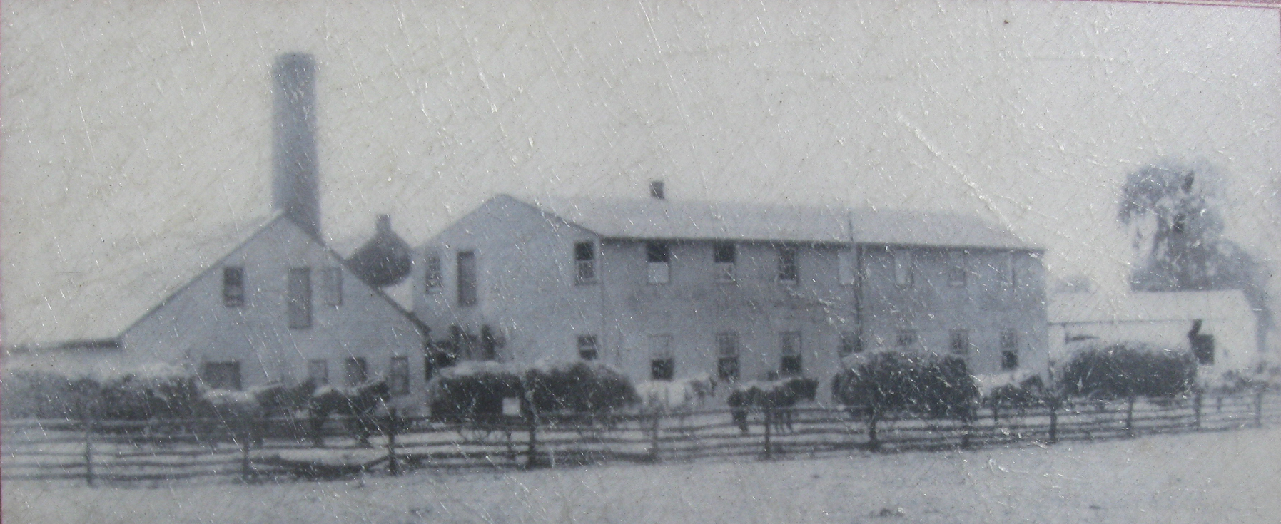
The Winebrenner Tannery was located south of the Hanover Town Square and southeast of Frederick Street. Lieutenant-Colonel William H. F. Payne of the 2nd North Carolina Cavalry Regiment fell into a vat in the tannery and was captured by the United States. This view was taken circa the 1860s.
The Battle for Hanover is a not very well known, but very important action in the Gettysburg Campaign.
In today’s post, Licensed Battlefield Guide John Krepps shows us how the fighting moved south and southwest of Hanover and how Major-General J.E.B. Stuart jumped a ditch as he escaped from Union forces.
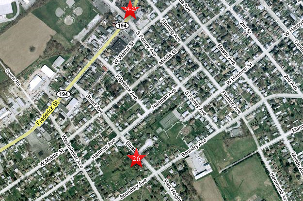
This map shows the location of where our videos were produced on the Old Hanover Road. Videos #1-#23 were shown in our previous Hanover posts. Videos #24 and #25 were taken on Frederick Street near its intersection with Forney Avenue. Video #26 was taken at Plum Run near the intersection of Stuart Avenue and Stuart Circle. This map was created facing north at approximately 9:30 AM on Thursday, August 20, 2009.

This map is from John Krepps’ book, A Strong and Sudden Onslaught, The Cavalry Action at Hanover, Pennsylvania. This map shows the United States troops regaining Hanover, and their advance on the Confederates south and southwest of town on June 30, 1863. Union units are shaded a dark color. Confederate units have lines running through them. Gettysburg Licensed Battlefield Guide Dave Weaver drew the basic map, and John Krepps drew the troop movements.

This map shows Hanover in 1860. It is known as “Shearer’s Map of York County, 1860: from surveys by D. J. Lake. W. O. Shearer and D. J. Lake, Publishers, Philadelphia.” This map is courtesy of John McGrew of the Pennsylvania Room of the Guthrie (Hanover) Public Library

Gettysburg Licensed Battlefield Guide John Krepps is the author of the book, A Strong and Sudden Onslaught, The Cavalry Action at Hanover, Pennsylvania. He is standing at Winebrenner Tannery wayside on the north side of Frederick Street south of the town square. This view was taken facing east at approximately 1:45 PM on Tuesday, August 18, 2009.
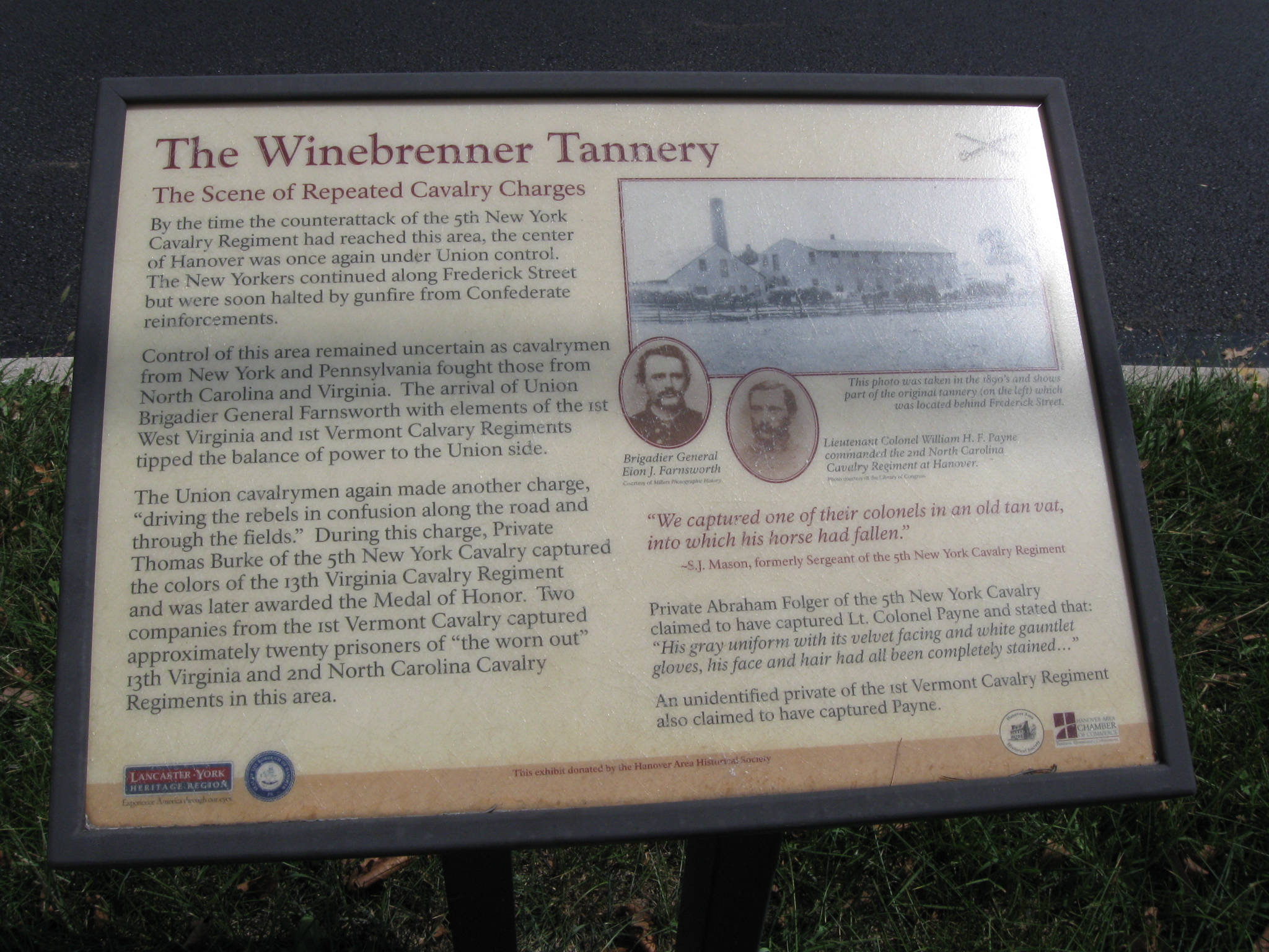
A closer view of the Winebrenner Tannery wayside on Frederick Street. This view was taken facing east at approximately 1:45 PM on Tuesday, August 18, 2009.
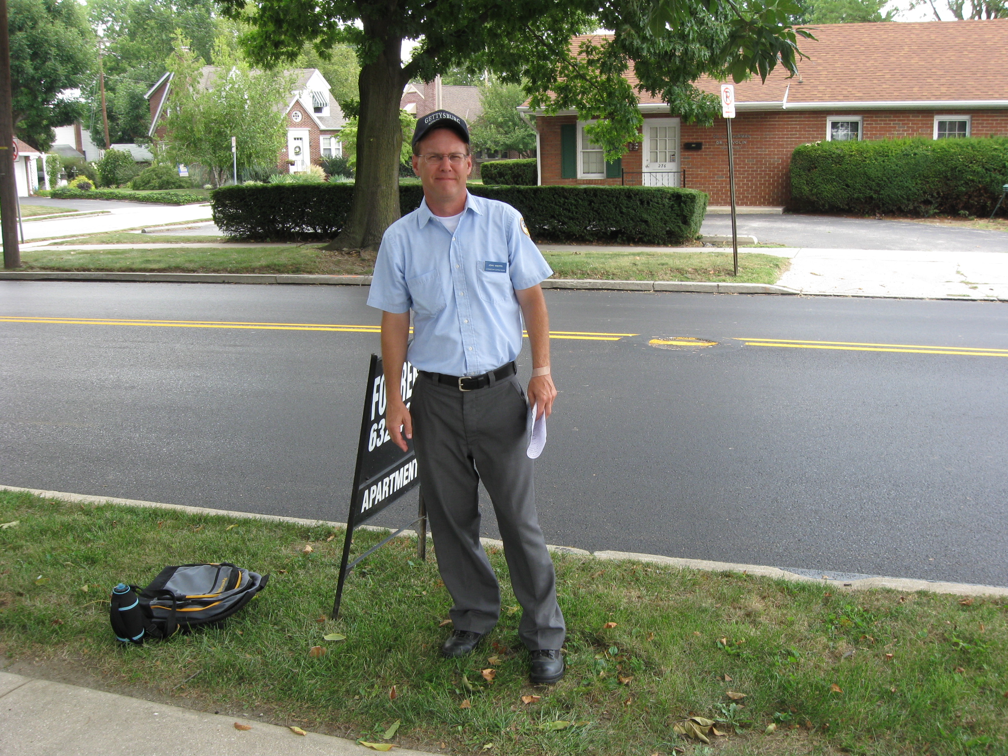
In Video #24 (Videos #1-#23 were shown in our previous Hanover posts) Gettysburg Licensed Battlefield Guide John Krepps is standing on Frederick Street near its intersection with Forney Avenue. He describes how after the United States troops regained control of Hanover’s Town Square, the fighting moved south and southwest of the town. This view was taken facing southeast at approximately 1:45 PM on Tuesday, August 18, 2009.
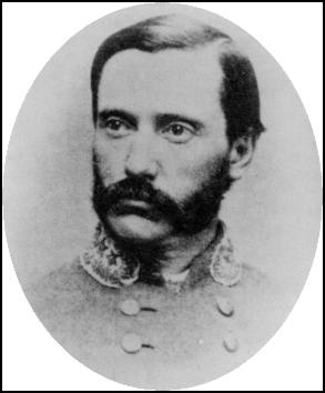
Lieutenant-Colonel William H. F. Payne of the 2nd North Carolina Cavalry Regiment claimed to have watched fighting in this area with a Union soldier after he was pulled out of the vat in the Winebrenner Tannery. This view was taken circa the 1860s.
Licensed Battlefield Guide John Krepps is still standing along Frederick Street. The location of the Winebrenner Tannery was in the background on the other side of Frederick Street. This view was taken facing east at approximately 1:45 PM on Tuesday, August 18, 2009.
In Video #25 Licensed Battlefield Guide John Krepps is still standing on Frederick Street near its intersection with Forney Avenue. He describes how a Union counterattack organized by Brigadier General Elon Farnsworth pushed the Confederates to positions south of Hanover. This view was taken facing south to northeast at approximately 1:45 PM on Tuesday, August 18, 2009.

Brigadier General Elon J. Farnsworth (July 30, 1837–July 3, 1863) was expelled from the University of Michigan following a drinking party in which a classmate died after being thrown from a window. He joined the prewar army as a civilian foragemaster and served on the staff of Albert Sidney Johnston during the Utah War of 1857–1858. He also worked as a buffalo hunter and scout in the Colorado Territory. He served as aide-de-camp to Brigadier General Alfred Pleasonton through the Battle of Chancellorsville and early stages of the Gettysburg Campaign. He was promoted to the rank of Brigadier General on June 29, 1863, the day before the Battle of Hanover. He would die at Gettysburg three days after the Battle of Hanover. This view was taken facing northeast at approximately 1:45 PM on Tuesday, August 18, 2009.

John Krepps is standing on Stuart Avenue, southwest of the Hanover Town Square. Stuart Circle is the road meeting Stuart Avenue in the right background. This view was taken facing north at approximately 2:00 PM on Tuesday, August 18, 2009.

Also at this location is Plum Run. There were three branches of Plum Run in this area, and this is now the widest of those three branches. This view was taken facing south at approximately 2:00 PM on Tuesday, August 18, 2009.
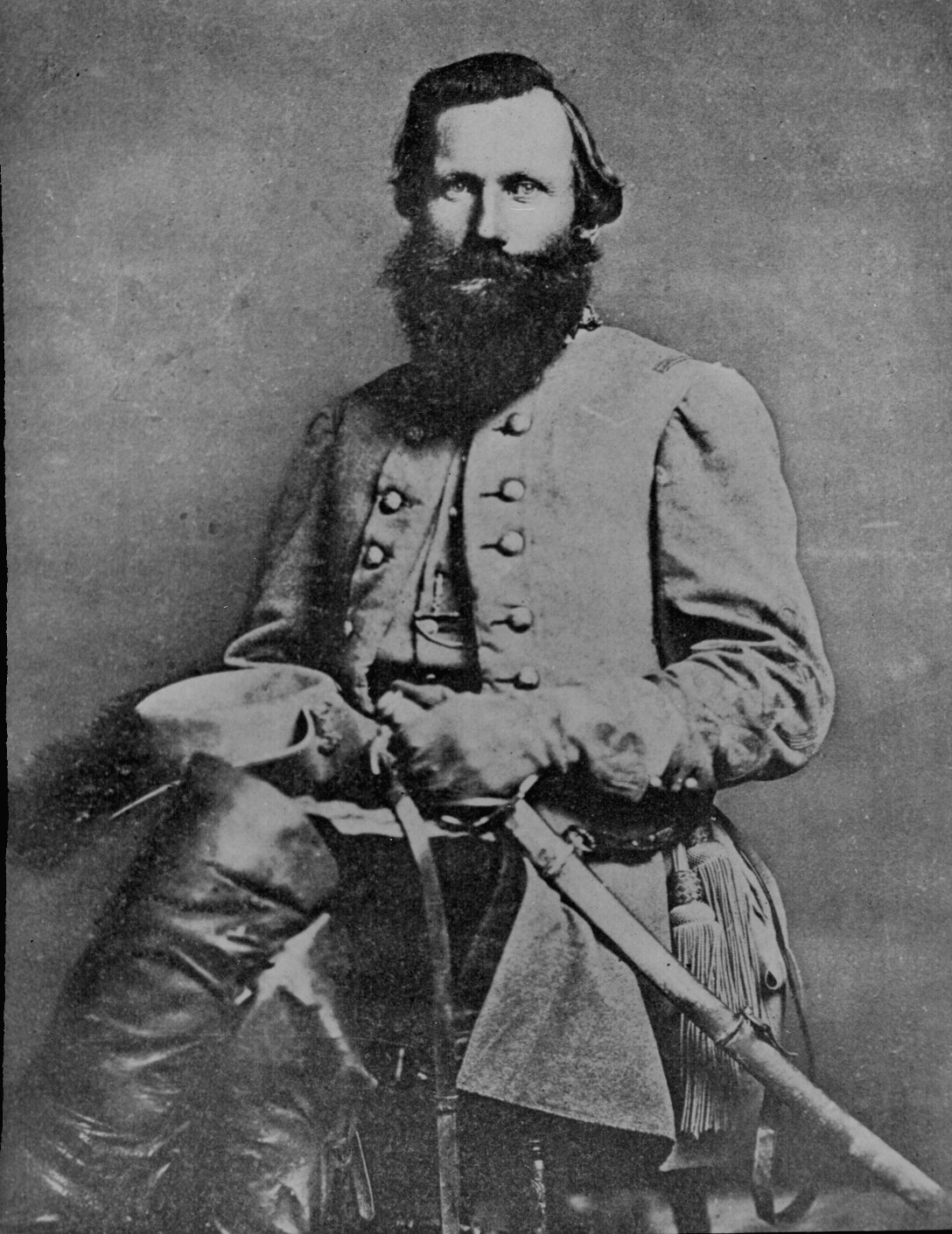
Major General James Ewell Brown Stuart, who commanded the Cavalry of the Army of Northern Virginia had to escape Union troops by jumping his horse Virginia over Plum Run somewhere south of Hanover. This view was taken circa 1863.
In Video #26 John Krepps is standing near Plum Run in the vicinity of Stuart Avenue and Stuart Circle. He describes how Major-Genereal J.E.B. Stuart had his horse, Virginia, jump Plum Run. This view was taken facing north to southwest at approximately 2:00 PM on Tuesday, August 18, 2009.
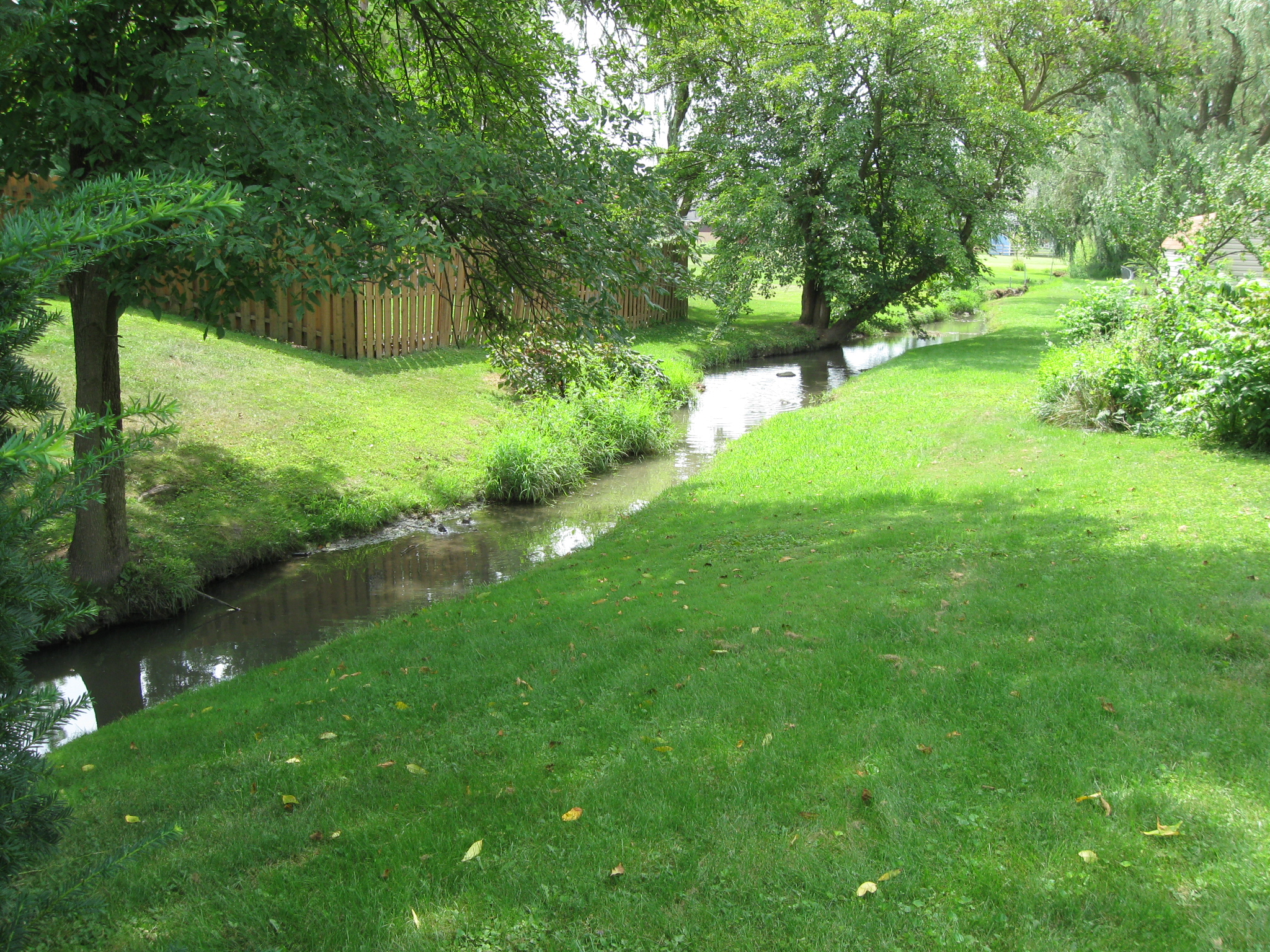
Someone has dammed up this section of Plum Run and ducks are putting it to good use. This view was taken facing southwest at approximately 2:00 PM on Tuesday, August 18, 2009.

In this area the south bank of Plum Run is high, but it might be built up because of the subdivision located here. This view was taken facing southwest at approximately 2:00 PM on Tuesday, August 18, 2009.

The part of Plum Run that Stuart’s horse, Virginia, had to leap was approximately 15 feet wide… This view was taken facing southwest at approximately 2:00 PM on Tuesday, August 18, 2009.

…which is close to the width of Plum Run in this area. This view was taken facing southwest at approximately 2:00 PM on Tuesday, August 18, 2009.