
The goal for our walk was to make it to East Cemetery Hill. We are standing in the parking lot of Gettysburg Tours. The monument to the 27th Pennsylvania Infantry Regiment is in the center foreground by the snow covered stone wall. In the background from left to right: Major General Oliver O. Howard Equestrian monument, the monument to Wiedrich’s New York Battery and some artillery pieces, the monument to the 73rd Pennsylvania, the monument to Rickett’s Battery, the headquarters marker for Oliver O. Howard, the monument to the 7th West Virginia, tree, the monument to Cooper’s Battery, 27th Pennsylvania in the foreground, the monument to the 14th Indiana Infantry, the equestrian statue of Major General Winfield Scott Hancock, tree, the monument to the 4th Ohio Infantry Regiment, the marker for Wainwright’s First Corps Artillery, tree, the marker and artillery pieces for Stewart’s Battery, tree, the Army of the Potomac itinerary tablets, and a little of the Evergreen Cemetery Gatehouse. This view was taken facing southeast at approximately 8:15 AM on Sunday, February 7, 2010.
In today’s post we finish our Sunday morning walk to East Cemetery Hill. It was snowing steadily in Gettysburg Tuesday evening, and it is supposed to continue throughout most of today (Wednesday). So it may be until Friday or Saturday before our first pictures with the added snow makes it to your computer.
See the following related posts:
Gettysburg’s February 6th “Blizzard,” the Morning After: Part 1 on February 8, 2010.
Gettysburg’s February 6th “Blizzard,” the Morning After: Part 2 on February 9, 2010.
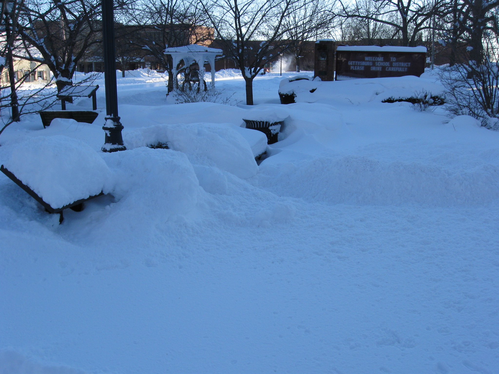
We’ll start at the corner of Baltimore Street and Lefever Street at the Gettysburg School District’s Alumni Park. This is where the latest Lincoln statue will not be erected. This view was taken facing east at approximately 8:15 AM on Sunday, February 7, 2010.

The John Rupp House. Although the part closest to the road was built circa 1867, the rear is mostly original. This view was taken facing southwest at approximately 8:15 AM on Sunday, February 7, 2010.

Looking towards town on Baltimore Street. This view was taken facing northwest at approximately 8:15 AM on Sunday, February 7, 2010.
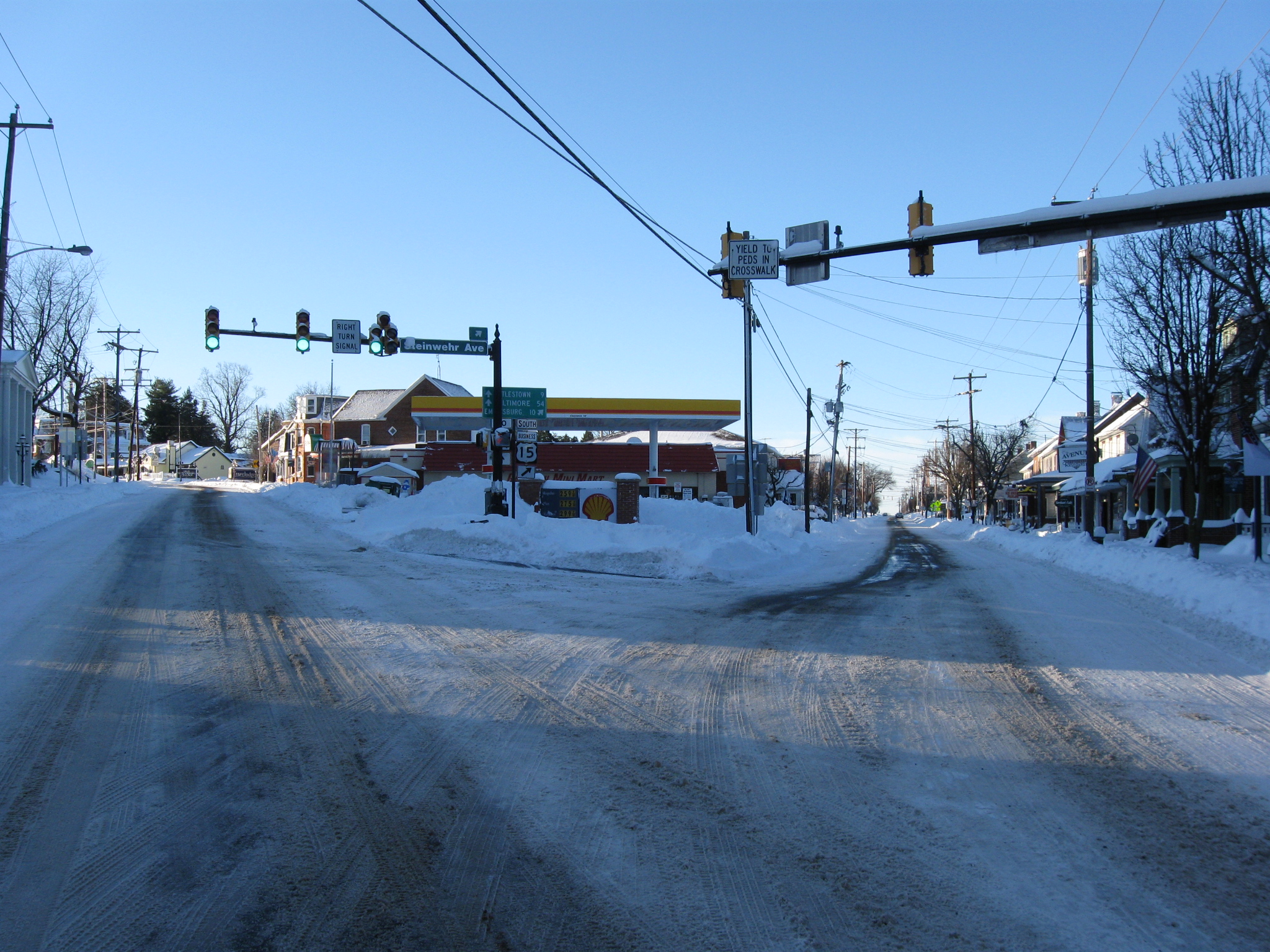
Looking the other way is the intersection junction of Baltimore Street, which continues over Cemetery Hill on the left, and the Emmitsburg Road (Steinwehr Avenue) on the right. Light traffic this morning allowed us to go into the street to recreate one of our favorite Cemetery Hill shots… This view was taken facing south at approximately 8:15 AM on Sunday, February 7, 2010.

…of this location where the Wagon Hotel was located in 1863. This view was taken facing south circa 1884.
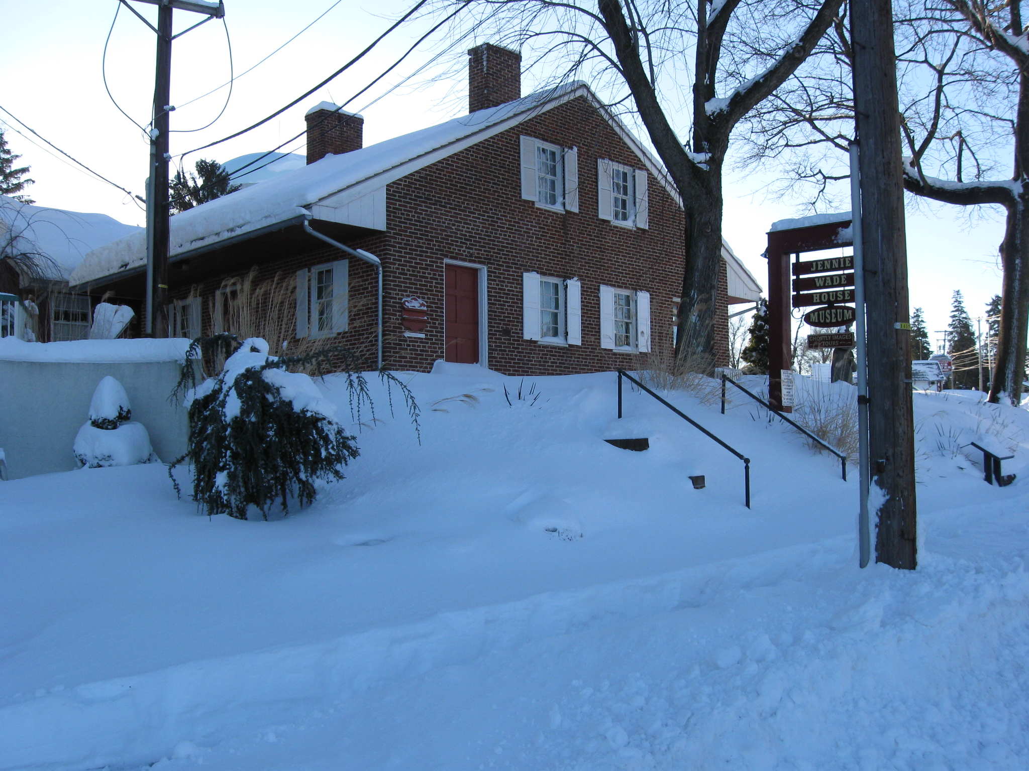
The Jennie Wade House, the two halves of which were owned by separate individuals, neither of whom were Jennie Wade. The left or north half was owned by Jennie Wade’s brother-in-law John Louis McClellan. This view was taken facing southeast at approximately 8:15 AM on Sunday, February 7, 2010.
The right or south side of the house was owned by Catharine McClain. Jennie Wade is making herself an easy target standing between the two trees. This view was taken facing northeast at approximately 8:15 AM on Sunday, February 7, 2010.
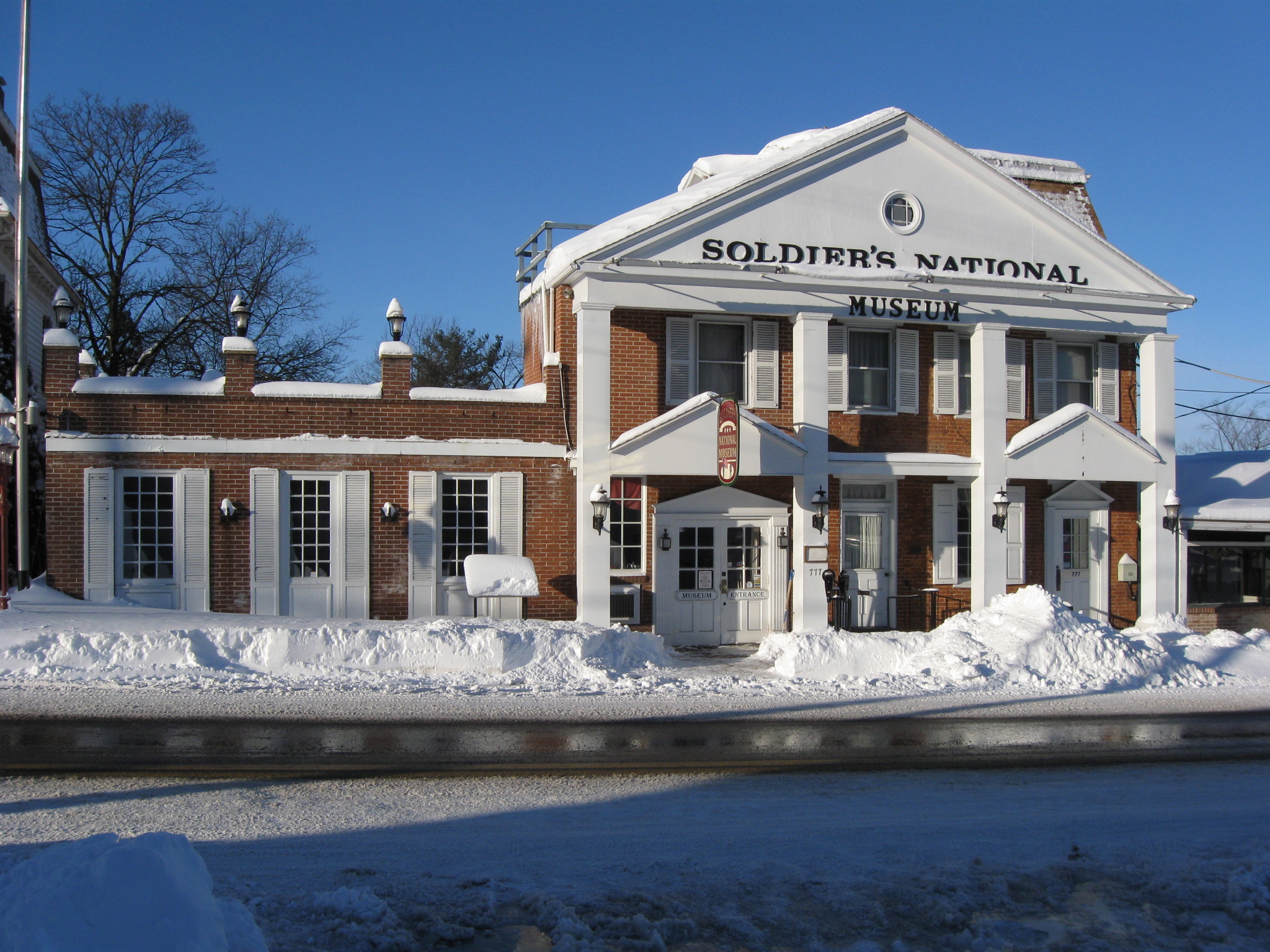
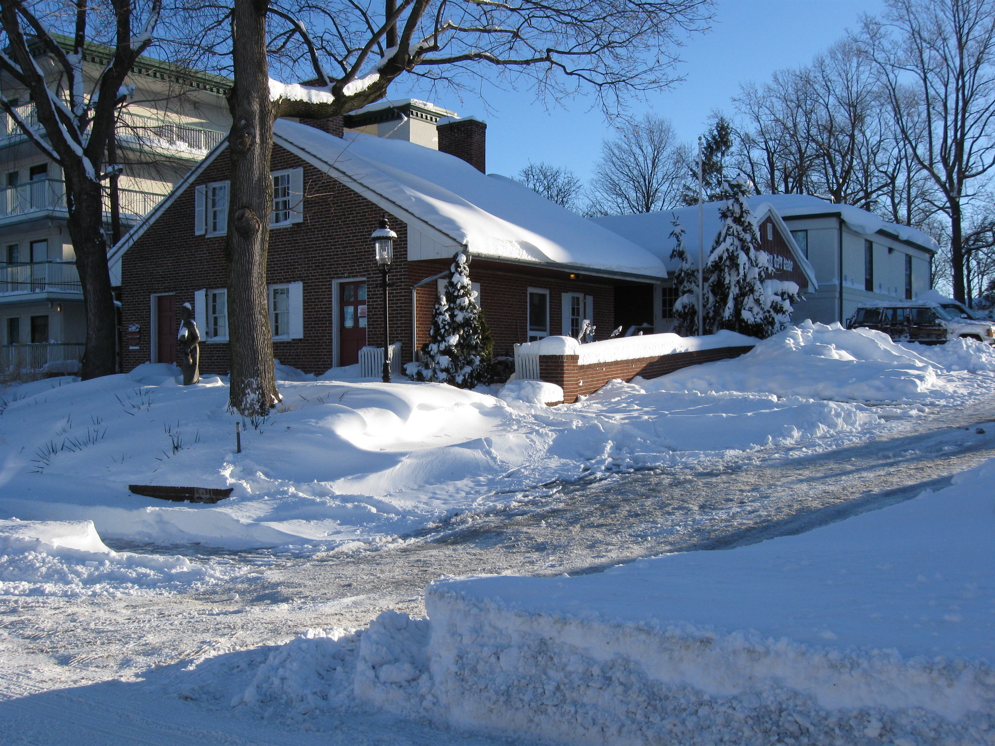
The right (north) side of the Soldiers National Museum was the home of “Captain” John Myers in 1863. On November 20, 1866, the Myers home was formally opened as the National Soldiers’ Orphans’ Homestead. The structure had originally been two stories high, and the third-floor mansard roof was added about 1865. The orphans were briefly visited here on June 21, 1867 by General Ulysses S. Grant. This view was taken facing southwest at approximately 8:15 AM on Sunday, February 7, 2010.
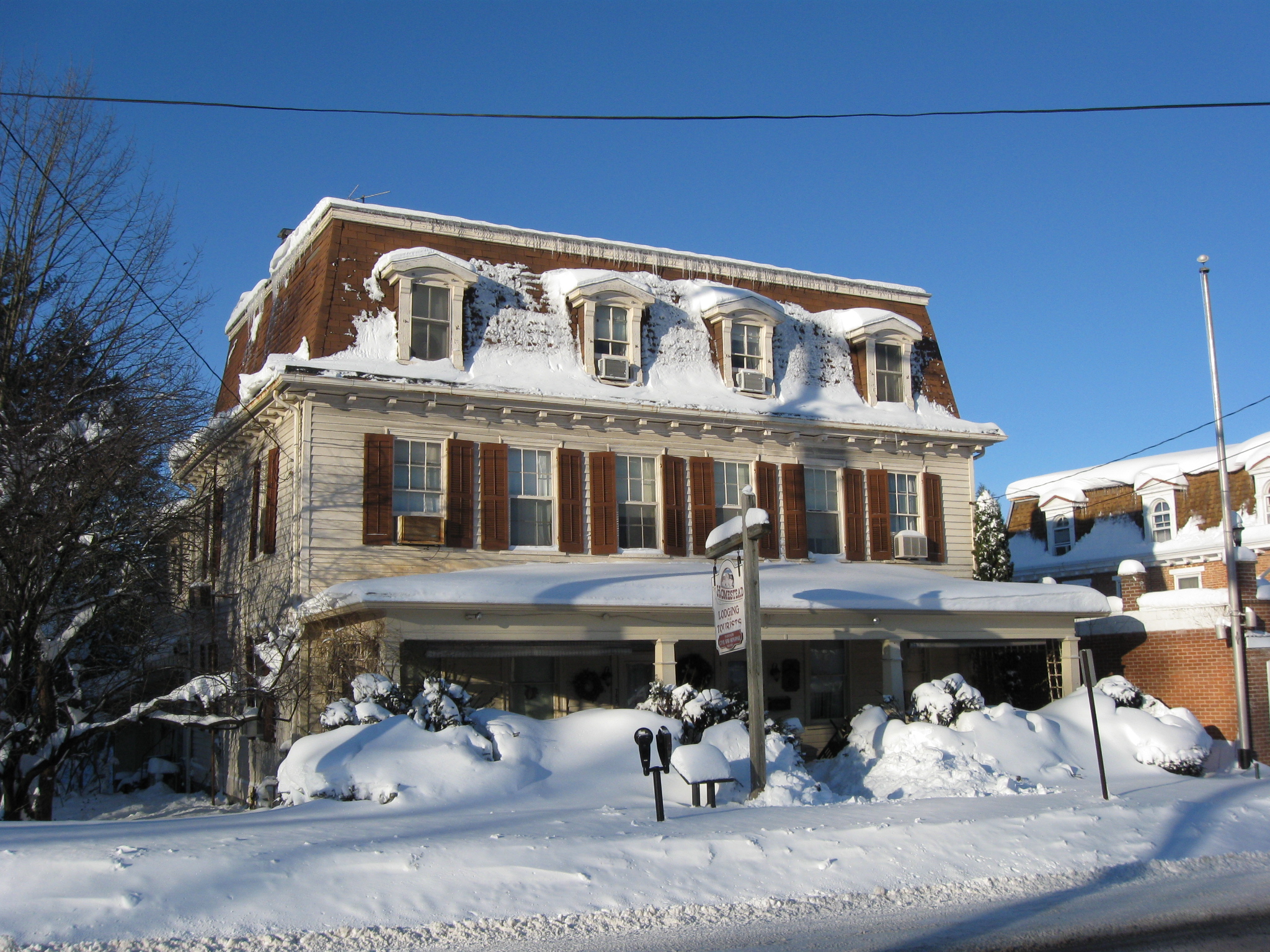
To the left of the Myers House is the framed building at 785 Baltimore Street, still known as “The Homestead.” It was constructed circa 1870 as a new home for the Orphans. When originally built, it was farther from Baltimore Street than it is today. The National Soldiers’ Orphans’ Homestead closed by late 1877 owing to declining financial support and charges of mistreatment of the orphans. The Myers and Homestead buildings were sold at public auction in February 1878. This view was taken facing southwest at approximately 8:15 AM on Sunday, February 7, 2010.
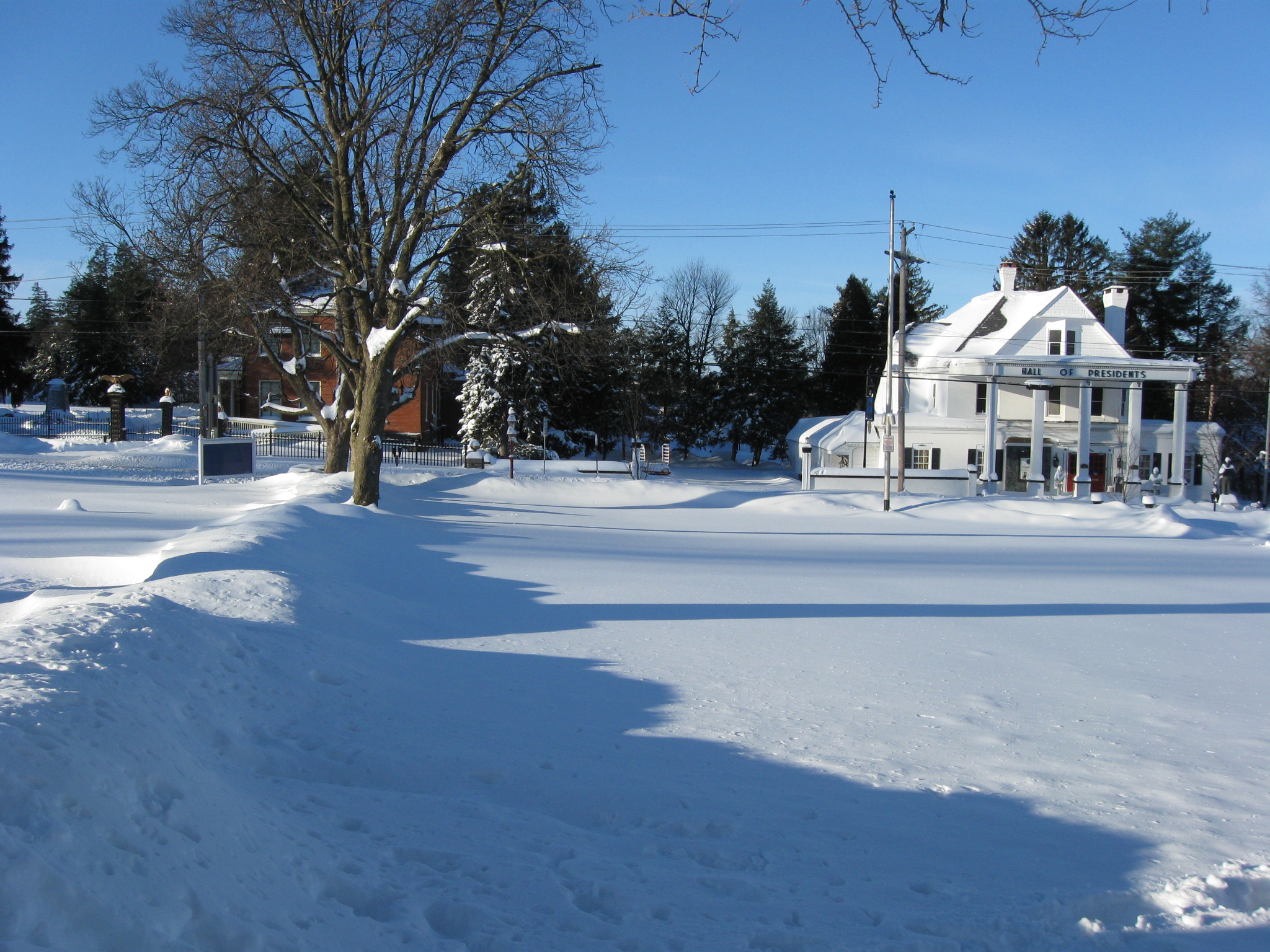
Looking across the Gettysburg Tours Parking Lot. Two post Civil War buildings are shown here, the Hall of Presidents on the right, and the original house of the Superintendent of the Gettysburg National Cemetery on the left. The hump on the left leading to Baltimore Street is a snow covered stone wall. This view was taken facing southwest at approximately 8:15 AM on Sunday, February 7, 2010.

We’ve now crossed the stone wall, and are looking at the National Cemetery. The New York State Monument is in the left background. The red brick Superintendent’s House is in the right background. This view was taken facing southwest at approximately 8:15 AM on Sunday, February 7, 2010.
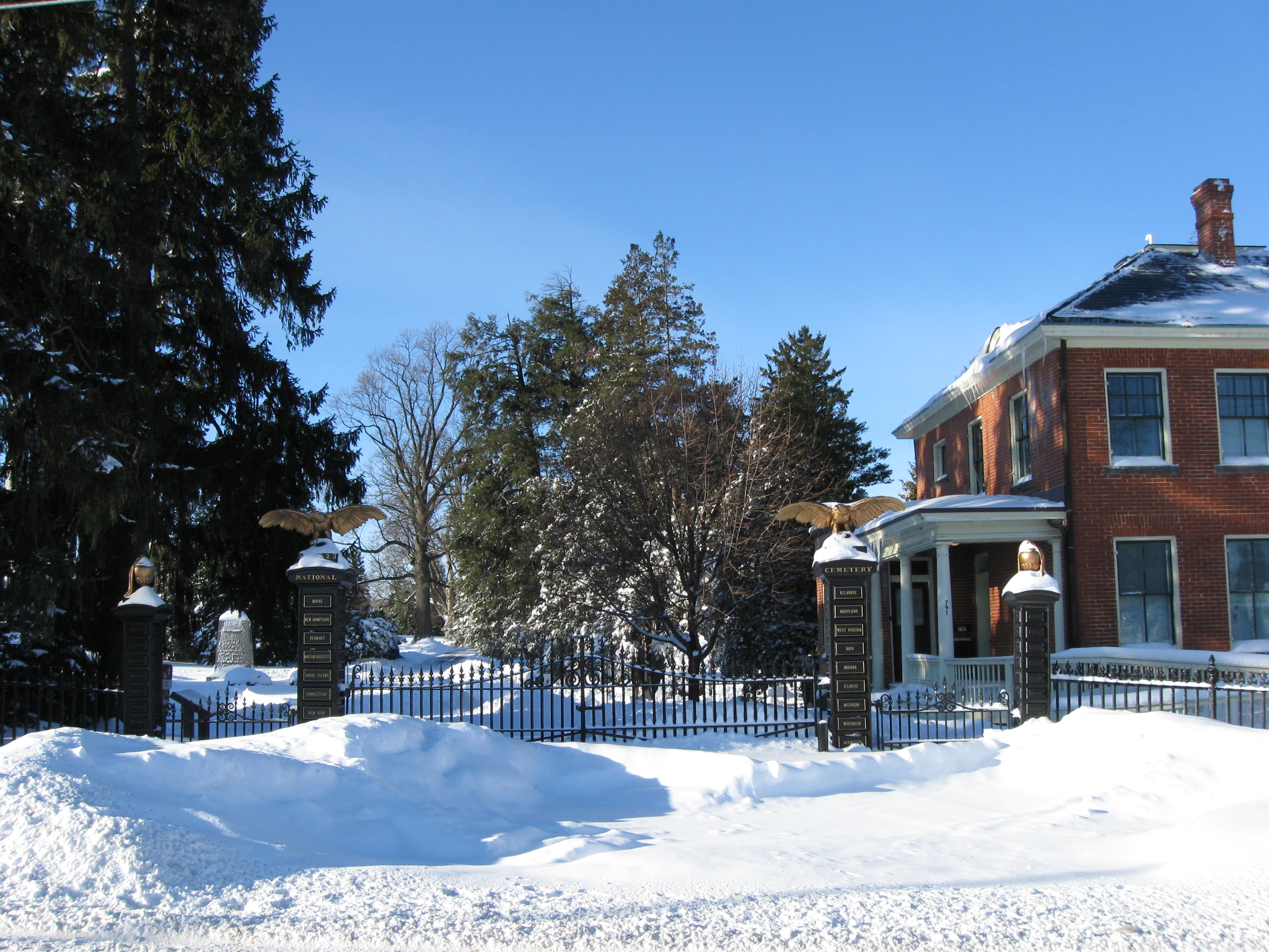
The Baltimore Street gate of the National Cemetery. This view was taken facing southwest at approximately 8:15 AM on Sunday, February 7, 2010.

The Soldiers’ National Cemetery Gate. The New York State Monument is the tallest statue in the background. To its right is the first Gettysburg statue to Major General John Reynolds. This view was taken facing south at approximately 8:15 AM on Sunday, February 7, 2010.

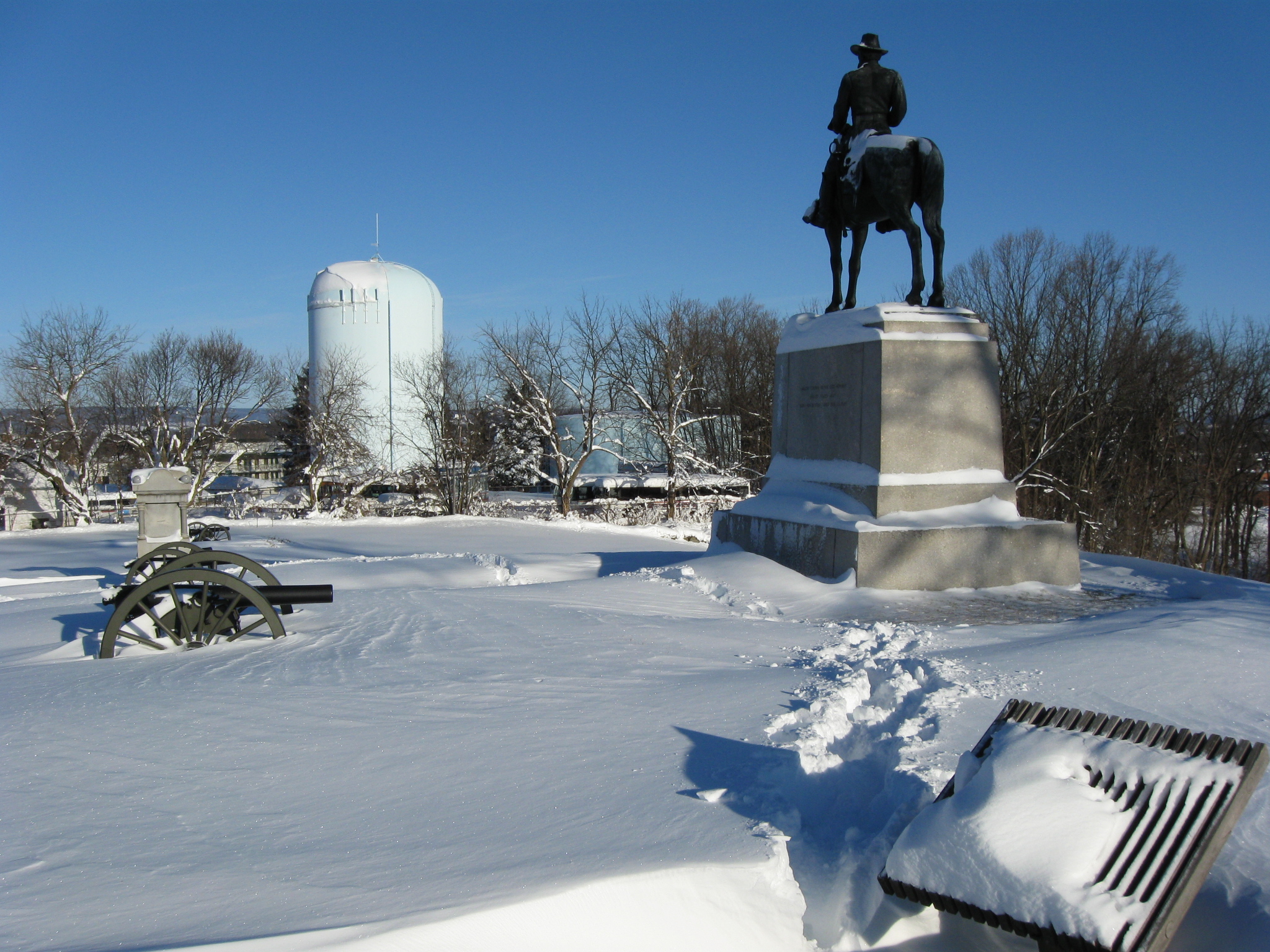
We’re getting closer to the statues on the crest of East Cemetery Hill. The equestrian monument is to Major General Winfield Scott Hancock. This view was taken facing southeast at approximately 8:15 AM on Sunday, February 7, 2010.
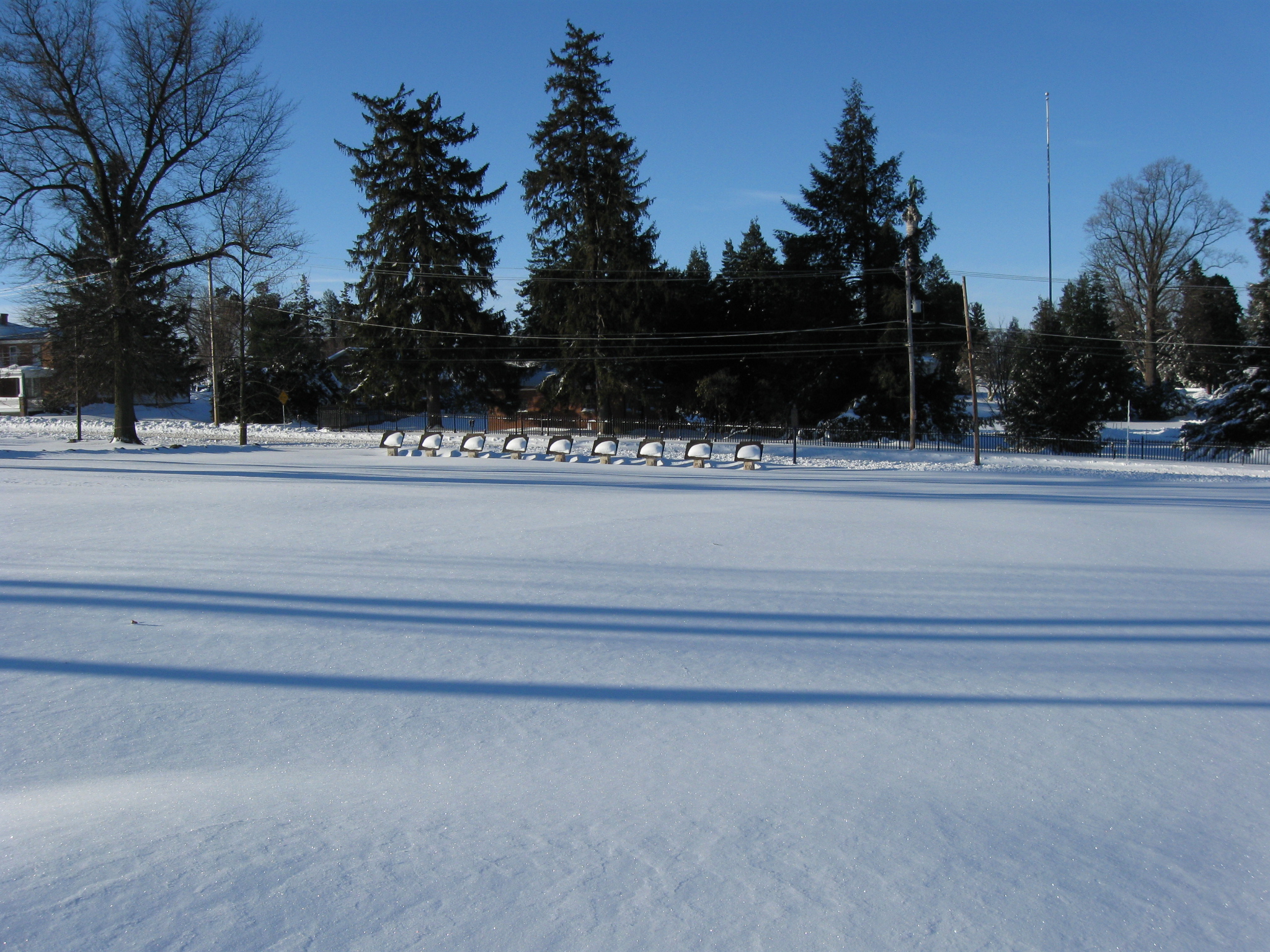
But the Army of the Potomac itinerary tablets near Baltimore Street attracted our attention. This view was taken facing southwest at approximately 8:15 AM on Sunday, February 7, 2010.
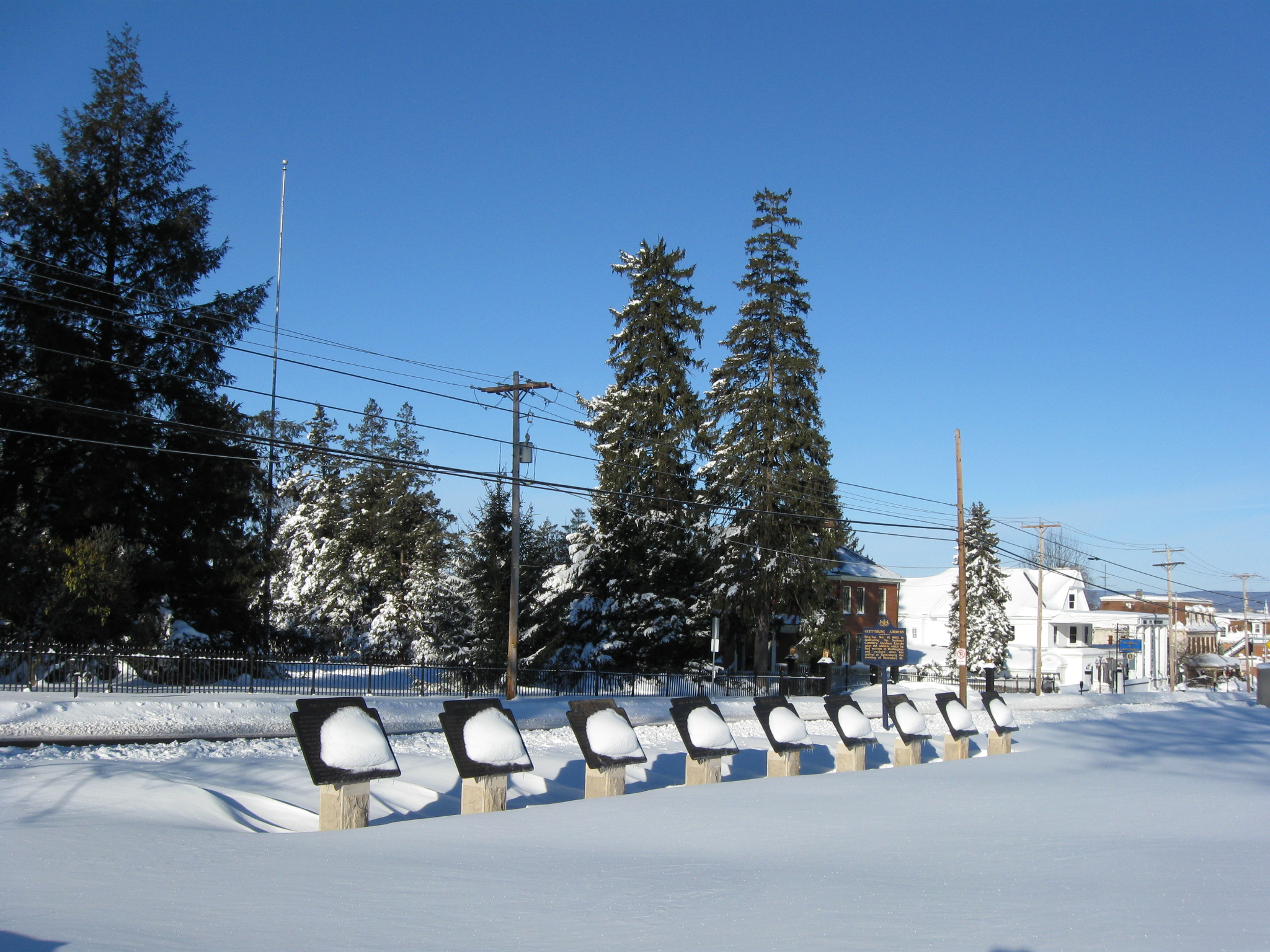
The tablets were reinstalled on August 21, 2008. This view was taken facing west at approximately 8:15 AM on Sunday, February 7, 2010.

In the foreground is the snow covered right flank marker to the 73rd Pennsylvania Infantry Regiment. This view was taken facing south at approximately 8:15 AM on Sunday, February 7, 2010.

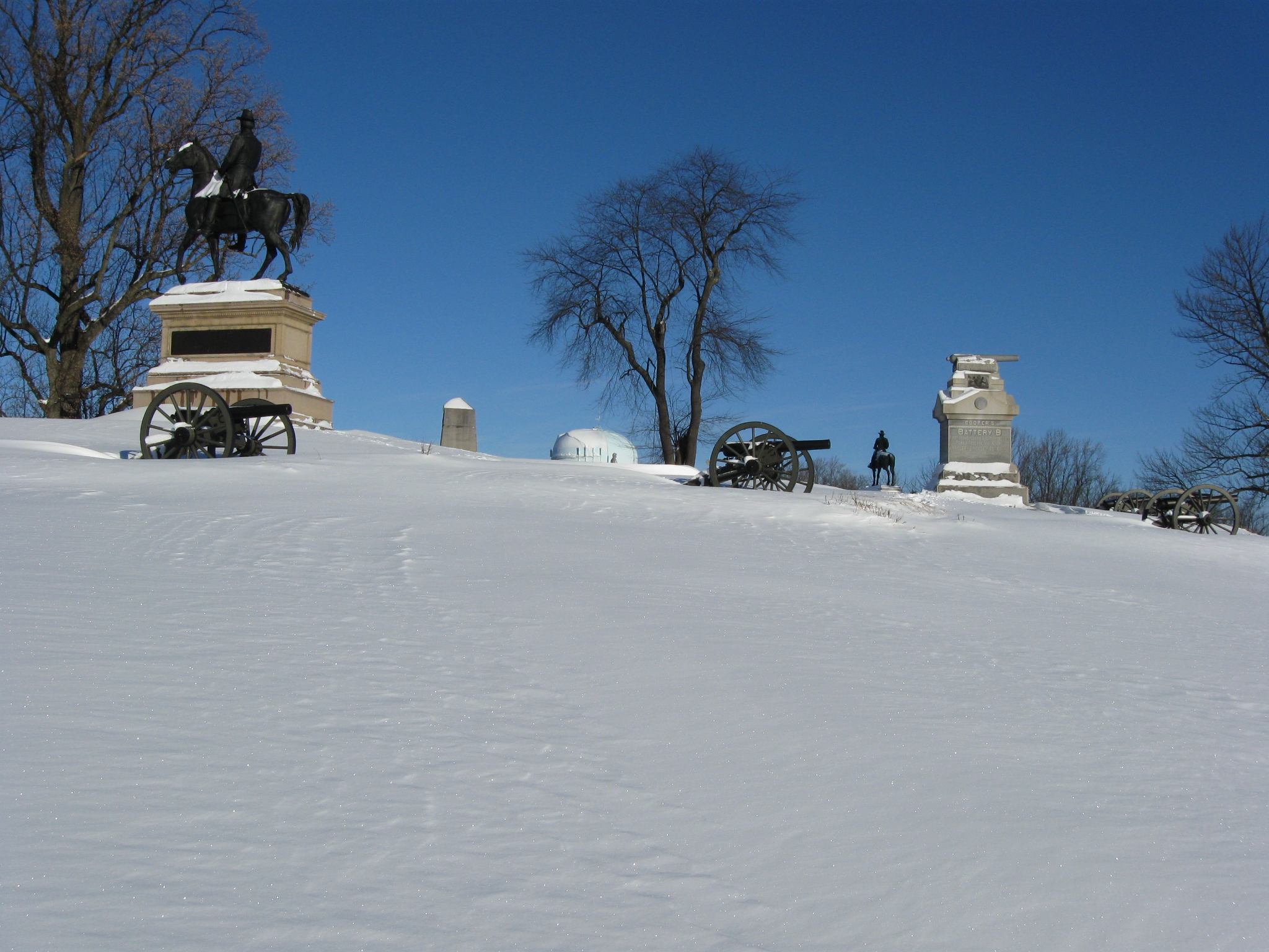
The smaller monument and the artillery pieces mark the position of Wiedrich’s New York Battery. The equestrian monument is to Major General Oliver O. Howard. This view was taken facing east at approximately 8:15 AM on Sunday, February 7, 2010.

Wiedrich’s Battery and Howard’s statue. The light green/light blue water tank prominently marks Cemetery Hill when the foliage is down. This view was taken facing north at approximately 8:15 AM on Sunday, February 7, 2010.
This view was taken facing north at approximately 8:15 AM on Sunday, February 7, 2010.
The same picture of Wiedrich’s Battery that opened our winter walking post on February 8th. This view was taken facing north at approximately 8:15 AM on Sunday, February 7, 2010.

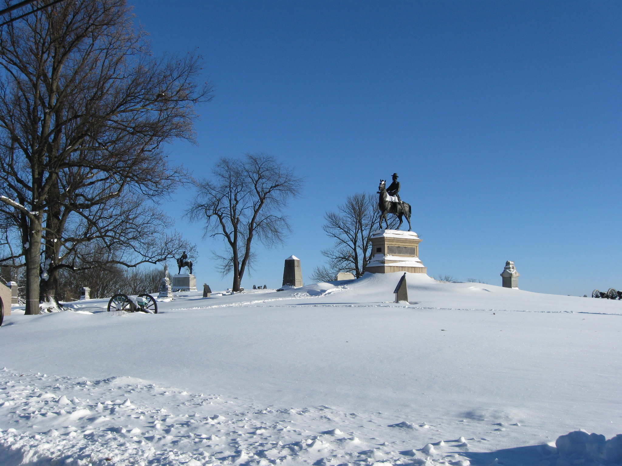
The Howard equestrian statue was dedicated in 1932. This view was taken facing north at approximately 8:15 AM on Sunday, February 7, 2010.

It is finally appropriate for the figure on the 7th West Virginia Monument to be wearing his winter coat. This view was taken facing west at approximately 8:15 AM on Sunday, February 7, 2010.

Another one of Wiedrich’s guns. But let’s walk towards the tree. This view was taken facing east at approximately 8:15 AM on Sunday, February 7, 2010.

The tree is growing out of a barely visible stone wall. This view was taken facing east at approximately 8:15 AM on Sunday, February 7, 2010.
At the bottom of the hill are two New York monuments. On the left is the monument to the 54th New York, and on the right is the monument to the 41st New York. In the background, the light green/light blue water tank marks the hospital site at Camp Letterman. To the right of the tank is a line of snow marking Benner’s Hill. Confederate artillery on Benner’s Hill lost an artillery duel with artillery posted on Cemetery Hill and Culp’s Hill on July 2, 1863. This view was taken facing east at approximately 8:15 AM on Sunday, February 7, 2010.
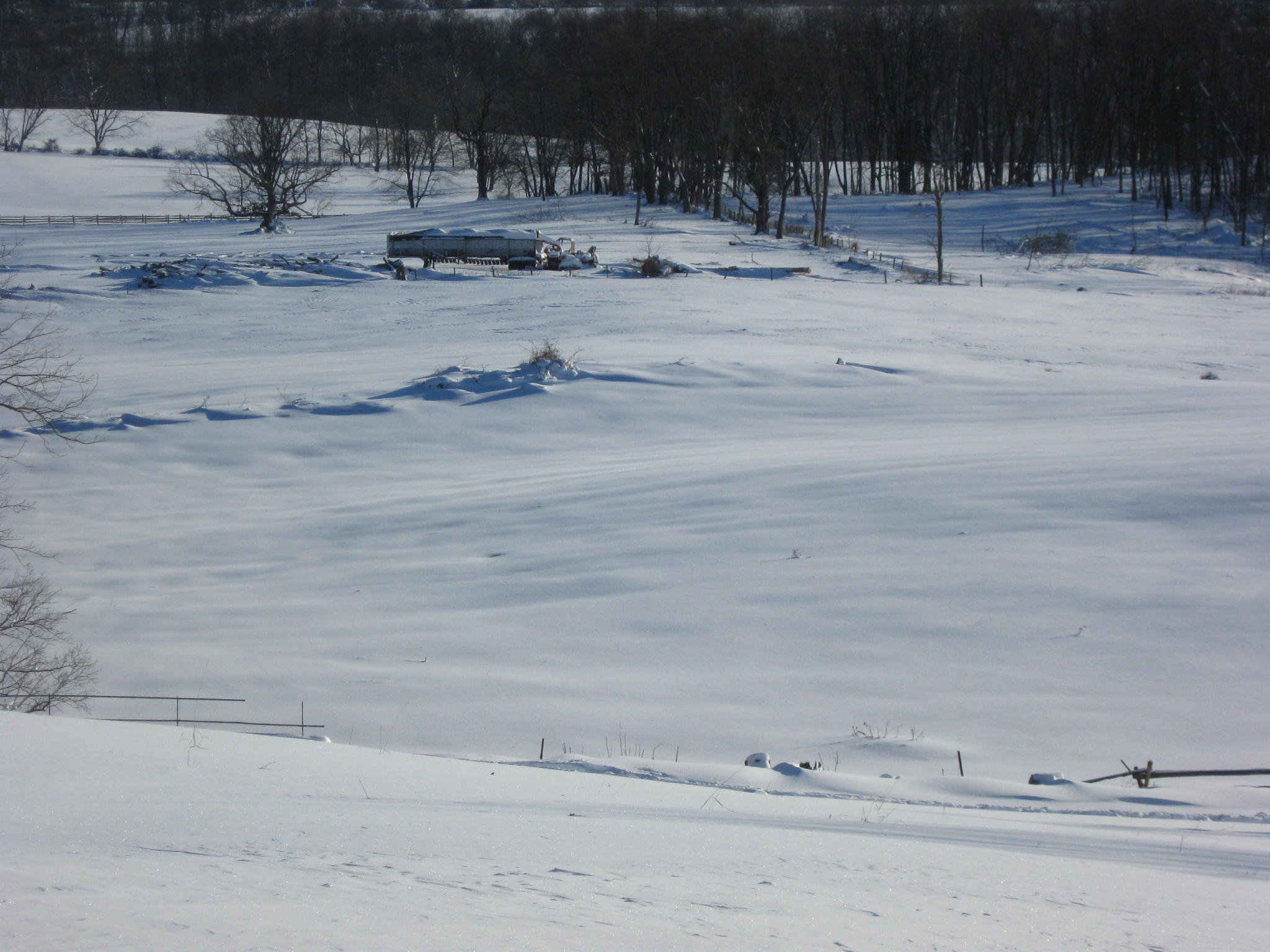
Some equipment from the tree cutting still going on in this area. This view was taken facing east at approximately 8:15 AM on Sunday, February 7, 2010.

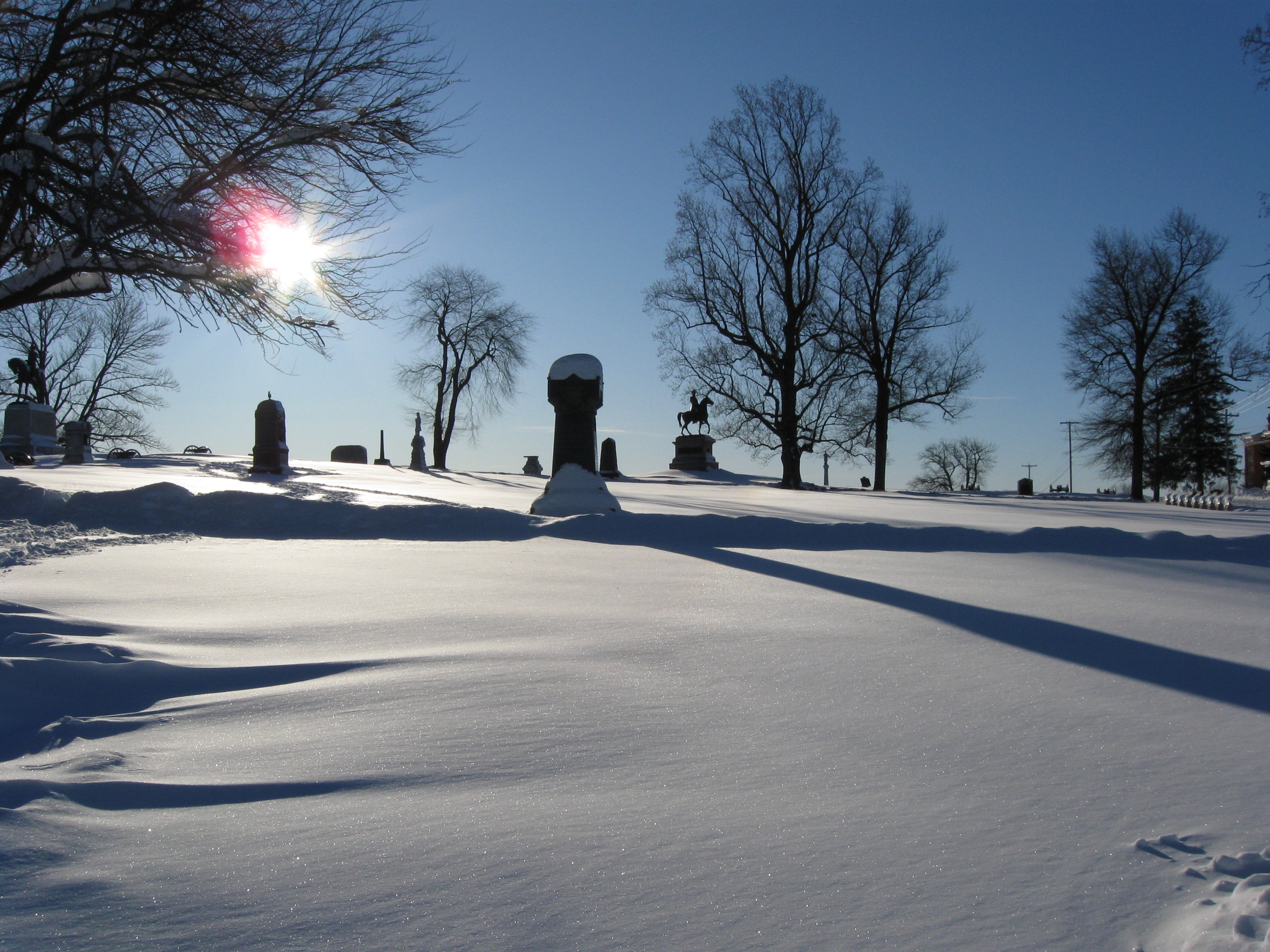
We have returned to the crest of East Cemetery Hill. The artillery pieces mark the locations occupied by first Cooper’s Battery, and then Rickett’s Battery. the monument to Rickett’s Battery is on the left, the monument to Cooper’s Battery is to its right, and at the far right is the monument to the 4th Ohio Infantry Regiment. This view was taken facing south at approximately 8:15 AM on Sunday, February 7, 2010.

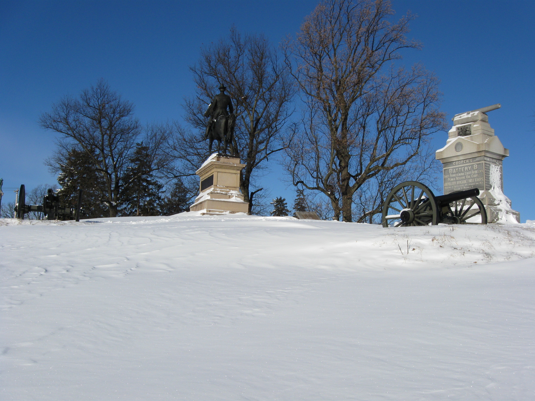
From left: the second monument to Cooper’s Battery with an artillery tube on top, the small original monument/marker to Cooper’s Battery, the equestrian statue to Hancock, and the red brick Evergreen Cemetery Gatehouse. This view was taken facing southwest at approximately 8:15 AM on Sunday, February 7, 2010.

From left: Gatehouse, Hancock, and the original Cooper’s Battery marker below the monument to the 14th Indiana Infantry Regiment. This view was taken facing southwest at approximately 8:15 AM on Sunday, February 7, 2010.

Cooper’s monument and Hancock’s monument. This view was taken facing southwest at approximately 8:15 AM on Sunday, February 7, 2010.

From left: 7th West Virginia, Howard’s Headquarters, Rickett’s monument, distinctive water tank, Howard’s monument. This view was taken facing northwest at approximately 8:15 AM on Sunday, February 7, 2010.
Hancock left, Cooper right. This view was taken facing west at approximately 8:15 AM on Sunday, February 7, 2010.

Hancock. This view was taken facing west at approximately 8:15 AM on Sunday, February 7, 2010.
From left: Hancock, 14th Indiana, DISTINCTIVE WATER TANK, Howard, Cooper. This view was taken facing northwest at approximately 8:15 AM on Sunday, February 7, 2010.

This view was taken facing north at approximately 8:15 AM on Sunday, February 7, 2010.

From left to right, 7th West Virginia, Howard (just to the left of the tree), 14th Indiana, Hancock, Cooper. This view was taken facing northeast at approximately 8:15 AM on Sunday, February 7, 2010.
Left foreground: Battery B, 4th United States, commanded by James Stewart; 73rd Pennsylvania, Wiedrich’s Monument, 7th West Virginia, Howard, 14th Indiana, Hancock, Cooper. This view was taken facing northeast at approximately 8:15 AM on Sunday, February 7, 2010.

From left: Rickett’s, 14th Indiana, Cooper (barely visible), Hancock. This view was taken facing east at approximately 8:15 AM on Sunday, February 7, 2010.

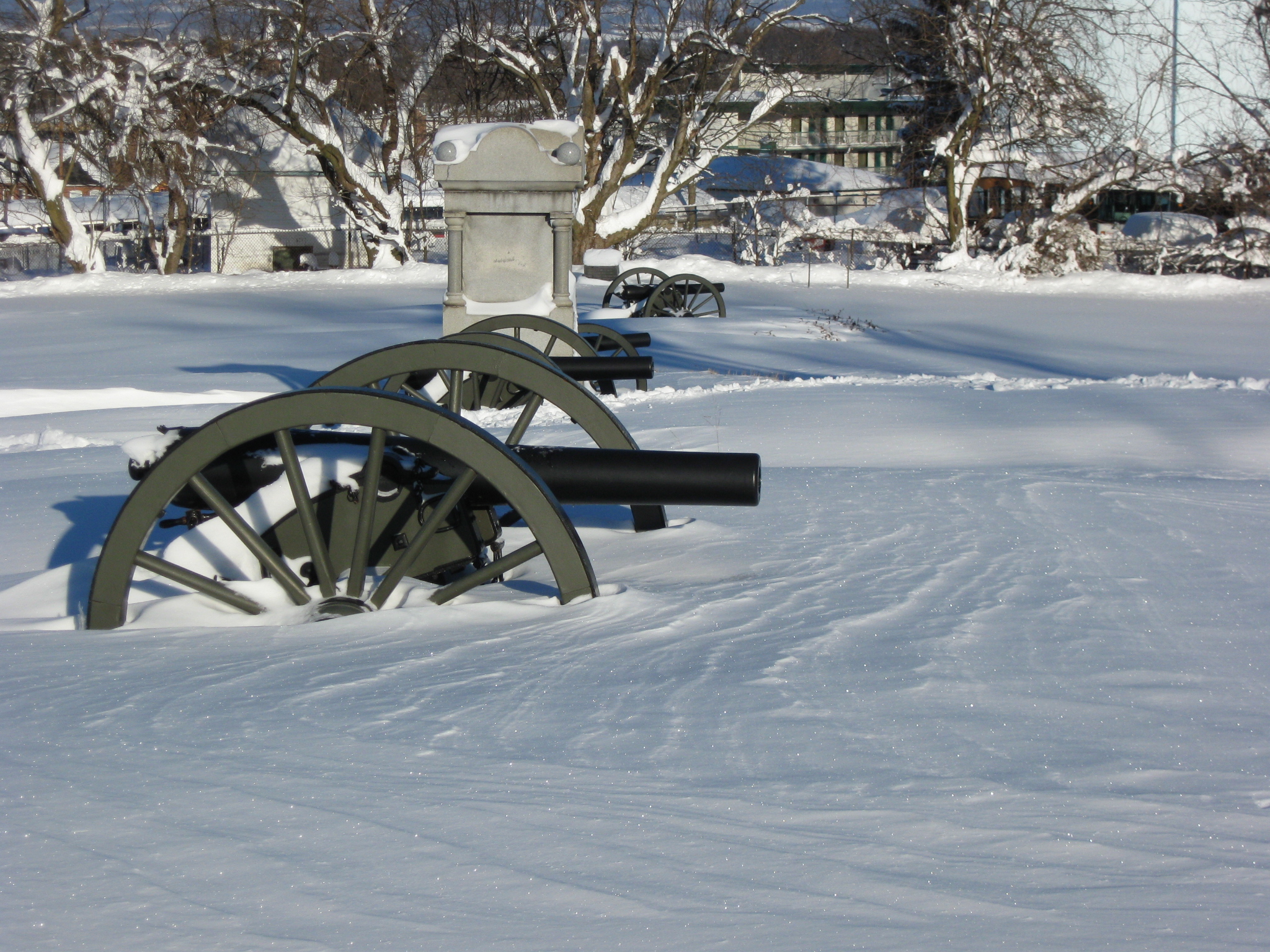
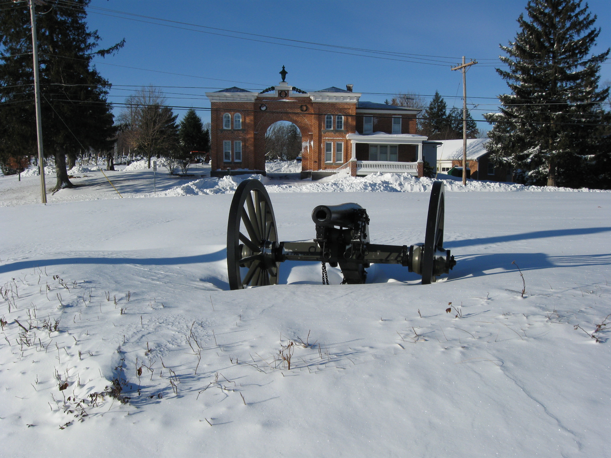
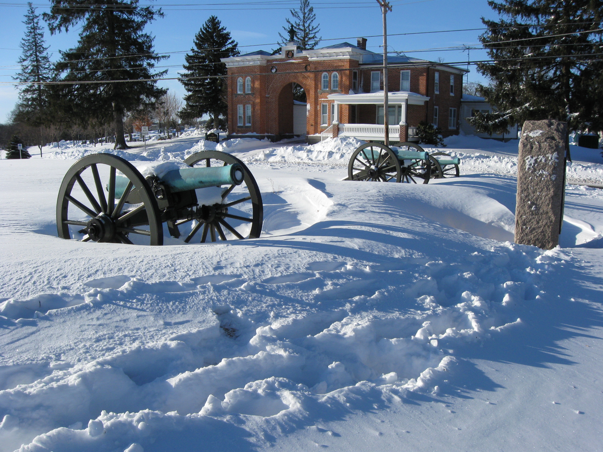
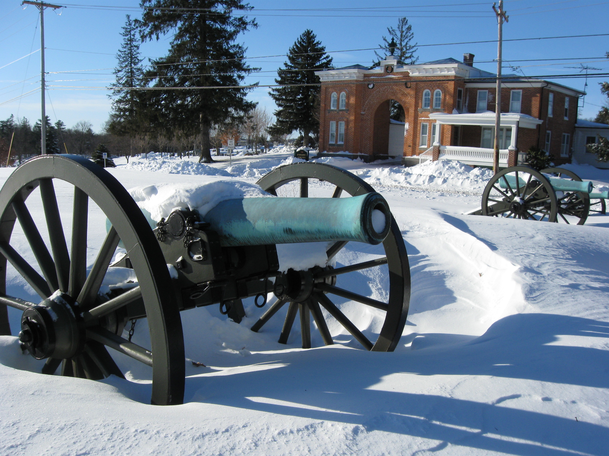
We’re making our way towards the Baltimore Pike. The appropriately dressed monument to the 4th Ohio Infantry Regiment is on the left. In the foreground are guns marking the position held at times by Rickett’s Battery, or Cooper’s Battery, or Breck’s Battery. In the background is the red brick Evergreen Cemetery Gatehouse. This view was taken facing southwest at approximately 8:15 AM on Sunday, February 7, 2010.

This view was taken facing southwest at approximately 8:15 AM on Sunday, February 7, 2010.
This view was taken facing southwest at approximately 8:15 AM on Sunday, February 7, 2010.
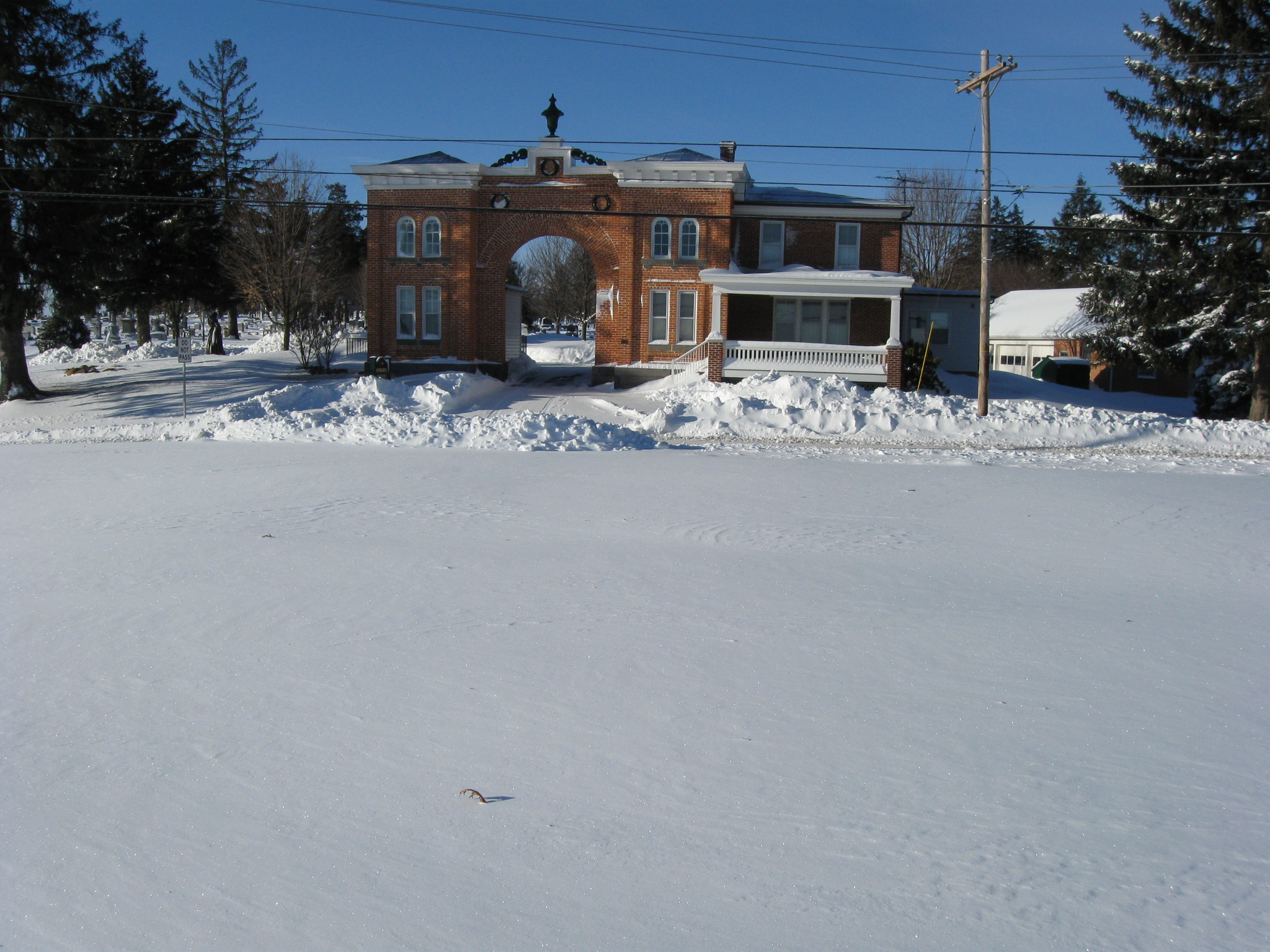
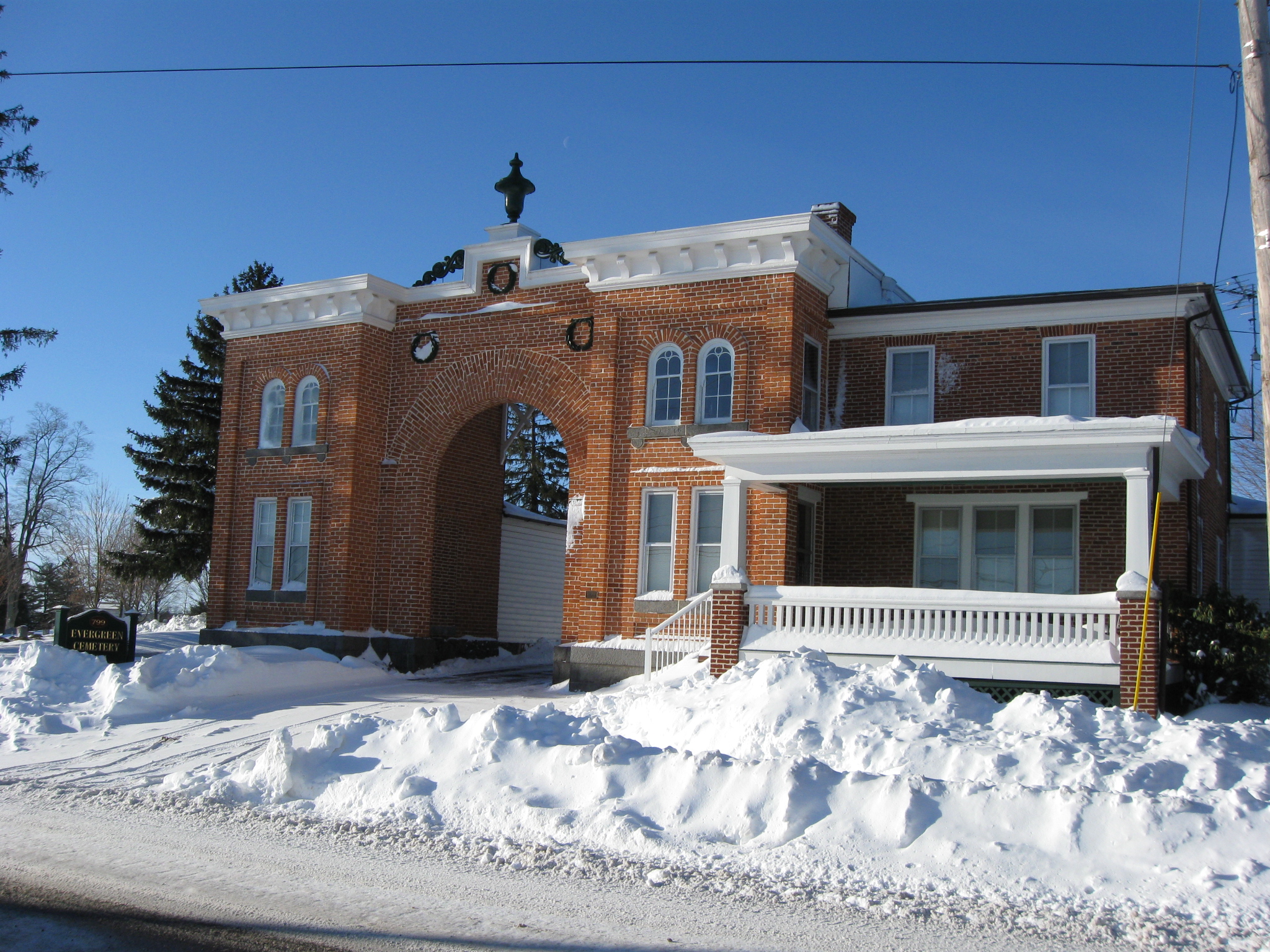
Evergreen Cemetery was established in 1854. The gatehouse was constructed in 1855. This view was taken facing southwest at approximately 8:15 AM on Sunday, February 7, 2010.

We are now approaching the guns marking the position of James Stewart’s Battery B, 4th United States Artillery. This view was taken facing west at approximately 8:15 AM on Sunday, February 7, 2010.
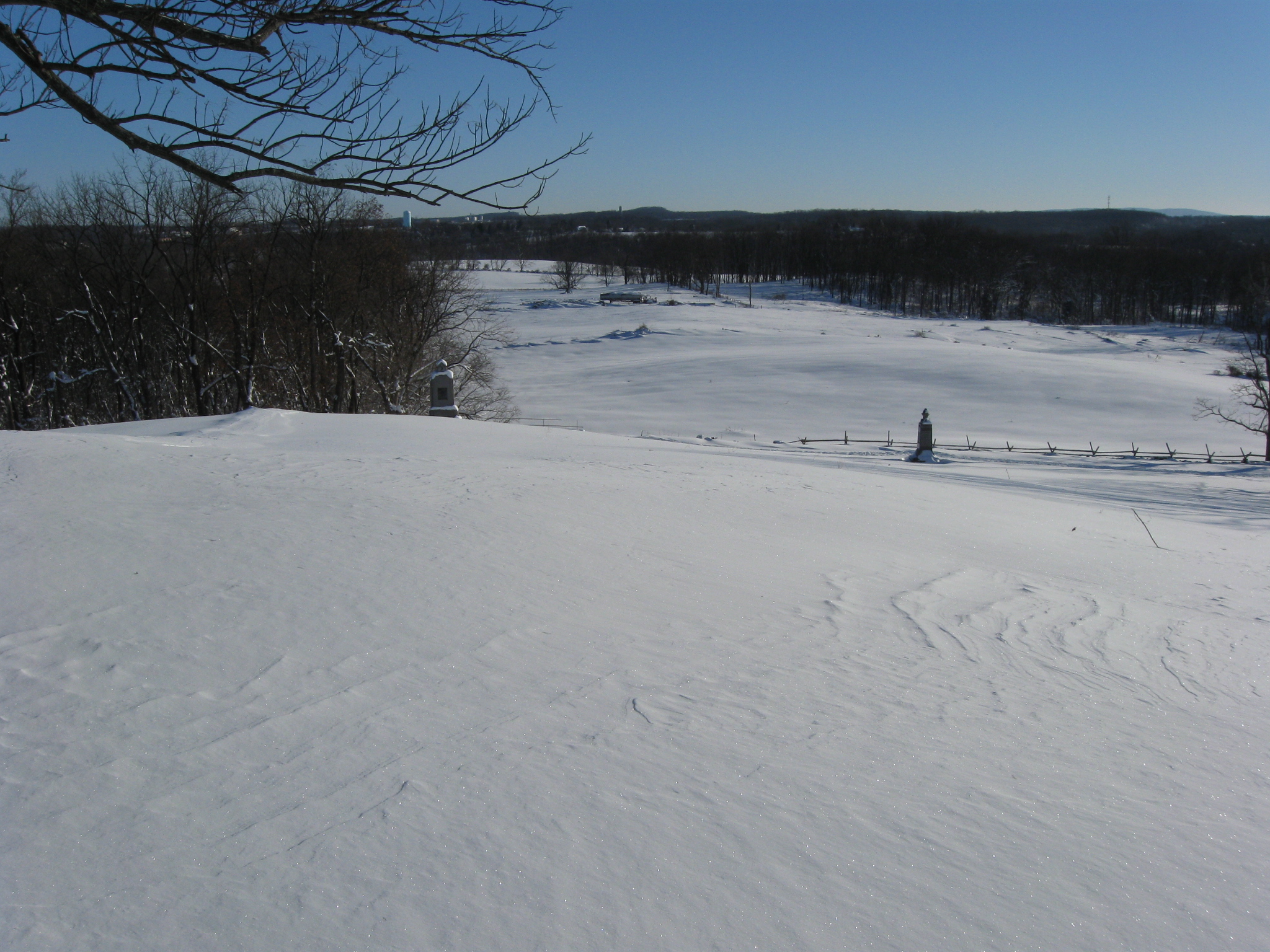
The lunettes here are still clearly defined by the snow. This view was taken facing south at approximately 8:15 AM on Sunday, February 7, 2010.
This view was taken facing south at approximately 8:15 AM on Sunday, February 7, 2010.

This view was taken facing south at approximately 8:15 AM on Sunday, February 7, 2010.
This view was taken facing south at approximately 8:15 AM on Sunday, February 7, 2010.
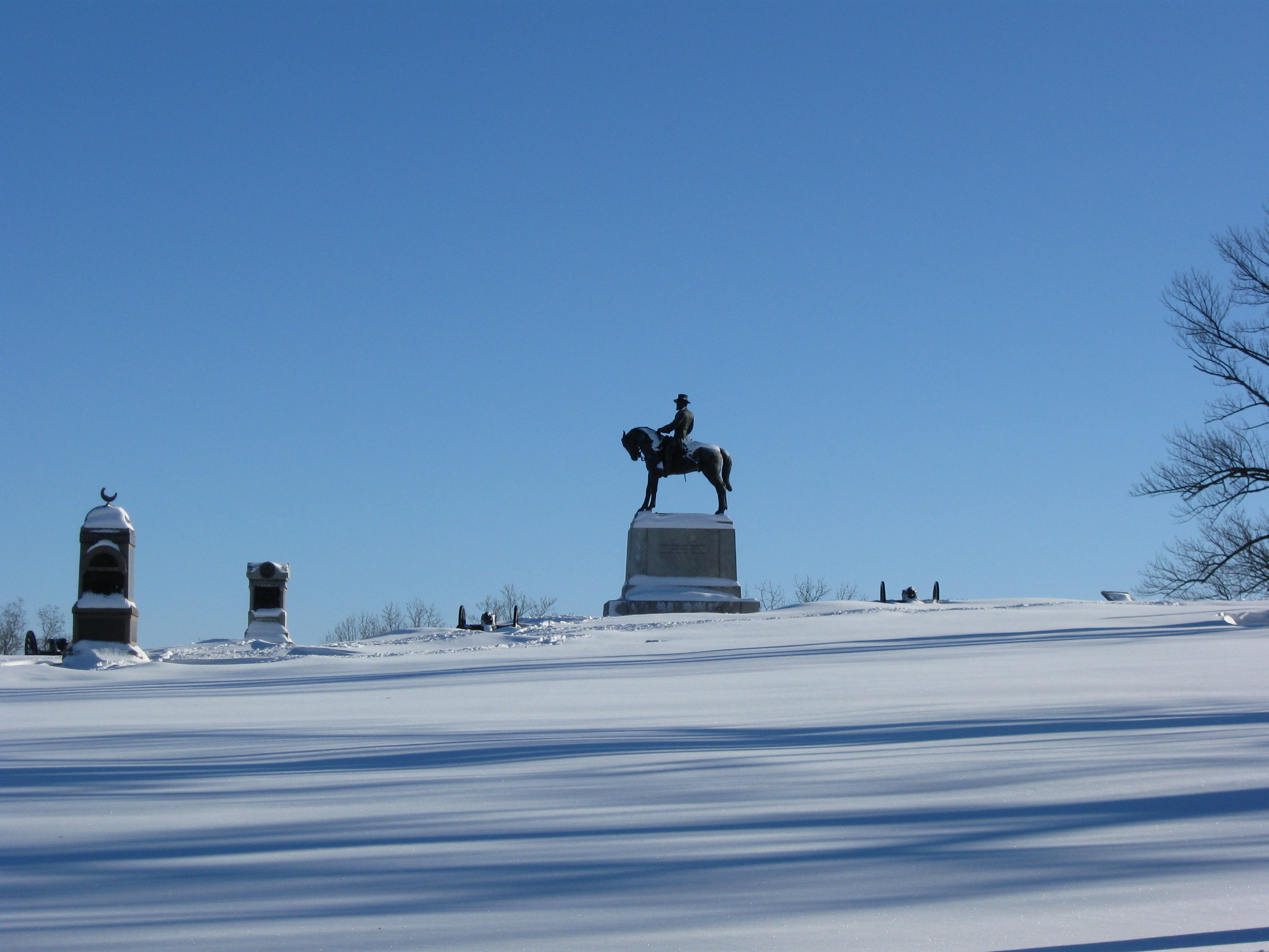
On our way back to town, we took a final shot of General Howard’s statue. This view was taken facing east at approximately 8:15 AM on Sunday, February 7, 2010.