
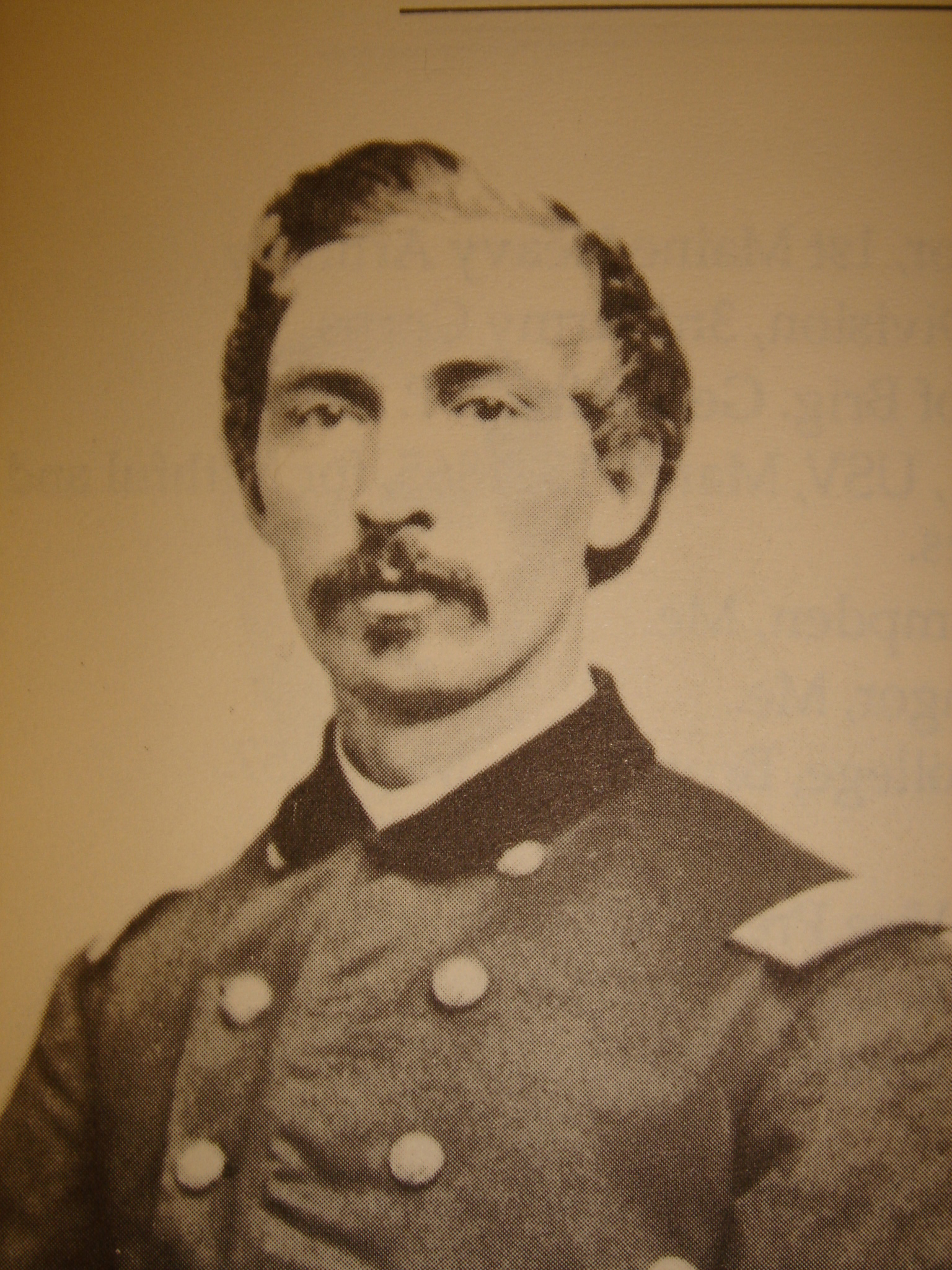
Major John Hammond (1827-1889) of the 5th New York Cavalry Regiment attended St. Albans Academy in St. Albans, Vermont, and graduated from Rensselaer Polytechnic Institute at Troy, New York, in 1847. When he was 22 years old, Hammond left his home in Crown Point, New York to join the gold rush in California. Hammond became instrumental in organizing potential recruits for what later became Company H of the 5th New York Cavalry. Hammond’s father, in the lumber business in Crown Point, advanced the funds to purchase horses for virtually the entire company. Hammond was wounded twice during the war, eventually rose to Colonel of the 5th New York. On June 22, 1867, he was appointed brevet brigadier general. After the war, he became president of the Whitehall & Plattsburgh Railroad Company. In 1878, he became a member of Congress. His counterattack at Hanover on June 30, 1863 drove the Confederates back (south and southwest) through the town square. This view was taken circa the 1860s. This view is courtesy of the New York State Military Museum.
In today’s post, Gettysburg Licensed Battlefield Guide John Krepps showed us “The Commons,” used by the 5th New York Cavalry as a staging area before they counterattacked the Confederates. He also shows us some monuments on the northeast quadrant of Hanover’s Town Square.

This map shows the location of where our videos were produced on the Old Hanover Road. Videos #1-#9 were shown in our previous Hanover posts. Videos #10 and #11 were taken at the “Confederates Invade Pennsylvania” wayside marker northeast of the junction of the Westminster Road/Westminster Avenue and Frederick Street. Video #12 was taken at the junction of Westminster Road/Westminster Avenue and Frederick Street. Video #13 was taken near the Henry Winebrenner House on Frederick Street. (Videos #10-13 are not shown on this map.) Videos #14 and #15 were taken in Exchange Alley, a block south of Frederick Street. Videos #16-#17 were taken in the southwest quadrant of Hanover’s Town Square. Video #18 was taken in the southeast quadrant of Hanover’s Town Square. Videos #19 and #20 were taken on Broadway, northeast of Hanover’s Town Square. Video #21 was taken in “The Commons” area. Videos #22 and #23 were taken on the northeast quadrant of Hanover’s Town Square. This map was created facing north at approximately 9:00 AM on Wednesday, August 5, 2009.

This map is from John Krepps’ book, A Strong and Sudden Onslaught, The Cavalry Action at Hanover, Pennsylvania. This map shows the Confederates occupying Hanover, their farthest advance northeast of the Town Square, and the Union counterattack on June 30, 1863. Union units are shaded a dark color. Confederate units have lines running through them. Gettysburg Licensed Battlefield Guide Dave Weaver drew the basic map, and John Krepps drew the troop movements.

Gettysburg Licensed Battlefield Guide John Krepps is the author of the book, A Strong and Sudden Onslaught, The Cavalry Action at Hanover, Pennsylvania. He is standing in Hanover’s “Commons” area. The tracks behind him are in the same area as the tracks were in 1863. The tracks lead from Hanover Junction on the right to Gettysburg on the left. This view was taken facing northeast at approximately 4:00 PM on Wednesday, July 29, 2009.
In Video #21 (Videos #1- #20 were shown in our previous Hanover posts) Gettysburg Licensed Battlefield Guide John Krepps is standing in what was known in the 1860s as Hanover’s “Commons.” John discusses the purpose of the Commons, and how the 5th New York Cavalry Regiment used it as a staging area before their counterattacks on the Confederates. This view was taken facing northeast to southeast at approximately 4:00 PM on Wednesday, July 29, 2009.

The “Commons” area ceased to be a place for open green space approximately when the railroad entered this area in the 1850s. After that point it became an industrial/warehouse center. This view was taken facing southeast at approximately 4:00 PM on Wednesday, July 29, 2009.

On this site was the railroad depot for the Hanover Junction, Hanover and Gettysburg Railroad. The tracks were to the right (southeast) of the station. The location is near the intersection of Railroad Street (right to left) and Park Avenue (out of sight on the right). This view was taken facing northeast at approximately 4:00 PM on Wednesday, July 29, 2009.

President Lincoln briefly stopped here on November 18, 1863, on his way to Gettysburg to dedicate the National Cemetery, and on November 19, 1863 on the way back from delivering his Gettysburg Address. This view was taken facing northeast at approximately 4:00 PM on Wednesday, July 29, 2009.
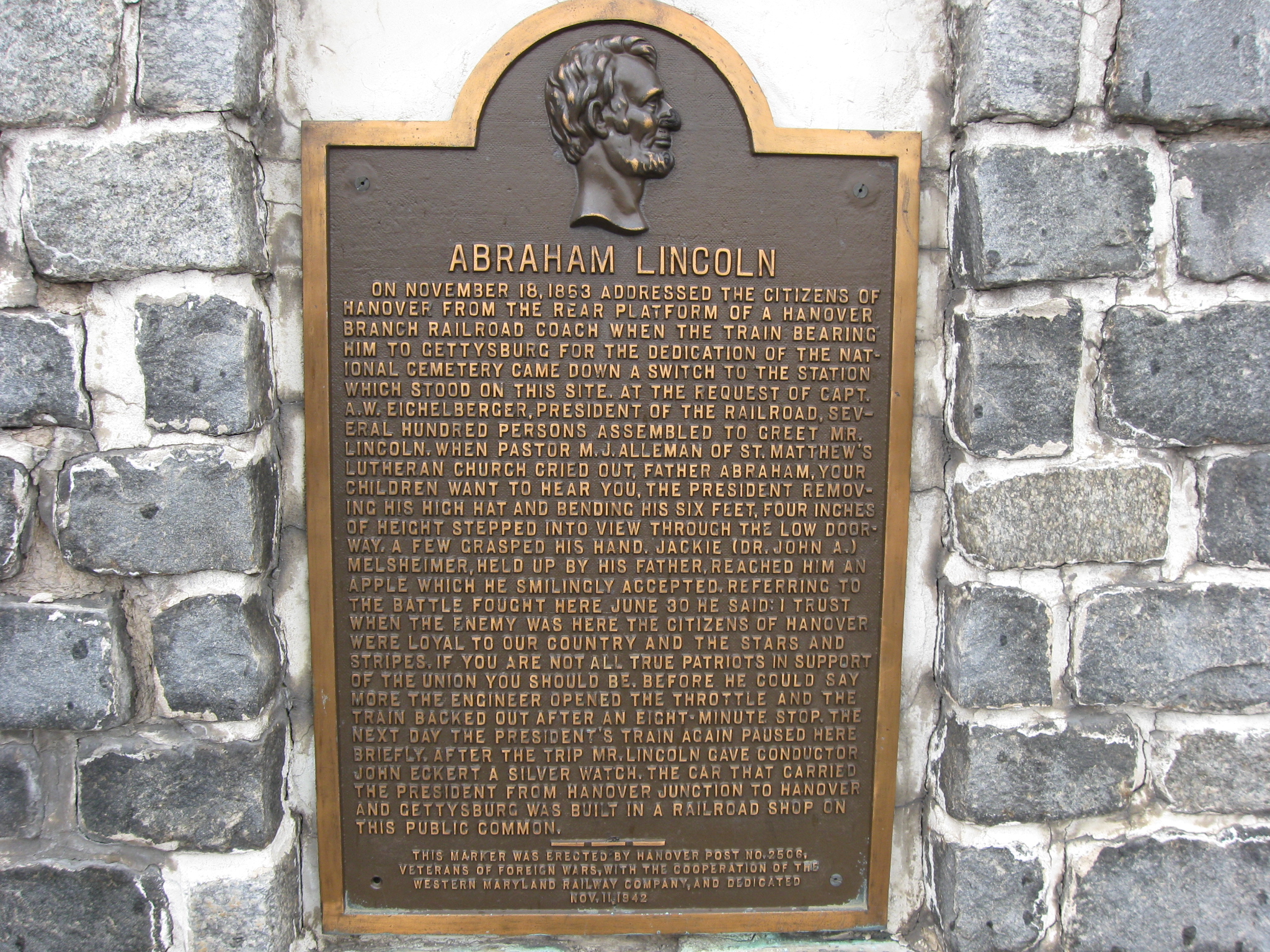
A closer view of the plaque describing Lincoln’s visits. This view was taken facing northeast at approximately 4:00 PM on Wednesday, July 29, 2009.
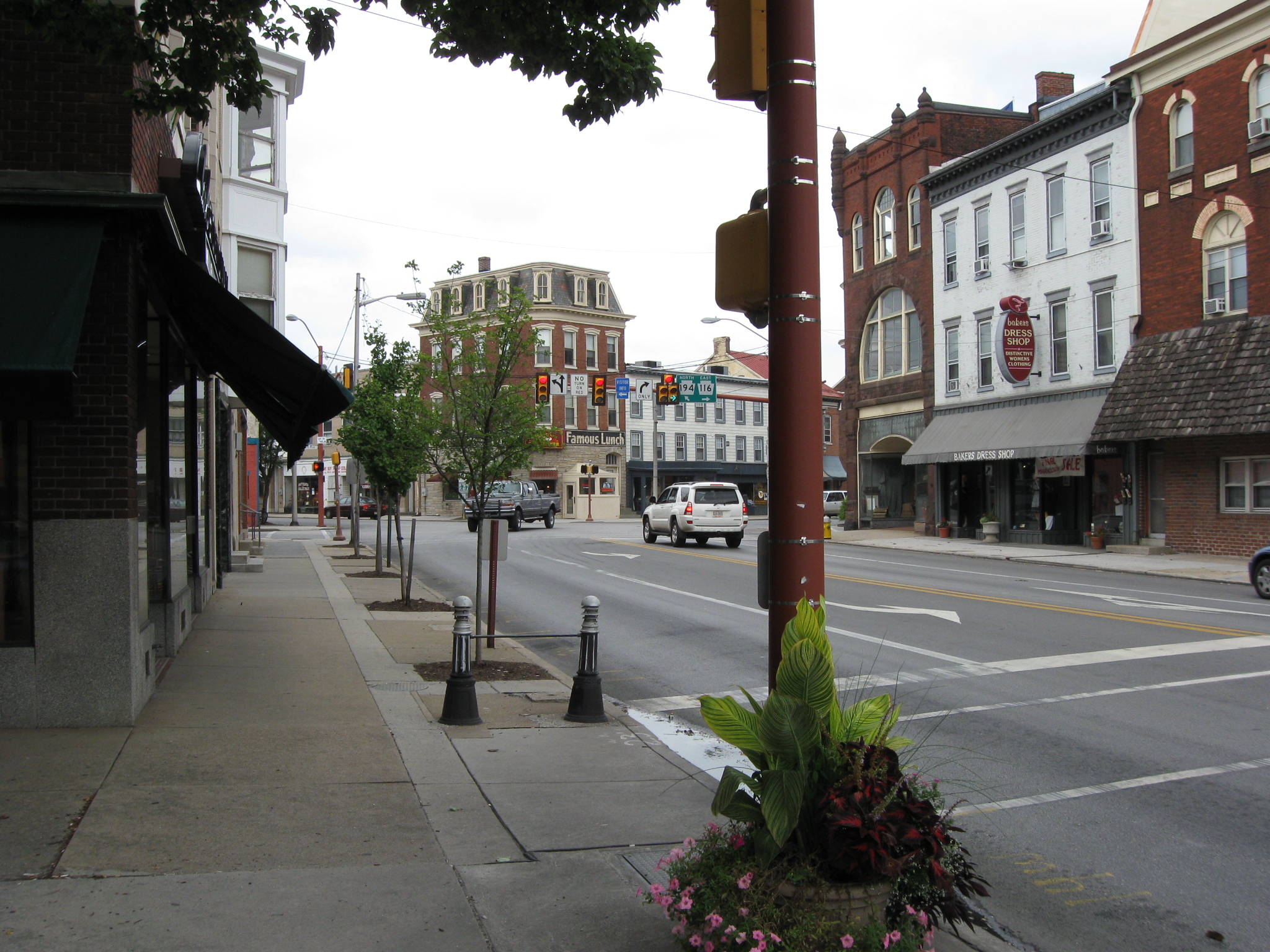
We are standing on the northeast quadrant of Hanover’s Town Square looking towards the “Y” junction of Broadway/Abbottstown Street (which branches to the left) and York Street (which branches to the right). This view was taken facing northeast at approximately 4:00 PM on Wednesday, July 29, 2009.

An 1860s view from Hanover’s Square to the intersection of Broadway/Abbottstown Street and York Street. Although this view is commonly dated 1863, the Wentz, Overbaugh & Co. Dry Goods store, shown on the right, opened for business in 1868. This view is courtesy of the Pennsylvania Room of the Guthrie (Hanover) Public Library.

Licensed Battlefield Guide John Krepps is standing on the northeast quadrant of Hanover’s Square. The light colored building in the right background was the Central Hotel. This view was taken facing southwest at approximately 4:00 PM on Wednesday, July 29, 2009.
In Video #22 Licensed Battlefield Guide John Krepps is standing in the northeast quadrant of Hanover’s Town Square. He shows us how Confederates were pushed back through the town and how the 5th New York Cavalry outflanked the Confederates in the square. This view was taken facing northeast to southwest at approximately 4:00 PM on Wednesday, July 29, 2009.

John Krepps is standing by “The Picket” monument in the northeast quadrant of Hanover’s Square. This view was taken facing north at approximately 4:00 PM on Wednesday, July 29, 2009.
In Video #23 John Krepps is still standing in the northeast quadrant of Hanover’s Town Square. He shows us the monuments to “The Picket” and to “Iron Mike.” This view was taken facing northeast at approximately 4:00 PM on Wednesday, July 29, 2009.

“The Picket” monument, dedicated in 1904, was sculpted by Cyrus Dallin, who also did the Winfield Scott Hancock statue on the Pennsylvania State Monument in Gettysburg. This view was taken facing east at approximately 4:00 PM on Wednesday, July 29, 2009.

“Iron Mike,” according to local legend, was a previous resident of Hanover’s Mount Olivet Cemetery until he began scaring the horses that entered the cemetery. This view was taken facing east at approximately 4:00 PM on Wednesday, July 29, 2009.