


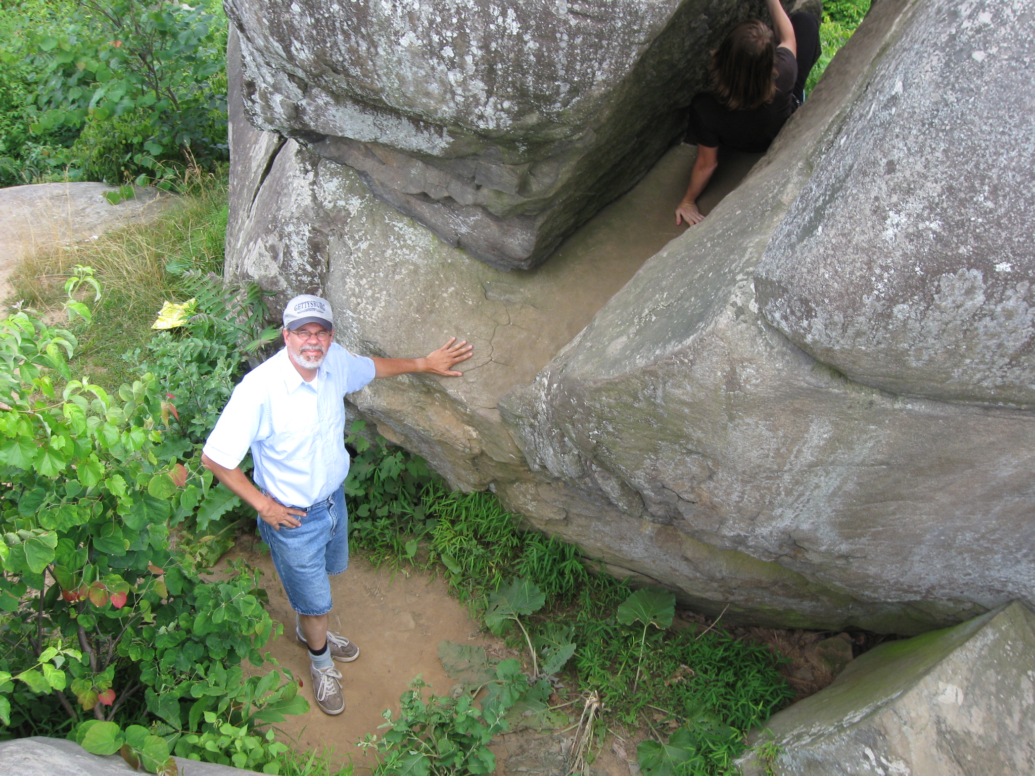
Gettysburg Licensed Battlefield Guide Tim Smith is the co-author of the book Devil’s Den, A History and Guide from Thomas Publications. He continues our look at Gettysburg Rock Carvings by showing us carvings on the Elephant Rock and on the Flag Boulder. Here Tim is balancing himself between the two halves of the Elephant Rock. This view was taken facing southeast at approximately 3:45 PM on Thursday, July 9, 2009.
In today’s post Tim shows us carvings at the Elephant Rock, his ability to get on top of the Elephant Rock, and carvings on the Flag Boulder.
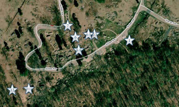
This map shows us the locations taken of videos for the Gettysburg Rock Carvings series. Video #1 was taken in the Slaughter Pen. Videos #2 and #3 were taken in the area of the “balancing rock” or “table rock” at Devil’s Den. Video #4 was taken in the passageway underneath the “table rock.” Video #5 was taken on the west side of the Table Rock. Video #6 was taken southwest of the Table Rock. Video #7 was taken near the left flank marker of Smith’s 4th New York Battery. Videos #8 and #9 were taken south of the wooden foot bridge over the “chasm” at Devil’s Den. Videos #10 and #11 were taken at the Elephant Rock. Video #12 was taken at the Flag Boulder. This map was created facing north at approximately 7:30 PM on Friday, July 17, 2009.

Gettysburg Licensed Battlefield Guide Tim Smith points the way to the Elephant Rock, the first stop on our post for today. The Elephant Rock is the tallest rock in the background. The not very wide trail to the rock begins behind Tim. This view was taken facing southeast at approximately 3:45 PM on Thursday, July 9, 2009.
Tim Smith is at the bottom of the Elephant Rock. Other individuals were enjoying climbing around the boulder when we visited. This view was taken facing east at approximately 3:45 PM on Thursday, July 9, 2009.
In Video #10 (Videos #1-#9 were shown in our previous Rock Carvings post) Gettysburg Licensed Battlefield Guide Tim Smith shows the best way to climb to the top of the Elephant Rock. If you are on a tour with a Licensed Battlefield Guide, please ask him or her to duplicate Tim’s effort. This view was taken facing east at approximately 3:45 PM on Thursday, July 9, 2009.
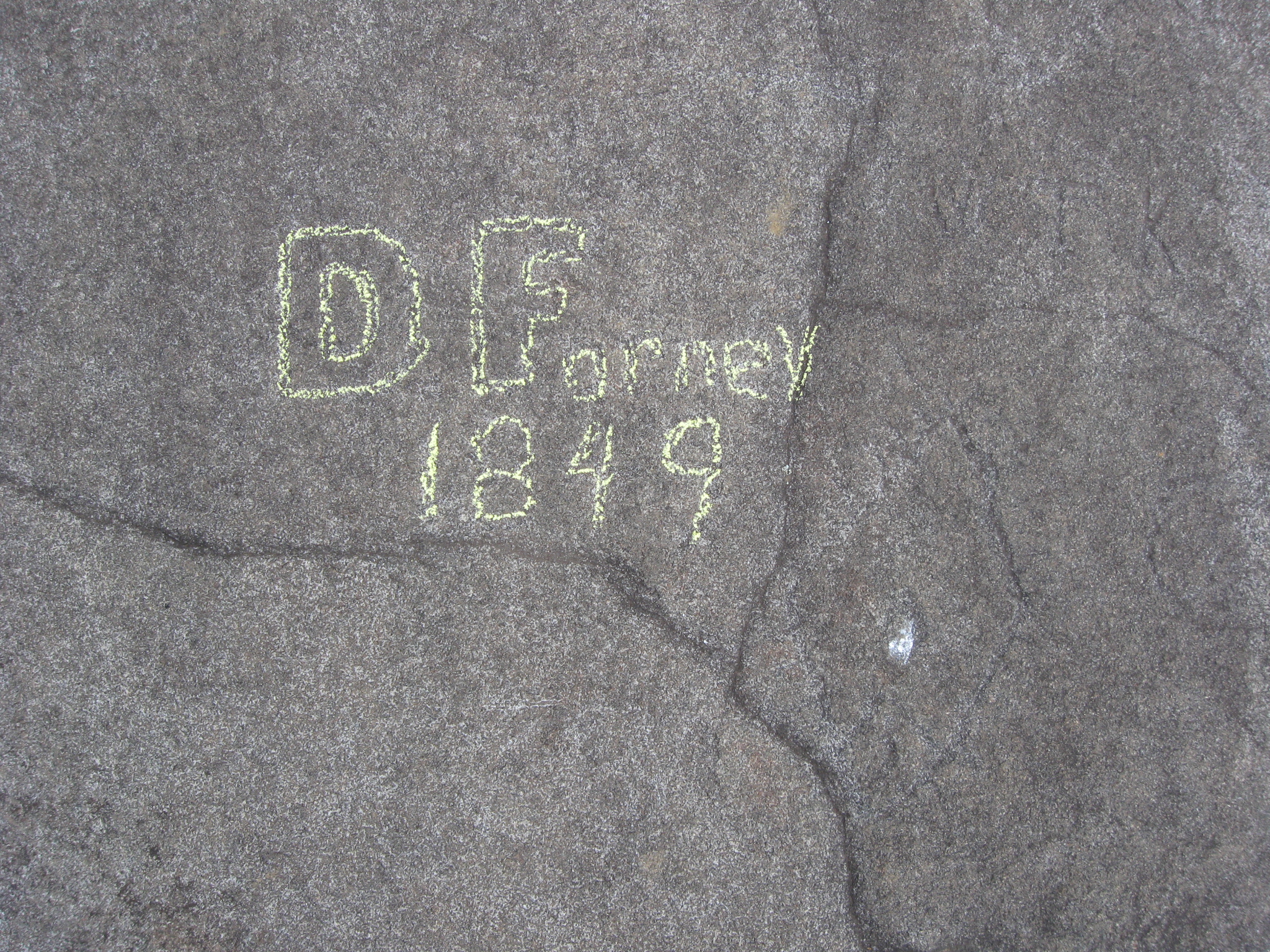
The D. Forney carving on the top of the Elephant Rock. This view was taken facing north at approximately 3:45 PM on Thursday, July 9, 2009.
In Video #11 Licensed Battlefield Guide Tim Smith explains that David Forney who carved his name on the Elephant Rock in 1849 was an artist, and might have a painting of the area that predates the battle. This view was taken facing east at approximately 3:45 PM on Thursday, July 9, 2009.

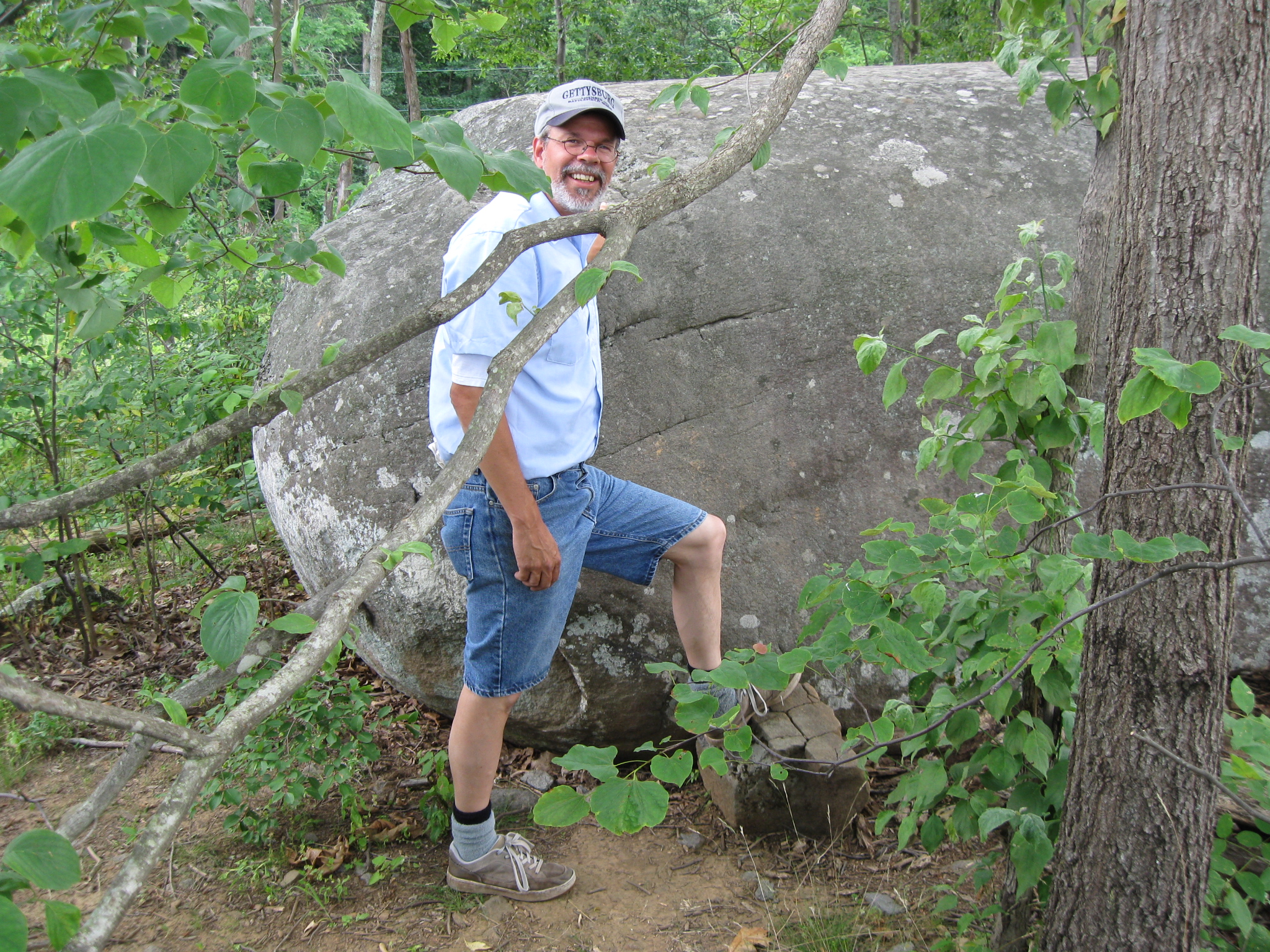
Licensed Battlefield Guide Tim Smith points out the Flag Rock or the Flag Boulder. This view was taken facing southeast at approximately 3:45 PM on Thursday, July 9, 2009.
The Flag Boulder is much easier to climb than the Elephant Rock. There is even a stepping stone. This view was taken facing southeast at approximately 3:45 PM on Thursday, July 9, 2009.
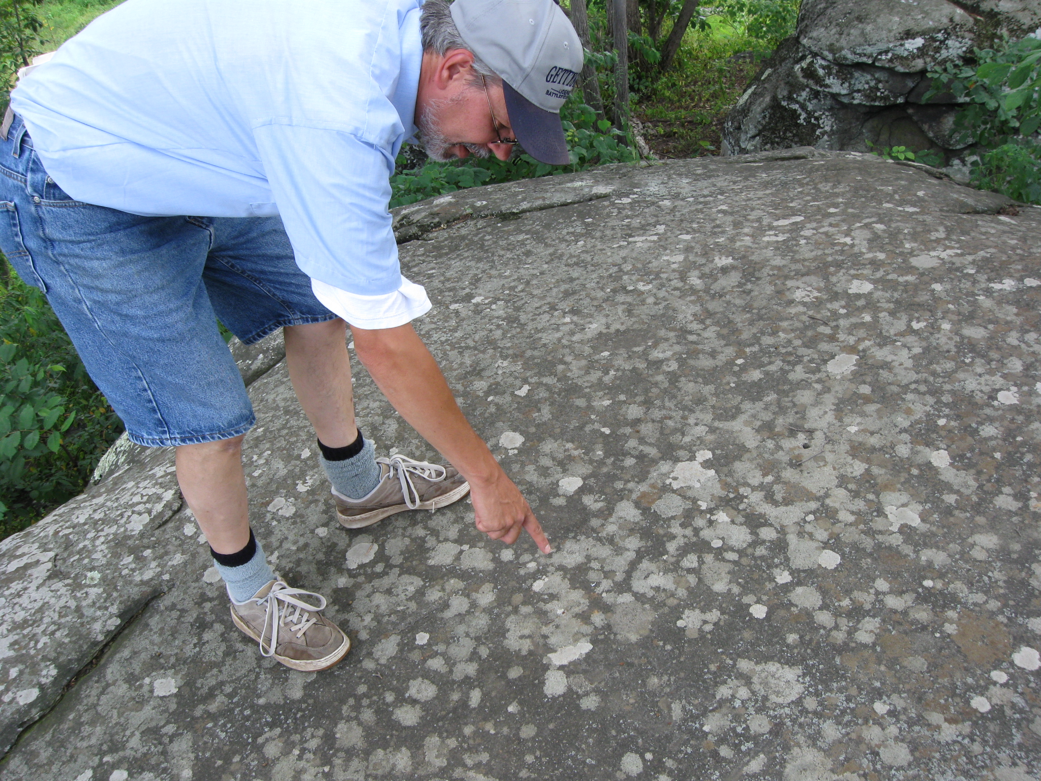
The day that we visited, carvings on the Flag Boulder were very difficult to see. This view was taken facing southeast at approximately 3:45 PM on Thursday, July 9, 2009.
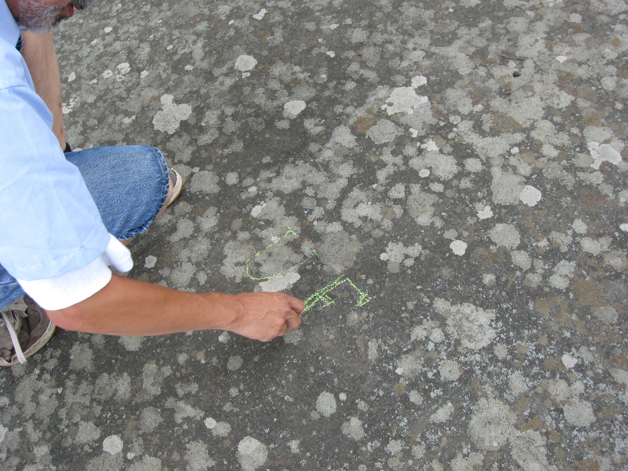
Tim is highlighting some initials on the Flag Boulder. This view was taken facing southeast at approximately 3:45 PM on Thursday, July 9, 2009.
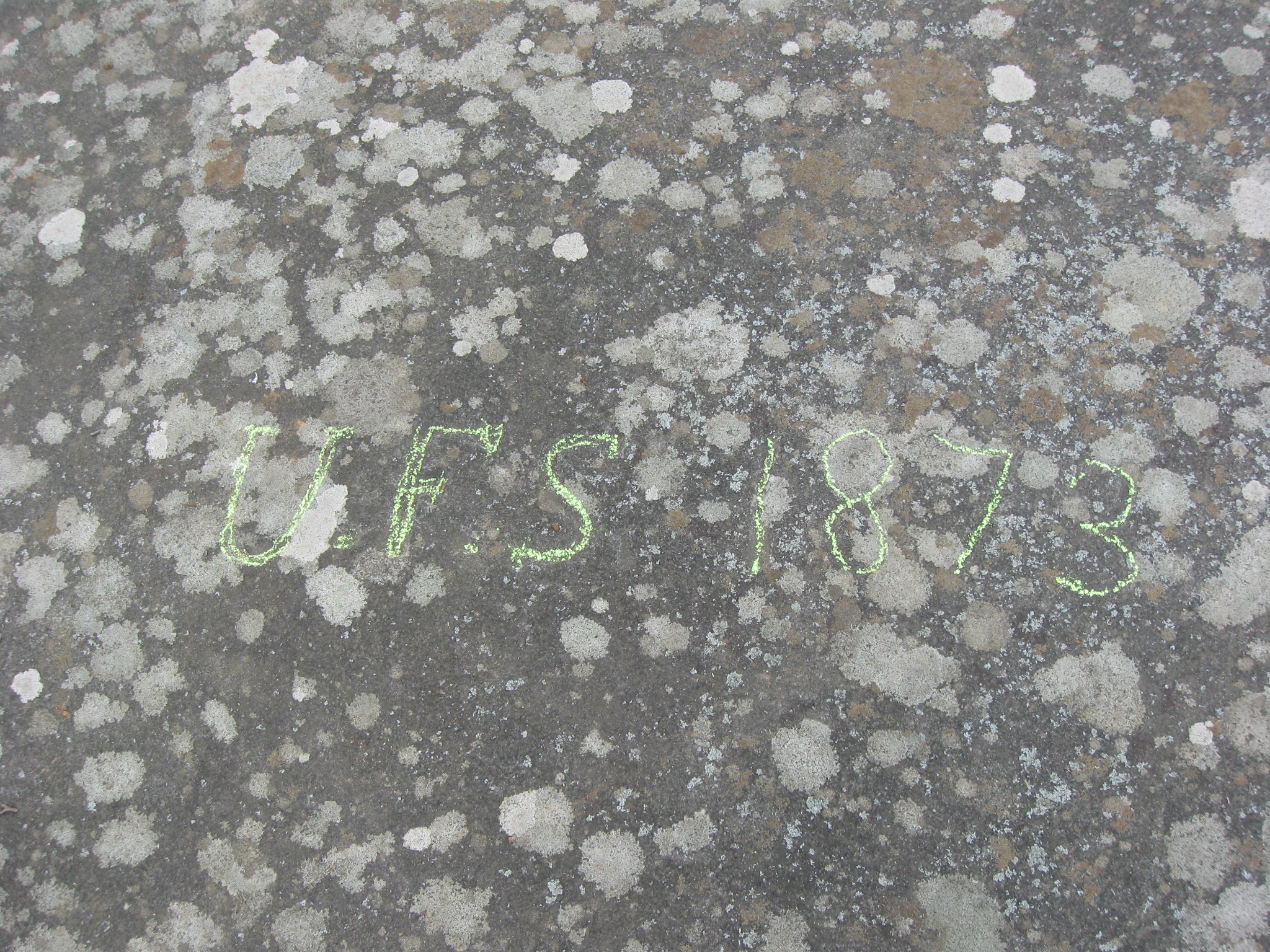
It’s anybody’s guess what whose initials these are. This view was taken facing south at approximately 3:45 PM on Thursday, July 9, 2009.
In Video #12 Licensed Battlefield Guide Tim Smith shows us the carvings that he can see on the Flag Boulder (couldn’t easily see the flags today) and explains the futility of trying to figure out the names of the people who carved their initials into the rocks. This view was taken facing southeast at approximately 3:45 PM on Thursday, July 9, 2009.

Tim is trying to figure out exactly where the flags are on the Flag Boulder today. This view was taken facing south at approximately 3:45 PM on Thursday, July 9, 2009.
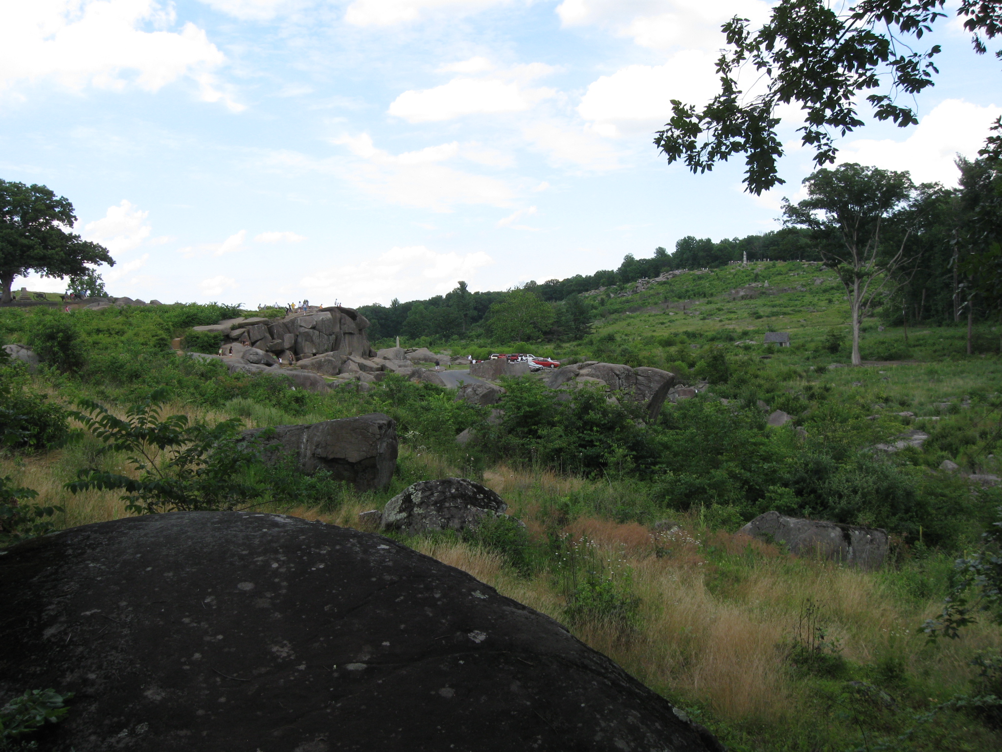
From the Flag Boulder we are shooting a picture back to Devil’s Den and Little Round Top. The Elephant Rock is on the right center, in the middle background. From this angle, one gets a better idea of why the rock formation is named the Elephant Rock. This view was taken facing northeast at approximately 3:45 PM on Thursday, July 9, 2009.