
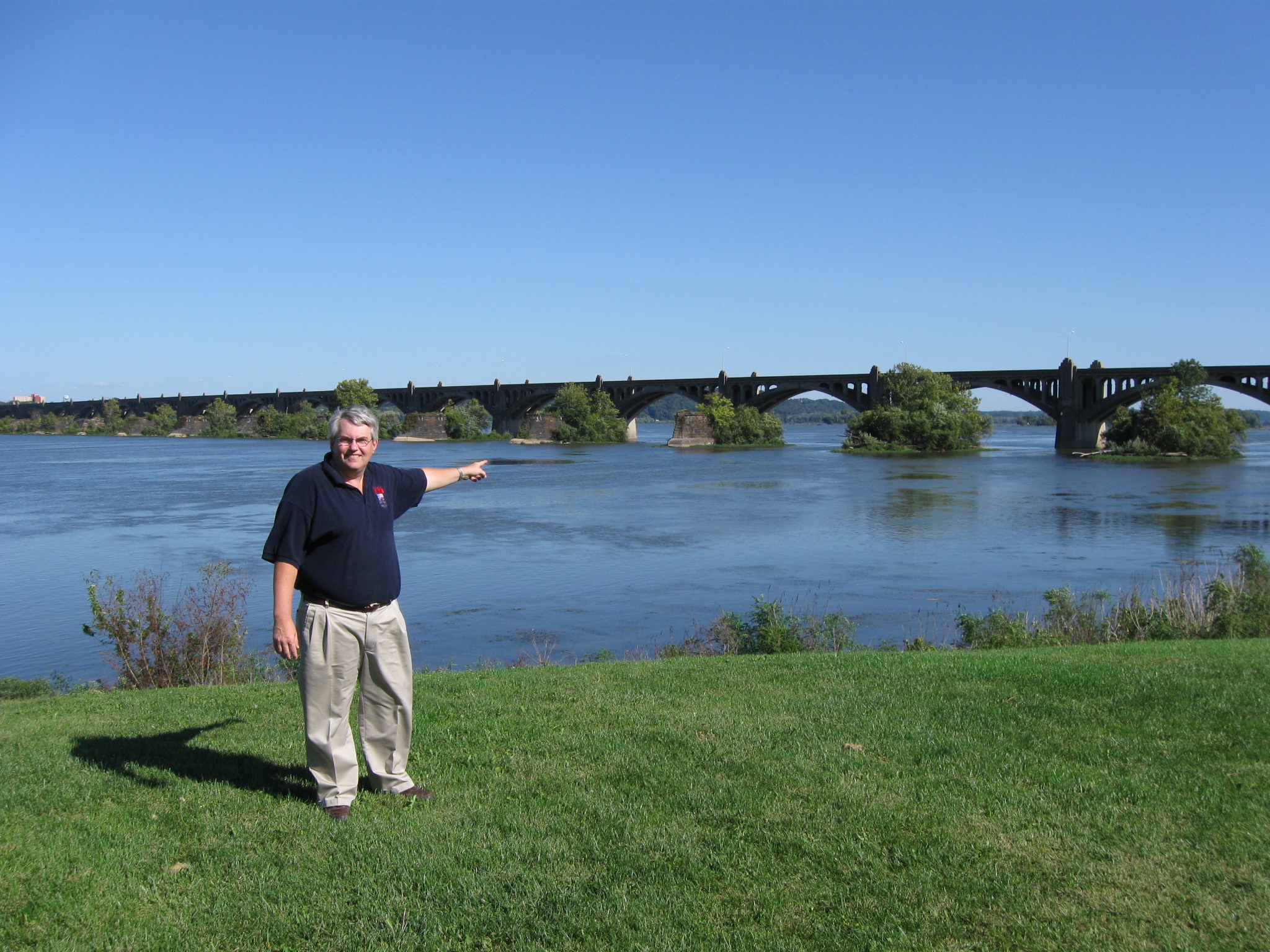
York County Heritage Trust Sanctioned Civil War Guide Scott Mingus is standing on the west bank of the Susquehanna River near Wrightsville. He is pointing to the stone piers that remain from the covered bridge that was here at the time of the Civil War. This view was taken facing southeast at approximately 3:30 PM on Sunday, September 13, 2009.
In today’s post, Scott Mingus shows us the piers to the covered bridge over the Susquehanna River, and describes the burning of the bridge and the attempt to save the buildings in Wrightsville from the fire.
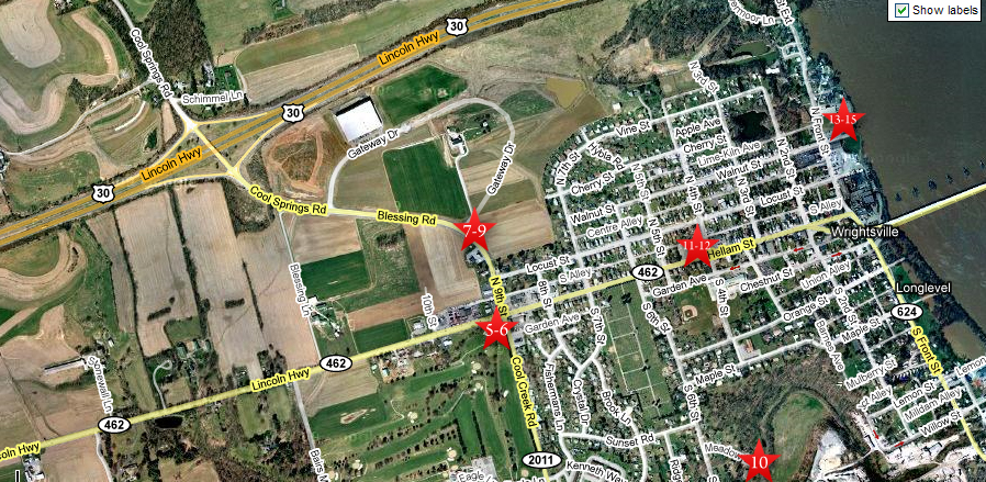
This map shows the location of where our Wrightsville videos were produced. Video #1-#6 were shown in our previous Wrightsville posts. Videos #5 and #6 were taken at the intersection of the Lincoln Highway and Cool Creek Road. Videos #7 -#9 were taken on Cool Creek Road near the Rutter’s convenience store. Video #10 was taken at Meadow Lane, south of Wrightsville. Videos #11 and #12 were taken at the intersection of Hellam Street and 4th Street in Wrightsville. Videos #13- #15 were taken on the banks of the Susquehanna River in view of the remains of the Civil War bridge. This map was created facing north at approximately 6:00 PM on Saturday, September 26, 2009.
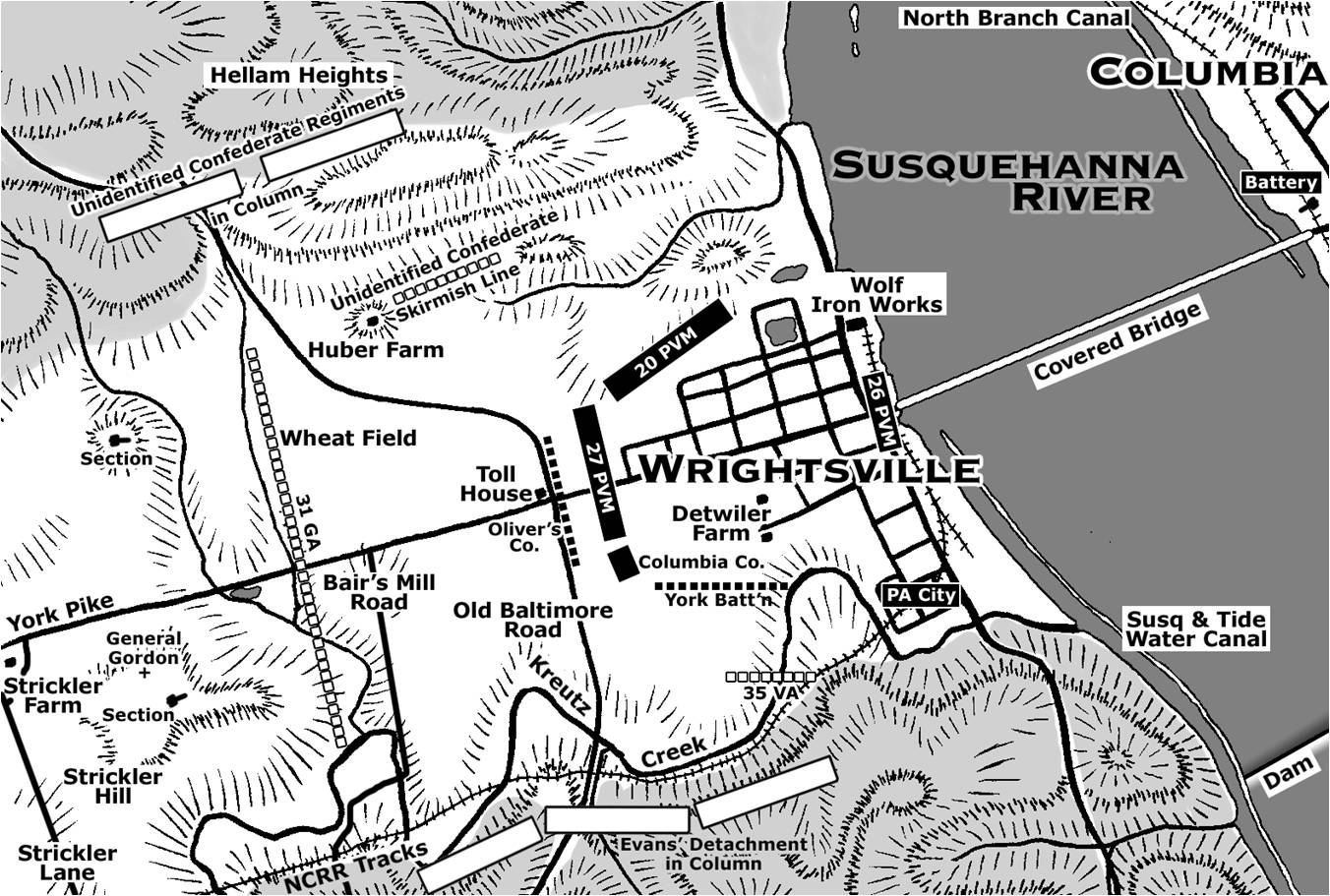
This map shows the units defending Wrightsville and the position of the Confederate units as they advanced on the defenses. Copyright Scott L. Mingus, Sr.; drawn for Flames Beyond Gettysburg by Tom Poston. All rights reserved.
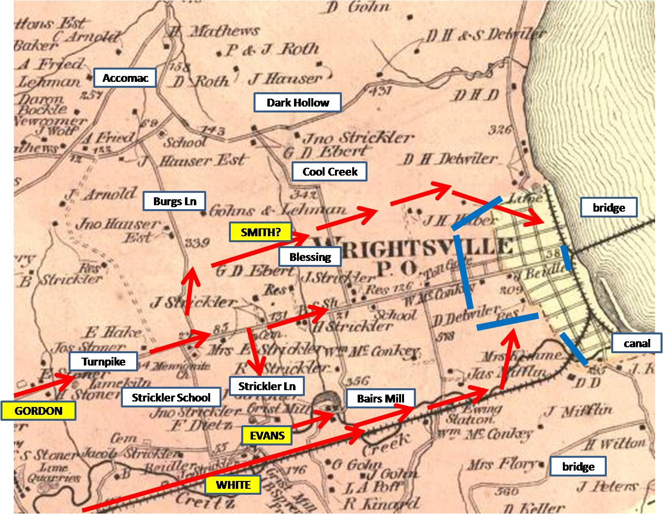
This 1876 map of Wrightsville shows landmarks, Confederate troop movements in red, and the Union defenses in blue. This map was created in 1876.
In Video #13 (Videos #1- #12 were shown in our previous Wrightsville posts) York County Heritage Trust Sanctioned Guide Scott Mingus is standing on the west bank of the Susquehanna River. He describes the covered bridge and other significant locations visible from this area. This view was taken facing southeast to northeast to southeast at approximately 3:30 PM on Sunday, September 13, 2009.
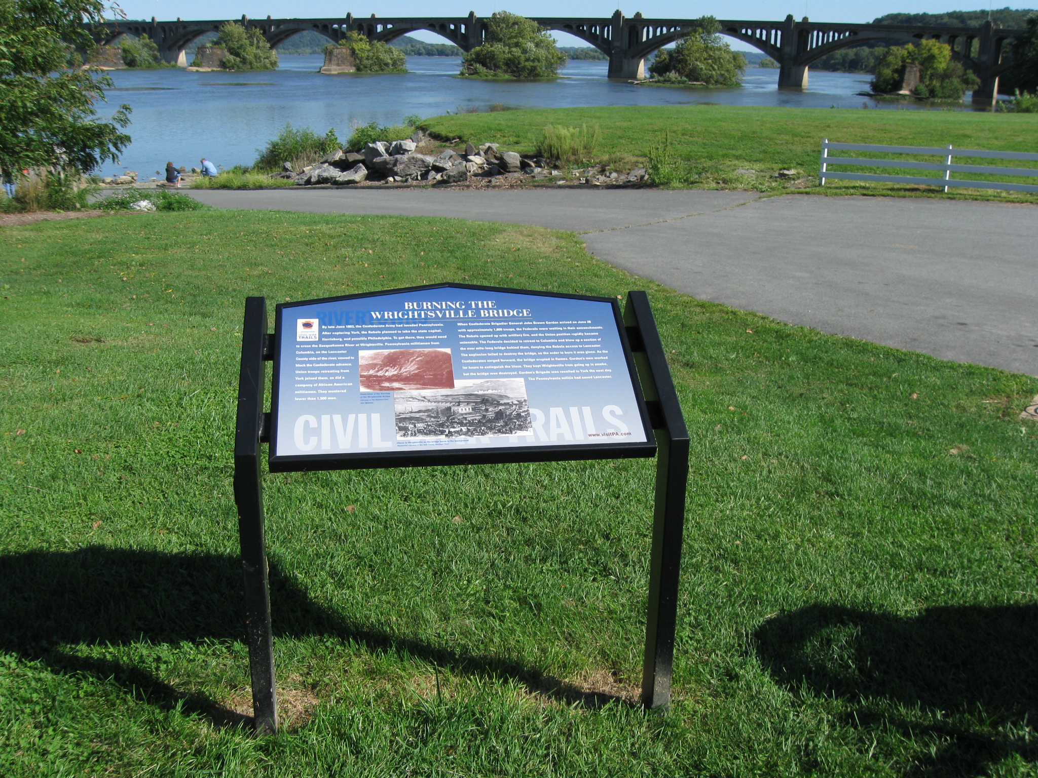
There are a couple of wayside exhibits on the Wrightsville riverfront. This one describes the burning of the Wrightsville Bridge. The piers of the Civil War era covered bridge have the trees growing near them. This view was taken facing east at approximately 3:30 PM on Sunday, September 13, 2009.

A closer view of the wayside describing the burning of the Wrightsville Bridge. This view was taken facing east at approximately 3:30 PM on Sunday, September 13, 2009.
In Video #14 Civil War Guide Scott Mingus is standing on the west bank of the Susquehanna River. He describes the burning of the covered bridge. This view was taken facing southeast to east to southeast at approximately 3:30 PM on Sunday, September 13, 2009.

The other wayside in this location describes commerce along the Susquehanna River. This view was taken facing east at approximately 3:30 PM on Sunday, September 13, 2009.

A closer view of the wayside describing commerce along the Susquehanna. This view was taken facing southeast at approximately 3:30 PM on Sunday, September 13, 2009.
In Video #15 Scott Mingus is standing on the west bank of the Susquehanna River. He describes how the Confederates attempted to put out the fire from the bridge that was blown into the structures of Wrightsville. This view was taken facing southeast to west to south to southeast to east at approximately 3:30 PM on Sunday, September 13, 2009.