
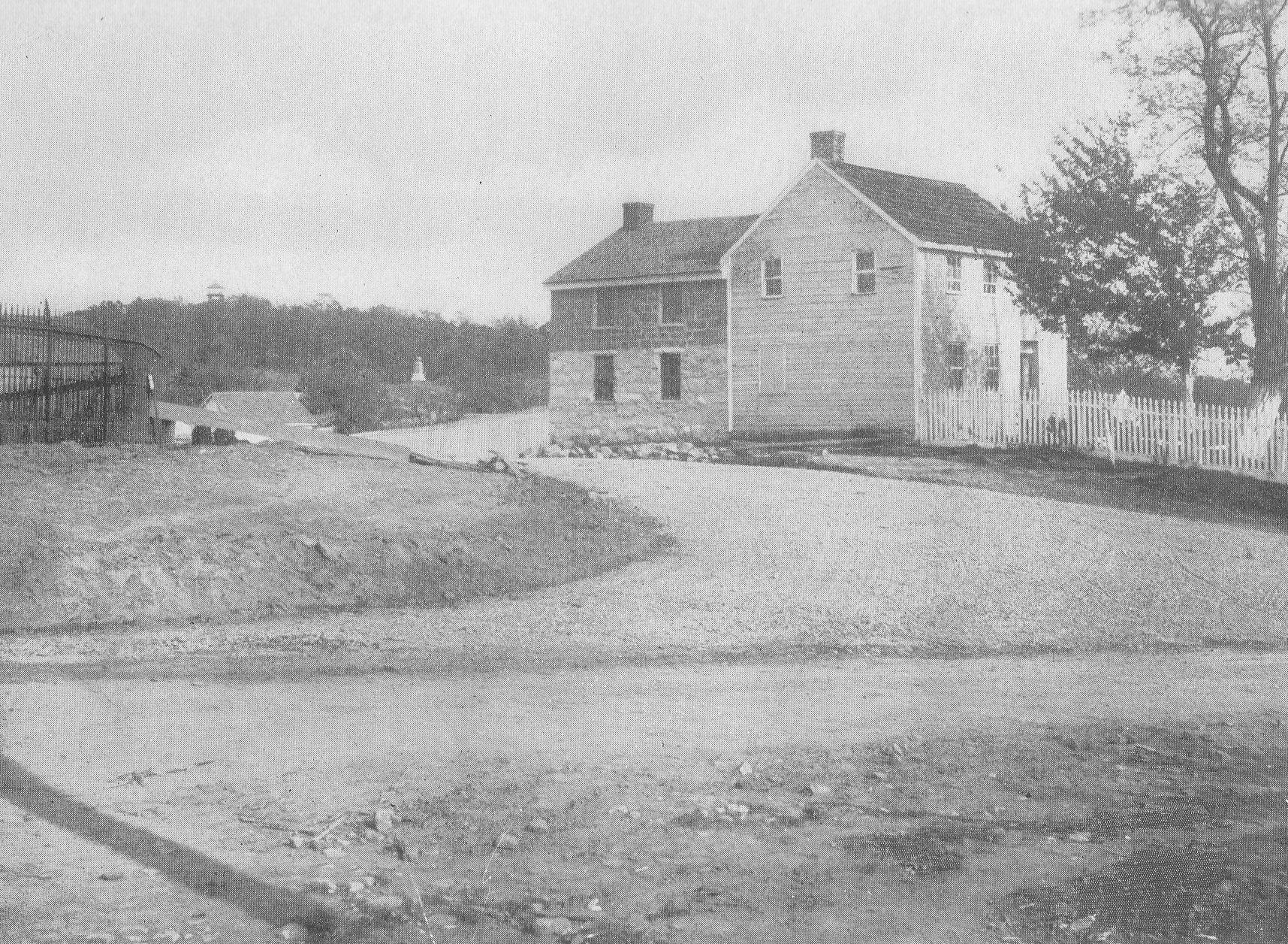
This image is titled “Entrance to Slocum Avenue.” The location is the junction of Slocum Avenue and the Baltimore Pike. The Annual Report of the Gettysburg National Military Park Commission to the Secretary of War in 1896 states: “Since our report of 1895 the Telford road, known as Seminary avenue, and section 1 of Confederate avenue, running from the Chambersburg pike southward along Seminary Ridge as far as the Government at present owns the right of way there, has been completed; … Slocum avenue, which follows the battle lines over Culp’s Hill, is in course of construction and nearly completed…The whole length of Telford avenues which have been constructed by our commission is 7 1/3 miles.”(page 29) The Baltimore Pike runs from left to right (north to south) in this photograph. Slocum Avenue is located to the left of the McKnight House. There is what appears to be a road or driveway that runs behind the McKnight House. There is a black, iron fence on the left. The fence along the Baltimore Pike is the Lafayette Square iron fence that had been donated to the Gettysburg Battlefield Memorial Association by a joint resolution of Congress on October 12, 1888 through the efforts of Major General Daniel Edgar Sickles. (Frederick Tilberg, “Historic Cemetery Survey Report” (June 24, 1958), Gettysburg National Military Park vertical files, page 11). Originally enclosing Lafayette Square in Washington, the fence was declared to be no longer needed by District of Columbia authorities, and prompted Sickles to urge the Congressional resolution giving the ornamental fence over to the Gettysburg Preservation and Memorial Association. On July 12, 1889 the Gettysburg Battlefield Memorial Association resolved that “so much of the iron fence, donated by the U. S. Government, be used as is necessary to enclose the front of East Cemetery Hill to Slocum Avenue, and by said avenue to the turn to Culp’s Hill, and that it be erected unpainted, in granite blocks, and according to the lay of the land, the contractor to furnish any castings that are necessary.” (“Minutes of the Gettysburg Battlefield Memorial Association, July 12, 1889,” page 193. The minutes are in the Gettysburg National Military Park Library). This fence was eventually erected sometime after April of 1890 by the firm of Gilbert and Smith. It was envisioned that three gates would be placed along the Baltimore Pike and one along Slocum Avenue where it joined Wainwright Avenue/Brickyard Lane at the base of East Cemetery Hill (Gettysburg Compiler April 8, 1890).Behind the black fence is a structure. To the right of the black fence is the roof of a structure. The monument in the center background is to Battery E, 5th Maine Artillery on McKnight’s Hill/Stevens’ Knoll. It was dedicated in 1889. Culp’s Hill is in the left background. The Culp’s Hill tower is visible above Culp’s Hill. Annual Reports of the Gettysburg National Military Park Commission to the Secretary of War, 1893-1904. Washington. Government Printing Office, 1905. This view was taken facing east circa 1896.

This image is titled “Slocum Avenue, Stevens Knoll.” The location is along Slocum Avenue between Stevens Knoll and the McKnight House, which is located on the Baltimore Pike. The Annual Report of the Gettysburg National Military Park Commission to the Secretary of War in 1896 states: “Since our report of 1895 the Telford road, known as Seminary avenue, and section 1 of Confederate avenue, running from the Chambersbug pike southward along Seminary Ridge as far as the Government at present owns the right of way there, has been completed; … Slocum avenue, which follows the battle lines over Culp’s Hill, is in course of construction and nearly completed…The whole length of Telford avenues which have been constructed by our commission is 7 1/3 miles.”(page 29) Slocum Avenue is the light colored roadway. Notice the dirt “lane” or short cut that people used to avoid this curve on Slocum Avenue. The monument and the cannon in the left background mark the position of Battery E, 5th Maine Artillery on McKnight’s Hill/Stevens’ Knoll. It was dedicated in 1889. The 1895 commission report states: “The volunteer batteries of the Union Army on the grounds of the Memorial Association are generally represented by one gun and mounted upon inferior carriages. This commission resolved to substitute an improved iron gun carriage. Sixty-two new carriages have been contracted for. Of these about 36 have been furnished by the contractor and placed on the field and mounted with the kind of gun used by each battery, respectively in the battle. The others will be put in position as soon as supplied by the contractor. Excellent granite foundation stones support each carriage. The following have already been placed on the Union lines, …(page 22) The 1896 commission report states: “During the past year we have also replaced all of the old inferior gun carriages which were formerly used for the Union batteries with our new iron ones, constructed as aforesaid, and we have mounted many additional guns to mark the positions of Union batteries… All stone fences and walls which existed at the time of the battle and which are upon ground owned by the United States we have caused to be restored and put in proper condition, as also suchy breastworks and other defencses as were erected by either army.”(page 30). Annual Reports of the Gettysburg National Military Park Commission to the Secretary of War, 1893-1904. Washington. Government Printing Office, 1905.This view was taken facing southeast circa 1896.
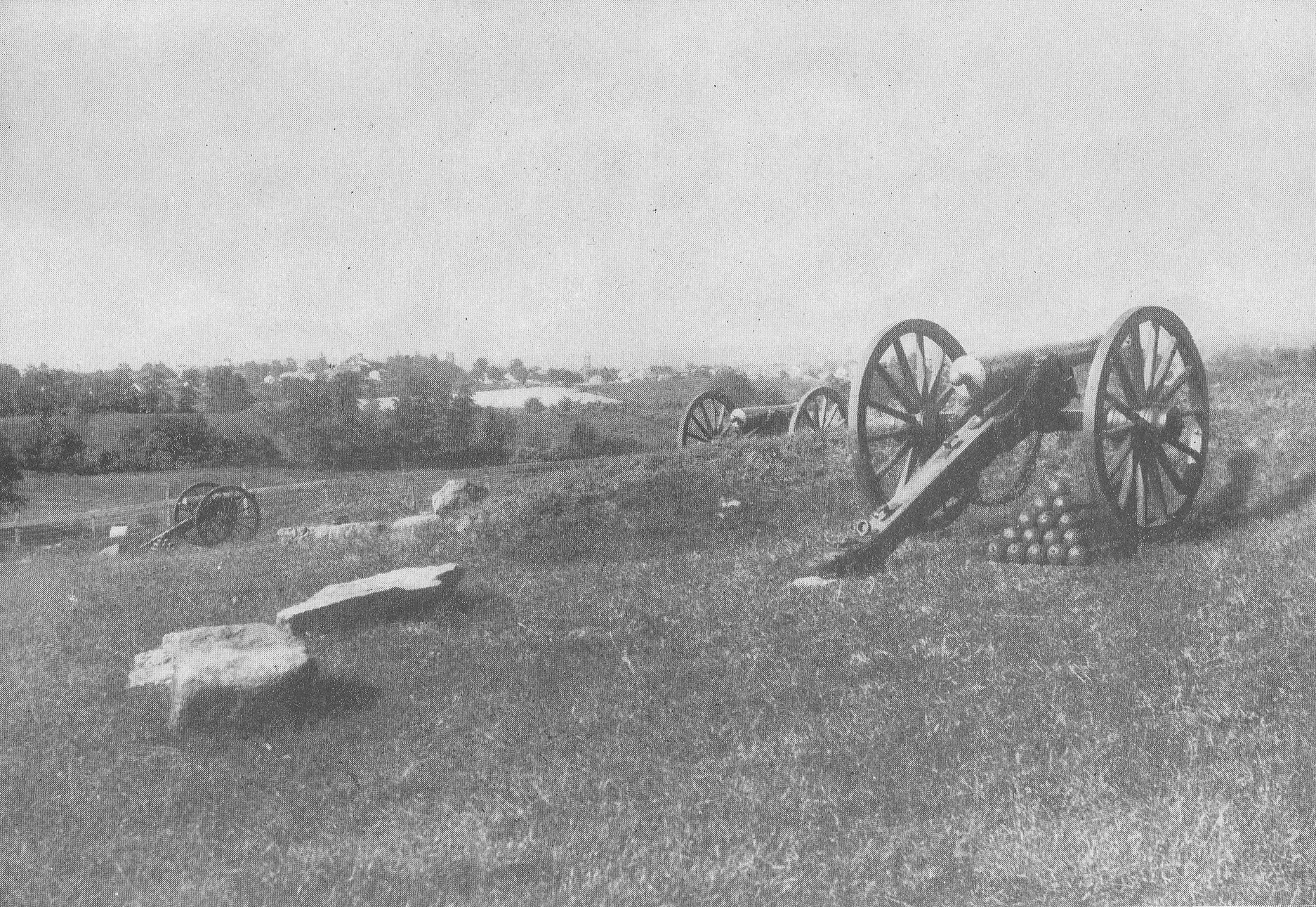
This image is titled “Stevens’s Battery E, Fifth Maine Light Artillery, Slocum Avenue.” The location is Stevens Knoll which is also known as McKnight’s Hill. It is located between East Cemetery Hill and Culp’s Hill. The Annual Report of the Gettysburg National Military Park Commission to the Secretary of War in 1895 states: “The volunteer batteries of the Union Army on the grounds of the Memorial Association are generally represented by one gun and mounted upon inferior carriages. This commission resolved to substitute an improved iron gun carriage. Sixty-two new carriages have been contracted for. Of these about 36 have been furnished by the contractor and placed on the field and mounted with the kind of gun used by each battery, respectively in the battle. The others will be put in position as soon as supplied by the contractor. Excellent granite foundation stones support each carriage. The following have already been placed on the Union lines, …(page 22) The 1896 commission report states: “During the past year we have also replaced all of the old inferior gun carriages which were formerly used for the Union batteries with our new iron ones, constructed as aforesaid, and we have mounted many additional guns to mark the positions of Union batteries… All stone fences and walls which existed at the time of the battle and which are upon ground owned by the United States we have caused to be restored and put in proper condition, as also such breastworks and other defenses as were erected by either army.”(page 30). The cannon mark the position of Battery E, 5th Maine Artillery on McKnight’s Hill/Stevens’ Knoll. The Borough of Gettysburg is in the left background. Annual Reports of the Gettysburg National Military Park Commission to the Secretary of War, 1893-1904. Washington. Government Printing Office, 1905. This view was taken facing northwest circa 1896.
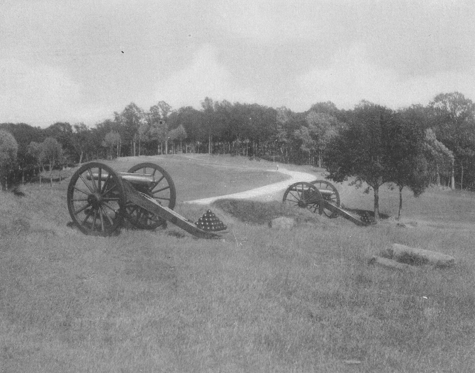
This image is titled “Slocum Avenue, Section of Stevens’s Fifth Maine Battery.” The location is Stevens Knoll which is also known as McKnight’s Hill. It is located between East Cemetery Hill and Culp’s Hill. The Annual Report of the Gettysburg National Military Park Commission to the Secretary of War in 1896 states: “Since our report of 1895 the Telford road, known as Seminary avenue, and section 1 of Confederate avenue, running from the Chambersbug pike southward along Seminary Ridge as far as the Government at present owns the right of way there, has been completed; … Slocum avenue, which follows the battle lines over Culp’s Hill, is in course of construction and nearly completed…The whole length of Telford avenues which have been constructed by our commission is 7 1/3 miles.”(page 29) The Annual Report of the Gettysburg National Military Park Commission to the Secretary of War in 1895 states: “The volunteer batteries of the Union Army on the grounds of the Memorial Association are generally represented by one gun and mounted upon inferior carriages. This commission resolved to substitute an improved iron gun carriage. Sixty-two new carriages have been contracted for. Of these about 36 have been furnished by the contractor and placed on the field and mounted with the kind of gun used by each battery, respectively in the battle. The others will be put in position as soon as supplied by the contractor. Excellent granite foundation stones support each carriage. The following have already been placed on the Union lines, …(page 22) The 1896 commission report states: “During the past year we have also replaced all of the old inferior gun carriages which were formerly used for the Union batteries with our new iron ones, constructed as aforesaid, and we have mounted many additional guns to mark the positions of Union batteries… All stone fences and walls which existed at the time of the battle and which are upon ground owned by the United States we have caused to be restored and put in proper condition, as also such breastworks and other defenses as were erected by either army.”(page 30). The cannon mark the position of Battery E, 5th Maine Artillery on McKnight’s Hill/Stevens’ Knoll. Slocum Avenue is winding its way to the top of Culp’s Hill, which is in the center background. Annual Reports of the Gettysburg National Military Park Commission to the Secretary of War, 1893-1904. Washington. Government Printing Office, 1905. This view was taken facing east circa 1896.
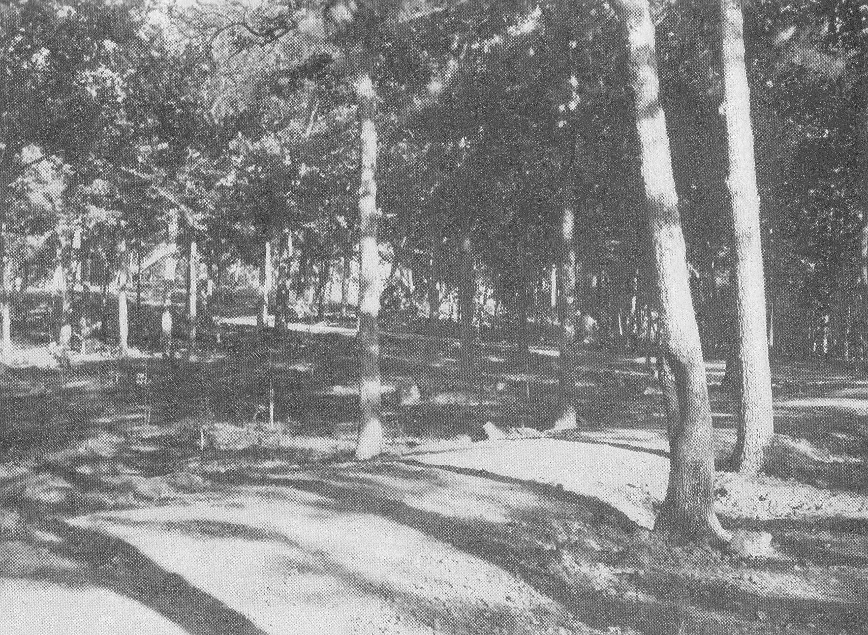
This image is titled “Slocum Avenue at Entrance to Woods, Culp’s Hill.” The location is the western slope of Culp’s Hill. The Annual Report of the Gettysburg National Military Park Commission to the Secretary of War in 1896 states: “Since our report of 1895 the Telford road, known as Seminary avenue, and section 1 of Confederate avenue, running from the Chambersbug pike southward along Seminary Ridge as far as the Government at present owns the right of way there, has been completed; … Slocum avenue, which follows the battle lines over Culp’s Hill, is in course of construction and nearly completed…The whole length of Telford avenues which have been constructed by our commission is 7 1/3 miles.”(page 29) Slocum Avenue is winding its way to the top of Culp’s Hill. The “foot” and stairs of the Culp’s Hill observation tower are visible in the left background. Slocum Avenue has changed since its original position in this photograph. This section of Slocum Avenue now longer is located here. Annual Reports of the Gettysburg National Military Park Commission to the Secretary of War, 1893-1904. Washington. Government Printing Office, 1905. This view was taken facing east circa 1896.
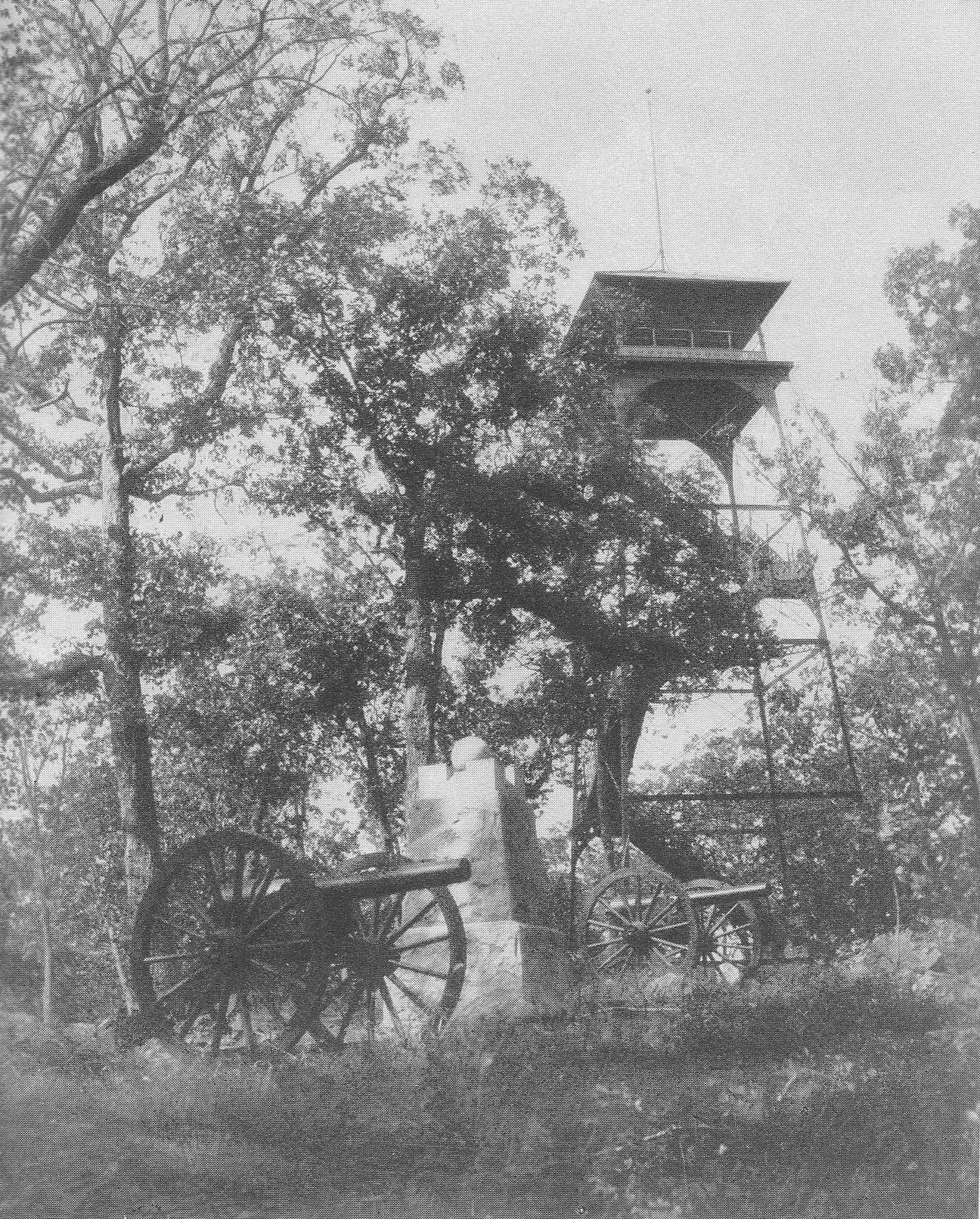
This image is titled “Tower and Knap’s Battery E, Pennsylvania Light Artillery, Summit of Culp’s Hill.” The location is the summit of Culp’s Hill. The Annual Report of the Gettysburg National Military Park Commission to the Secretary of War in 1895 states: “Four steel towers, to be constructed upon a design prepared by the engineer, Col. E.B. Cope, and approved by the commission, have been contracted for and are now being erected by the Variety Iron Works, of Cleveland, Ohio. No. 1 is 60 feet high and stands on the summit of Big Round Top; No. 2 is 75 feet high, on Seminary Ridge, near the Wheatfield road; No. 3, 75 feet high, is on Seminary Ridge, near the Mummasburg road, and overlooks specially the scene of the first day’s fight; No. 4, 60 feet high, is on the summit of Culp’s Hill. Nos. 1 and 2 are nearly finished, and all four will be completed with a month.”(page 22) The Annual Report of the Gettysburg National Military Park Commission to the Secretary of War in 1896 states: “The four steel towers which were in course of construction at the date of our last report were completed soon thereafter. We have since caused another to be erected near the center of the field in Ziegler’s Grove and not far from the point where the battle ended with the final grand but unsuccessful Confederate assault of the third day. These are all solid and well-built structures, and located as they are, they afford the observer a complete and satisfactory view of the entire scene of the great battle and enable him to get a consistent and accurate idea of it as a whole.” (page 31) The Annual Report of the Gettysburg National Military Park Commission to the Secretary of War in 1895 states: “The volunteer batteries of the Union Army on the grounds of the Memorial Association are generally represented by one gun and mounted upon inferior carriages. This commission resolved to substitute an improved iron gun carriage. Sixty-two new carriages have been contracted for. Of these about 36 have been furnished by the contractor and placed on the field and mounted with the kind of gun used by each battery, respectively in the battle. The others will be put in position as soon as supplied by the contractor. Excellent granite foundation stones support each carriage. The following have already been placed on the Union lines, …(page 22) The 1896 commission report states: “During the past year we have also replaced all of the old inferior gun carriages which were formerly used for the Union batteries with our new iron ones, constructed as aforesaid, and we have mounted many additional guns to mark the positions of Union batteries…”(page 30). The Culp’s Hill tower is in the right background. The cannon tubes at the position of Knap’s Battery represent 10 pounder parrotts. The monument to Knap’s Pennsylvania Battery was erected in 1885. Annual Reports of the Gettysburg National Military Park Commission to the Secretary of War, 1893-1904. Washington. Government Printing Office, 1905. This view was taken facing northwest circa 1896.

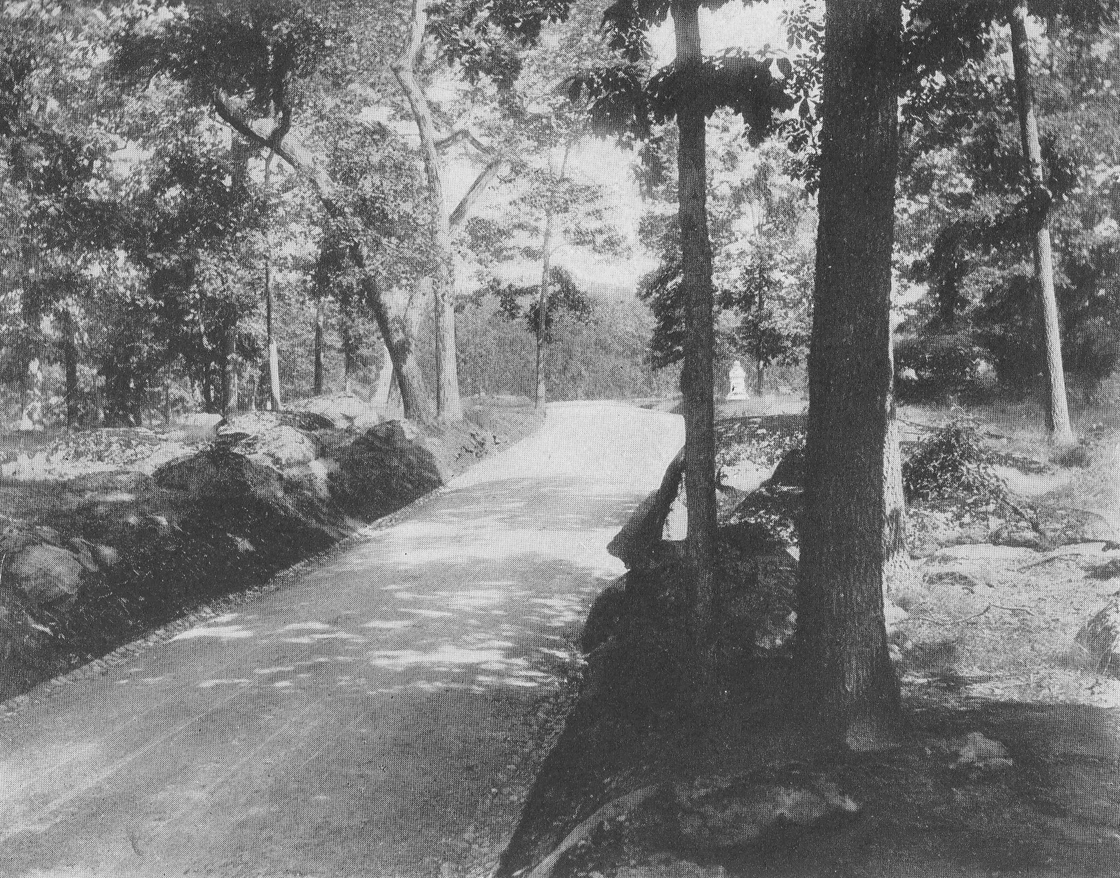
This image is titled “Slocum Avenue, Graded Roadbed.” The location is the southeastern slope of Culp’s Hill. The Annual Report of the Gettysburg National Military Park Commission to the Secretary of War in 1896 states: “Since our report of 1895 the Telford road, known as Seminary avenue, and section 1 of Confederate avenue, running from the Chambersburg pike southward along Seminary Ridge as far as the Government at present owns the right of way there, has been completed; … Slocum avenue, which follows the battle lines over Culp’s Hill, is in course of construction and nearly completed…The whole length of Telford avenues which have been constructed by our commission is 7 1/3 miles.”(page 29) Slocum Avenue is no longer in this location. The monument to the 150th New York Infantry Regiment is in the left background. Slocum Avenue has changed since its original position in this photograph. It now runs on the other (west) side of the monument to the 150th New York. The road shown in this photograph is now a path. Annual Reports of the Gettysburg National Military Park Commission to the Secretary of War, 1893-1904. Washington. Government Printing Office, 1905. This view was taken facing south circa 1896.
This image is titled “Slocum Avenue, Graded Roadbed.” The location is “lower” Culp’s Hill. The 1895 commission report states, “At the date when our report as the Battlefield Commission was made last year the only roadway in process of construction was section 4 of the Confederate avenue, from the Wheatfield road to the Emmitsburg road along Seminary Ridge… All these avenues have been and are being constructed on the Telford system, which was adopted after full consideration and tudy of the subject as promising the best results in solidity and durability. The stone used is syenitic granite and ironstone, very hard and of excellent quality. A foundation pavement is laid of 8-inch wedgelike stones set on edge and well knapped and chinked; on this 4 inches of stone 1 1/2 inches in size; then a slight layer of clay as a binder, and finally a top dressing of 1 or 2 inches of quarter-inch stone screenings; the whole rolled thoroughly with a steam roller weighing 14 tons; side and under drains are placed where needed. The results of the above method and process are roadways smooth and solid and which will last for generations.” (page 21) The Annual Report of the Gettysburg National Military Park Commission to the Secretary of War in 1896 states: “Since our report of 1895 the Telford road, known as Seminary avenue, and section 1 of Confederate avenue, running from the Chambersburg pike southward along Seminary Ridge as far as the Government at present owns the right of way there, has been completed; … Slocum avenue, which follows the battle lines over Culp’s Hill, is in course of construction and nearly completed…The whole length of Telford avenues which have been constructed by our commission is 7 1/3 miles.”(page 29) Slocum Avenue is in the center of this view. The monument to the 20th Connecticut Infantry Regiment (erected in 1885) and the 3rd Maryland Infantry Regiment (USA) (erected in 1888) are in the right background. Annual Reports of the Gettysburg National Military Park Commission to the Secretary of War, 1893-1904. Washington. Government Printing Office, 1905. This view was taken facing northwest circa 1896.

This image is titled “Terminus of Slocum Avenue, Near Spangler’s Spring.” The 1895 commission report states, “At the date when our report as the Battlefield Commission was made last year the only roadway in process of construction was section 4 of the Confederate avenue, from the Wheatfield road to the Emmitsburg road along Seminary Ridge… All these avenues have been and are being constructed on the Telford system, which was adopted after full consideration and tudy of the subject as promising the best results in solidity and durability. The stone used is syenitic granite and ironstone, very hard and of excellent quality. A foundation pavement is laid of 8-inch wedgelike stones set on edge and well knapped and chinked; on this 4 inches of stone 1 1/2 inches in size; then a slight layer of clay as a binder, and finally a top dressing of 1 or 2 inches of quarter-inch stone screenings; the whole rolled thoroughly with a steam roller weighing 14 tons; side and under drains are placed where needed. The results of the above method and process are roadways smooth and solid and which will last for generations.” (page 21) The Annual Report of the Gettysburg National Military Park Commission to the Secretary of War in 1896 states: “Since our report of 1895 the Telford road, known as Seminary avenue, and section 1 of Confederate avenue, running from the Chambersburg pike southward along Seminary Ridge as far as the Government at present owns the right of way there, has been completed; … Slocum avenue, which follows the battle lines over Culp’s Hill, is in course of construction and nearly completed…The whole length of Telford avenues which have been constructed by our commission is 7 1/3 miles.”(page 29) Slocum Avenue would be coming off Lower Culp’s Hill from the woods in the right background to end at this point. Spangler’s Spring would be located behind the rocks in the left background. Today East Confederate Avenue would enter the view from the right. East Confederate Avenue was not built until 1900. The photographer is standing in Spangler’s Meadow. Annual Reports of the Gettysburg National Military Park Commission to the Secretary of War, 1893-1904. Washington. Government Printing Office, 1905. This view was taken facing northwest circa 1896.
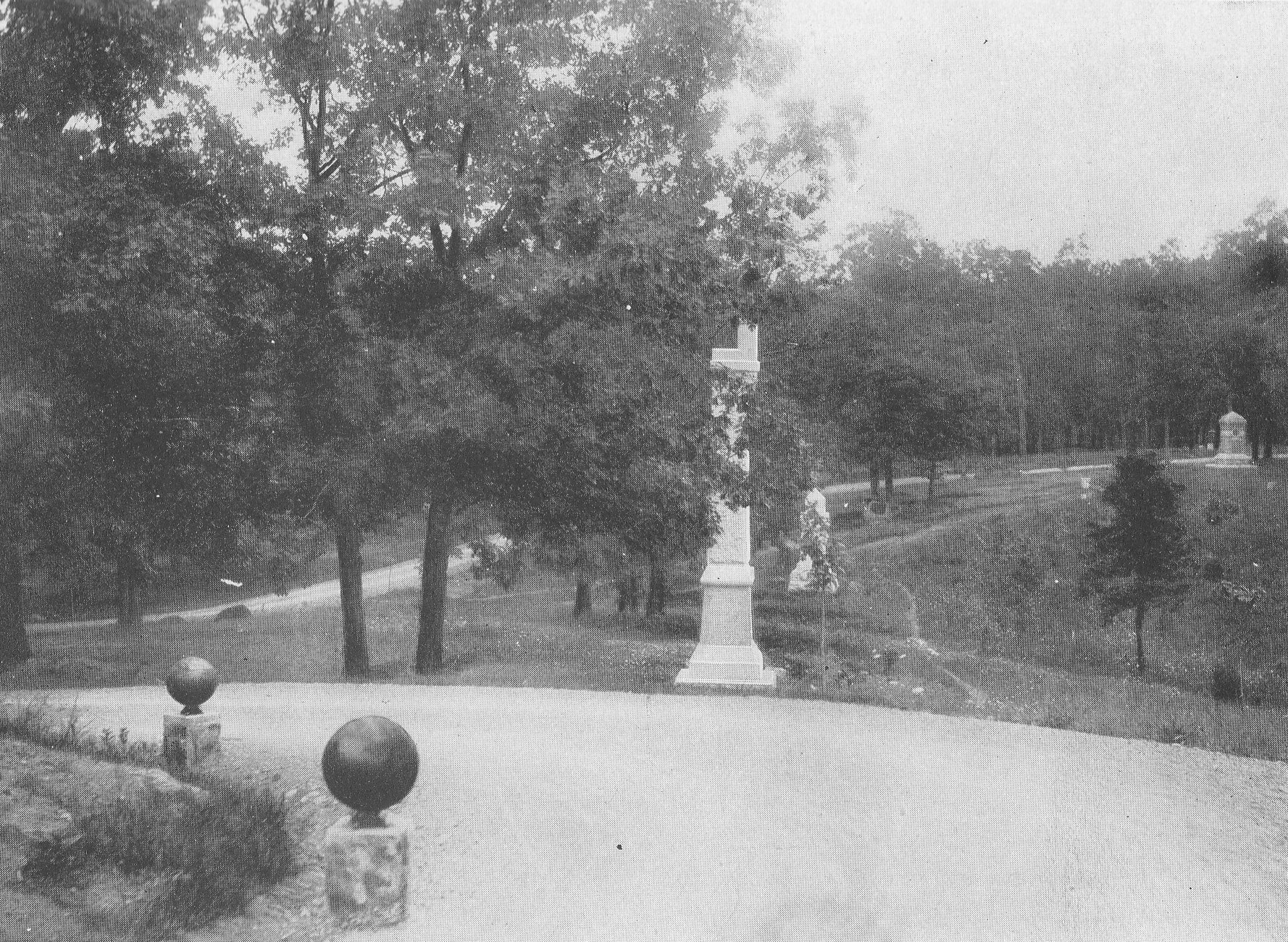
This image is titled “Entrance to Slocum Avenue.” The location is the junction of Slocum Avenue and the Baltimore Pike. The Annual Report of the Gettysburg National Military Park Commission to the Secretary of War in 1896 states: “Since our report of 1895 the Telford road, known as Seminary avenue, and section 1 of Confederate avenue, running from the Chambersbug pike southward along Seminary Ridge as far as the Government at present owns the right of way there, has been completed; … Slocum avenue, which follows the battle lines over Culp’s Hill, is in course of construction and nearly completed…The whole length of Telford avenues which have been constructed by our commission is 7 1/3 miles.”(page 29) The Baltimore Pike runs from left to right (north to south) in this photograph. Slocum Avenue is located to the left of the McKnight House. There is what appears to be a road or driveway that runs behind the McKnight House. There is a black, iron fence on the left. The fence along the Baltimore Pike is the Lafayette Square iron fence that had been donated to the Gettysburg Battlefield Memorial Association by a joint resolution of Congress on October 12, 1888 through the efforts of Major General Daniel Edgar Sickles. (Frederick Tilberg, “Historic Cemetery Survey Report” (June 24, 1958), Gettysburg National Military Park vertical files, page 11). Originally enclosing Lafayette Square in Washington, the fence was declared to be no longer needed by District of Columbia authorities, and prompted Sickles to urge the Congressional resolution giving the ornamental fence over to the Gettysburg Preservation and Memorial Association. On July 12, 1889 the Gettysburg Battlefield Memorial Association resolved that “so much of the iron fence, donated by the U. S. Government, be used as is necessary to enclose the front of East Cemetery Hill to Slocum Avenue, and by said avenue to the turn to Culp’s Hill, and that it be erected unpainted, in granite blocks, and according to the lay of the land, the contractor to furnish any castings that are necessary.” (“Minutes of the Gettysburg Battlefield Memorial Association, July 12, 1889,” page 193. The minutes are in the Gettysburg National Military Park Library). This fence was eventually erected sometime after April of 1890 by the firm of Gilbert and Smith. It was envisioned that three gates would be placed along the Baltimore Pike and one along Slocum Avenue where it joined Wainwright Avenue/Brickyard Lane at the base of East Cemetery Hill (Gettysburg Compiler April 8, 1890). Notice the cannon balls mounted on granite blocks in the foreground. The 1897 commission report states: “All these avenues, like those previously built by the commission on this field, are constructed on the Telford system and are substantial and durable. Wherever along their sides there are sloping banks, these are turfed or set with grass; the gutters are well paved with stones, and wherever needful at short curves, low granite pillars, topped with 13-inch shells, have been set on the edge of the avenues to prevent careless driving off the roadway. (page 37). This photograph was taken facing southeast circa 1897. Annual Reports of the Gettysburg National Military Park Commission to the Secretary of War, 1893-1904. Washington. Government Printing Office, 1905. This view was taken facing east circa 1896.

This image is titled “Slocum Avenue at Sixty-Sixth Ohio Monument.” The location is the eastern slope of Culp’s Hill. The 66th Ohio Infantry Monument, dedicated in 1887, is behind the tree in the left background. The Annual Report of the Gettysburg National Military Park Commission to the Secretary of War in 1896 states: “Since our report of 1895 the Telford road, known as Seminary avenue, and section 1 of Confederate avenue, running from the Chambersbug pike southward along Seminary Ridge as far as the Government at present owns the right of way there, has been completed; … Slocum avenue, which follows the battle lines over Culp’s Hill, is in course of construction and nearly completed…The whole length of Telford avenues which have been constructed by our commission is 7 1/3 miles.”(page 29) The Annual Report of the Gettysburg National Military Park Commission to the Secretary of War in 1897 states: “Since the last report Slocum avenue, then under construction, has been completed. It leads from the Baltimore pike at the base of East Cemetery Hill over the summit of Culp’s Hill to its southeastern base at Spanglers Spring, closely following and marking the main battle line of the right wing of the Union Army.” (page 37) Notice the cannon balls mounted on granite blocks in the foreground. The 1897 commission report states: “All these avenues, like those previously built by the commission on this field, are constructed on the Telford system and are substantial and durable. Wherever along their sides there are sloping banks, these are turfed or set with grass; the gutters are well paved with stones, and wherever needful at short curves, low granite pillars, topped with 13-inch shells, have been set on the edge of the avenues to prevent careless driving off the roadway. (page 37). This photograph was taken facing southeast circa 1897. Annual Reports of the Gettysburg National Military Park Commission to the Secretary of War, 1893-1904. Washington. Government Printing Office, 1905.

This image is titled “Retaining Wall Along Slocum Avenue.” The location is the southeastern slope of Culp’s Hill. The 60th New York Infantry Monument, dedicated in 1888, is visible behind the curve in the right background. The Annual Report of the Gettysburg National Military Park Commission to the Secretary of War in 1896 states: “Since our report of 1895 the Telford road, known as Seminary avenue, and section 1 of Confederate avenue, running from the Chambersbug pike southward along Seminary Ridge as far as the Government at present owns the right of way there, has been completed; … Slocum avenue, which follows the battle lines over Culp’s Hill, is in course of construction and nearly completed…The whole length of Telford avenues which have been constructed by our commission is 7 1/3 miles.”(page 29) The Annual Report of the Gettysburg National Military Park Commission to the Secretary of War in 1897 states: “Since the last report Slocum avenue, then under construction, has been completed. It leads from the Baltimore pike at the base of East Cemetery Hill over the summit of Culp’s Hill to its southeastern base at Spanglers Spring, closely following and marking the main battle line of the right wing of the Union Army.” (page 37) Notice the cannon balls mounted on granite blocks in the left foreground. The 1897 commission report states: “All these avenues, like those previously built by the commission on this field, are constructed on the Telford system and are substantial and durable. Wherever along their sides there are sloping banks, these are turfed or set with grass; the gutters are well paved with stones, and wherever needful at short curves, low granite pillars, topped with 13-inch shells, have been set on the edge of the avenues to prevent careless driving off the roadway. (page 37). This photograph was taken facing northeast circa 1897. Annual Reports of the Gettysburg National Military Park Commission to the Secretary of War, 1893-1904. Washington. Government Printing Office, 1905.
This image is titled “Retaining Wall Along Slocum Avenue, From One Hundred and Fiftieth New York Monument.” The location is the southeastern slope of Culp’s Hill. The 150th New York Infantry Monument is out of sight behind the cameraman. The monument to the 1st Maryland Eastern Shore Regiment, dedicated on October 25, 1888, is on the right. The Annual Report of the Gettysburg National Military Park Commission to the Secretary of War in 1896 states: “Since our report of 1895 the Telford road, known as Seminary avenue, and section 1 of Confederate avenue, running from the Chambersbug pike southward along Seminary Ridge as far as the Government at present owns the right of way there, has been completed; … Slocum avenue, which follows the battle lines over Culp’s Hill, is in course of construction and nearly completed…The whole length of Telford avenues which have been constructed by our commission is 7 1/3 miles.”(page 29) The Annual Report of the Gettysburg National Military Park Commission to the Secretary of War in 1897 states: “Since the last report Slocum avenue, then under construction, has been completed. It leads from the Baltimore pike at the base of East Cemetery Hill over the summit of Culp’s Hill to its southeastern base at Spanglers Spring, closely following and marking the main battle line of the right wing of the Union Army.” (page 37) This photograph was taken facing northwest circa 1897. Annual Reports of the Gettysburg National Military Park Commission to the Secretary of War, 1893-1904. Washington. Government Printing Office, 1905.
This image is titled “Slocum Avenue, From Second Maryland, C.S.A. Monument.” The location is the northern slope of Lower Culp’s Hill. The 111th Pennsylvania Infantry Monument, dedicated on September 11, 1889, is the tall, thin monument in the center of the view. The monument behind (north of) it is to the 109th Pennsylvania Infantry Regiment which was also dedicated on September 11, 1889. The small monument behind (north of) the 109th Pennsylvania, and underneath two small trees is to the 14th Brooklyn Infantry Regiment. The marker to the 14th Brooklyn, also known as the 84th New York Infantry Regiment, was dedicated on September 1, 1889. The monument in the right background is to the 7th Ohio Infantry Regiment, which was dedicated on September 14, 1887. The Annual Report of the Gettysburg National Military Park Commission to the Secretary of War in 1896 states: “Since our report of 1895 the Telford road, known as Seminary avenue, and section 1 of Confederate avenue, running from the Chambersbug pike southward along Seminary Ridge as far as the Government at present owns the right of way there, has been completed; … Slocum avenue, which follows the battle lines over Culp’s Hill, is in course of construction and nearly completed…The whole length of Telford avenues which have been constructed by our commission is 7 1/3 miles.”(page 29) The Annual Report of the Gettysburg National Military Park Commission to the Secretary of War in 1897 states: “Since the last report Slocum avenue, then under construction, has been completed. It leads from the Baltimore pike at the base of East Cemetery Hill over the summit of Culp’s Hill to its southeastern base at Spanglers Spring, closely following and marking the main battle line of the right wing of the Union Army.” (page 37) Notice the cannon balls mounted on granite blocks in the left foreground. The 1897 commission report states: “All these avenues, like those previously built by the commission on this field, are constructed on the Telford system and are substantial and durable. Wherever along their sides there are sloping banks, these are turfed or set with grass; the gutters are well paved with stones, and wherever needful at short curves, low granite pillars, topped with 13-inch shells, have been set on the edge of the avenues to prevent careless driving off the roadway. (page 37). This photograph was taken facing northwest circa 1897. Annual Reports of the Gettysburg National Military Park Commission to the Secretary of War, 1893-1904. Washington. Government Printing Office, 1905.
This image is titled “Slocum Avenue, North From One Hundred Twenty-Third New York Monument.” The location is Lower Culp’s Hill. The 123rd New York Infantry Monument, is out of sight on the right. The monument to the 2nd Maryland Infantry Regiment (CSA), which was dedicated on November 19, 1886, is the light colored monument in the background to the right (east) of Slocum Avenue. The Annual Report of the Gettysburg National Military Park Commission to the Secretary of War in 1896 states: “Since our report of 1895 the Telford road, known as Seminary avenue, and section 1 of Confederate avenue, running from the Chambersbug pike southward along Seminary Ridge as far as the Government at present owns the right of way there, has been completed; … Slocum avenue, which follows the battle lines over Culp’s Hill, is in course of construction and nearly completed…The whole length of Telford avenues which have been constructed by our commission is 7 1/3 miles.”(page 29) The Annual Report of the Gettysburg National Military Park Commission to the Secretary of War in 1897 states: “Since the last report Slocum avenue, then under construction, has been completed. It leads from the Baltimore pike at the base of East Cemetery Hill over the summit of Culp’s Hill to its southeastern base at Spanglers Spring, closely following and marking the main battle line of the right wing of the Union Army.” (page 37) This photograph was taken facing north circa 1897. Annual Reports of the Gettysburg National Military Park Commission to the Secretary of War, 1893-1904. Washington. Government Printing Office, 1905.

This image is titled “Slocum Avenue, South From One Hundred Twenty-Third New York Monument.” The location is Lower Culp’s Hill. The 123rd New York Infantry Monument, is out of sight on the left. The Annual Report of the Gettysburg National Military Park Commission to the Secretary of War in 1896 states: “Since our report of 1895 the Telford road, known as Seminary avenue, and section 1 of Confederate avenue, running from the Chambersbug pike southward along Seminary Ridge as far as the Government at present owns the right of way there, has been completed; … Slocum avenue, which follows the battle lines over Culp’s Hill, is in course of construction and nearly completed…The whole length of Telford avenues which have been constructed by our commission is 7 1/3 miles.”(page 29) The Annual Report of the Gettysburg National Military Park Commission to the Secretary of War in 1897 states: “Since the last report Slocum avenue, then under construction, has been completed. It leads from the Baltimore pike at the base of East Cemetery Hill over the summit of Culp’s Hill to its southeastern base at Spanglers Spring, closely following and marking the main battle line of the right wing of the Union Army.” (page 37) This photograph was taken facing south circa 1897. Annual Reports of the Gettysburg National Military Park Commission to the Secretary of War, 1893-1904. Washington. Government Printing Office, 1905.