

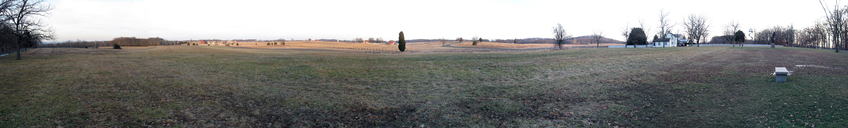
Today’s panorama concentrates on the Confederate view of the Peach Orchard at ground level. This panorama is taken from in front of (east of) the Louisiana State Monument. On the left is Pitzer’s and Spangler’s Woods the red Alexander Spangler Barn, and Cemetery Hill. In the center are the Sherfy Farm and the Peach Orchard. On the right are the Round Tops, the Sheffler House and the Warfield House. Also visible is the Longstreet Tower and the Mississippi State Monument. This view was taken at approximately 4:40 PM on Wednesday, March 24, 2010. On the left we are looking to the north. On the right we are looking to the south. For a medium-sized version of the panorama click here. For the larger JPEG version, click here. If you’d like to see the uncompressed TIFF file, you can download it here (40.6 MB).
In an effort to show some other panorama views around the battlefield, today we are concentrating on the Confederate view of the Peach Orchard. Of course, this is at ground level, not up in the Longstreet Tower. This panorama is taken from in front of (east of) the Louisiana State Monument.
January 18, 2010.