Licensed Battlefield Guide Dave Hamacher: Texas Brigade Part 2
April 2, 2012
Gettysburg Licensed Battlefield Guide Dave Hamacher is the host for our series on the Texas Brigade. He is standing by Marsh Creek near the Chambersburg Pike (US 30). A railroad trestle is in the left background. This view was taken facing northeast at approximately 4:30 PM on Friday, March 9, 2012.
Gettysburg Licensed Battlefield Guide Dave Hamacher a native Pennsylvanian and a lifelong student of history. He is in his twelfth year as a Licensed Battlefield Guide. This is his fourteenth year teaching history at Harrisburg Area Community College in Harrisburg, Pennsylvania. Dave has also been a Licensed Town Guide in Gettysburg for the last seven years. Dave attended Penn State and Indiana University of Pennsylvania and has earned two degrees (B.A. and M.A.) in history. Dave states, “I have always considered it a privilege to guide on this historic battlefield. I have a lot of fun doing it.” Dave is married to Gettysburg Licensed Battlefield Guide Kim Hamacher. They live in Red Lion, Pennsylvania.
In the first post, Gettysburg Licensed Battlefield Guide Dave Hamacher introduced us to the Texas Brigade and provided background on their actions before the Battle of Gettysburg.
In today’s post, Gettysburg Licensed Battlefield Guide Dave Hamacher brings the Texas Brigade to Gettysburg, explains the movement of the First Corps along Herr’s Ridge, and the beginning of the countermarch.
This map shows the location of where our the Texas Brigade videos were produced. Videos #1-5 were shown in our previous Texas Brigade post. Video #6 was taken where US 30 (Chambersburg Pike) crosses Marsh Creek. Video #7 was taken on Herr’s Ridge Road. Video #8 was taken near Francis Bream’s Black Horse Tavern. This map was created facing north at approximately 4:00 PM on Saturday, March 31, 2012.
Gettysburg Licensed Battlefield Guide Dave Hamacher is standing near the Chambersburg Pike bridge that crosses Marsh Creek. He is pointing to the distant ridge, Knoxlyn Ridge. From Knoxlyn Ridge elements of the 8th Illinois Cavalry fired at Confederates crossing Marsh Creek here on the morning of July 1, 1863. This view was taken facing facing southeast at approximately 4:00 PM on Saturday, March 31, 2012.
In Video #6 (Videos #1-#5 were shown in our previous post) Gettysburg Licensed Battlefield Guide Dave Hamacher is standing by Marsh Creek near the Chambersburg Pike. He explains how the Texas Brigade and Longstreet’s First Corps marched to Gettysburg. This view was taken facing northeast to southeast to northeast at approximately 4:30 PM on Friday, March 9, 2012.
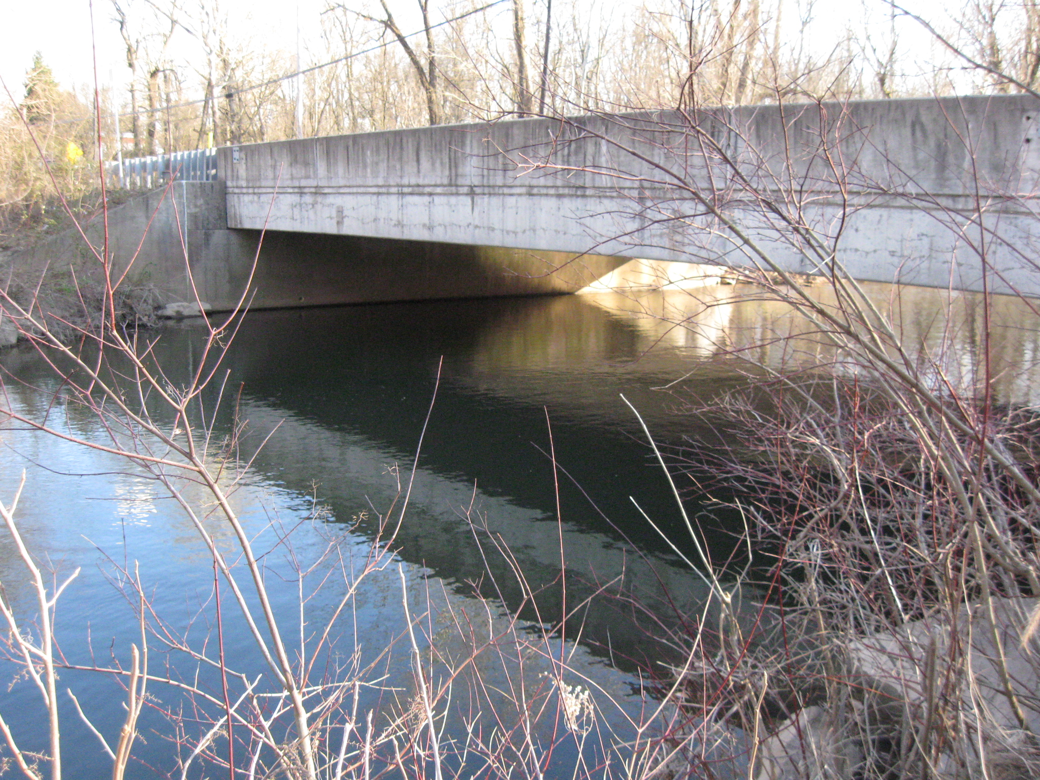
The railroad bridge crossing Marsh Creek occupies the area that the “Unfinished Railroad/Tapeworm Railroad” would have occupied if it were complete at the time of the battle. This view was taken facing west at approximately 4:30 PM on Friday, March 9, 2012.
The U.S. Highway 30 (Chambersburg Pike) bridge crossing Marsh Creek. This view was taken facing southeaset at approximately 4:30 PM on Friday, March 9, 2012.
Licensed Battlefield Guide Dave Hamacher is standing on Herr’s Ridge near a new development. He is pointing to the Round Tops. This view was taken facing southeast at approximately 4:30 PM on Friday, March 9, 2012.
In Video #7 Licensed Battlefield Guide Dave Hamacher is standing on Herr’s Ridge. He explains the movement of Longstreet’s First Corps towards the southern end of the battlefield on July 2, 1863. This view was taken facing north to east to southeast to east to southeast to south at approximately 4:30 PM on Friday, March 9, 2012.
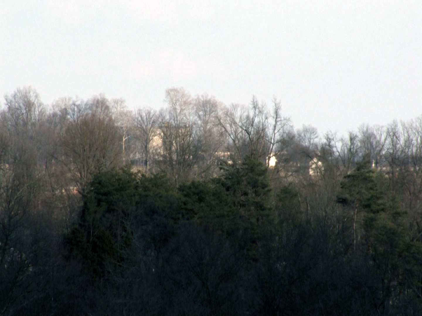
While at this location, we were surprised to see Cemetery Ridge, which are the tallest trees in the left and center background. This view was taken facing southeast at approximately 4:30 PM on Friday, March 9, 2012.
Under magnification, one can see the “old Cyclorama” building in the left center background, and the sun shining on the white Brian/Bryan Farm buildings in the right center background. This view was taken facing southeast at approximately 4:30 PM on Friday, March 9, 2012.
Herr’s Ridge Road leads from this location to Bream’s Hill, which are the tallest trees in the center background. This view was facing southwest at approximately 4:30 PM on Friday, March 9, 2012.
Francis Bream’s Black Horse Tavern is on the left. Dave Hamacher is pointing to the part of Bream’s Hill that forced Longstreet’s Corps to turn around and perform its countermarch on July 2, 1863. This view was taken facing southeast at approximately 4:30 PM on Friday, March 9, 2012.
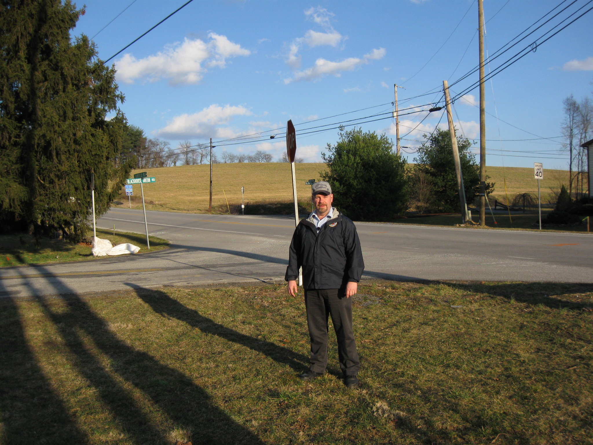
In Video #8 Dave Hamacher is standing near the Black Horse Tavern at the intersection of the Fairfield/Hagerstown Road and Black Horse Tavern Road. He explains the beginning of Longstreet’s Countermarch. This view was taken facing southwest to southeast to east at approximately 4:30 PM on Friday, March 9, 2012.
Dave Hamacher is standing by the intersection of Black Horse Tavern Road, which is to the left of Dave and the Fairfield/Hagerstown Road which is behind Dave. The southern part of the Black Horse Tavern Road is also behind Dave, but lost in the shadows at the foot of the cleared Bream’s Hill. This view was taken facing southeast at approximately 4:30 PM on Friday, March 9, 2012.
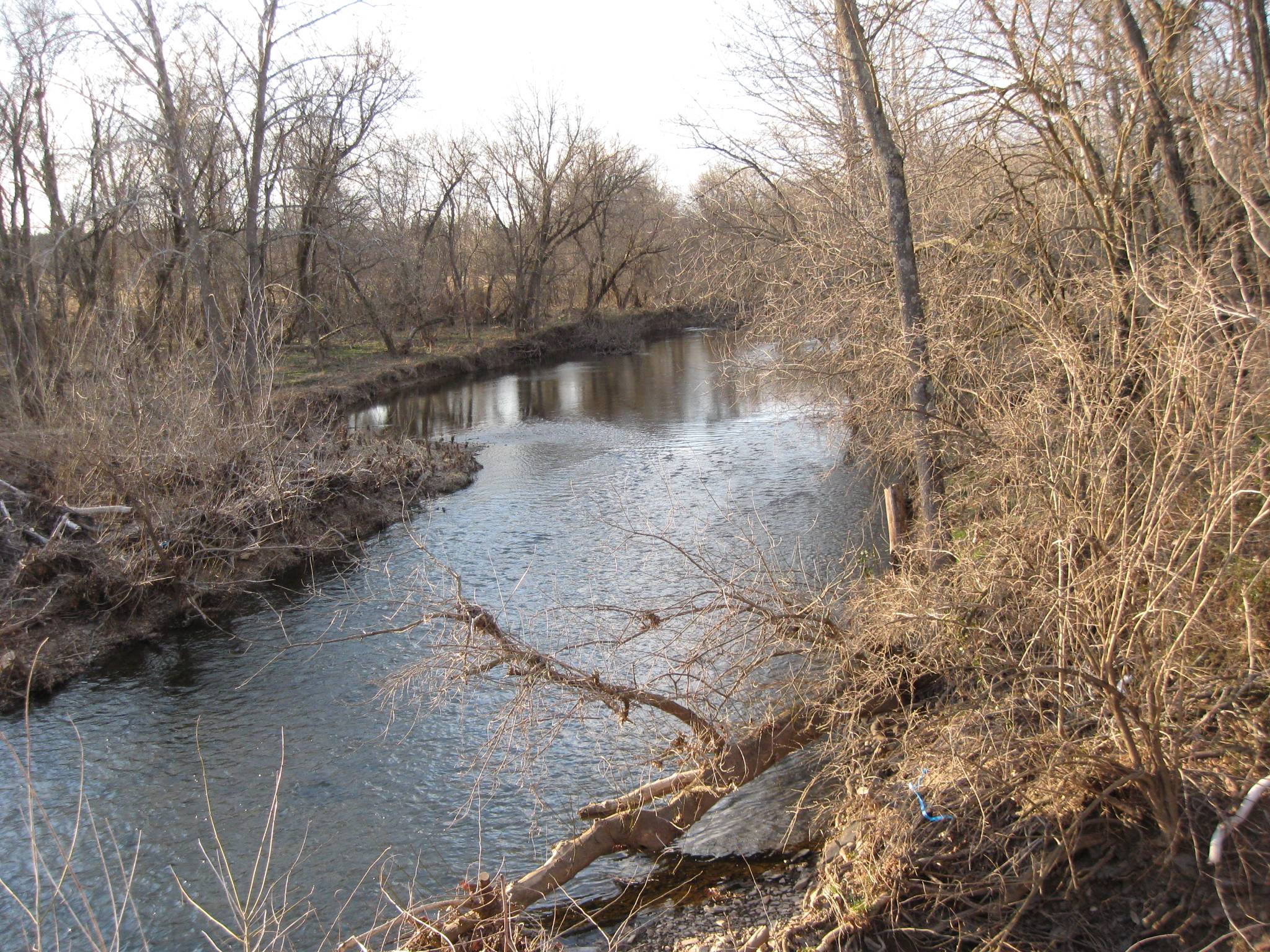
Black Horse Tavern is also located near Marsh Creek. This view was taken facing northwest at approximately 4:30 PM on Friday, March 9, 2012.
To see other posts by Gettysburg Licensed Battlefield Guides,click here.