

To shut down avenues that are not usually shut down with a “gate,” the National Park Service has prepared barricades and orange cones to close off the road. The Carlisle Road is in the background. Remember in this post, we are only showing the areas shut down on the first day’s battlefield. This view was taken facing northeast at approximately 4:00 PM on Saturday, April 9, 2011.
If the government had “shut down” this weekend, some were wondering how much the National Park Service could actually close off to the public. Would this be like the 1995 shutdown, when even though the visitor center was closed, visitors could still tour much of the battlefield? No, visitors would not have the same access that they did in 1995. This time, more avenues would have been closed and the public’s access to their National Military Park (which they have paid for in federal taxes each year since 1895) will be severely limited.

In today’s post we will show you which avenues would be closed on the First Day’s (July 1, 1863) Battlefield. Anything in red are avenues that the government would have shut down. Anything in bright/lime green are the avenues that the National Park Service would leave open. This map was created facing north at approximately 4:00 PM on Saturday, April 9, 2011.

A memo from the Superintendent of Gettysburg National Military Park to “All Battlefield Guides, Park Volunteers, Commercial Operators/holders of Commercial Use Authorizations” dated April 8, 2011 stated the following: “In the event of the shutdown of the federal government… the use of the park for any reason will be prohibited…All park entrances, parking lots will be closed and secured. All facilities other than the VC will be closed. (The Visitor Center is owned and operated by the Gettysburg Foundation, which is a private nonprofit organization and is not subject to government shutdown requirements.)” This view was taken facing southeast at approximately 4:00 PM on Saturday, April 9, 2011.

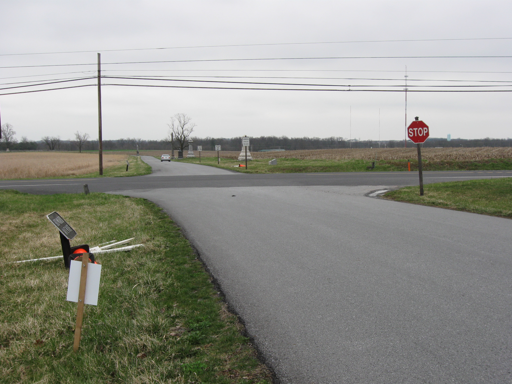
We’re not going to take you and show you every area that is closed. For this post, we’ll show you the access, or lack thereof, to the first day’s battlefield. The Fairfield/Hagerstown/Millertown Road is in the foreground. The road running away from us is South Reynolds Avenue, which runs along East McPherson’s Ridge. How do we know South Reynolds Avenue would have been shut down? This view was taken facing northeast at approximately 4:00 PM on Saturday, April 9, 2011.

Because of the cones and barricades readied to be placed across the road. This view was taken facing northeast at approximately 4:00 PM on Saturday, April 9, 2011.
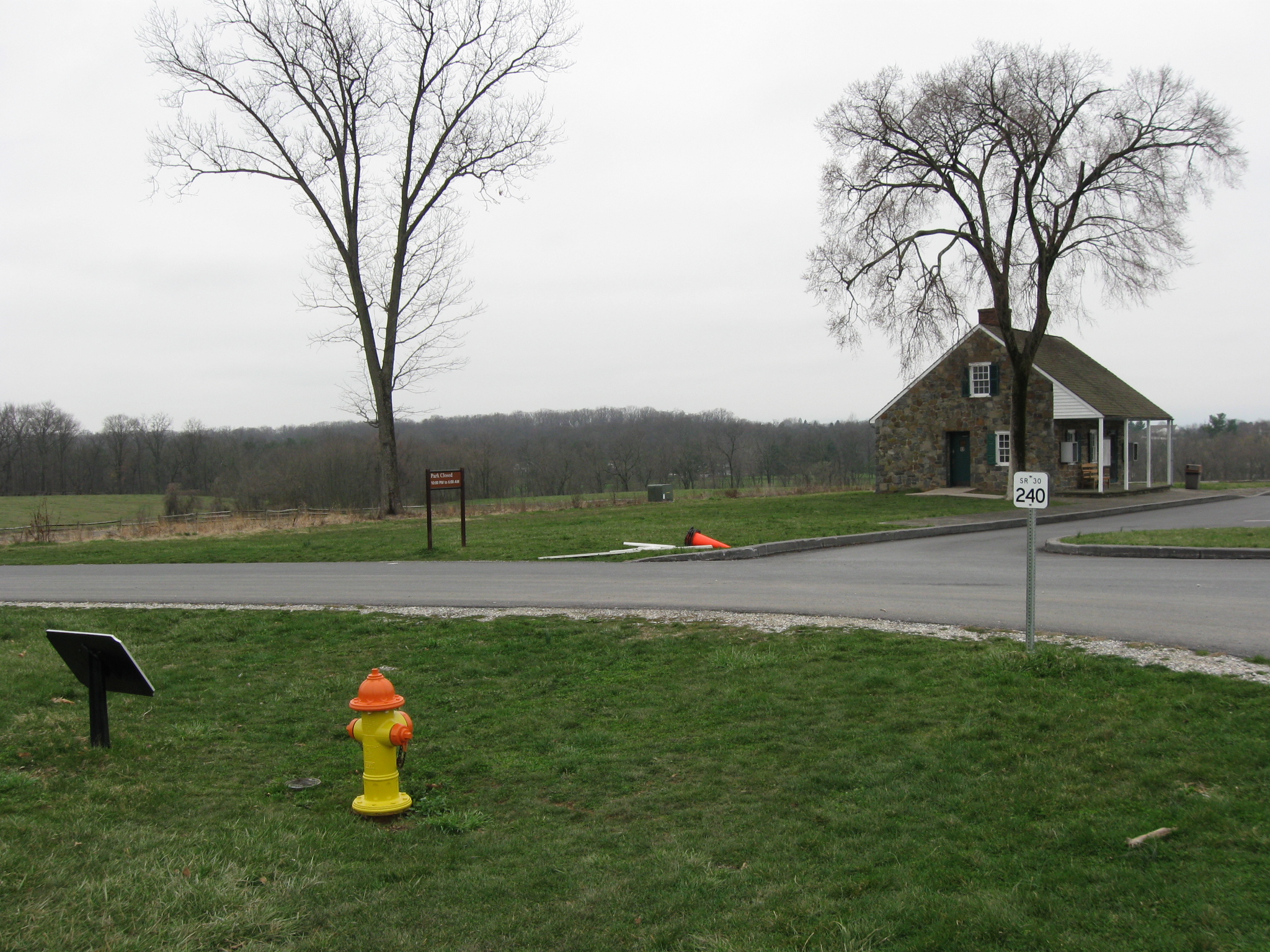
So let’s jump over to the Chambersburg Pike and the West End Guide Station. The building and its restrooms would be shut down, as would Stone Avenue. It appears that they would at least allow visitors access to the parking lot at the West End Guide Station before they go to the building entrance and/or restroom and see the signs telling them that the park was closed. This view was taken facing southwest at approximately 4:00 PM on Saturday, April 9, 2011.

The McPherson Barn is in the left background. Stone Avenue is shown here along West McPherson’s Ridge. The Superintendent’s memo also states that “Education programs and special events will be canceled. Permits for special events will be rescinded…” This view was taken facing southeast at approximately 4:00 PM on Saturday, April 9, 2011.

The cameraman is standing on South Reynolds Avenue, which would be closed in case of a shutdown. The Chambersburg Pike, running from left to right is a U.S. Highway, would not be shutdown. North Reynolds Avenue, on the other side of the traffic light and going over the bridge, would remain open. This view was taken facing northeast at approximately 4:00 PM on Saturday, April 9, 2011.

The Superintendent’s memo states: “Only park roads that serve as thruways will remain open. The thruways include Millerstown Roa and wheatfield Road as well as the route consisting of North Reynolds Ave. to Doubleday Ave to Robinson Ave to allow for resident access. Seminary Ridge Ave and West Confederate Ave to the McMillan House will remain open for resident access-the rest of West Confederate Ave and all other park avenues will be closed.” So one could drive along North Reynolds Avenue to the stop sign… This view was taken facing northeast at approximately 4:00 PM on Saturday, April 9, 2011.
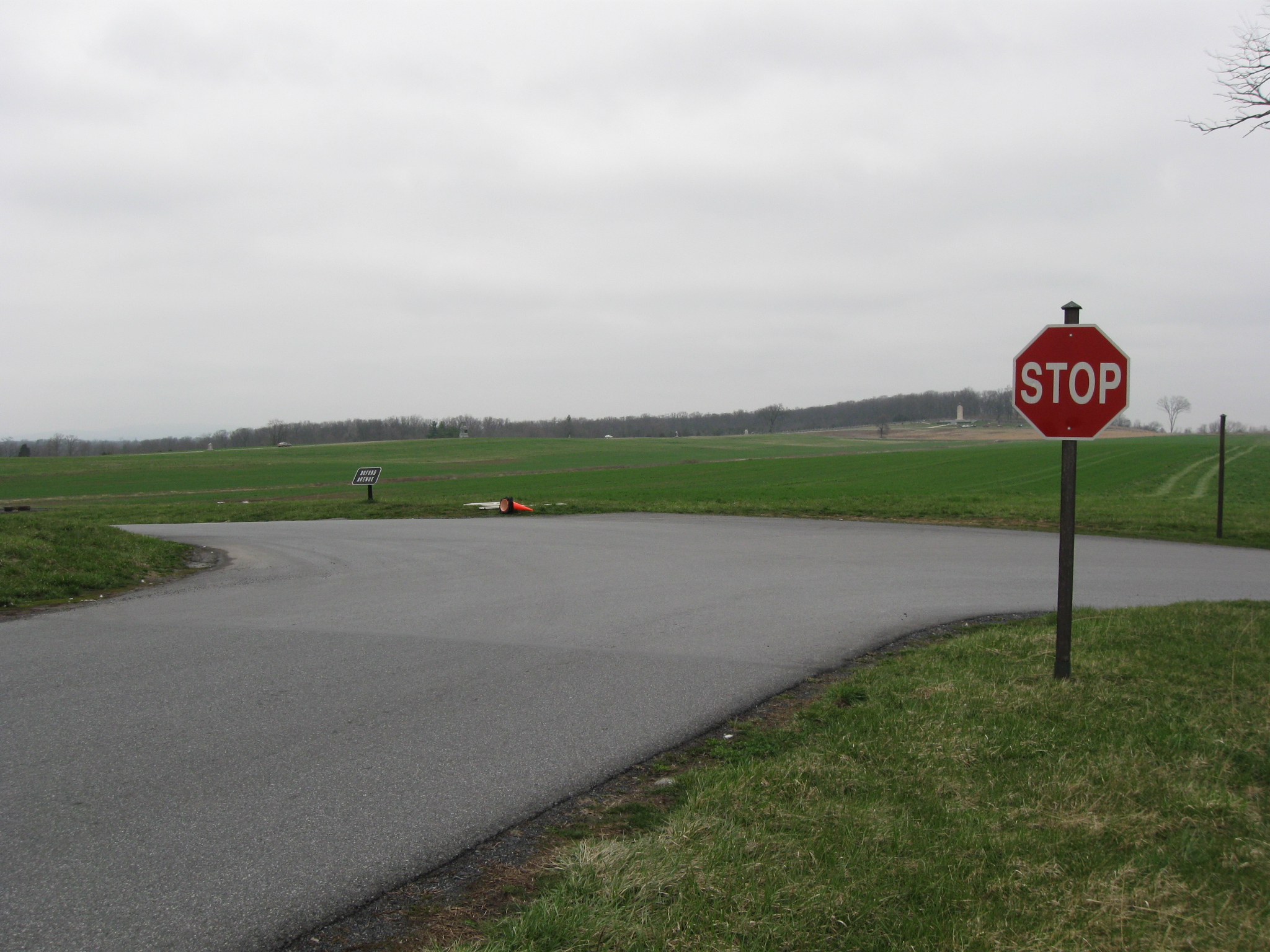
…but you can’t take a left onto Buford Avenue. The Superintendent’s Memo: “All volunteer activities will be cancelled and volunteers will not be able to serve or visit in any capacity.” This image was taken facing north at approximately 4:00 PM on Saturday, April 9, 2011.

Buford Avenue would be closed. The Eternal Light Peace Memorial (Peace Light) is in the background on Oak Hill. The Superintendent’s Memo: “National Park Service law enforcement employees will remain to protect park resources.” This view was taken facing north at approximately 4:00 PM on Saturday, April 9, 2011.

You can however, take Wadsworth Avenue up into Sheads Woods where it runs into Doubleday Avenue because the residents living on top of Oak Ridge/Seminary Ridge here need to have access. This view was taken facing southeast at approximately 4:00 PM on Saturday, April 9, 2011.

The cameraman is standing on the left (west) side of Buford Avenue, which would be closed. The road running from left to right on the other side of the stop sign is the Mummasburg Road, which would be open. The road leading to the Peace Light is North Confederate Avenue, which would be closed. How can we tell? There are two green posts on either side of North Confederate Avenue. This view was taken facing northeast at approximately 4:00 PM on Saturday, April 9, 2011.
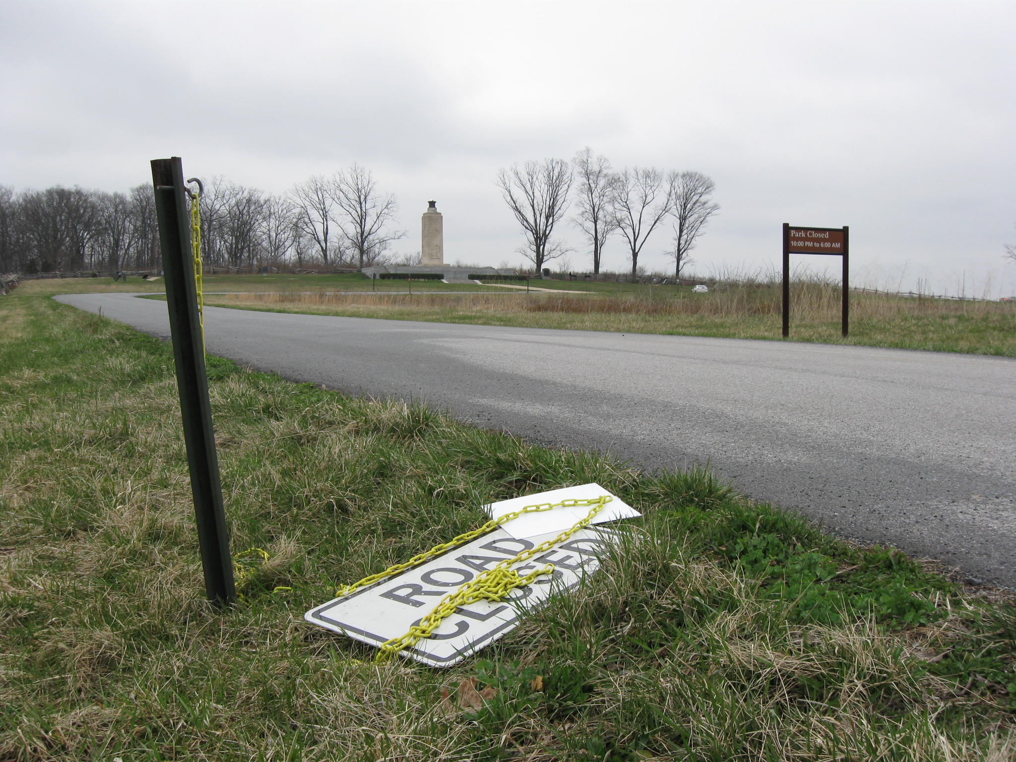
The left (west) post has a chain and a “Road Closed” sign waiting to be pulled across the road to connect to the other post. These posts are in place because during snowy/icy winter weather North Confederate Avenue is frequently closed. The Peace Light is in the background. This view was taken facing northeast at approximately 4:00 PM on Saturday, April 9, 2011.

The cameraman is standing on North Confederate Avenue. The Mummasburg Road is running right to left on the other side of the stop sign. Doubleday Avenue is on the other side of the stop sign running away from the camera and to the right of the Oak Ridge Tower. It should be easy to tell by now if the road is going to be closed. This view was taken facing southeast at approximately 4:00 PM on Saturday, April 9, 2011.

One you know what you’re looking for the orange cones are pretty easy to spot. This view was taken facing south at approximately 4:00 PM on Saturday, April 9, 2011.
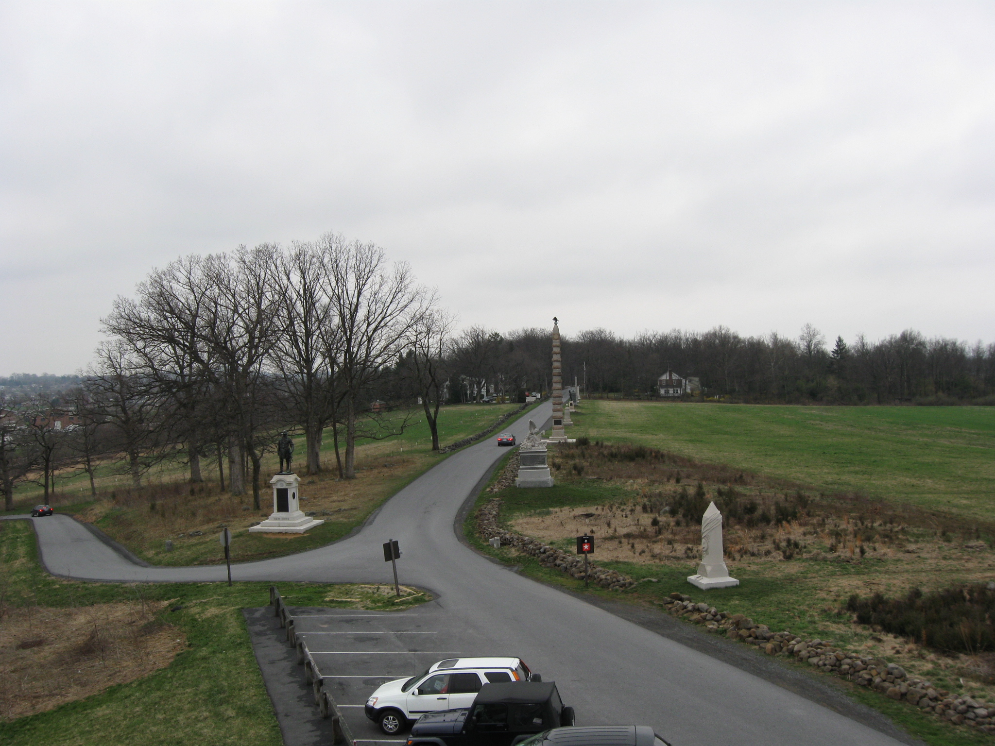
So we’ve climbed the Oak Ridge Tower. The parking lot would be closed. Doubleday Avenue running away from the camera into the woods would be open because the houses in Sheads Woods need access. The statue to Brigadier John Robinson is on the left. This view was taken facing south at approximately 4:00 PM on Saturday, April 9, 2011.

Robinson Avenue, which is the curvy road climbing Oak Ridge, will stay open to connect residents on Doubleday Avenue with the Mummasburg Road, shown on the left. The Superintendent’s memo states: “All Licensed Battlefield Guides and Commerical Operators/holders of Commercial Use Authorizations will be prohibited from using or working in the park for any reason during the shutdown.” This view was taken facing southeast at approximately 4:00 PM on Saturday, April 9, 2011.

And what about Howard Avenue, running along the Eleventh Corps battle line? The Mummasburg Road is in the foreground. Howard Avenue is in the center background. Three cars are on it. This view was taken facing southeast at approximately 4:00 PM on Saturday, April 9, 2011.

Well, West Howard Avenue will be closed. The Mummasburg Road is in the foreground. The Superintendent’s Memo: “Persons who violate this notification will be warned and asked to leave. If the same individual(s) must be warned again, they may be cited for entering a closed area or other violations. Your cooperation is appreciated.” This image was taken facing northeast at approximately 4:00 PM on Saturday, April 9, 2011.
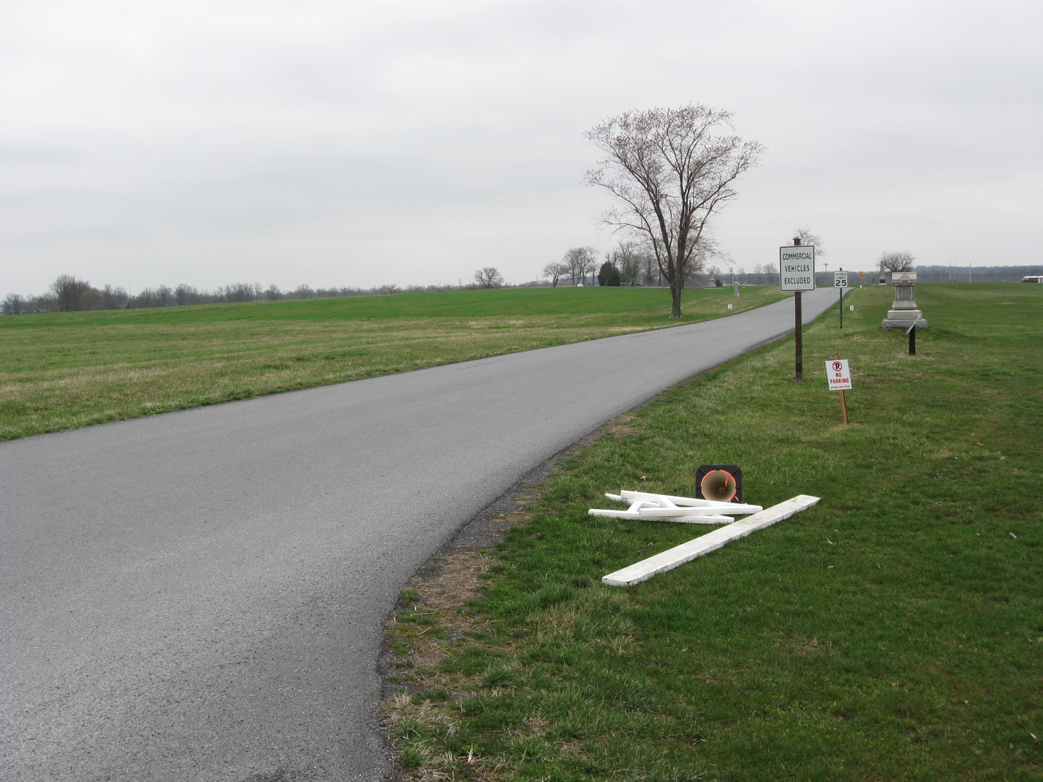
We really think that the park needs to place more signs on the battlefield. After the barricade, the No Parking Sign, the Commercial Vehicles Excluded Sign, the Howard Avenue Sign and next to the Speed Limit 25 Sign, there is a monument to the 157th New York. This view was taken facing northeast at approximately 4:00 PM on Saturday, April 9, 2011.
West Howard Avenue is a two way road connecting the Mummasburg Road, which we showed in our previous picture, with the Carlisle Road shown running right to left on the other side of the stop sign. So a barricade would be placed here to block traffic coming off the Carlisle Road, and there is a barricade on the other side of the Carlisle Road which would block access to East Howard Avenue. This view was taken facing west at approximately 4:00 PM on Saturday, April 9, 2011.

Again, got to love the subtle signage here. The marker closest to the camera is the right flank marker for the 157th New York. The first monument is to the 199th New York. You might wonder why the barricades are still up. Well it could be that they are waiting for the maintenance employees to pick them up on Monday. Or it could be that the government shut down has only been averted to next Friday, and they could be doing this all over again, so why not leave them? This view was taken facing northeast at approximately 4:00 PM on Saturday, April 9, 2011.