
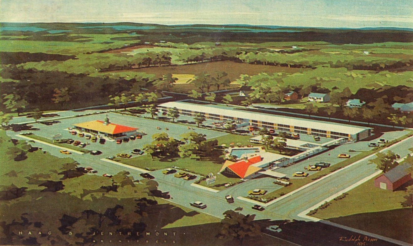
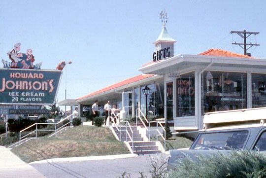
During the Civil War Centennial (late 1950s-early 1960s) Steinwehr Avenue became the home to motels and restaurants which were built to accommodate the millions of visitors that poured into Gettysburg during that time. The Howard Johnson’s was one of those structures. This is the architect’s drawing of the Howard Johnson’s Motor Lodge, which was located across Steinwehr Avenue from the Electric Map. This image was created in the 1950s. This image is courtesy of ebay.com.
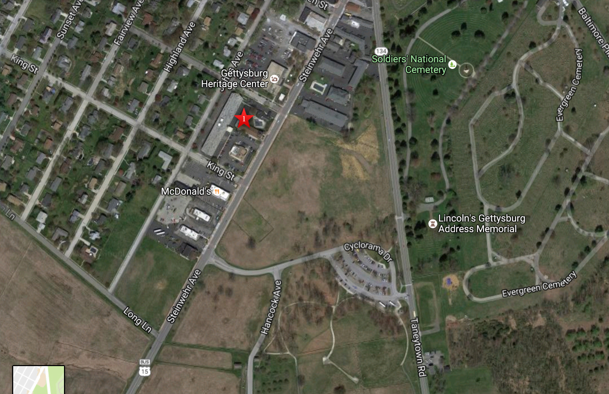
This aerial view shows the area of area of the Howard Johnson’s that has now been demolished. The red star is between the office and the rooms. This image is courtesy of googlemaps.
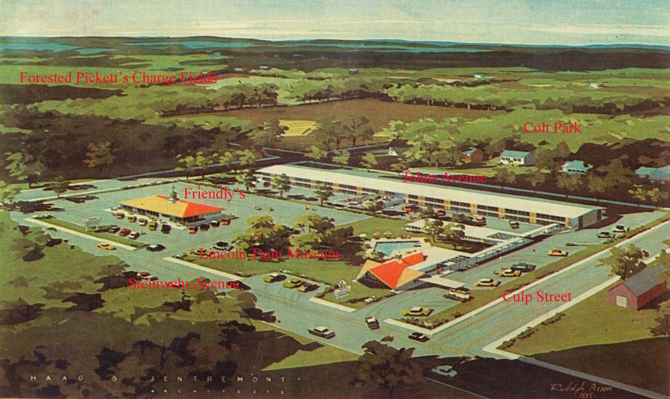
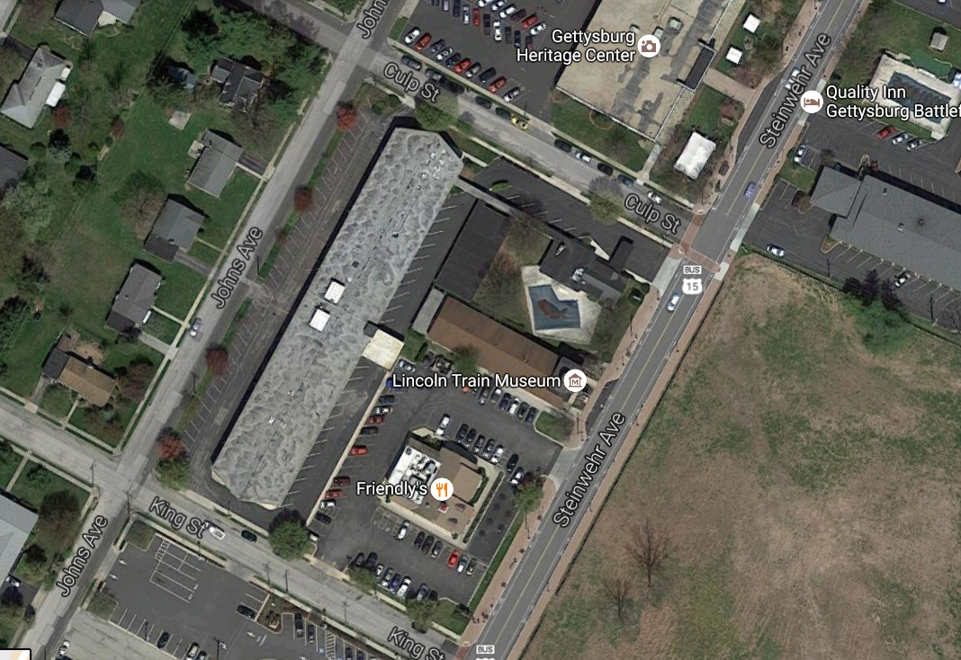
To give you a better idea of the area that we are discussing, the streets have now been labeled. The old orange roofed Howard Johnson’s Restaurant is now the Friendly’s Restaurant. The Lincoln Train Museum sits between the orange roofed Howard Johnson Restaurant and the orange roofed Howard Johnson Office. This original image was created in the 1950s. This original image is courtesy of ebay.com.
When one compares the architect’s drawing to the latest google aerial image that is available, it appears that the pool was moved closer to Steinwehr Avenue and the restaurant might have had a longer front facing Steinwehr Avenue than the Friendly’s Restaurant does today. This image image is courtesy of googlemaps.

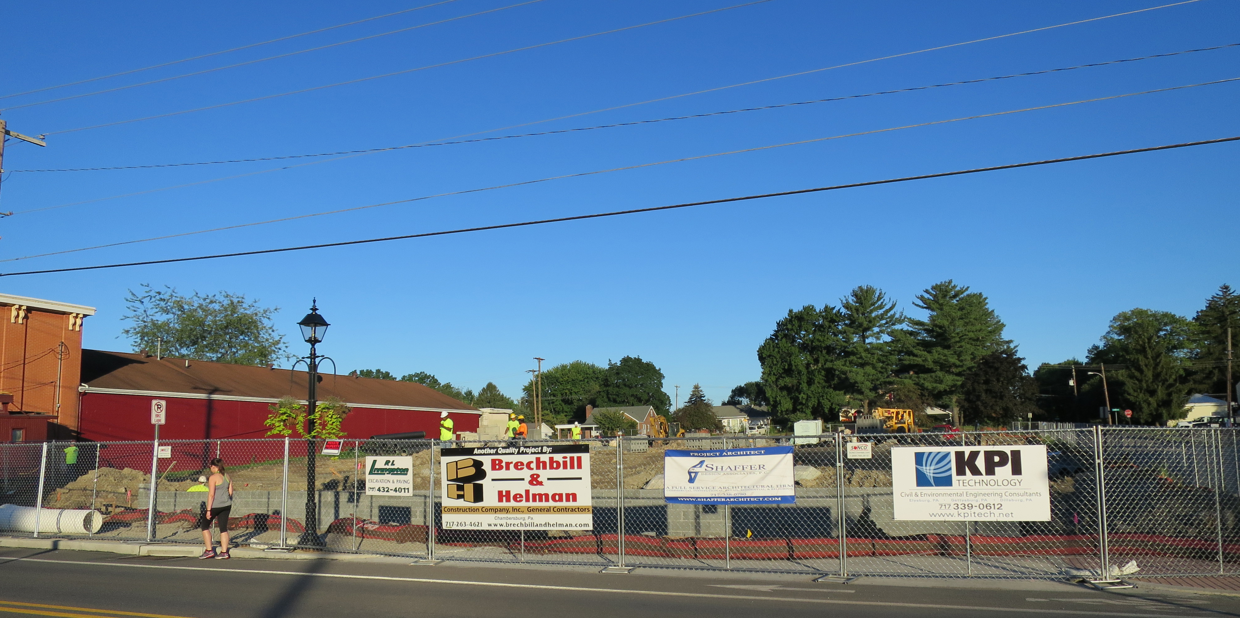
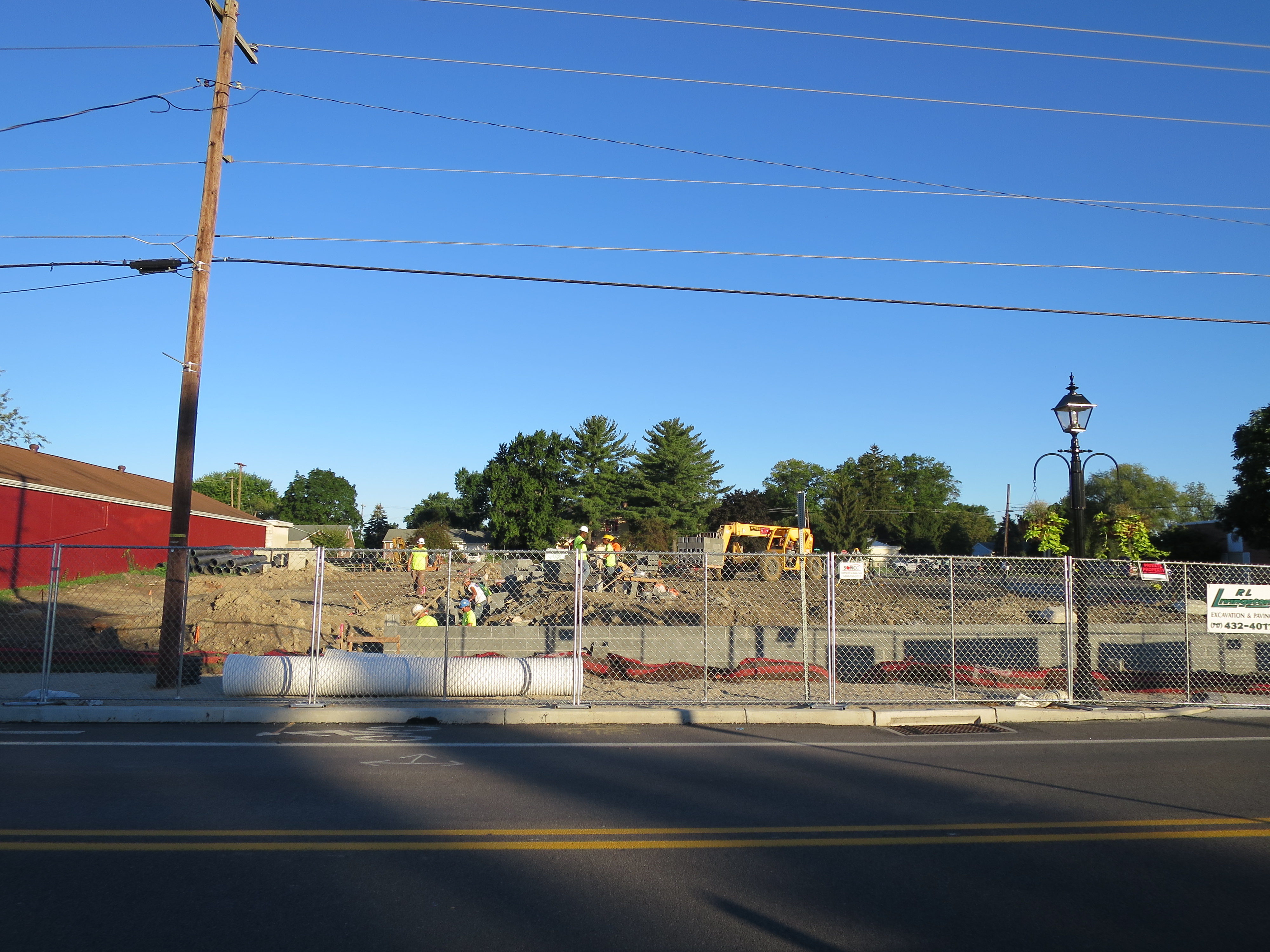
The Howard Johnson’s was to the right of the Lincoln Train Museum, and is located where the construction workers are in this photograph. The trees in the background are at Colt Park. This view is from the former location of the Electric Map Visitors Center. This image was taken facing west at approximately 7:30 AM on Monday, August 22, 2016.
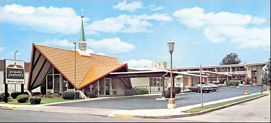
Of course we keep calling it the “Howard Johnson’s” which were known for their distinctive orange roofs. During the 1960s and the 1970s, Howard Johnson’s was the largest restaurant chain in the United States with more than 1000 either company owned or franchised outlets. The Howard Johnson’s Motor Lodge existed under that name in Gettysburg from when it opened in 1960 until 1999. This image was on a promotional brochure for the Howard Johnson’s Motor Lodge. This view was taken facing west circa the 1970s. This image is courtesy of pinterest.com.
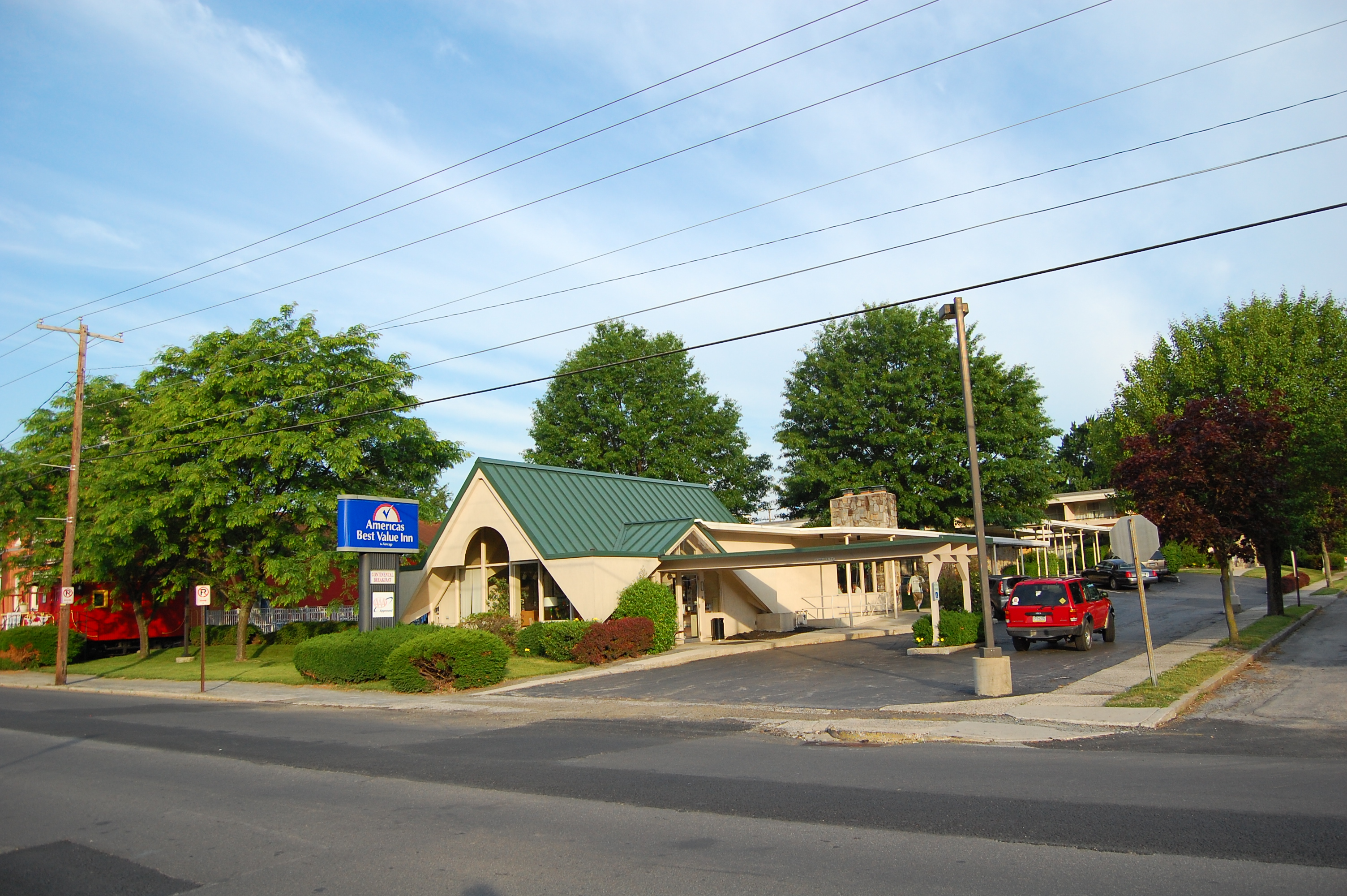
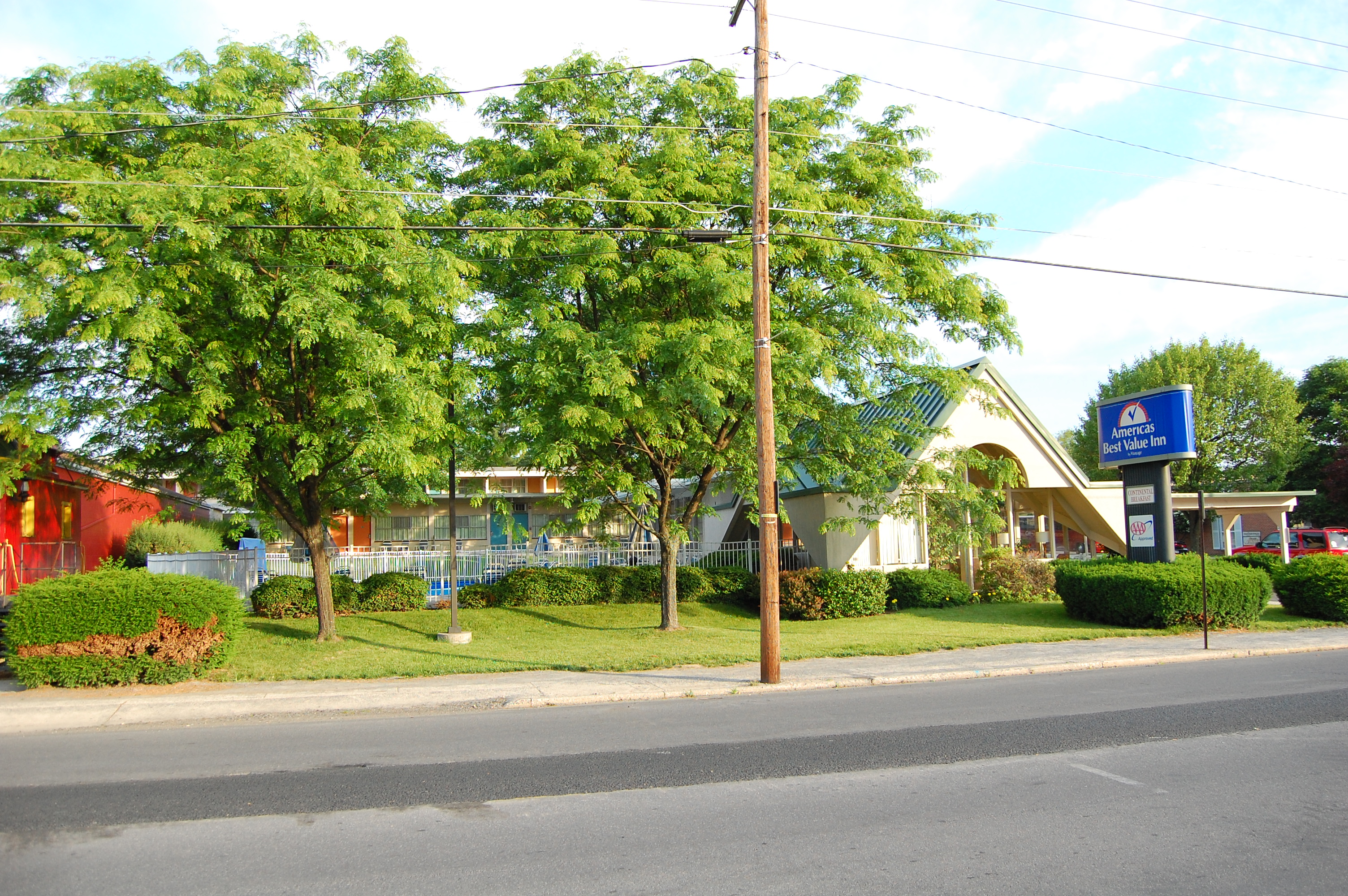
The motel was known as a “Best Inn” from 1999-2006 and as an “America’s Best Value Inn” from 2006-2016. This image was taken facing southwest at approximately 7:30 AM on Sunday, June 8, 2014.
Here’s a view of the office location. The Lincoln Train Museum is still standing on the far left. This image was taken facing southwest at approximately 7:30 AM on Monday August 22, 2016.
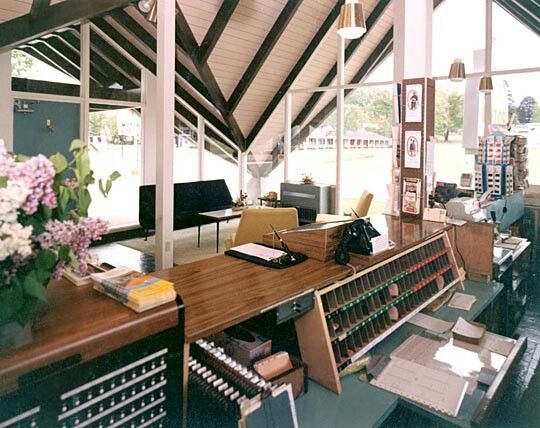
Here’s the interior of the office from the clerk’s point of view. This view was taken facing northeast in 1961. This image is courtesy of highwayhost.org.
This image shows the railing for the pool just to the left of the office. This view was taken facing west at approximately 7:30 AM on Sunday June 8, 2014.
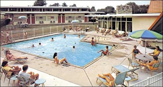
Here’s a view of the pool circa the 1980s. This image was on a promotional brochure for the Howard Johnson’s Motor Lodge. This view was taken facing west circa the 1980s. This image is courtesy of pinterest.com.
Here’s a recent picture of the pool area. This view was taken facing west at approximately 7:30 AM on Monday August 22, 2016.
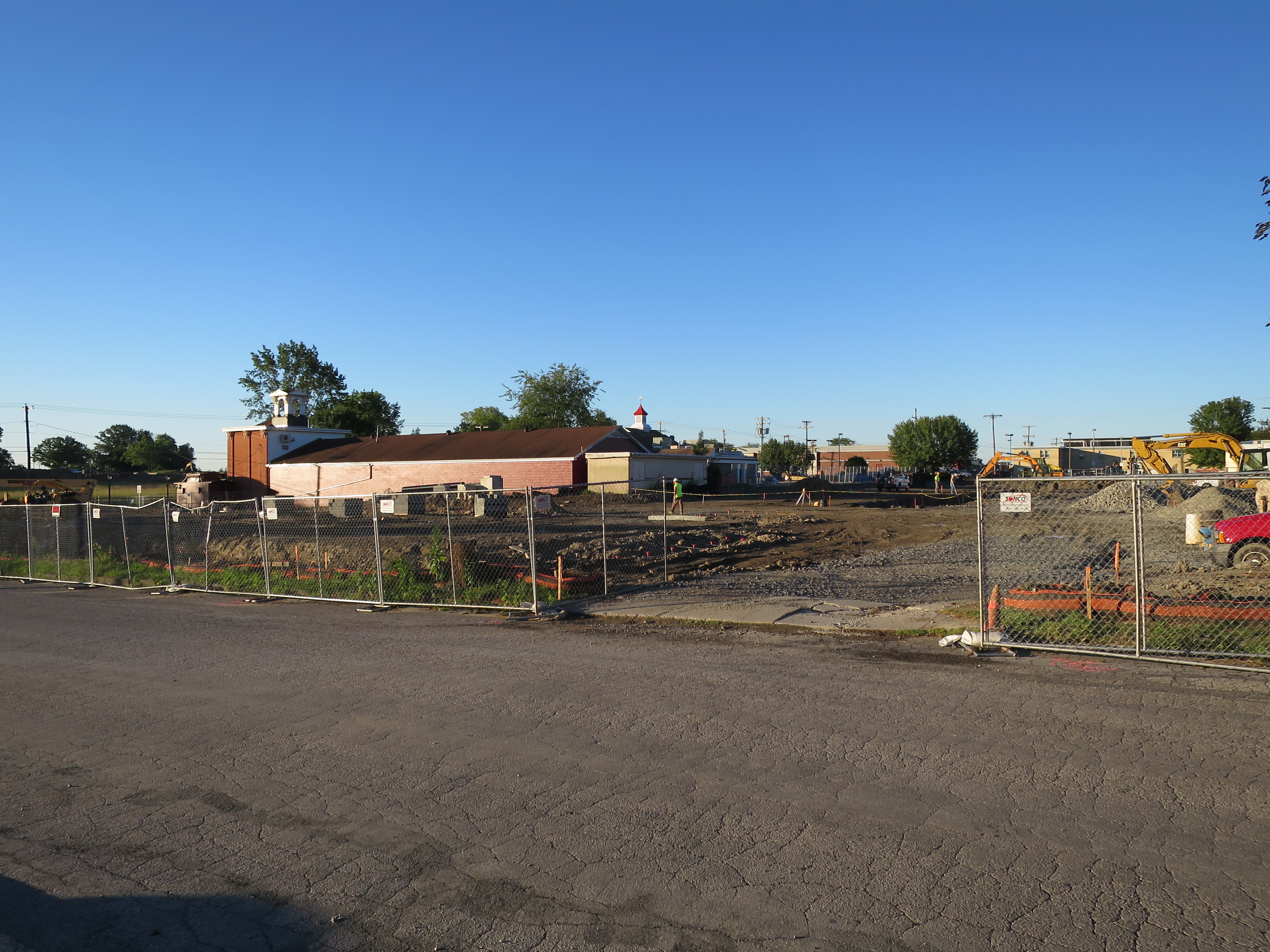
We’re going to look at the area on which the property is being transformed as we walk along Culp Street. That means we will be going to our right. This view was taken facing southwest at approximately 7:30 AM on Monday August 22, 2016.

Before we go for our stroll, here’s what the property is supposed to look like next spring. This view was taken facing west at approximately 7:30 AM on Monday, August 22, 2016.

The Howard Johnson’s was constructed in this location because of its proximaty to other locations such as the Electric Map (which was located on the slope of ground on the far left, and the new National Park Service Visitors Center (Cyclorama Visitors Center) which was located behind the tallest trees in the center of this view. This view was taken facing southeast at approximately 7:30 AM on Monday, August 22, 2016.

Another attraction during the 1960s was the National Civil War Wax Museum, whose location was behind the camera position. This view was taken facing southwest at approximately 7:30 AM on Monday, August 22, 2016.

Prominent guests to the Motor Lodge included movie star John Wayne. This view was taken facing southwest at approximately 7:30 AM on Monday, August 22, 2016.
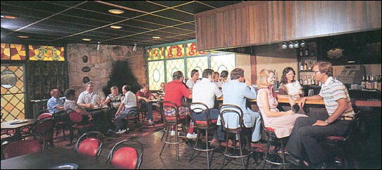
A sometimes guest to the cocktail lounge, which was attached to the office, was President Dwight D. Eisenhower. This image was on a promotional brochure for the Howard Johnson’s Motor Lodge. This view was taken facing west circa the 1970s. This image is courtesy of pinterest.com.
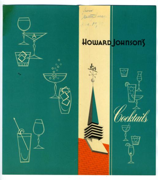
Here’s the cover of the Gettysburg Howard Johnsons’s cocktail menu for 1965. This image is courtesy of pinterest.com.
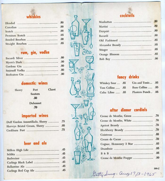
Here’s are the items and prices of the Gettysburg Howard Johnsons’s cocktail menu for 1965. This image is courtesy of pinterest.com.
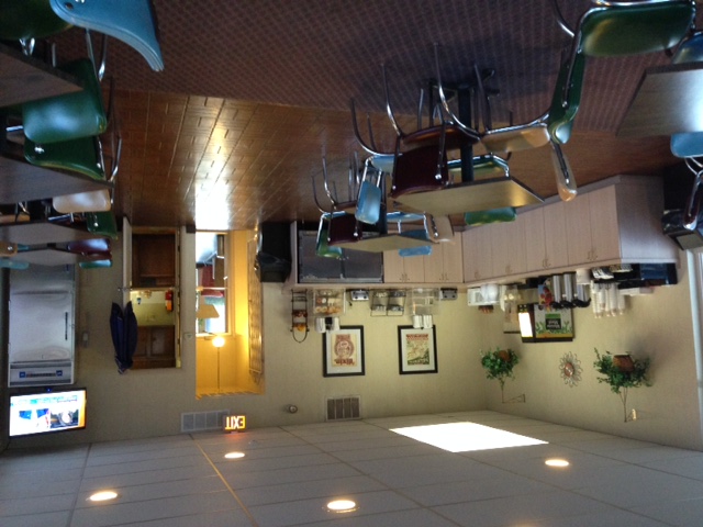
A more recent view of the lounge area shows that it was used as a breakfast room. Thanks to reader Bill H. for this info. This image is courtesy of Bill H., a reader from Newburyport, MA. and was taken in November of 2015.

There were 78 rooms at the Gettysburg Howard Johnson’s Motor Lounge. The lounge and office are on the far left. Culp Street is in the foreground. Notice the parking spaces underneath the rooms. This image was taken facing southeast on a late fall/early winter’s afternoon circa the 1970s. This image is courtesy of flickr.com.
This recent picture approximates the same view. This view was taken facing southeast at approximately 7:30 AM on Monday, August 22, 2016.
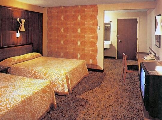
The rooms were outfitted with standard Howard Johnsons’s furnishings. This image was on a promotional brochure for the Howard Johnson’s Motor Lodge. This view was taken circa the 1970s. This image is courtesy of pinterest.com.

This view is taken near the intersection of Culp Street (shown here) and Johns Avenue which is behind the camera position. The National Cemetery is on Cemetery Hill in the trees on the far left of this image. This view was taken facing southeast at approximately 7:30 AM on Monday, August 22, 2016.
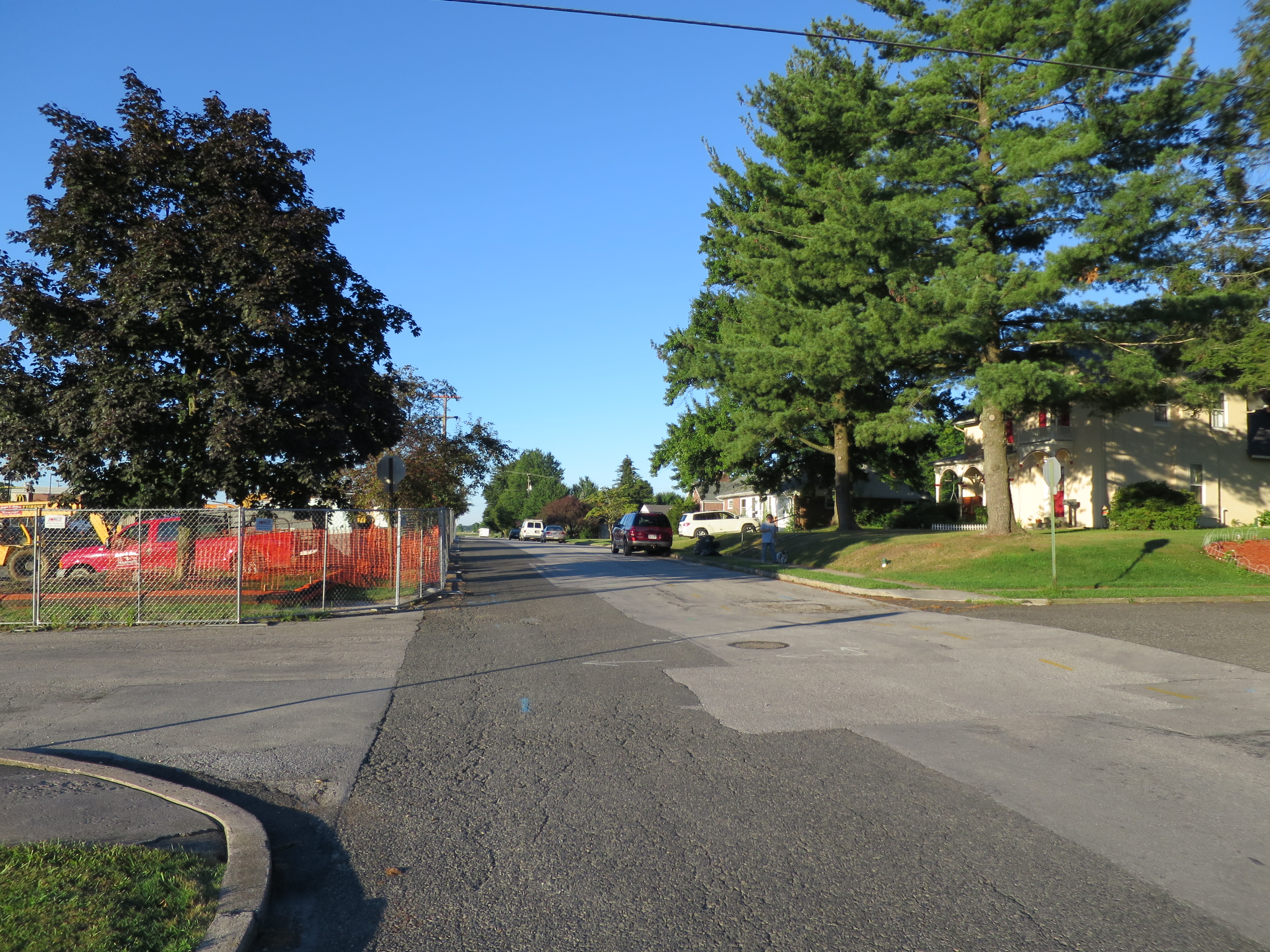
Many guests would enter the parking area to the Howard Johnsons’s from Johns Avenue (shown here). Culp Street is on the left and the right of this view. This view was taken facing southwest at approximately 7:30 AM on Monday, August 22, 2016.
The old Howard Johnson’s Restaurant is not being demolished. This image was on a promotional brochure for the Howard Johnson’s Motor Lodge. This view was taken facing southwest circa the 1970s. This image is courtesy of pinterest.com.
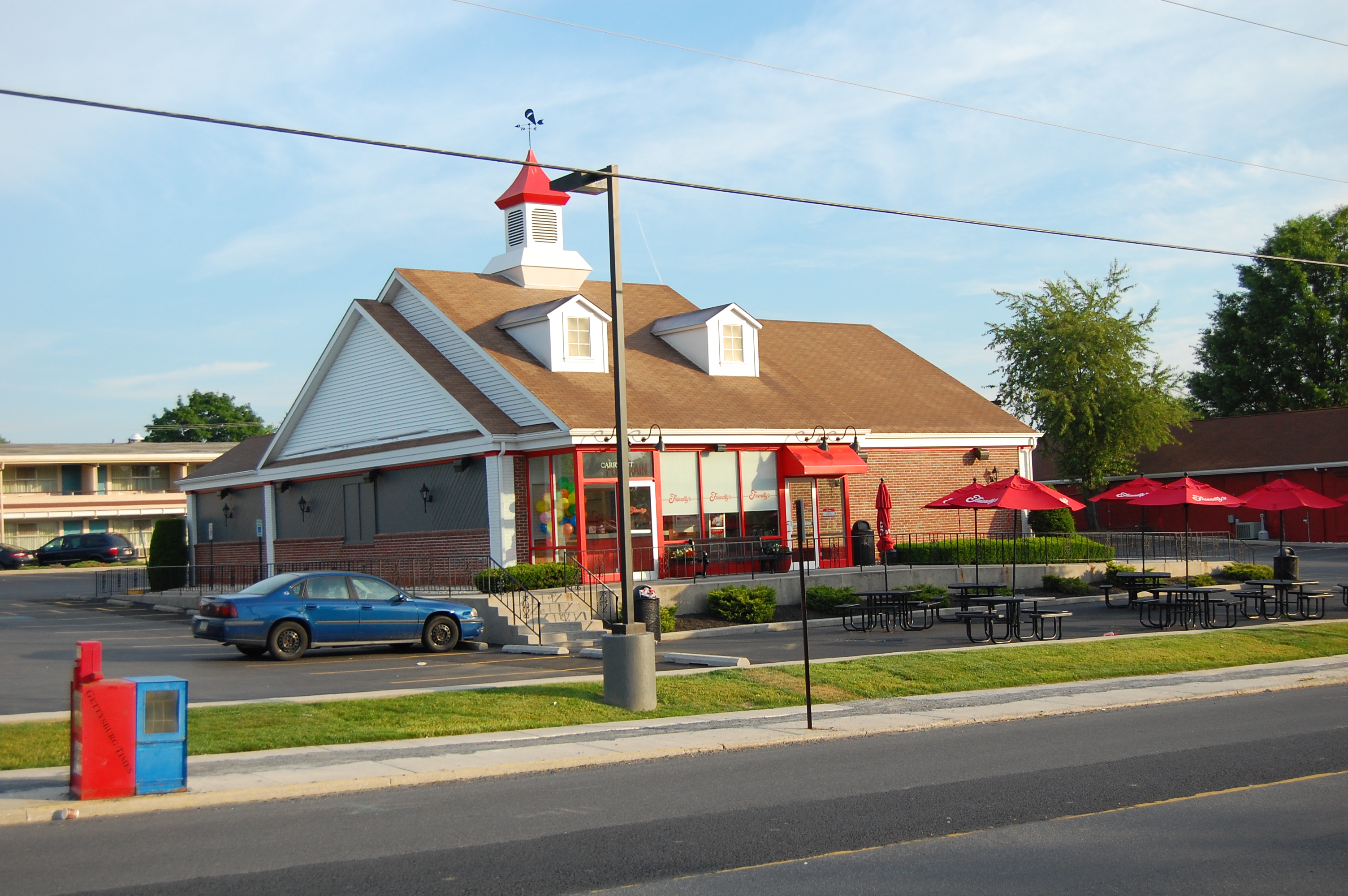
This restaurant is now the Friendly’s Restaurant. Notice the old Howard Johnson’s Motor Lodge rooms in the background. This image was taken facing north at approximately 7:30 AM on Sunday, June 8, 2014.