Gettysburg National Military Park Winter Hours Begin November 1st
October 27, 2008
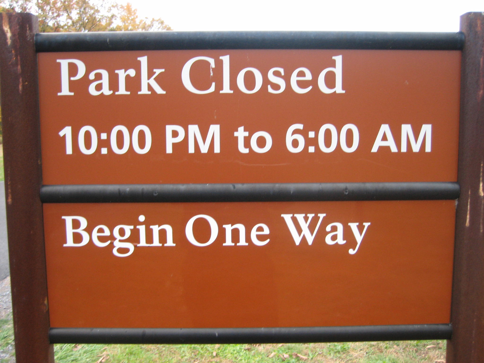
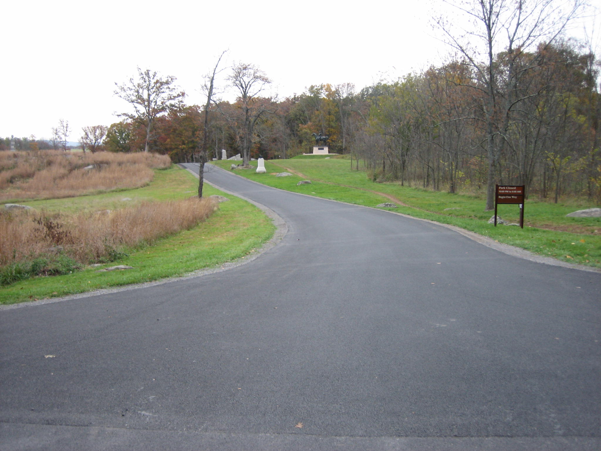
These hours are good for just a few more days. Beginning this Saturday, and continuing until April 1st, the hours will be 6:00 AM to 7:00 PM. This sign is on the west side of Ayres Avenue. This view was taken from the north facing south at approximately 5:00 PM on Monday, October 27, 2008.
The National Park Service announced today that the winter hours will begin this Saturday, November 1st and last through Tuesday, March 31st. On Halloween, Friday, October 31st, the battlefield will be open from 6:00 AM to 10:00 PM. But the next day, Saturday, November 1st, the battlefield hours are 6:00 AM to 7:00 PM. We feel badly for the National Park Service law enforcement employees and Park Watch volunteers who will have to run the ghost hunters out on the Saturday after Halloween. Those caught on the battlefield after hours are subject to a $75 fine.
We like the earlier closing of the park in the winter, and we wish the Park Service would have more gates to increase the difficulty for individuals to vandalize the monuments.
And we don’t feel that more gates means means the park is one step closer to charging a fee to visit the battlefield. There are too many access points where employees would have to be posted to collect or glance at a fee or ticket.
“Click” on this map to enlarge it, and then “click” on it again so that it will be readable. We’re attempting to show you a large area. This map shows some of the primary roads in Gettysburg National Military Park. Roads highlighted in green will remain open 24 hours a day. Roads in red will be closed from 7:00 PM to 6:00 AM. Roads in purple are roads that are open, but we don’t know for what purpose. We feel that to protect the resource, they should also be closed from 7:00 PM to 6:00 AM. This map was created from the south facing north at approximately 6:45 PM on Monday, October 27, 2008.
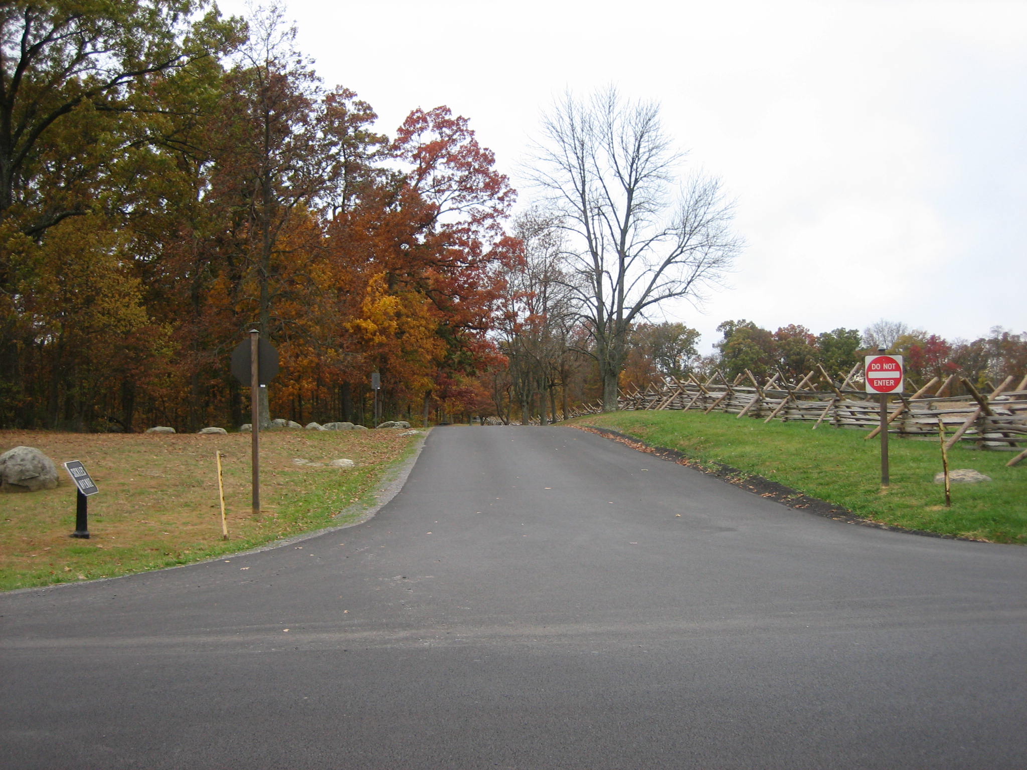
The reasons for the early road closures during the winter revolve around better protection of the resource. Some roads have gates that can block access and make it more difficult (not fullproof) for individuals to vandalize the monuments. Some roads, such as Stone Avenue/Meredith Avenue are not gated, and we don’t know why they do not have a barrier. This view was taken from the north facing south at approximately 5:00 PM on Monday, October 27, 2008.
Some of the gates, such as this one across South Confederate Avenue near the Bushman Farm, are fairly impressive. But for those concerned about the Park Service shutting down the park in order to charge a fee, that would be very difficult logistically. Look at the map, and look at all of the different intersections where employees would have to be placed to either collect money, and/or look at tickets. Its just not very cost effective. This view was taken from the northeast facing southwest at approximately 5:00 PM on Monday, October 27, 2008.
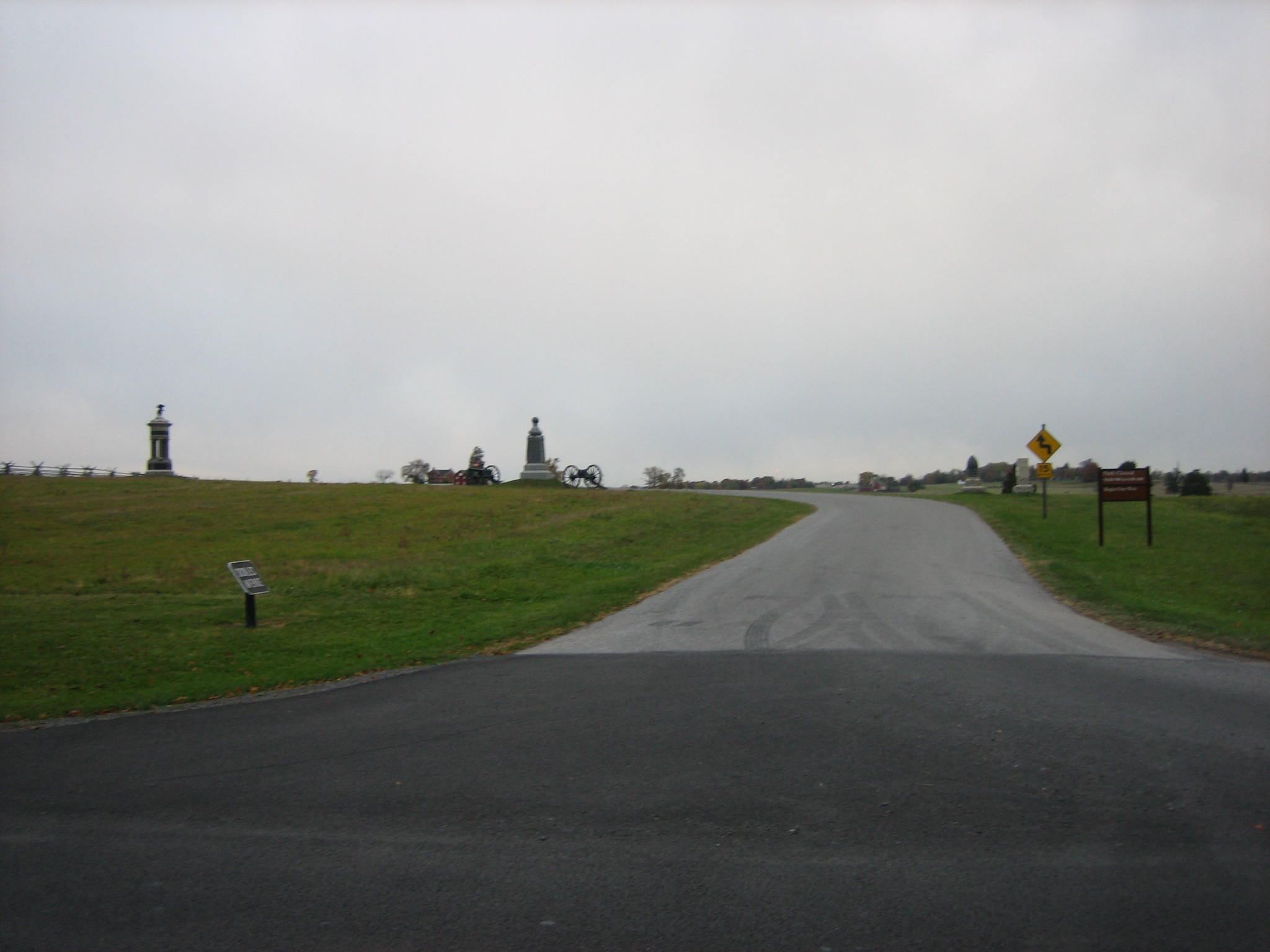
Let’s just look at some of the access points to the Wheatfield Road. The Wheatfield is in the distant background, and Munshower Hill is out of sight to our right (north). Little Round Top is to our left. The Wheatfield Road is a connector road between the Taneytown Road to the east, and the Emmitsburg Road to the west. For emergency vehicle access, and other traffic (political) considerations, it would stay a free and open road. This view was taken from the east facing west at approximately 5:00 PM on Monday, October 27, 2008.
Here is the intersection of Sykes Avenue with the Wheatfield Road. Traffic comes off Little Round Top towards the camera position on the Wheatfield Road. Again, we have a nice gate across Sykes Avenue. This view was taken from the northeast facing southwest at approximately 5:00 PM on Monday, October 27, 2008.
Turn around from the previous picture, and here is the intersection of the Wheatfield Road with Sedgwick Avenue. Sedgwick Avenue does not have a gate, and we don’t know why not. Why does this road need to be open after 7:00 PM in the winter? This view was taken from the south facing north at approximately 5:00 PM on Monday, October 27, 2008.
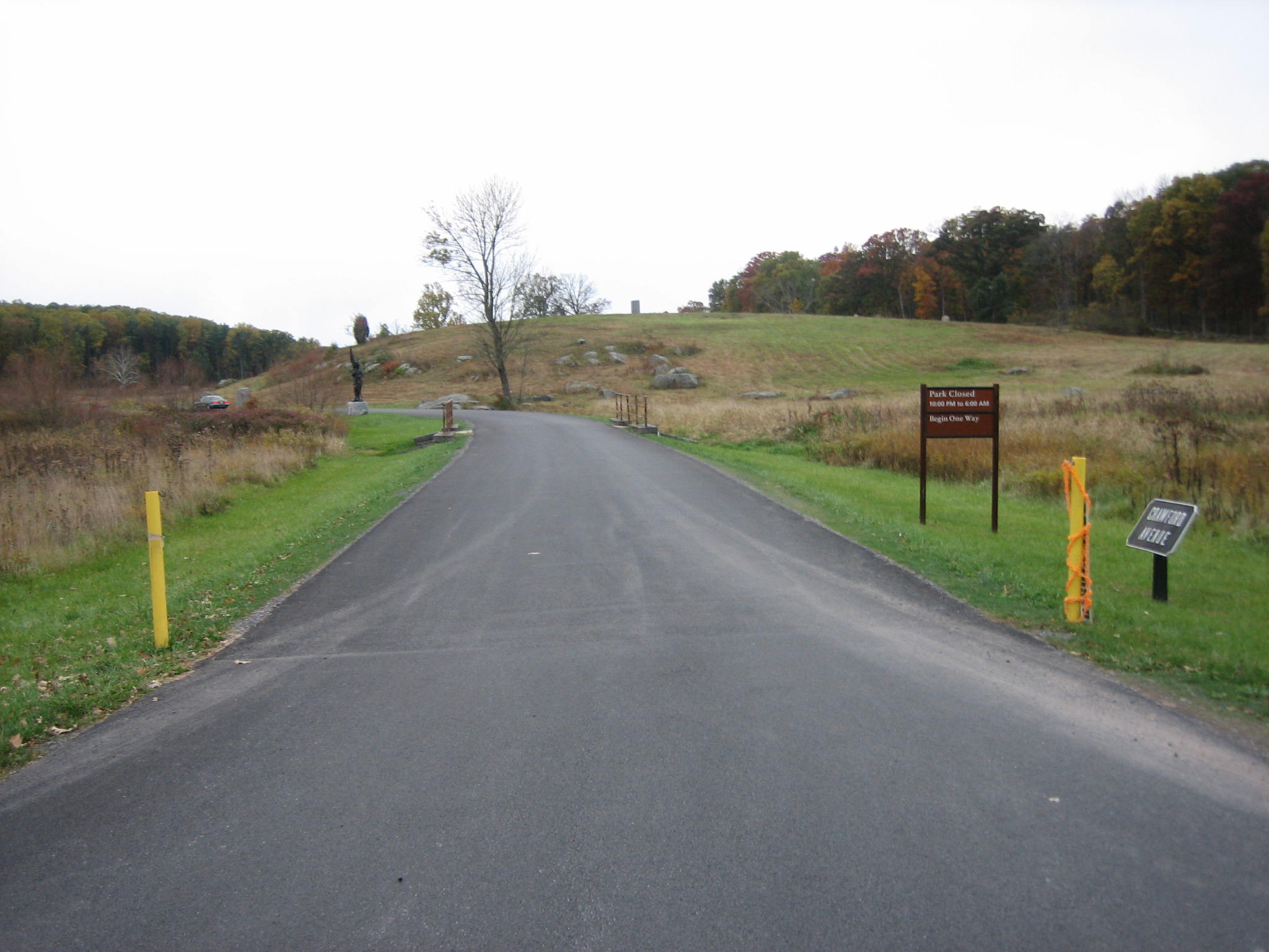
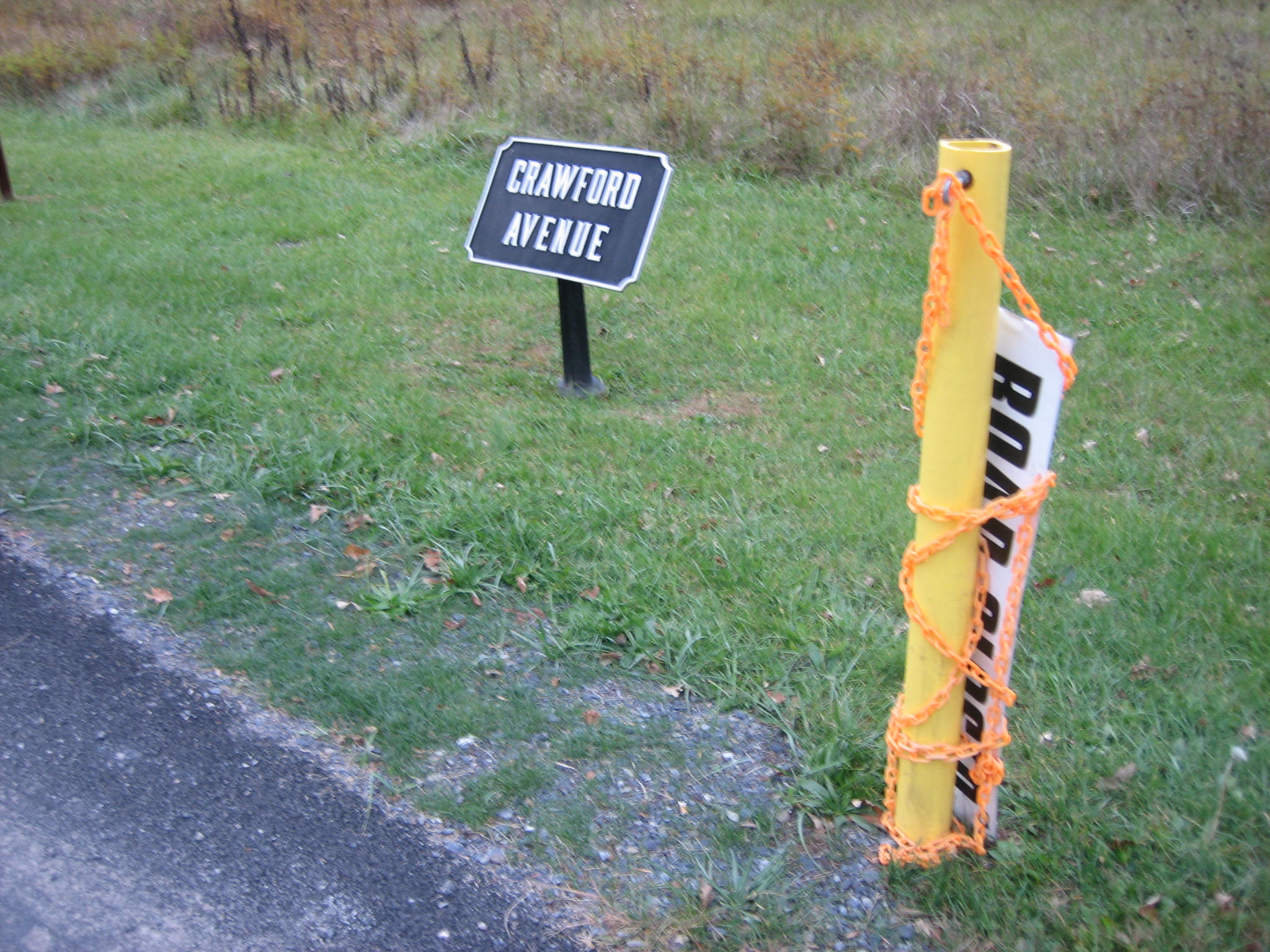
Farther west on the Wheatfield Road is the intersection with Crawford Avenue. The gated area here is far from impressive. Two yellow plastic posts with an orange chain that connects them. This view was taken from the north facing south at approximately 5:00 PM on Monday, October 27, 2008.
A couple of years ago, it is believed that the individuals who vandalized the Smith’s 4th New York Artillery monument used this easily accessed road. This view was taken from the northeast facing southwest at approximately 6:45 PM on Monday, October 27, 2008.
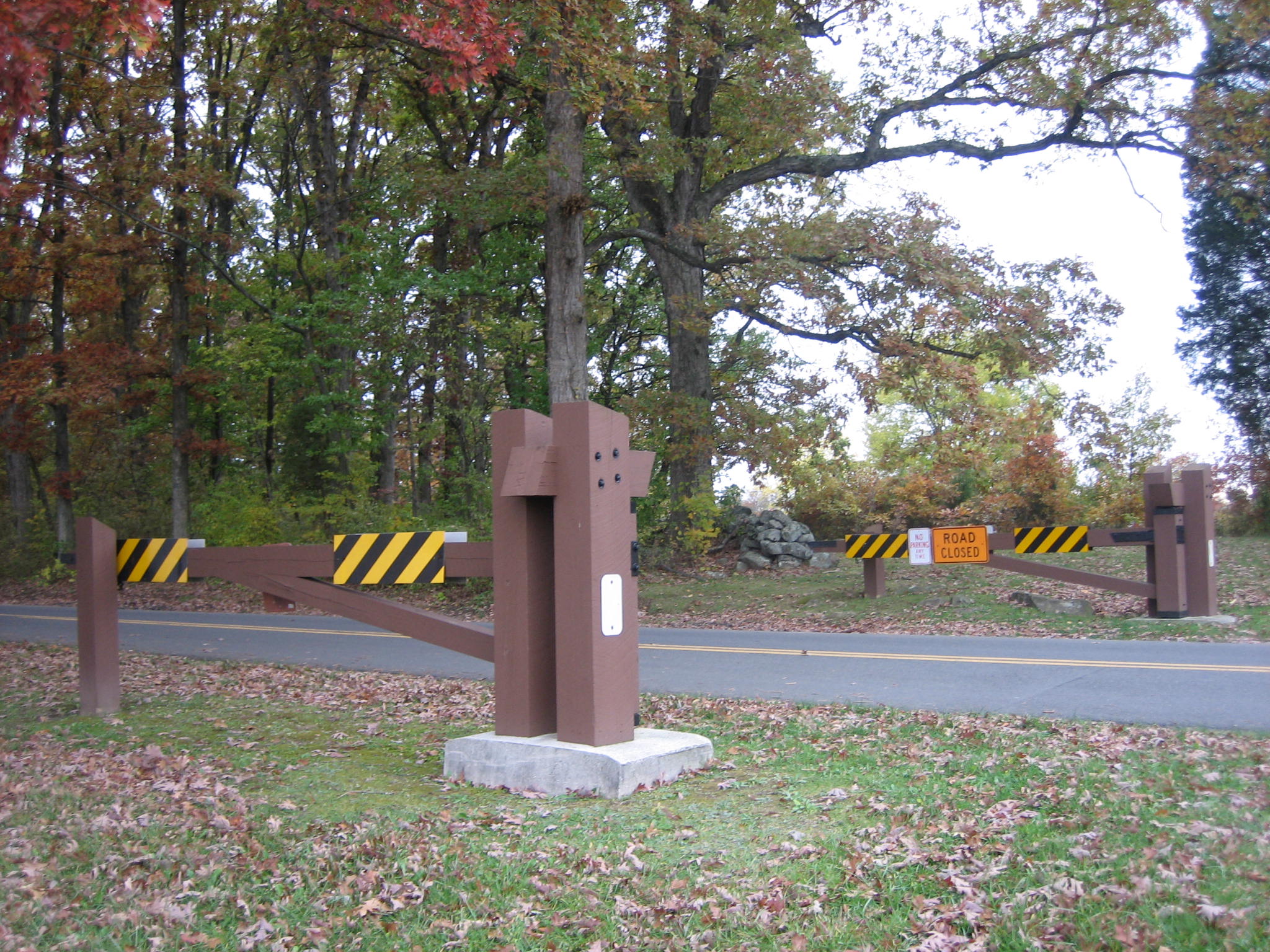
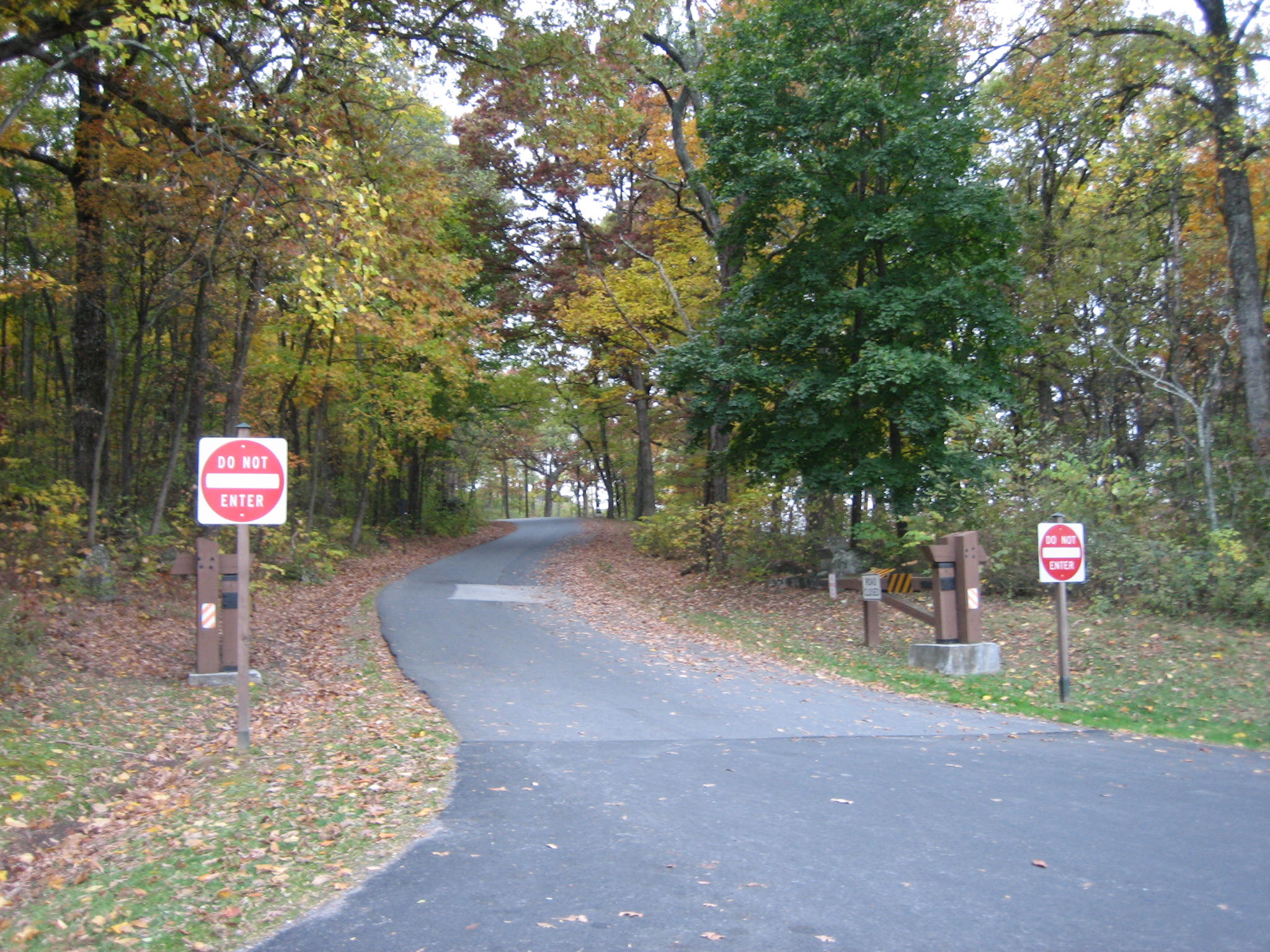
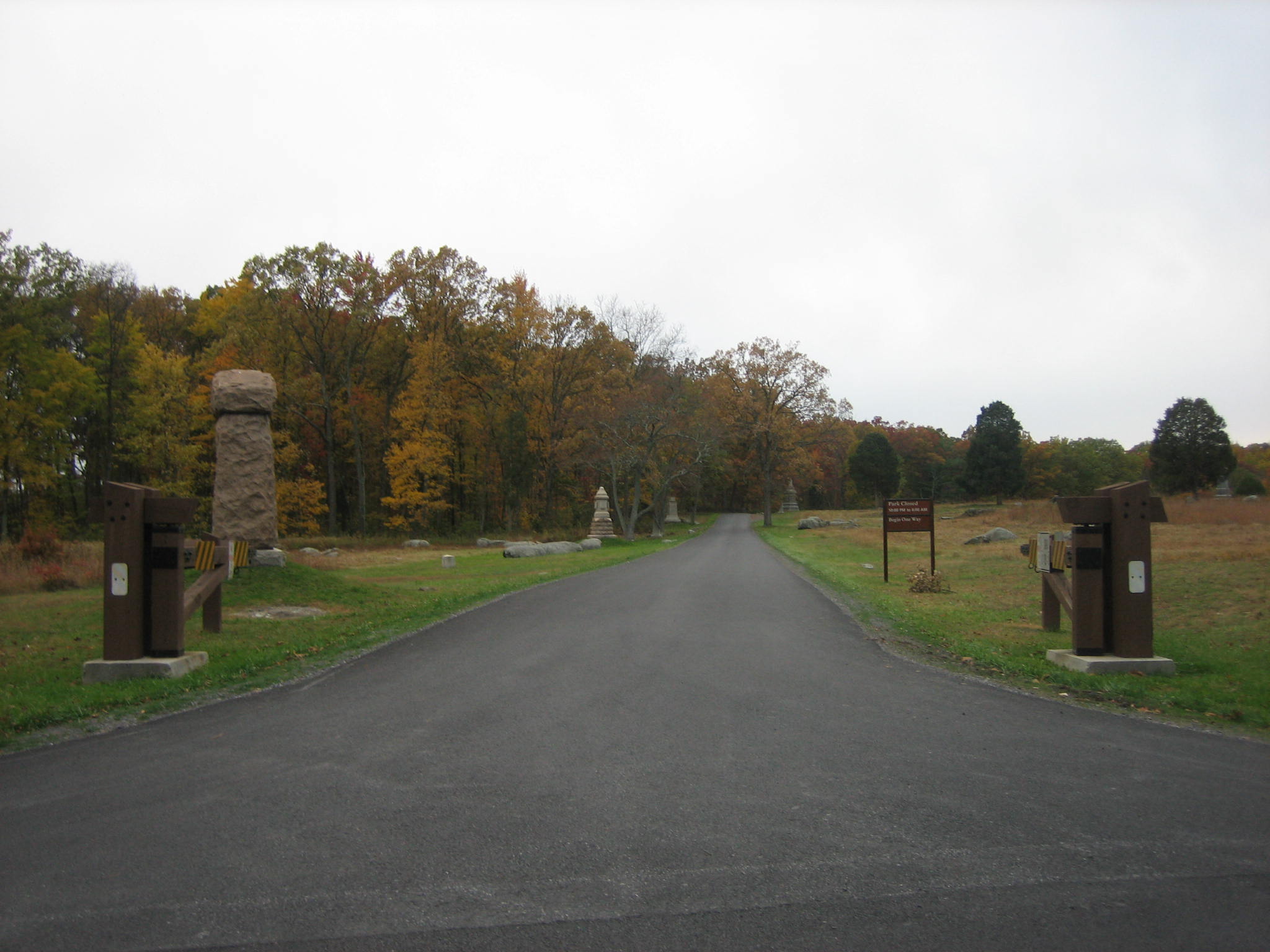
Farther west on the Wheatfield Road, Ayres Avenue has the impressive looking gates. This view was taken from the north facing south at approximately 5:00 PM on Monday, October 27, 2008.
But look at South Sickles Avenue, and its intersection with the Wheatfield Road. This view was taken from the north facing south at approximately 5:00 PM on Monday, October 27, 2008.
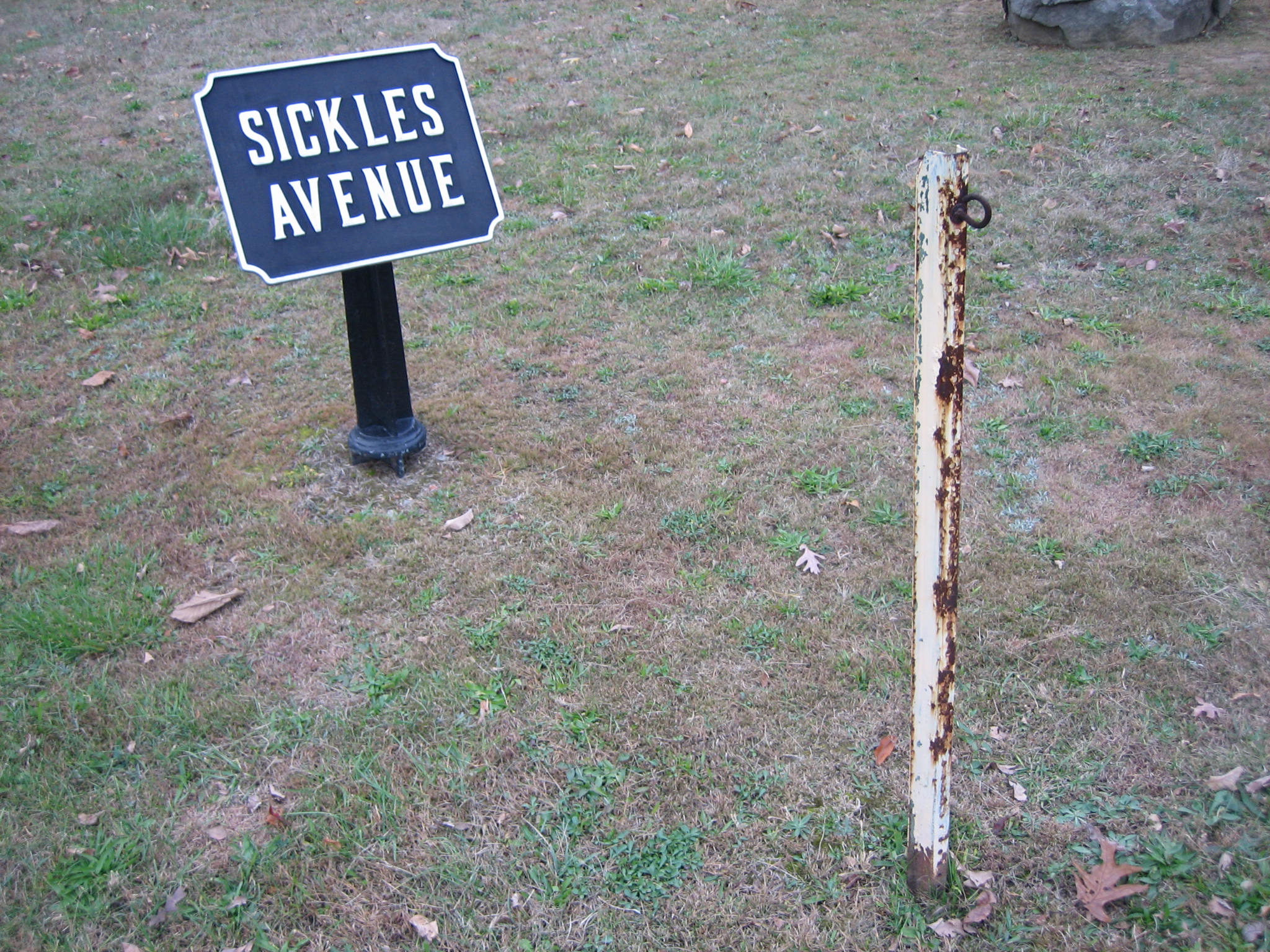
These rusting metal poles don’t even have an orange plastic chain. This view was taken from the northwest facing southeast at approximately 5:00 PM on Monday, October 27, 2008.
North Sickles Avenue does not have any pretense of stopping traffic at its intersection with the Wheatfield Road. In the left background are the monuments to the Excelsior Brigade, and Clark’s New Jersey Battery. Again, we don’t know why this road is open after 7:00 PM in the winter. This view was taken from the south facing north at approximately 5:00 PM on Monday, October 27, 2008.
The winter hours have been a good first step to better protecting the battlefield. However, when more of these gates begin showing up, we’ll know the Park Service is taking the after hours access problem more seriously. This view was taken from the northeast facing southwest at approximately 5:00 PM on Monday, October 27, 2008.