Gettysburg Hospitals Part 6 With Licensed Battlefield Guide Phil Lechak
August 24, 2011
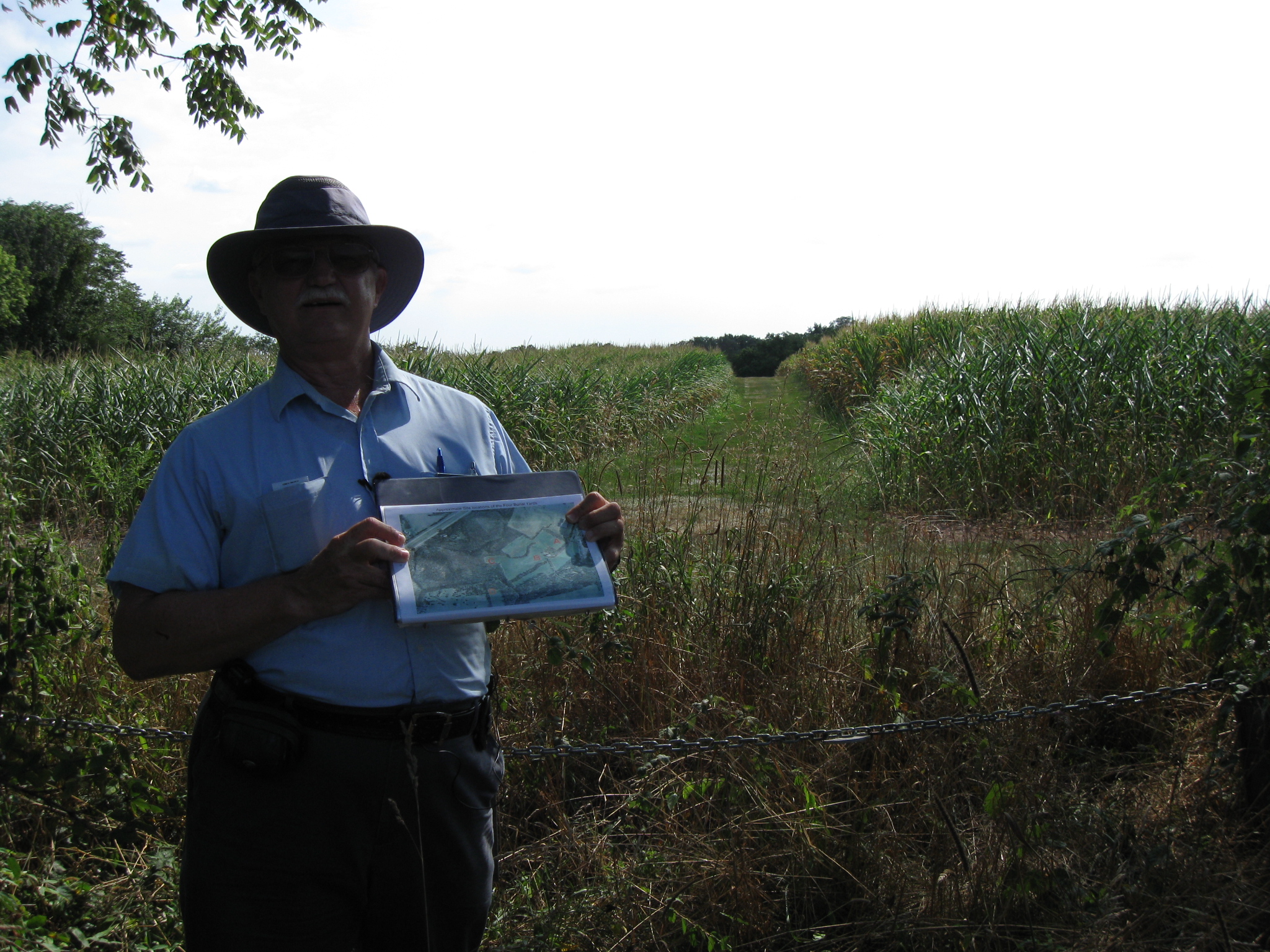
Gettysburg Licensed Battlefield Guide Phil Lechak is the host for our Gettysburg Hospitals series. He is standing on the property of the Gettysburg Outlets near the Aaron Sheely Barn. This view was taken facing southeast at approximately 4:00 PM on Friday, August 5, 2011.
Gettysburg Licensed Battlefield Guide Phil Lechak retired after spending 37 years working for the United States Postal Service. Phil first came to Gettysburg in 1999 and had Paul Cooksey as his guide. Phil became a self-described “Gettysburgaholic,” and decided to study to become a Licensed Battlefield Guide. He passed the December 2004 exam, and was licensed in November of 2005. He started as a part-time Guide, but became full time when he retired in January, 2007.
To see Phil Lechak’s previous series on Camp Letterman, click here.
In our first Gettysburg Hospitals’ post, Gettysburg Licensed Battlefield Guide Phil Lechak introduced us to the George Spangler Farm which is known as the site where Confederate Brigadier General Lewis Armistead died.
In our second Gettysburg Hospitals’ post, Gettysburg Licensed Battlefield Guide Phil Lechak shows some photographs taken on the farm by William Tipton circa the 1880s and in 1906.
In our third Gettysburg Hospitals’ post, Gettysburg Licensed Battlefield Guide Phil Lechak shows us the George Spangler Barn, used by the wounded of both sides.
In the fourth Gettysburg Hospitals’ post, Gettysburg Licensed Battlefield Guide Phil Lechak showed us the George Spangler House, and the smokehouse.
In the fifth Gettysburg Hospitals’ post, Gettysburg Licensed Battlefield Guide Phil Lechak shows us the George Spanlger Summer Kitchen where Confederate Brigadier General Lewis Armistead died on July 5, 1863.
In today’s Gettysburg Hospitals’ post, Gettysburg Licensed Battlefield Guide Phil Lechak shows us the Aaron Sheely, Red Hill, and the property of the Jacob Schwartz Farm.
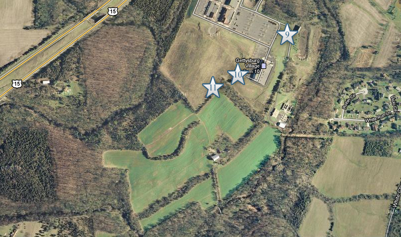
This map shows the location of the videos we shot at for this post. Videos #1-8 were shown in our previous Gettysburg Hospitals posts. Video #9 was taken near the Aaron Sheely Barn. Video #10 was taken near the Gettysburg Outlets Movie “Stadium.” Video #11 was taken on Red Hill near the Jacob Schwartz property. This map was created facing north at approximately 7:30 AM on Saturday, June 11, 2011.
This map from taken from Greg Coco’s Book A Vast Sea of Misery. It shows the locations of the Aaron Sheely Farm, Red Hill and the Jacob Schwartz Farm. This image was scanned facing north at approximately 5:00 PM on Friday, August 19, 2011.
In Video #9 Gettysburg Licensed Battlefield Guide Phil Lechak shows us the location of the Aaron Sheely Farm and Red Hill. This view was taken facing south to northwest to southwest at approximately 4:00 PM on Friday, August 5, 2011.
Licensed Battlefield Guide Phil Lechak is standing on the south slope of Red Hill. The roofs of the Gettysburg Outlet Mall are visible in the right background. Phil is holding Grappling With Death, the Union Second Corps Hospital at Gettysburg by Roland R. Maust. This view was taken facing north at approximately 4:00 PM on Friday, August 5, 2011.
In Video #10 Licensed Battlefield Guide Phil Lechak is standing on the slope of Red Hill. He shows a copy of Grappling With Death, the Union Second Corps Hospital at Gettysburg by Roland R. Maust. This view was taken facing north at approximately 4:00 PM on Friday, August 5, 2011.
The Second Corps Hospital at Rock Creek. This view was taken by Frederick Gutekunst circa 1863, and is courtesy of Phil Lechak.
The Second Corps Hospital at Rock Creek. This view was taken by Frederick Gutekunst circa 1863, and is courtesy of the National Park Service.
Phil Lechak is standing on Red Hill. On the other side of the chain is the property of what was formerly known as the Jacob Schwartz Farm. This view was taken facing southwest at approximately 4:00 PM on Friday, August 5, 2011.
In Video #11 Phil Lechak is standing on Red Hill. He describes how wounded soldiers were moved from Rock Creek to Red Hill. This view was taken facing southwest to northeast to southwest at approximately 4:00 PM on Friday, August 5, 2011.
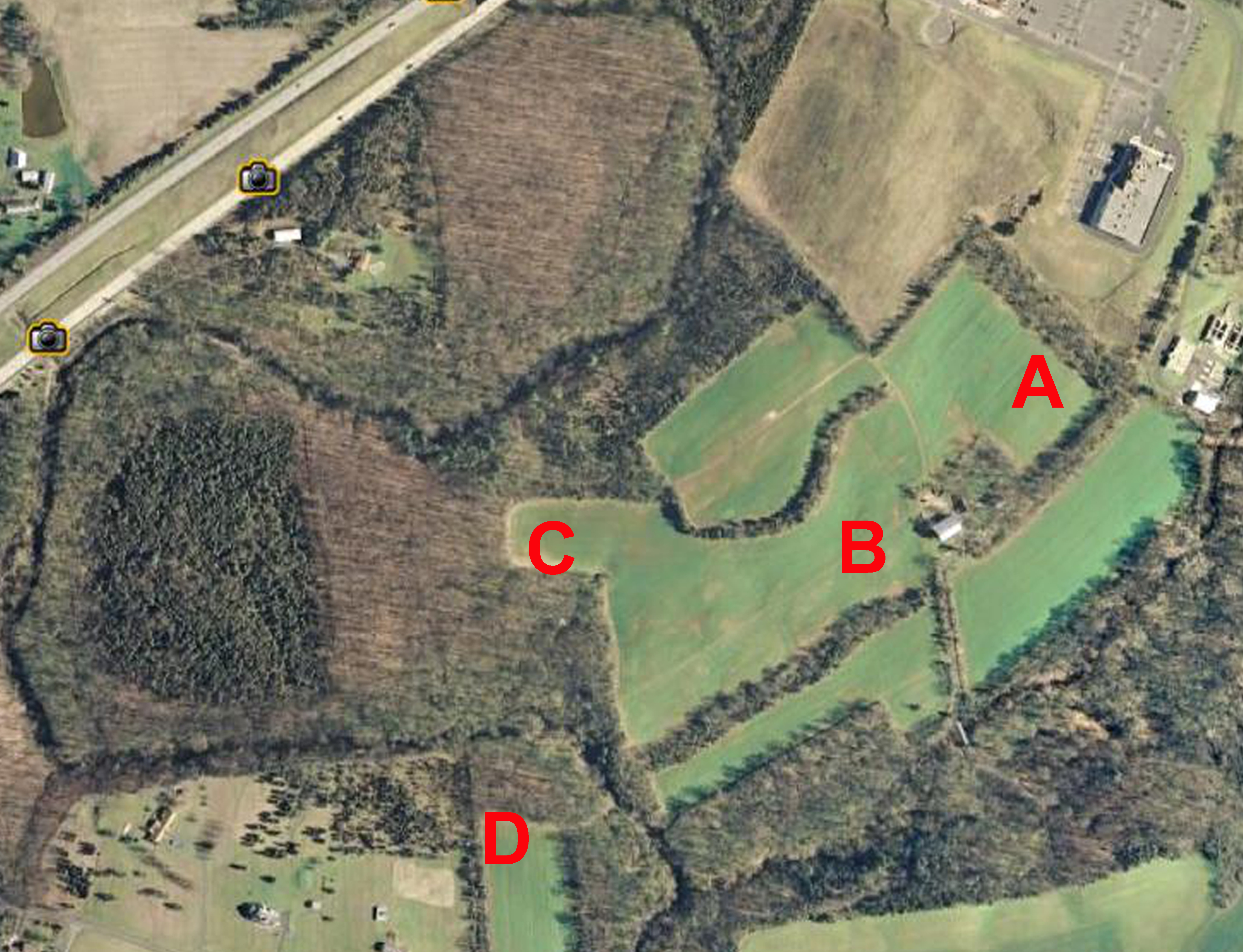
This map shows that there were four burial yards at the site of the Second Corps Hospital as evidenced by the A B C D, reference is Grappling with Death by Roland Maust. This map is courtesy of Phil Lechak.
The Rock Creek topographical maps show the curves and the elevation changes. On the morning of July 6, 1863 Rock Creek flooded and the curves became a flood plain. Wounded had to be taken from the lower ground (July 3rd) location to the much higher ground across the stream bed so that drowning would not occur, at least for the Union soldiers. The elevation photos show the dramatic variance from the east and west creek sides (415 feet versus 450 feet. 35 feet of higher ground means soldiers did not drown! The maps are courtesy of Phil Lechak.
This photo shows Rock Creek with the lower ground on the left and the significantly higher ground on the right. The photo was taken in November, 2010, and is courtesy of Phil Lechak.
Looking across the Schwartz farm fields towards the Second Corps Divisional Hospital sites on July 5, 1863. The photo was taken facing south in November, 2010, and is courtesy of Phil Lechak.
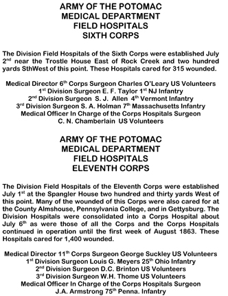
The text for all of the Corps Hospital markers. For a pdf version, click here.
Dr. Jonathan Letterman’s Official Report of the Battle of Gettysburg. For a pdf version, click here.