

Civil War author J.D. Petruzzi (along with his co author Steve Stanley) is the host for our series on the Battle of Fairfield. He is standing near the intersection of Carroll’s Tract Road and Knox Road. This view was taken facing south at approximately 4:15 PM on Sunday, September 20, 2009.
In today’s Fairfield post, J.D. Petruzzi shows us the initial Fairfield fighting which occurred north of and around the Marshall House, on Carroll’s Tract Road.
See our post on Some Fairfield, Pennsylvania Civil War Markers on September 1, 2008.
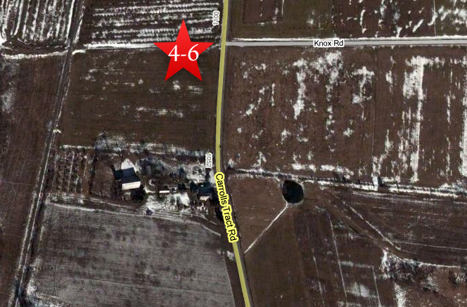
This map shows the location of our Fairfield videos. The Google Map photograph was taken during the winter with snow on the ground. Videos #1-#3 were shown in our previous Fairfield post. Videos #4-#6 were taken near the intersection of Carroll’s Tract Road and Knox Road. This map was created facing north at approximately 9:00 AM on Monday, October 12, 2009.

Civil War author J.D. Petruzzi is standing west of the Carroll’s Tract Road (where the red car is) and north of the Benjamin Marshall House, which is seen in the background. This area, near the intersection with Knox Road, is where the Battle of Fairfield began. This view was taken facing south at approximately 4:15 PM on Sunday, September 20, 2009.
In Video #4 (Videos #1- #3 were shown in our previous Fairfield post) Civil War author J.D. Petruzzi is standing near the Carroll’s Tract Road at its intersection with Knox Road. He explains the 1863 landscape, and describes the initial Union deployment. This view was taken facing south at approximately 4:15 PM on Sunday, September 20, 2009.

This map of the opening phase (12:30 PM) of the Battle of Fairfield was created by cartographer Steve Stanley. It shows the intial pursuit of Confederate wagons by the 6th U.S. Cavalry as they move north along Carroll’s Tract Road.
In Video #5 Civil War author J.D. Petruzzi is still standing near the Carroll’s Tract Road at its intersection with Knox Road. He shows us the initial Union attack and the Confederate counterattack which occurred at this location. This view was taken facing southeast at approximately 4:15 PM on Sunday, September 20, 2009.
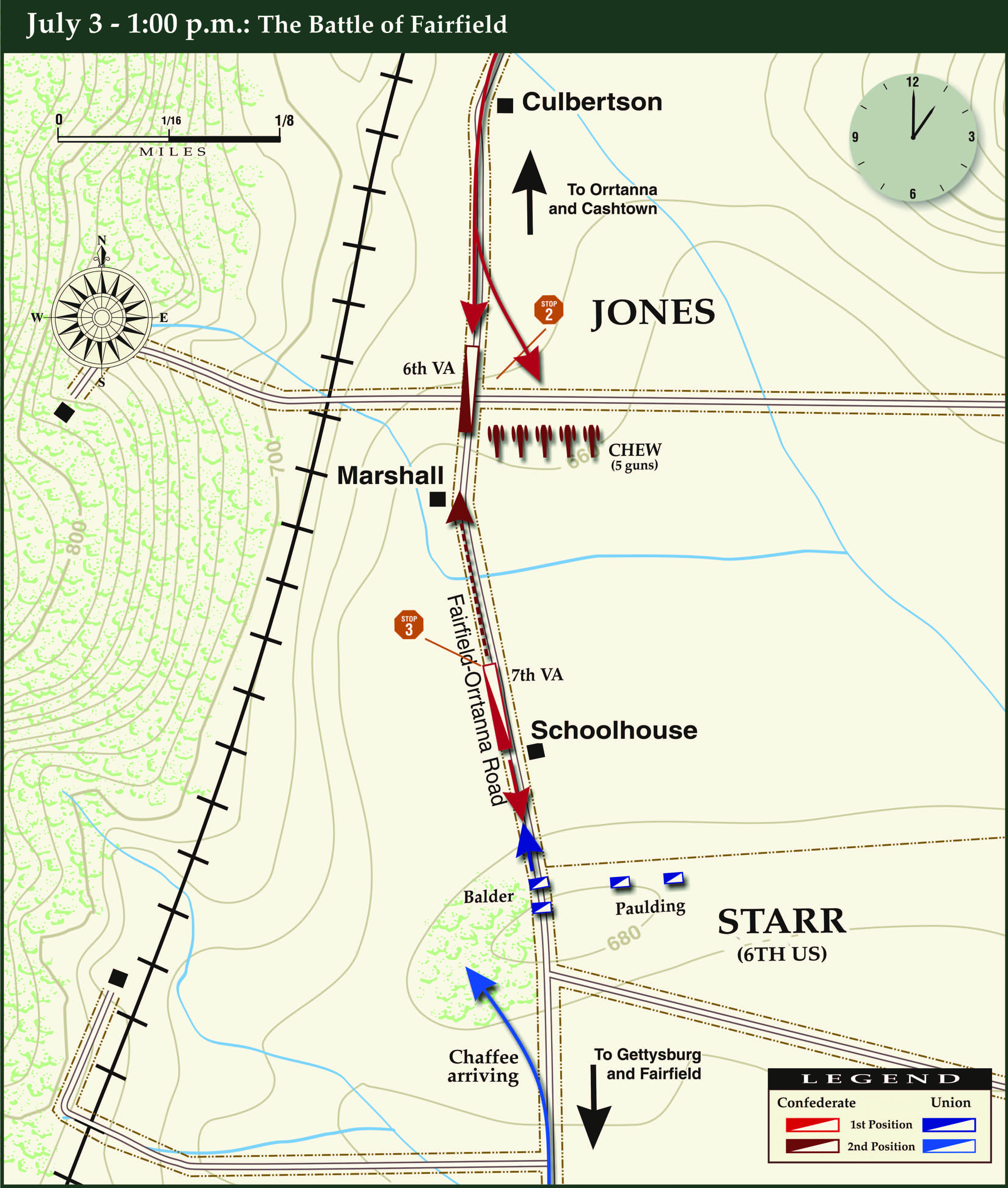
This map of the 1:00 PM phase of the Battle of Fairfield was created by cartographer Steve Stanley. It shows the intial attack by the 6th U.S. Cavalry and the Confederate counterattack along Carroll’s Tract Road.
In Video #6 Civil War author J.D. Petruzzi is still standing near the Carroll’s Tract Road at its intersection with Knox Road. He describes the deployment of Chew’s Confederate battery, and relates that the Confederate Cavalry will now attack Starr’s men on a ridge south of the Marshall House. This view was taken facing southeast to south at approximately 4:15 PM on Sunday, September 20, 2009.