

National Park Service contractors have made lots of progress in the Culp’s Hill area this summer removing trees. This photo was taken just off of East Confederate Avenue — the Culp’s Hill observation tower would be through the woods up the hill to the photographer’s front. This view was taken facing southeast at approximately 4:00 PM on Tuesday, September 21, 2010.
This summer has seen a number of tree removal efforts taking place across Gettysburg National Military Park. One that has been going on for a few months now has occurred in the area of Culp’s Hill and Spangler’s Spring. Today we’ll show you the tree removal in the area between East Cemetery Hill and Culp’s Hill, as well as the removal at the base of the northern portion of Culp’s Hill.
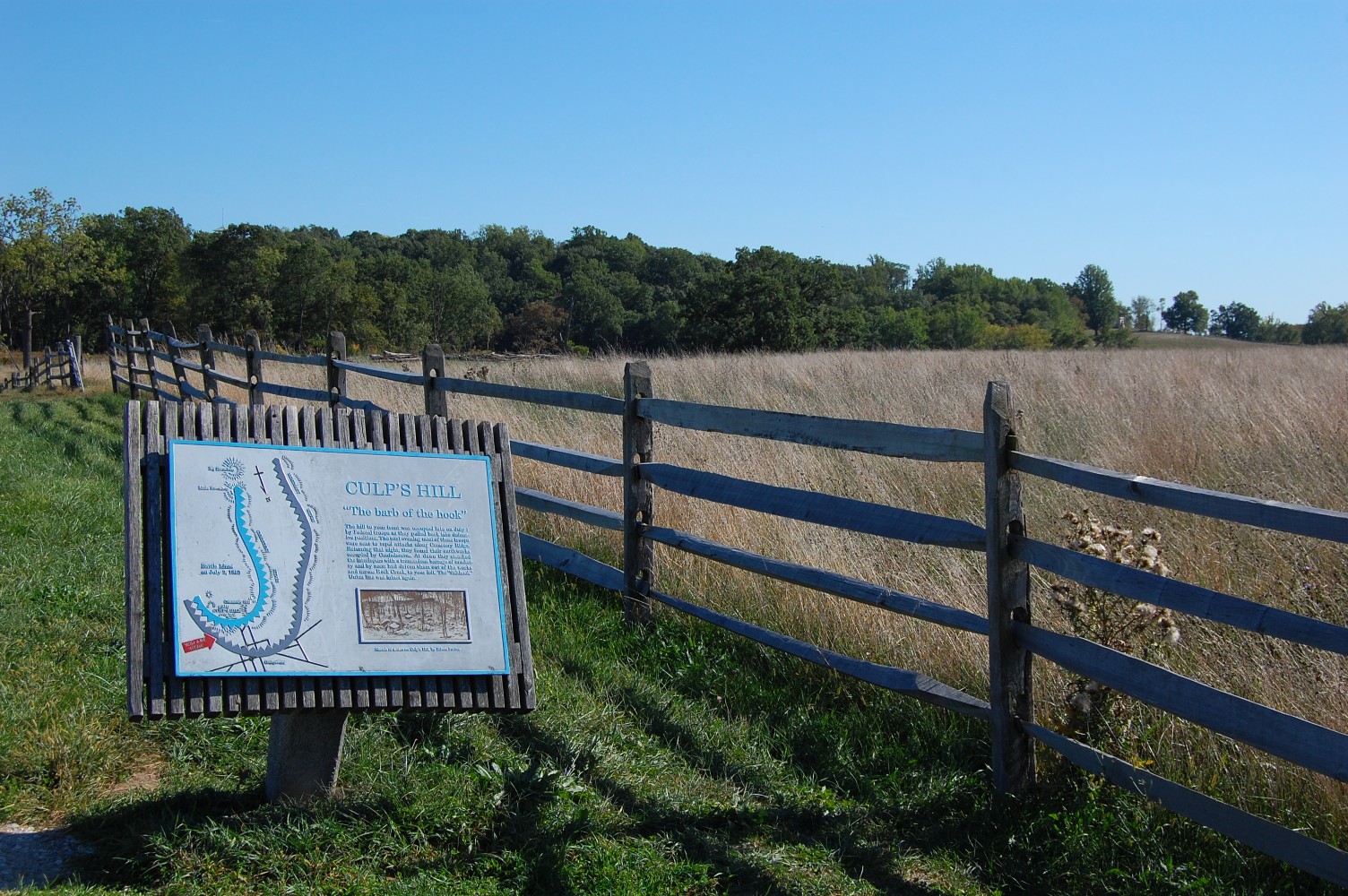
We begin here at the Mission 66 Wayside introducing visitors to barb of the hook that this portion of the Union line represented. Notice the hole in the fence-line in the left background … This view was taken facing southeast at approximately 4:00 PM on Tuesday, September 21, 2010.

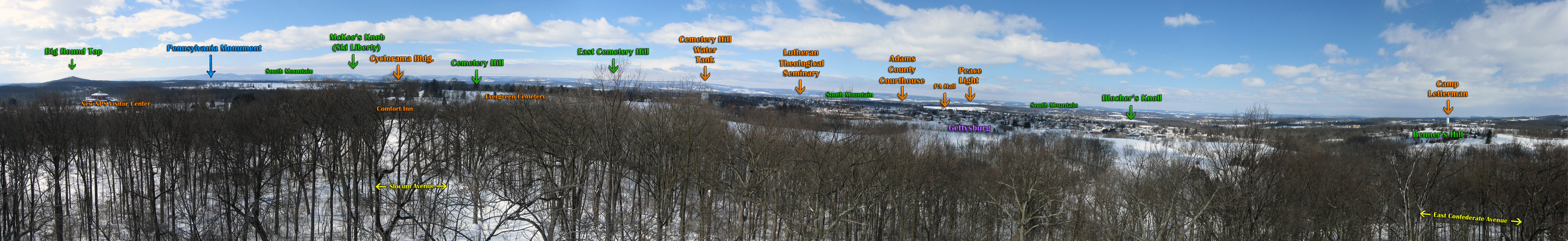
… Yes, that one. We’ll walk in the direction of McKnight’s Hill/Stevens’ Knoll in the center background. The main stand of trees that was removed in this area is visible in our Culp’s HIll panorama from February under the label “South Mountain.” This view was taken facing south at approximately 4:00 PM on Tuesday, September 21, 2010.

The paths here have been worn by contractor vehicles needing access across the field, both in this southwesterly direction … This view was taken facing south at approximately 4:00 PM on Tuesday, September 21, 2010.
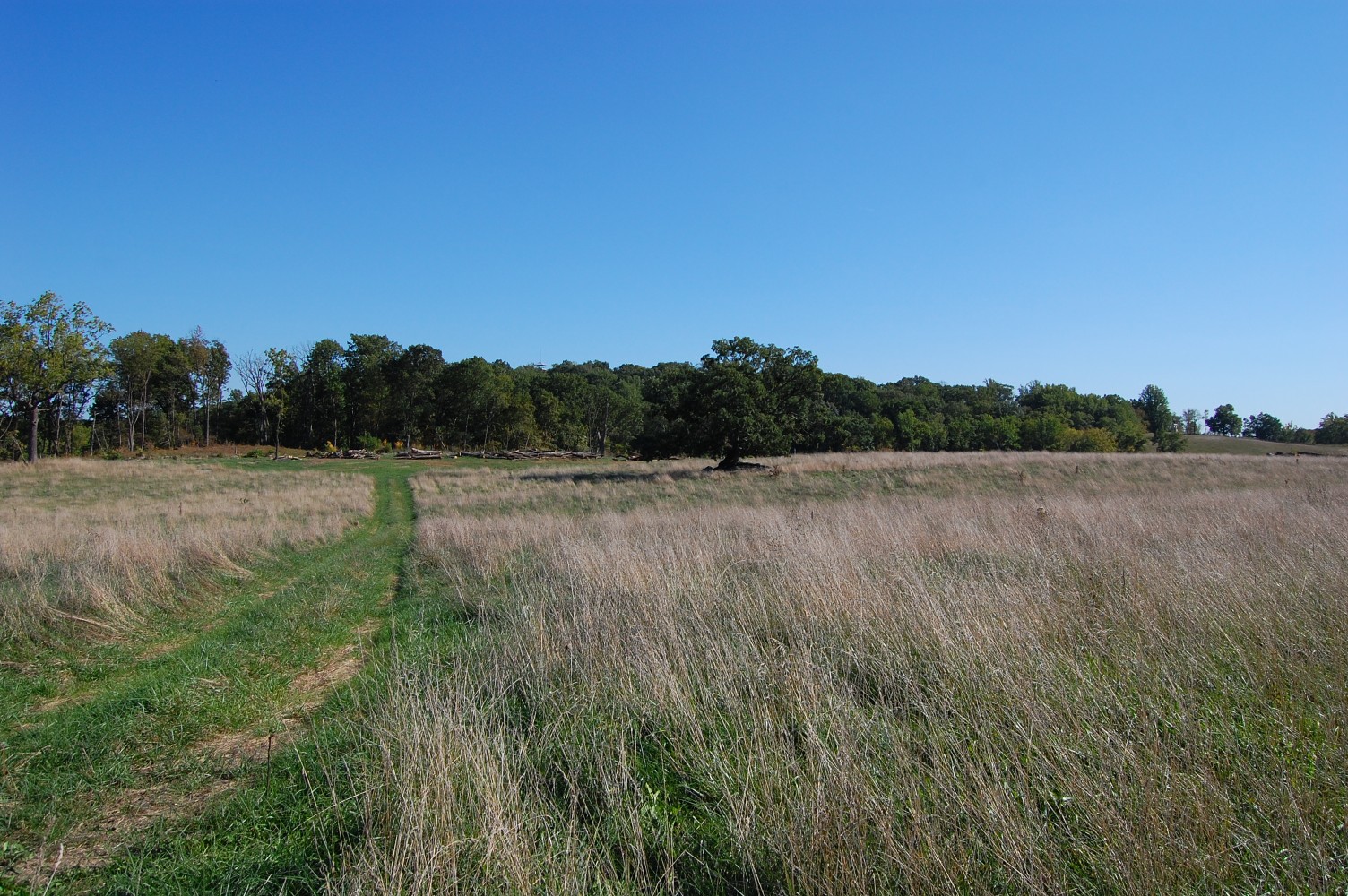
… And turning to our left, towards the southeast. If we take a closer look at the large tree in the center … This view was taken facing southeast at approximately 4:00 PM on Tuesday, September 21, 2010.

… The Culp’s Hill observation tower is visible just above the tree-line. This view was facing southeast at approximately 4:00 PM on Tuesday, September 21, 2010.
From this position on the rise of the small ridge in this area, where these trees in front of the photographer stood, it is now easy to spot both the Slocum equestrian statue on Stevens’ Knoll (click the image to enlarge and look in the center background) … This view was facing south at approximately 4:00 PM on Tuesday, September 21, 2010.

… and the Evergreen Cemetery Gatehouse on Cemetery Hill. This view was taken facing west at approximately 4:00 PM on Tuesday, September 21, 2010.

We are now looking from the vantage point of the previous two photographs southeast towards Culp’s Hill. The tree removal down in the ravine below follows the stream (part of Rock Creek) that flows around this portion hill. This view was taken facing southeast at approximately 4:00 PM on Tuesday, September 21, 2010.
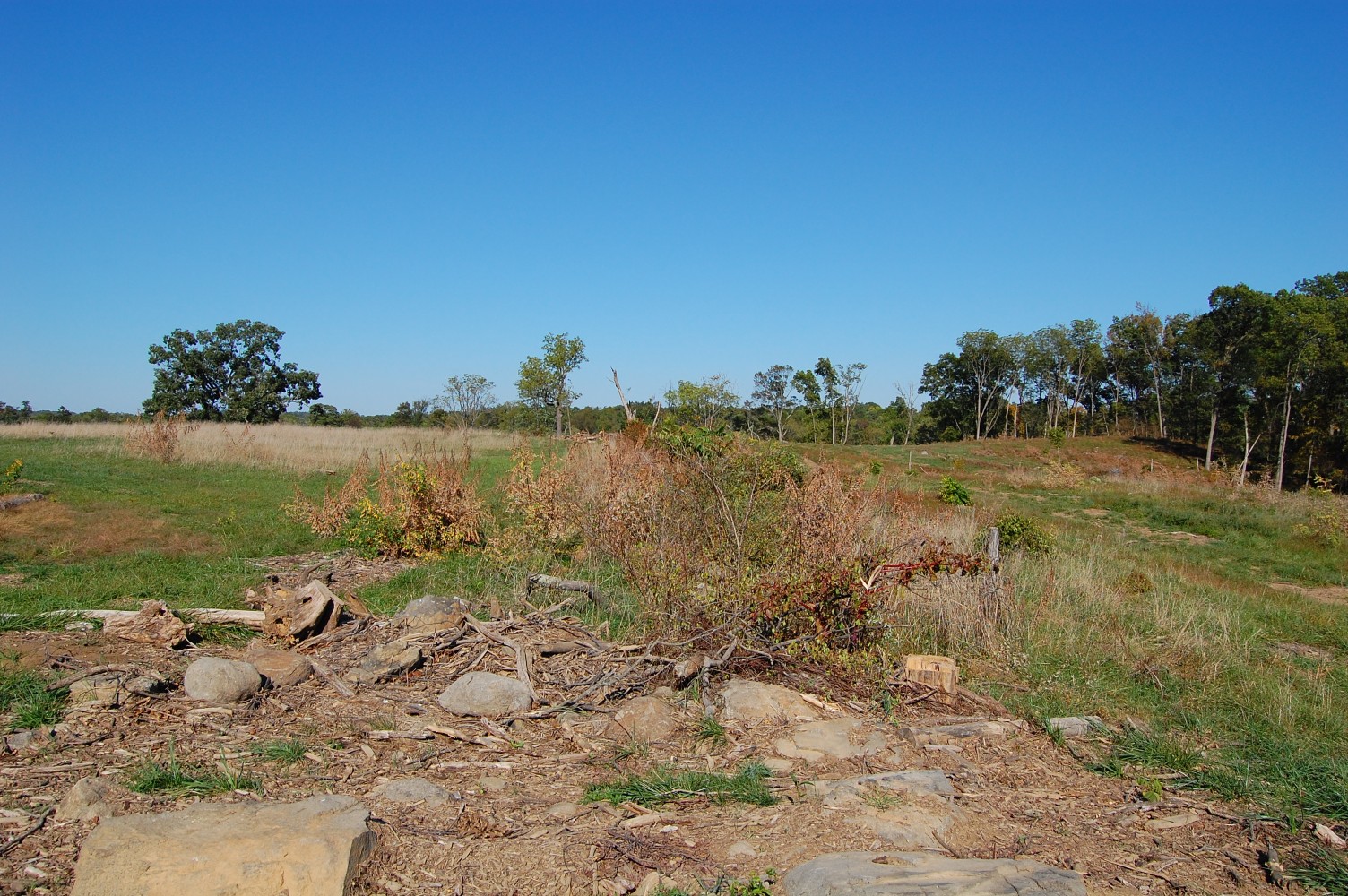
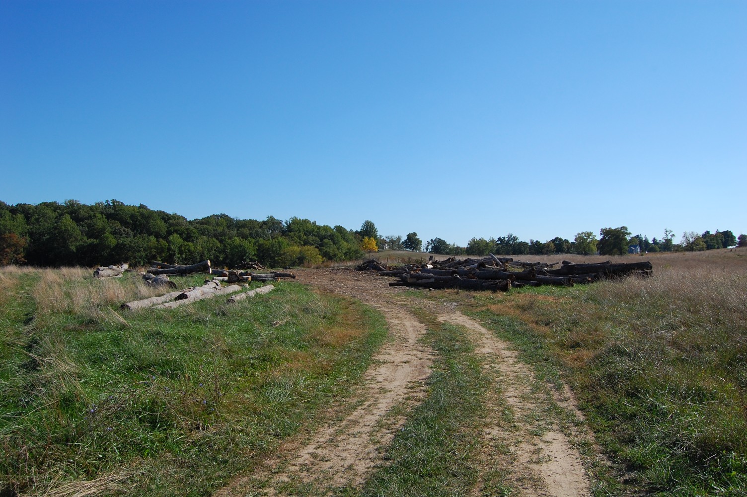
We have now turned to our left from the previous position. The large tree in the left background should provide a landmark. Notice the tree removal that’s taken place all along the right portion of this photograph. The growth in the center of this shot marks a rock wall, which we’ll follow from here back to East Confederate Avenue. This view was taken facing northeast at approximately 4:00 PM on Tuesday, September 21, 2010.

Like most of this tree removal project, lots of wood still remains on the field. This view was taken facing northeast at approximately 4:00 PM on Tuesday, September 21, 2010.

Looking back towards the Mission 66 Wayside on East Confederate Avenue. This view was taken facing northwest at approximately 4:00 PM on Tuesday, September 21, 2010.

We’ve moved down E Confederate Avenue a bit, and are still looking back towards the Mission 66 Wayside, which is now out of view over the ridge to our front. If we turn to our left … This view was taken facing northwest at approximately 4:00 PM on Tuesday, September 21, 2010.
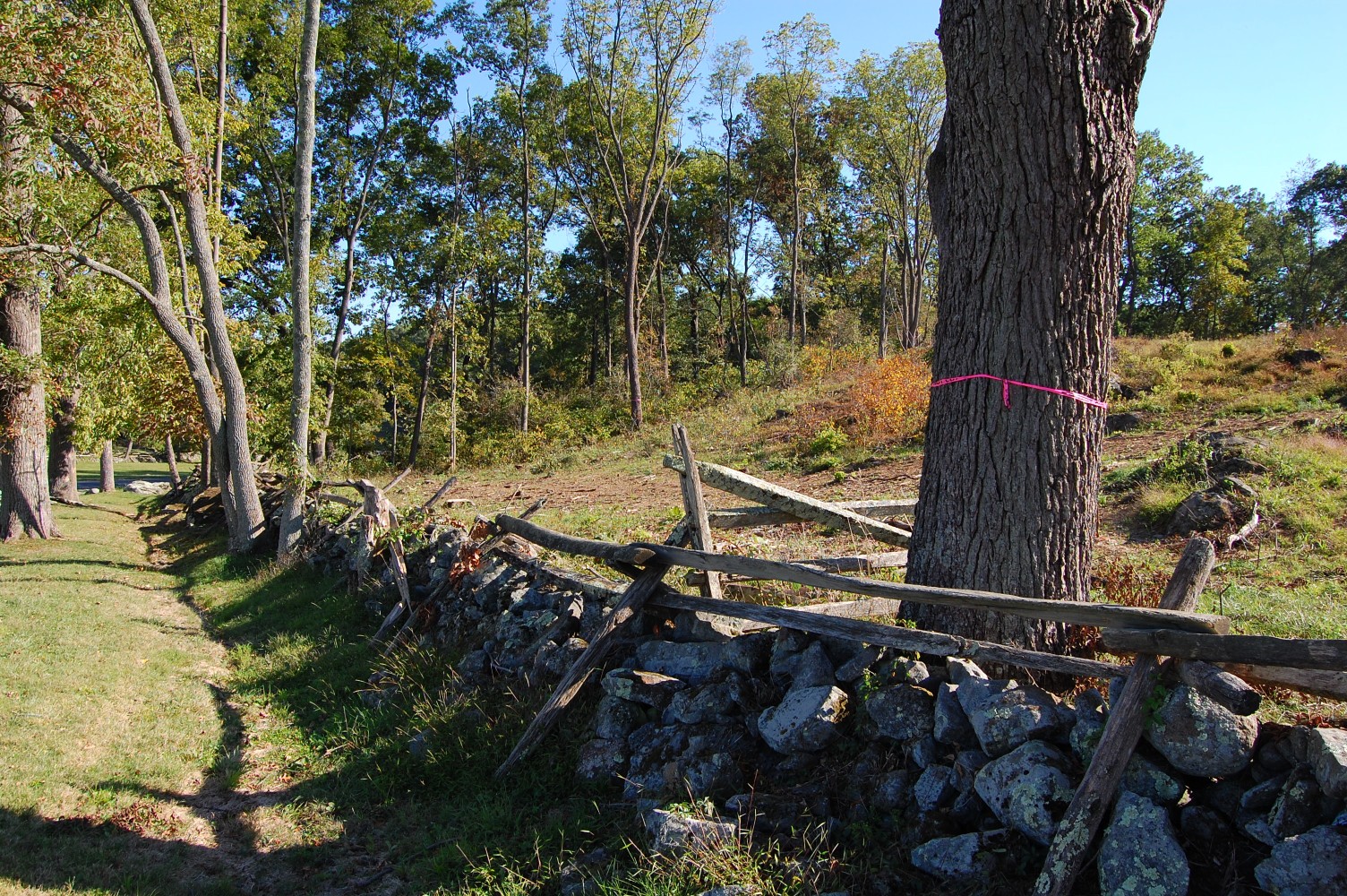
… You will notice that the tree removal extends down towards the road. The neon pink “DO NOT CUT” tags we are all familiar with by now are to be found all over the areas where this removal project has occurred. This view was taken facing southeast at approximately 4:00 PM on Tuesday, September 21, 2010.

Continuing down E Confederate Avenue, we come to the location of the first photo in this post. The stream that we showed earlier goes under the bridge in the left background of this shot. The brown patches of ground against the tree-line mark the location of a large swath of trees that has been removed in this area. This includes trees just to the right of the camera position … This view was taken facing southeast at approximately 4:00 PM on Tuesday, September 21, 2010.
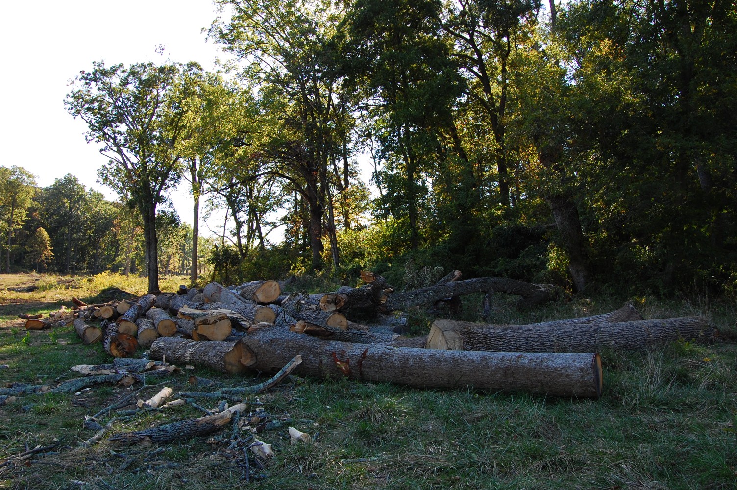
… Where a great deal of wood has yet to be removed from the field. This view was taken facing southeast at approximately 4:00 PM on Tuesday, September 21, 2010.

We’ve stitched together a panorama of the removal in this area. Please click on the image above to enlarge it. This view was taken at approximately 4:00 PM on Tuesday, September 21, 2010.

Another worthwhile tree removal project that has dramatically improved the views from this portion of the field to East Cemetery Hill. Even from this overgrown spot it’s now possible to make out the Evergreen Cemetery Gatehouse in the left background, and the Howard equestrian statue in the center background. This view was taken facing west at approximately 4:00 PM on Tuesday, September 21, 2010.