

Battlefield rehabilitation along the Taneytown Road is progressing well. This view is from the Taneytown Road near the Michael Frey Farm, looking west. In the distance, one may now pick out the blue ridge of the Applachian Mountains or South Mountains. This view was taken from the east facing west at approximately 9:00 AM on Saturday, August 9, 2008.
The battlefield rehabilitation project between the Taneytown Road and Cemetery Ridge is progressing well. Now someone on the Taneytown Road may look to the west and see the Appalachian Mountains. See our previous post of the work here on July 18, 2008.
The horse trail from Artillery Ridge Campground is on the left, and the clearing is occurring on the right side of this photograph. This view was taken from the southeast facing northwest at approximately 9:00 AM on Saturday, August 9, 2008.

Opening up the view in this area will expose the east side of Cemetery Ridge closer to as it looked in 1863. This view was taken from the south facing north at approximately 9:00 AM on Saturday, August 9, 2008.

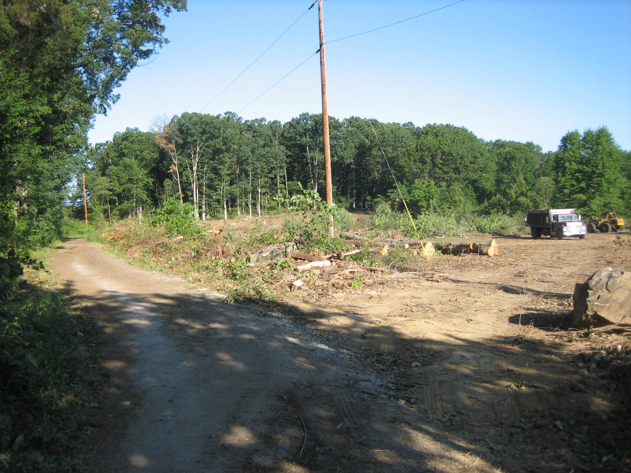
On the late afternoon/early evening of July 2, 1863, Lockwood’s Brigade of the 12th Corps left the area of Culp’s Hill to reenforce Union troops on Cemetery Ridge. They marched up the Granite Schoolhouse Road (where the photographer is standing) to the intersection of the Taneytown Road (from left to right in this photograph). This view was taken from the east facing west at approximately 9:00 AM on Saturday, August 9, 2008.

The marker is for Battery C, Third U.S. Artillery (Fuller’s Battery C) of the Horse Artillery. Lockwood’s Brigade continued west on a road in the area behind the monument… This view was taken from the southeast facing northwest at approximately 9:00 AM on Saturday, August 9, 2008.
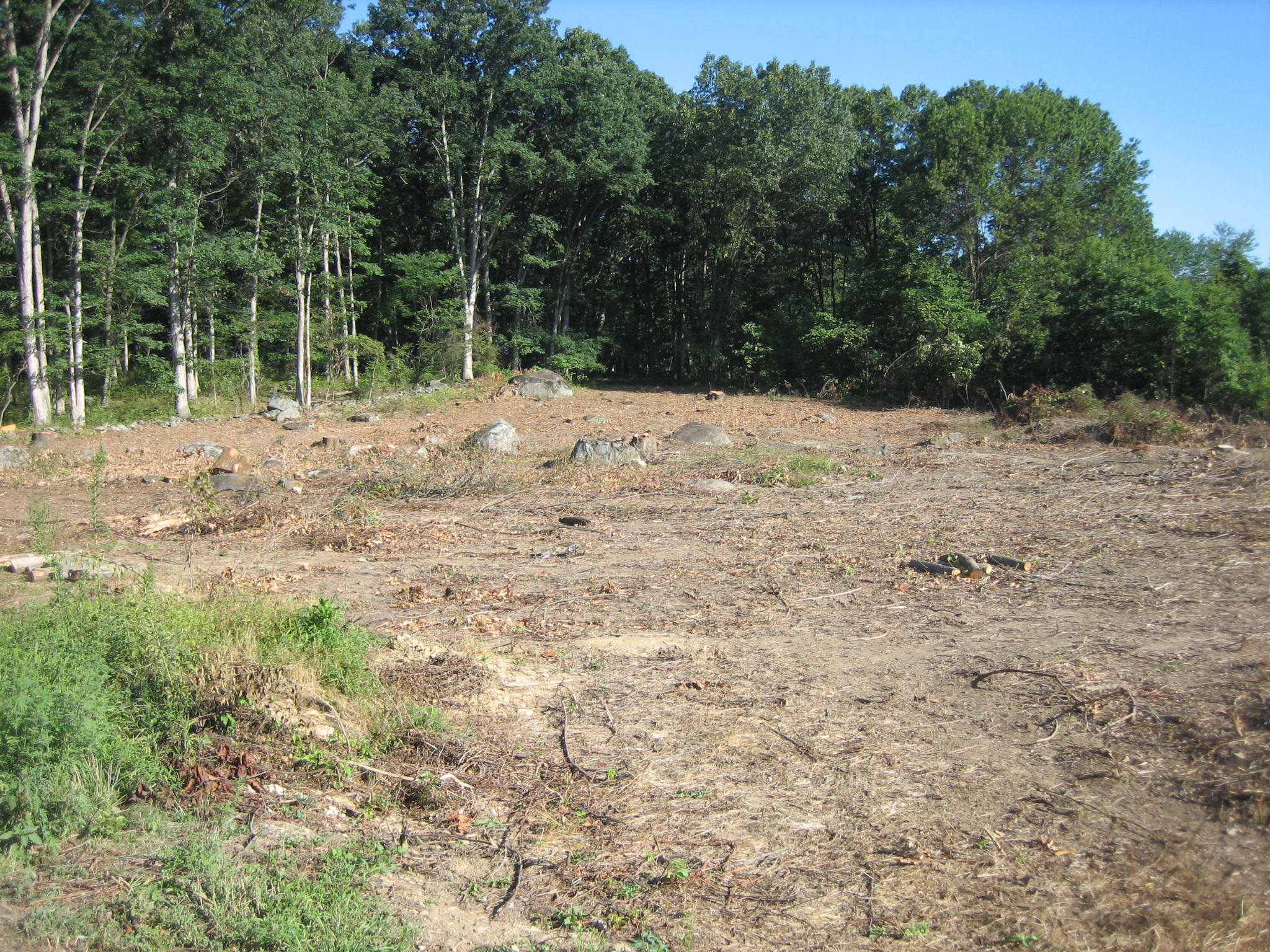
…crossed Cemetery Ridge in this area as they advanced from right to left… This view was taken from the south facing north at approximately 9:00 AM on Saturday, August 9, 2008.
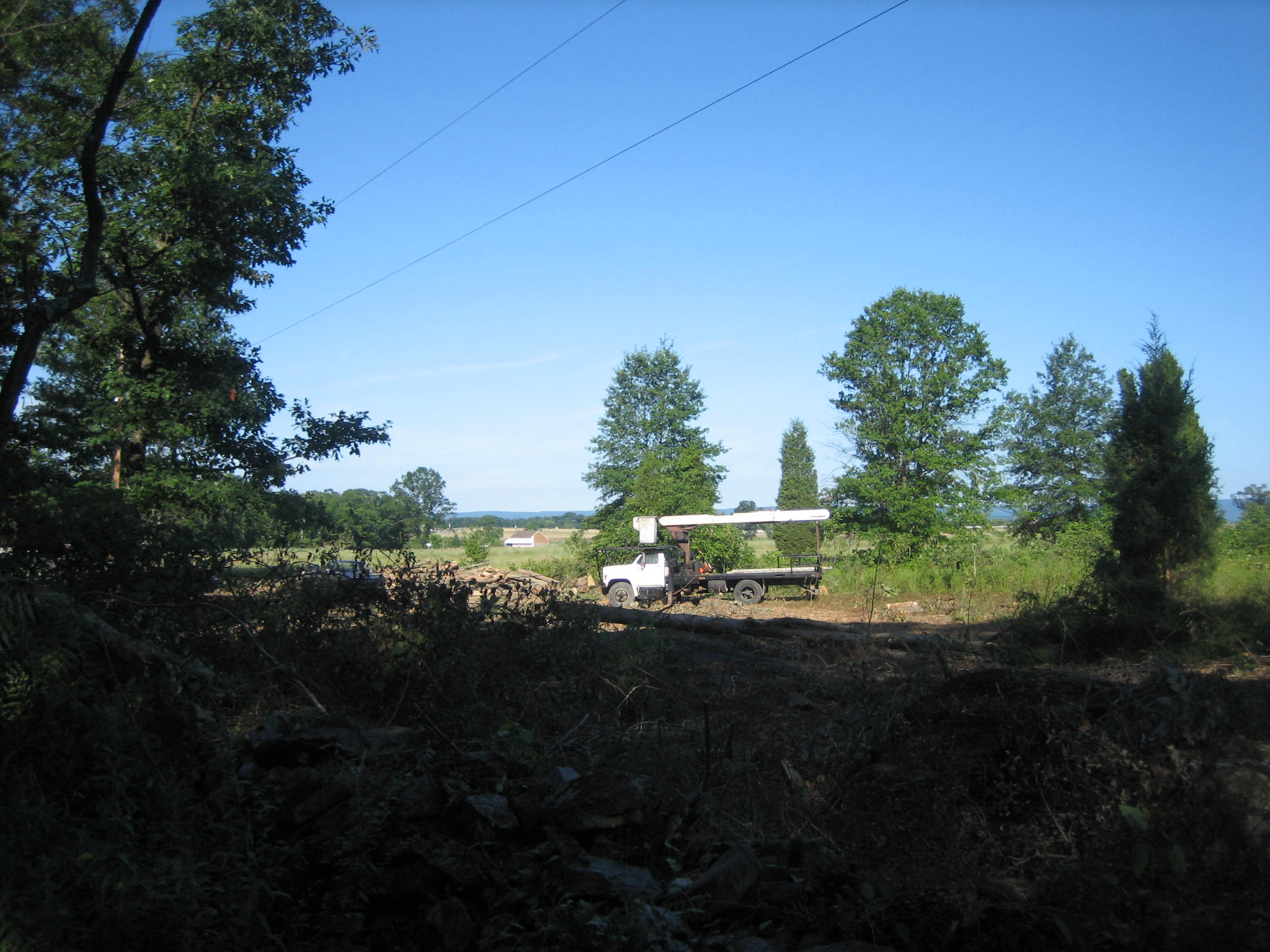
… and made their way over Cemetery Ridge to the Trostle Farm which is in the background. Near the barn they recaptured the guns from Bigelow’s 9th Massachusetts Battery. This view was taken from the northeast facing southwest at approximately 9:00 AM on Saturday, August 9, 2008.