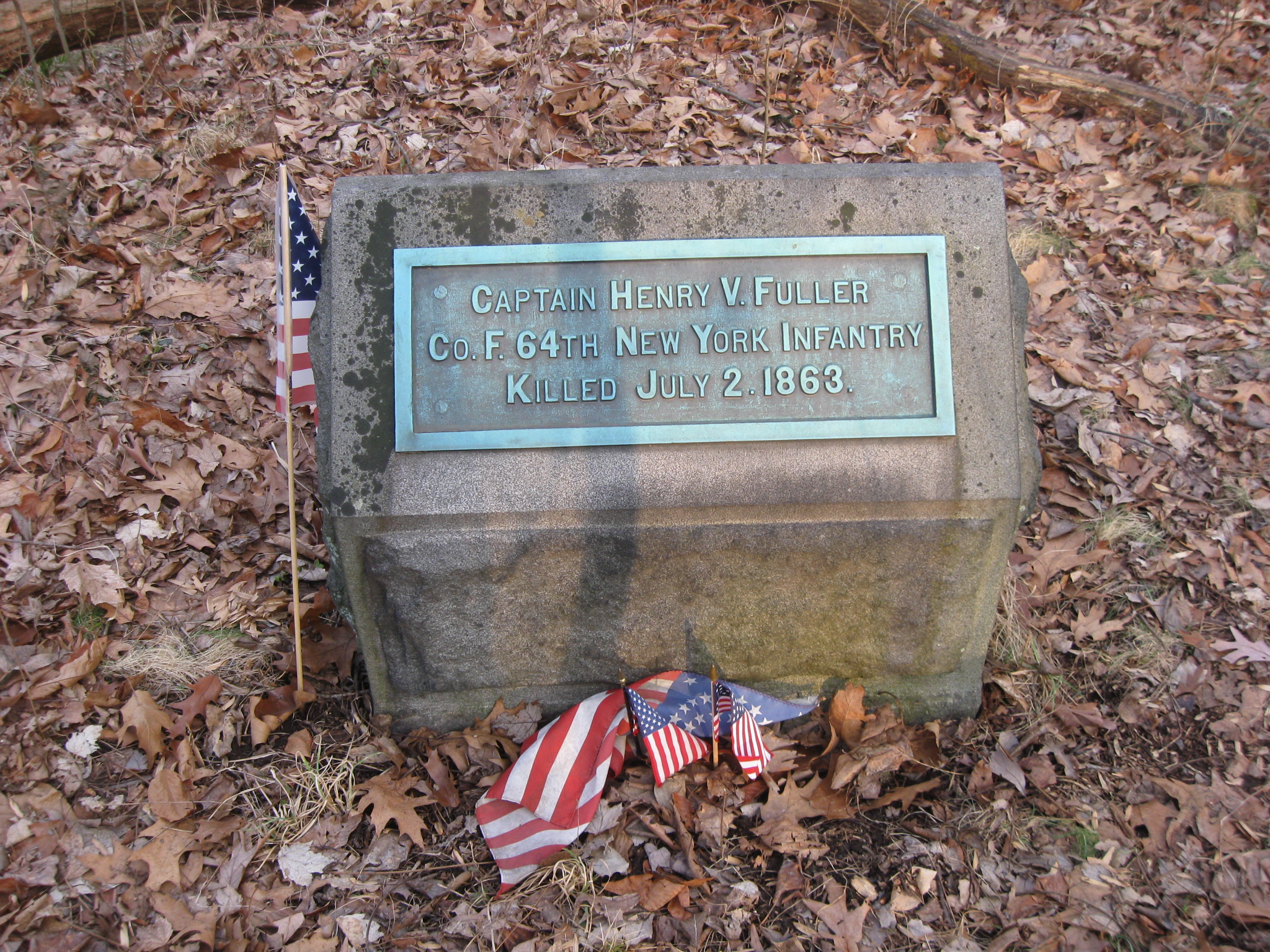
Captain Henry V. Fuller, 64th New York Infantry Marker
February 14, 2009
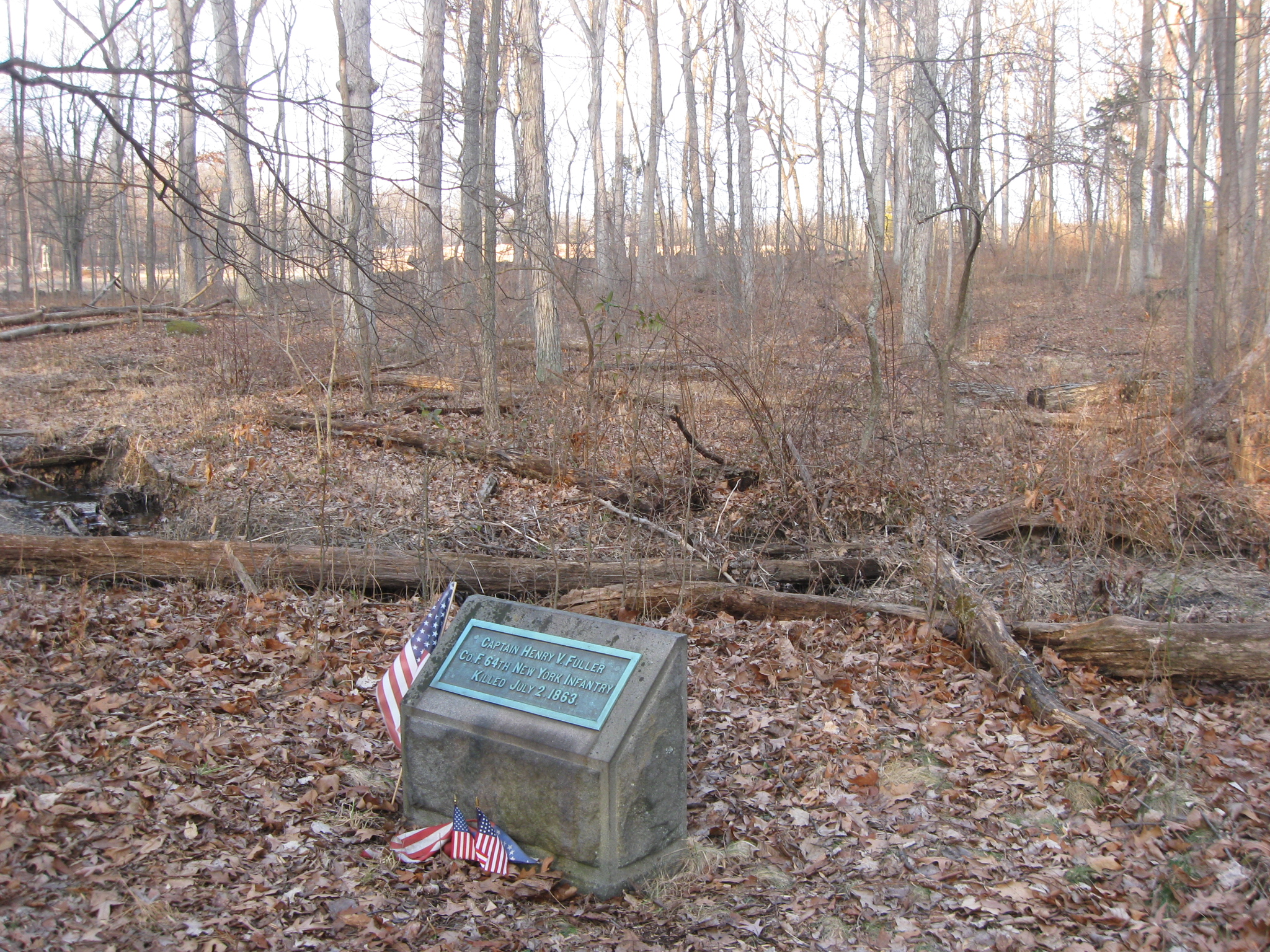
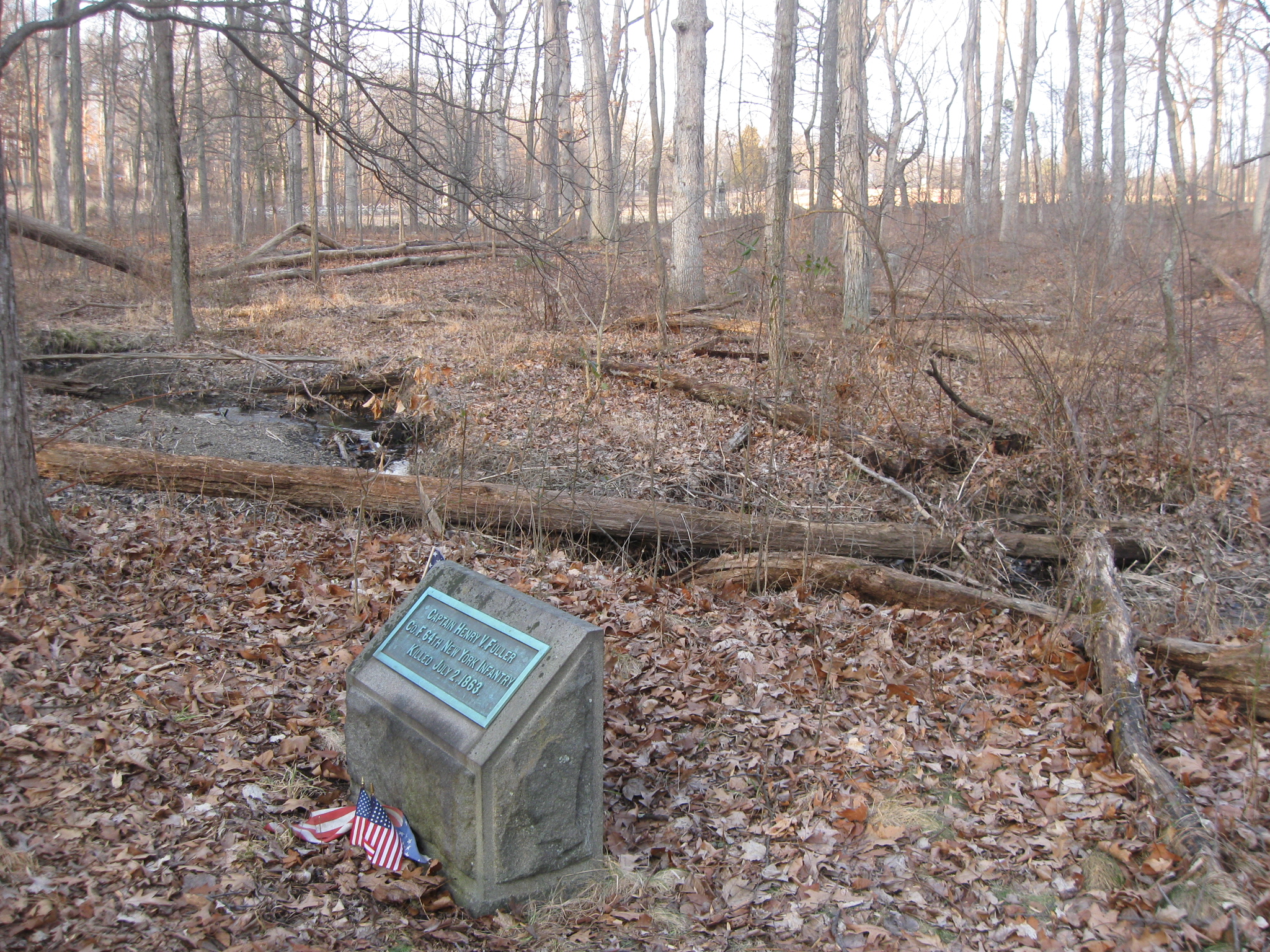
The Henry V. Fuller marker, one of the least visited markers at Gettysburg National Military Park, is located in Rose’s Woods along Rose’s Run. Rose’s Wheatfield is in the open area beyond the woods in the left background. This view was taken facing northeast at approximately 5:00 PM on Friday, February 13, 2009.
Captain Henry Van Aernam Fuller is probably best known at Gettysburg for having one of the least visited markers on the battlefield. It is located in Rose’s Woods near Rose’s Run. Fuller was commander of Company F of the 64th New York Infantry Regiment. He was killed on July 2, 1863 as the 64th New York, of Brooke’s Brigade, was retreating through Rose’s Woods towards the Wheatfield.
Captain Fuller was born in Little Valley, Cattaraugus County, New York on February 16, 1841. In 1858, at the age of 17, Henry was employed by a lumber manufacturer, to “run the river,” down the Allegheny and Ohio, to Pittsburgh, Cincinnati, and Louisville, taking charge of the stock and making sales. His employer said of him, “Henry standing, walking, or speaking, exhibited the qualities of superior manhood.”
On December 24, 1860, at the age of 19, he married Adelaide C. Twomley, of Little Valley. On September 10, 1861, at the age of 20, Fuller entered the army a private, joining Company F, 64th Regiment, New York Volunteers. He was promoted to Orderly Sergeant, and on December 10, 1861 he was commissioned 2nd Lieutenant of Company F.
On May 19, 1862, Henry and Adelaide’s son, Henry Twomley Fuller, was born. After the 64th New York’s first battle at Fair Oaks, Virginia at the end of May and the beginning of June, 1861, he was promoted to 1st Lieutenant, for bravery in the field, on July 23, 1862.
The 64th New York participated in the following battles/campaigns: Peninsula, Second Manassas, Antietam, and Fredericksburg. For gallant and meritorious service at Fredericksburg, he was promoted to the rank of Captain in 1863 with the date of rank listed as December 30, 1862. He participated with his regiment in the Battle of Chancellorsville in May, 1863.
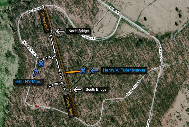
This map gives what we believe is the best way to find and approach the Henry V. Fuller marker. Some individuals recommend entering Rose’s Woods and looking for the Fuller marker from the stone wall near the Wheatfield. However, this does not take into consideration Rose’s Run, which is fairly steep in places, and the area is pretty wet and muddy in the non-dry seasons. We believe the best way to find the marker is from the old trolley bed, which we have drawn in brown, then taking the orange colored route to the marker. This way, there are no streams to cross. This map was created at approximately 9:00 PM on Friday, February 13, 2009.
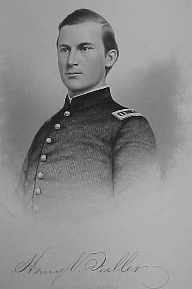
Colonel D. G. Bingham of the 64th New York on January 1, 1863 wrote to New York Governor Seymour recommending 1st Lieutenant Fuller’s promotion to Captain, saying that Fuller was “a young man of good education and intelligence; has served as Lieutenant since the organization of the regiment; acting at different times as 2nd and 1st Lieut., and commandant of company and Adjutant; and has been constantly with his regiment. He has been in all the battles in which his regiment has been engaged, viz (besides the Siege of Yorktown) Fair-Oaks, Gaines-Mill, Peach-Orchard, Savage’s-Station, White-Oaks-Swamp, Malvern-Hill, Antietam, and Fredericksburg, besides several skirmishes; and has, in all, displayed a gallantry and intrepidity deserving reward. For these and other minor considerations, which I might detail, I hope your Excellency will favorably consider this application.” This image was made after Fuller’s promotion in 1863.
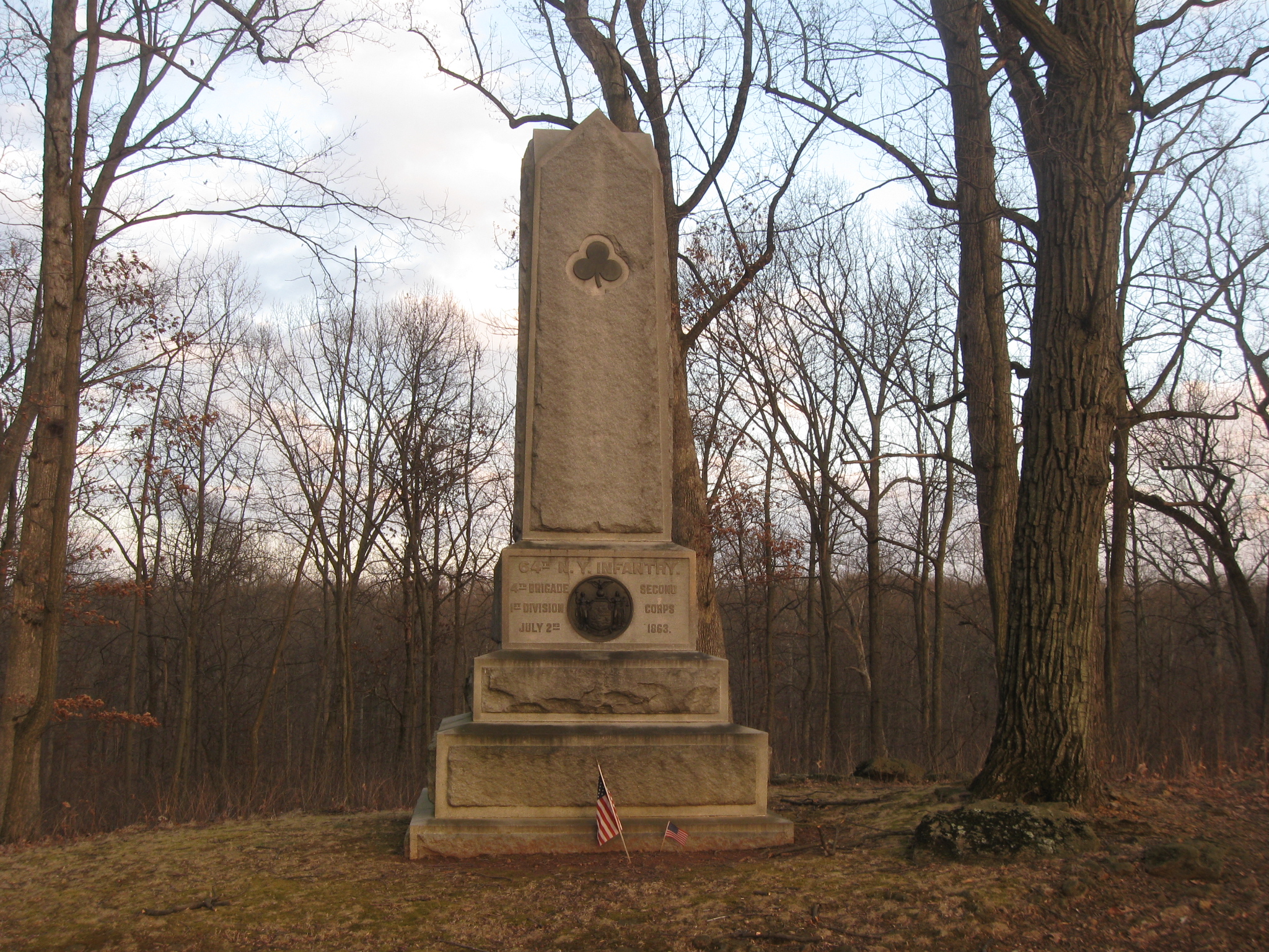
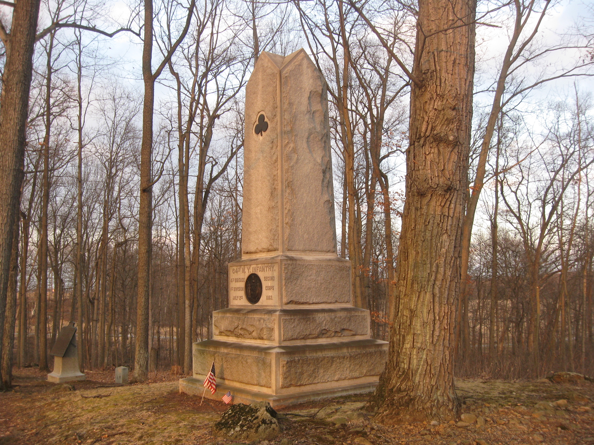
At Gettysburg, on July 2, 1863, Fuller advanced with Brooke’s Brigade against Anderson’s Division across the Wheatfield, into Rose’s Woods, and up the slope to the present Brooke Avenue. The monuments shown along Brooke Avenue from right to left: 64th New York, Brooke Brigade Plaque, 53rd Pennsylvania, 27th Connecticut, and the 145th Pennsylvania. Brooke’s Brigade pushed back Anderson’s Brigade of Georgians from right to left. This view was taken facing north at approximately 5:00 PM on Friday, February 13, 2009.
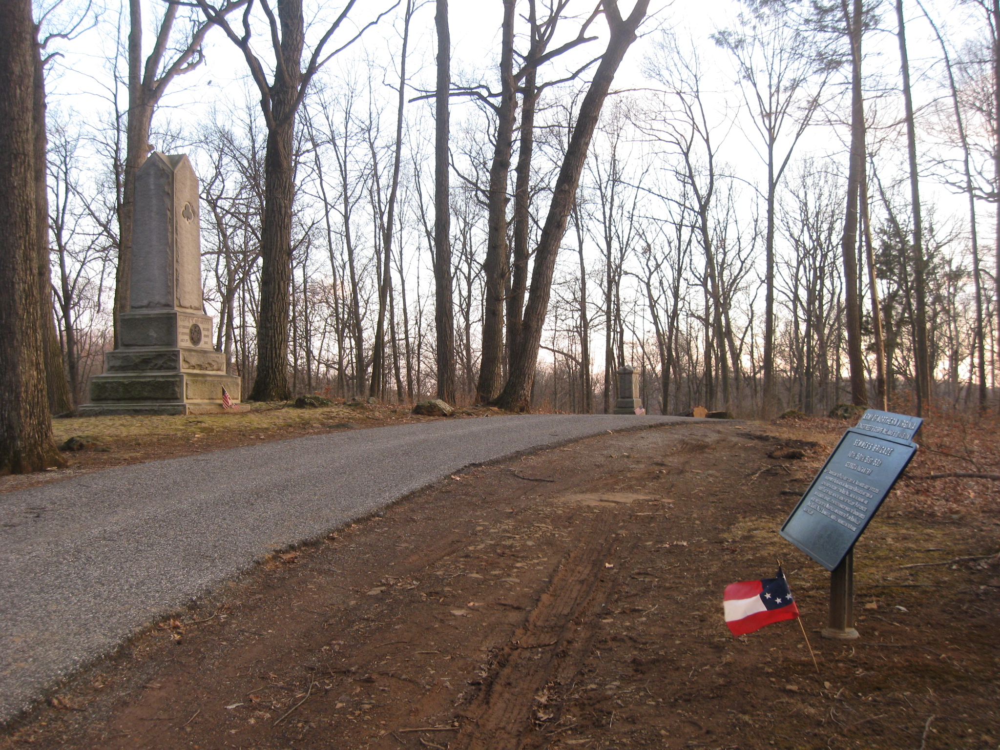
Near the top of the ridge, however, they were met by Georgians of Semmes Brigade attacking from right to left in this view. Semmes’ Brigade plaque is on the right. The monument to the 2nd Delaware of Brooke’s Brigade is in the background, and the monument to the 64th New York is on the left. This view was taken facing south at approximately 5:00 PM on Friday, February 13, 2009.
Brooke’s Brigade advanced too far from the rest of the brigades in their (Caldwell’s) division. They were hit in the front by Semmes Brigade… This view was taken facing northeast at approximately 5:00 PM on Friday, February 13, 2009.
…on the left (our right) or southwest by the 1st Texas of Robertson’s Brigade and the 15th Georgia of Benning’s Brigade… This view was taken facing northeast at approximately 5:00 PM on Friday, February 13, 2009.
…and on the right (our left) or northwest by Kershaw’s South Carolina Brigade. This view was taken facing northwest at approximately 5:00 PM on Friday, February 13, 2009.
The 64th New York (part of the monument shown to the left) and the rest of Brooke’s Brigade had to retreat before being surrounded. They had to go back down the slope into the ravine in Rose’s Woods. This view was taken facing northeast at approximately 5:00 PM on Friday, February 13, 2009.
Moving through the woods towards the Wheatfield, the 64th was closely pursued by the Confederates and Fuller was wounded in the leg and could not continue. This view was taken facing northeast at approximately 5:00 PM on Friday, February 13, 2009.
Private George Whipple of Company F saw that Fuller was wounded and moved to help him. This view was taken facing southeast at approximately 5:00 PM on Friday, February 13, 2009.
As Private Whipple attempted to support his Captain and help him through the woods, Fuller was shot in the back, and the bullet passed out his shoulder. The monument to the 8th New Jersey Regiment in barely visible through the trees in the background. This view was taken facing northwest at approximately 5:00 PM on Friday, February 13, 2009.
“In a few moments,” Fuller was dead. This view was taken facing northeast at approximately 5:00 PM on Friday, February 13, 2009.
Private Whipple was captured by a Georgian who demanded, “Go to the rear you d__d son of a b___h.” This view was taken facing southwest at approximately 5:00 PM on Friday, February 13, 2009.
Fuller’s body was recovered on July 4, 1863. This view was taken facing northwest at approximately 5:00 PM on Friday, February 13, 2009.
He was buried on July 18, 1863 in Little Valley Rural Cemetery, Little Valley, Cattaraugus County, New York. This view was taken facing northwest at approximately 5:00 PM on Friday, February 13, 2009.
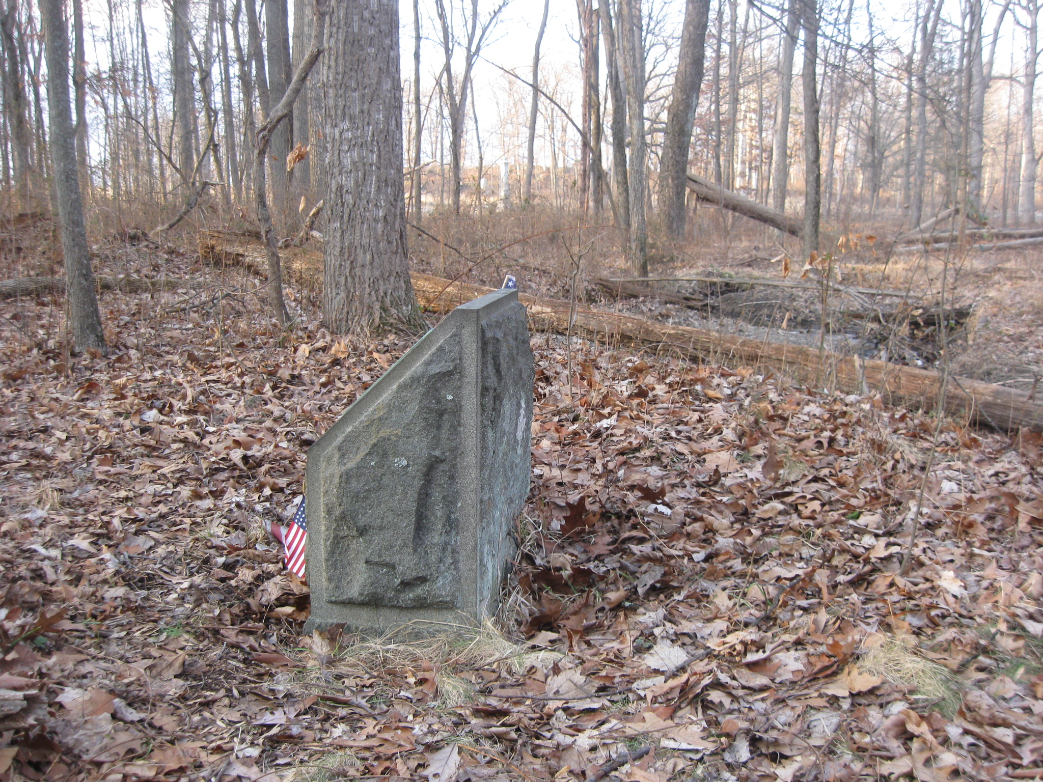
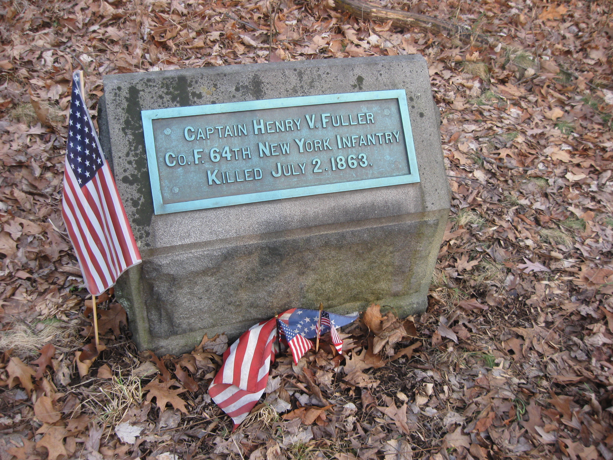
His marker was dedicated by the surviving members of his company in July, 1894. This view was taken facing northeast at approximately 5:00 PM on Friday, February 13, 2009.
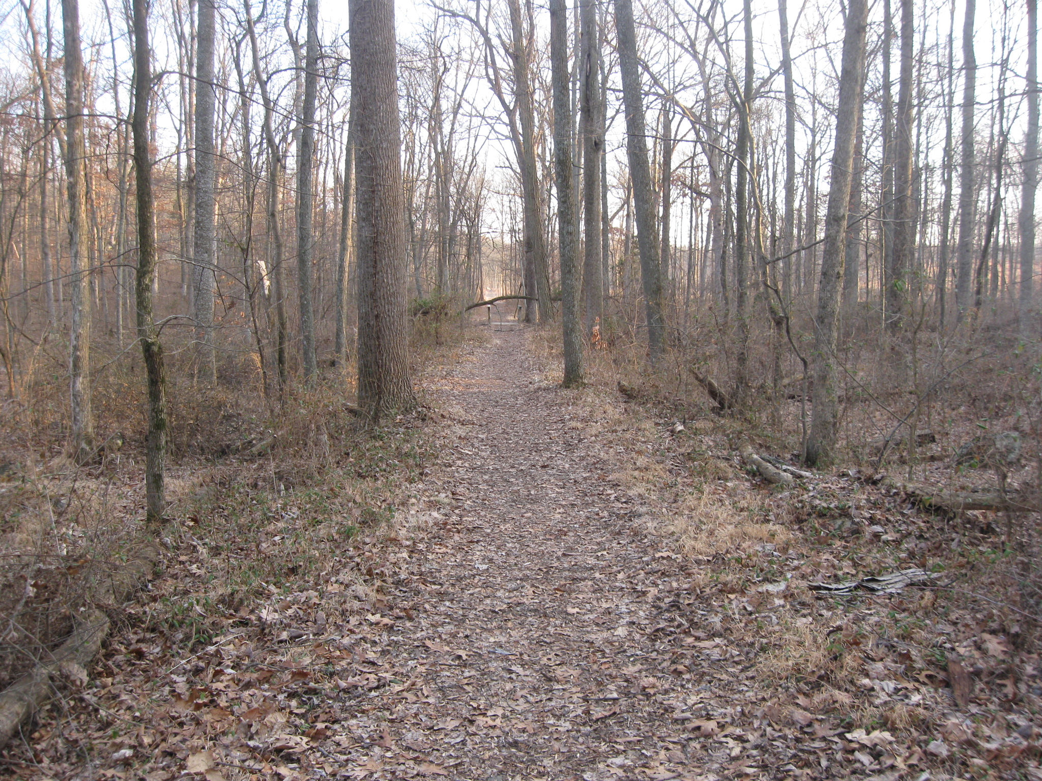
To get to the Fuller Marker, we recommend that you get on the old trolley bed. We’ll take you in from the “north bridge” over Rose’s Run as we have labeled it on the map. From here it’s approximately 175 yards to a spot where we can take you on another path to the Fuller marker. This view was taken facing southeast at approximately 5:00 PM on Friday, February 13, 2009.
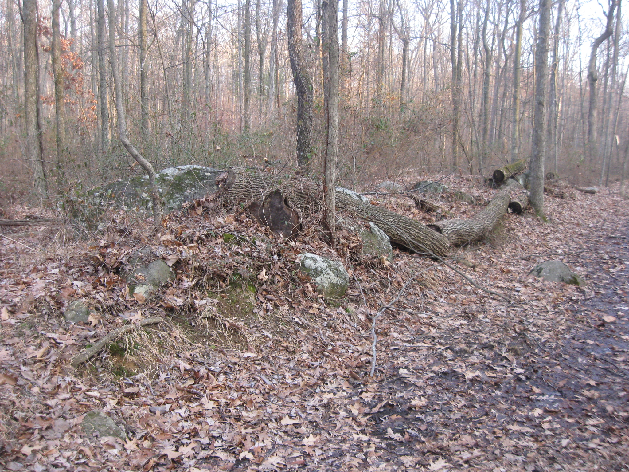
After approximately 140 yards you’ll see this rock formation on the left (northeast) side of the trolley bed (trail). 35 yards to go before we’ll take you off to the left. This view was taken facing southeast at approximately 5:00 PM on Friday, February 13, 2009.
In another 20 yards you’ll see these stones on the left which appear to have been cut out of William Wible’s Rock Quarry. 15 yards to go… This view was taken facing southeast at approximately 5:00 PM on Friday, February 13, 2009.
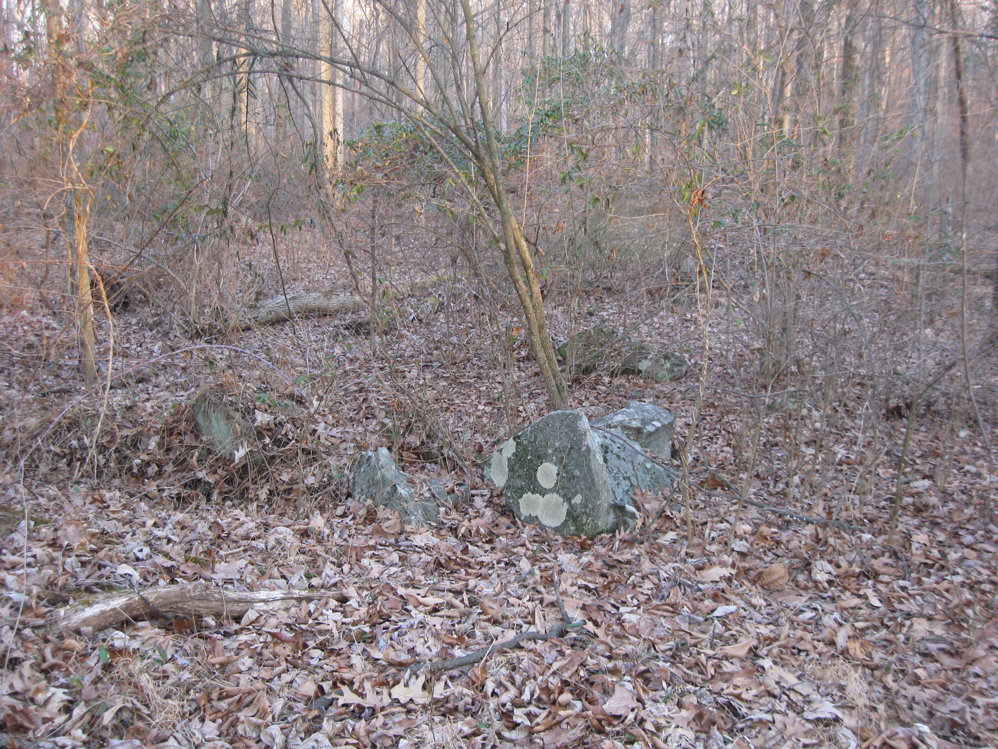
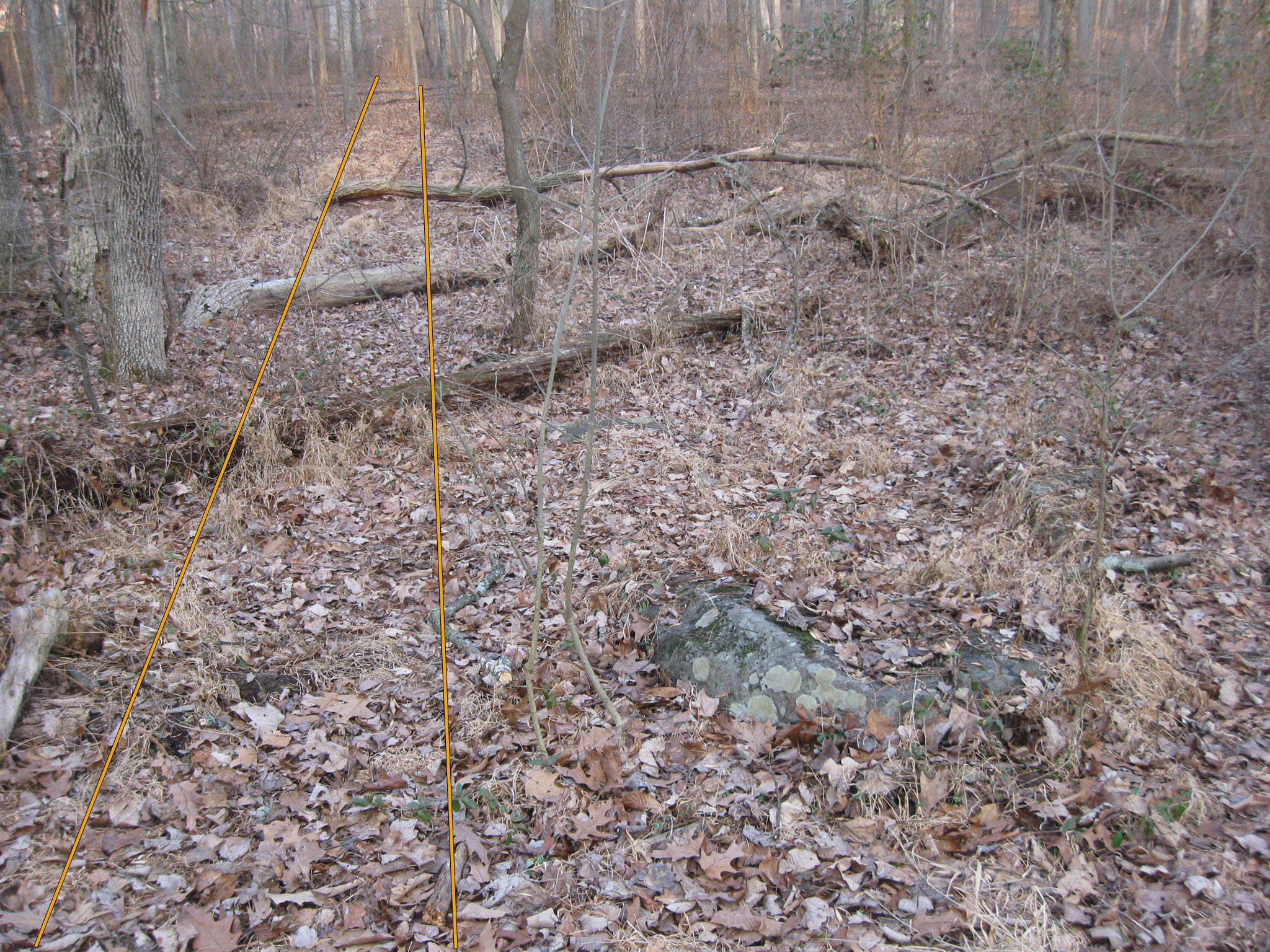
After 15 yards from the quarried rocks, we’ll want to look for this spot on the left… This view was taken facing east at approximately 5:00 PM on Friday, February 13, 2009.
…and especially for this rock. This view was taken facing east at approximately 5:00 PM on Friday, February 13, 2009.
If you’re walking from the “south bridge,” seen in the background, you’ll walk approximately 70 yards from the bridge and towards the camera to the tall tree on the left. Look for the rock that we showed you in the last picture. The camera position is near where the rock is located. This view was taken facing southeast at approximately 5:00 PM on Friday, February 13, 2009.
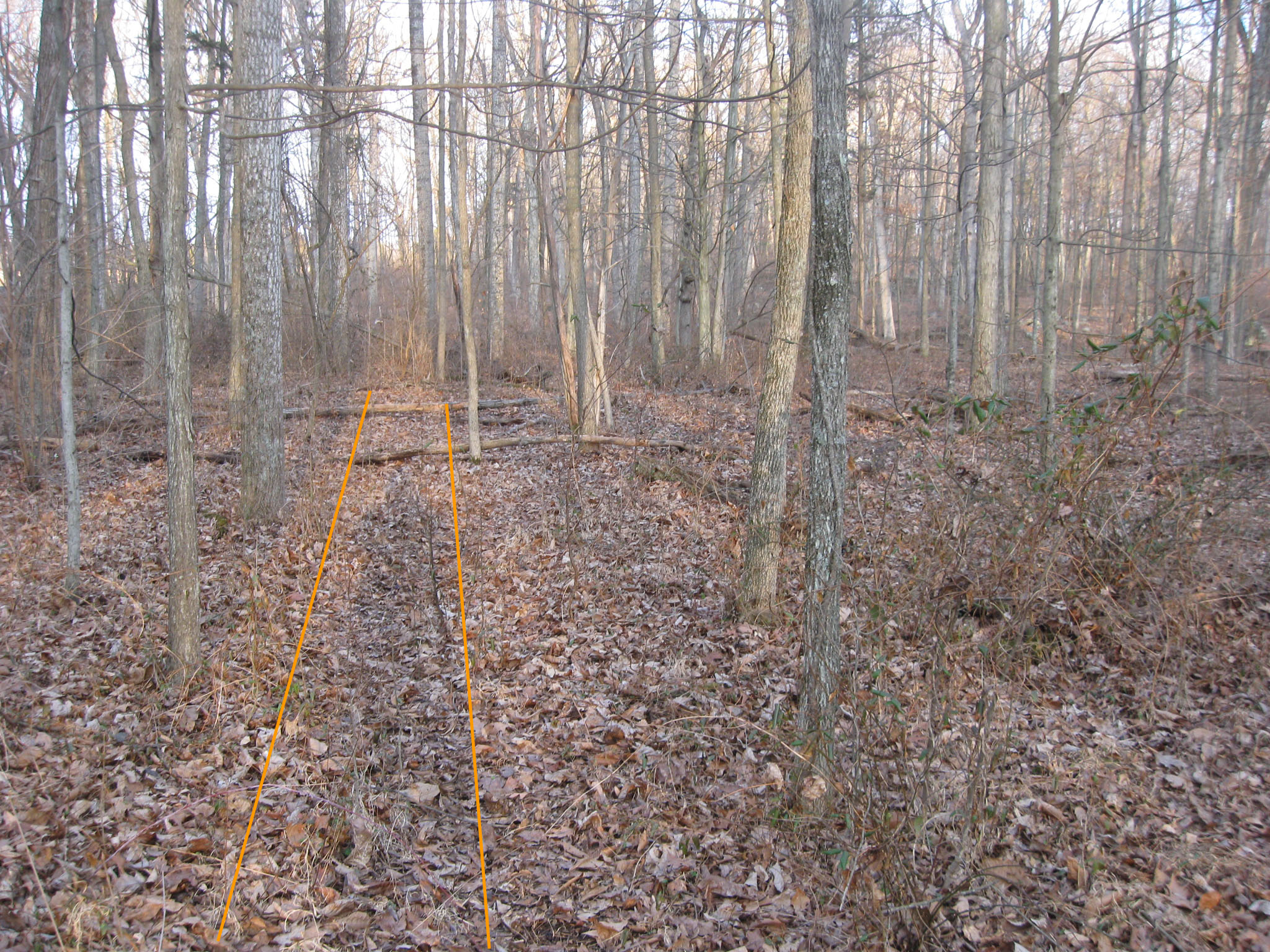
Then we start to walk in. We have outlined the “path” as we see it through the woods. This view was taken facing east at approximately 5:00 PM on Friday, February 13, 2009.
It’s not exactly a straight shot as we showed you on the map. There are some turns on the journey of approximately 75 yards. This view was taken facing east at approximately 5:00 PM on Friday, February 13, 2009.
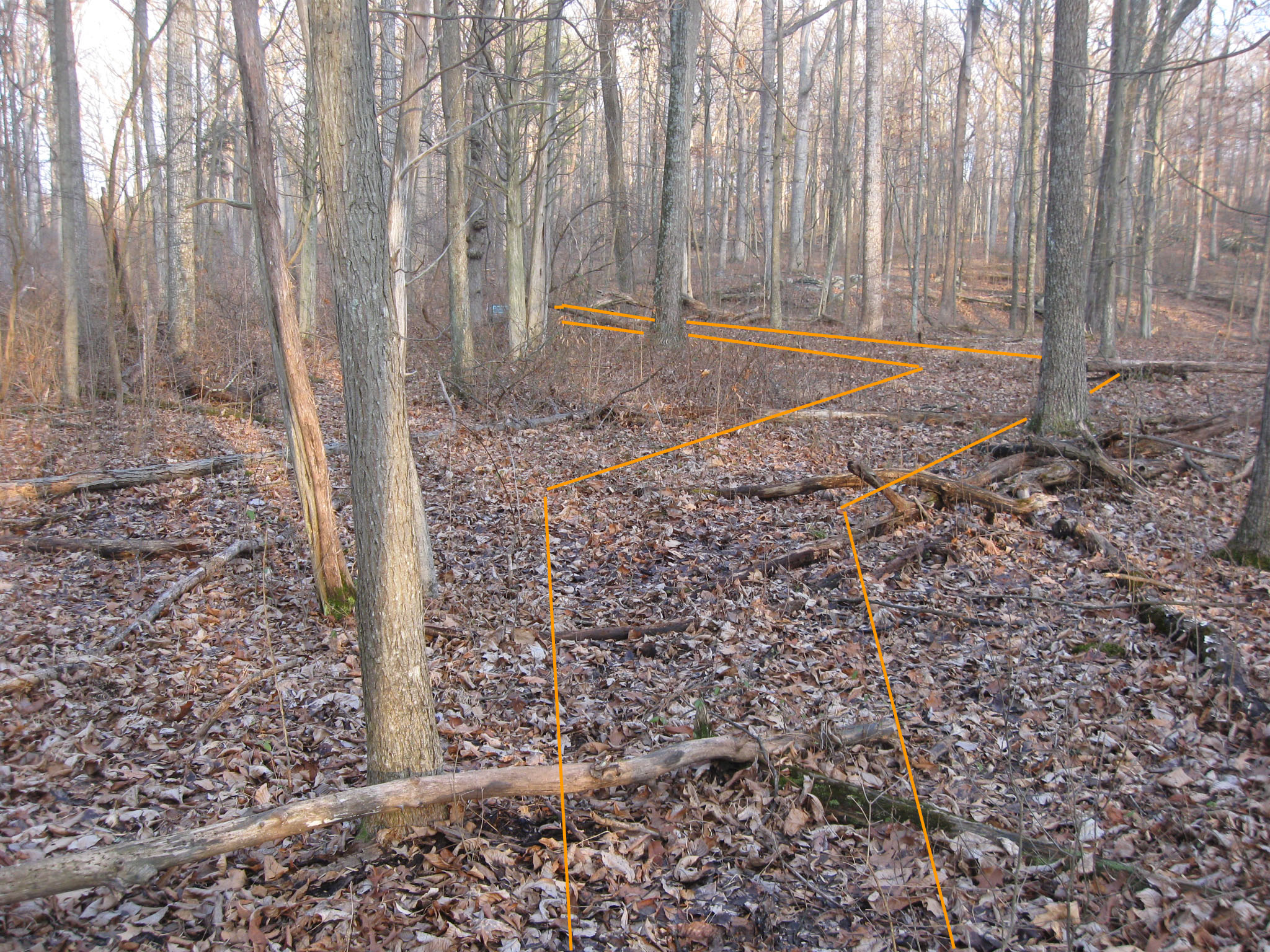
The path goes to the right, and the marker is now barely visible between the trees in the background. This view was taken facing east at approximately 5:00 PM on Friday, February 13, 2009.
The marker is now easily seen. This view was taken facing east at approximately 5:00 PM on Friday, February 13, 2009.
And after 75 yards, here we are. This way is a little muddy, but not nearly as bad as attempting to cross Rose’s Run, which you can see in the background. This view was taken facing northwest at approximately 5:00 PM on Friday, February 13, 2009.