

Black Horse Tavern, or Bream’s Tavern is located at the intersection of the Fairfield/Hagerstown Road and the Black Horse Tavern Road. The stone part of the building, on the right in this view is still standing, and was constructed circa 1812. This view was taken facing northwest circa the 1860s and is courtesy of John Winkleman.
Gettysburg Licensed Battlefield Guide John Winkleman is a native of New Jersey and a resident of Adams County, Pennsylvania since 2000. He is U.S. Navy, Vietnam War Veteran. John has been a Licensed Battlefield Guide since 2004.
To see John Winkleman’s previous posts on Adams County Civil War Taverns, click here.
In today’s Adams County Civil War Taverns’ post, Gettysburg Licensed Battlefield Guide John Winkleman shows us Bream’s Hill and the Black Horse Tavern.

This map shows the location of the video taken for our series on Adams County Civil War Taverns. Videos #1-13 were shown in our previous Tavern posts. Video #14 was taken on Bream’s Hill. Video #15 was taken at the Black Horse Tavern. This map was created facing north at approximately 8:00 PM on Saturday, April 16, 2011.
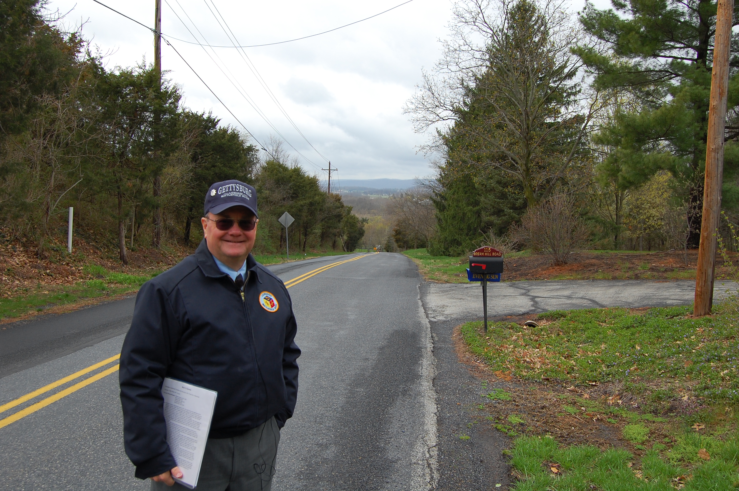
Gettysburg Licensed Battlefield Guide John Winkleman is the host for our series on Adams County Civil War Taverns. He is standing on Bream’s Hill, and on Bream’s Hill Road. This road during the Civil War, was the Fairfield/Hagerstown Road. This view was taken facing southwest at approximately 2:30 PM on Wednesday, April 13, 2011.
In Video #14 (Videos #1-13 were shown in our previous 140 Places Posts) Gettysburg Licensed Battlefield Guide John Winkleman shows us Bream’s Hill and a photograph taken from this location in the 1800s. This view was taken facing southwest to southeast to southwest at approximately 2:30 PM on Wednesday, April 13, 2011.

In the modern view from this location, the Black Horse Tavern and barn are hidden at the bottom of the hill by the foliage. The lighter colored buildings just right of center, and below the South Mountains, however… This view was taken facing southwest at approximately 2:30 PM on Wednesday, April 13, 2011.

…are visible in this 1800s view (or at least buildings at the same location. At the bottom of the hill, the Bream Barn and to its left the Black Horse Tavern are visible. This view was taken facing southwest circa the late 1800s and is courtesy of John Winkleman.
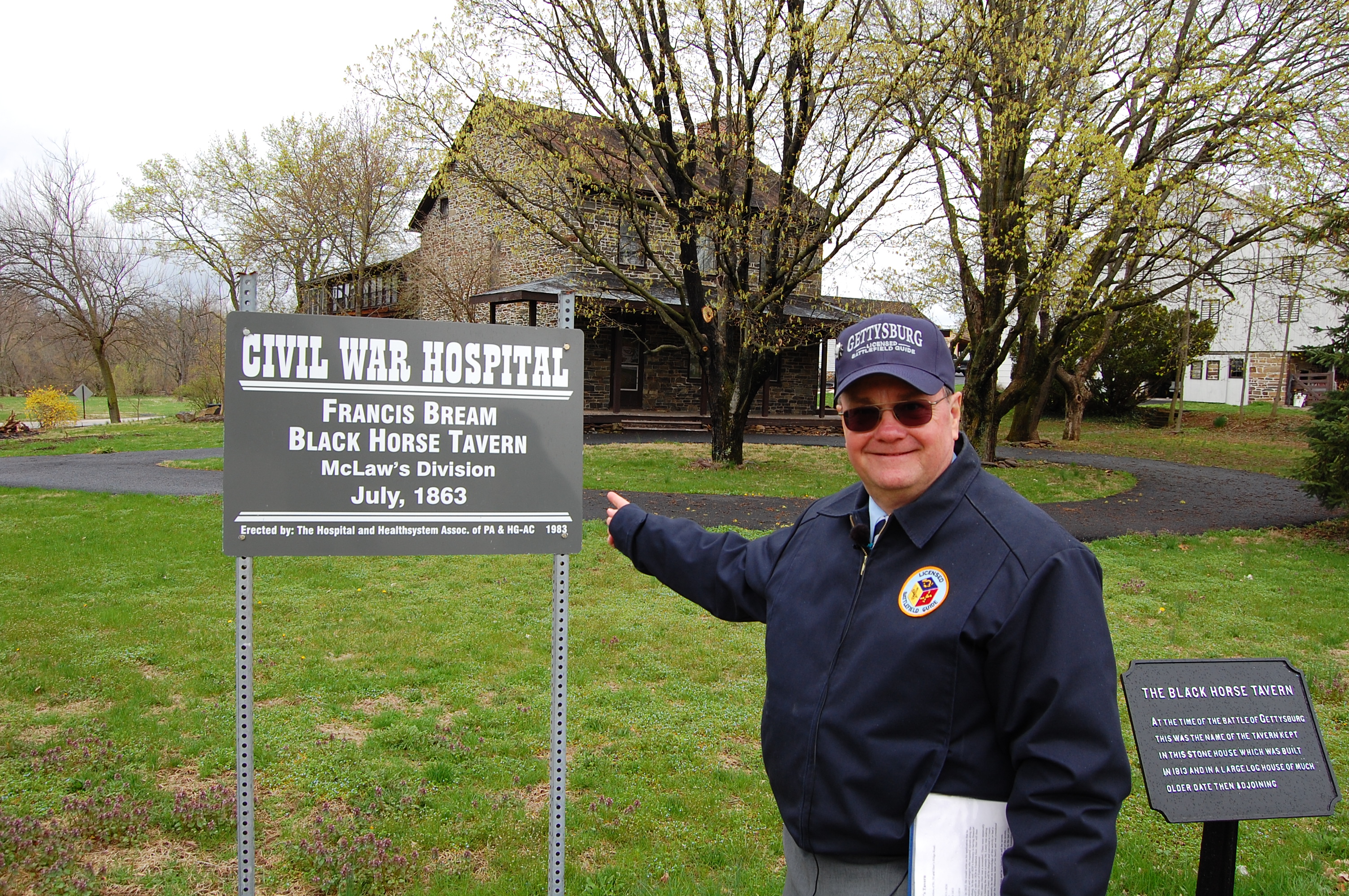
Licensed Battlefield Guide John Winkleman is now standing near the Fairfield Road (behind the cameraman), and in front of the Black Horse Tavern. Part of the barn is visible on the right. This view was taken facing north at approximately 2:30 PM on Wednesday, April 13, 2011.
In Video #15 Licensed Battlefield Guide John Winkleman presents a history of the Black Horse Tavern, and especially it’s roll during the Gettysburg Campaign. This view was taken facing north to south to north to south to north at approximately 2:30 PM on Wednesday, April 13, 2011.

According to the 1860 federal population census Francis Bream was “white,” he was born in Pennsylvania, he was 54 years old, he a Farmer, and that he lived in the same dwelling and was part of the same family with Elizabeth Bream (1817-), born in Pennsylvania; Henry L. Bream (1843-), born in Pennsylvania; Jacob Bream (1844-), born in Pennsylvania; Calvin Bream (1846-), born in Pennsylvania; Harvey Bream (1848-), born in Pennsylvania; William Bream (1850-), born in Pennsylvania; Elizabeth Bream (1856-), born in Pennsylvania; Robert Bream (1858-), born in Pennsylvania; John Armstrong (1800-), born in Pennsylvania; Mary Grimes (1847-), born in Pennsylvania. This view was taken facing north at approximately 2:30 PM on Wednesday, April 13, 2011.

This photograph of the Black Horse Tavern was taken by the National Photo Company. This view was taken facing north circa 1920 and is courtesy of the Library of Congress.

The 1860 federal population census shows that Francis Bream’s real estate had a value of $32,000 and his personal estate had a value of $4433. According to the 1860 federal population census, Francis Bream owned more real estate than anyone in Cumberland Township, and he was the wealthiest person (real estate and personal estate combined) in Cumberland Township. This view was taken facing north at approximately 2:30 PM on Wednesday, April 13, 2011.
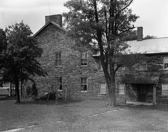
This image of the east wall of Black Horse Tavern was taken by Gettysburg National Park Service Historian Frederick Tilberg as part of the Historic American Buildings Survey. This view was taken facing southwest in July, 1950, and is courtesy of the Library of Congress.
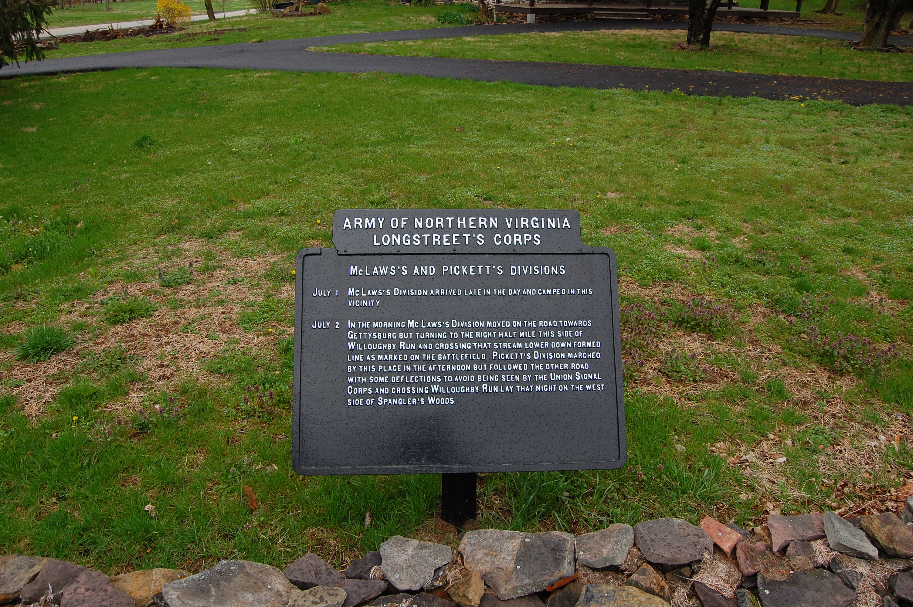
The War Department plaque in the front yard of the Black Horse Tavern. We find it interesting that it does not mention Hood’s Division. This view was taken facing north at approximately 2:30 PM on Wednesday, April 13, 2011.
To see other posts by Gettysburg Licensed Battlefield Guides, click here.