
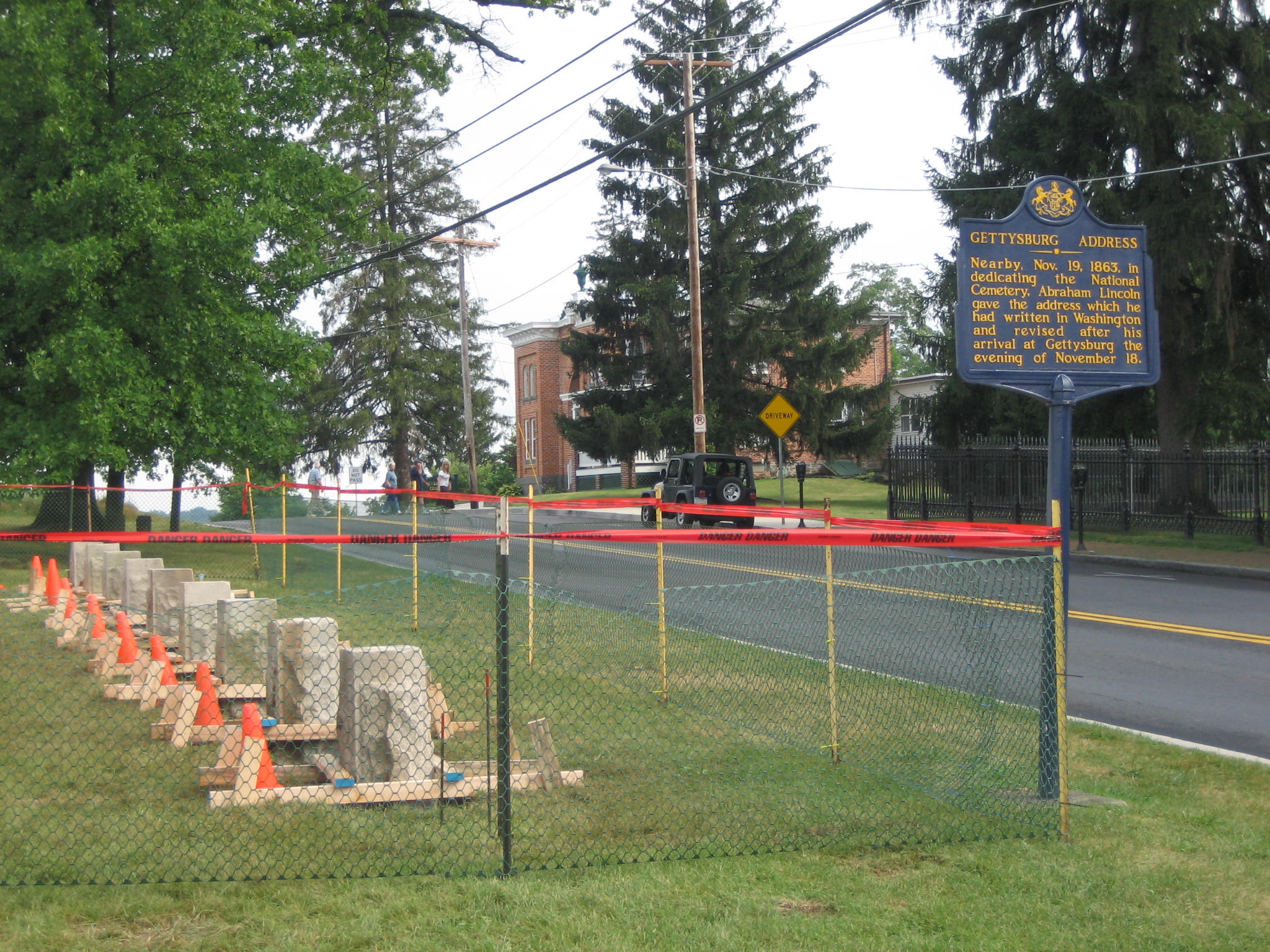
Itinerary tablets, or markers, which show actions taken by the Army of the Potomac each day from June 26, 1863 to July 5, 1863 are being placed on East Cemetery Hill on the east side of the Baltimore Pike. The tablets originally were on the top of East Cemetery Hill across the street from the Evergreen Cemetery Gatehouse, shown in the background of this photograph. This view was taken from the northeast facing southwest at approximately 5:00 PM on Wednesday, July 23, 2008.
When the War Department was first marking Gettysburg National Military Park, they included itinerary tablets for each army, stating what that army did from June 26th to July 5th, 1863. The itinerary tablets for the Confederate States’ Army of Northern Virginia have been in place on Seminary Ridge for over a year. There are 10 Confederate tablets. The tablets for the United States’ Army of the Potomac will soon be arriving on East Cemetery Hill, but there are only to be nine of those tablets. The Gettysburg Daily took photographs of the bases that are being placed on the east side of the Baltimore Pike.
Please see updates on the East Cemetery Hill Markers on July 31, 2008 , August 20, 2008, and August 21, 2008.
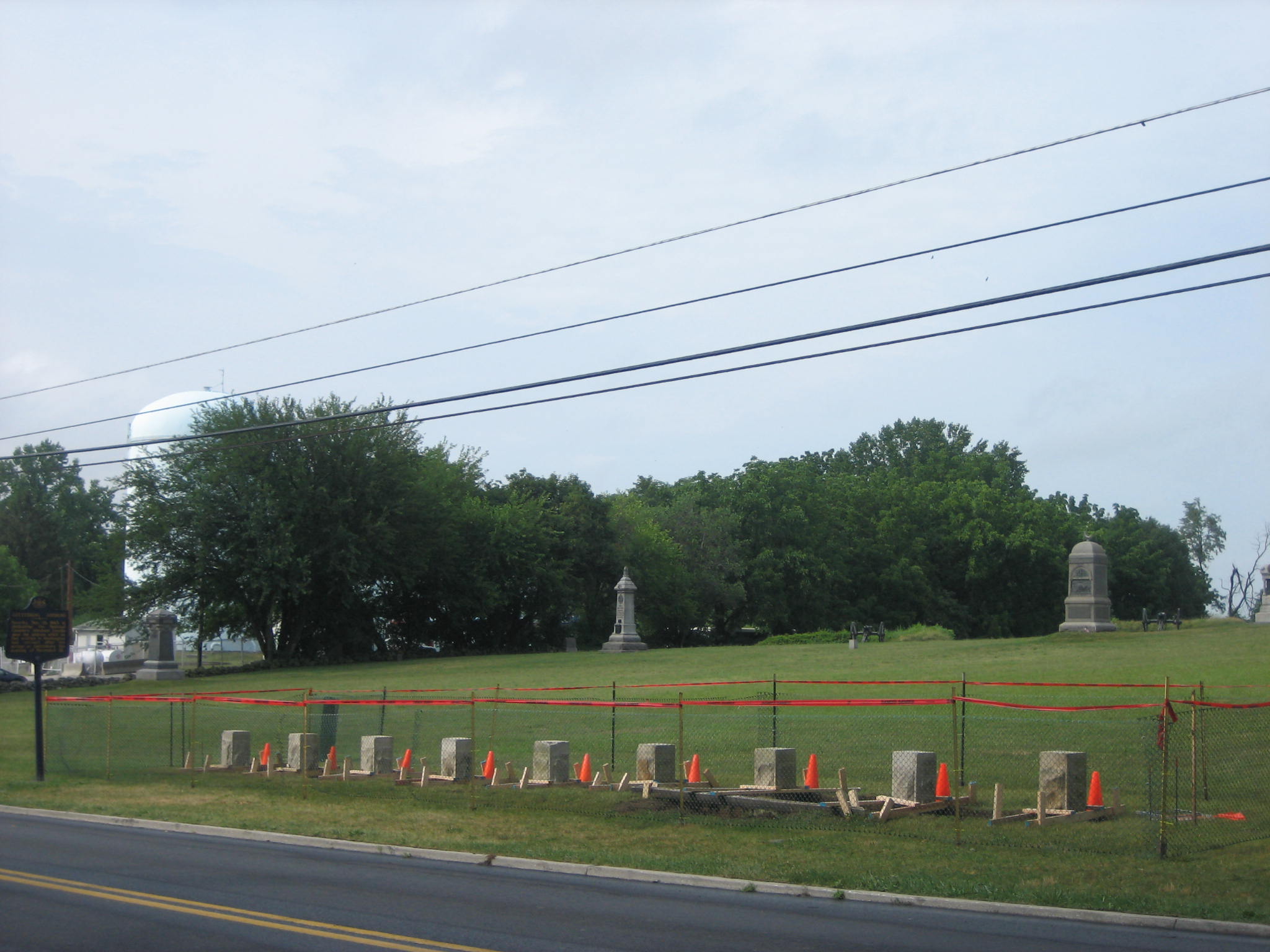
There are only nine markers being put in place for the Army of the Potomac itinerary tablets, but he Army of Northern Virginia has 10 tablets. This view was taken from the southwest facing northeast at approximately 5:00 PM on Wednesday, July 23, 2008.
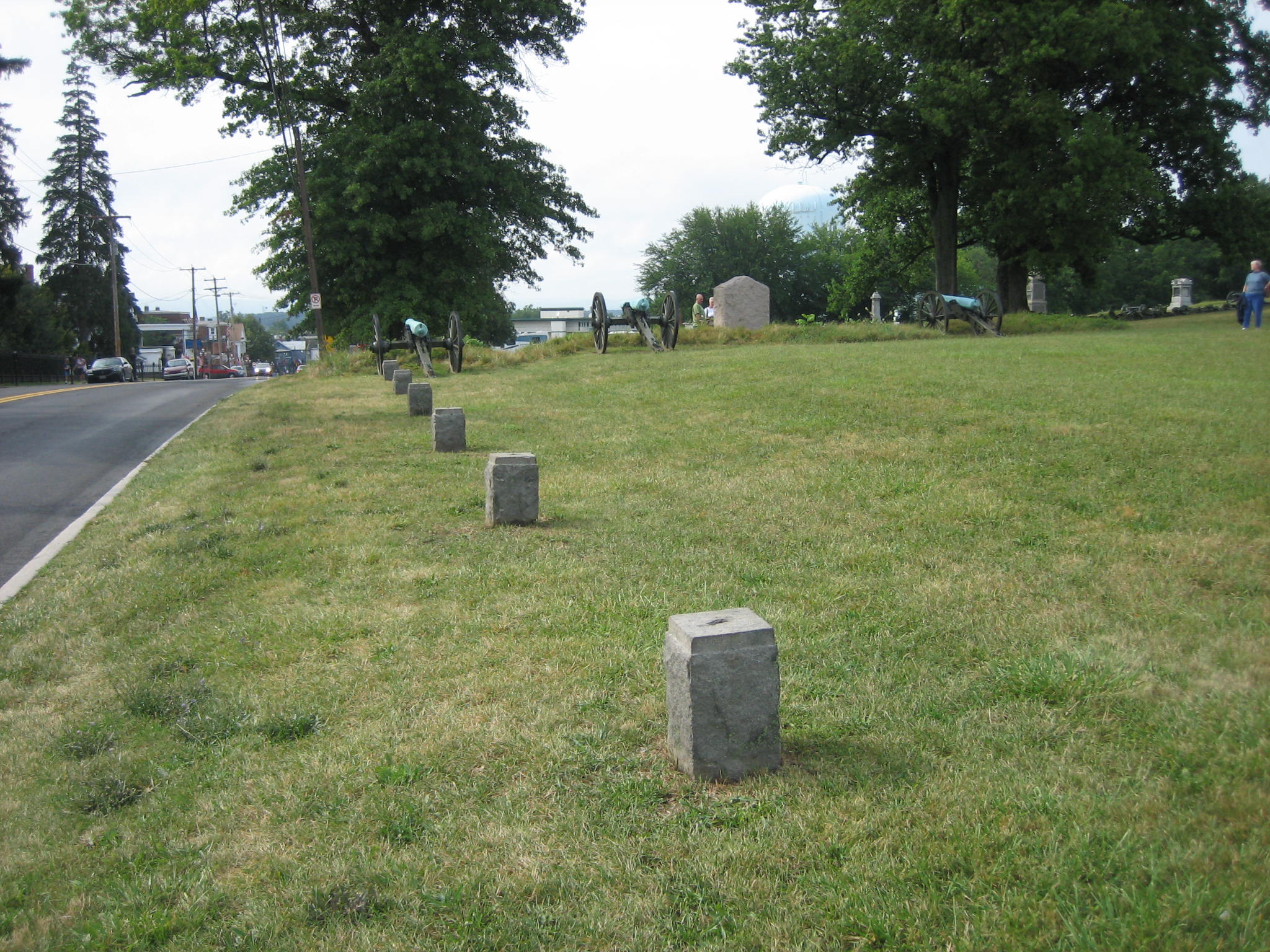
Some people think these were the original bases for the itinerary markers for the Army of the Potomac. However, there are only six of them, and only one hole on the top of each base. These bases were used to hold the metal piping for the old boundary fences erected by the United States government. The cannon and lunettes from Stewart’s Battery B, 4th U.S. Artillery are in the background. This view was taken from the south facing north at approximately 5:00 PM on Wednesday, July 23, 2008.

Notice the four holes on the top of the base needed to keep the itinerary tablets in place. Most of the base is located underneath the ground. This view was taken from the southwest facing northeast at approximately 5:00 PM on Wednesday, July 23, 2008.
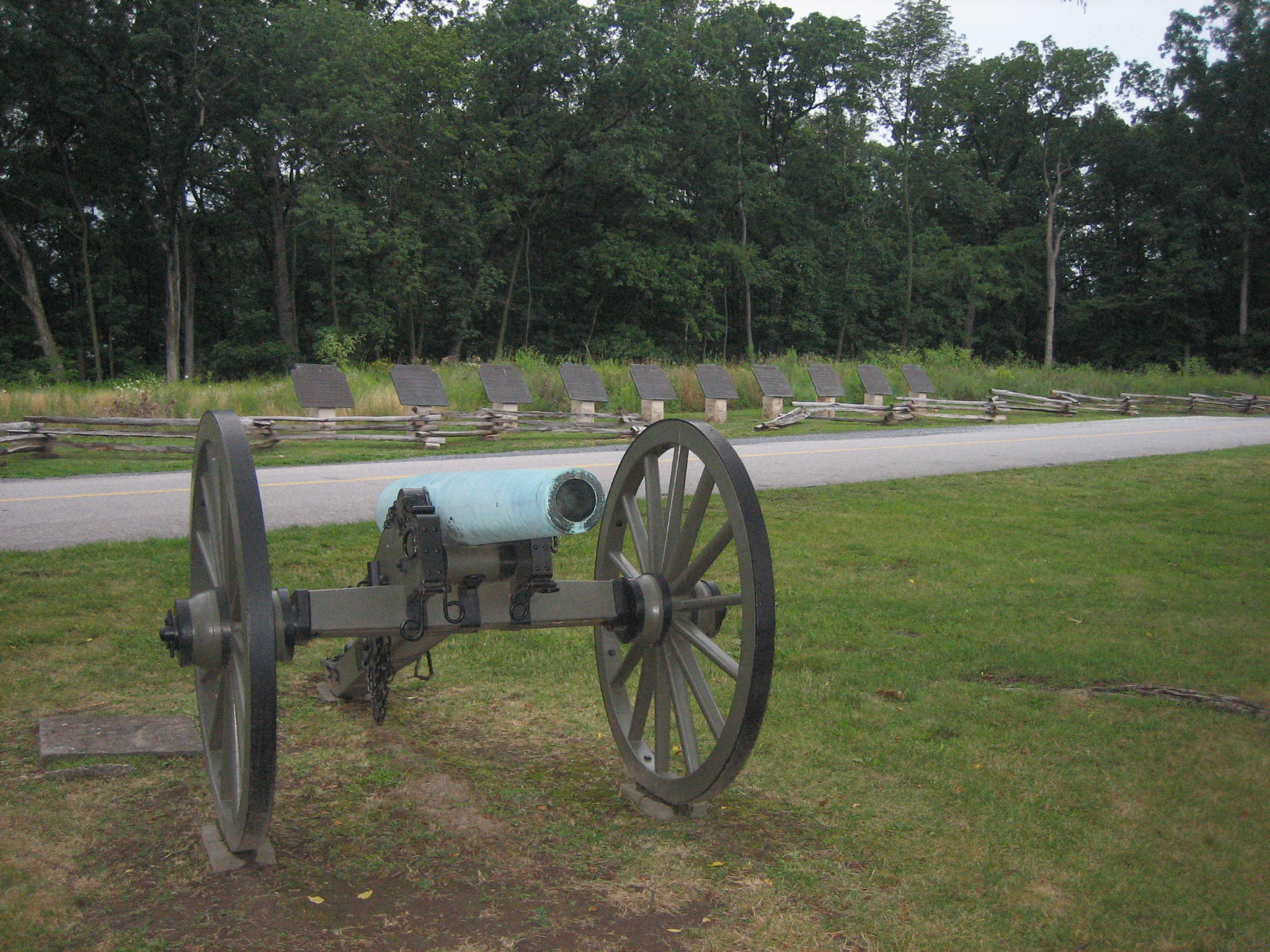
In the background are the Army of Northern Virginia itinerary tablets on Seminary Ridge across West Confederate Avenue from the National Guard Armory. This view was taken from the southeast facing northwest at approximately 7:50 PM on Wednesday, July 23, 2008.

Again, please notice that there are ten Confederate itinerary tablets. The earliest date is the far right (northern) marker (June 26th), and the latest date is the far left (southern) marker (July 5th). This view was taken from the northeast facing southwest at approximately 7:50 PM on Wednesday, July 23, 2008.
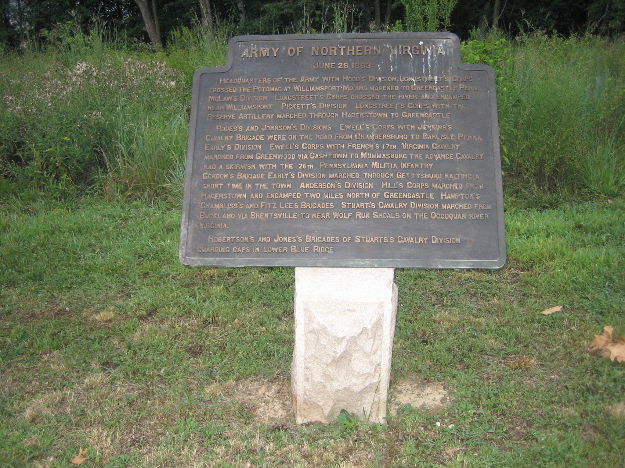
The itinerary tablets give the movements for the army on that day. Here is the Army of Northern Virginia itinerary tablet for June 26, 1863. This view was taken from the east facing west at approximately 7:50 PM on Wednesday, July 23, 2008.