

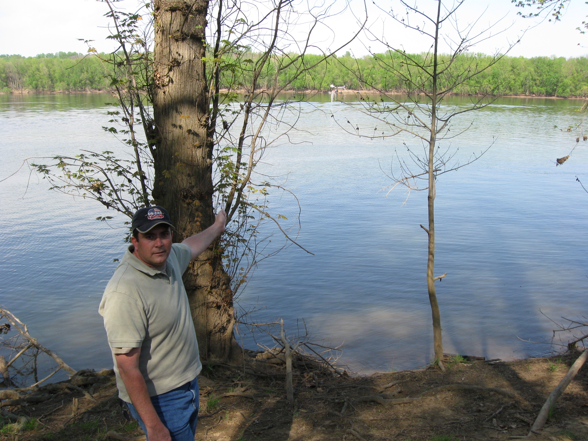
Craig Swain is a native of Missouri who now lives in Northern Virginia. He is standing at the location where Goose Creek on the left empties into the Potomac River on the right. This view was taken facing north at approximately 3:30 PM on Sunday, April 11, 2010.
The United States’ Army of the Potomac crossed the Potomac River near Leesburg, Virginia, from June 25-27, 1863. Historian Craig Swain describes this movement of men, animals, equipment and supplies, from Virginia to Maryland during the Gettysburg Campaign.
In today’s Edwards Ferry post, Craig Swain shows us where Goose Creek empties into the Potomac River, and points out other landmarks in the area where the Edwards Ferry pontoon bridges were constructed.
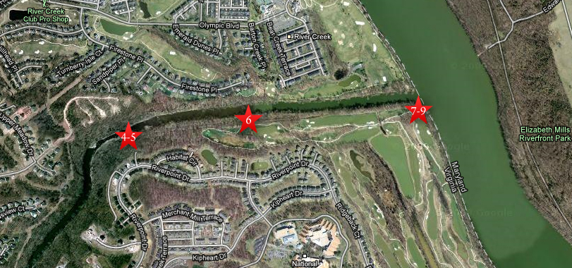
This map shows the location of the Edwards Ferry Videos. Video #s 1-3 were shown in our first Edwards Ferry post. Videos #4-5 were taken along Goose Creek near the site of Kephart’s Mill. Video #6 was taken near one of the canal locks of the Goose Creek canal. Videos #7-9 were taken along the Virginia side of the Potomac River at the mouth of Goose Creek. This map was created facing north at approximately 4:30 PM on Sunday, April 25, 2010.
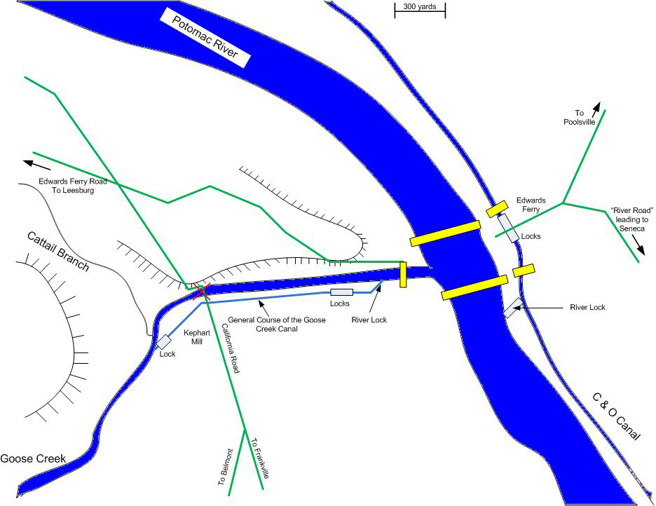
This map shows some of the important locations along Goose Creek including the Goose Creek Canal, the locks of the canal, and the California Road crossing Goose Creek. The red X shows that the bridge had been destroyed earlier in the war, so was not available in 1863. In yellow are the pontoon bridges of the Army of the Potomac constructed in June, 1863. One bridge crosses Goose Creek (Craig will show where he believes its location was in our last picture on this post), the two pontoon bridges crossing the Potomac River at Edwards Ferry, and the bridges crossing the Chesapeake and Ohio Canal on the east (Maryland) side of the Potomac River. In today’s post, Craig shows us where Goose Creek empties into the Potomac River. The map was provided by Craig Swain.
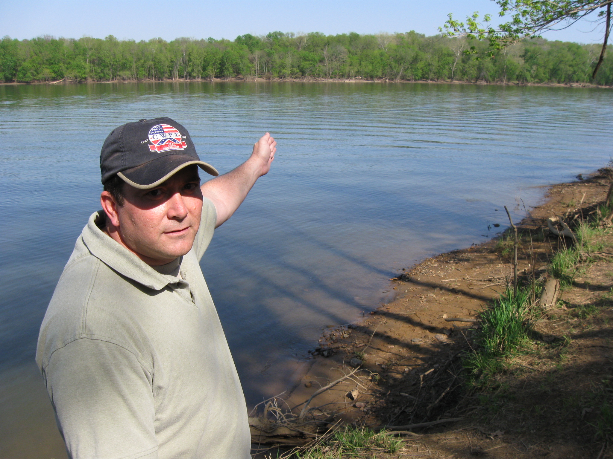
In Video #7 (Videos #1-#6 were shown in our previous Edwards Ferry post) Craig Swain is standing on the Virginia side of the Potomac River where Goose Creek empties into the Potomac. He shows the location of the first pontoon bridge constructed across the Potomac River by soldiers in Major General Henry Slocum’s Twelfth Corps. This view was taken facing north to east at approximately 3:30 PM on Sunday, April 11, 2010.
Craig Swain is on the Virginia side of the Potomac River pointing to the boat ramp on the Maryland side of the Potomac. The boat ramp is where the light colored objects (boats and cars) are in the distance. The Potomac River runs from left to right or north to south. The first pontoon bridge was upstream, or to the left of, the current boat landing near Chesapeake and Ohio Canal Lock #25. This view was taken facing east at approximately 3:30 PM on Sunday, April 11, 2010.
In Video #8, Craig Swain not only reminds us where we are, he shows us the location of the River Lock on the Maryland side of the Potomac. This River Lock for the Chesapeake and Ohio Canal enabled goods from that canal to be brought to the Virginia side of the Potomac (where Craig is standing) and be transported along the Goose Creek canal. This view was taken facing north to east to southeast at approximately 3:30 PM on Sunday, April 11, 2010.
Historian Craig Swain is pointing to the location of the River Lock on the Maryland side of the Potomac River. This view was taken facing southeast at approximately 3:30 PM on Sunday, April 11, 2010.
In Video #9, Craig Swain explains the conditions under which the first pontoon bridge was constructed, and reminds us of its purpose. This view was taken facing north to northeast at approximately 3:30 PM on Sunday, April 11, 2010.