

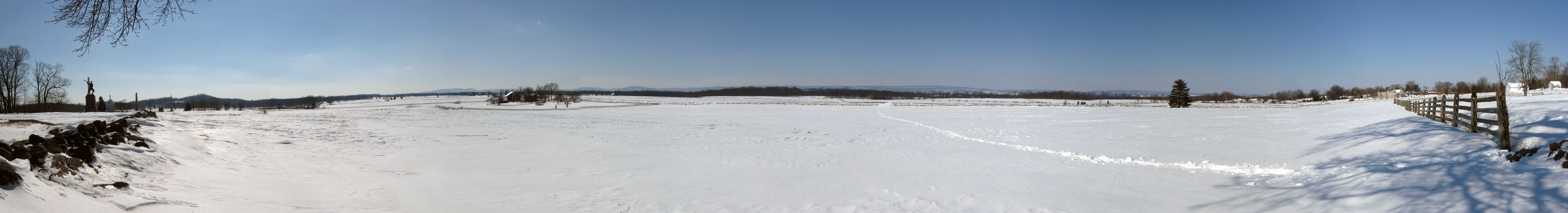
Today we are introducing another new panorama at the famous outer “Angle” at the stone wall in the High Water Mark area. To our left we can see the Copse/Clump of Trees, the monument to the 72nd Pennsylvania Infantry Regiment, and the Round Tops. The Codori Farm is visible to the front left. The Pickett’s Charge fields are before us, as is the treeline on Seminary Ridge. On the far right are the white buildings at the Bryan Farm. To the left we are facing south, to the right we are facing north. This view was taken at approximately 12:55 PM on Friday, February 12, 2010. For a medium-sized version of the panorama click here. For the larger JPEG version, click here. If you’d like to see the uncompressed TIFF file, you can download it here (28.3 MB).
We have put off doing a panorama of “the Angle” before this time because of the high traffic area that it is. But since the National Park Service had not yet plowed Hancock Avenue from the Pennsylvania Monument to around Meade’s Equestrian statue, we decided that a lot of people wouldn’t be a problem Friday. As you look across the fields of Pickett’s Charge, notice how high the snow is piled at the fences along the Emmitsburg Road. One person before us had obviously made the trek from the Emmitsburg Road to the area where we are standing, as their trail is visible. We are standing in front of the wayside exhibit for the Angle, in front of, or west of the wall. We will show you how we got there over the next three or four posts this week.