

Gettysburg Licensed Battlefield Guide Anthony Kellon is an attorney in the Cuyahoga County, Ohio Public Defender’s Office. Tony has been a Licensed Battlefield Guide since 2006. He continues his series on United States Major General John Gibbon. Tony is standing near the monument to the 106th Pennsylvania Infantry Regiment of Webb’s Brigade near the Codori Farm. This view was taken facing southeast at approximately 4:00 PM on Sunday, November 8, 2009.
In today’s post on John Gibbon, Gettysburg Licensed Battlefield Guide Anthony Kellon shows the relationship between the 15th Massachusetts and the 1st Massachusetts Sharpshooters. He also shows the position of some companies of the 106th Pennsylvania on July 2, 1863.
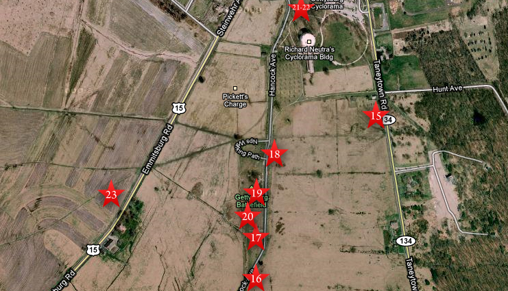
This map shows the location of the videos taken during our series on John Gibbon. Videos #1-14 were shown in our previous Gibbon posts. Video #15 was taken at the headquarters marker for Brigadier Henry Hunt on the Taneytown Road. Video #16 was taken at the marker for the Second Division of the Second Corps (Gibbon’s Division) on Cemetery Ridge’s Hancock Avenue. Video #17 was taken at the U.S. Regulars Monument on Cemetery Ridge. Video #18 was taken at the monument to Brigadier General Alexander Webb on Cemetery Ridge. Video #19 was taken at the position of the brigade commanded by Colonel Norman J. Hall. Video #20 was taken at the position of the brigade commanded by Brigadier General William Harrow. Videos #21 and #22 were taken north of the “old” Cyclorama building. Video #23 was taken west of the Codori Farm. This map was created facing north at approximately 5:30 PM on Saturday, November 28, 2009.

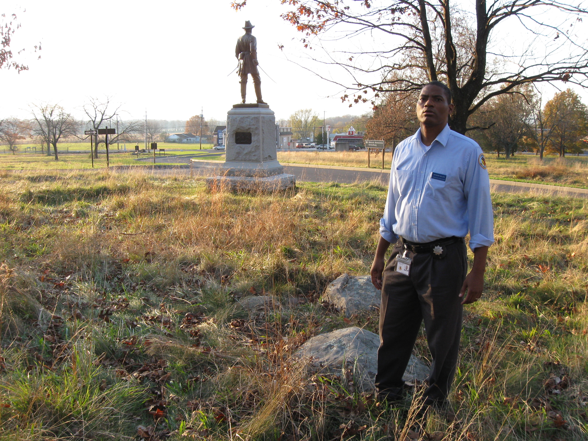
Gettysburg Licensed Battlefield Guide Tony Kellon is standing near the monument to the 15th Massachusetts Infantry Regiment on Cemetery Ridge. The 15th Massachusetts was part of Harrow’s Brigade of Gibbon’s Division. This view was taken facing northwest at approximately 4:00 PM on Sunday, November 8, 2009.
In Video #21 (Videos #1-20 were shown in our previous Gibbon posts) Gettysburg Licensed Battlefield Guide Anthony Kellon is standing near the marker to the First Massachusetts Infantry Regiment. He explains that the First Massachusetts duty on July 2, 1863 was to harass Confederate artillery on Seminary Ridges. This view was taken facing south to west at approximately 4:00 PM on Sunday, November 8, 2009.

Gettysburg Licensed Battlefield Guide Tony Kellon is standing by the marker for the First Massachusetts Sharpshooters. Although they were an independent unit, they cooperated with the 15th Massachusetts Infantry Regiment. This view was taken facing south at approximately 4:00 PM on Sunday, November 8, 2009.
In Video #22 Licensed Battlefield Guide Anthony Kellon is standing north of the “old” Cyclorama Building, and behind (east of) the statue to Brigadier General Alexander Hays. He gives us a better view of the Confederate position on Seminary Ridge. This view was taken facing west at approximately 4:00 PM on Sunday, November 8, 2009.
Licensed Battlefield Guide Anthony Kellon is standing north of the “old” Cyclorama Building, and behind (east of) the statue to Brigadier General Alexander Hays. Seminary Ridge is the distant treeline to the left of Hays’ monument. This view was taken facing west at approximately 4:00 PM on Sunday, November 8, 2009.
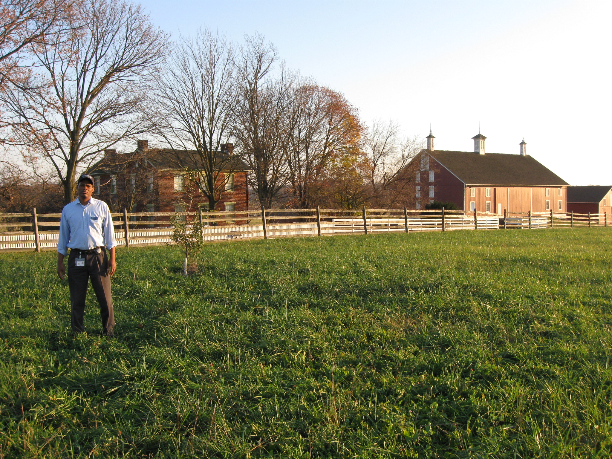
Tony Kellon has now moved west of the Codori Farm. The Emmitsburg Road runs between the white pickett fence and the post and rail fence. This view was taken facing southeast at approximately 4:00 PM on Sunday, November 8, 2009.
In Video #23 Tony Kellon is standing west of the Codori Farm. He explains how two companies (he mistakenly said “regiments” at the beginning of the video) of the 106th Pennsylvania Infantry Regiment will advance to this position and then towards the Bliss Farm. This view was taken facing southeast to east to northeast to northwest at approximately 4:00 PM on Sunday, November 8, 2009.

Tony Kellon is west of the Emmitsburg Road near the Codori Farm. The obelisk shaped U.S. Regulars monument, which is located on Cemetery Ridge in the left background, marks the approximate center of Gibbon’s line. This view was taken facing east at approximately 4:00 PM on Sunday, November 8, 2009.