

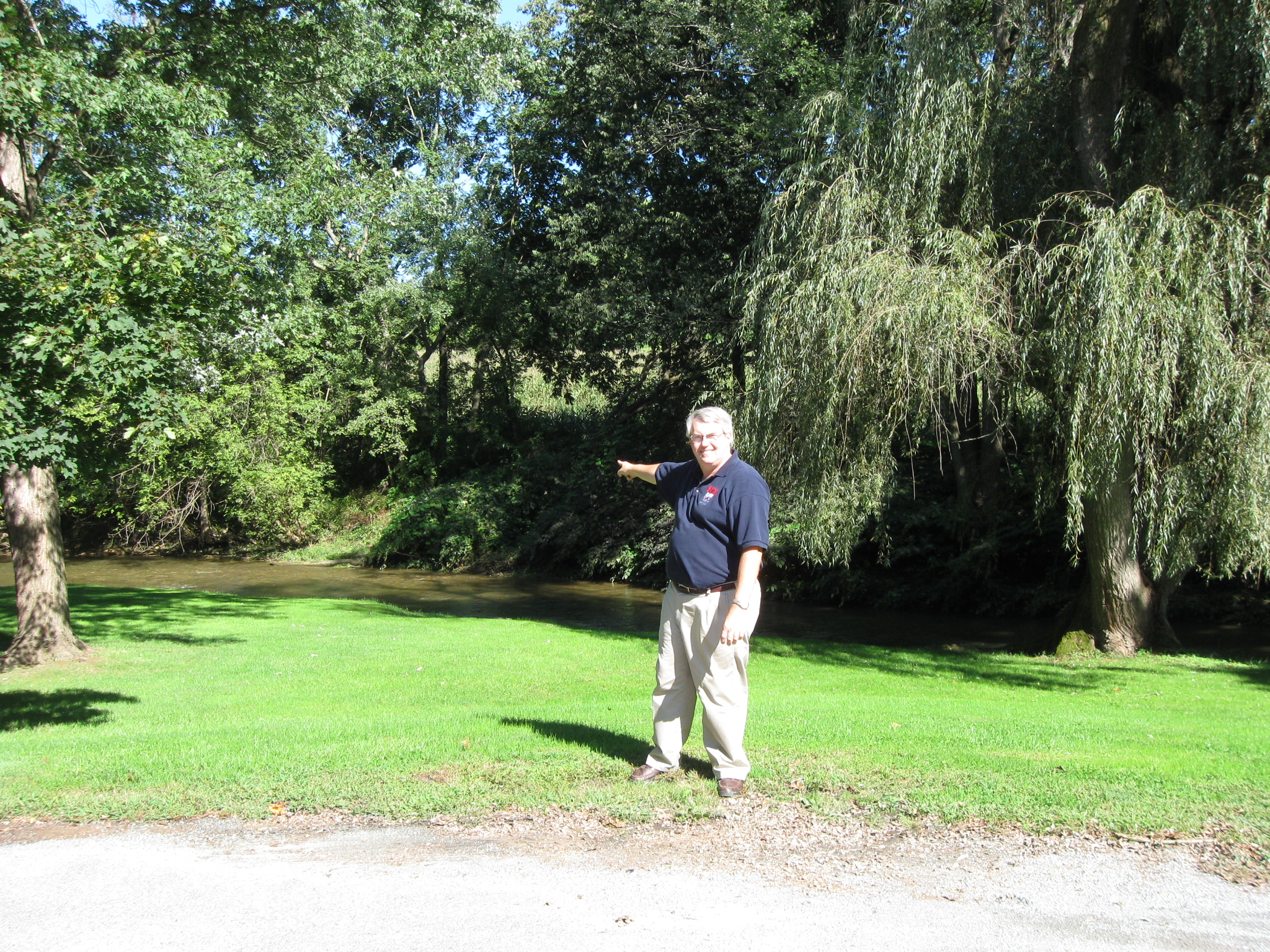
York County Heritage Trust Sanctioned Civil War Guide Scott Mingus is standing on the cul de sac at Meadow Lane south of Wrightsville. The Confederates overran the Union defenses near this location. This view was taken facing southeast at approximately 3:15 PM on Sunday, September 13, 2009.
In today’s post, author Scott Mingus shows us where the Confederates broke through the Wrightsville defenses south of the town, describes the artillery used, and the contributions of African Americans to the battle.

This map shows the location of where our Wrightsville videos were produced. Video #1-#6 were shown in our previous Wrightsville posts. Videos #5 and #6 were taken at the intersection of the Lincoln Highway and Cool Creek Road. Videos #7 -#9 were taken on Cool Creek Road near the Rutter’s convenience store. Video #10 was taken at Meadow Lane, south of Wrightsville. Videos #11 and #12 were taken at the intersection of Hellam Street and 4th Street in Wrightsville. This map was created facing north at approximately 7:00 PM on Thursday, September 17, 2009.
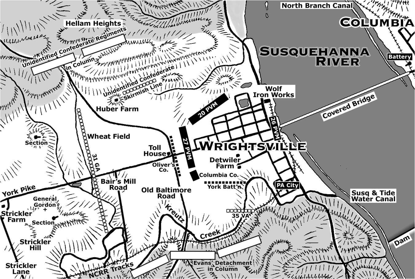
This map shows the units defending Wrightsville and the position of the Confederate units as they advanced on the defenses. Copyright Scott L. Mingus, Sr.; drawn for Flames Beyond Gettysburg by Tom Poston. All rights reserved.
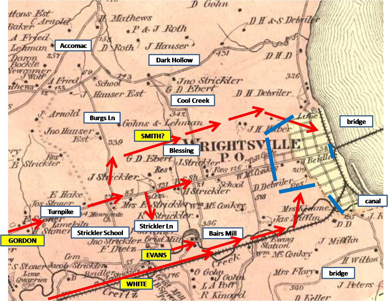
This 1876 map of Wrightsville shows landmarks, Confederate troop movements in red, and the Union defenses in blue. This map was created in 1876.
In Video #10 (Videos #1- #9 were shown in our previous Wrightsville posts) York County Heritage Trust Sanctioned Guide Scott Mingus is standing at the cul de sac on Meadow Lane south of Wrightsville. He describes how the Confederates broke through the Union defenses in this area. This view was taken facing southeast to northwest at approximately 3:15 PM on Sunday, September 13, 2009.
Georgians crossed Kreutz Creek near this location… This view was taken facing east at approximately 3:15 PM on Sunday, September 13, 2009.

…and moved uphill towards the Union defenses. This view was taken facing northwest at approximately 3:15 PM on Sunday, September 13, 2009.

Scott Mingus is standing at the intersection of Hellam Street and 4th Street. The artillery pieces mark the farthest eastern advance of the Confederates “during the Civil War” although this mostly true of the Pennsylvania campaign. This view was taken facing north at approximately 3:15 PM on Sunday, September 13, 2009.
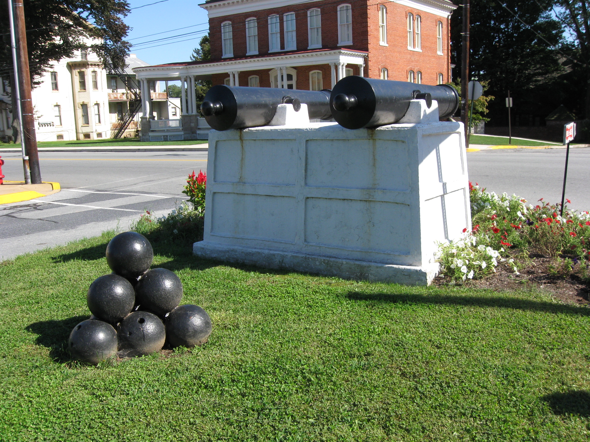
The artillery pieces even come with ammuntion, which is more than the United States had for their artillery pieces during the Battle of Wrightsville. This view was taken facing southeast at approximately 3:15 PM on Sunday, September 13, 2009.
In Video #11 Sanctioned Civil War Guide Scott Mingus is standing in Wrightsville at the intersection of Hellam Street and 4th Street. He shares information about the artillery used and not used during the battle, and a story about civilians hiding in their homes. This view was taken facing southeast to north at approximately 3:15 PM on Sunday, September 13, 2009.

Scott Mingus is pointing north down 4th Street. Locust Street runs right to left behind the white van in the background. This view was taken facing north at approximately 3:15 PM on Sunday, September 13, 2009.
In Video #12 Scott Mingus is standing in Wrightsville at the intersection of Hellam Street and 4th Street. He describes the contributions of African Americans to Wrightsville’s defenses. This view was taken facing southeast at approximately 3:15 PM on Sunday, September 13, 2009.