Battle for Hanover Part 2 With Licensed Battlefield Guide John Krepps
June 30, 2009
J.E.B. Stuart probably arrived at Union Mills, Maryland, from Westminster, Maryland early in the morning of June 30, 1863. He stayed at the home of Confederate sympathizer William Shriver. This drawing was produced facing south.
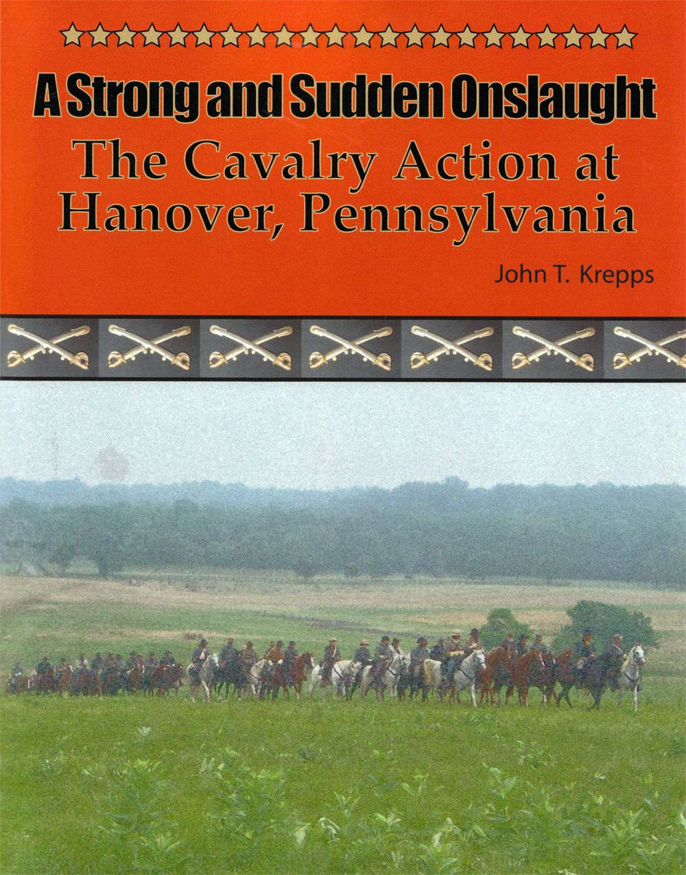
The Battle for Hanover is a not very well known, but very important action in the Gettysburg Campaign. Licensed Battlefield Guide John Krepps has written a book on this event: A Strong and Sudden Onslaught, The Cavalry Action at Hanover, Pennsylvania. John will be the host for our series on the events leading up to the battle, and the battle itself. John is a McSherrystown, Pennsylvania native, a Hanover, Pennsylvania resident, and has been a Licensed Battlefield Guide since 1995. He had four ancestors who fought in the Civil War, all with Pennsylvania units. One relative fought on Gettysburg’s East Cemetery Hill the night of July 2, 1863.
In today’s post we continue our visit to Union Mills and look at the route of the Old Hanover Road.
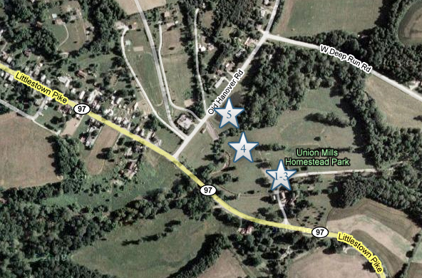
This map shows the location of where our Battle of Hanover videos were produced. Videos #1-#3 were taken near the main cluster of buildings at Union Mills, Maryland. Video #4 was taken in a large field at Union Mills south of Big Pipe Creek. Video #5 was taken north of Big Pipe Creek. This map was created facing north at approximately 4:00 PM on Tuesday, June 23, 2009.
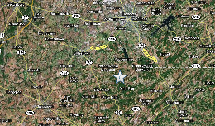
This map shows the location of where our videos were produced on the Old Hanover Road. Video #6 was taken at the intersection of Old Hanover Road and Leppo Road. This map was created facing north at approximately 4:00 PM on Tuesday, June 23, 2009.
Gettysburg Licensed Battlefield Guide John Krepps is the author of the book, A Strong and Sudden Onslaught, The Cavalry Action at Hanover, Pennsylvania. He is the host for our series on the movements to Hanover and the fighting within the borough. John is standing north of Big Pipe Creek at Union Mills, Maryland. Big Pipe Creek is the muddy water in the right background. This view was taken facing southeast at approximately 2:30 PM on Thursday, June 11, 2009.
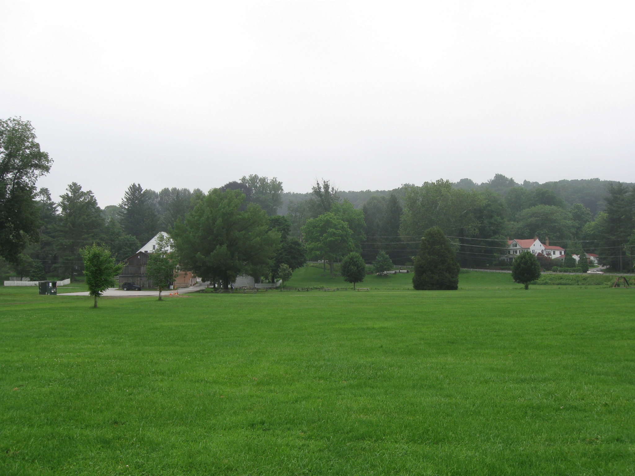
The cluster of buildings at Union Mills is in the left background. The William Shriver House is the white building in the right background. This view was taken facing southeast at approximately 2:30 PM on Thursday, June 11, 2009.
In Video #4 (Video #s 1-3 were shown in our first Battle of Hanover post) Gettysburg Licensed Battlefield Guide John Krepps describes J.E.B. Stuart’s arrival in Union Mills, and the route most of his men would take as they moved to Hanover. This view was taken facing southeast to northeast at approximately 2:30 PM on Thursday, June 11, 2009.
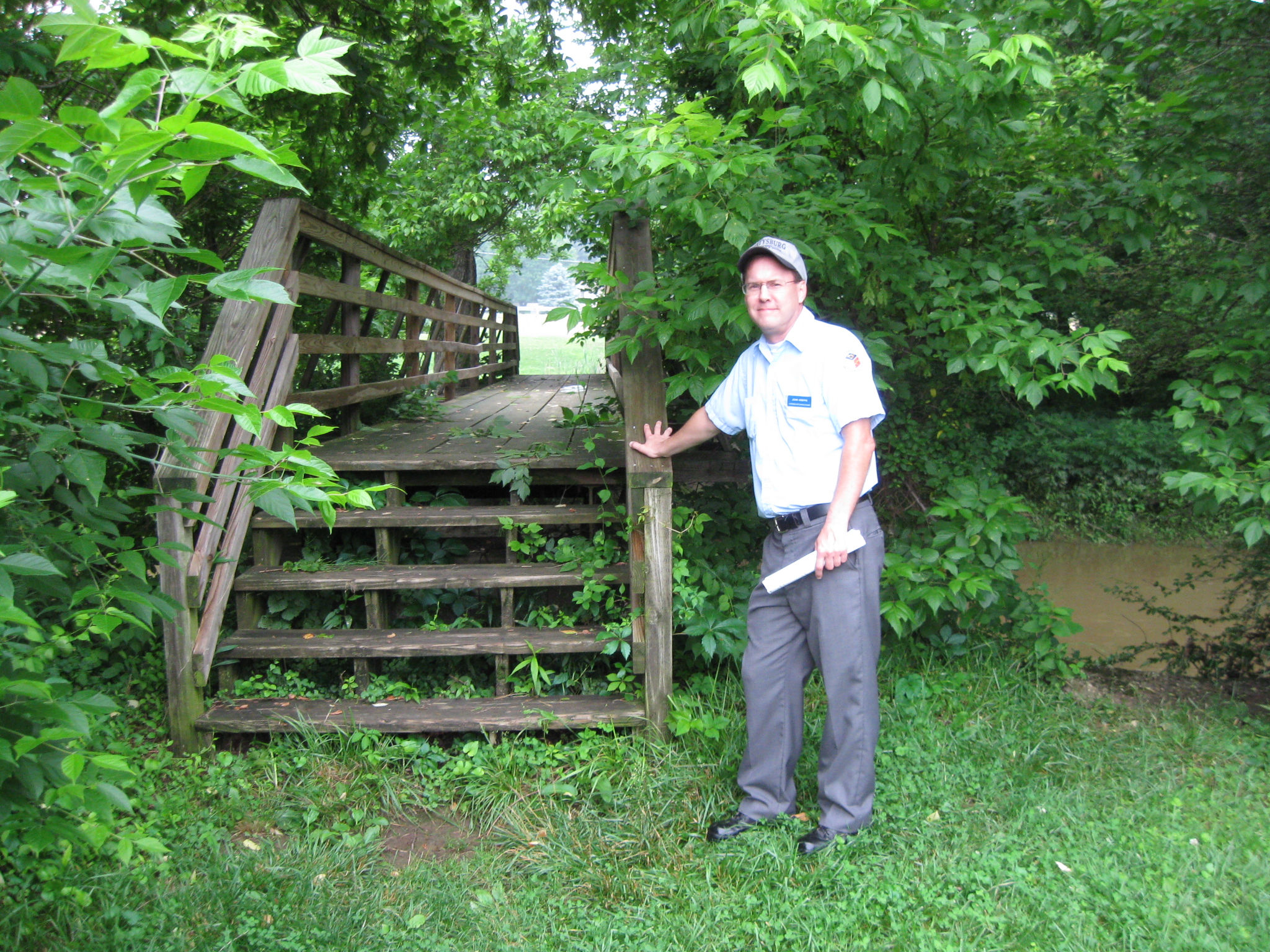
We crossed a footbridge over Big Pipe Creek. At the time of the battle, there was a bridge here wide enough to accommodate wagons. This view was taken facing southeast at approximately 2:30 PM on Thursday, June 11, 2009.
It is believed that some of the stones shown here were part of the bridge in this location during the 1860s. This view was taken facing east at approximately 2:30 PM on Thursday, June 11, 2009.
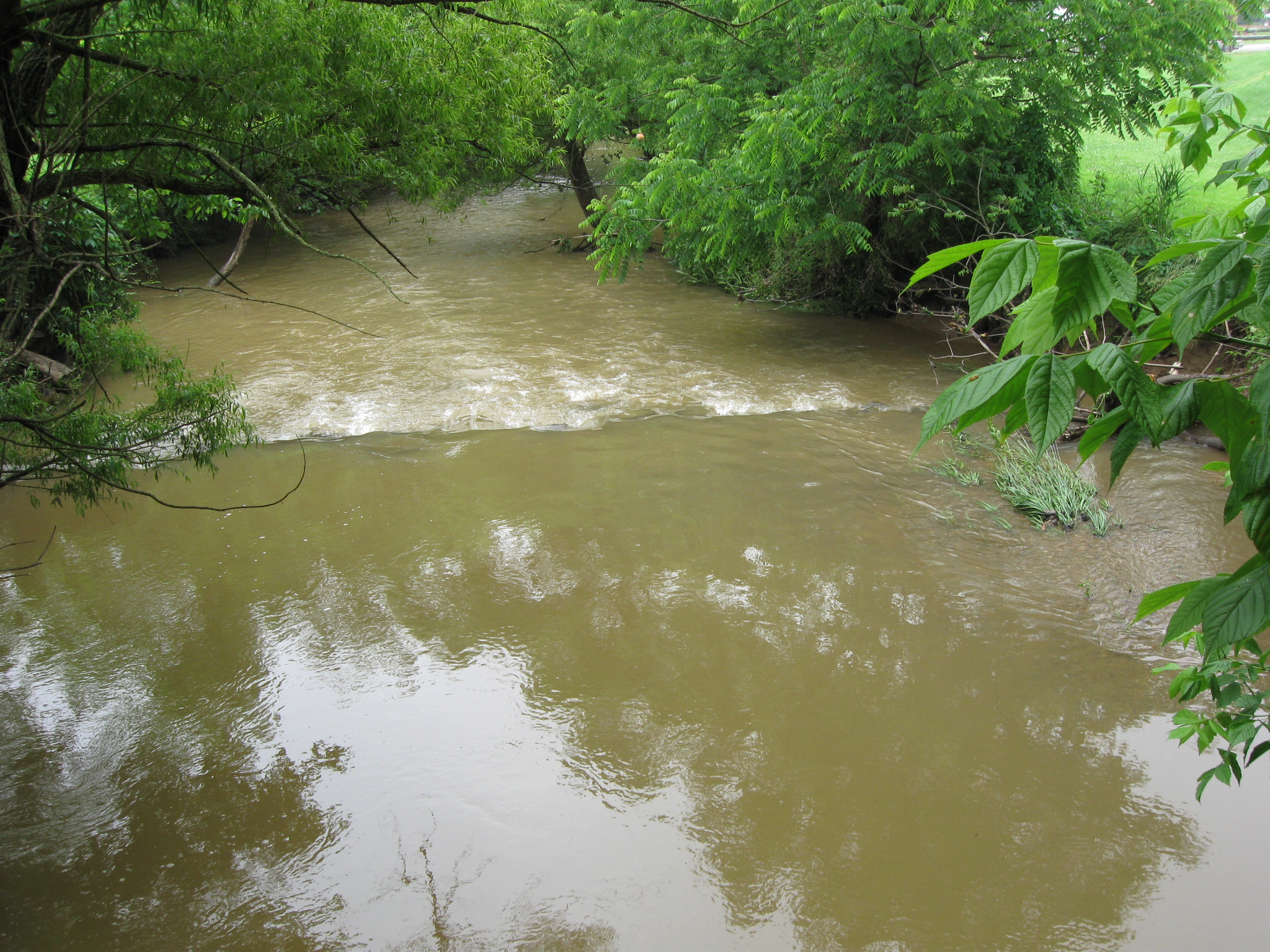
The recent rains have made Big Pipe Creek a fast moving, muddy stream. This view was taken facing west at approximately 2:30 PM on Thursday, June 11, 2009.
In Video #5 Licensed Battlefield Guide John Krepps is standing on the north side of the bridge (and of Big Pipe Creek) and shows us where the Old Hanover Road was located in this area. This view was taken facing southeast to northeast at approximately 2:30 PM on Thursday, June 11, 2009.
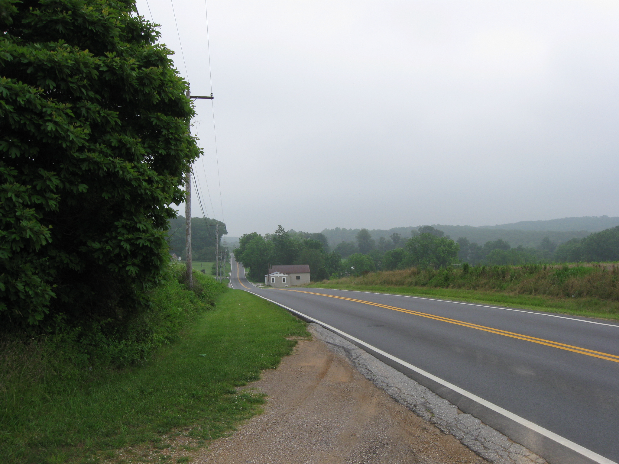
The Old Hanover Road is a series of ridges between Union Mills and Hanover. Twelve significant ridges made travel very difficult for the wagon train Stuart’s men were bringing with them. This view was taken facing northeast at approximately 2:30 PM on Thursday, June 11, 2009.
In Video #6 John Krepps is at the intersection of the Old Hanover Road and Leppo Road. He shows us some of the ridges and how crossing them will affect Stuart’s column. This view was taken facing southwest to northeast at approximately 2:30 PM on Thursday, June 11, 2009.