Licensed Battlefield Guide Rich Kohr: Gettysburg’s Electric Trolley Part 9
May 8, 2009
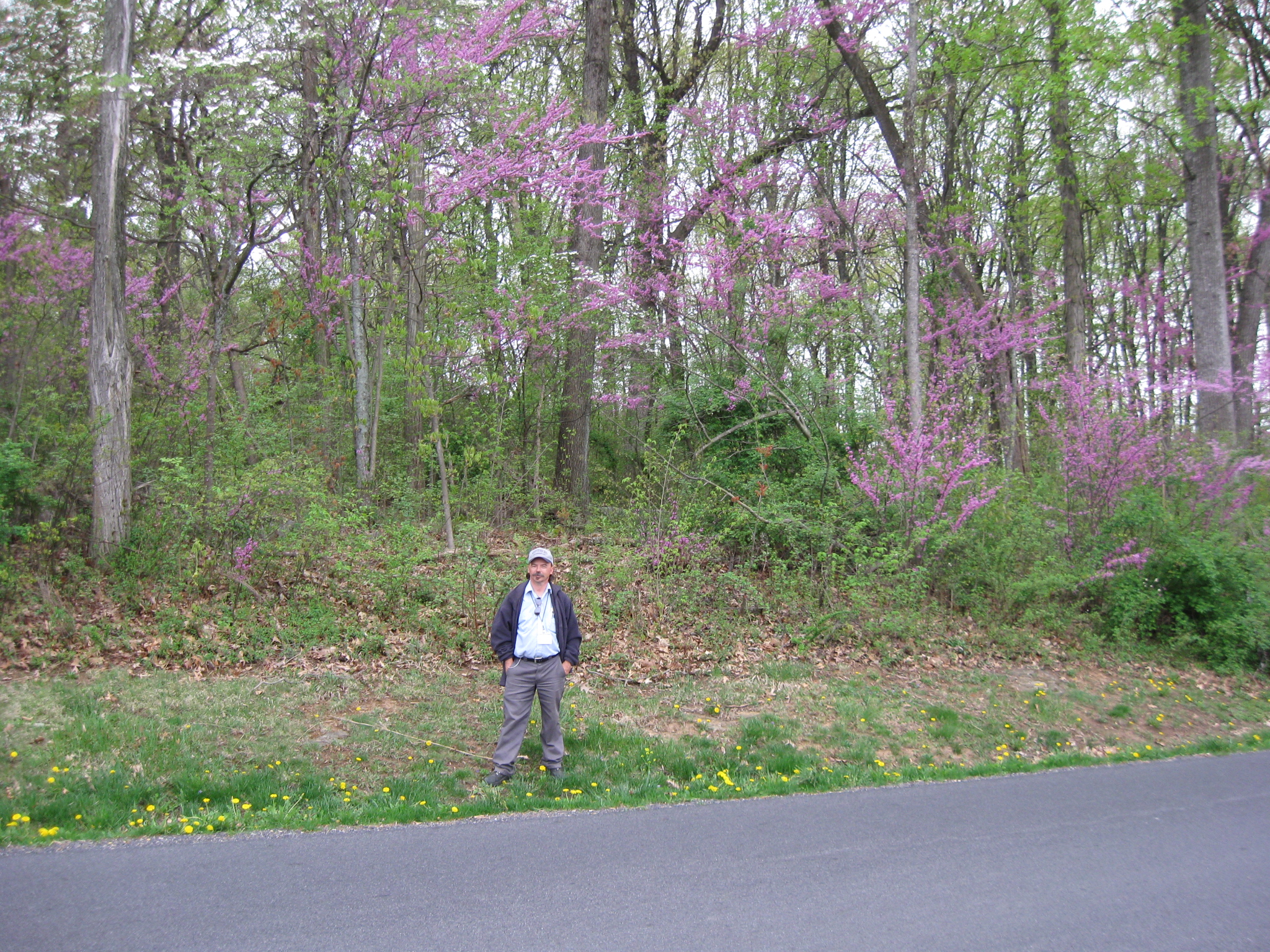
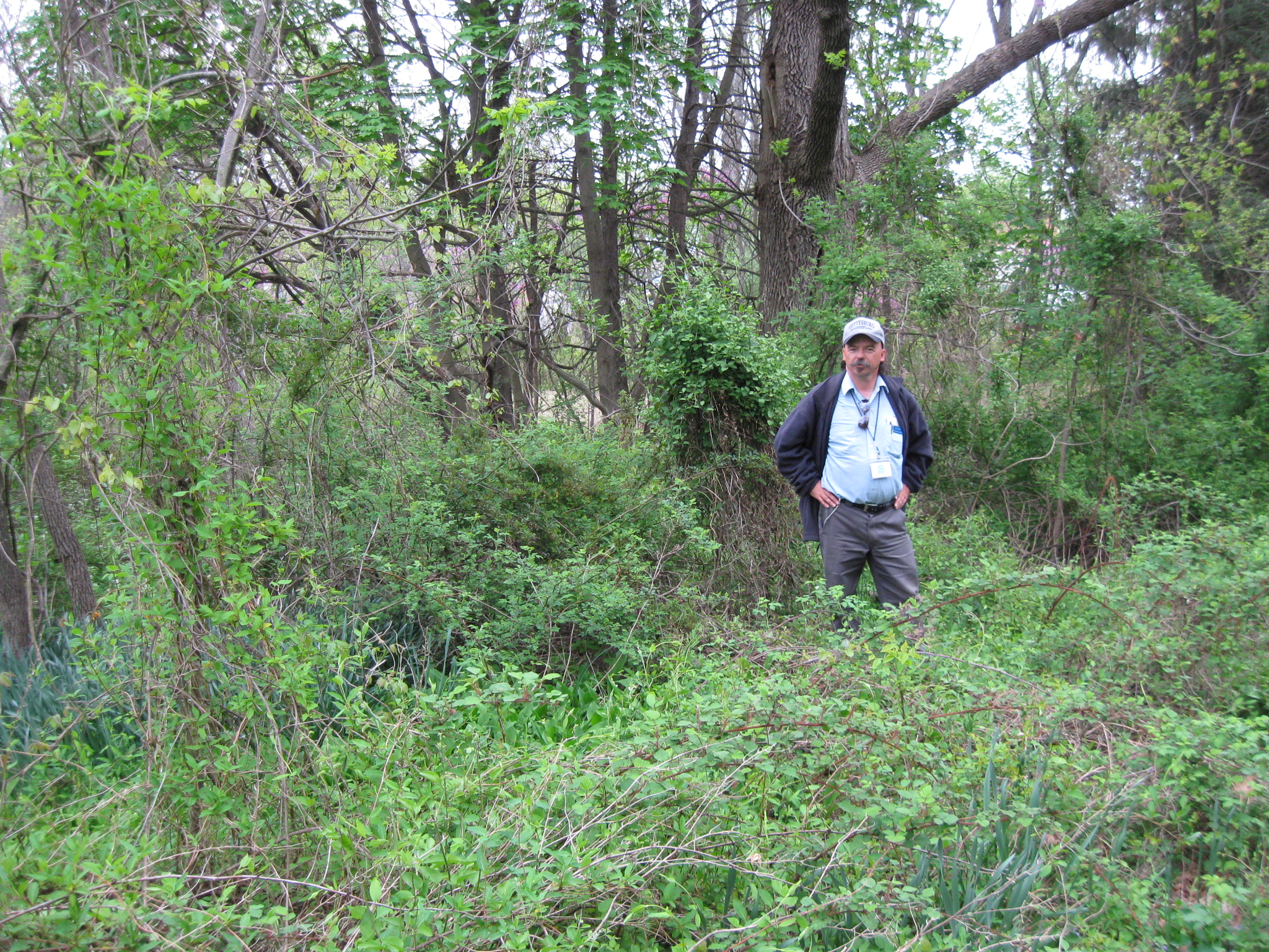
In today’s trolley post, Gettysburg Licensed Battlefield Guide Rich Kohr shows where the Gettysburg Electric Trolley came out of the woods directly behind him on the north side of Little Round Top, and south of the Wheatfield Road (in the foreground). This view was taken facing southwest at approximately 5:30 PM on Thursday, April 30, 2009.
With this post, we are concluding our series on the Gettysburg Electric Trolley, which existed from 1893 to 1916. In our first trolley post, Gettysburg Licensed Battlefield Guide Rich Kohr took us from the Electric Power Station in the town of Gettysburg, over Cemetery Hill to Evergreen Cemetery. In our second post, Rich took the trolley out of Evergreen Cemetery, around the area of the “old” National Park Service Visitor Center, and showed how it was not allowed to continue along its proposed route on Cemetery Ridge. Our third post showed that because the trolley couldn’t travel on Cemetery Ridge, the “outbound” route needed to go to the Emmitsburg Road, where there were some other options, including double tracks at the Klingel Farm. The fourth trolley post took the trolley south along the Emmitsburg Road to where it turns on the Wheatfield Road at the Peach Orchard. The fifth trolley post took the trolley into the Wheatfield area. Our sixth trolley post covered “the big fill” near Plum Run, and the worst trolley accident. Our seventh post covered the Devil’s Den area and an automobile-trolley accident. In our eighth post the trolley came across Plum Run Valley (Valley of Death) and climbed the north slope of Little Round Top. In today’s post, we conclude our trolley posts by showing the two different locations that the line ended on the north slope of Little Round Top.
We would like to thank the following individuals for their assistance, photographs, etc… on our Gettysburg Electric Trolley Posts:
Gary Adelman
Sue Boardman
Dr. Ben Dixon
Rich Kohr
Phil Lechak
Tim Smith
Don Walters
Michael Waricher
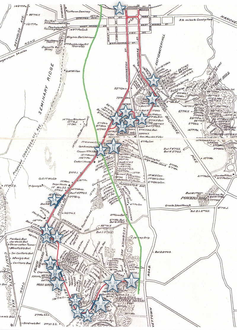
This map shows the route of the trolley. The red line is the trolley route. The green line is the route of the Gettysburg/Harrisburg/Reading Railroad. For some time, the trolley used the Gettysburg/Harrisburg/Reading Railroad line from the Emmitsburg Road to Little Round Top to help establish a circular route on the battlefield. The blue sections are where the trolley had double or passing tracks. The white stars are the locations where we filmed videos, which we have numbered. Today’s post features videos #s 31-32. This map was created at approximately 8:00 PM on Wednesday, May 6, 2009.
See our posts on the Gettysburg Harrisburg Railroad here.
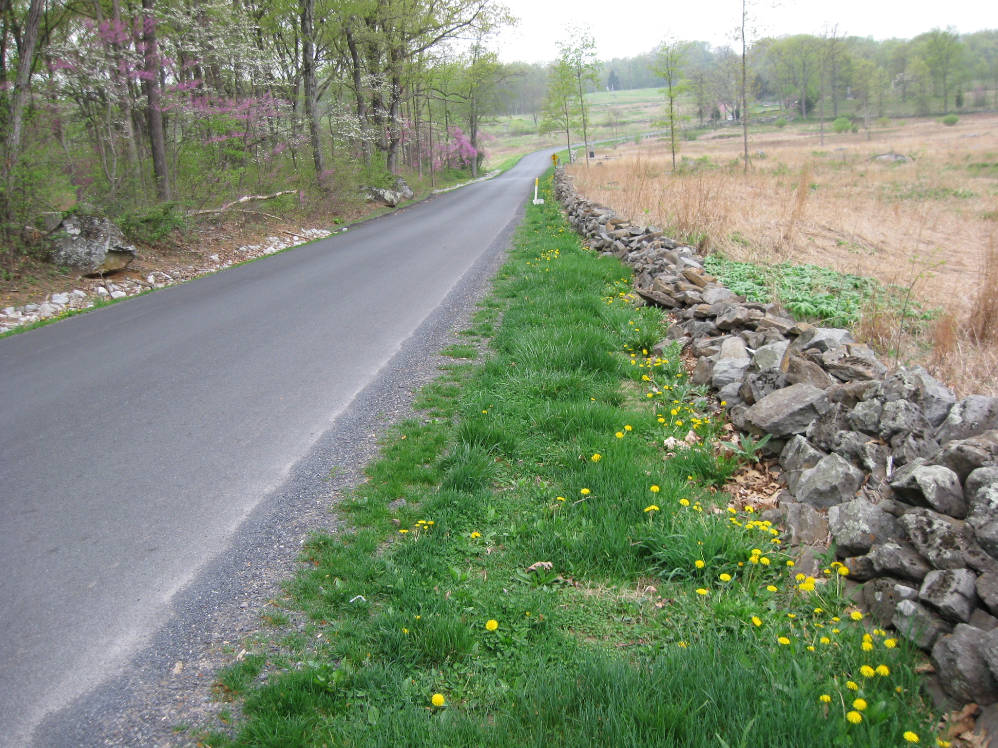
The trolley came out of the woods on the left, and crossed from left to right (south to north) to the north side of the Wheatfield Road. Notice how at the bottom of the slope the rock wall was closer to the Wheatfield Road than in our location where the trolley crossed from left to right (south to north) and was located north of the Wheatfield Road? This was probably to accomodate the trolley bed/tracks. This view was taken facing northwest at approximately 5:30 PM on Thursday, April 30, 2009.
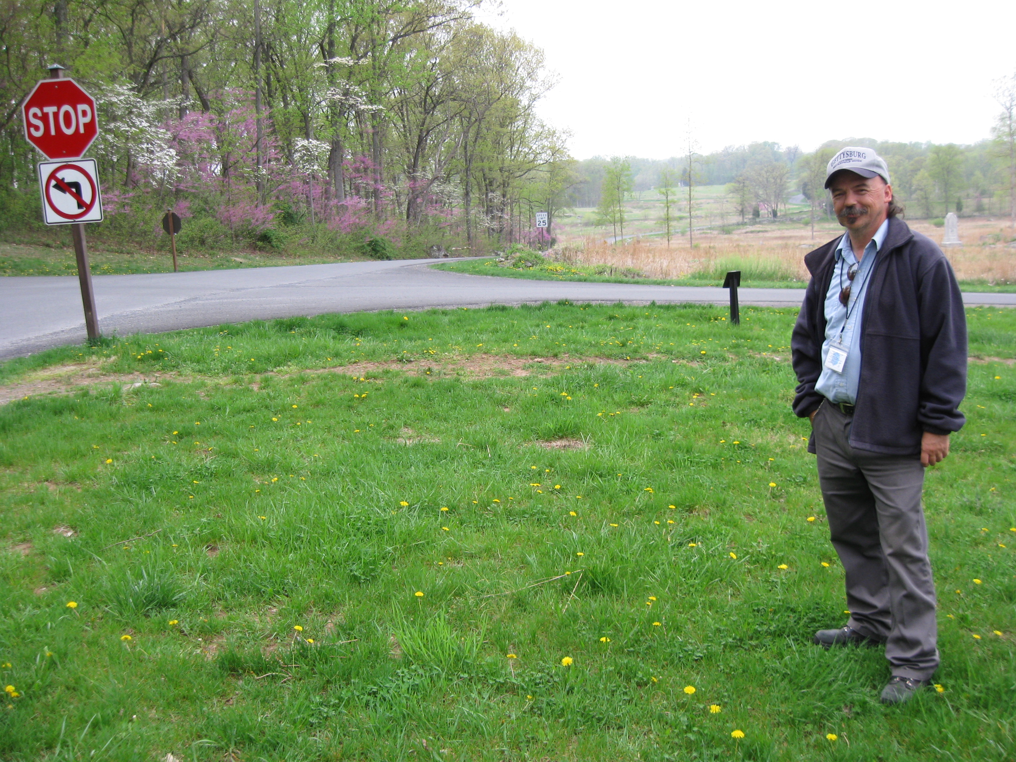
We are now looking up the Wheatfield Road to its intersection with Sedgwick Avenue at the stop sign. Rich Kohr is standing in the location of the trolley bed. The wall is far enough from the road in this location to accomodate the trolley bed. This view was taken facing southeast at approximately 5:30 PM on Thursday, April 30, 2009.
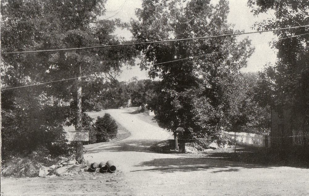
We are looking north along Sedwick Avenue. The Wheatfield Road climbs the north slope of Little Round Top from left to right or west to east. Although the trolley tracks were cut off in this picture taken for the Annual Reports of the Gettysburg National Military Park Commission, the trolley wires are still visible overhead. The building which housed the old Rosensteel Museum is visible on the right. This view was taken facing north circa 1906.
Rich is now standing on the trolley bed north of the Wheatfield Road. The trolley came over the hill on this north side of the Wheatfield Road near where the light colored pickup truck is on top of the hill. It then came to the right of the current mailboxes. Rich Kohr believes this is the area where the trolley connected to the Gettysburg Harrisburg Railroad. This view was taken facing northwest at approximately 5:30 PM on Thursday, April 30, 2009.
In Video #31 (Videos #s 1-30 were shown in our previous trolley posts) Rich shows us where the trolley connected to the Gettysburg Harrisburg Railroad. This view was taken facing northwest to northeast to southeast at approximately 5:30 PM on Thursday, April 30, 2009.
Rich is pointing to where the trolley line left the Wheatfield Road to go into the woods to connect with the Gettysburg Harrisburg Railroad. This view was taken facing northeast at approximately 5:30 PM on Thursday, April 30, 2009.
Gettysburg Licensed Battlefield Guide Rich Kohr is standing on the trolley bed where it entered the woods to the left of (north of) the Wheatfield Road. It would connect with the Gettysburg Harrisburg Railroad in some very thick woods approximately a couple of hundred yards behind him. This connection allowed the trolley to make a round trip on the Gettysburg Harrisburg Railroad line to its intersection with the Emmitsburg Road near the Codori Farm. This view was taken facing northeast at approximately 5:30 PM on Thursday, April 30, 2009.
After the agreement to use the Gettysburg Harrisburg Railroad tracks ended, the trolley stopped at the top of the ridge near the intersection of Sedgwick Avenue and the Wheatfield Road. This is a large parking lot because the trolley loaded and unloaded here, and the Rosensteel Museum was to the right (north of) the parking lot. The trolley then reversed its direction and retraced its route back to Gettysburg. This view was taken facing west at approximately 5:30 PM on Thursday, April 30, 2009.
Rich Kohr is standing near the intersection of the Wheatfield Road and Sedgwick Avenue which runs from left to right (south to north). The trolley ended in this area and reversed its direction here. This view was taken facing west at approximately 5:30 PM on Thursday, April 30, 2009.
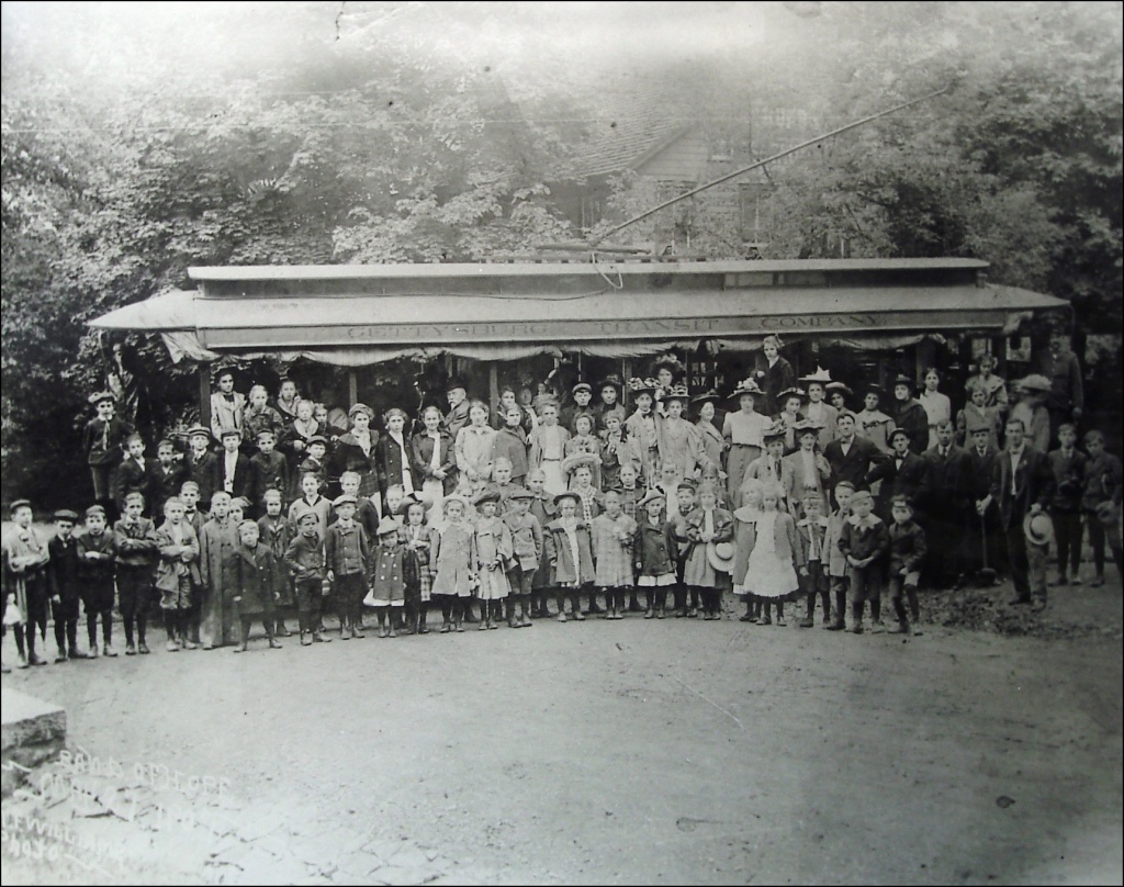
The photograph shows the group “Band of Hope” on a trip to the battlefield. The Rosensteel Museum is the building behind the trolley. Notice how the trolley pole on the top of the car has been reversed for its trip down the Wheatfield Road, across Plum Run Valley, etc… until it reached Gettysburg. This view is courtesy of Dr. Ben Dixon and Michael Waricher. This view was taken facing northeast circa 1907.
In Video #32, Rich explains how the trolley line ended near the old Rosensteel Museum at the intersection of Sedgwick Avenue and the Wheatfield Road. This view was taken facing west to northeast to north at approximately 5:30 PM on Thursday, April 30, 2009.
On the return trip to the Borough of Gettysburg, the trolley travelled north along the Emmitsburg Road, and then north along Washington Street. This postcard of the Eagle Hotel shows the trolley tracks at the intersection of Washington Street and Chambersburg Street which runs from right to left (east to west). At this point the trolley could either go straight (north) down Washington Street to the trolley car barn, or right (east) on Chambersburg Street, into the Diamond/Town Square/Circle, and north on Carlisle Street to the Western Maryland Railroad Station (Lincoln Train Station). This view was taken facing northeast circa 1910.
In this view the photographer is standing at the Eagle Hotel looking back at the Alexander Cobean House on the southwest corner of the intersection of Washington Street and Chambersburg Street. Chambersburg Street runs from left to right (east to west) in this view. The trolley tracks turn left on Chambersburg Street or continue to the bottom right of the photograph which is north on Washington Street. This view was taken facing southwest circa 1910.
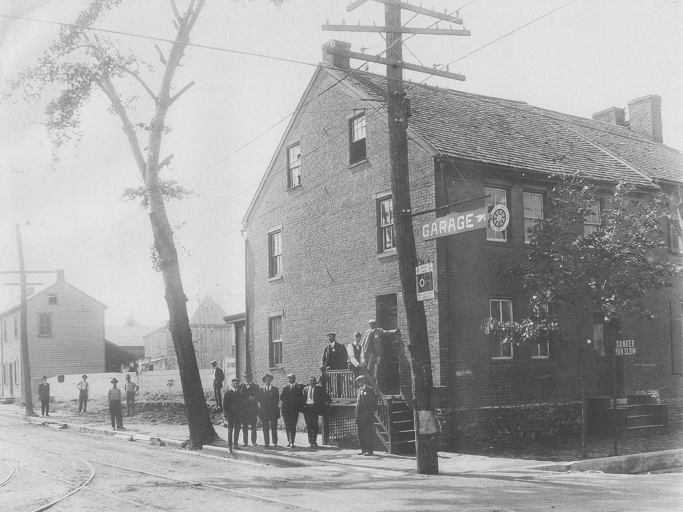
If one continued north on Washington Street, they would proceed towards the Gettysburg Electric Powerhouse and Trolley Barn. It is the stone building on the left of the photograph. The large opening is the trolley car entrance. On the way to the “car barn” one passes the livery/stable of William Holtzworth a Battlefield Guide. The tours of the battlefield by the carriages were the competition for the trolley. Notice the trolley lines in the top left of this photograph. This view was taken facing northeast between 1893 and 1916.
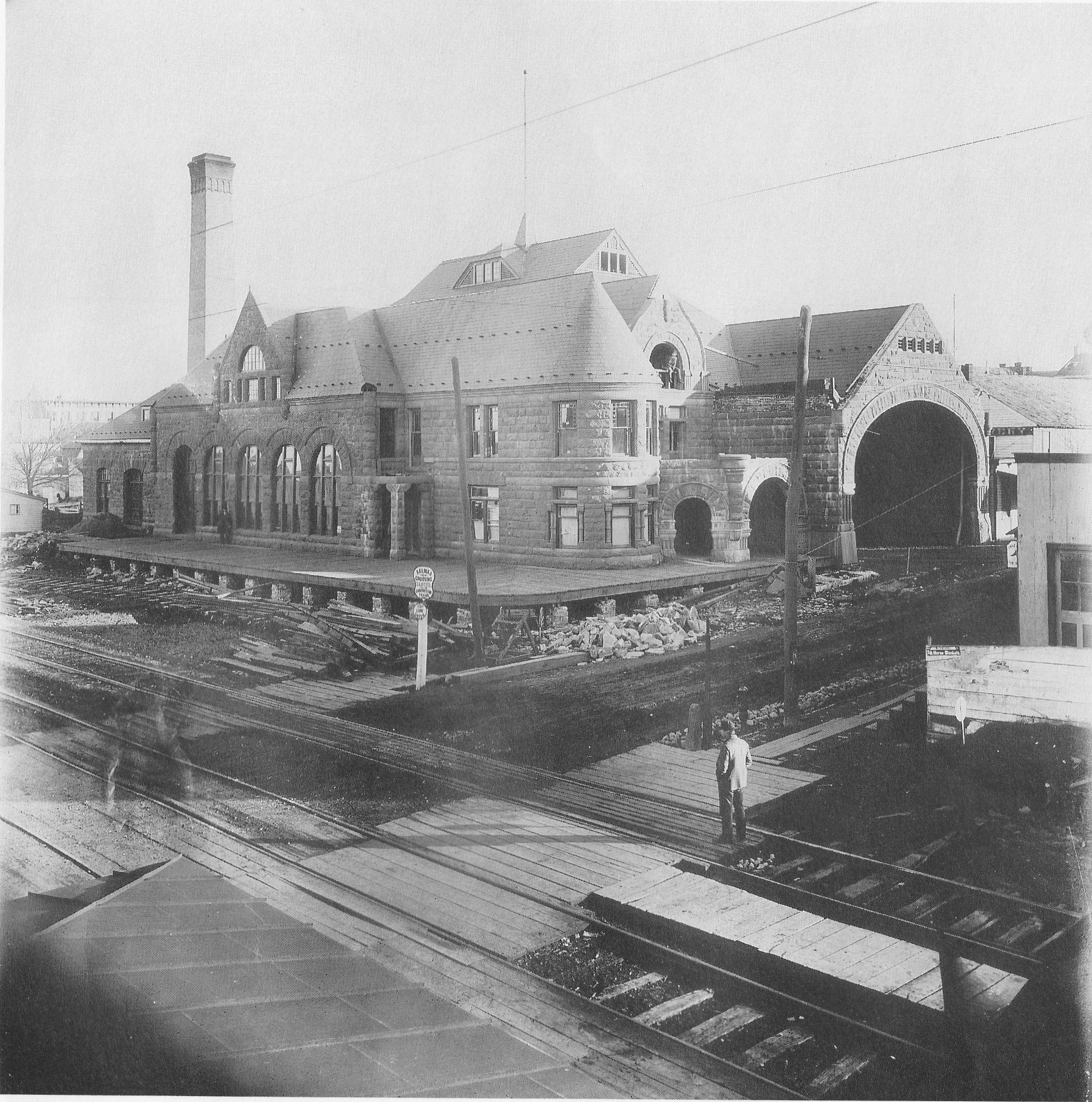
Remember when travelers on the Gettysburg Harrisburg Railroad disembarked at this station, they had to choose how they wanted to tour the battlefield. Did they want the electric trolley or a horse drawn carriage? Today’s visitors make similar decisions when they choose between bus tours of the battlefield versus going in the private vehicles. This view was taken facing northwest at approximately 1:45 PM on Thursday, January 1, 2009.
We have finally arrived back at the beginning of our tour. The electric powerhouse/trolley barn at the southeast corner of Washington Street and Railroad Street. The trolley barn is the large opening on the right of the building. Washington Street goes from the bottom left of the photograph towards the top right of the photograph. This view was taken facing southeast (probably from the roof of the Gettysburg Harrisburg Railroad station) in 1893.
To see other posts by Gettysburg Licensed Battlefield Guides,click here.