
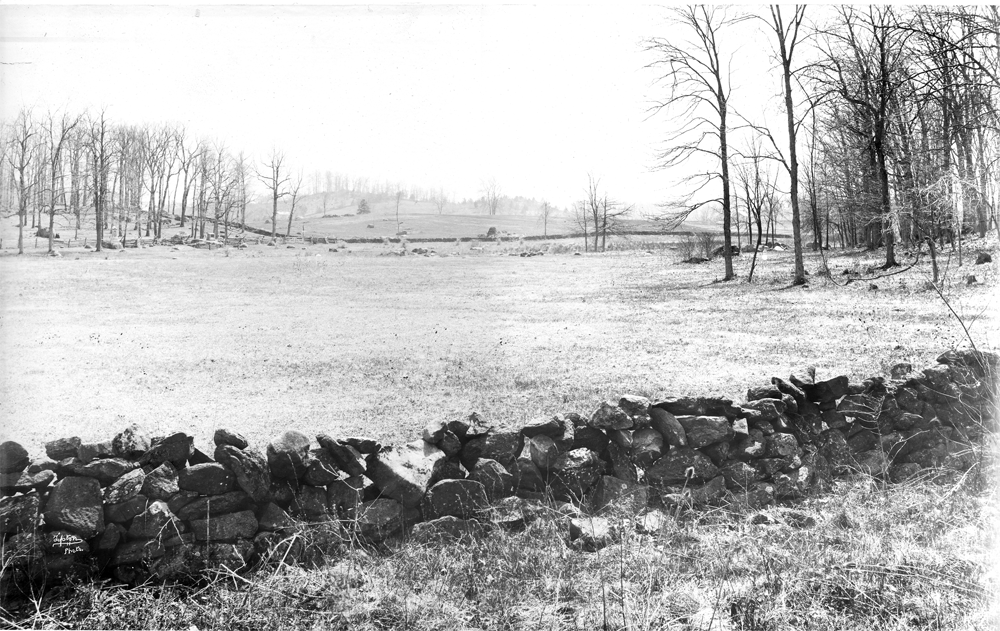
Here is how the Spangler’s Meadow looked in the 1880s. McAllister’s Field and Powers’ Hill are clearly visible in the center background. The monuments to the 27th Indiana (dedicated 1885) and the 2nd Massachusetts (dedicated 1879) are in the left background. These regiments charged across Spangler’s Meadow from left to right on July 3, 1863. This William Tipton photograph is courtesy of Gettsyburg Licensed Battlefield Guide John Archer. This view was taken facing southwest circa 1885-1890.
Tree cutting progress is slowly continuing in the Spangler’s Spring area. Just a little progress has been made in making McAllister’s Field visible from Spangler’s Meadow and Spangler’s Meadow visible from McAllister’s Field.
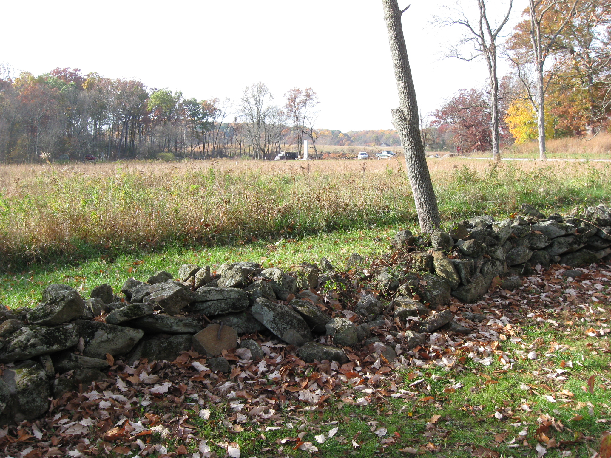
Here is a view showing the progress of the tree cutting from behind the stone wall on the northeast side of Spangler’s Meadow. The tall, white Indiana State Monument (dedicated 1971) is clearly visible in the center of this view. The 27th Indiana marker (dedicated after September 1890) is barely visible in the center of Spangler’s meadow among the tall foliage. The 27th Indiana Monument is visible in the left background, and the 2nd Massachusetts monument is hidden by the light green bush. Powers’ Hill, in the center background, needs a lot of trees removed, and the trees there are currently being marked. This view was taken facing southwest at approximately 9:30 AM on Saturday, October 30, 2010.

The same view taken the previous week. This view was taken facing southwest at approximately 8:00 AM on Sunday, October 24, 2010.
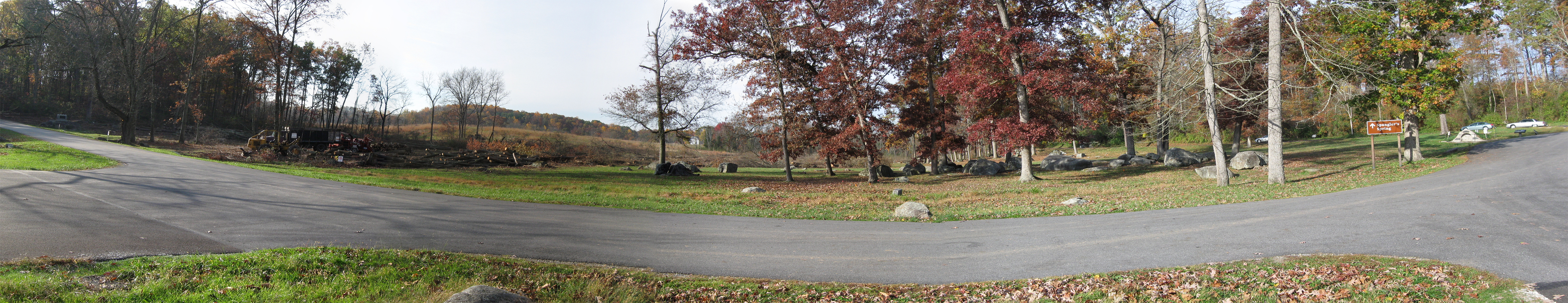
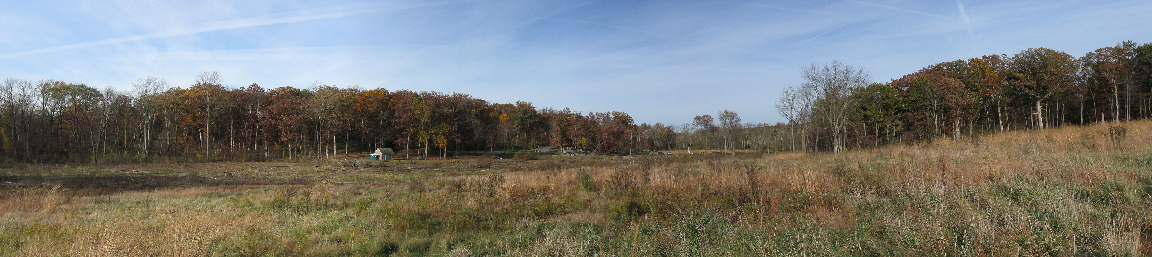
We have moved closer to the tree cutting to show a panorama of the progress. The monument to the 2nd Massachusetts is on the left. Spangler’s Spring is on the right. This view was taken facing southeast to northwest at approximately 9:45 AM on Saturday, October 30, 2010.
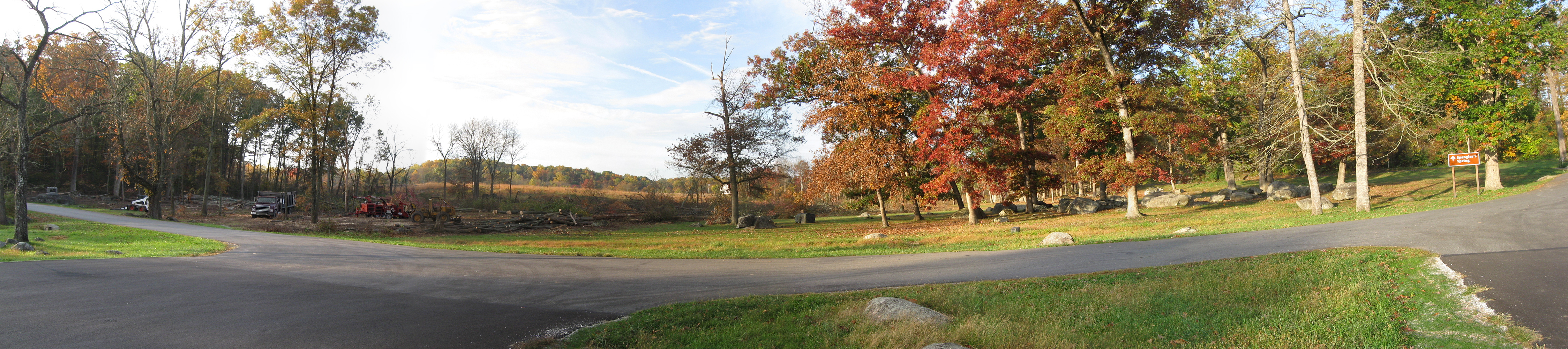
The same panorama taken last week. This view was taken facing southeast to northwest at approximately 8:00 AM on Sunday, October 24, 2010.

This view was taken from McAllister’s Field looking towards Culp’s Hill on the left and Spangler’s Meadow in the right background. The tree line in the left background is Culp’s Hill. The treeline in the right background is Wolf’s Hill. This Tyson Brothers’ photograph is courtesy of Gettsyburg Licensed Battlefield Guide John Archer. This view was taken facing northeast circa 1866.

We don’t think we matched up the present view with the 1866 view last week. Here is another view showing the progress of the tree cutting from McAllister’s Field. The white shaft of the Indiana State Monument is clearly visible in the background. Behind the Indiana State Monument is Spangler’s Meadow. This view was taken facing northeast at approximately 4:00 PM on Saturday, October 30, 2010.
We have moved closer to the tree cutting to show a panorama from McAllister’s Field. On the far left is the cleared area by the NPS contractor northeast of the private treeline. The Spangler’s Spring restroom has now been really, really exposed by the tree cutting. On the far right, the monument to the 3rd Wisconsin Infantry Regiment is in the woods behind the stone wall. This view was taken facing north to southeast at approximately 3:30 PM on Saturday, October 30, 2010.