

Gettysburg Licensed Battlefield Guide John Winkleman is our host for the series on Adams County Civil War Taverns. He is holding a photograph of the Graffenburg Tavern, which was located where John is standing. This view was taken facing northwest at approximately 2:30 PM on Sunday, November 29, 2009.
In today’s post, Gettysburg Licensed Battlefield Guide John Winkleman begins his series on Adams County Civil War Taverns. He starts at the Graffenberg Tavern on South Mountain in Franklin Township.
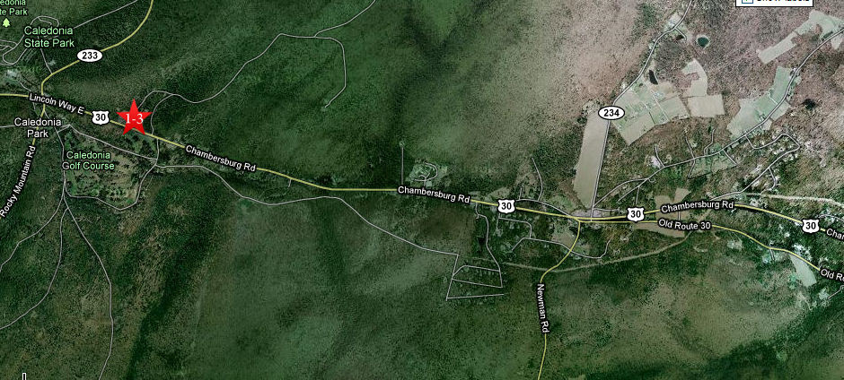
This map shows the location of the videos taken during our series on Adams County Civil War Taverns. Videos #1-3 were taken at the site of the Graffenburg Tavern on the north side of the Chambersburg Pike, U.S. 30. This map was created facing north at approximately 5:00 PM on Sunday, November 29, 2009.
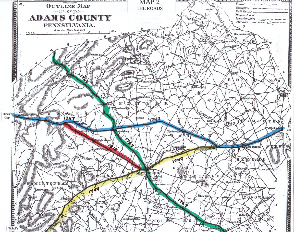
This map shows the early roads of Adams County, Pennsylvania. The blue line shows the first road (Black Gap’s Road) constructed in 1747 which led from York to Chambersburg. The green line shows the road constructed two and a half years later which led to Gettysburg, and eventually through Monterrey Pass to Hagerstown, Maryland. The green line shows the road from Baltimore Maryland to Shippensburg, Pennsylvania. The red line shows the Chambersburg Pike from Gettysburg to the area of McKnightstown. This map, based on the 1858 Adams County Map is from the collection of John Winkleman.

The Graffensburg Tavern on the Gettysburg-Chambersburg Pike. The tavern burned down in 1849, and the Confederates burned it down in 1863. It was rebuilt and burned for its third and last time in 1980. This view was taken facing northwest circa the 1890s.
In Video #1 Gettysburg Licensed Battlefield Guide John Winkleman is standing on the site of the Graffenburg Tavern near the Chambersburg Pike. He gives us some background on taverns. This view was taken facing northwest at approximately 2:30 PM on Sunday, November 29, 2009.

Licensed Battlefield Guide John Winkleman is standing on the site of the Graffenburg Tavern in what is now the Michaux State Forest. This view was taken facing northwest at approximately 2:30 PM on Sunday, November 29, 2009.
In Video #2 Licensed Battlefield Guide John Winkleman informs us about the early years of the Graffenburg Tavern. This view was taken facing northwest to west to northwest to north to southwest to northwest to southeast to northwest to north at approximately 2:30 PM on Sunday, November 29, 2009.

John Winkleman is standing on the Adams-Franklin County line near the Chambersburg Pike. The county line ran through the middle of the Graffenburg Tavern. This is the approximate area where the black and white photograph of the Graffenburg Tavern was taken. This view was taken facing northwest at approximately 2:30 PM on Sunday, November 29, 2009.
In Video #3 John Winkleman explains the events that occurred at the Graffenburg Tavern at the time of the Civil War, and the damages that occurred here. This view was taken facing north to northwest to north at approximately 2:30 PM on Sunday, November 29, 2009.
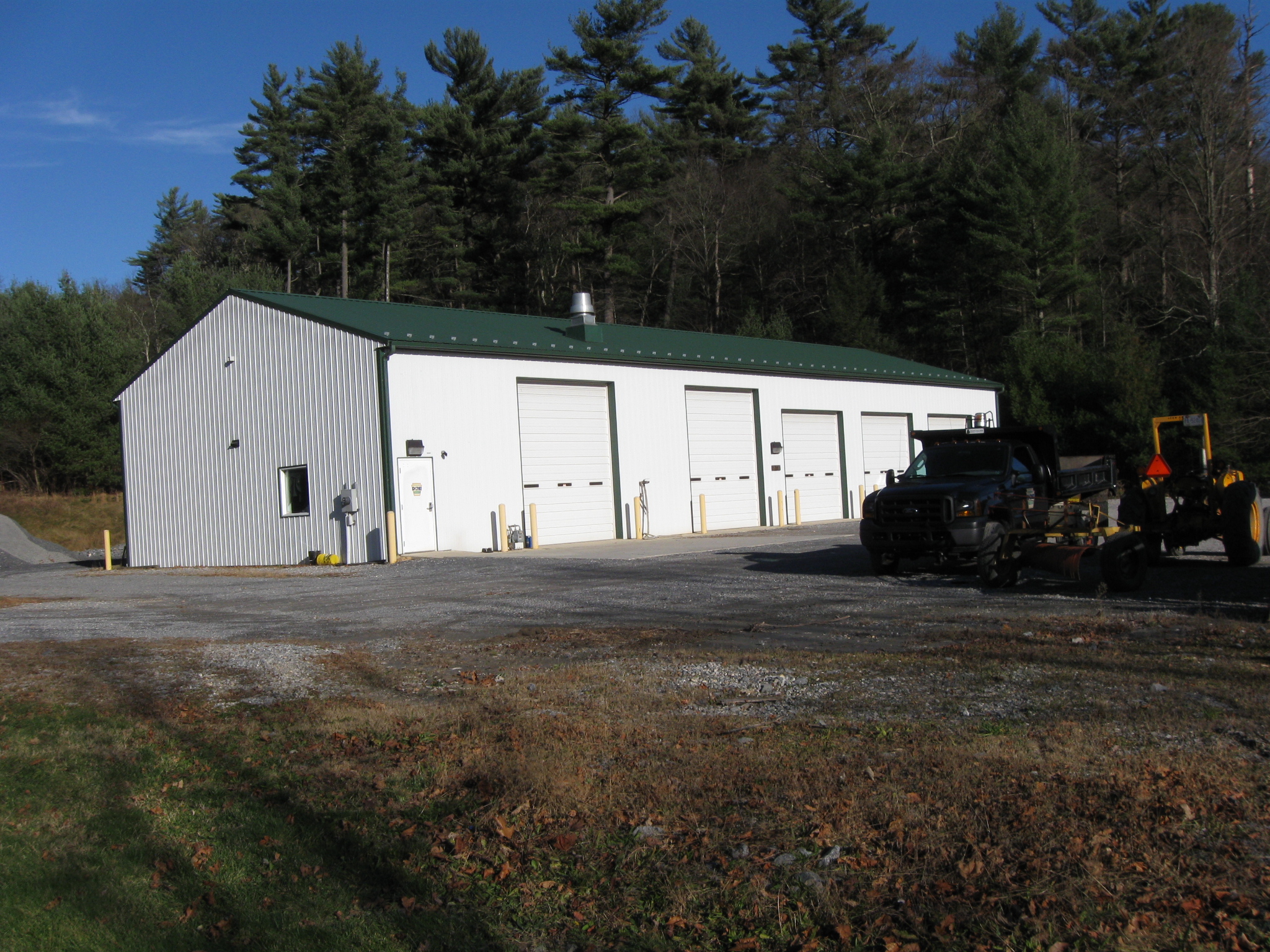
Today the area occupied by the Graffenburg Tavern is now a maintenance area for the Michaux State Forest. This view was taken facing north at approximately 2:30 PM on Sunday, November 29, 2009.

Today the community of Graffenburg consists of only a few structures. This view was taken facing east at approximately 2:30 PM on Sunday, November 29, 2009.