

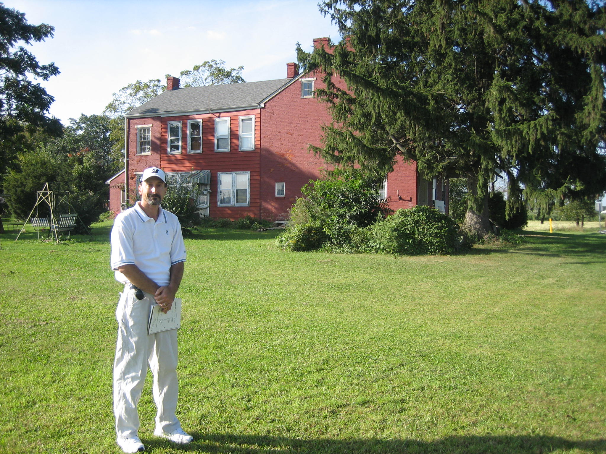
Civil War author J.D. Petruzzi (along with his co author Steve Stanley) are the hosts for our series on the Battle of Fairfield. They are standing near the Carroll’s Tract Road at the Benjamin Marshall House. They are showing us a map that Steve created during the Battle of Fairfield. The time on the map is 1:30 PM on July 3, 1863. This view was taken facing north at approximately 4:15 PM on Sunday, September 20, 2009.
In today’s Fairfield post, authors J.D. Petruzzi and Steve Stanley show us the final actions at July 3, 1863’s Battle of Fairfield.
See our post on Some Fairfield, Pennsylvania Civil War Markers on September 1, 2008.
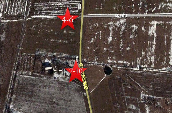
This map shows the location of our Fairfield videos. The Google Map photograph was taken during the winter with snow on the ground. Videos #1-#3 were shown in our previous Fairfield post. Videos #4-#6 were taken near the intersection of Carroll’s Tract Road and Knox Road. Videos #7-#10 were taken at the Benjamin Marshall House near the Carroll’s Tract Road. This map was created facing north at approximately 3:00 PM on Monday, October 12, 2009.
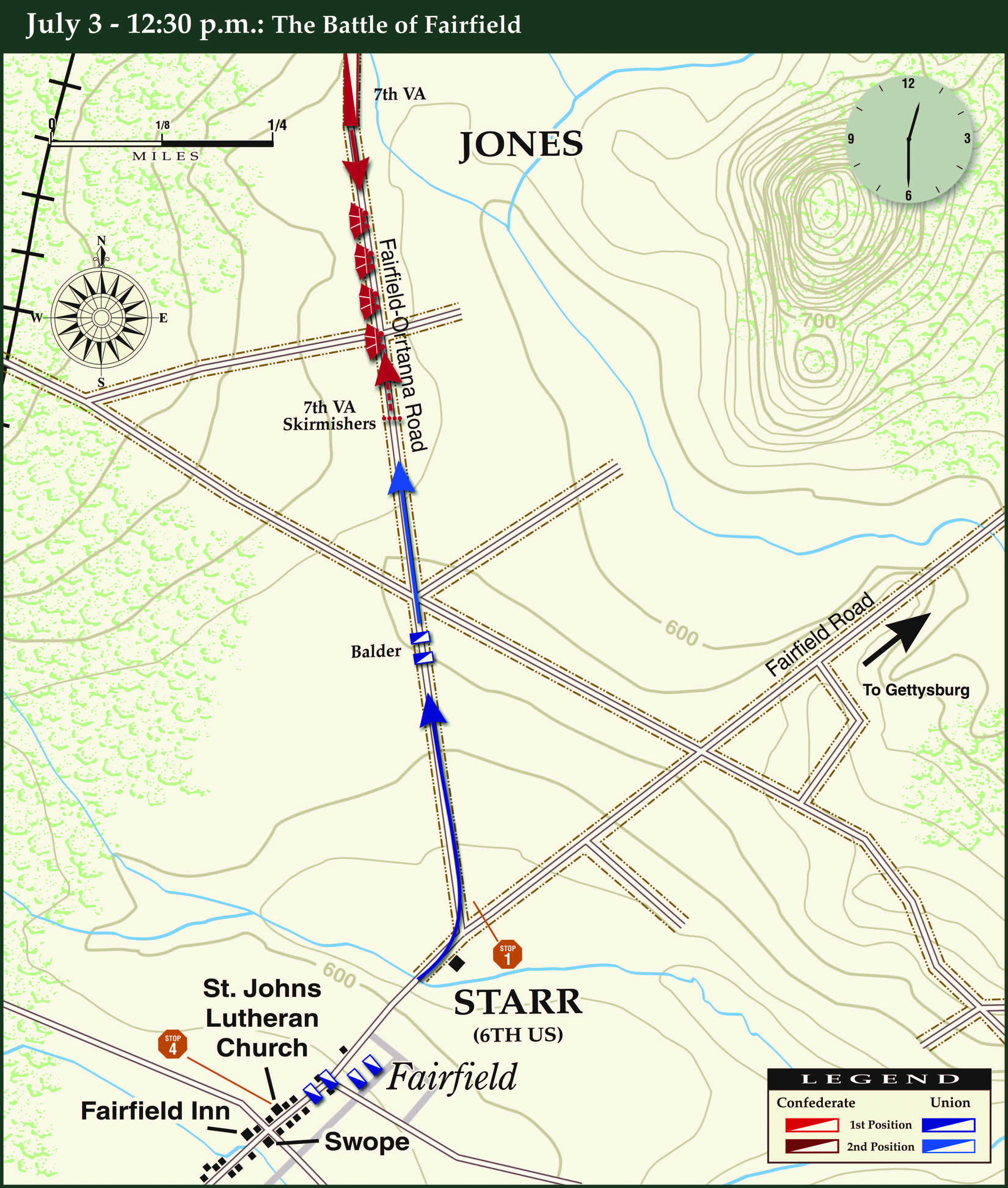
This map of the opening phase (12:30 PM) of the Battle of Fairfield was created by cartographer Steve Stanley. It shows the intial pursuit of Confederate wagons by the 6th U.S. Cavalry as they move north along Carroll’s Tract Road.

This map of the 1:00 PM phase of the Battle of Fairfield was created by cartographer Steve Stanley. It shows the intial attack by the 6th U.S. Cavalry and the Confederate counterattack along Carroll’s Tract Road.
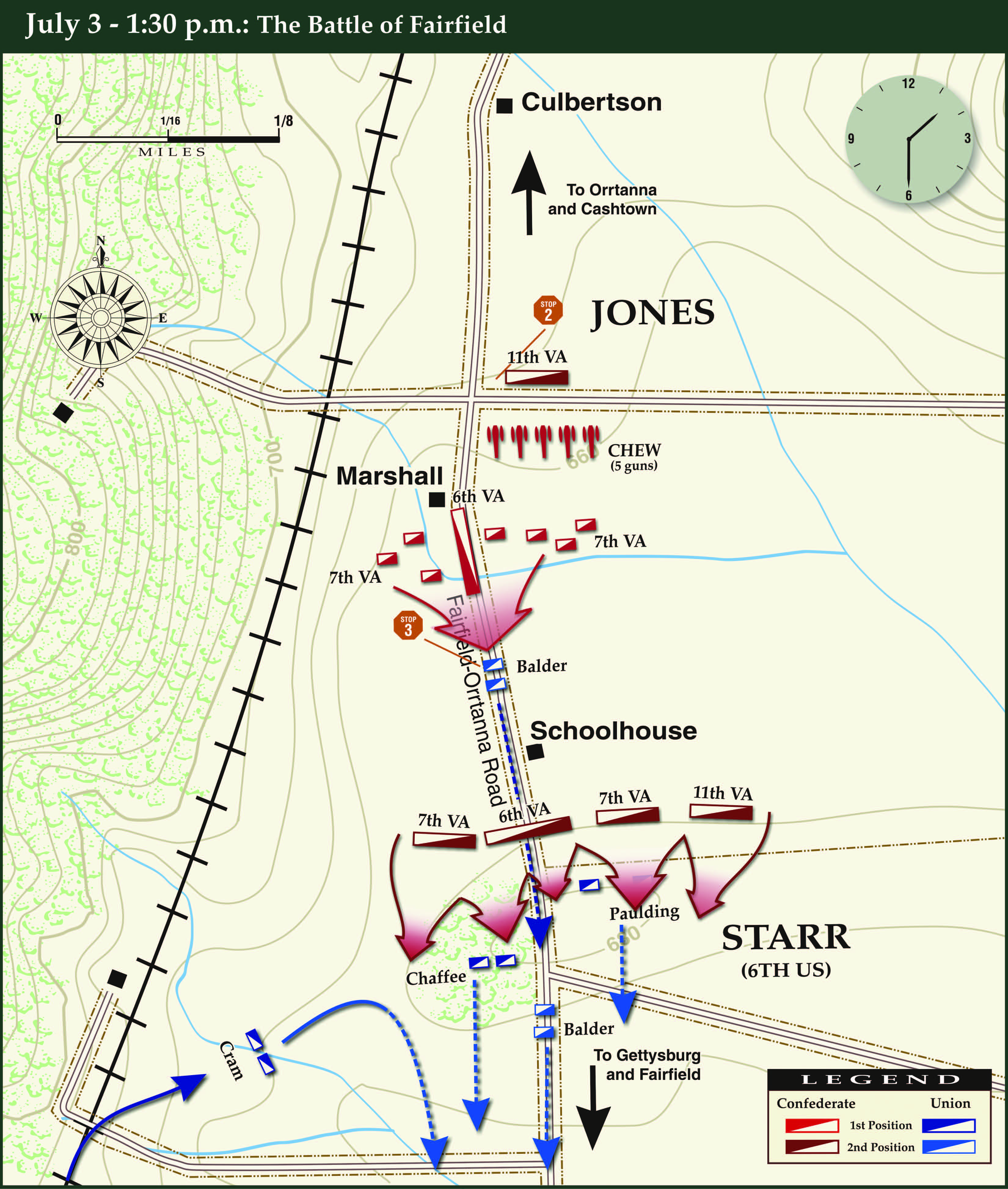
This map of the 1:30 PM phase of the Battle of Fairfield was created by cartographer Steve Stanley. It shows the final attack by the Confederates along Carroll’s Tract Road.
In Video #7 (Videos #1- #6 were shown in our previous Fairfield posts) Civil War authors J.D. Petruzzi and Steve Stanley are standing near the Carroll’s Tract Road at the Benjamin Marshall House. They show us the map that Steve created for the fighting at Fairfield at 1:30 PM on July 3, 1863. This view was taken facing north at approximately 4:15 PM on Sunday, September 20, 2009.

Civil War author J.D. Petruzzi is standing near the Carroll’s Tract Road at the Benjamin Marshall House, which is in the background. This view was taken facing southwest at approximately 4:15 PM on Sunday, September 20, 2009.
In Video #8 Civil War author J.D. Petruzzi is standing near the Carroll’s Tract Road at the Benjamin Marshall House. He describes the Confederate cavalry movement south on this road to the ridge on which the 6th U.S. Cavalry was attempting to regroup. This view was taken facing south to southwest to south at approximately 4:15 PM on Sunday, September 20, 2009.
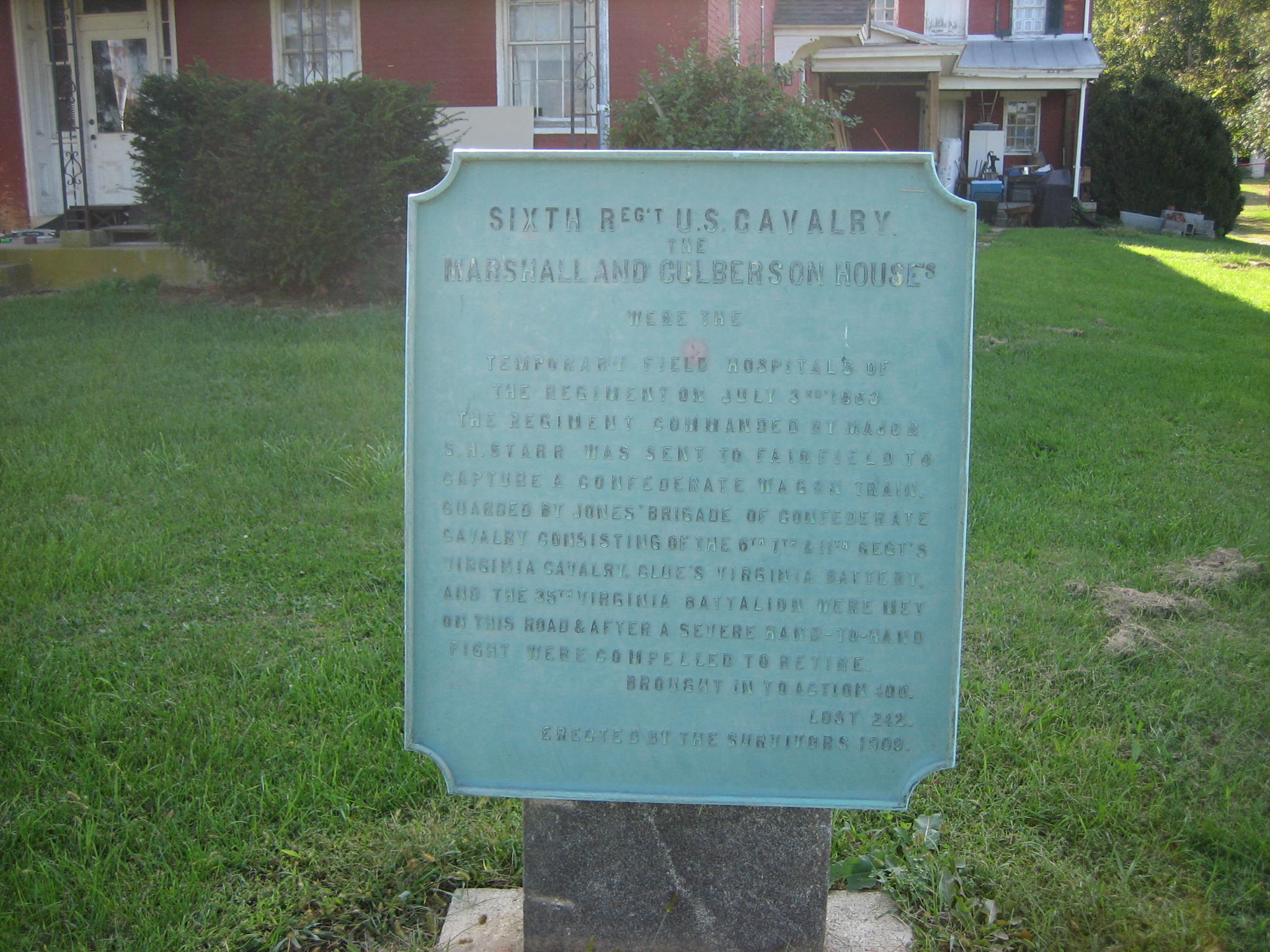
The historic marker in front of the Benjamin Marshall House. This view was taken facing west at approximately 4:15 PM on Sunday, September 20, 2009.
In Video #9 Civil War author J.D. Petruzzi is standing near the Carroll’s Tract Road at the Benjamin Marshall House. He has now moved south of the house. He describes the Confederate cavalry succeeded in pushing the remnants of the 6th U.S. cavalry off the battlefield. This view was taken facing south at approximately 4:15 PM on Sunday, September 20, 2009.
J.D. Petruzzi has now moved south of the Benjamin Marshall House. This view was taken facing northwest at approximately 4:15 PM on Sunday, September 20, 2009.
In Video #10 Civil War author J.D. Petruzzi is standing near the Carroll’s Tract Road at the Benjamin Marshall House. He explains why the Battle of Fairfield was important. This view was taken facing northwest at approximately 4:15 PM on Sunday, September 20, 2009.